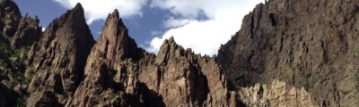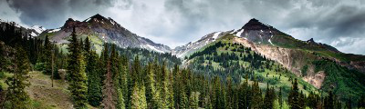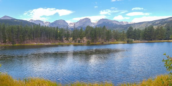
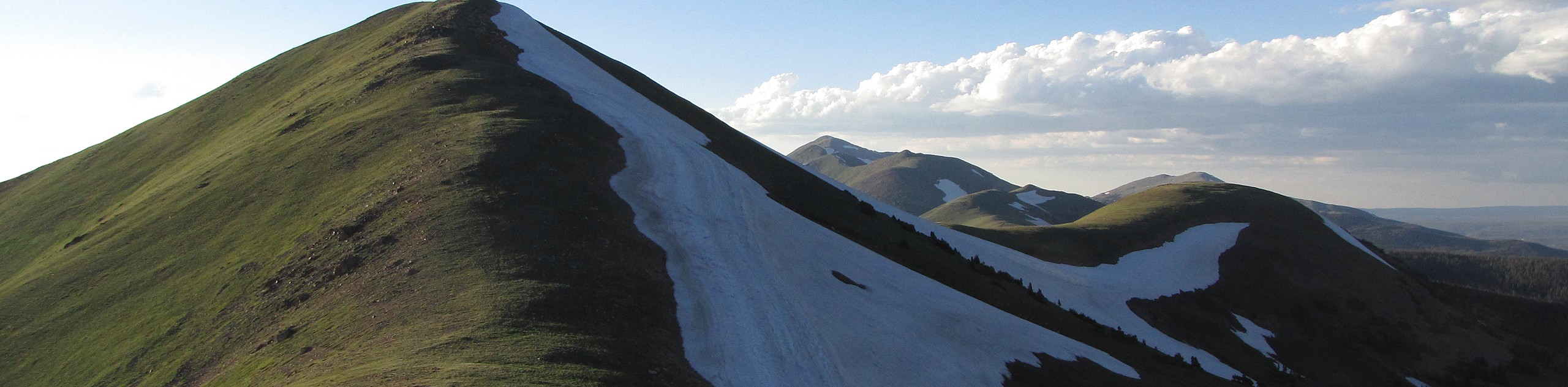
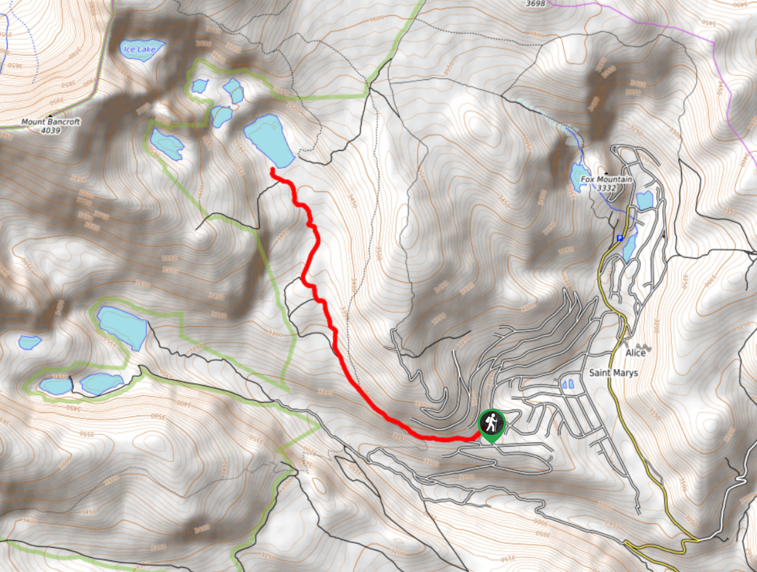
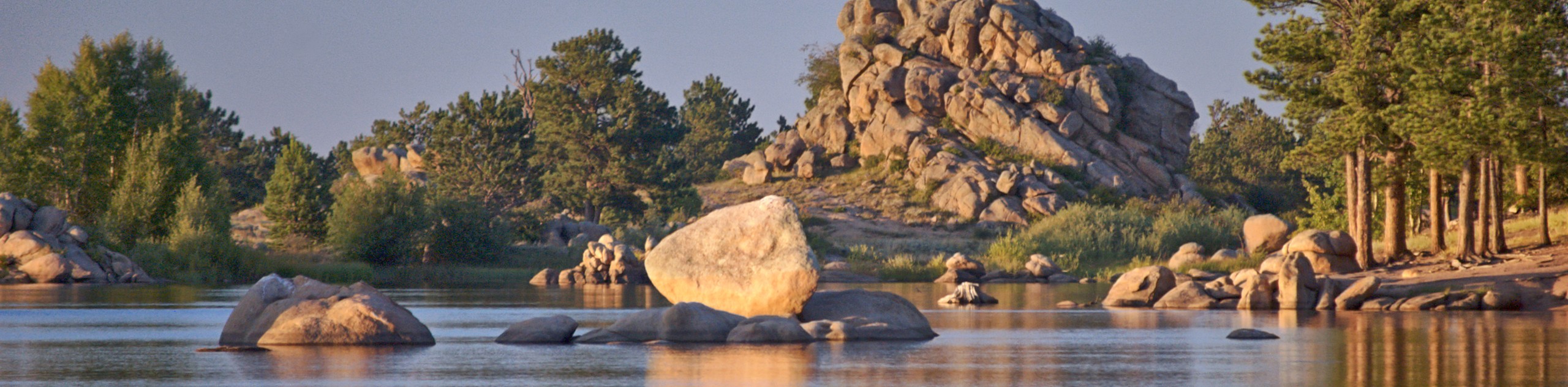
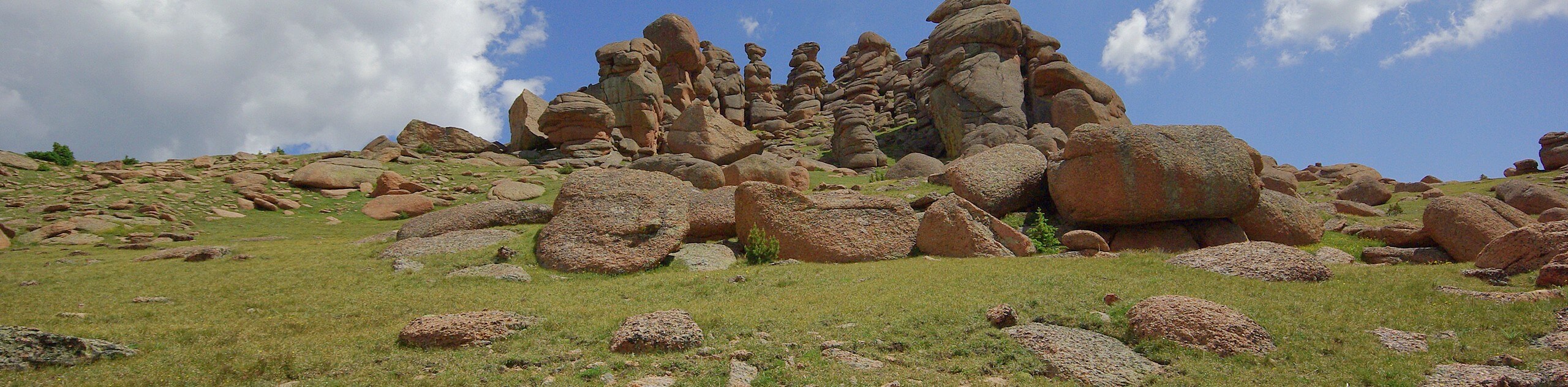
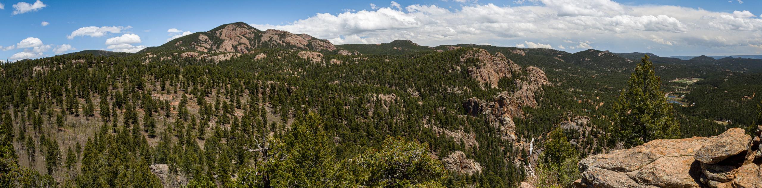
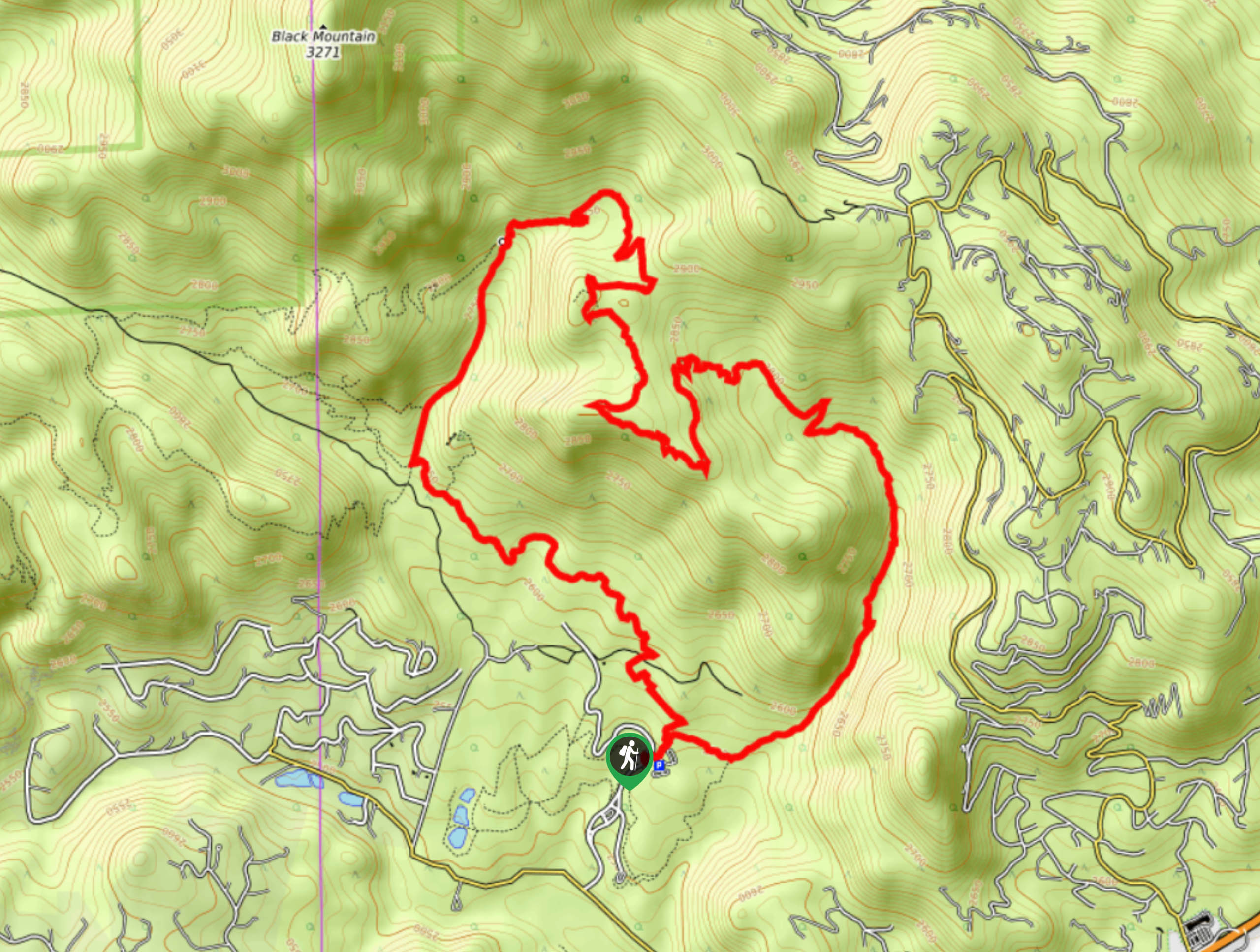
hikes in Front Range
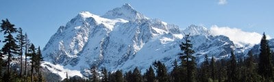
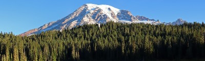
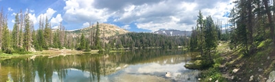
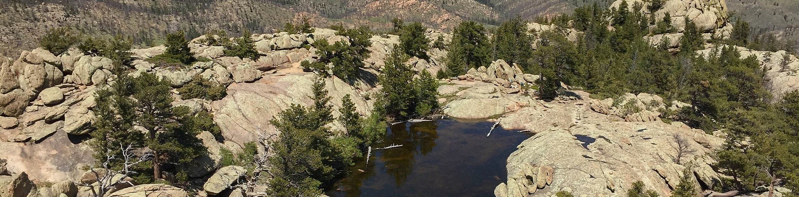
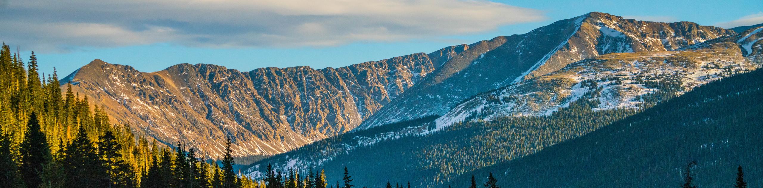
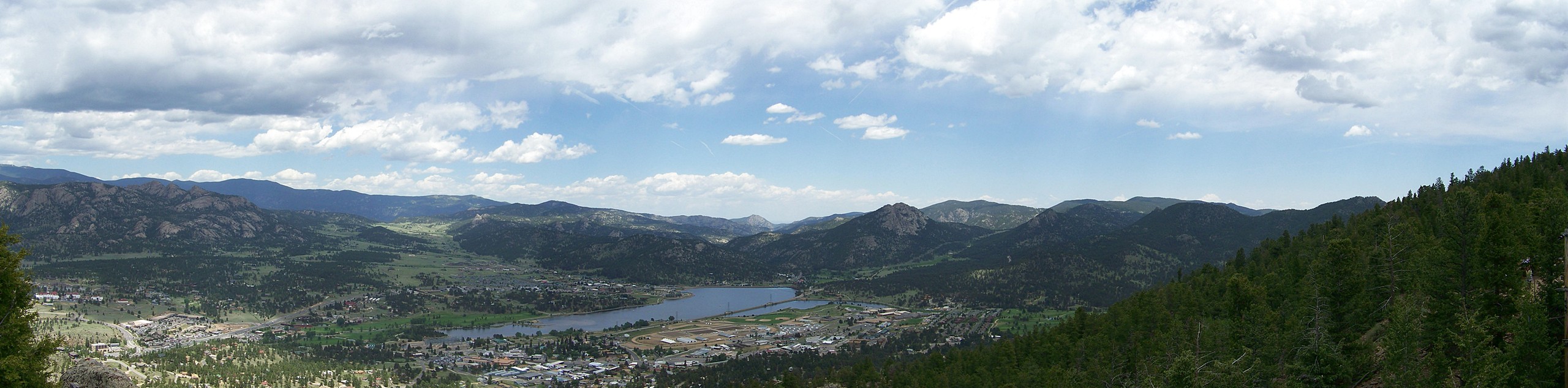
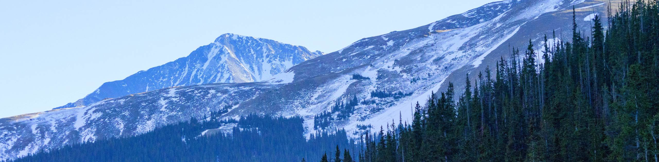
Hikes within the Front Range are perfectly balanced between exhilarating summit hikes and family-friendly strolls. This expansive range covers thousands of trails from southern Wyoming all the way down to southern Colorado. Spanning over 300.0mi north to south, there is no shortage of hikes. The diversity of the terrain along the Front Range necessitates assorted adventures of varying difficulties.
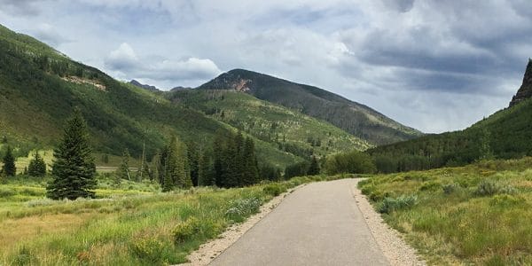
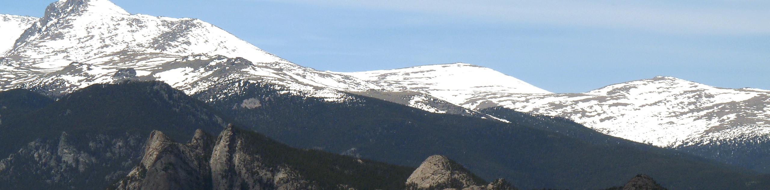
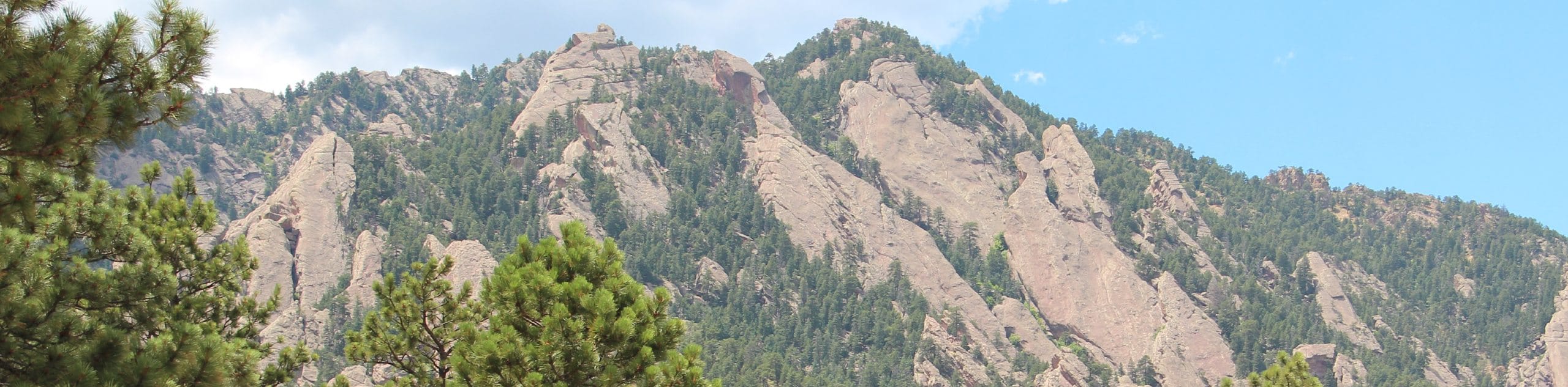
Travel through alpine tundra, along grassy meadowlands, or under aspen groves. The Front Range is unique in that it includes different regions with different landscapes and climates. Adventure the Rocky Mountain National Park or the Indian Peaks Wilderness; travel along the Continental Divide or explore river canyons. There is no comparable experience to hiking the Front Range. The only way to describe the Front Range adventures is scenic, diverse, and abundant. You will just have to come see for yourself.
Whether you are seeking a meadowland stroll or a scramble up a technical peak, the Front Range delivers. Inexperienced hikers and avid adventurers alike can enjoy the best of what Colorado has to offer. Hike amongst locals and visitors as you adventure the trails amongst the Front Range.
The 20 Greatest Hikes in Colorado’s Front Range Region
- Paradise Cove Swimming Hole Trail - The Paradise Cove Swimming Hole Trail is an epic-adventure the whole family will enjoy. Hike the short, woodland path to a scenic swimming hole, nestled among the granite cliffs of the Guffey Gorge. This excursion is the perfect recovery incubator after a long journey up to Pikes Peak the day before. Veg out and relax next to the jade-colored swimming hole, and if you are feeling daring, jump off the vertigo inducing bluffs.
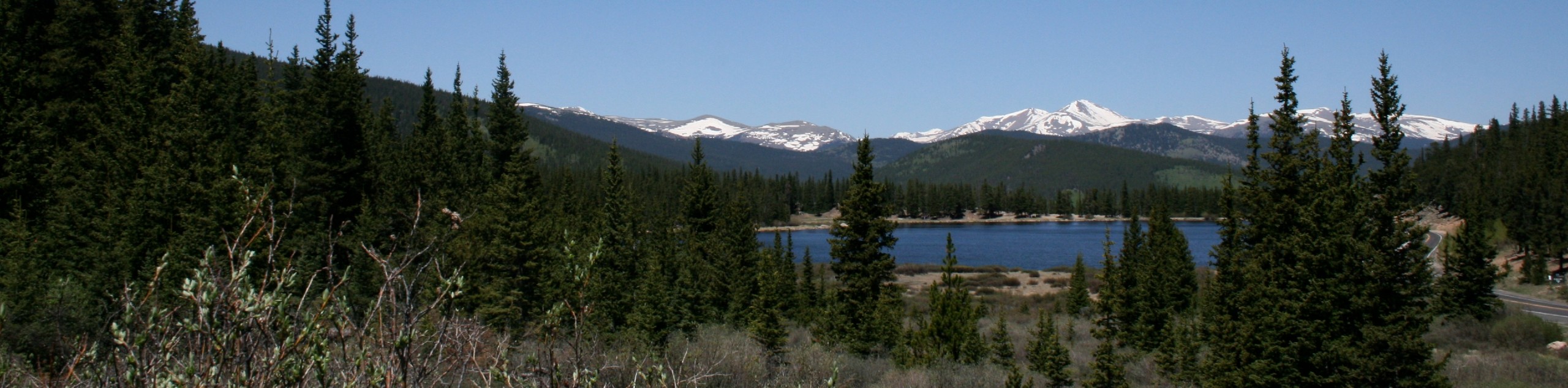
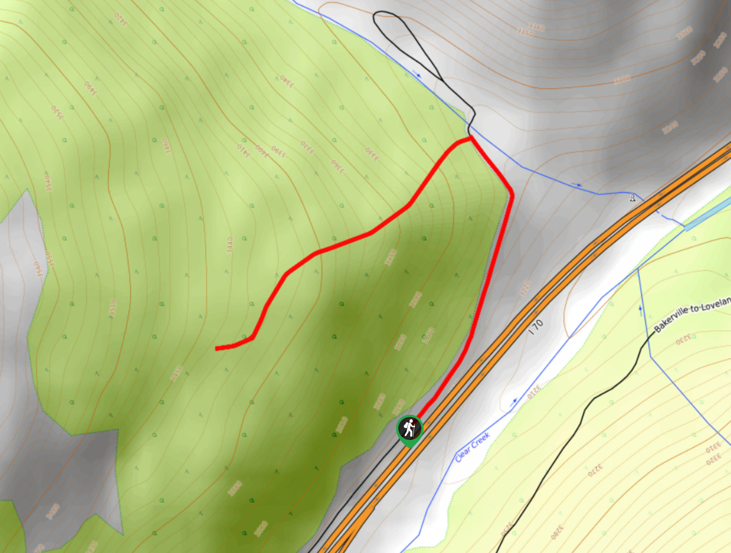
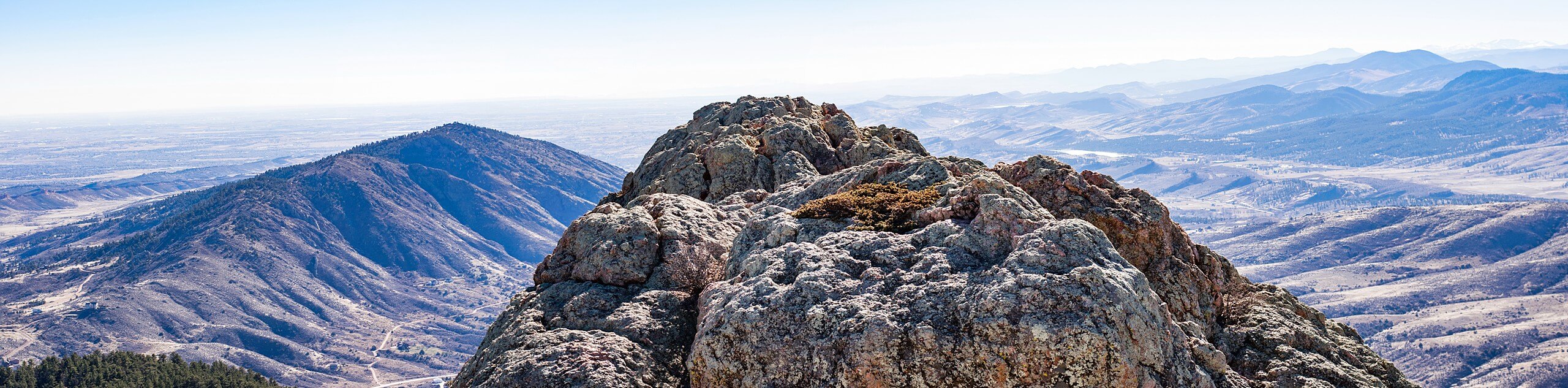
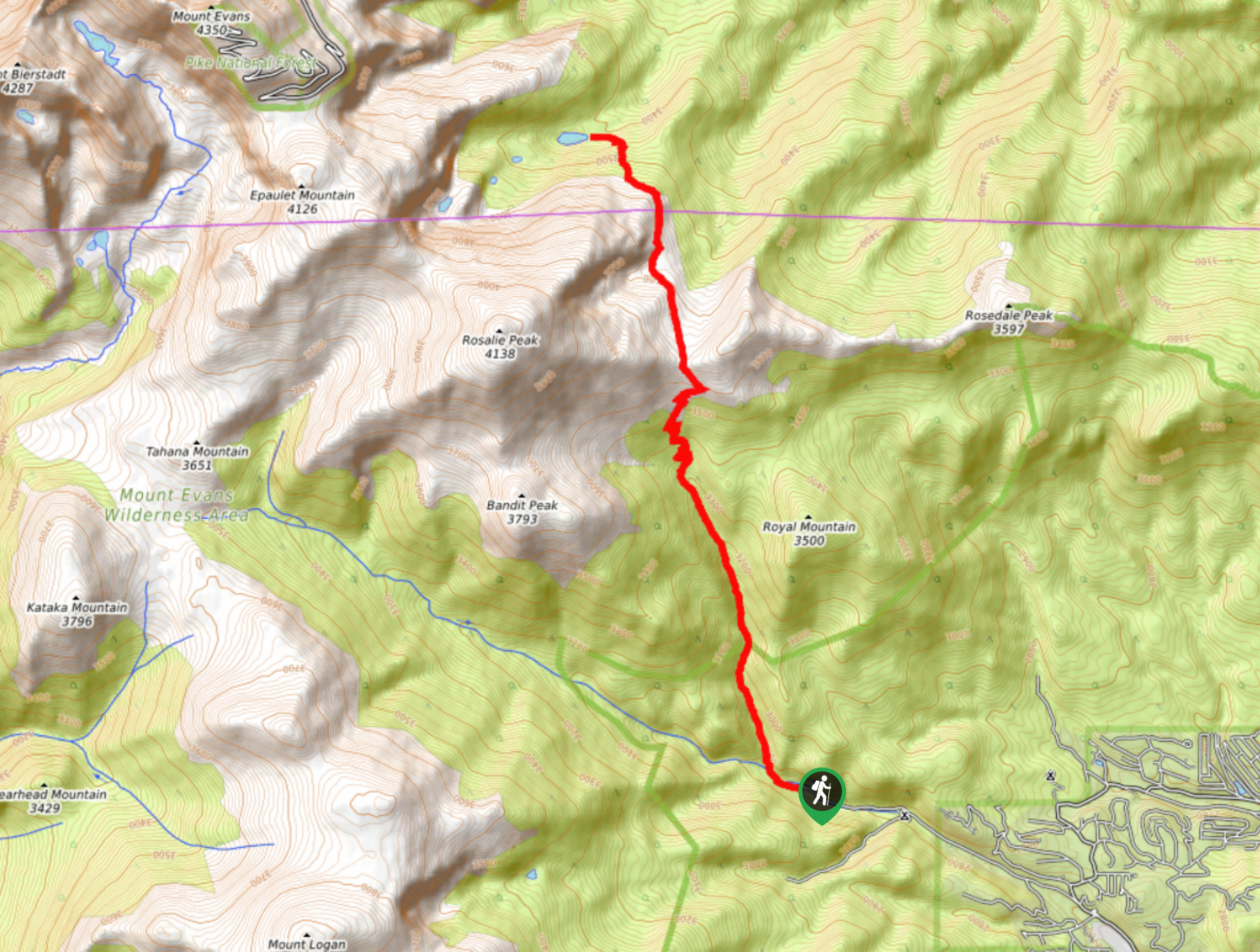
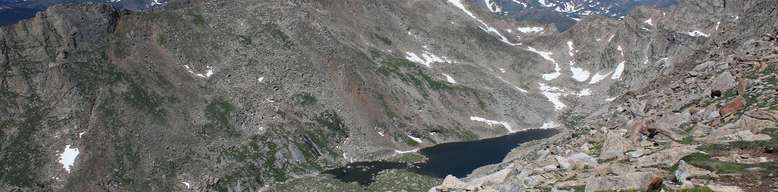
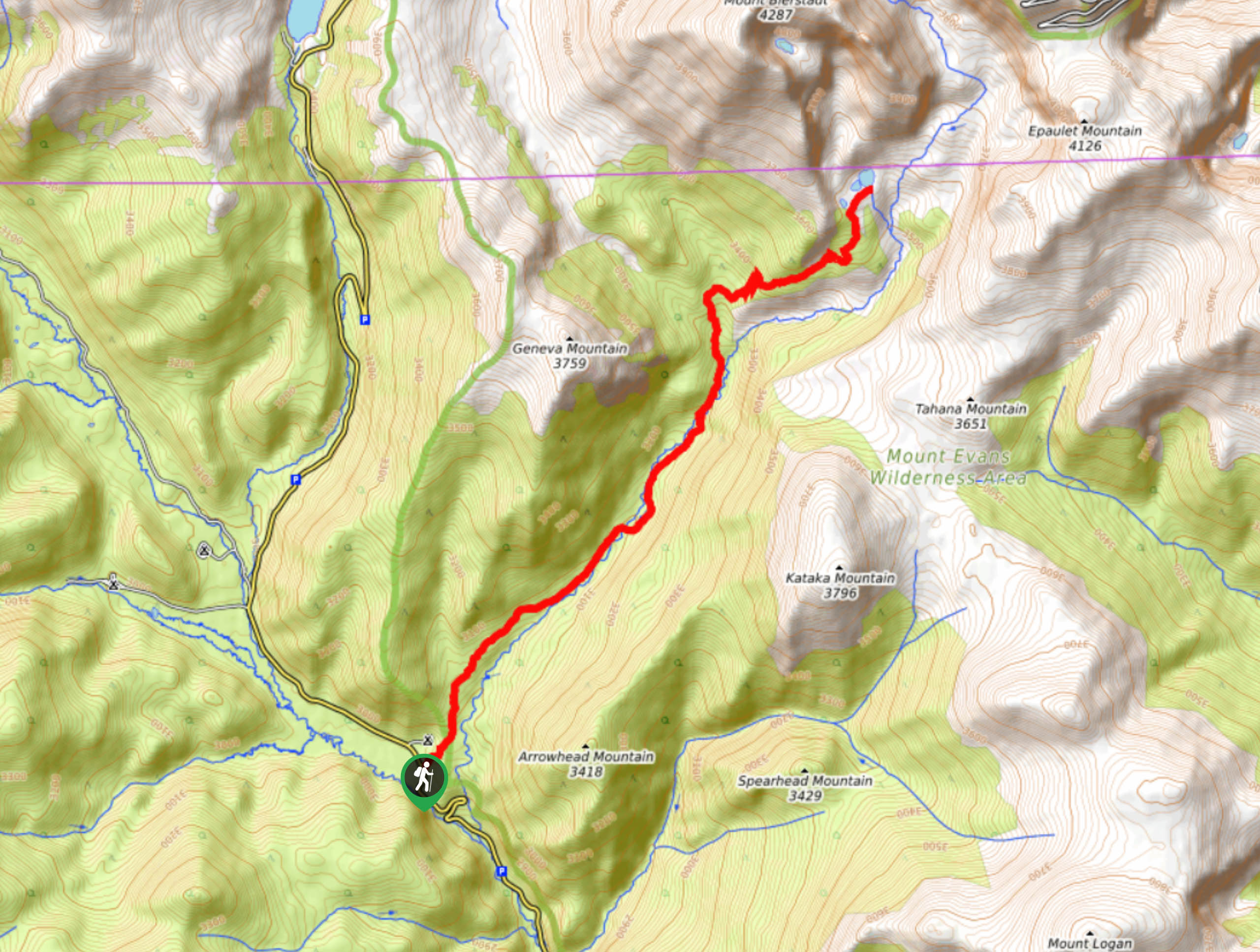
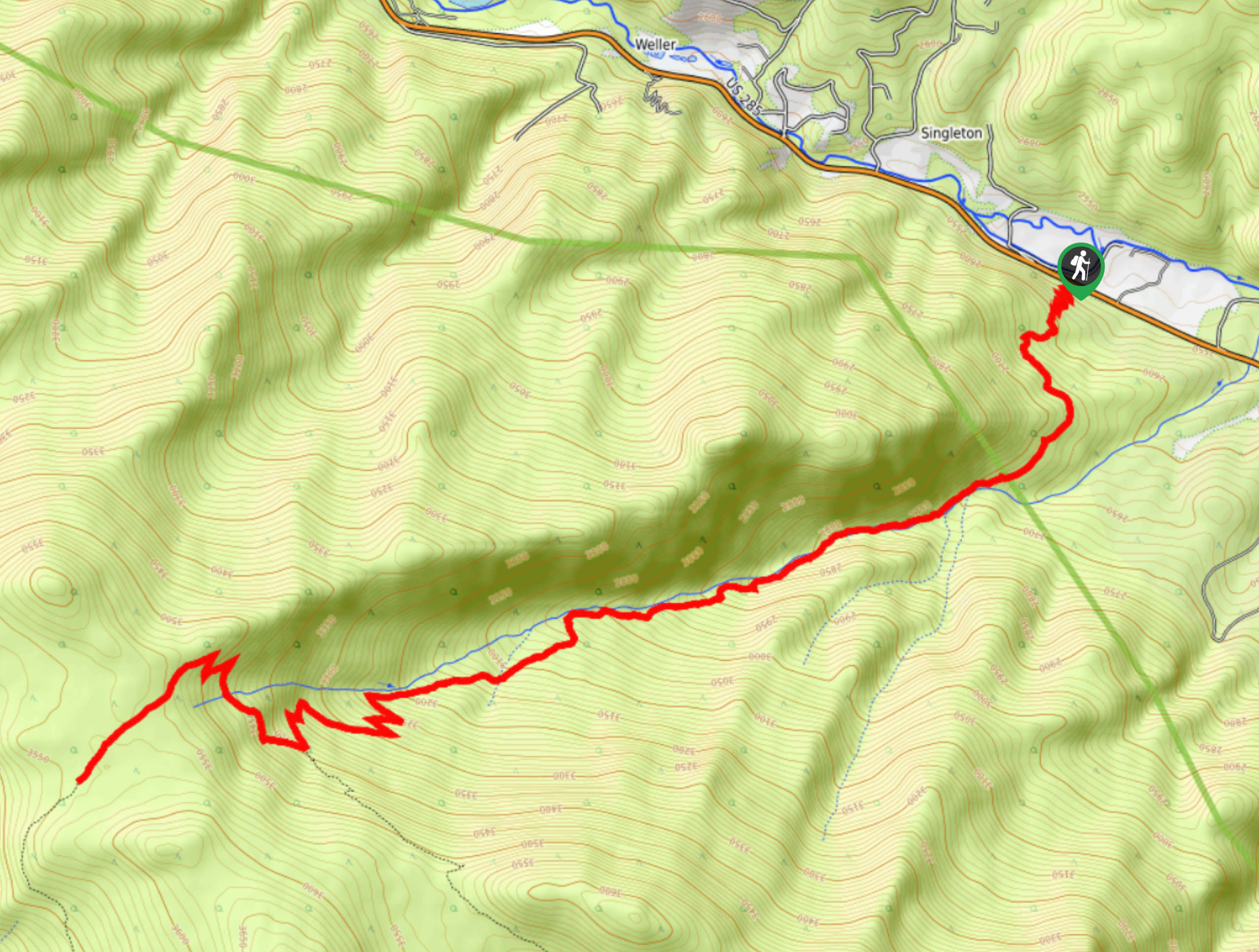
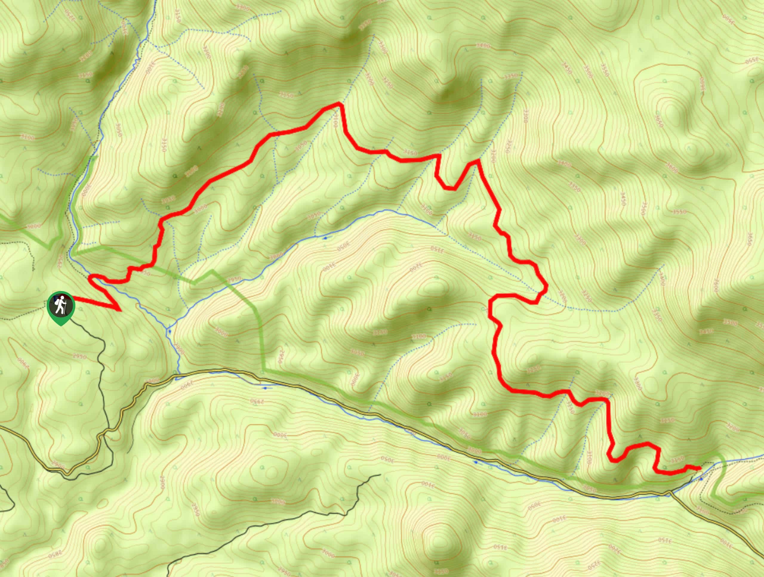
- Mount Evans via Chicago Creek Hike - Hike up to a Colorado 14er. The Mount Evans via Chicago Creek Trail may just be one of the most demanding, but picturesque hikes in the Front Range. Hike up through the postcard-worthy scenery of the Mount Evans Wilderness to the namesake’s summit. Trek past several shimmering blue-hued lakes and through the alpine tundra before ascending Mount Evans. Though challenging, the mountain top vistas are undoubtedly rewarding.
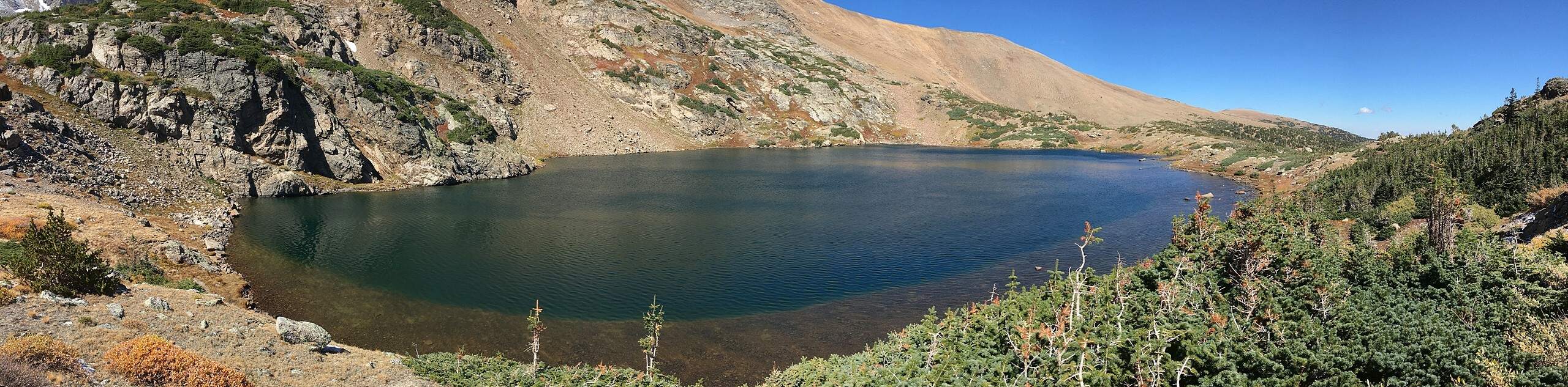
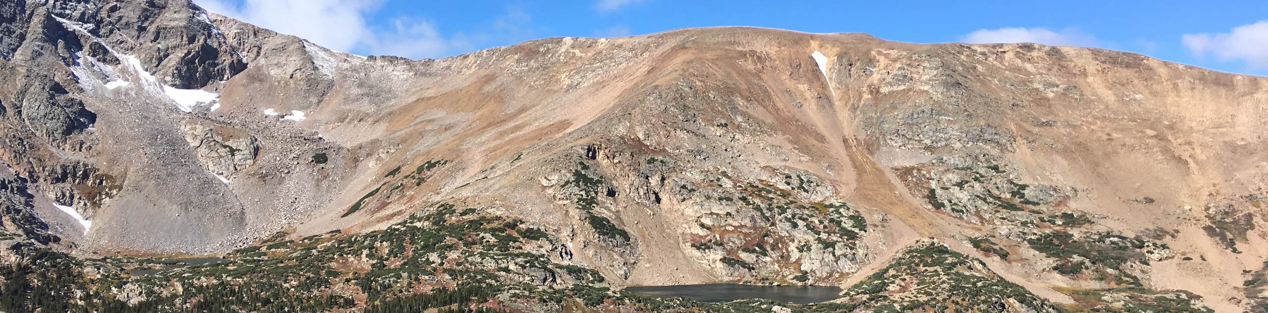
- Loch Lomond Trail - Hike the Loch Lomond Trail to a crystalline alpine lake hemmed by snow-dusted, craggy peaks. The Loch Lomond Trail is a shared OHV route through towering pine trees up to the mountain cirque. Hike, bike, or drive, we love this trail because of its versatility. Situated high on the Continental Divide, the lake offers panoramic views of the encompassing peaks and sights of the diverse Colorado landscape below. Don’t forget to bring your fishing rod if you have a permit!
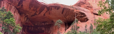
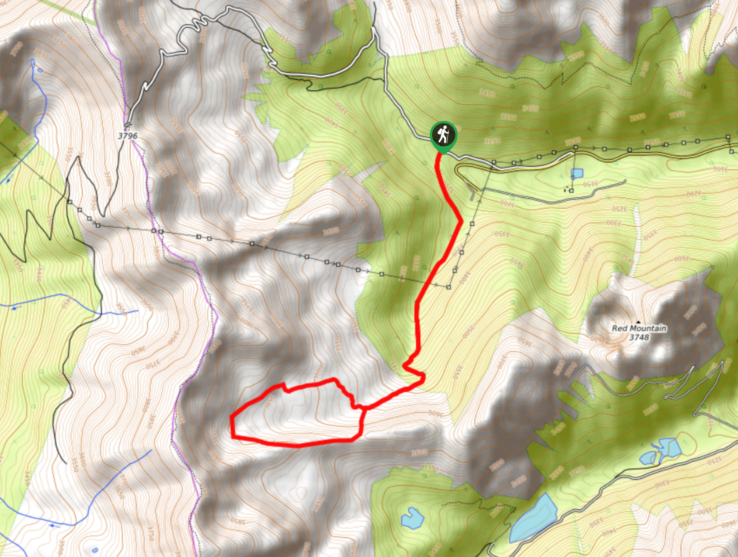
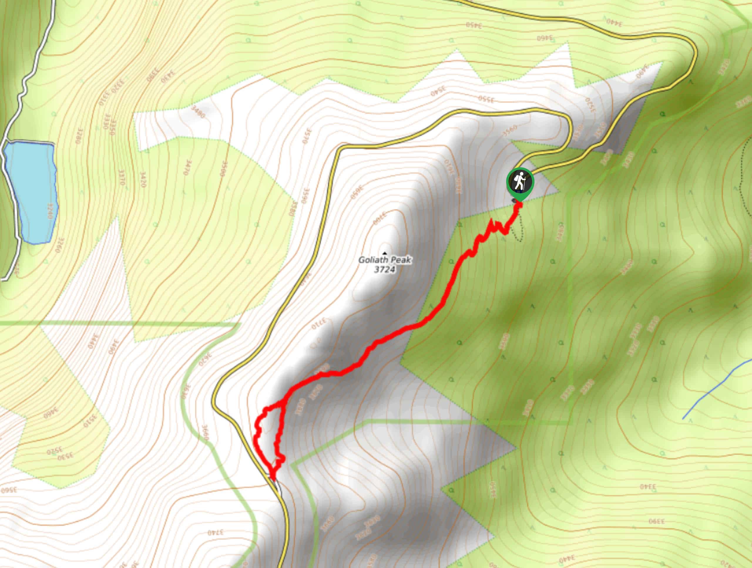
- Diamond Peaks Hike - The Diamond Peaks Hike is an exciting backcountry excursion through the Colorado wilderness. Hike the steep, but scenic primitive trail up to the summit of North Diamond Peak and the Montgomery Pass. This stimulating trek will guide adventures through dense woodlands, lush meadows, through alpine tundras, and up steep trails to summit the North Diamond Peak. From atop the mountain enjoy 360-degree panoramic vistas of the surrounding mountainous landscape that flanks the lush subalpine forests below.
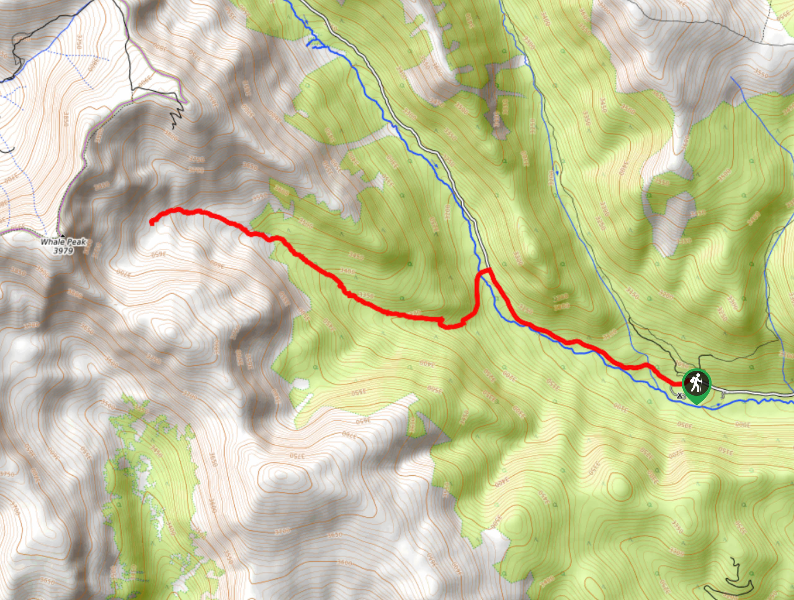
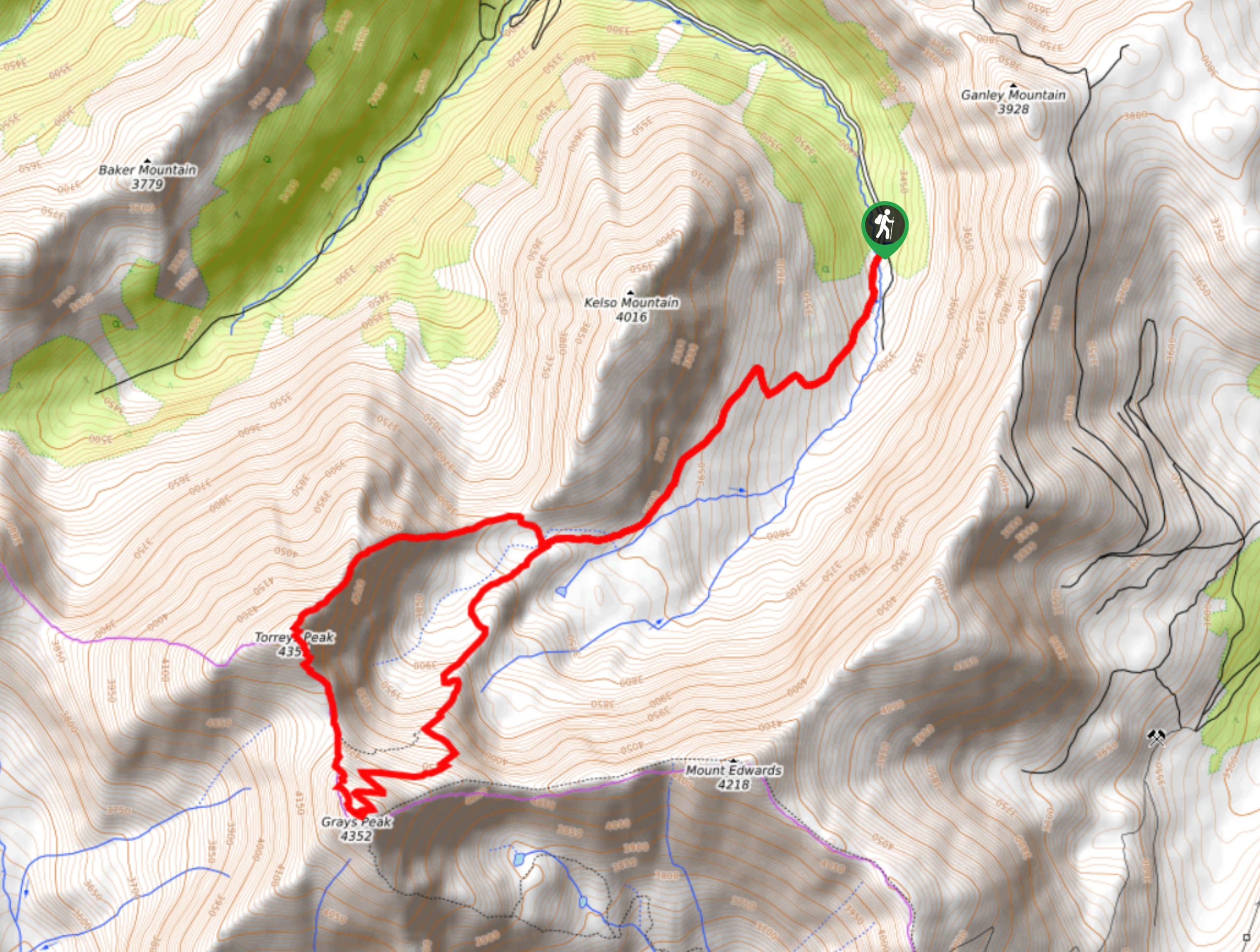
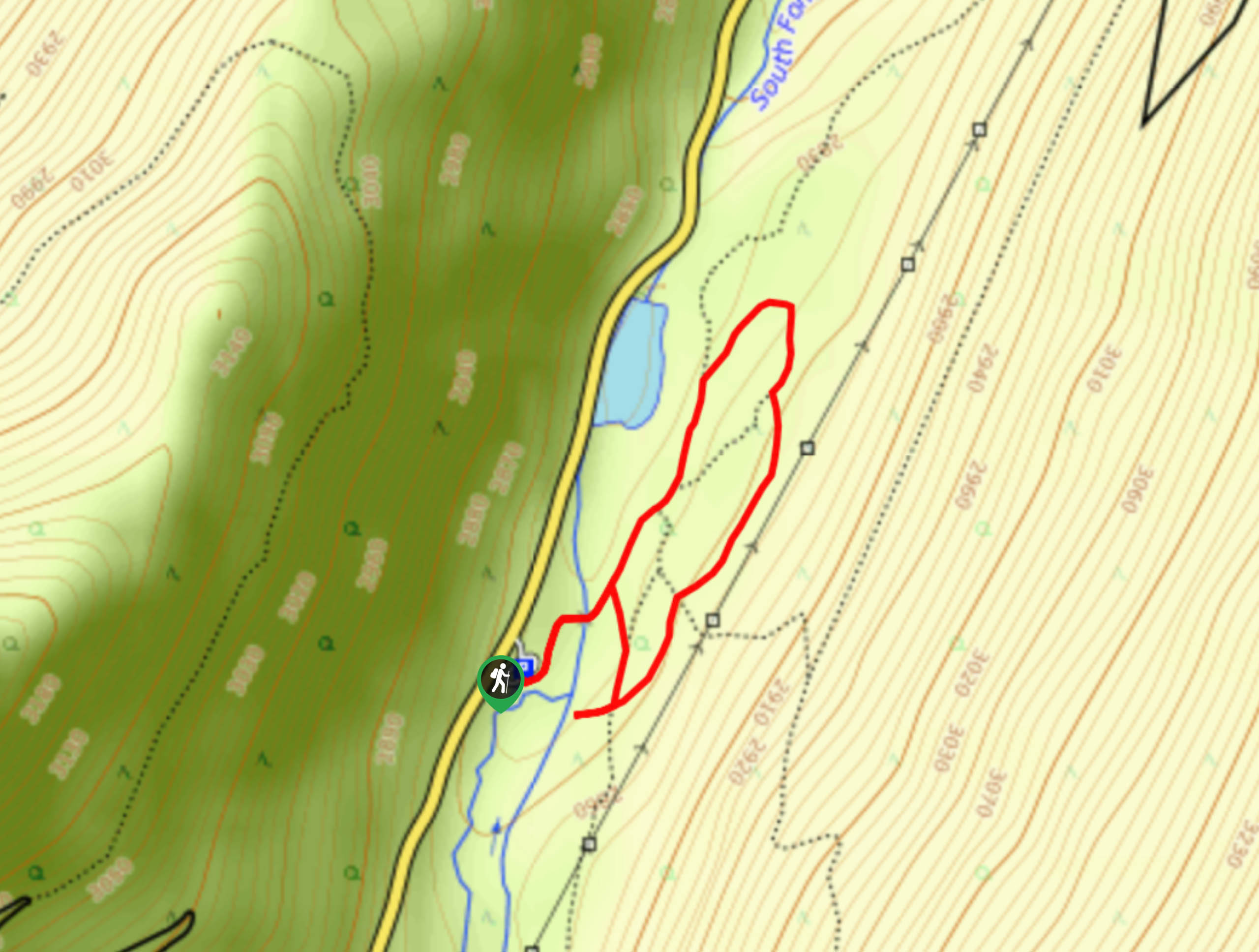
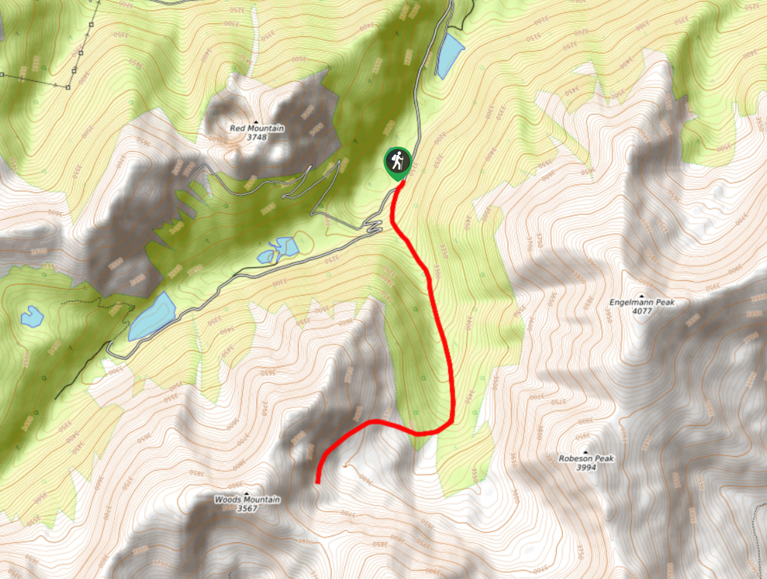
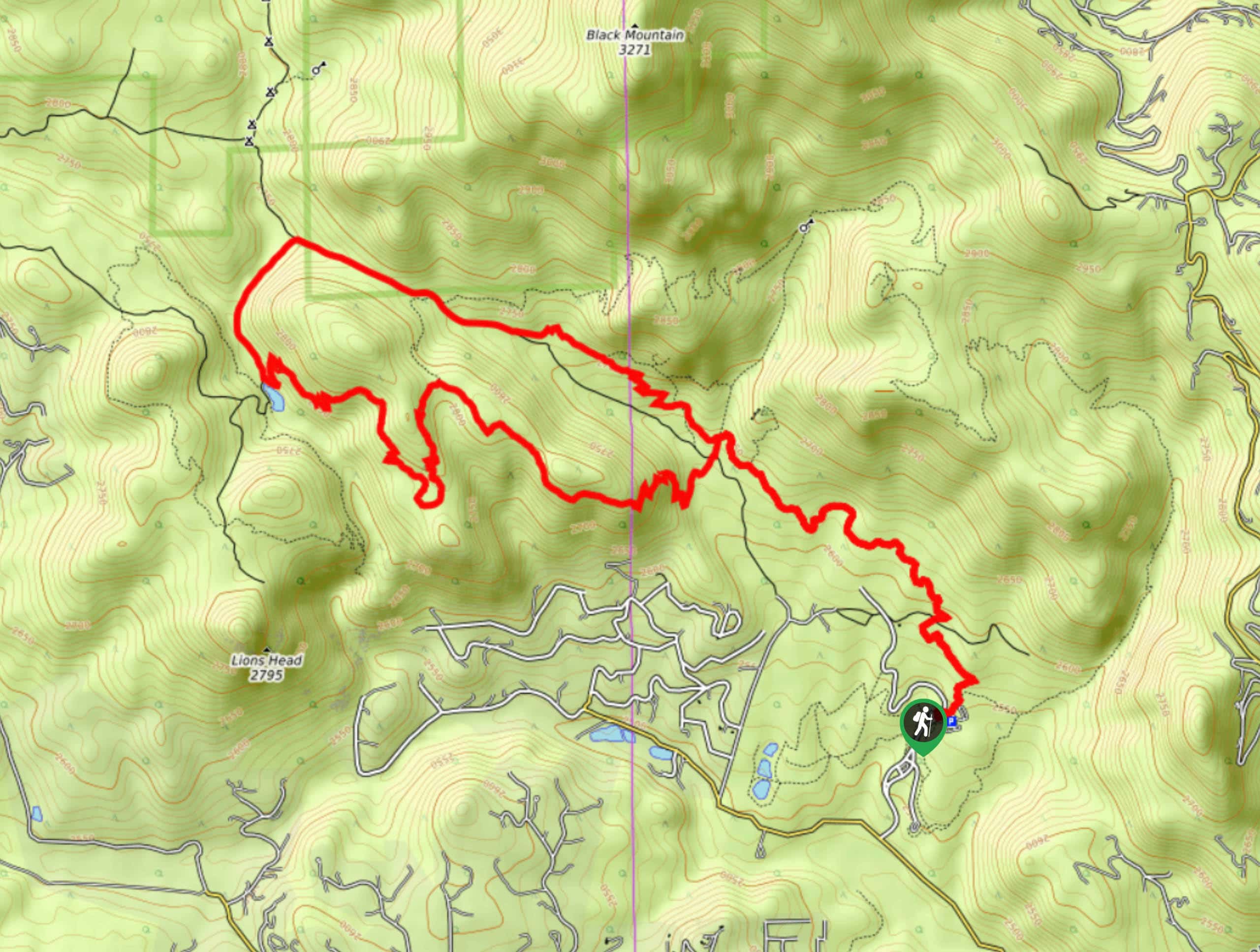
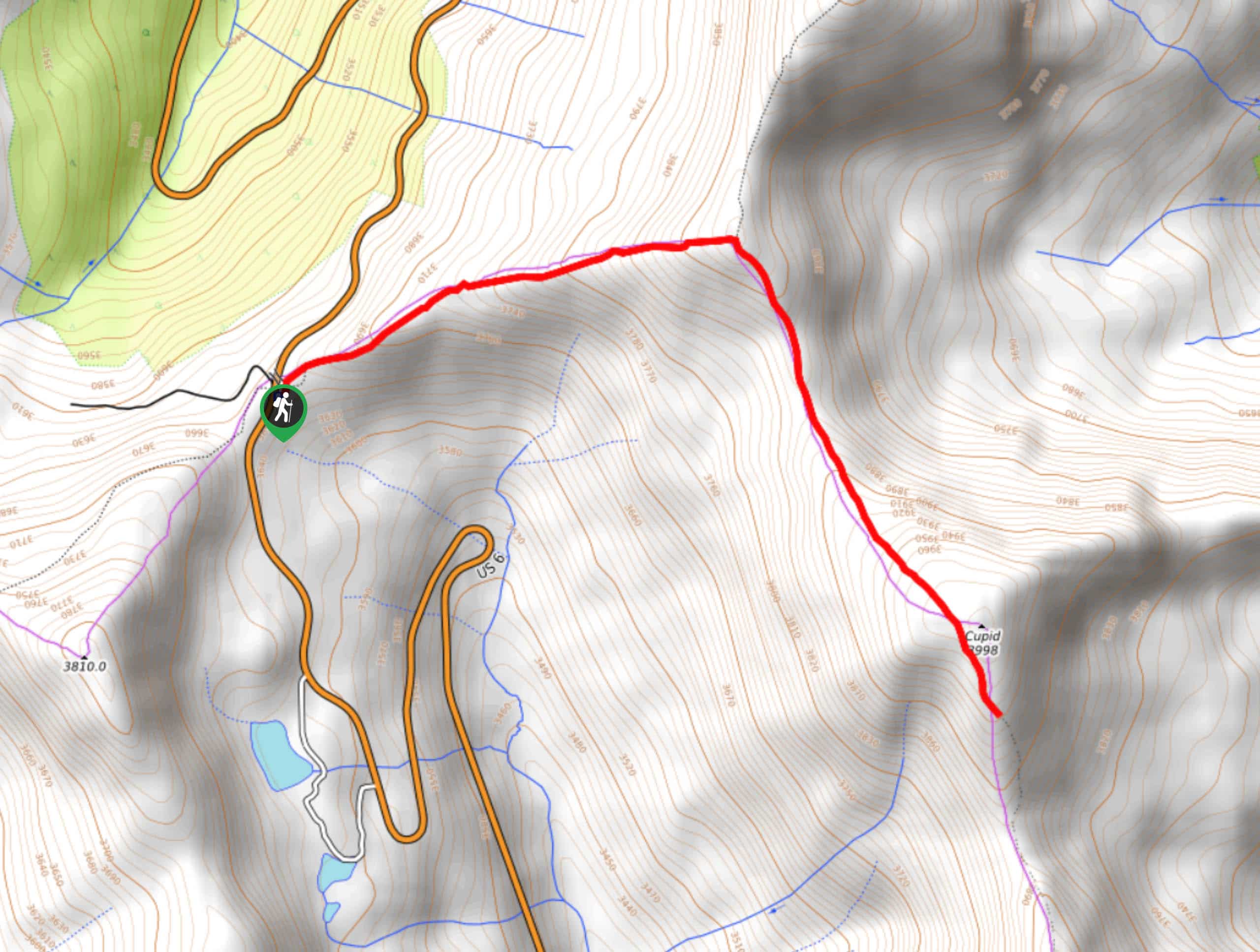
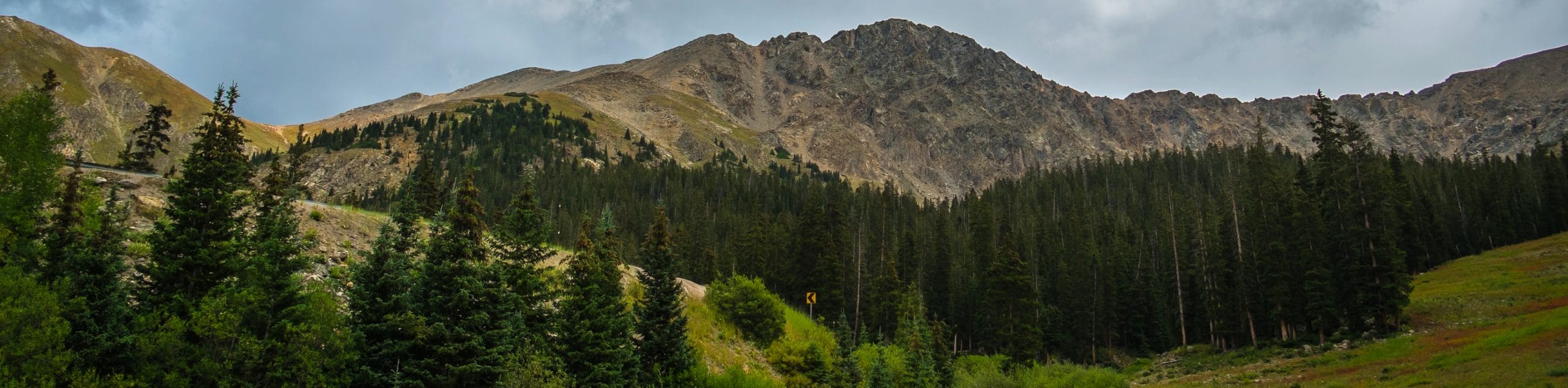
- Grizzly and Cupid Peaks Hike - Hike the Front Range to not one, but two snow-capped summits. The Grizzly and Cupid Peaks Hike is an ambitious adventure along the Continental Divide to summit the peaks. This excursion is incredibly scenic. Enjoy breathtaking vistas as you make your way along the ridge of the pass and notice the prominent Torreys and Grays Peaks in the distance. Though demanding, this venture to Grizzly and Cupid Peaks is well worth the effort.
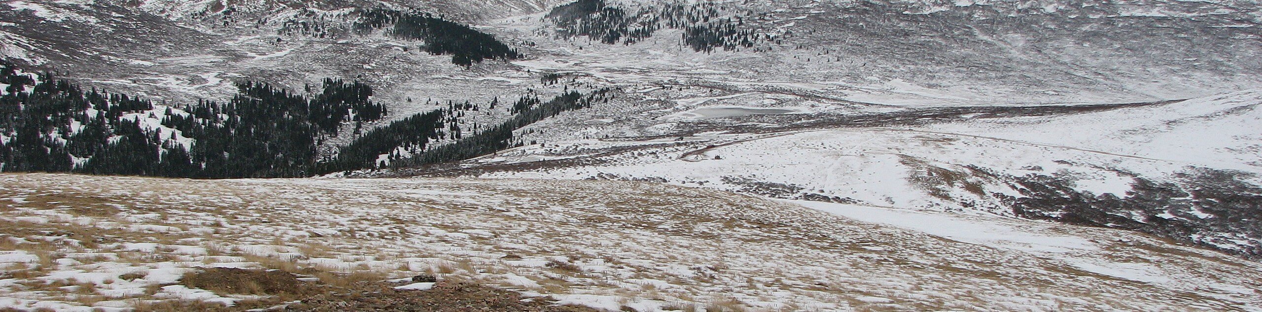
- Loveland Pass Lake Trail - The Loveland Pass Lake Trail is a family-friendly nature walk nestled among the demanding summit hikes in the area. Admire shimmering alpine lakes that sit in the foreground of the encompassing snow-dusted peaks and consider having lunch in the scenic picnic area. Adventure this hike with your little ones and keep an eye out for pika, marmots and even mountain goats as you walk the path.
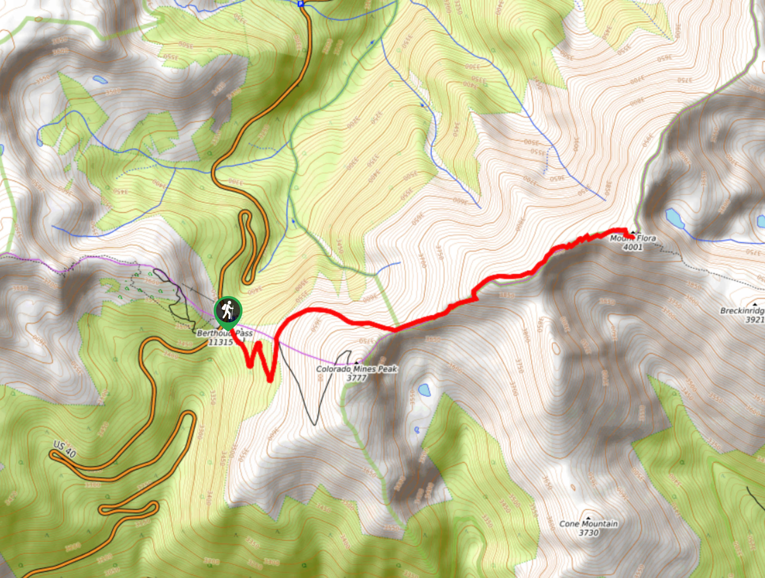
- Colorado Mines Peak Hike - Explore the Berthoud Pass Automated Weather Observing System atop Colorado Mines Peak. The Colorado Mines Peak Hike is a stimulating adventure along the Berthoud Pass up a winding service road. Navigate the seemingly endless number of switchbacks up to the summit of the Colorado Mines Peak and revel in the expansive mountainous vistas. Don’t forget to check out the weather station equipment that the Colorado Mines School uses to help aviation navigation through the Front Range.
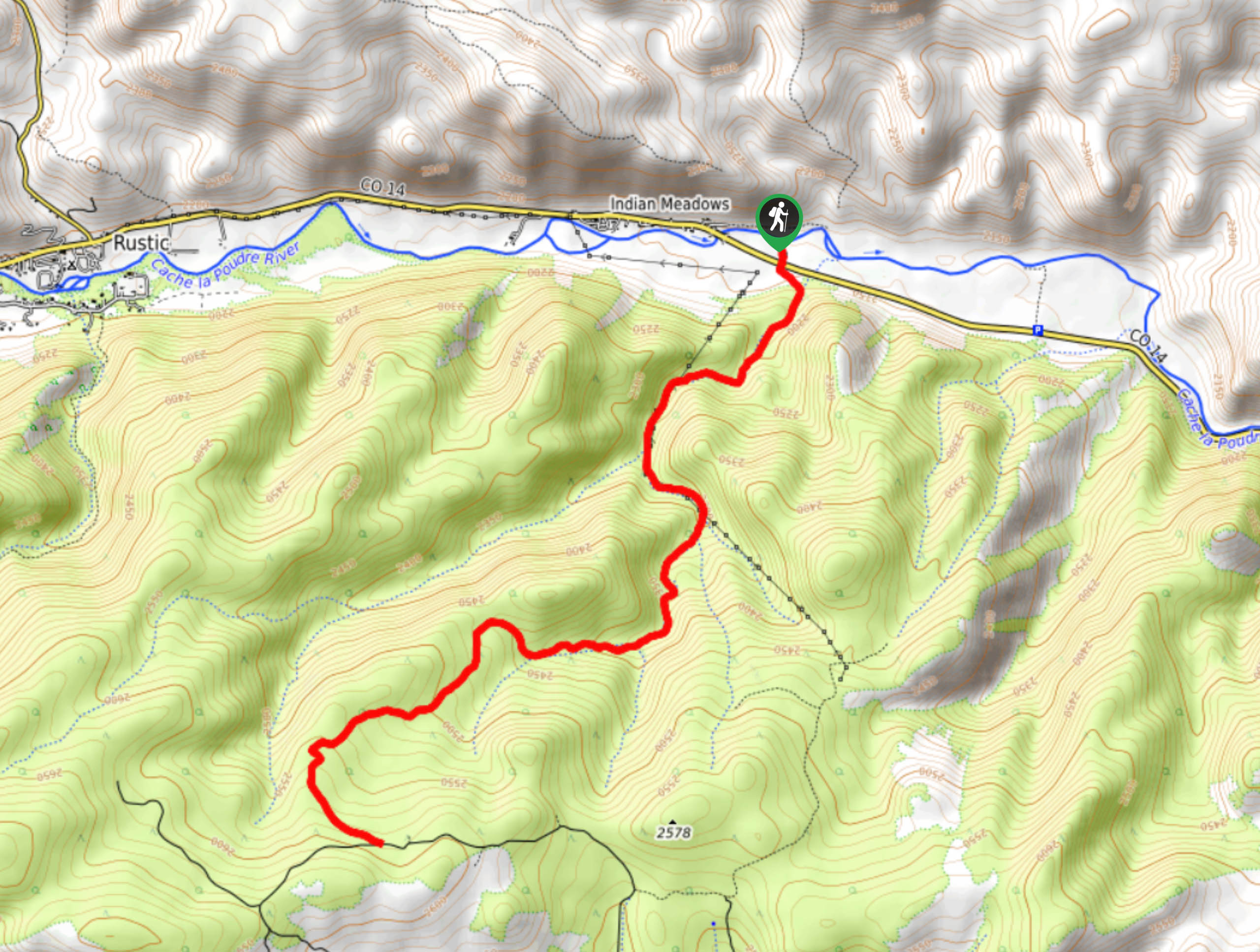
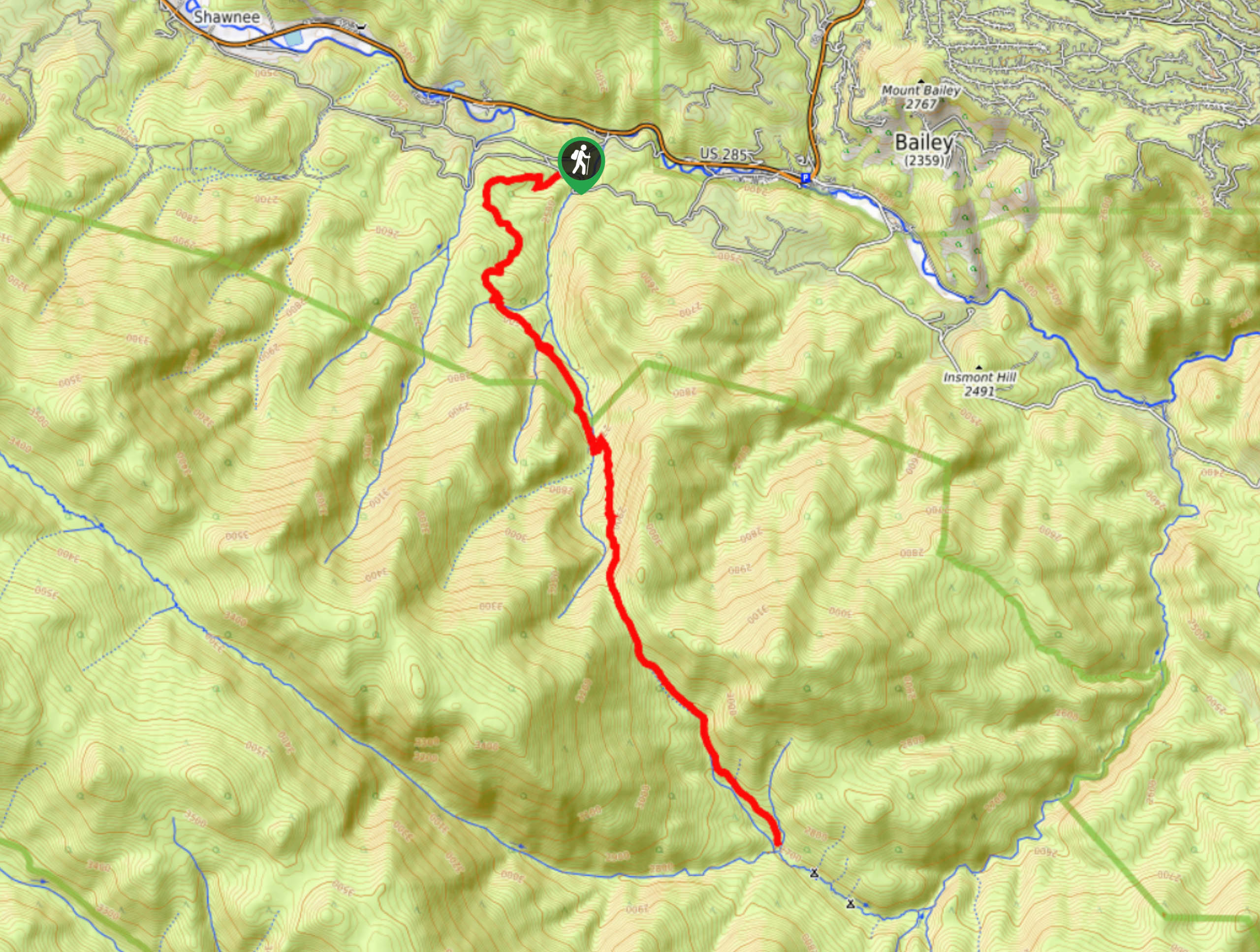
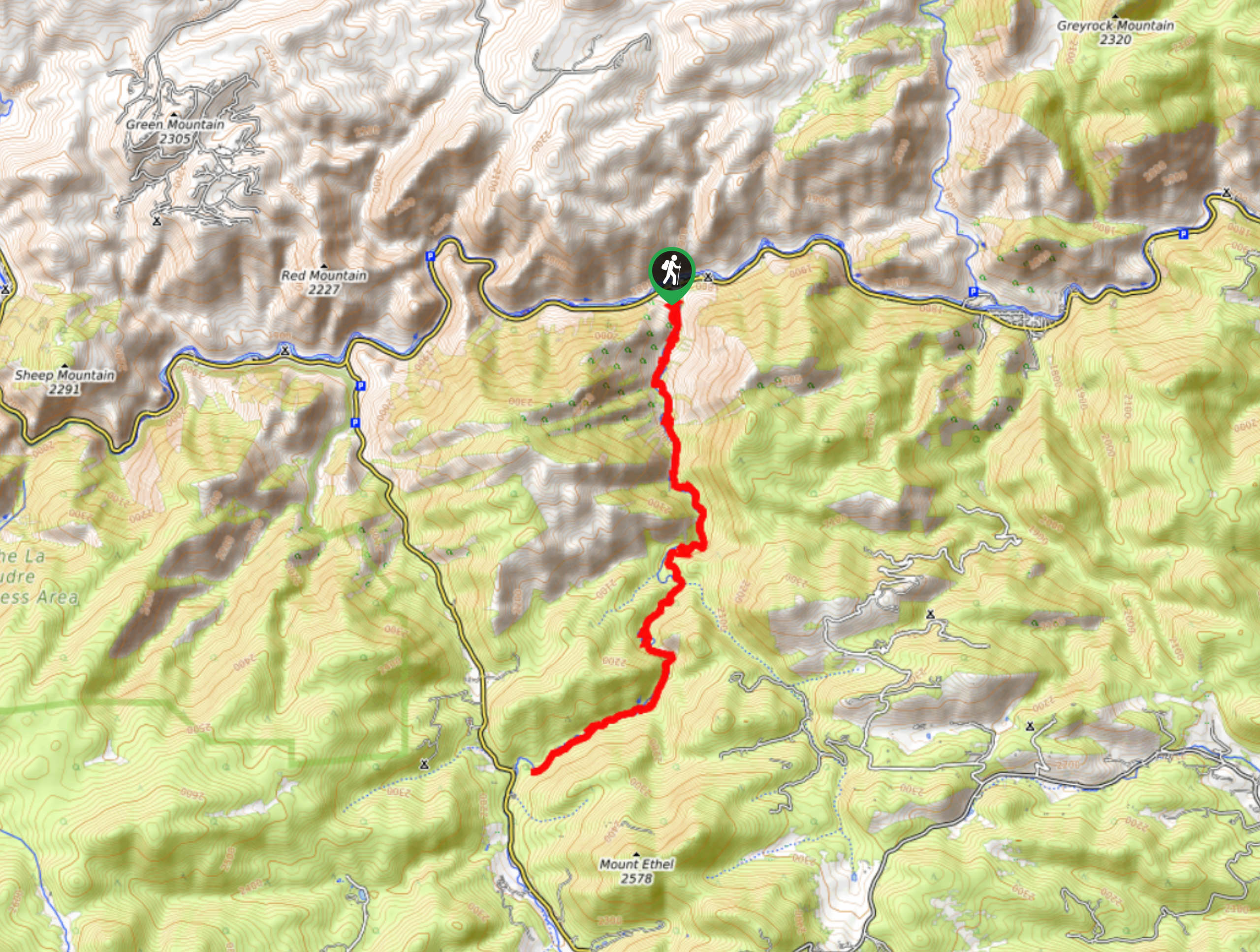
- Greyrock Trail - There is no denying that the Greyrock Trail lives up to its name. Hike the meadow-cloaked trail up through an aspen grove to the summit. Explore the pile of granite rocks that structure Greyrock Mountain. Appreciate the grandeur of the surrounding Rocky Mountains and the forested river valleys below. There is no wonder why this trail is so popular, this hike features all the best environments that the Colorado wilderness has to offer.
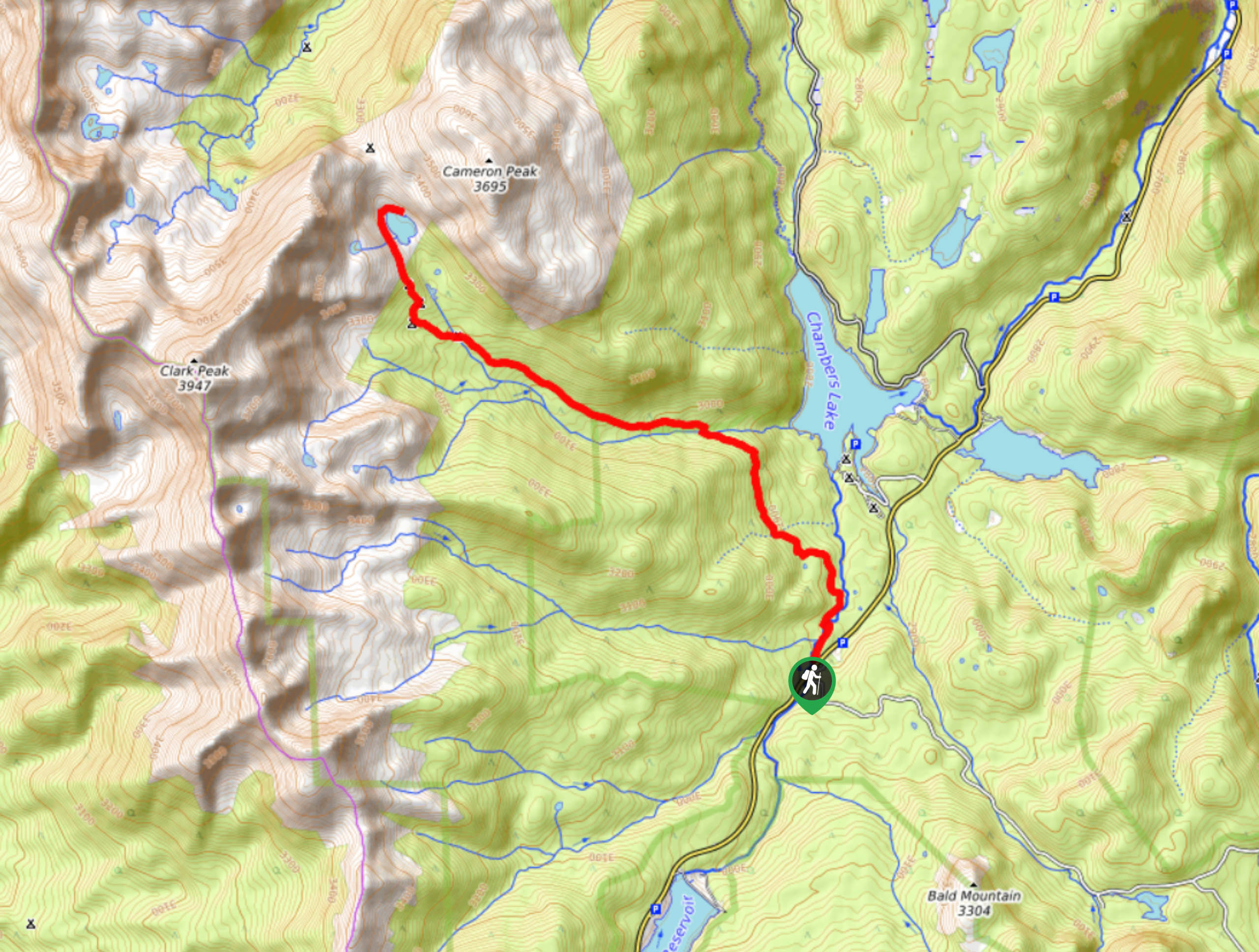
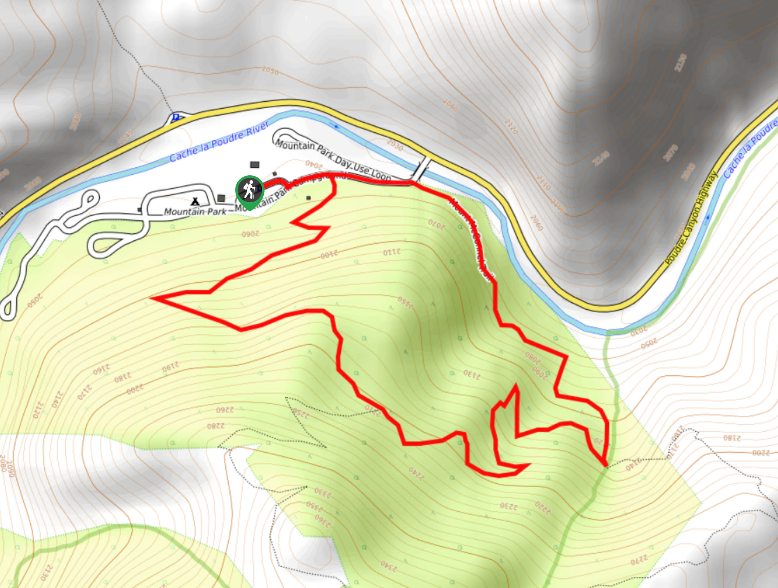
- Blue Lake Hike - The Blue Lake Hike is a stunning adventure through the Roosevelt National Forest. Travel along the soft, forested floor, past a babbling creek and small cascading waterfalls before ascending the rocky ridge to the blue-hued lake. The Blue Lake Trail is a charming family friendly adventure up to Blue Lake, hemmed by craggy peaks. Get an up close and personal view of Cameron Peak and vistas of Clark Mountain in the distance.
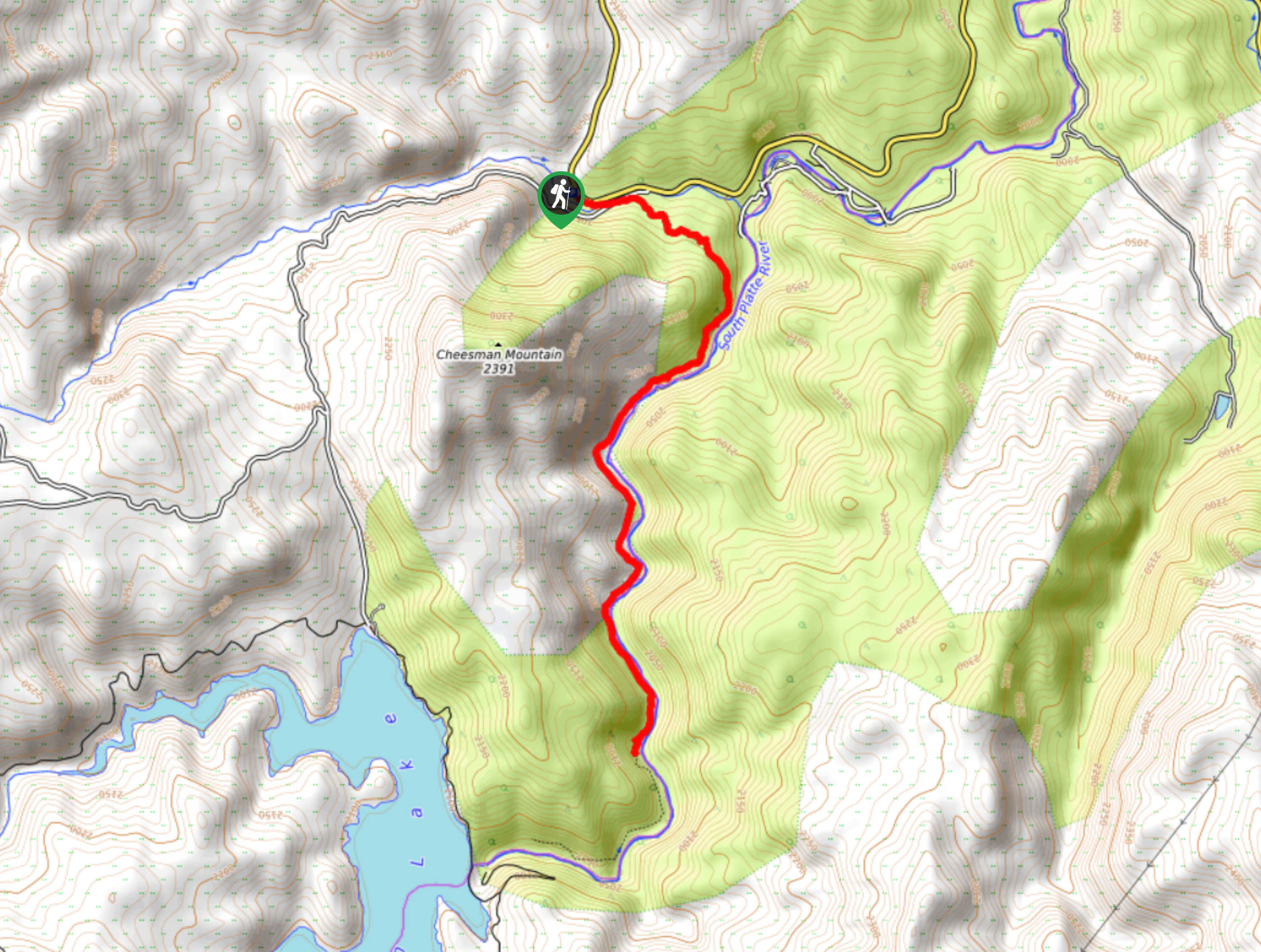
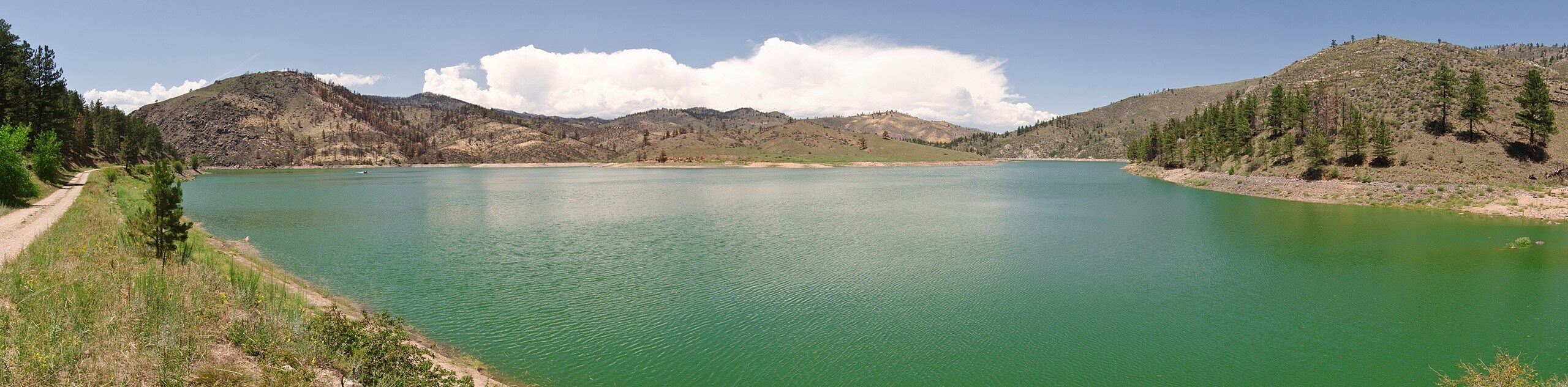
- Cheesman Canyon Hike - Cheesman Canyon Hike is one of our favorite adventures! Follow the curves of the South Platte River up to the Cheesman Reservoir. Walk along the river’s edge whilst enjoying the tranquility of the running river and sights of anglers fishing the picturesque waters. Thousands of fly fishermen flock to the South Platte River yearly to fish the abundant waters for trout. If you have a permit, bring your fishing rod and join them!
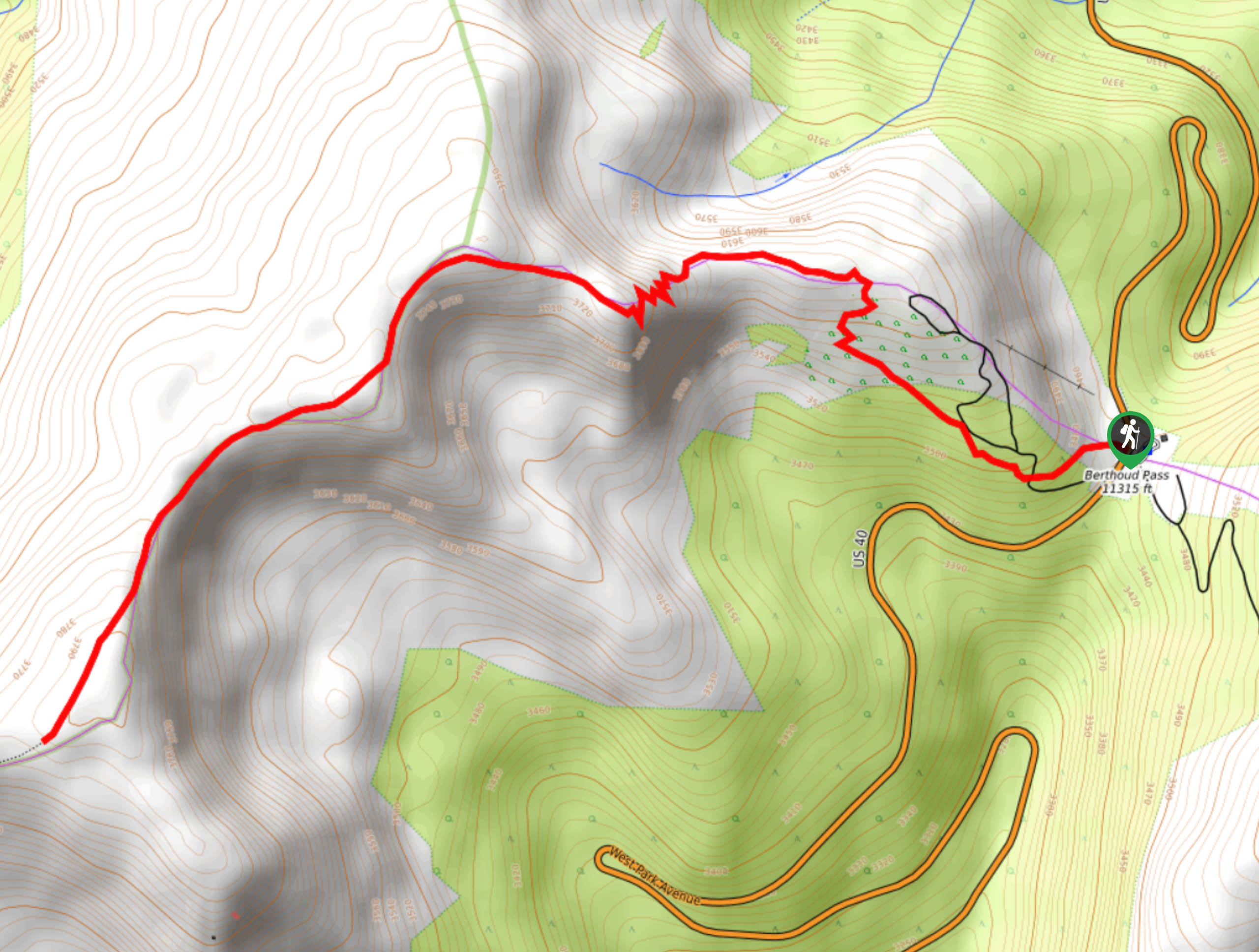
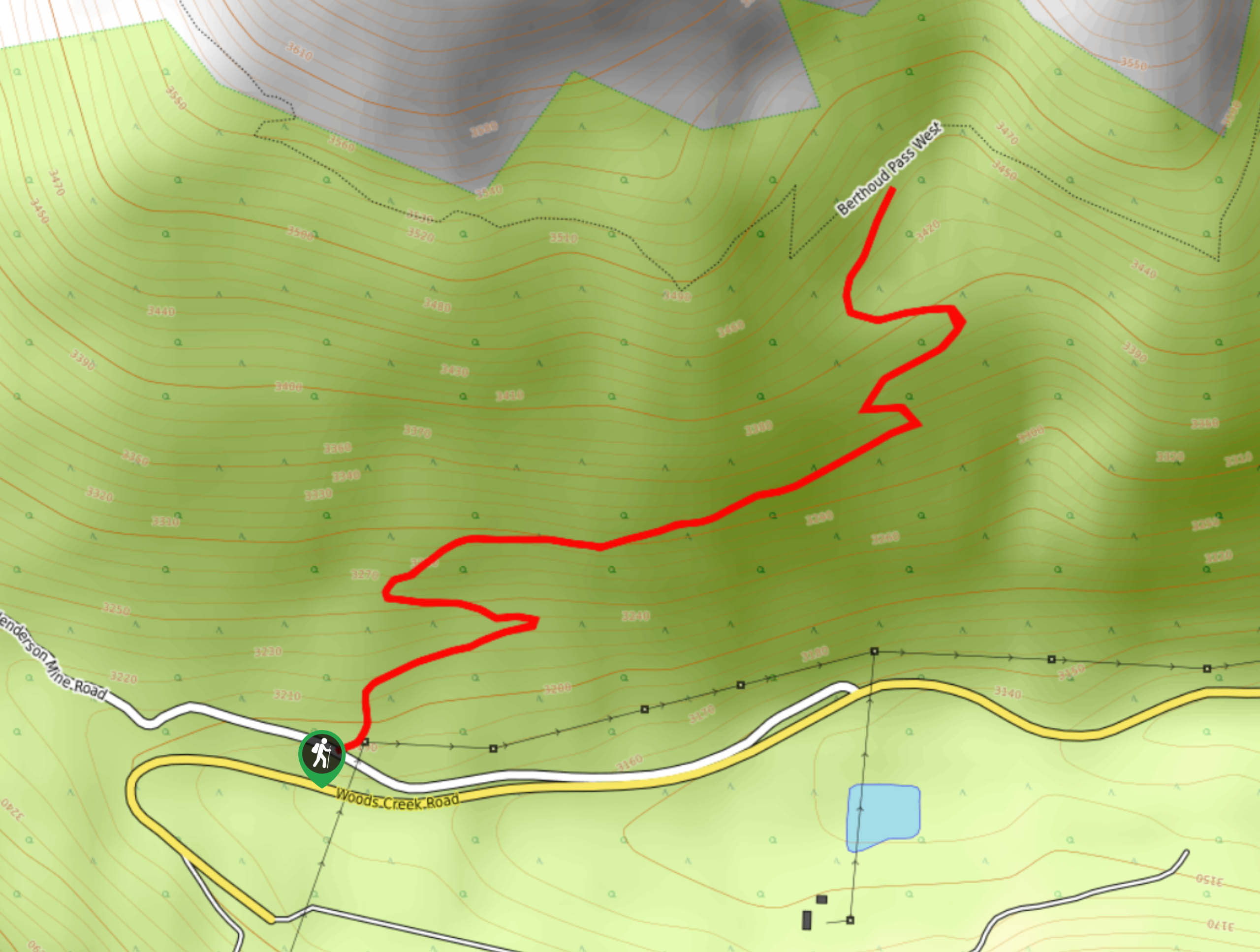
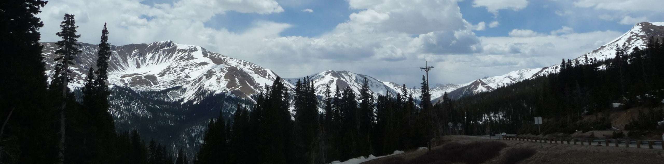
- Berthoud Pass Trail - The Berthoud Pass Trail is an unforgettable experience up the Continental Divide. This adventure will guide you up various alpine environments to the pass. Hike through the towering fir and spruce trees before ascending the exposed alpine tundra to the Divide. Trek along the ridge and feel as though you are in a movie as you walk the trail set against the picturesque Colorado backdrop. Surround yourself with the incredibly beautiful scenery and the path will reward you with a new perspective of the Colorado wilderness with every step you take.
- Devil’s Head Lookout Trail - Located in the Pike National Forest, the Devil’s Head Fire Lookout is the last of the original seven fire lookouts that dotted the granite peaks in the Front Range. This unique excursion up to the ranger’s cabin and historic fire overlook is an ideal family friendly adventure that kids will love. Blow off some steam as you track up 143 steps to the stunning lookout where you will be rewarded with striking views of the Rampart Ranges and the surrounding Colorado landscape.
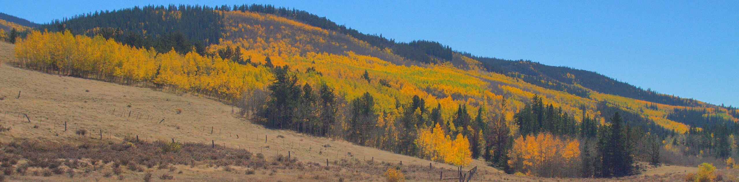
- Kenosha Pass North Hike - There is no arguing that the Kenosha Pass North Trail is the best place to immerse yourself in the golden aspens in the fall. Bring the whole family on this scenic nature walk through lush aspen groves to a meadow that exposes you to expansive vistas of the encompassing Front Range peaks. Though this trail can be adventured year-round, the autumn vibrance is unforgettable.
- Butler Gulch Trail - The Butler Gulch Trail is a scenic expedition through the Arapaho National Forest. The diversity of this hike will astound you, travel up through towering pine and fir trees, past small waterfalls, along a babbling creek up to the alpine tundra. Ascend the timberline and the path will reveal panoramic vistas of the encompassing snow-capped peaks that hem the verdant forested valleys.
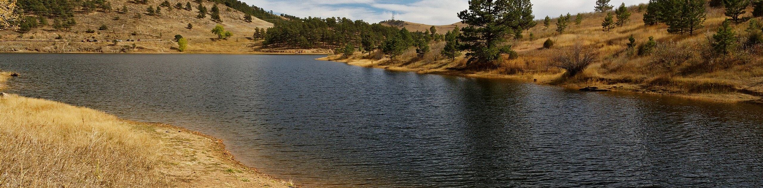
- Pinewood Reservoir Hike - Hike the shoreline of the Pinewood Reservoir along this family-friendly nature walk. The Pinewood Reservoir offers several outdoor activities that outdoor enthusiasts of all sorts will enjoy, hike, bike, kayak, fish, snowshoe, or canoe. Hike the woodland path around the lake’s edge and bask in the impressive vistas. The Pinewood Reservoir Trail and the surrounding recreational area is ideal for a weekend adventure into nature!
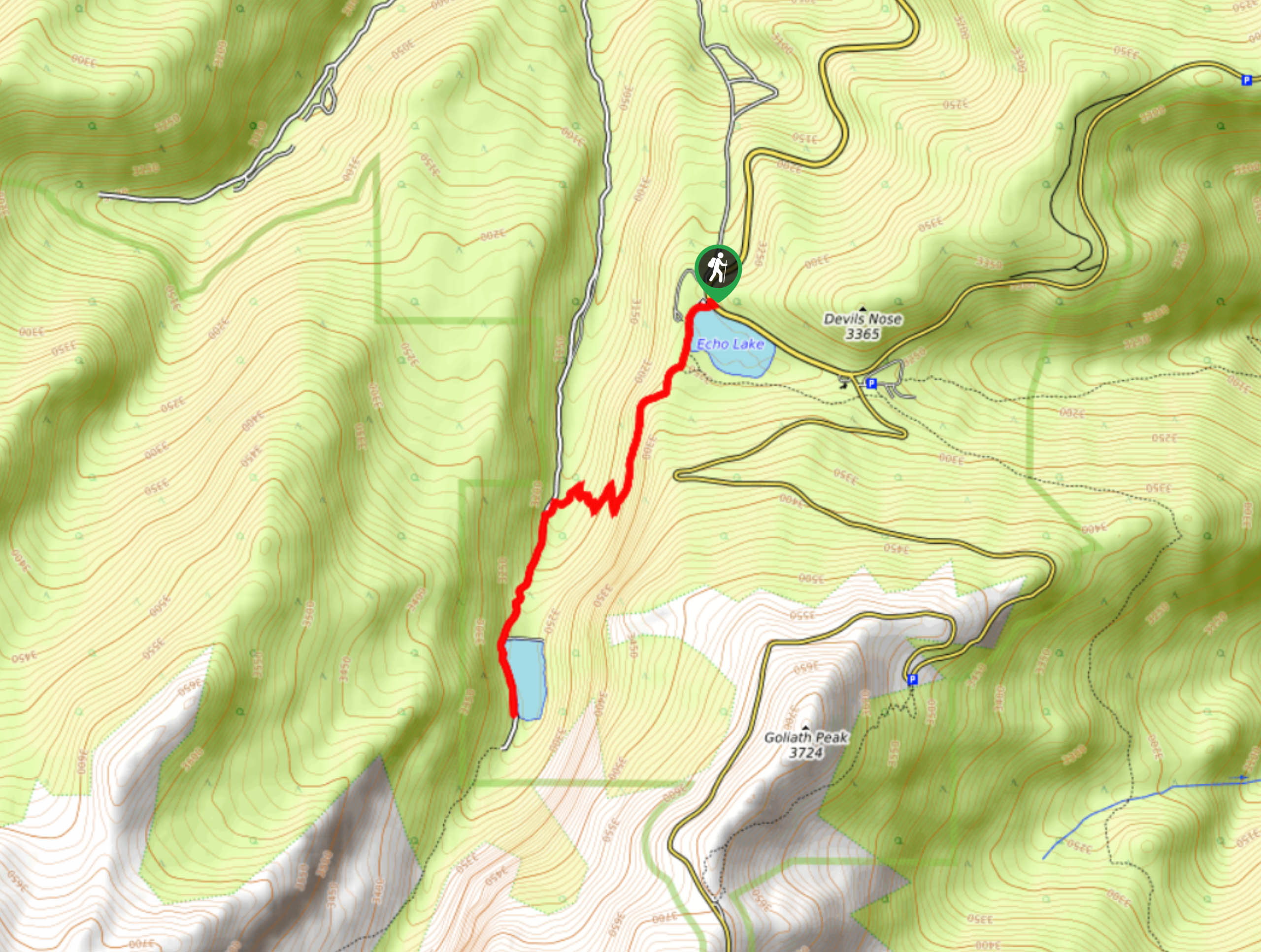
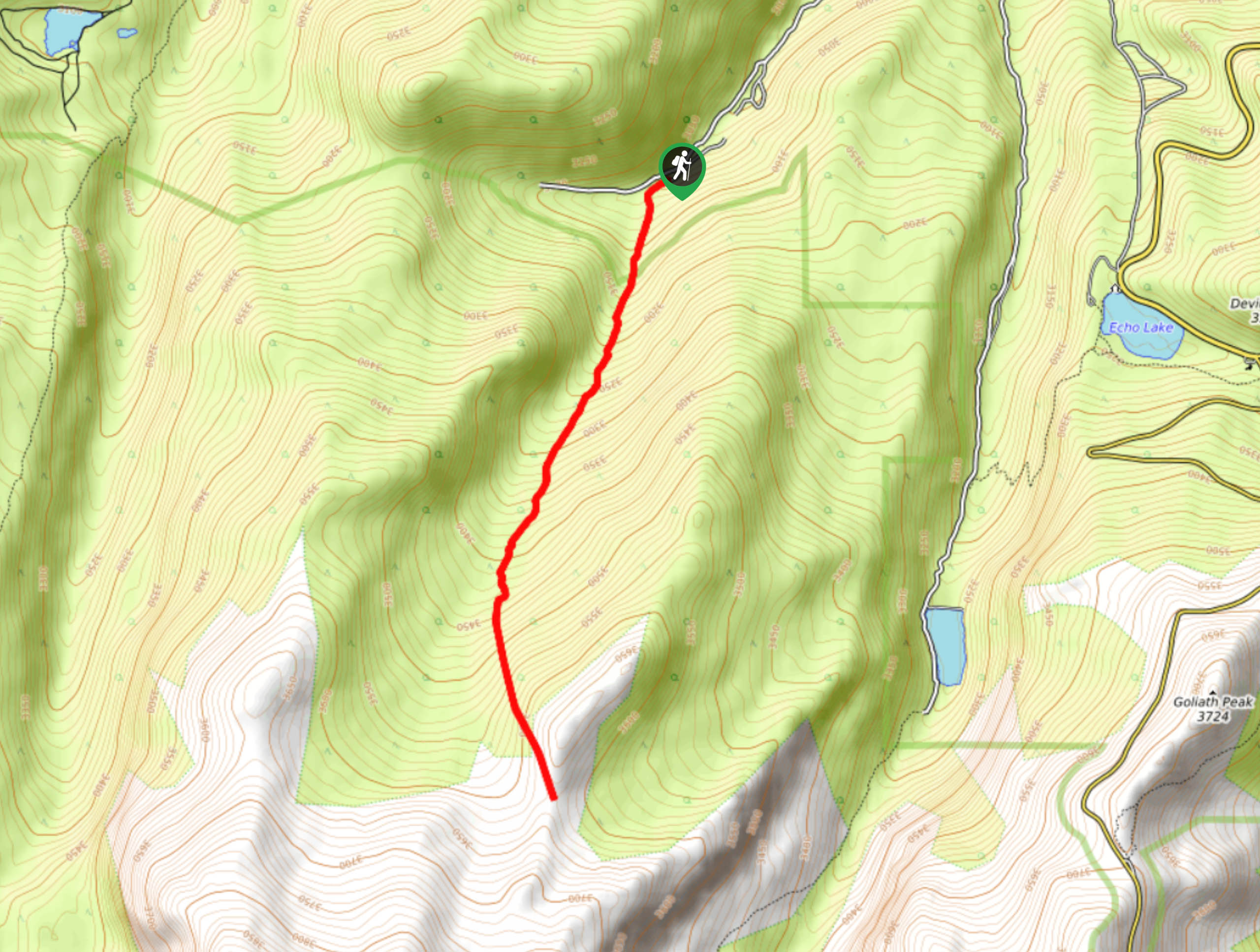
- Echo Lake Trail - Located near the Mount Evans Byway, the Echo Lake Park and trail is a popular spot. The Echo Lake Trail is short and sweet. Weave along the shore’s edge and through dense pine forests. This easy to navigate, well-maintained trail is perfect for hikers of all-skill levels and young kids. Adventure this path on your next trip to the Mount Evans Wilderness
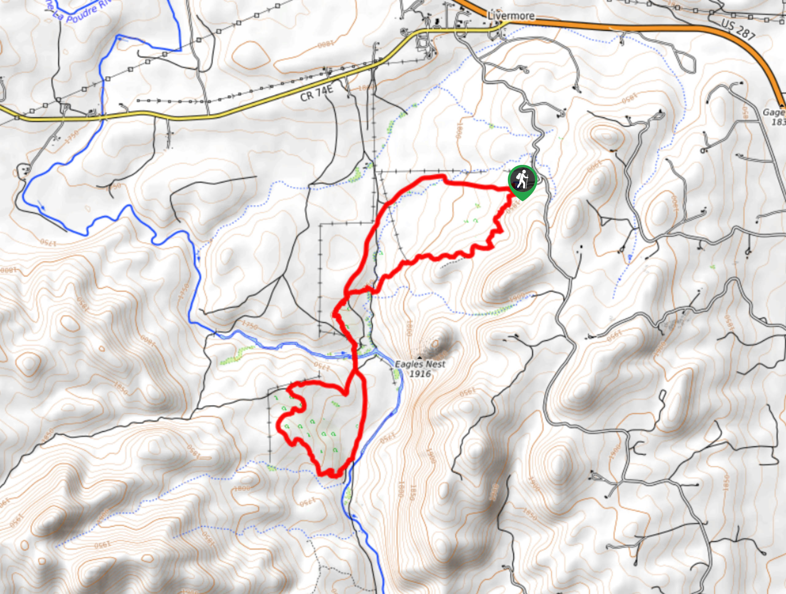
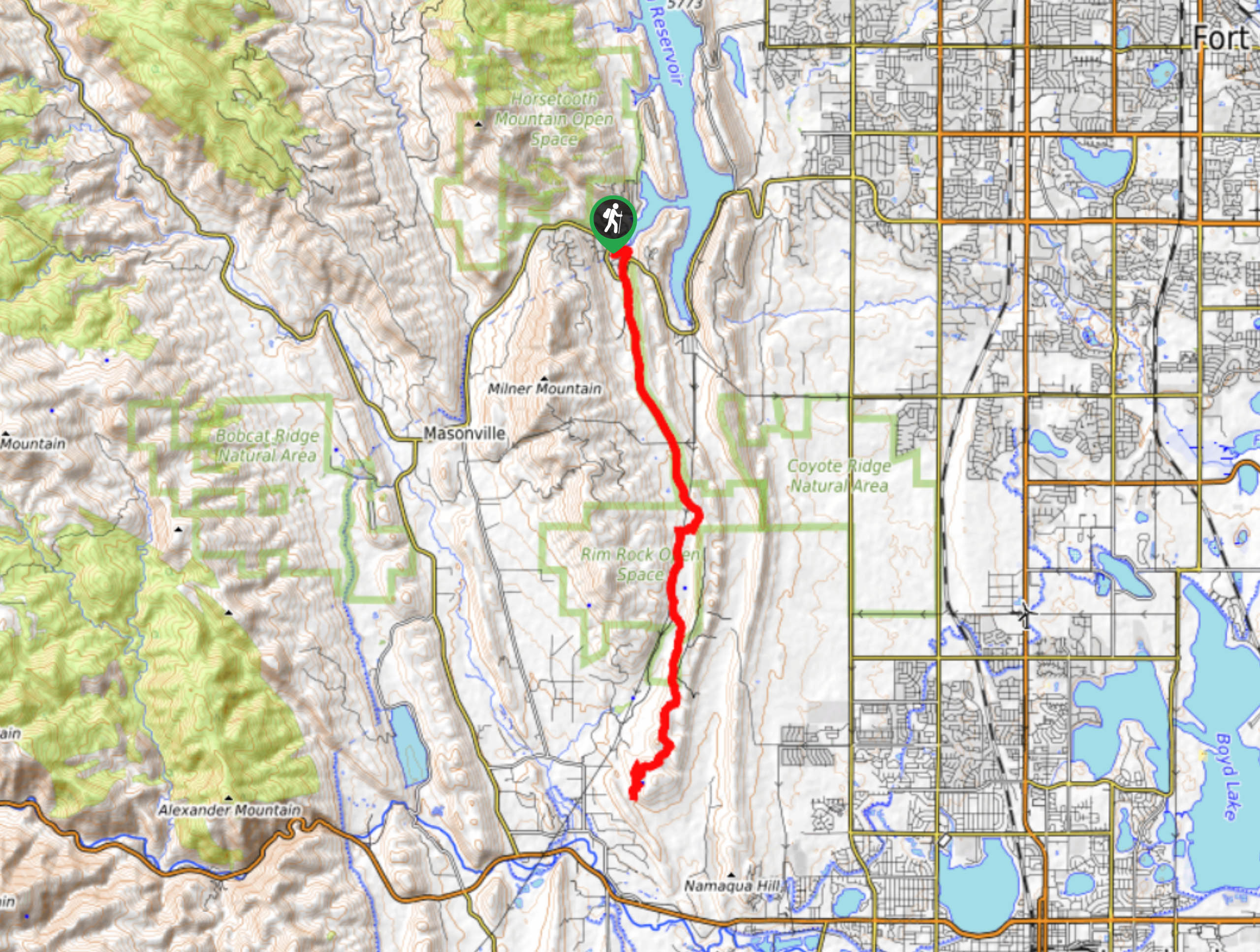
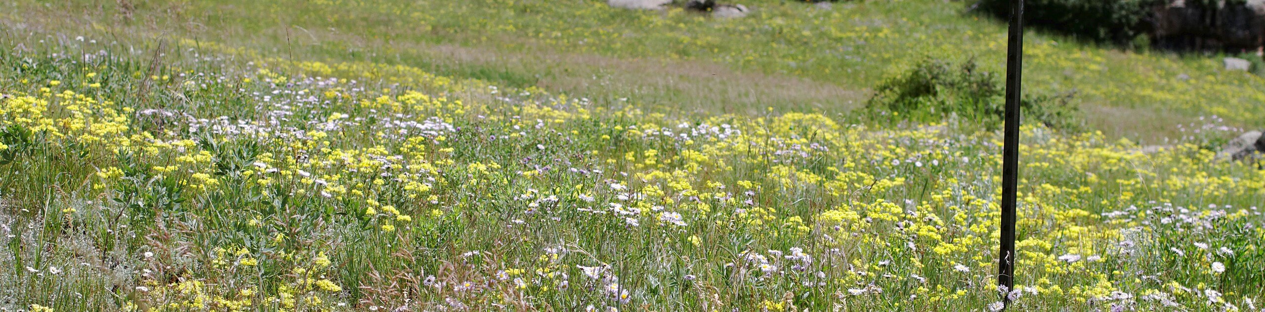
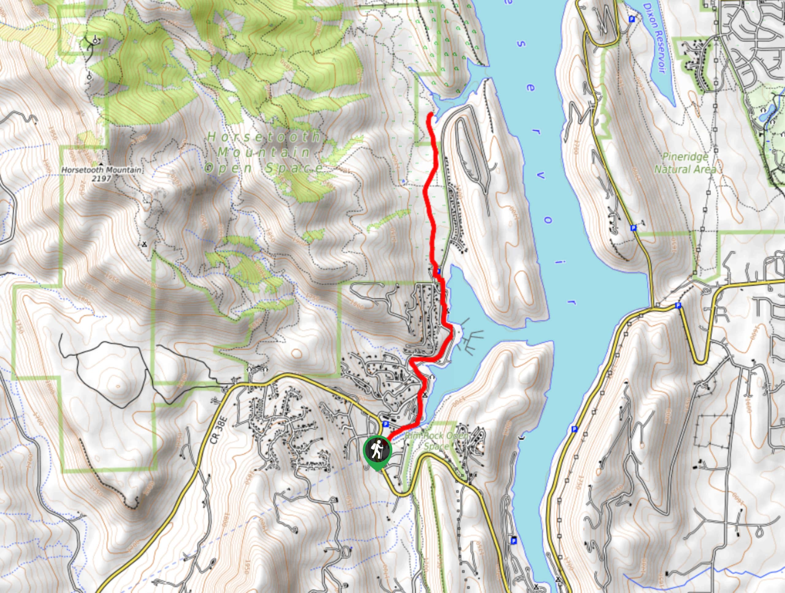
- Horsetooth Falls Hike - Hike up to Horsetooth Falls and enjoy the ambiance of the waterfall. This adventure is a crowd-favorite in the Horsetooth Mountain Open Space. This trail is the perfect excuse to get your whole family out into nature. Trek the incredibly scenic path along plains abundant with wildflowers, through a pine forest and to a cascading waterfall. Dip your tired toes in the waterfall pool and enjoy the relaxing sounds of the cascading waterfall.
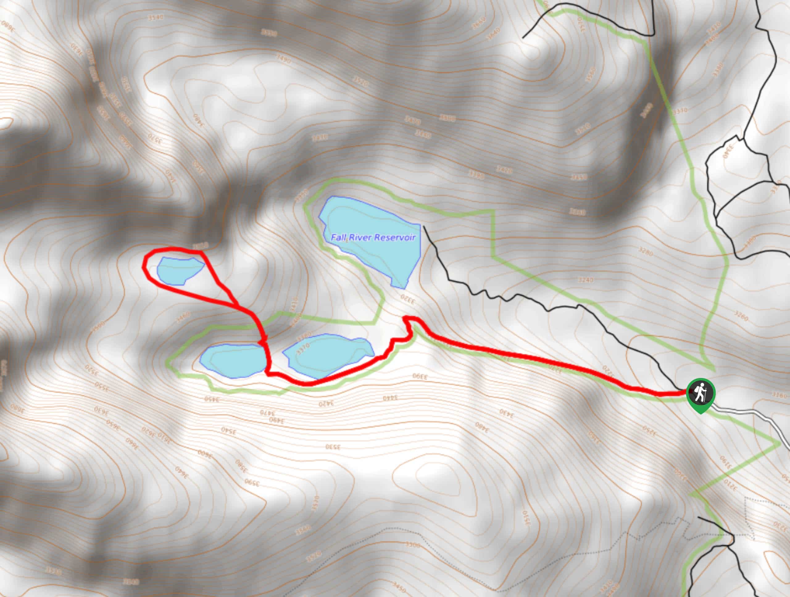
- Herman Gulch Trail - Hike the Herman Gulch Trail up to a crystalline alpine lake hemmed by snow-capped mountains. The Herman Gulch Trail is an unforgettable experience up a forested creek valley to unobstructed views of a crystal-clear lake hemmed by the Continental Divide. Challenge yourself as you ascend the rocky terrain to Herman Lake. Explore the lake’s shore and bask in the beautiful scenery that surrounds you.
- Mount Flora Hike - The Mount Flora Hike is a wonderfully scenic trail along the ridgeline of the famous Continental Divide. This adventure demands high effort, but the stakes are highly rewarding. The Mount Flora Trail is an unforgettable adventure through the diverse terrain of the Arapaho National Forest and up to the summit Mount Flora. Revel in the expansive panoramic views of the surrounding mountainous landscape from atop the summit.
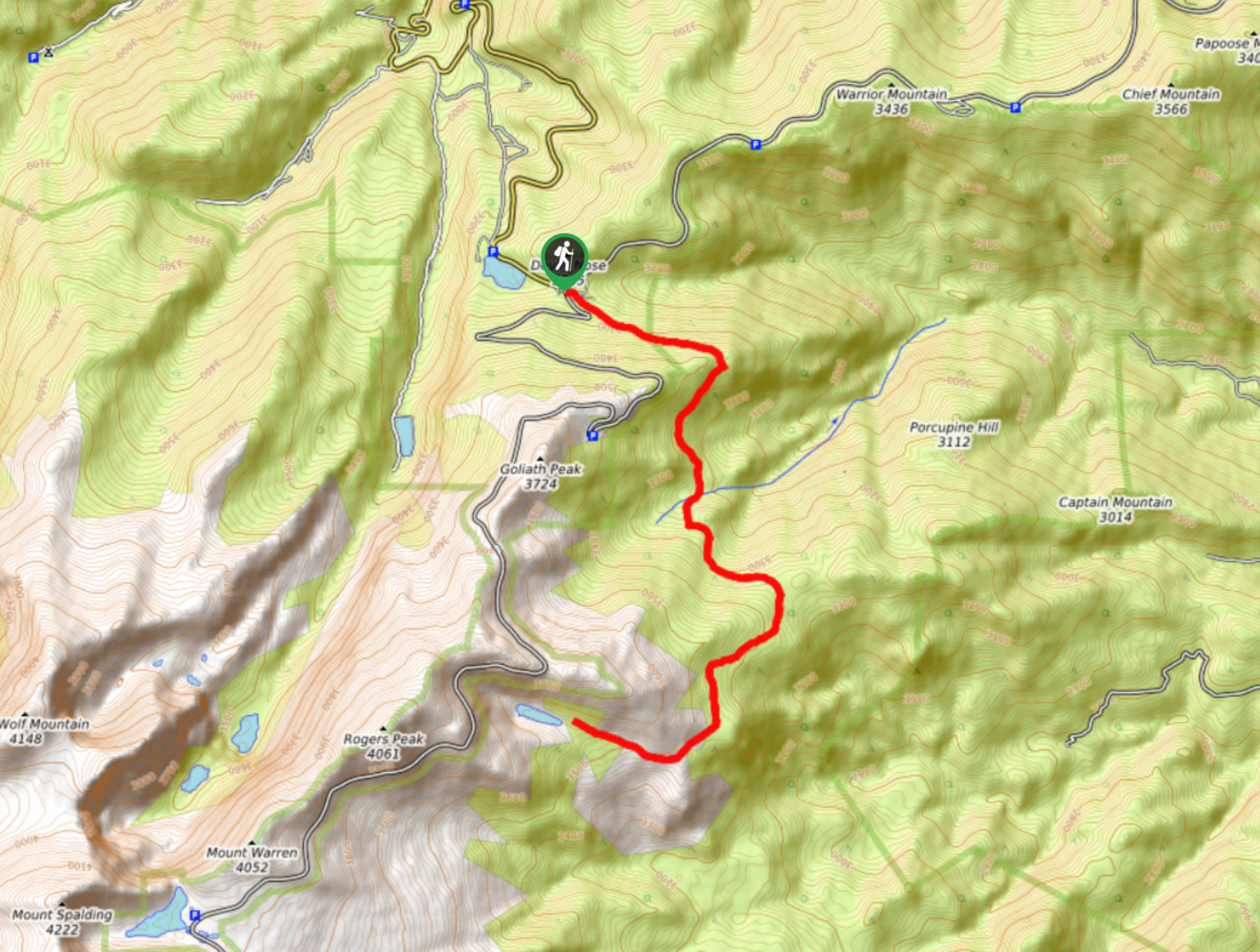
- Chief Mountain Hike - The Chief Mountain Hike is an easily manageable summit adventure in the Front Range region. This excursion ascends the woodlands up to the rocky summit. Navigate the switchbacks up to the peak where you will be rewarded with views of the Mount Evans Wilderness and the dozens of peaks that dot the Colorado landscape below.
Scroll down to see all of the hiking trailers in the Front Range.
When Is the Best Time to Visit the Front Range?
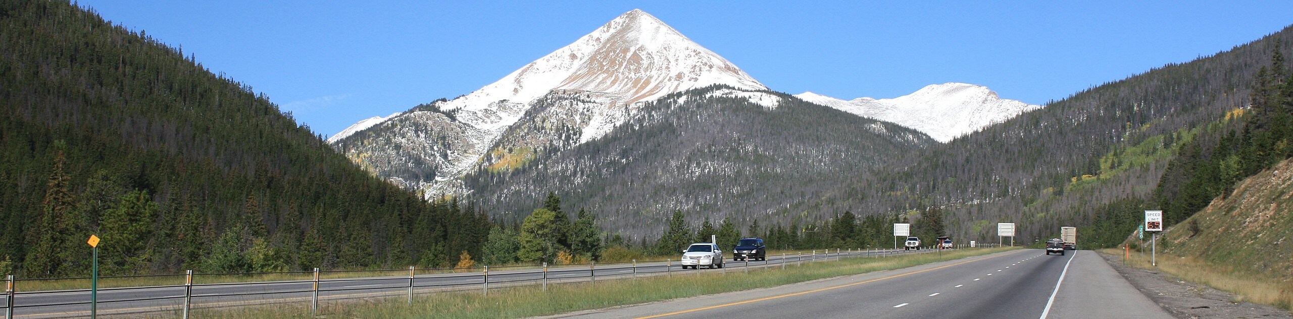
As Coloradans often preach, the state has the best weather all the time. This answer isn’t wrong per se, but it isn’t exactly true. Like the state of Colorado, the Front Range has two major tourist seasons- the winter months and the summer. Each season attracts a different type of adventurer, so depending on what you intend on doing, dictates the best time of year to visit.
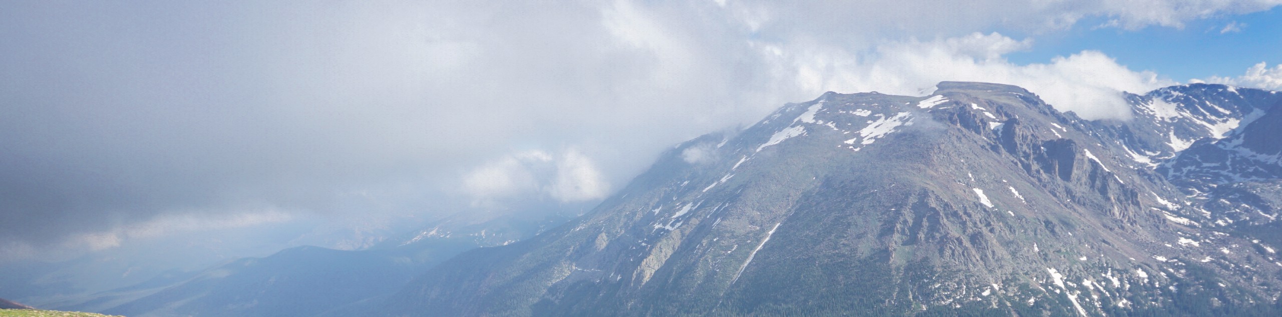
The Front Range can be enjoyed year-round, but if you are hoping to backpack, camp, bike, or hike, consider heading out to the mountain range in the summer. Summers in the Front Range region see vibrant wildflowers, verdant vegetation and optimal fishing or swimming weather. It is worth noting that along with the warm air and lush greenery presents the increased possibility of getting caught in an afternoon thunder and lightning storm. These afternoon occurrences are notorious among the sky-scraping peaks in the Front Range.
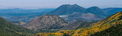
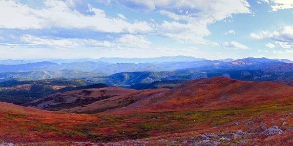
Our favorite month to visit the Front Range might just be autumn. The thinning crowds and the crispness of the fall air appeals to us. Enjoy the sights of the vibrant aspen trees and trek along the crispy leaves that line the paths. Note that the autumn at high elevation warrants snowfall so though it may be warm at the trailhead, an autumn summit hike will usually culminate on a snow-dusted peak.
The winter months are equally as busy as the summer months in the Front Range. Adventurers trade their hiking boots for snowshoes or skis as they explore the snowy mountain range. There are plenty of ski resorts that litter the Front Range region and intrepid adventurers can even backcountry ski down the impressive peaks. The Colorado Front Range is a crowd-favorite for a reason, and the versatility of its peaks attract adventurous spirits year-round.
Other Outdoor Activities in the Front Range
The Front Range offers much more than just breathtaking wilderness hikes and summit treks. There are outdoor activities to satisfy all sorts of outdoor enthusiasts, and hiking is just one. There are plenty of exciting opportunities to participate in, like off-roading up one of many certified OHV summit trails, backcountry skiing down the Berthoud Pass or snowshoeing through Homestead Meadows.
There are also many reservoirs, alpine lakes, and rivers perfect for fishing! The Cheesman Canyon is not only an awesome hike, but a renowned fishing destination. Like we said, this region has it all and will please all sorts of adventurous spirits.
Frequently-Asked-Questions About the Front Range
How long is the Front Range?
The Front Range is approximately 300.0mi long. The Front Range spans from Casper, Wyoming all the way down to Pueblo, Colorado.
How many peaks are there in the Front Range?
There are 917 named mountains in the Front Range.
What is the highest peak in the Front Range?
Grays Peak is the highest mountain in the Front Range that stands at about 14278ft in elevation. Grays Peak is also the highest summit along the Continental Divide.
What is considered the Front Range?
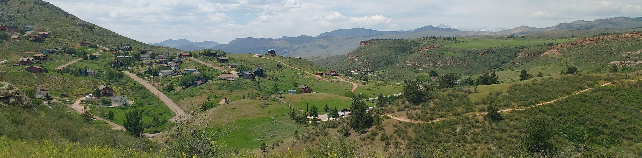
The Front Range includes the Rocky Mountain National Park, Indian Peaks Wilderness, Medicine Bow, Laramie Mountains, Pikes Peak, Mummy Range, and more. The expansive mountain range also borders the cities of Denver, Fort Collins, Boulder, and Colorado Springs.
Is Breckenridge the Front Range?
Yes, Breckenridge Mountain is located within the Front Range region. The Breckenridge Ski Resort’s highest summit peaks at 12998ft, awarding it the title of the highest ski resort on the Front Range.
Adventures Tours in Colorado
Bummer, we have yet to create a Front Range adventure package…ensure to keep an eye out as we are working to add more tours in the area! Until then, take a look at our other epic Colorado Adventure Tours, like the Rocky Mountain National Park Hiking Tour.
Find other amazing hiking regions in Colorado
- Rocky Mountain National Park
- Indian Peaks Wilderness
- Boulder
- Denver
- Aspen
- Black Canyon of the Gunnison National Park
The best hikes in Front Range
01. Mount Evans via Chicago Creek Hike
Difficulty
The Mount Evans via Chicago Creek Hike is a beautiful, but demanding hike through Colorado’s… Read More
02. Diamond Peaks Hike
Difficulty
The Diamond Peaks Hike is a scenic trek through the Colorado wilderness up the North… Read More
03. Grizzly and Cupid Peaks Hike
Difficulty
The Grizzly and Cupid Peak Hike is an ambitious climb to the Continental Divide and… Read More
04. Loveland Pass Lake Trail
Difficulty
The Loveland Pass Lake Trail is an awesome little hike around the Pass Lake and… Read More
05. Colorado Mines Peak Hike
Difficulty
The Colorado Mines Peak Hike is a neat excursion in the Rocky Mountains. Trek up… Read More
06. Greyrock Trail
Difficulty
Greyrock Trail lives up to its name. This trail will give you sights of the… Read More
07. Blue Lake Hike
Difficulty
The Blue Lake Hike in the Roosevelt National Forest is a wonderful woodland hike. Hike… Read More
08. Berthoud Pass Trail
Difficulty
The Berthoud Pass Trail is more than just a hike, it is an experience. Let… Read More
09. Cheesman Canyon Hike
Difficulty
We know what you are going to ask, only because we asked too. No, the… Read More
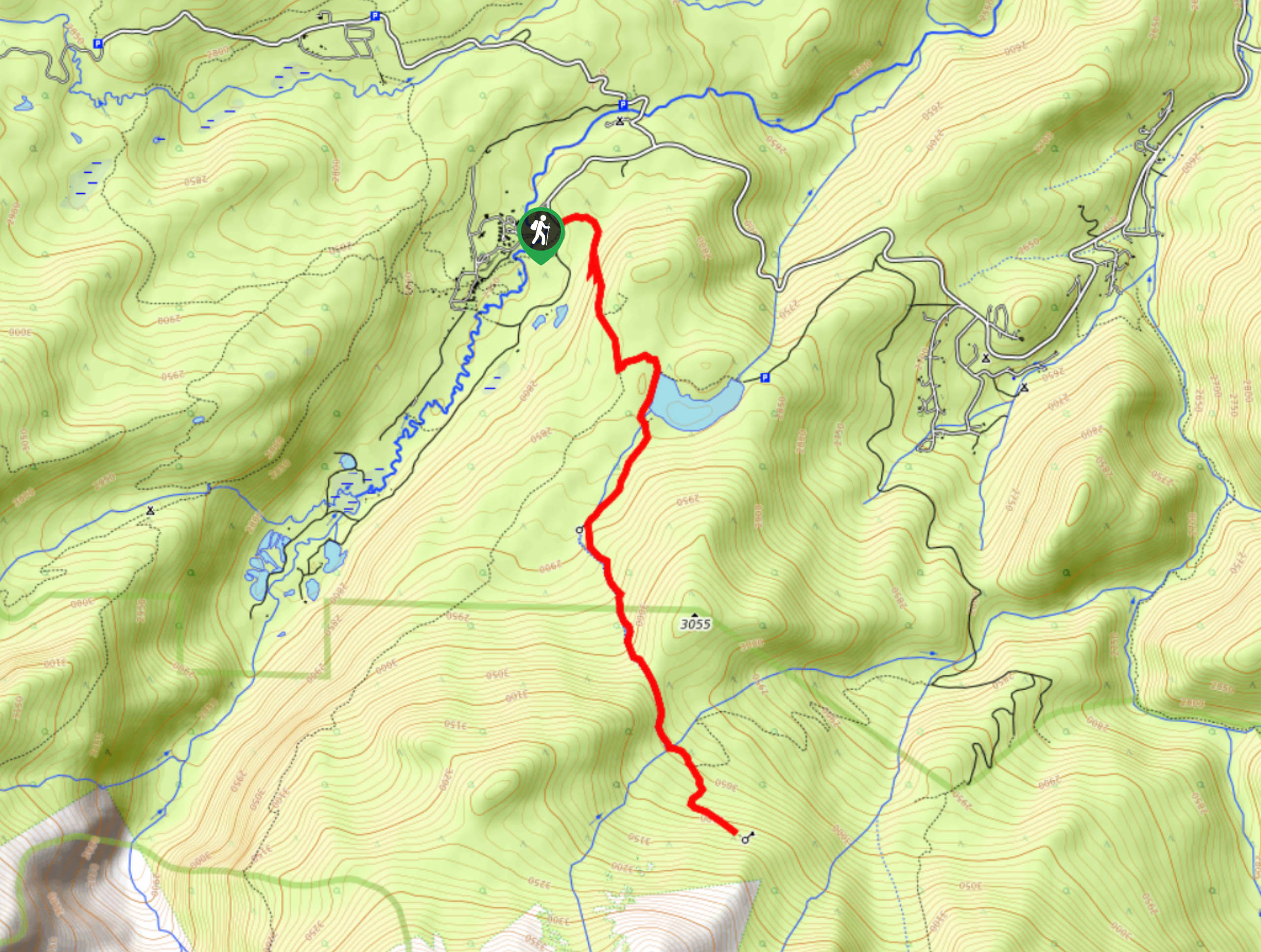
10. Browns Lake Trail
Difficulty
On your next trip to the Roosevelt National Forest make sure to add the Browns… Read More
Yes, there are more than 10
Front Range is so beautiful that we can not give you only 10 hikes. So here is a list of bonus hikes in Front Range that you should take a look at as well
11. Devil’s Head Lookout Trail
Difficulty
The Devil’s Head Lookout Trail is a perfect family-friendly excursion in the Front Range. Located… Read More
12. Kenosha Pass North Hike
Difficulty
The Kenosha Pass North Hike might just be the best place to enjoy the changing… Read More
13. Paradise Cove Swimming Hole Trail
Difficulty
Spend the day at the Paradise Cove Swimming Hole. Nestled among granite cliffs in the… Read More
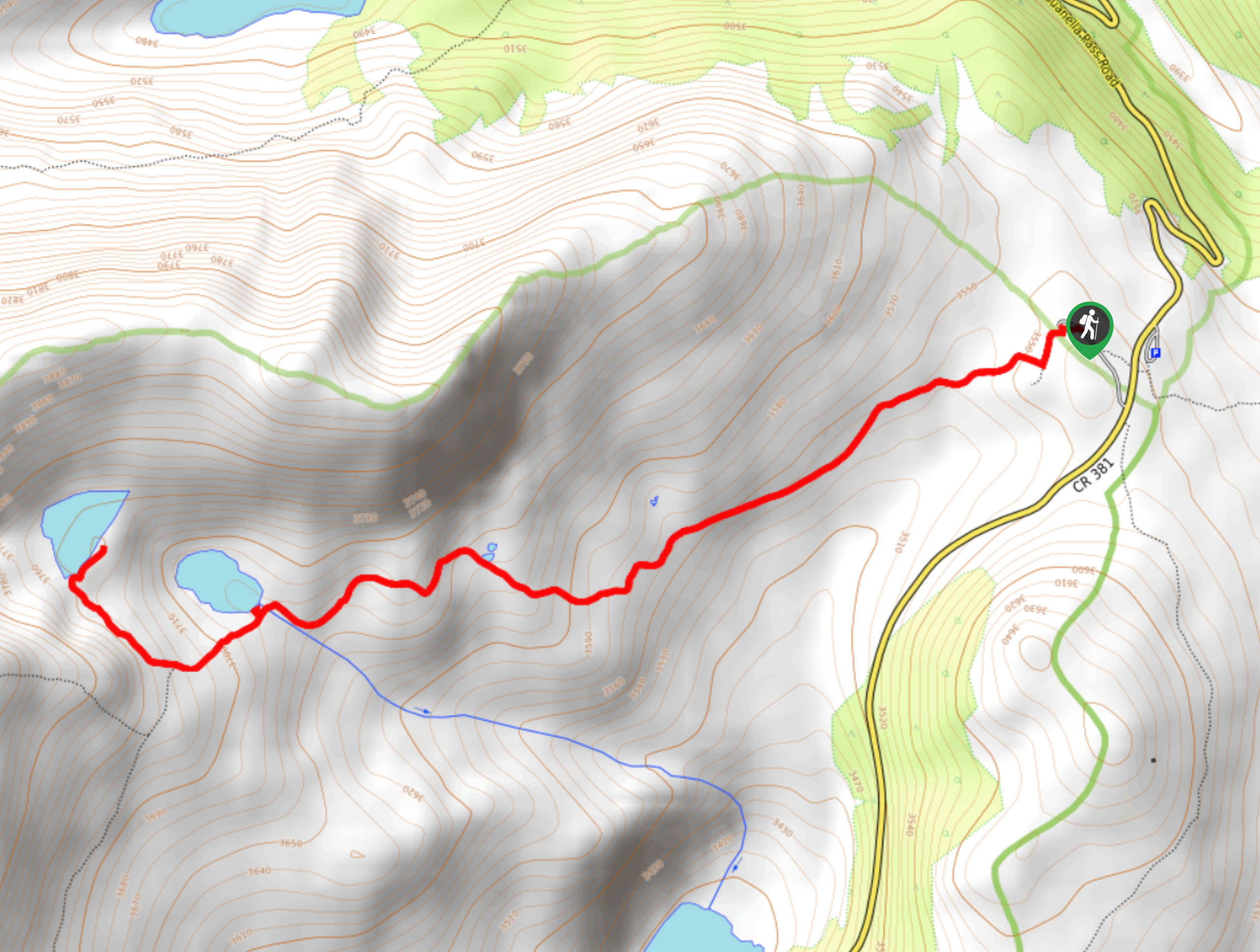
14. Loch Lomond Colorado Trail
Difficulty
The Loch Lomond Colorado Trail is a shared OHV route up to Loch Lomond Lake.… Read More
15. Pinewood Reservoir Hike
Difficulty
The Pinewood Reservoir Hike is an epic adventure for the whole family to enjoy. Hike… Read More
16. Echo Lake Trail
Difficulty
The Echo Lake Trail is a wonderful scenic adventure for the whole family. This hike… Read More
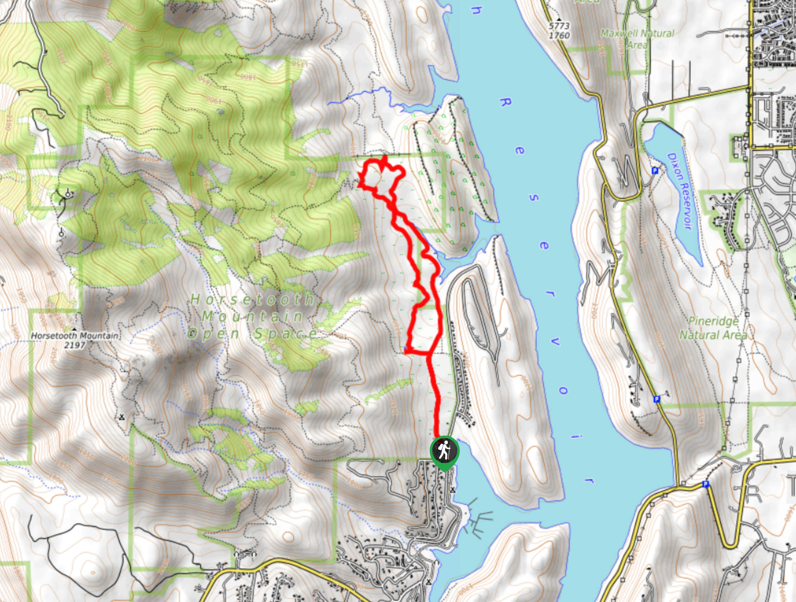
17. Horsetooth Falls Hike
Difficulty
The Horsetooth Falls Hike is a crowd favorite in the Horsetooth Mountain Open Space, and… Read More
18. Herman Gulch Trail
Difficulty
Hike up the Continental Divide to a picturesque alpine lake. The Herman Gulch Trail is… Read More
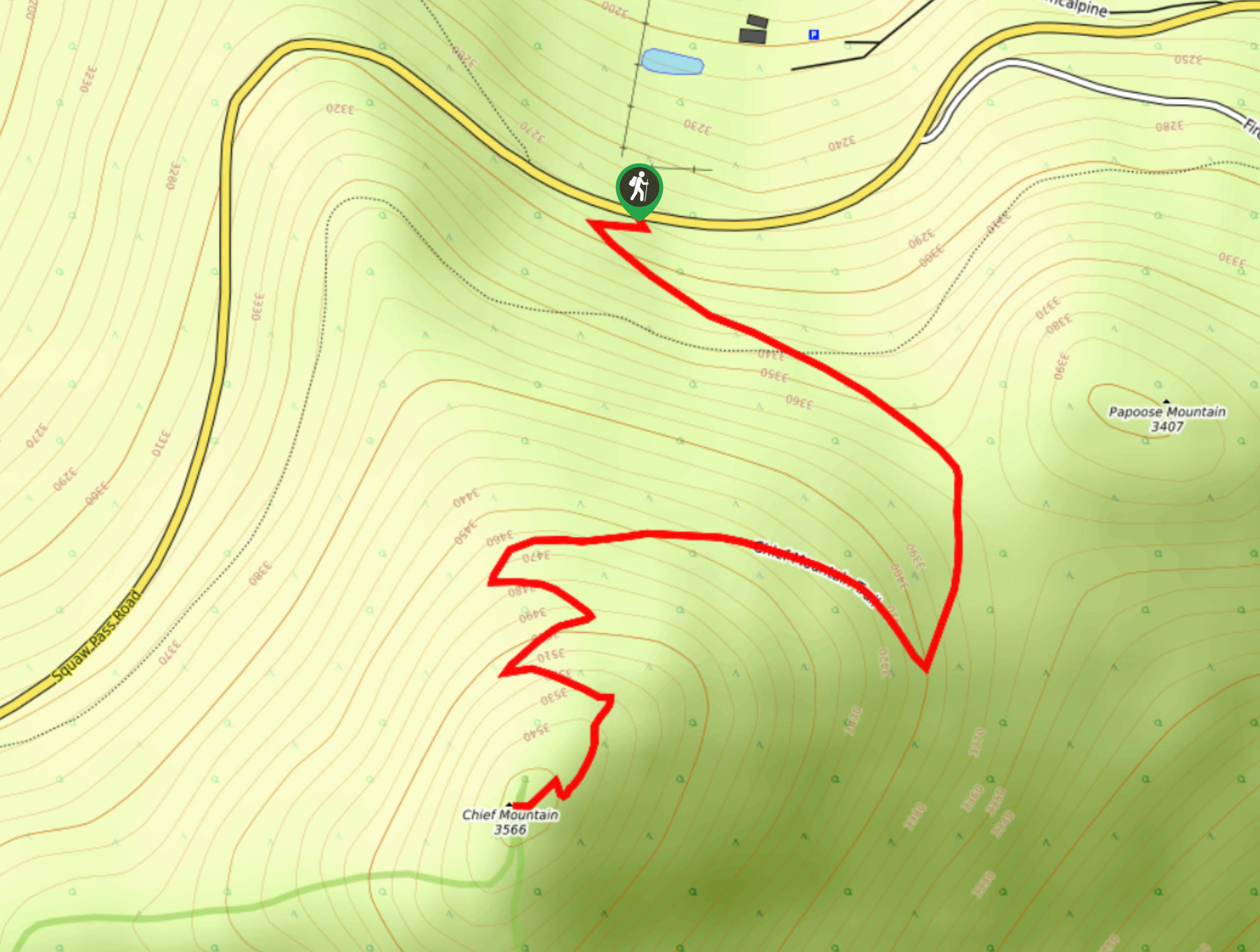
19. Chief Mountain Hike
Difficulty
Hike the Chief Mountain Trail and be rewarded with 360-degree panoramic vistas of the Rocky… Read More
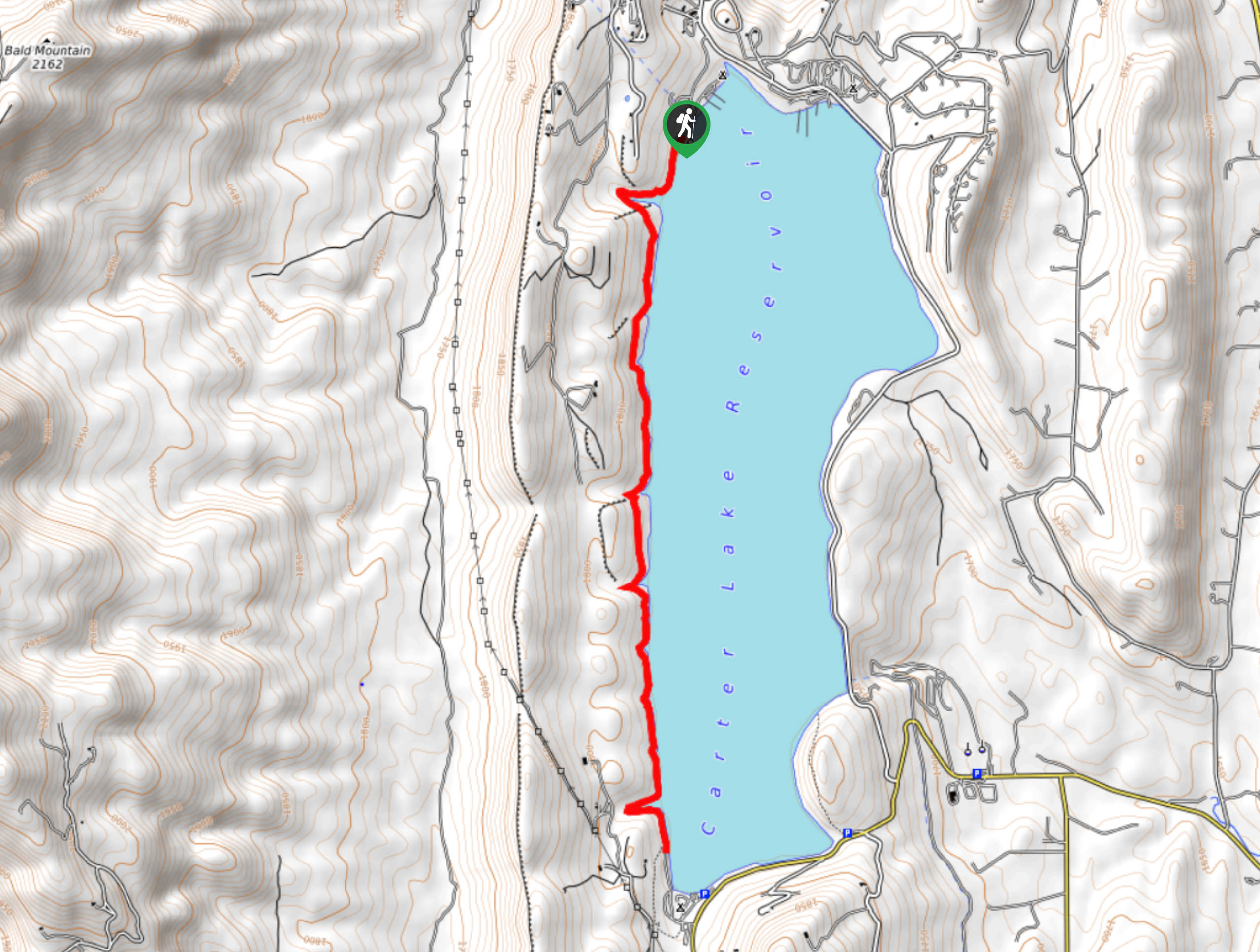
20. Carter Lake’s Sundance Trail
Difficulty
Carter Lake’s Sundance Trail is a crowd-favorite in Larimer County Park. Hike along the shores… Read More
21. Round Mountain Nature Trail
Difficulty
If you are seeking a short hike to let the kids burn off some energy,… Read More
22. Dowdy Lake Trail
Difficulty
Hike the Dowdy Lake Trail around the lovely shoreline. Enjoy sights of paddlers, kayakers and… Read More
23. Mount Flora Hike
Difficulty
Hike the Mount Flora Trail up the Continental Divide and enjoy overwhelming 360-degree vistas of… Read More
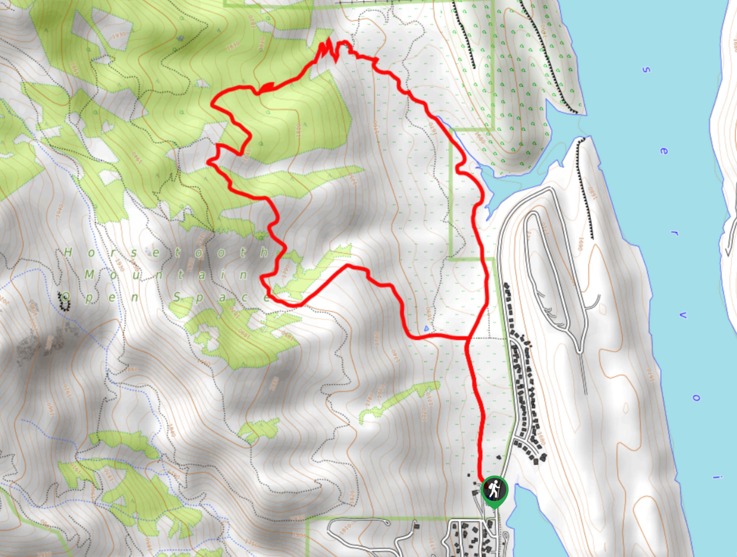
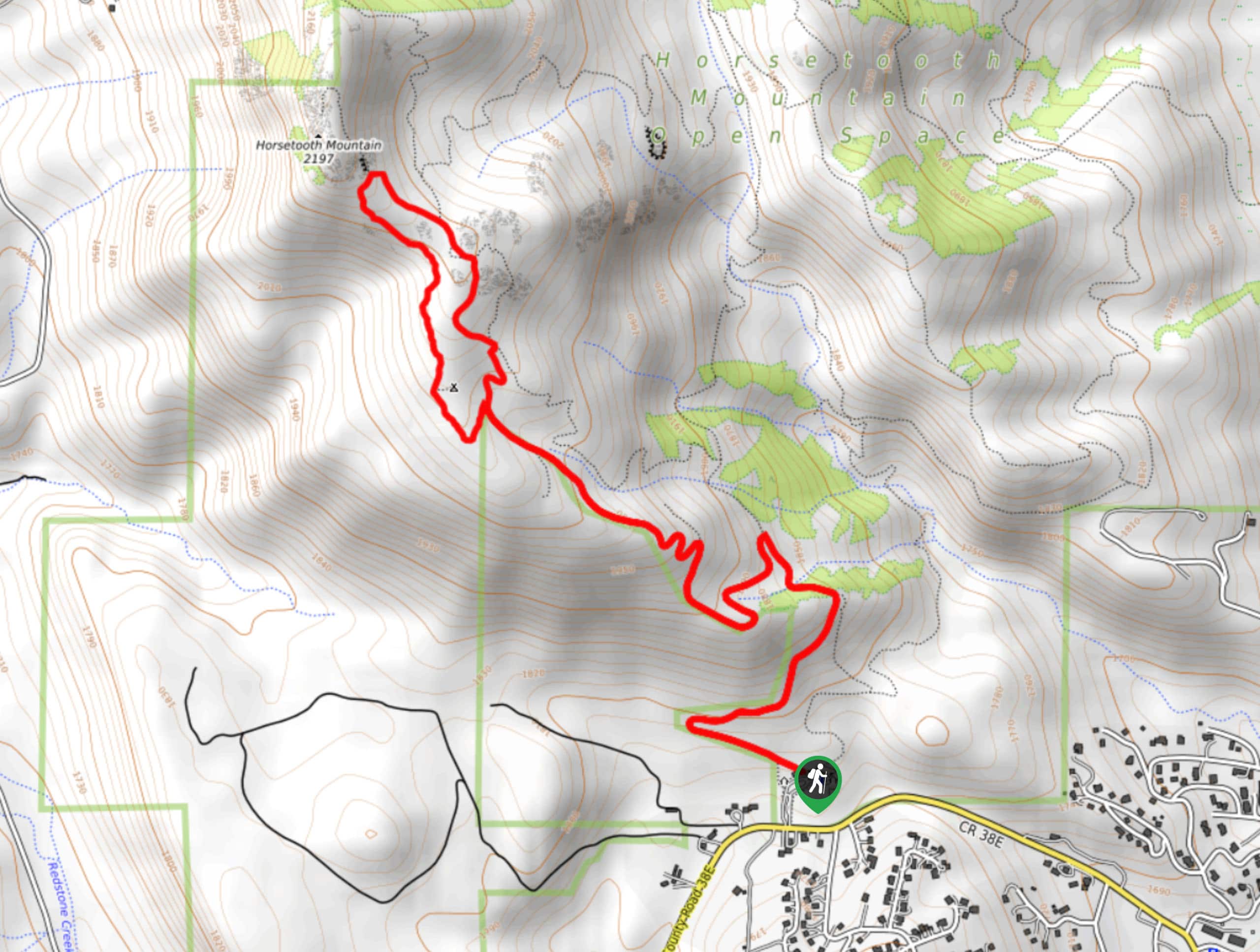
24. Horsetooth Mountain Hike
Difficulty
The Horsetooth Mountain Hike guides its hikers through various landscapes up to a stunning lookout.… Read More
25. Horsetooth Falls Loop
Difficulty
Hike the lovely lollipop loop up to Horsetooth Falls. The Horsetooth Falls Loop is a… Read More
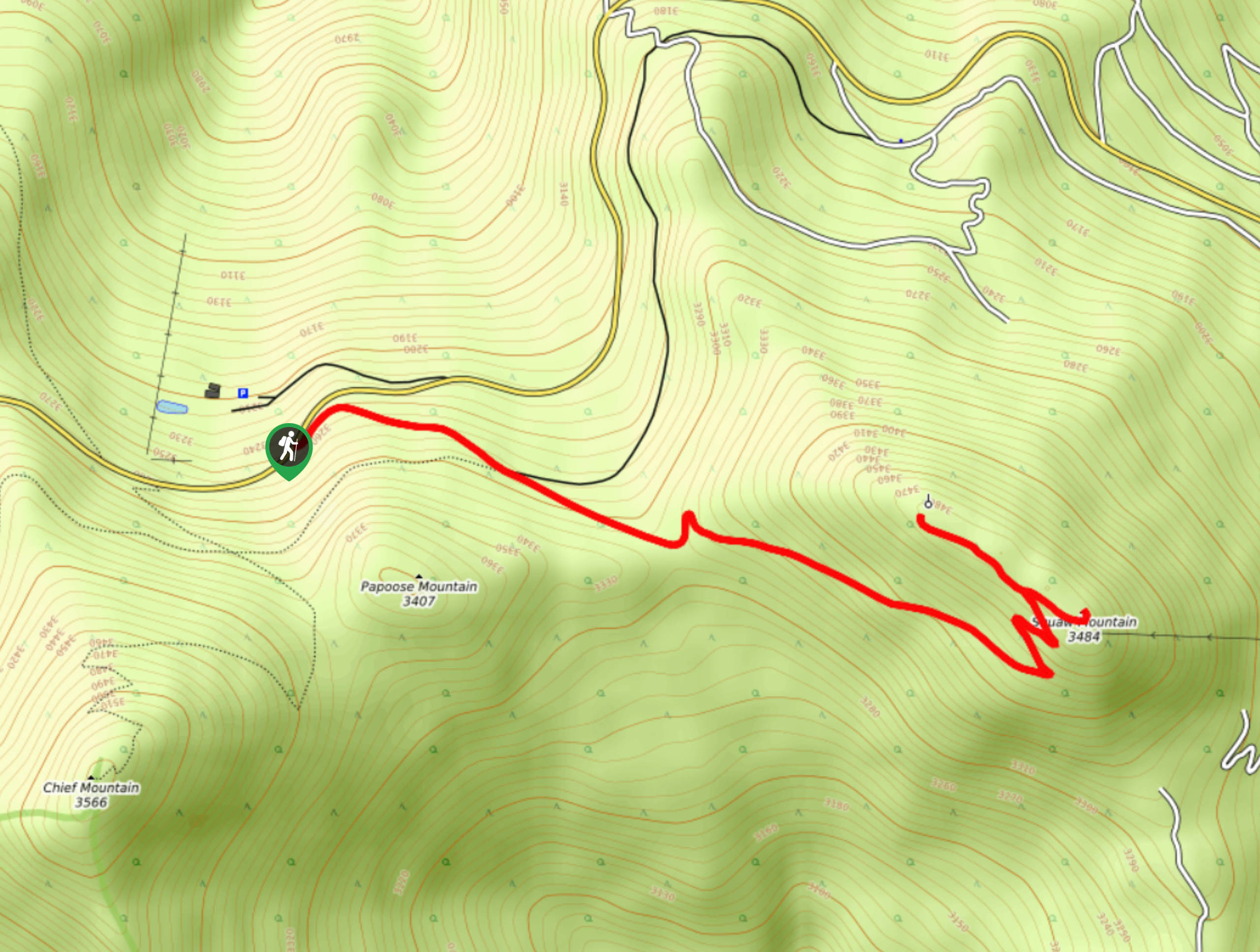
26. Squaw Mountain Hike
Difficulty
The Squaw Mountain Hike is an awesome and accessible hike up to the summit of… Read More
27. Hell’s Hole Hike
Difficulty
Hell’s Hole Hike is a demanding but stimulating hike through forested valleys. This adventure is… Read More
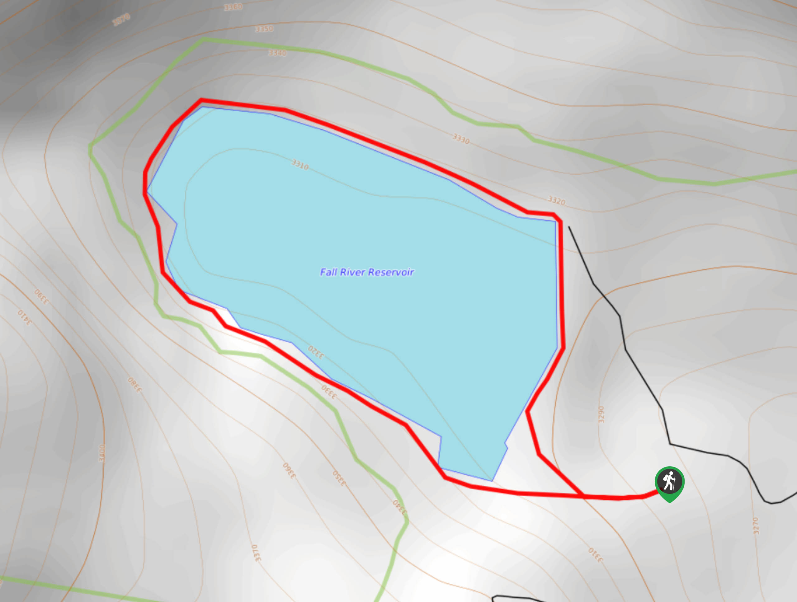
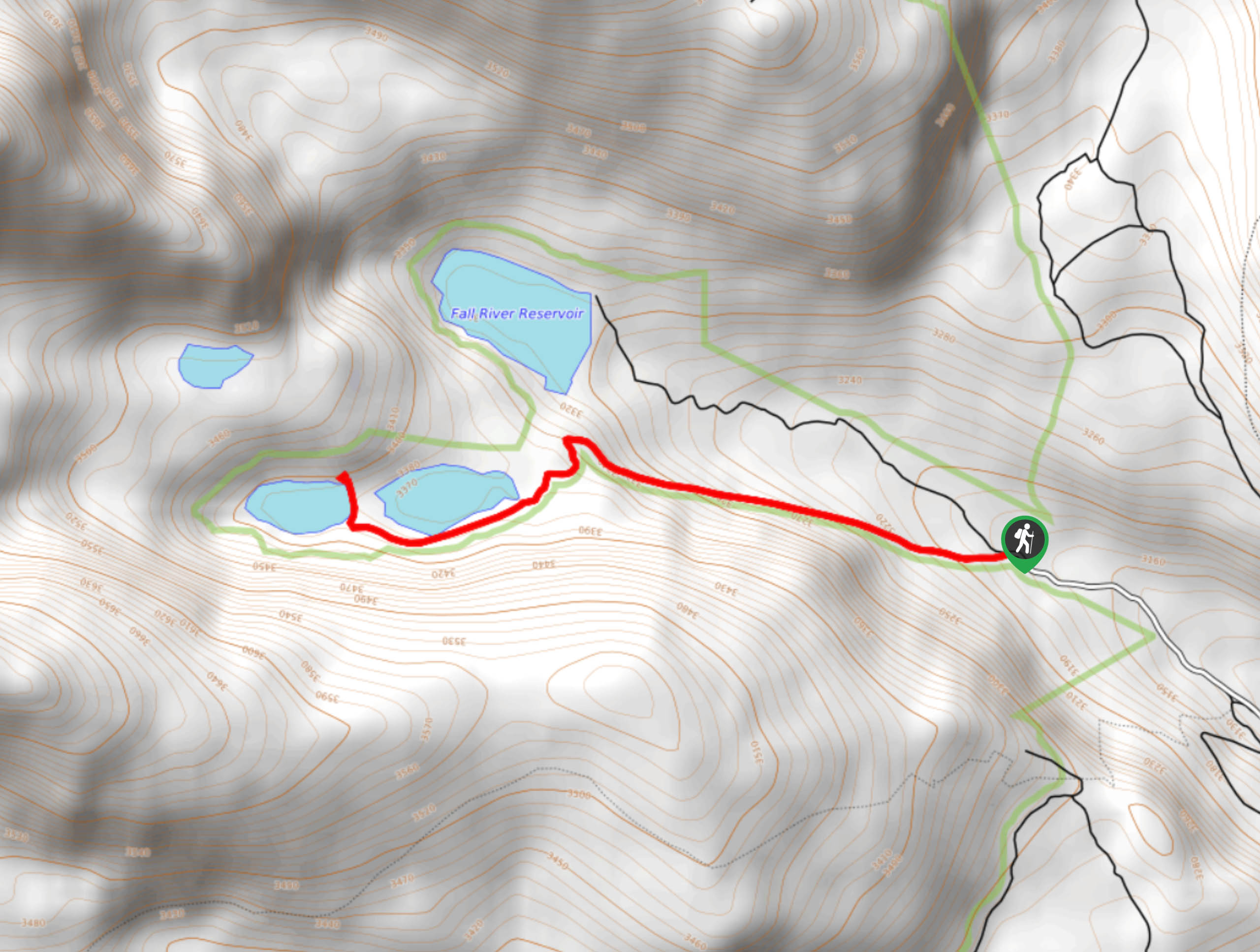
28. Fall River Lake Trail
Difficulty
A hike around a stunning crystalline lake? Yes, please! The Fall River Lake Trail is… Read More
29. Jones Pass Hike
Difficulty
The Jones Pass Trail is a popular route in the Arapaho National Forest. This adventure… Read More
30. Square Top Mountain Trail
Difficulty
Avoid the crowds of the neighboring 14er hikes. The Square Mountain Hike is an isolated… Read More
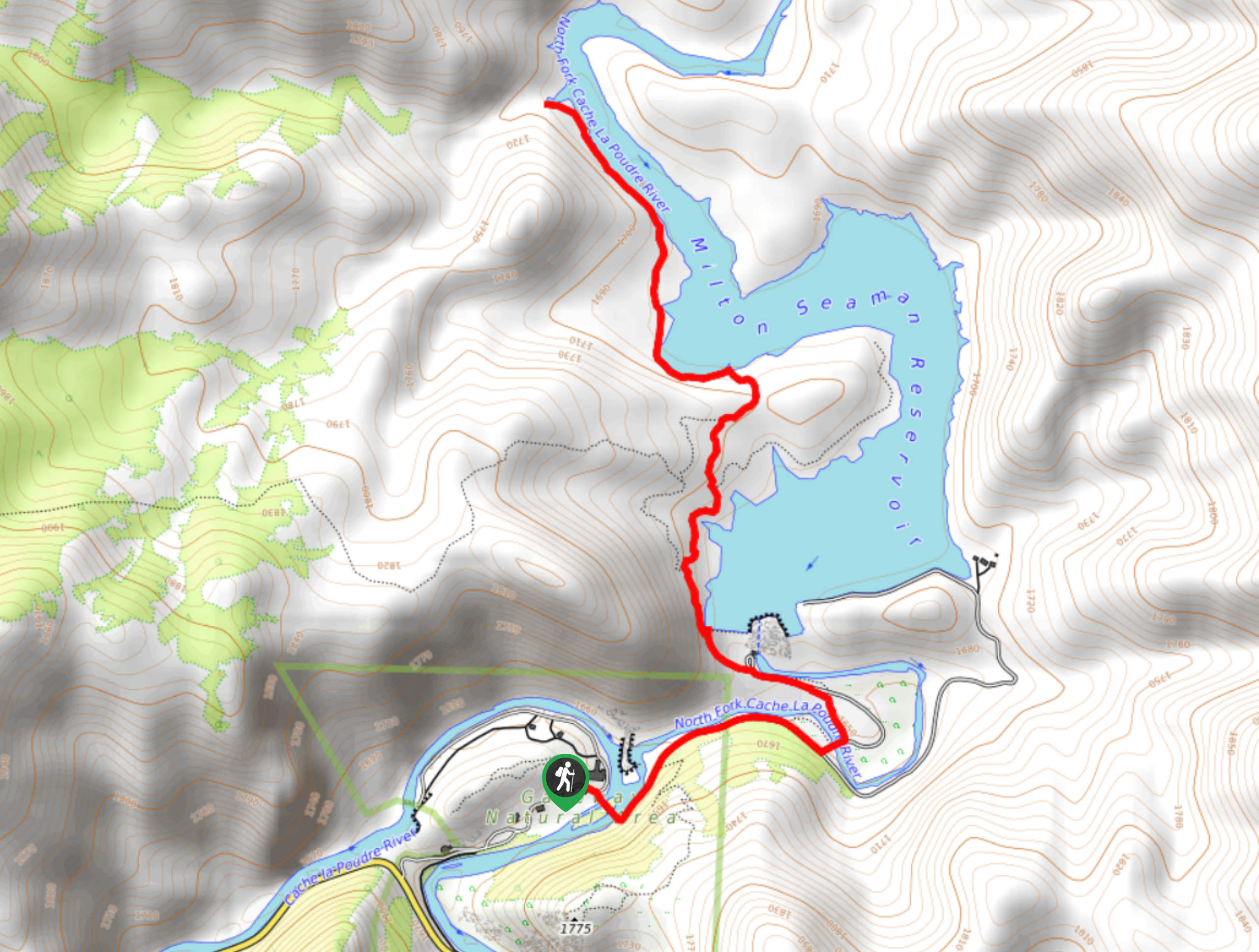
31. Seaman Reservoir Trail
Difficulty
Hike along the Seaman Reservoir Trail and enjoy the stunning mountainous landscape that hem its… Read More
32. Wichita State Plane Wreck
Difficulty
On October 2, 1970, a plane carrying the Wichita State Football Team went down near… Read More
33. Butler Gulch Trail
Difficulty
The Butler Gulch Trail is an incredible day hike through the Arapaho Forest. This hike… Read More
34. Bison Peak Summit
Difficulty
Hike the Bison Peak Summit Trail to one of the most unique mountain plateaus. Dotted… Read More
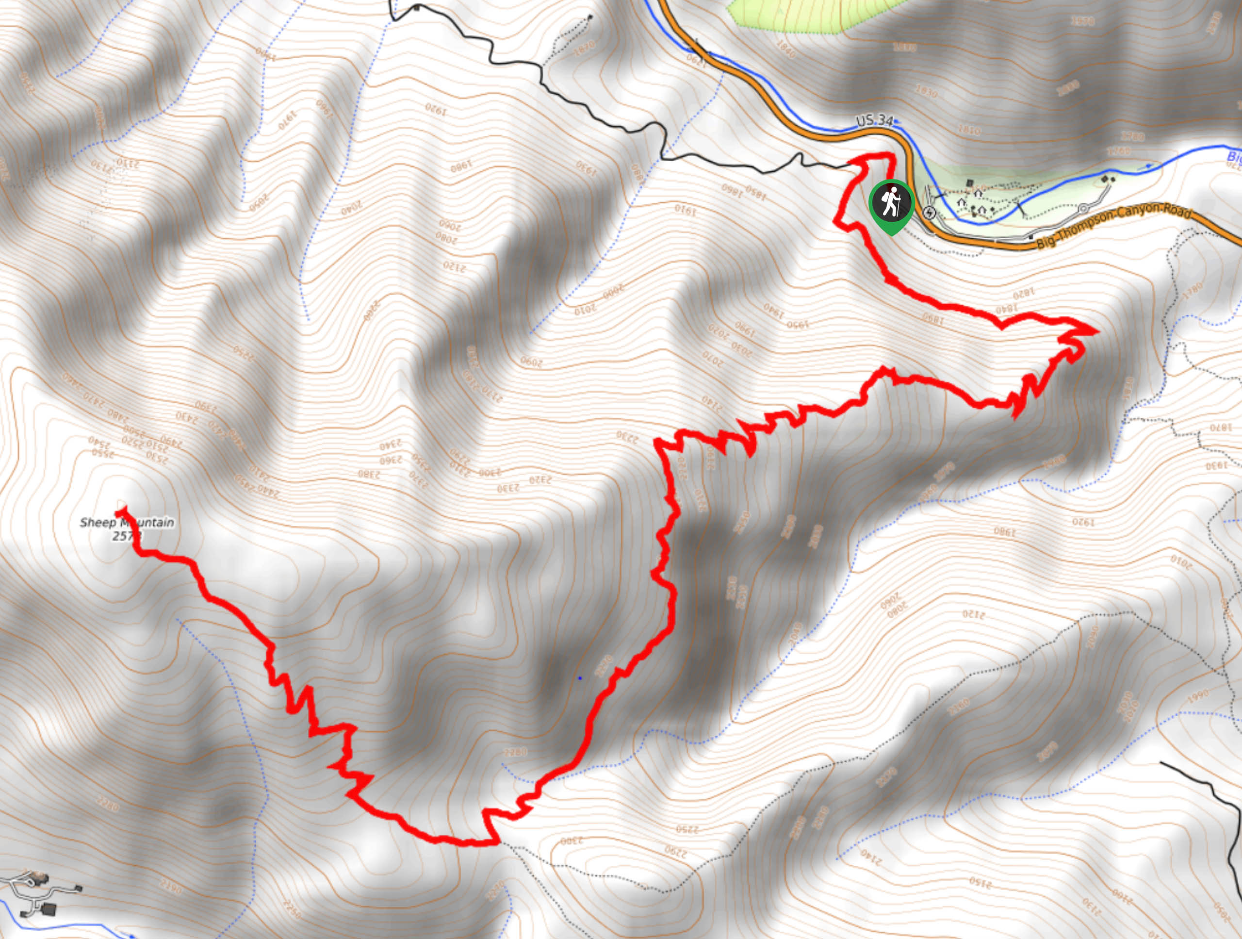
35. Sheep Mountain Trail
Difficulty
The Sheep Mountain Hike is a great introductory or training hike for those who wish… Read More
36. James Peak Hike
Difficulty
Bask in beautiful scenery along the entirety of the James Peak Hike. This demanding trail… Read More
37. Mount Bethel Trail
Difficulty
If you are seeking an isolated excursion among the packed 13er and 14er trails, then… Read More
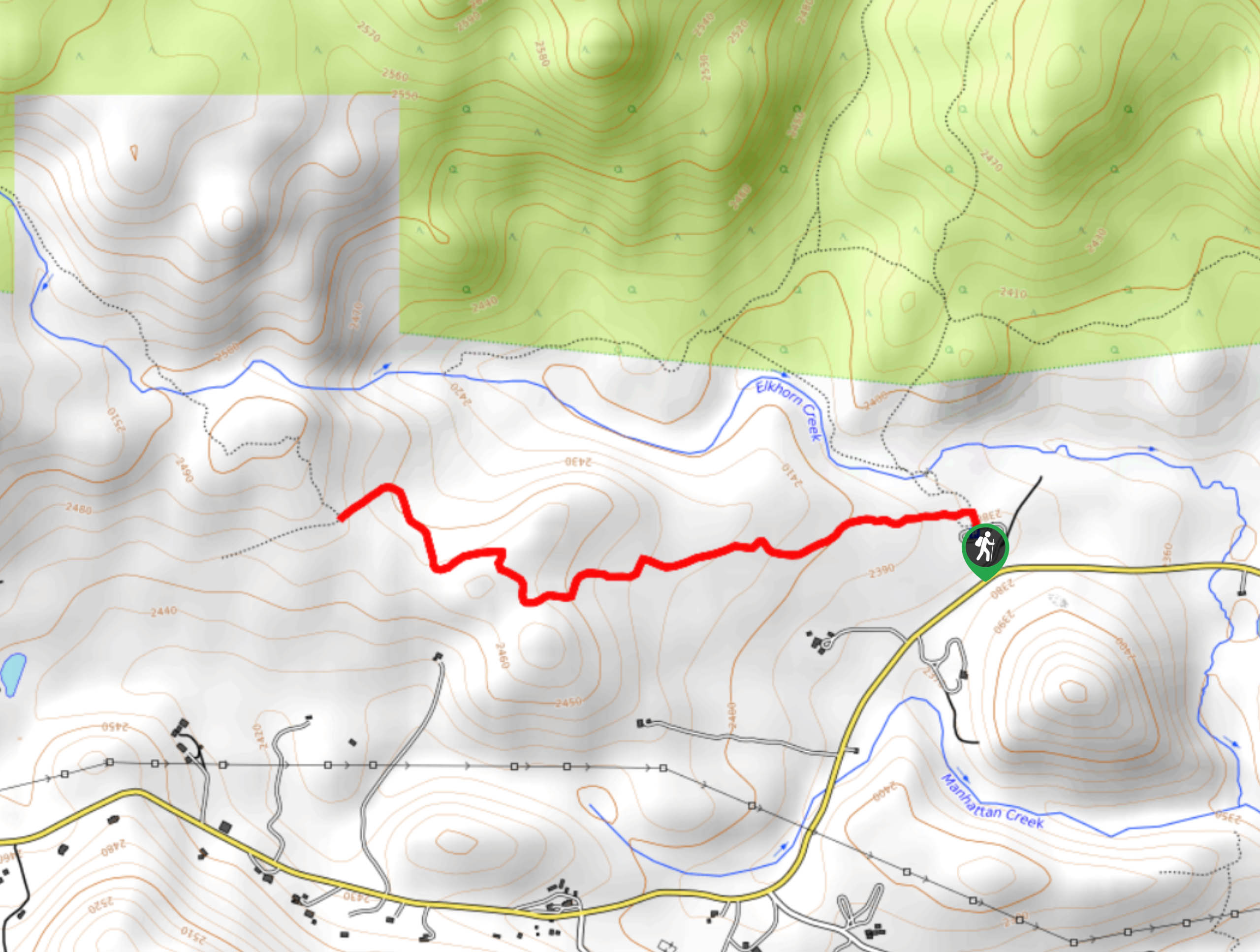
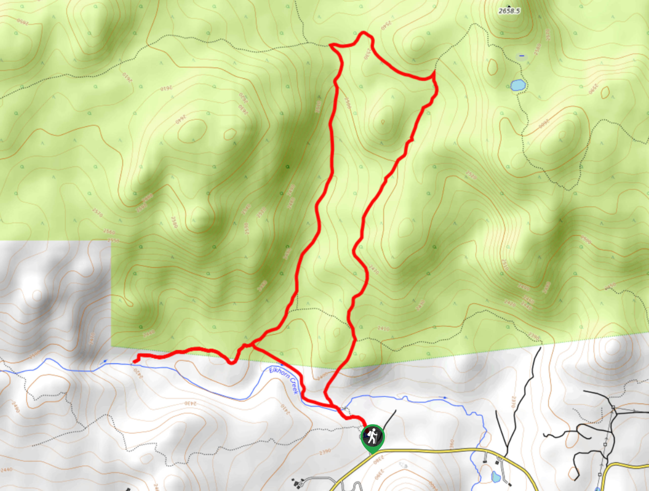
38. Elkhorn Creek Trail
Difficulty
Weave through ponderosa pine forests and lush Colorado plains, abundant with vibrant wildflowers on the… Read More
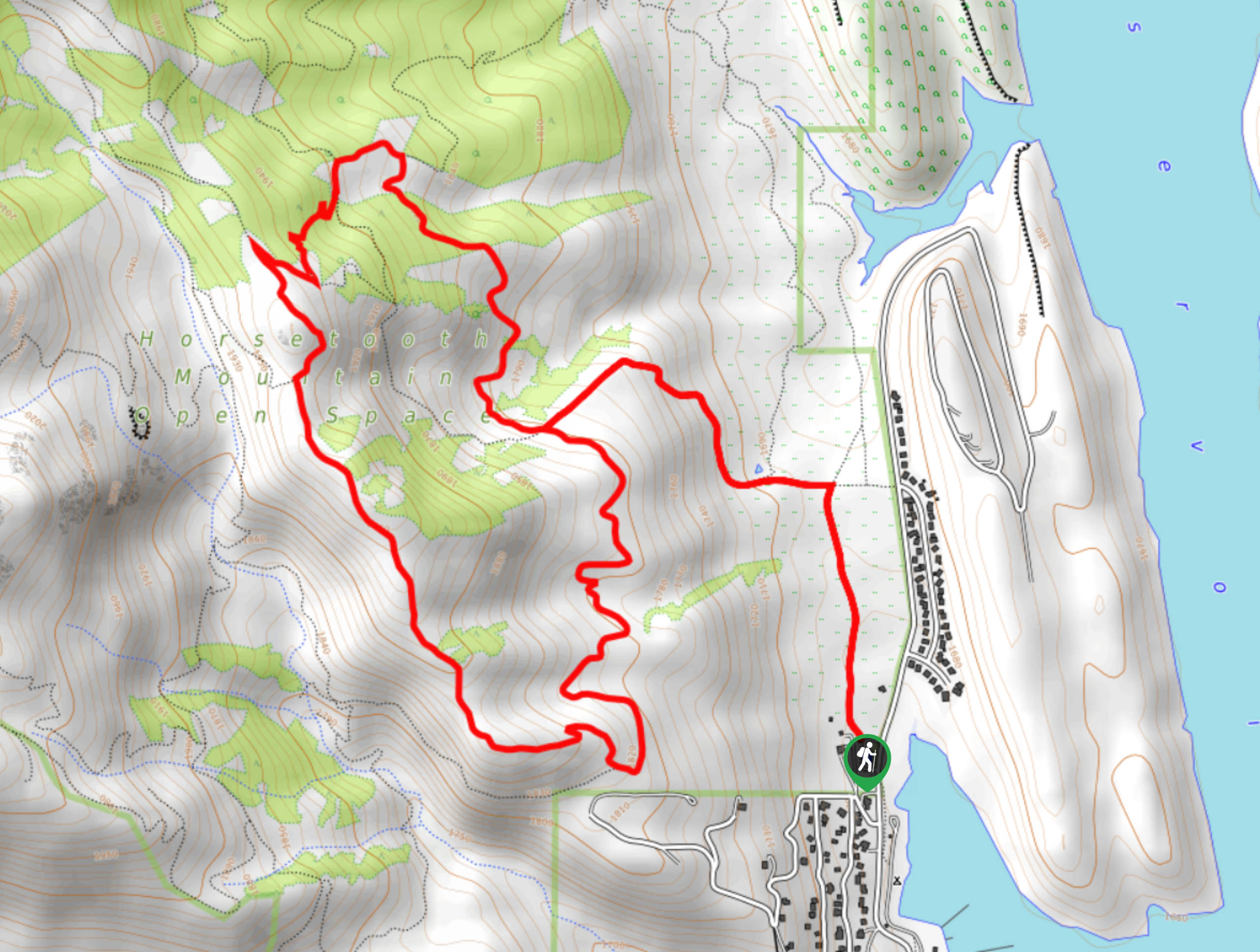
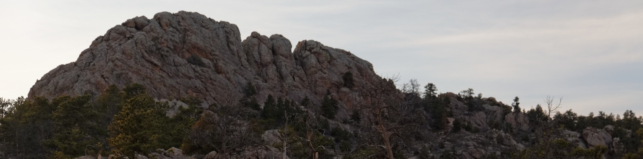
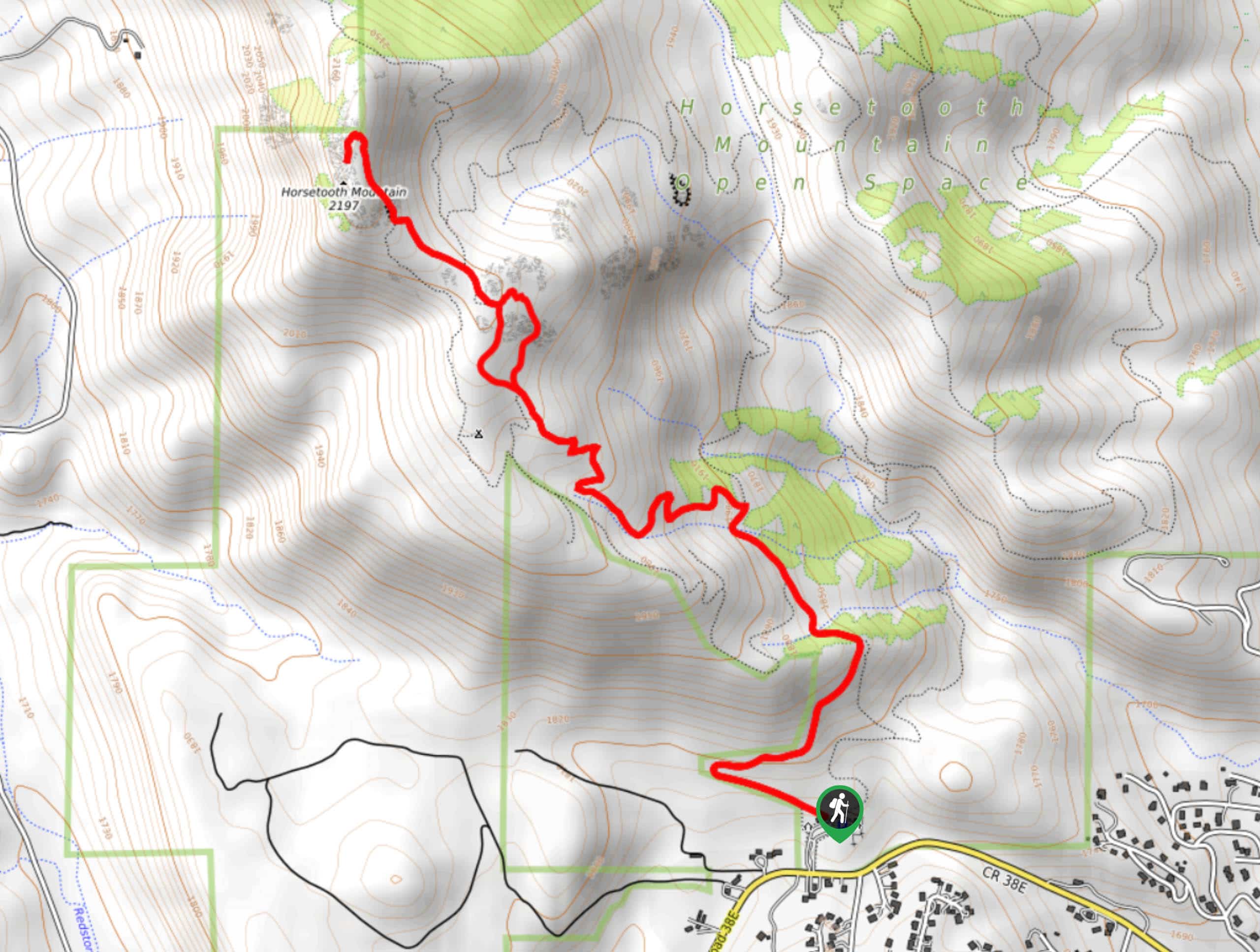
39. Horsetooth Rock Trail
Difficulty
Located within the Horsetooth Mountain Open Space, the Horsetooth Rock Trail offers a unique experience.… Read More
40. Homestead Meadows Hike
Difficulty
The Homestead Meadows Trail is a hike that will appease adventurers and history buffs alike.… Read More
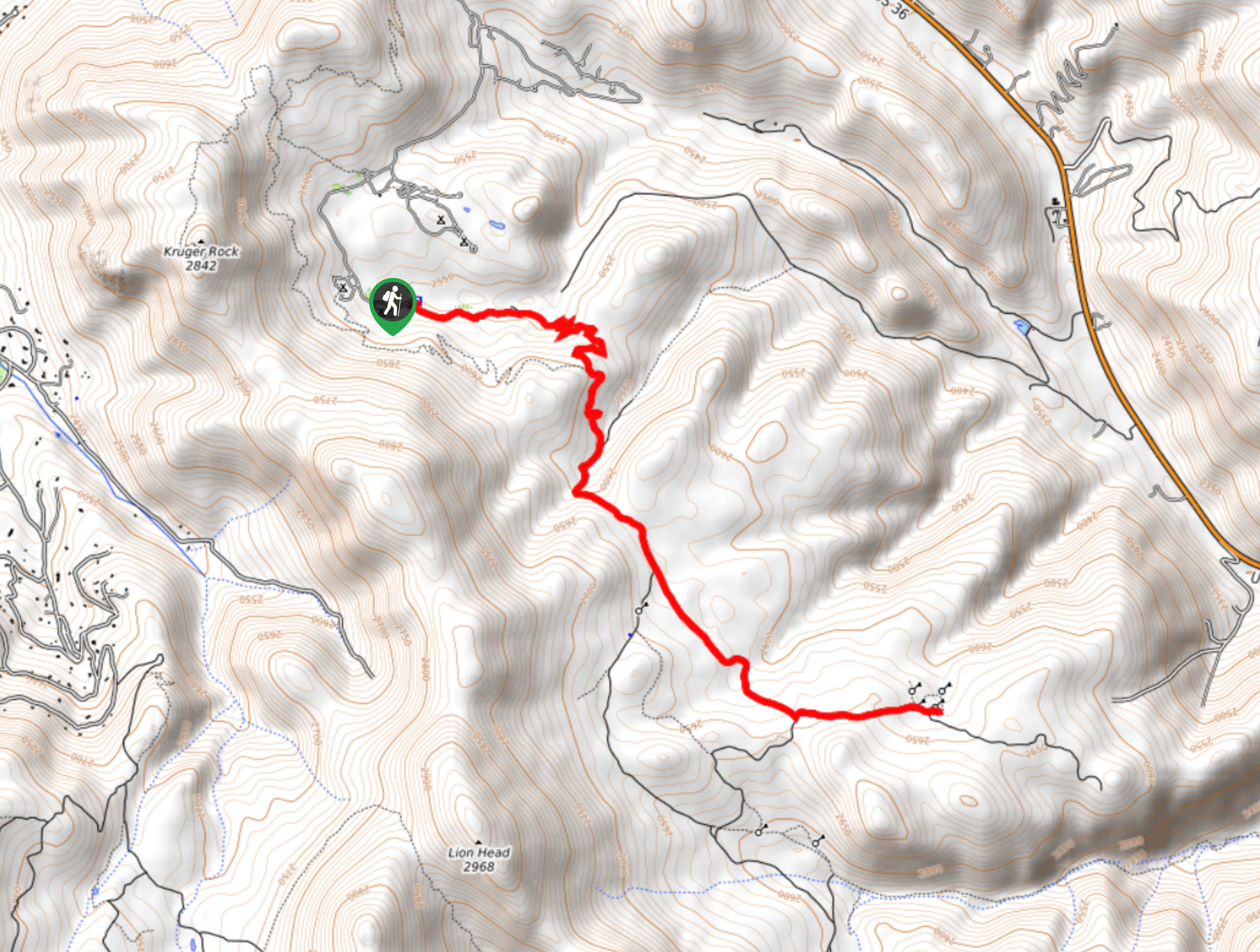
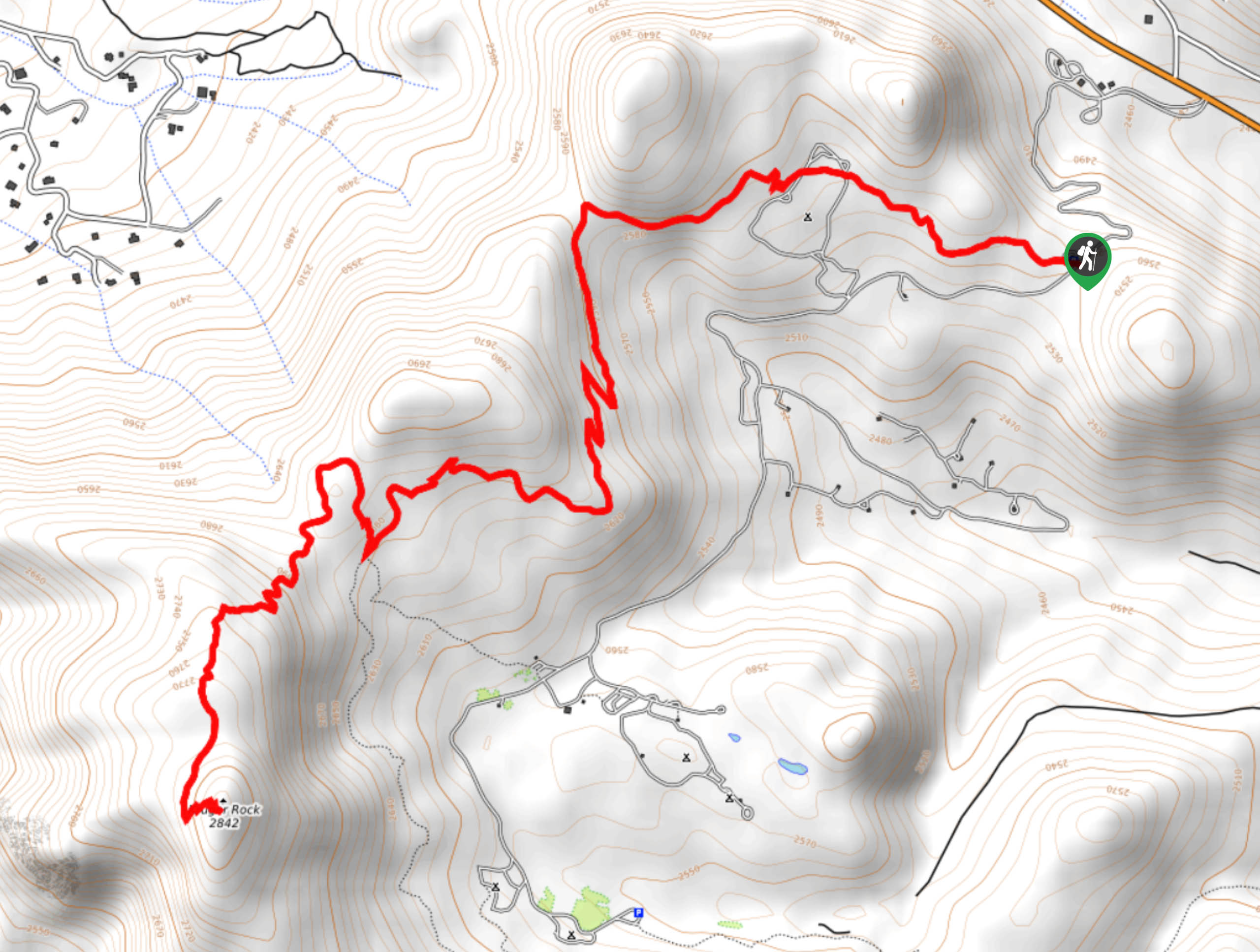
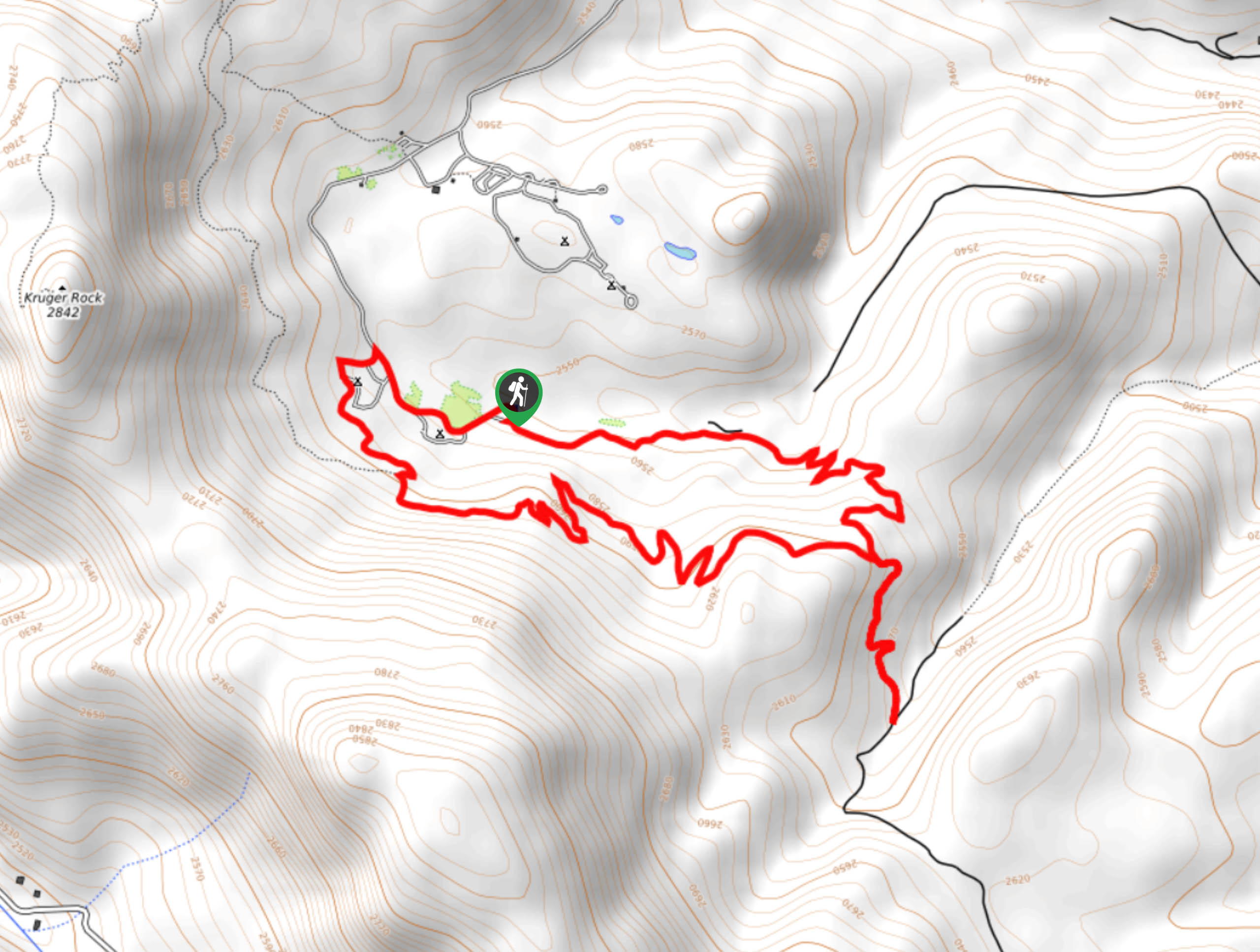
41. Kruger Rock Trail
Difficulty
The Kruger Rock Trail is a stunning hike through lush aspen forest and between towering… Read More
42. Elk Falls Hike
Difficulty
The Elk Falls Hike is a stunning hike through the Staunton State Park wilderness. See… Read More
43. Emmaline Lake Trail
Difficulty
The Emmaline Lake Trail has it all. A forested path, babbling streams, waterfalls, a lake,… Read More
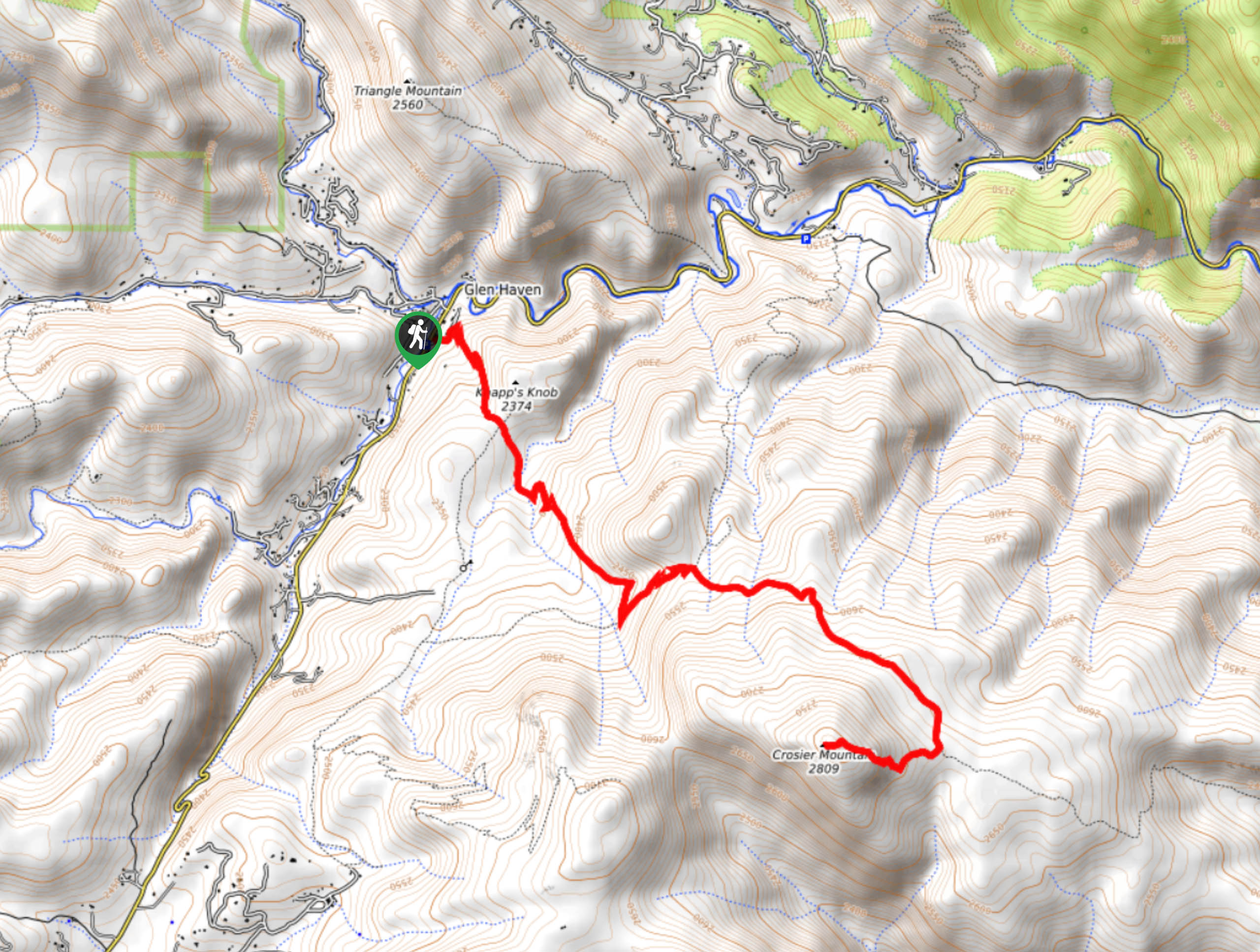
44. Crosier Mountain via Devil’s Gulch Trail
Difficulty
The Crosier Mountain via Devil’s Gulch Trail is a lovely, forested excursion in the Roosevelt… Read More
45. Idaho Springs Hike
Difficulty
If you still want mountain views but do not necessarily want to hike up a… Read More
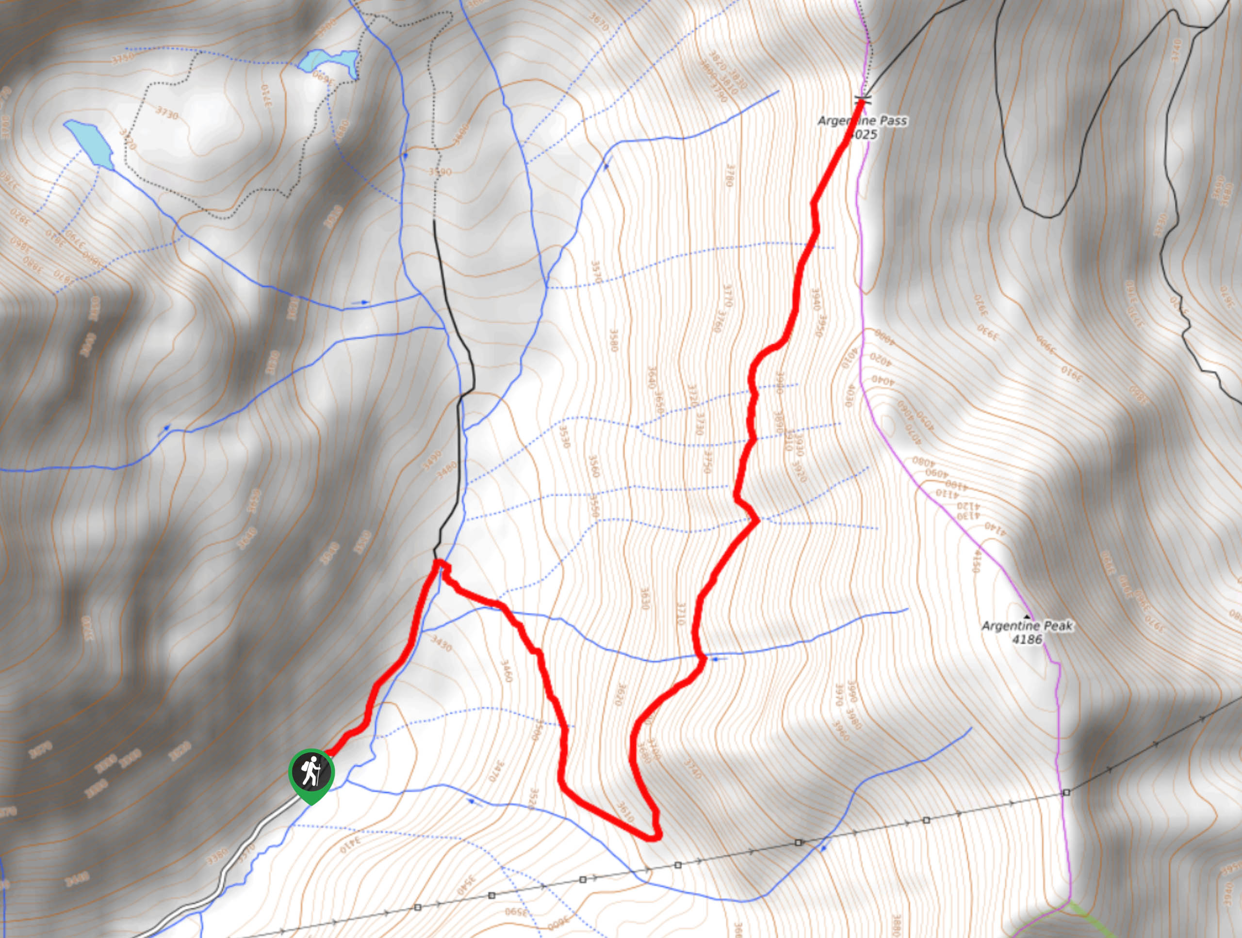
46. Argentine Pass Trail
Difficulty
The Argentine Pass Trail is a demanding excursion through the Colorado wilderness, but trust us,… Read More
47. B-17 Plane Crash Site
Difficulty
Hike the woodland path to the B-17 Plane Crash Site. The World War II Bomber… Read More
48. Triple Bar and OT Trail
Difficulty
Hike the scenic Triple Bar and OT Trail. This meadowed path will loop you around… Read More
49. Sawmill Trail
Difficulty
The Sawmill Trail is a family-friendly circuit in the Horsetooth Mountain Open Space. This magical… Read More
50. Blue Sky Trail
Difficulty
Bordering the city of Fort Collins, the Blue Sky Trail is a wonderful escape into… Read More
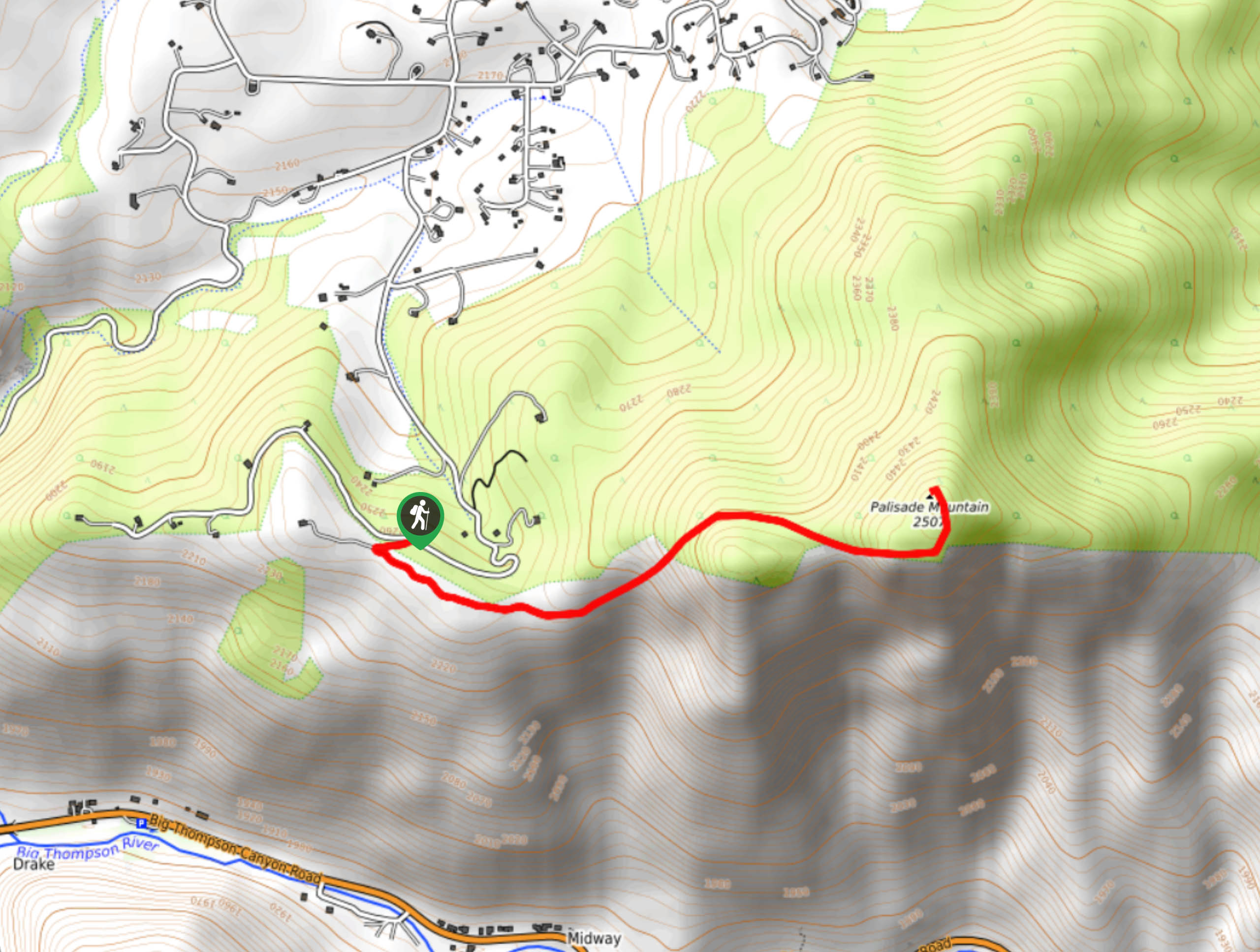
51. Palisade Mountain Hike
Difficulty
Hike the Palisade Mountain Trail to an epic overlook of the surrounding mountainous landscape and… Read More
52. Grizzly Gulch Trail
Difficulty
The Grizzly Gulch Trail is not as scary as it may sound. This beautiful trail… Read More
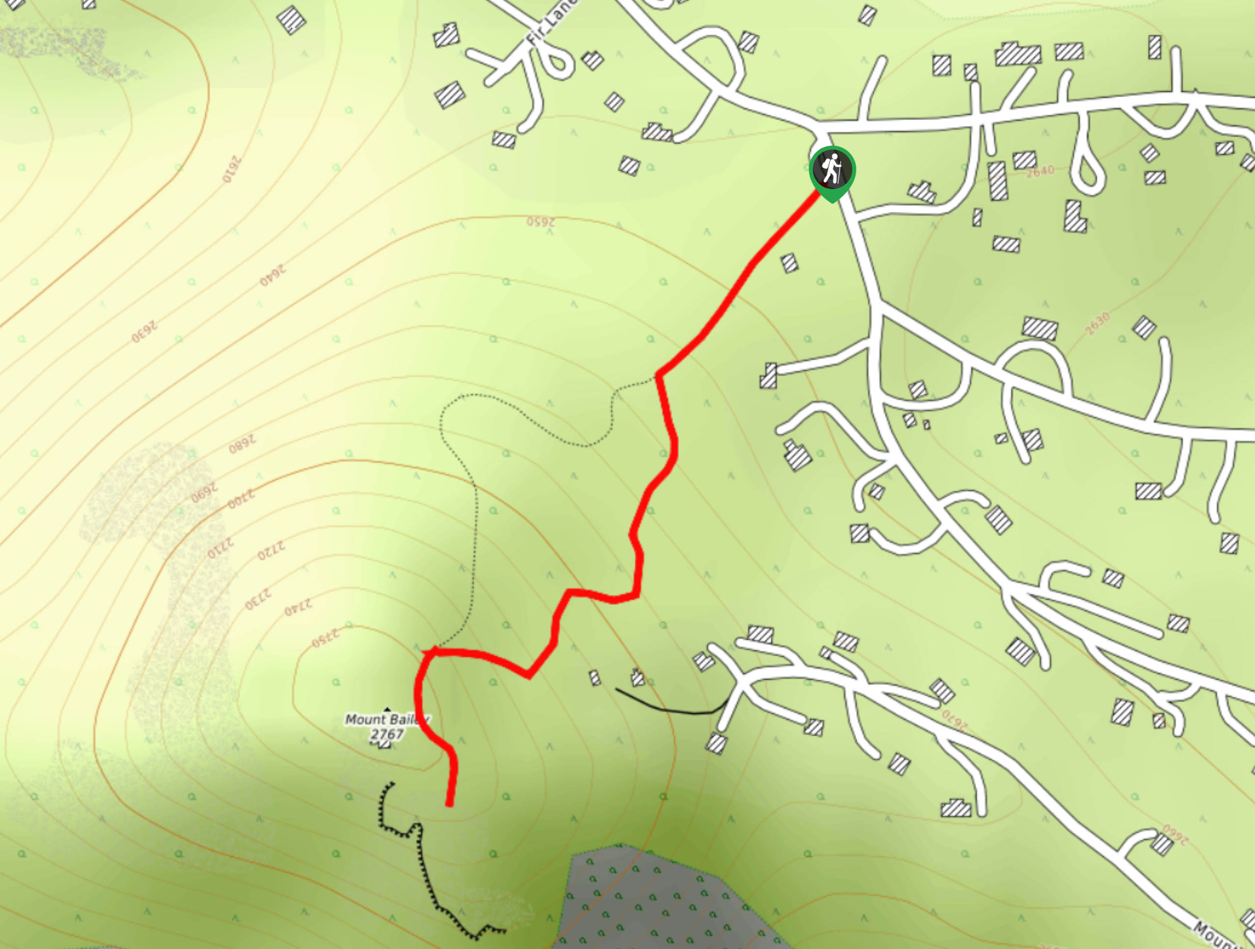
53. Mount Bailey Hike
Difficulty
The Mount Bailey Hike is a wonderful adventure that the whole family will enjoy. Hike… Read More
54. Gibson Lake Trail
Difficulty
Hike the Gibson Lake Trail along the banks of the South Platte River up to… Read More
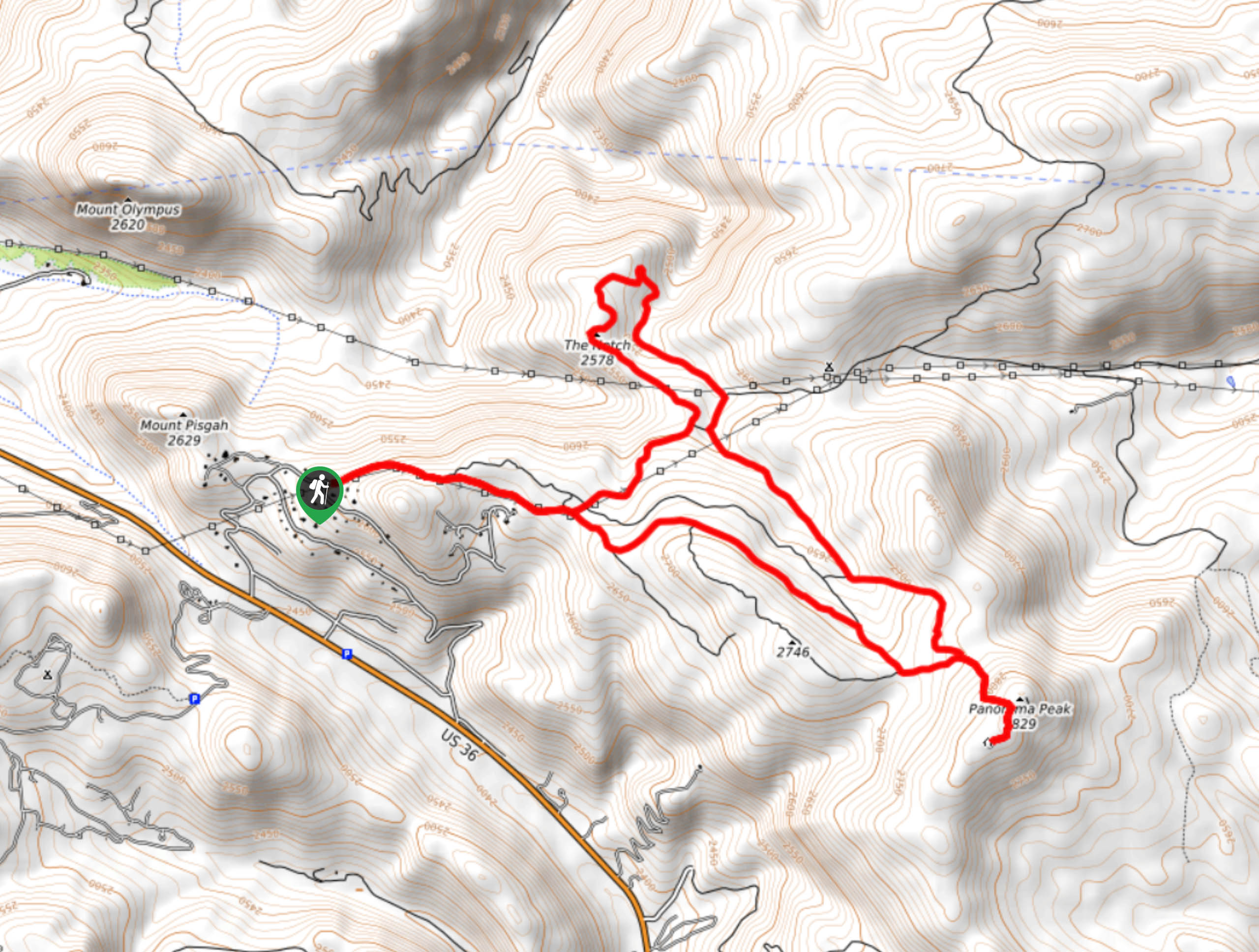
55. Panorama Peak Hike
Difficulty
Hike the Panorama Peak Trail to not one, but two mountain summits. A shared path… Read More
56. Mount Stanley Trail
Difficulty
Cruise along the ridges of the Continental Divide up to Mount Stanley. The Mount Stanley… Read More
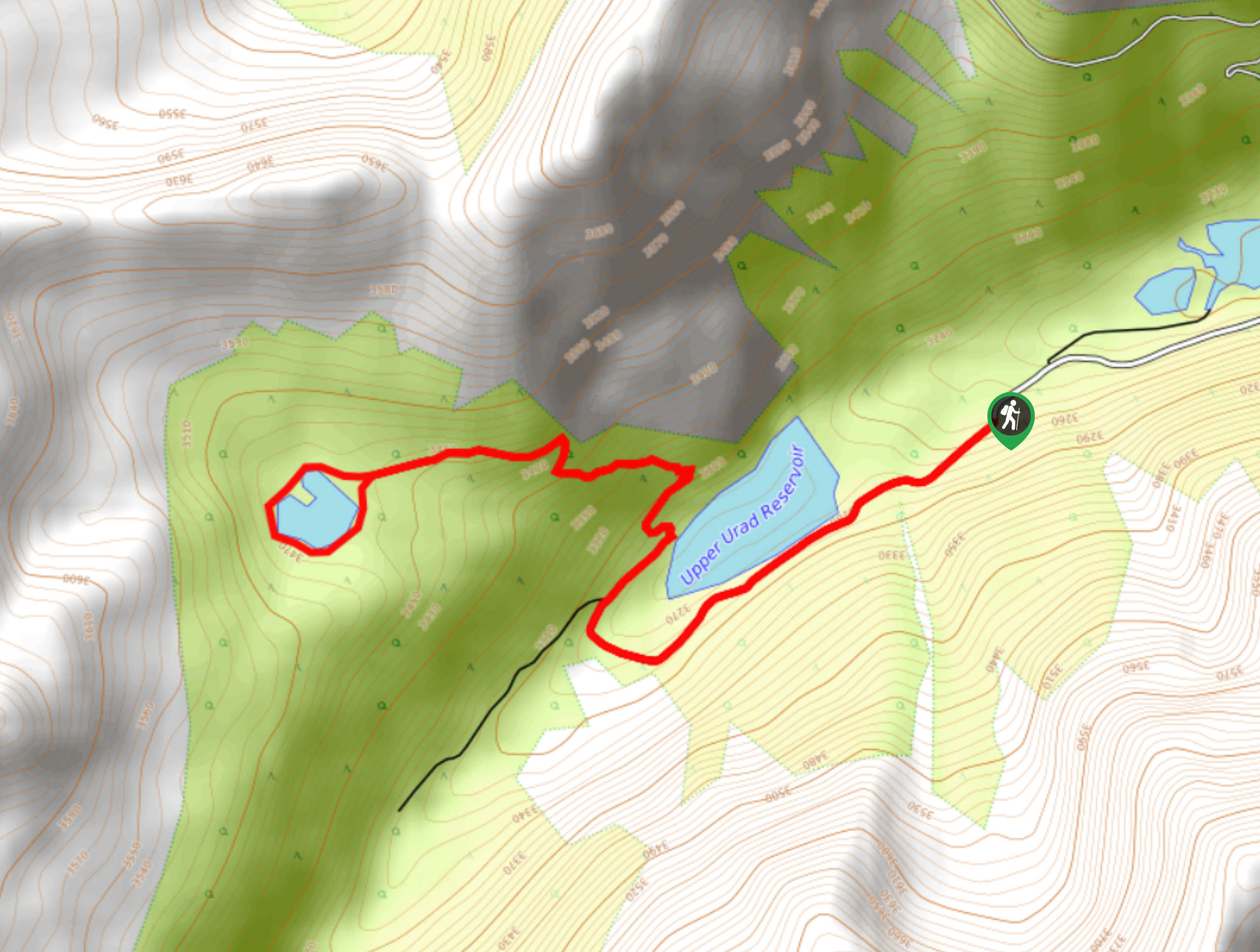
57. Urad Lakes Trail
Difficulty
Hike the Urad Lakes Trail in the Arapaho National Forest. This forested trail attracts outdoor… Read More
58. Tanglewood Trail
Difficulty
The Tanglewood Trail is a demanding hike up a woodland gulch to scenic alpine lakes.… Read More
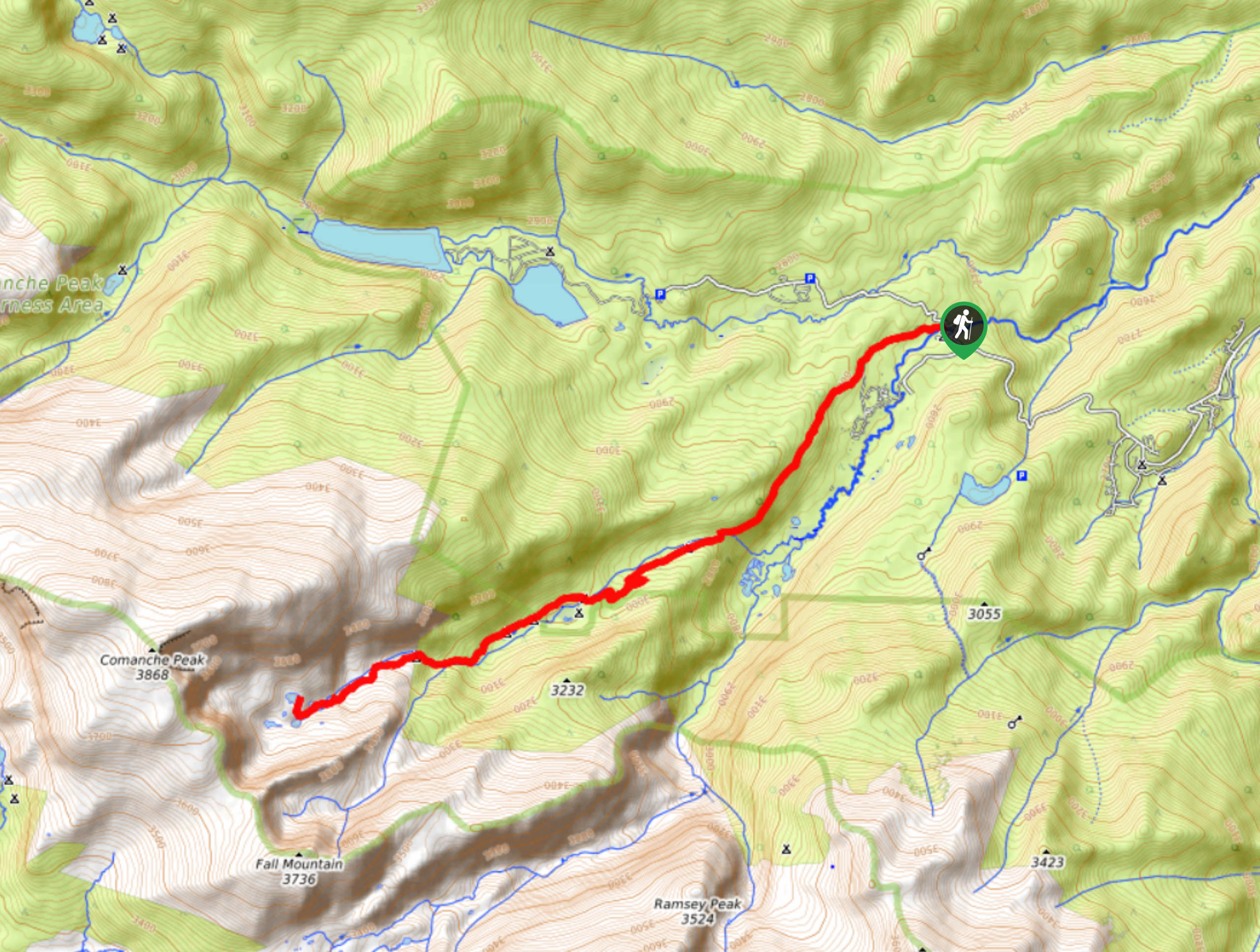
59. North Fork Trail
Difficulty
Hike up a forested river valley from the Comanche Peak Wilderness into the Rocky Mountain… Read More
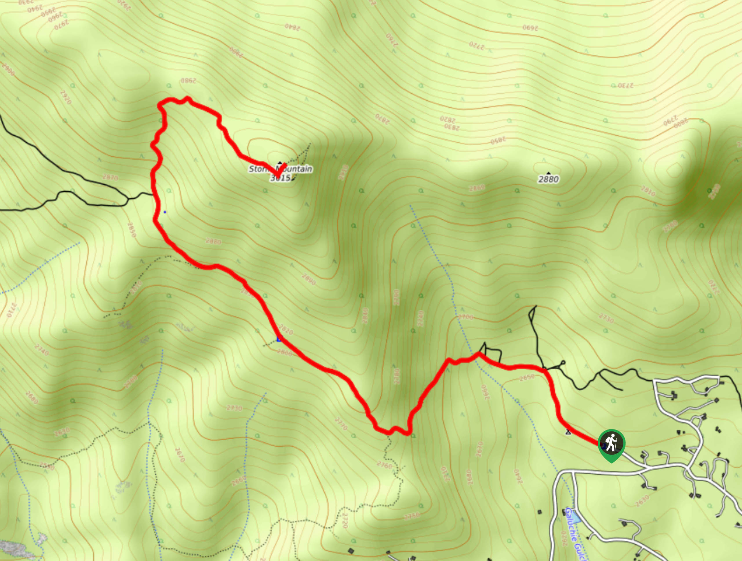
60. Storm Mountain Trail
Difficulty
Hike the Storm Mountain Trail up a forest road to the summit. The road to… Read More
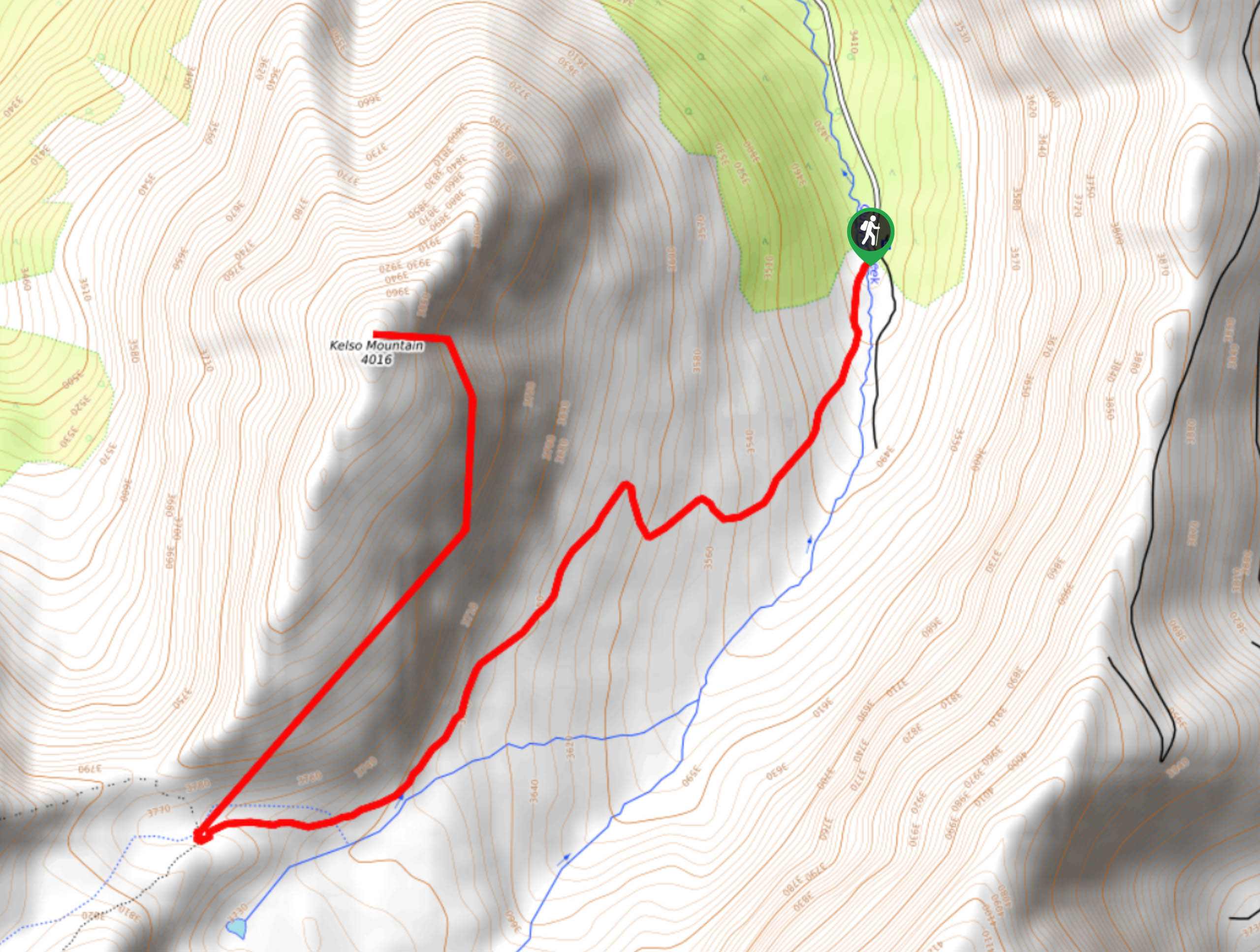
61. Kelso Ridge Hike
Difficulty
Hiking the Kelso Ridge Trail will guide you along a lollipop loop to not one,… Read More
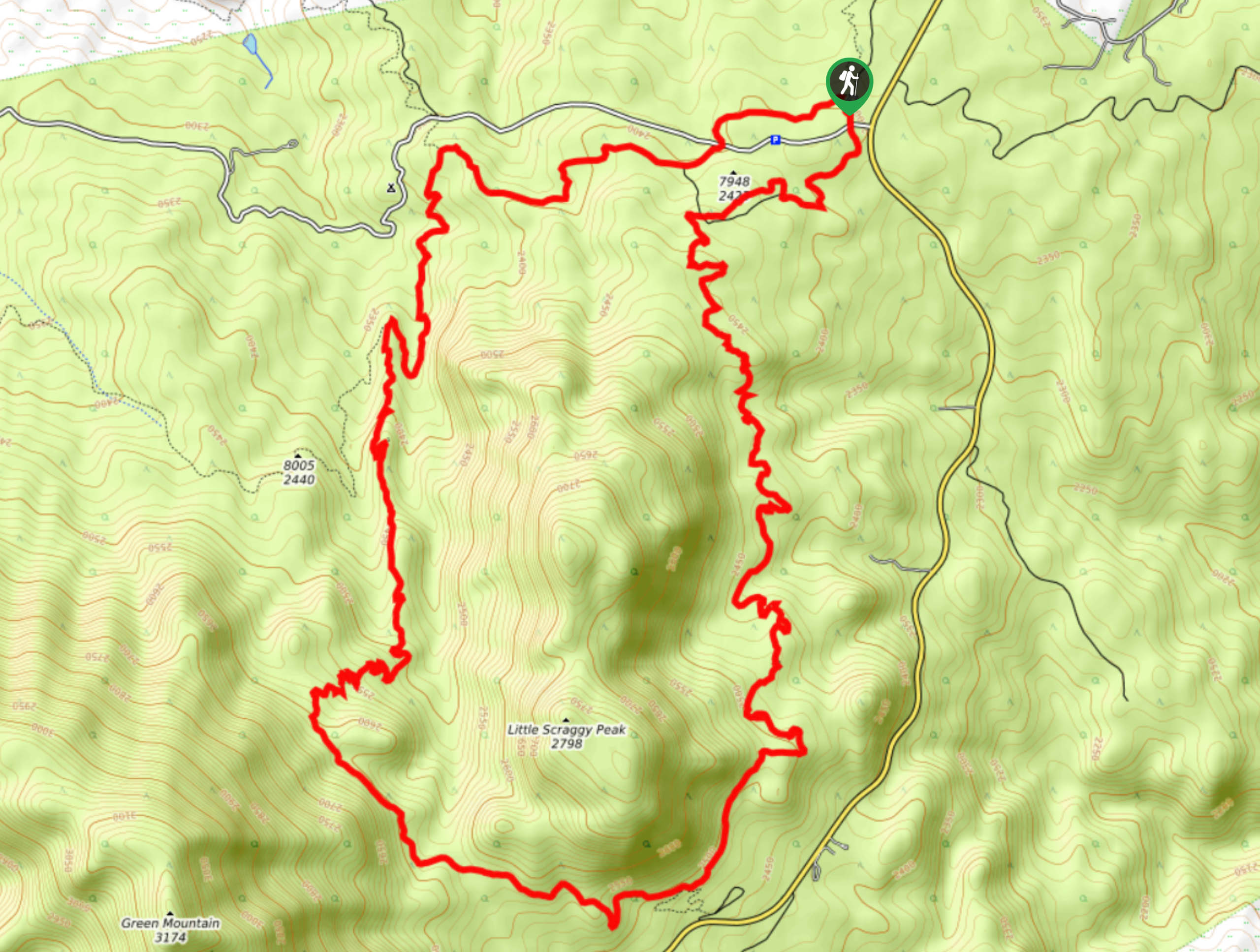
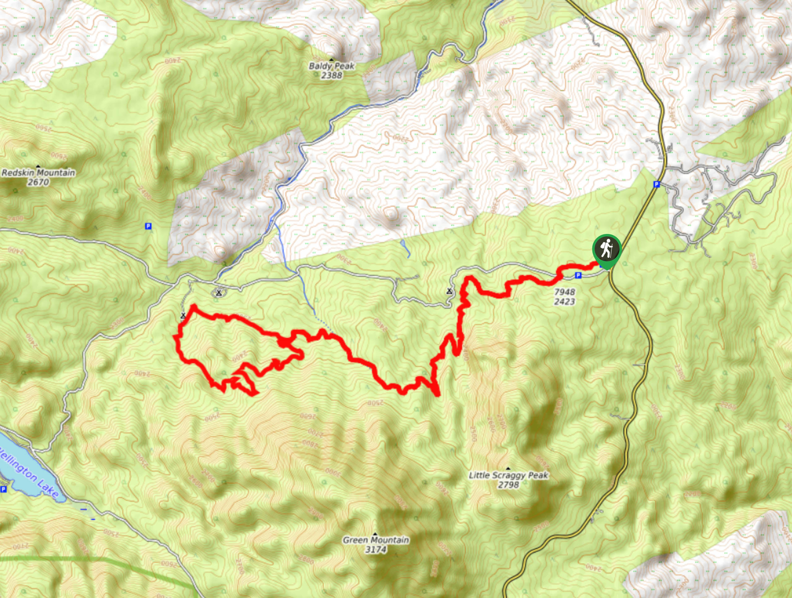
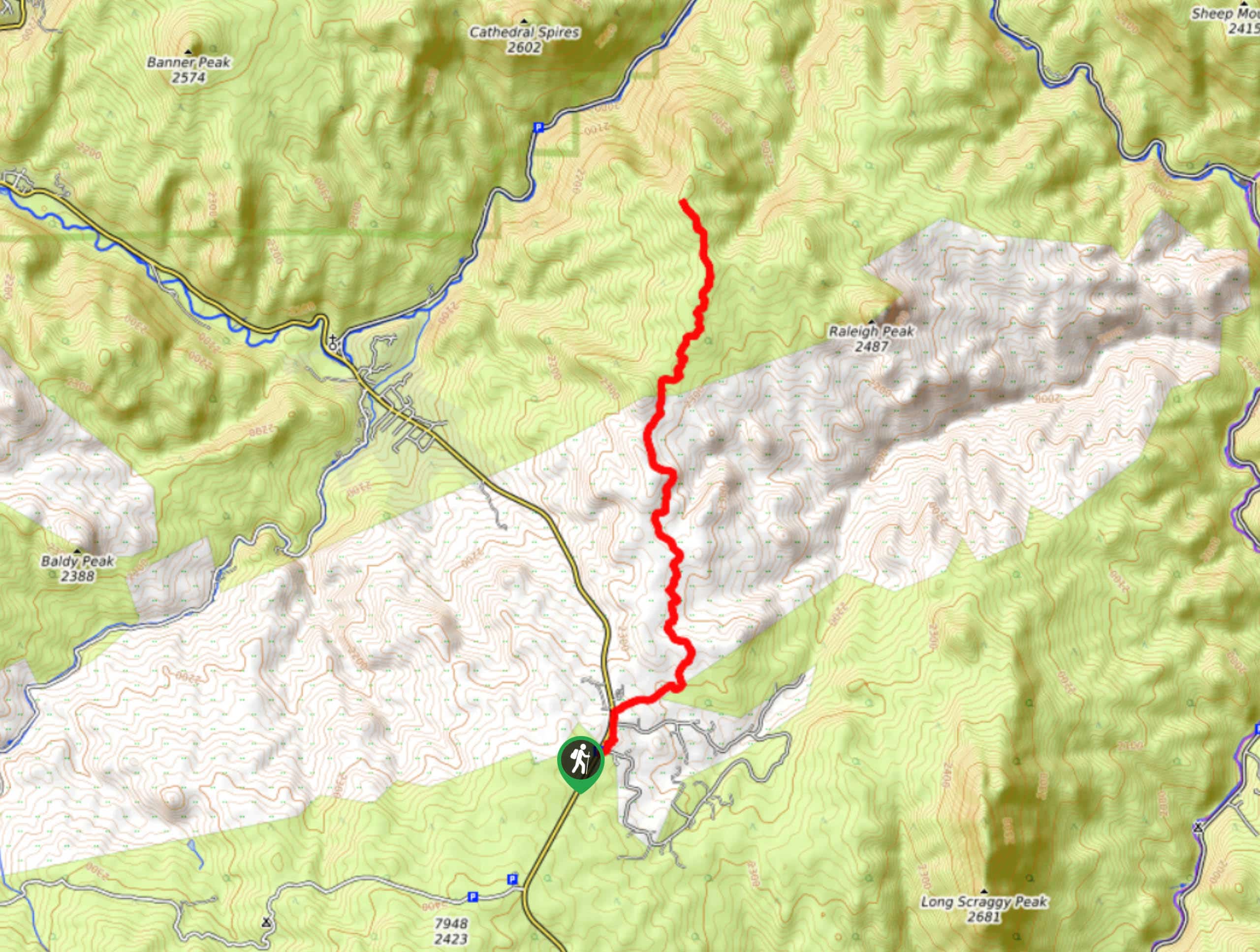
62. Little Scraggy Trail
Difficulty
Little Scraggy Trail is an epic loop hike through the diverse Colorado landscapes. Shared with… Read More
63. Three Mile Creek Trail
Difficulty
Featuring numerous stream crossings and diverse scenery, the Three Mile Creek Trail is one of… Read More
64. Goose Creek Trail
Difficulty
Hike the popular Goose Creek Trail in the Lost Creek Wilderness. Travel the woodland valley… Read More
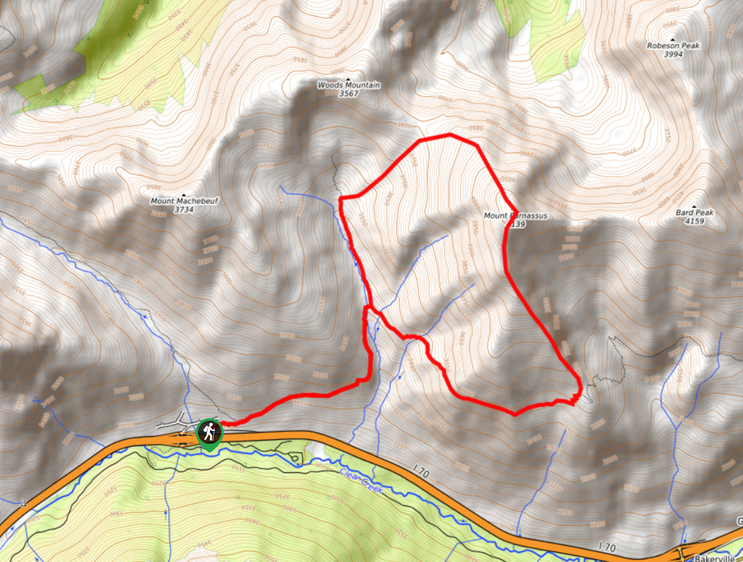
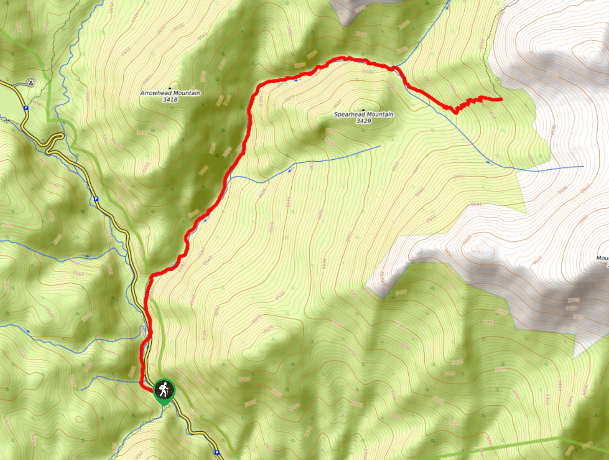
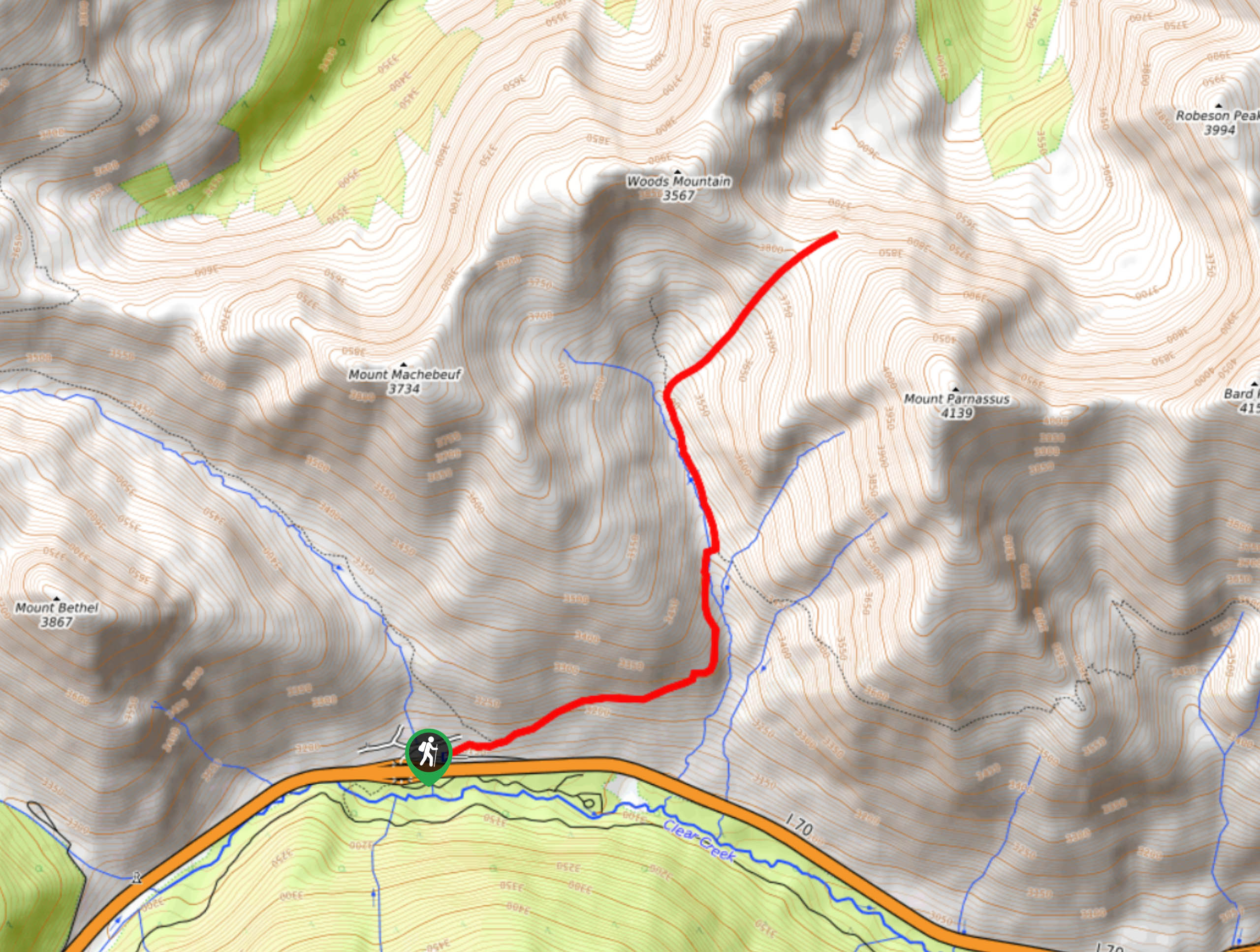
65. Mount Parnassus Hike
Difficulty
Mount Parnassus Hike is a demanding adventure, but it is well worth the effort. Reserved… Read More
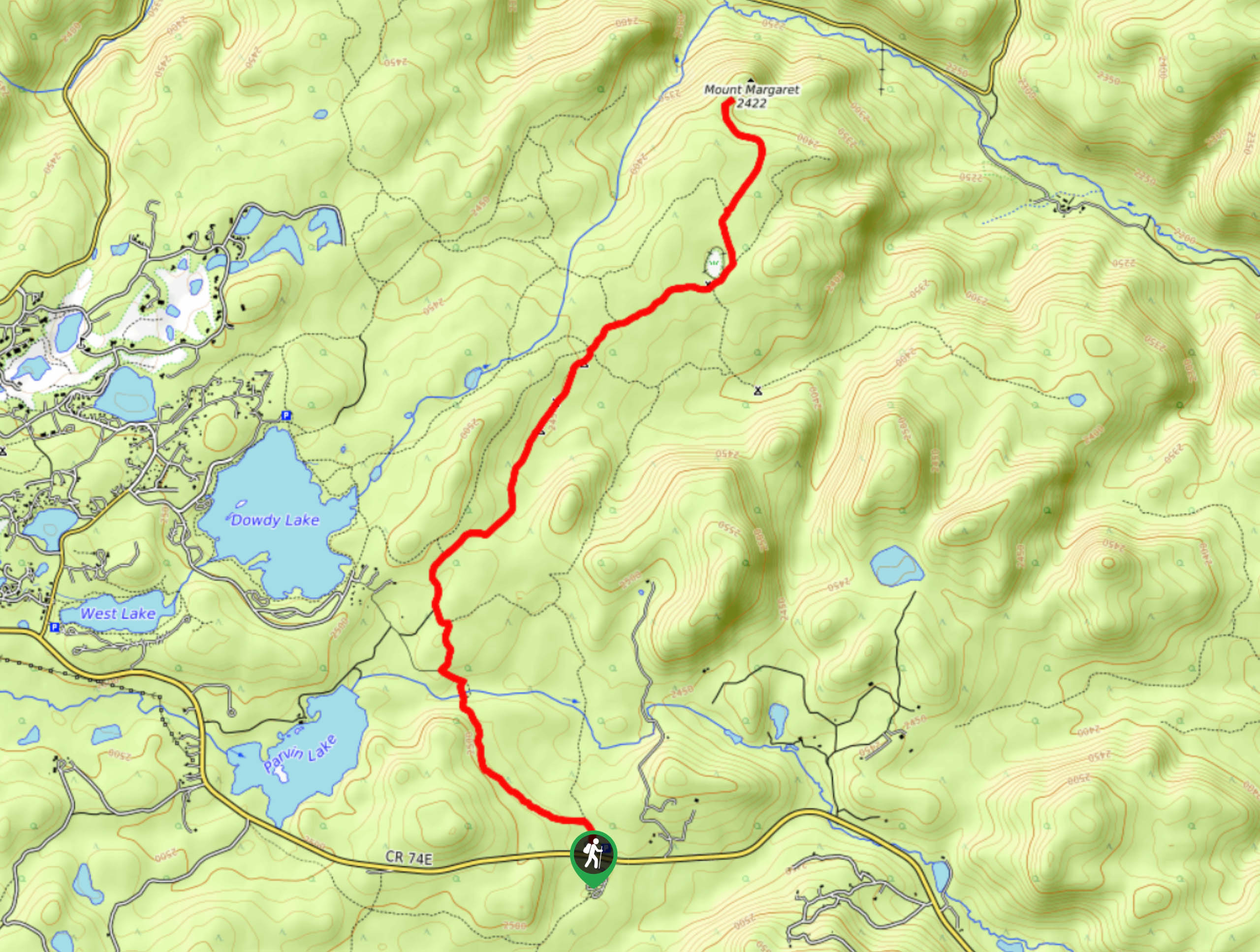
66. Mount Margaret Trail
Difficulty
Take the Mount Margaret Trail to the low summit. Travel through stunning scenery and share… Read More
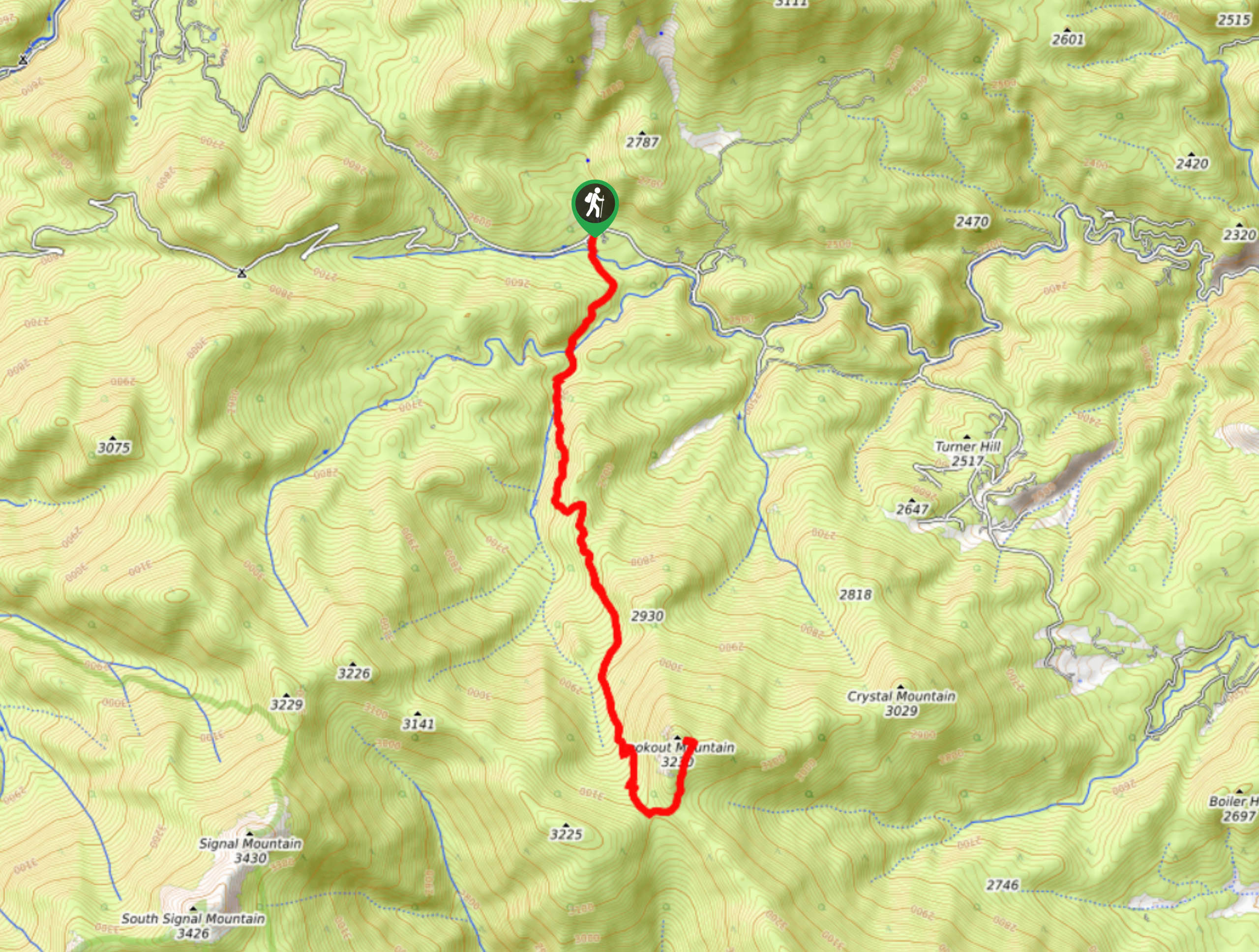
67. Lookout Mountain Hike
Difficulty
Lookout Mountain really does live up to its name, trust us. Hike up the quintessential… Read More
68. Hewlett Gulch Trail
Difficulty
With the perfect ratio between steep and easy terrain, the Hewlett Gulch Trail is a… Read More
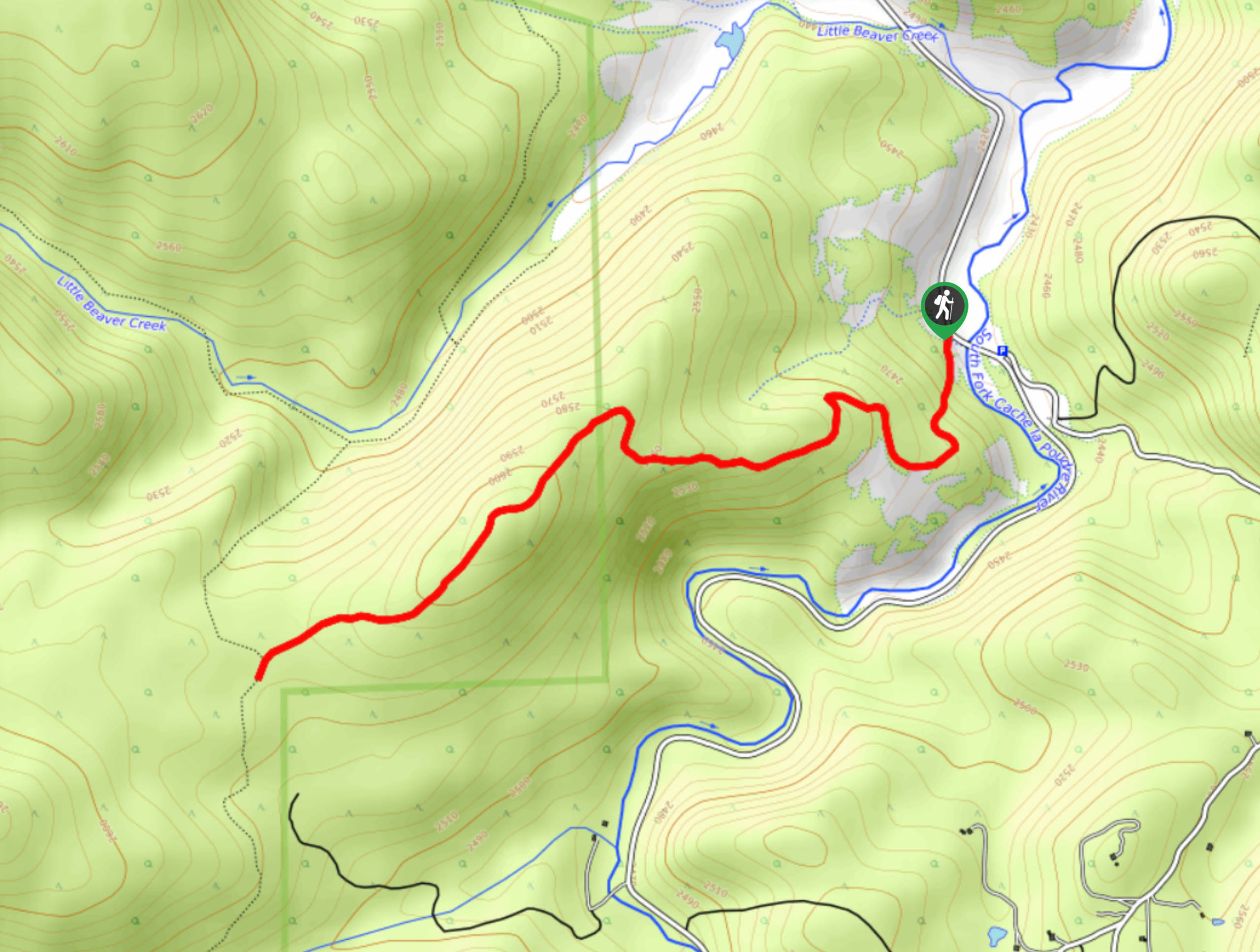
69. Little Beaver Creek Trail
Difficulty
Leave the city in the rear-view mirror and head out into the Comanche Peak Wilderness.… Read More
70. Prospect Mountain Hike
Difficulty
Take a drive to Estes Park and hike up Prospect Mountain. This short but steep… Read More
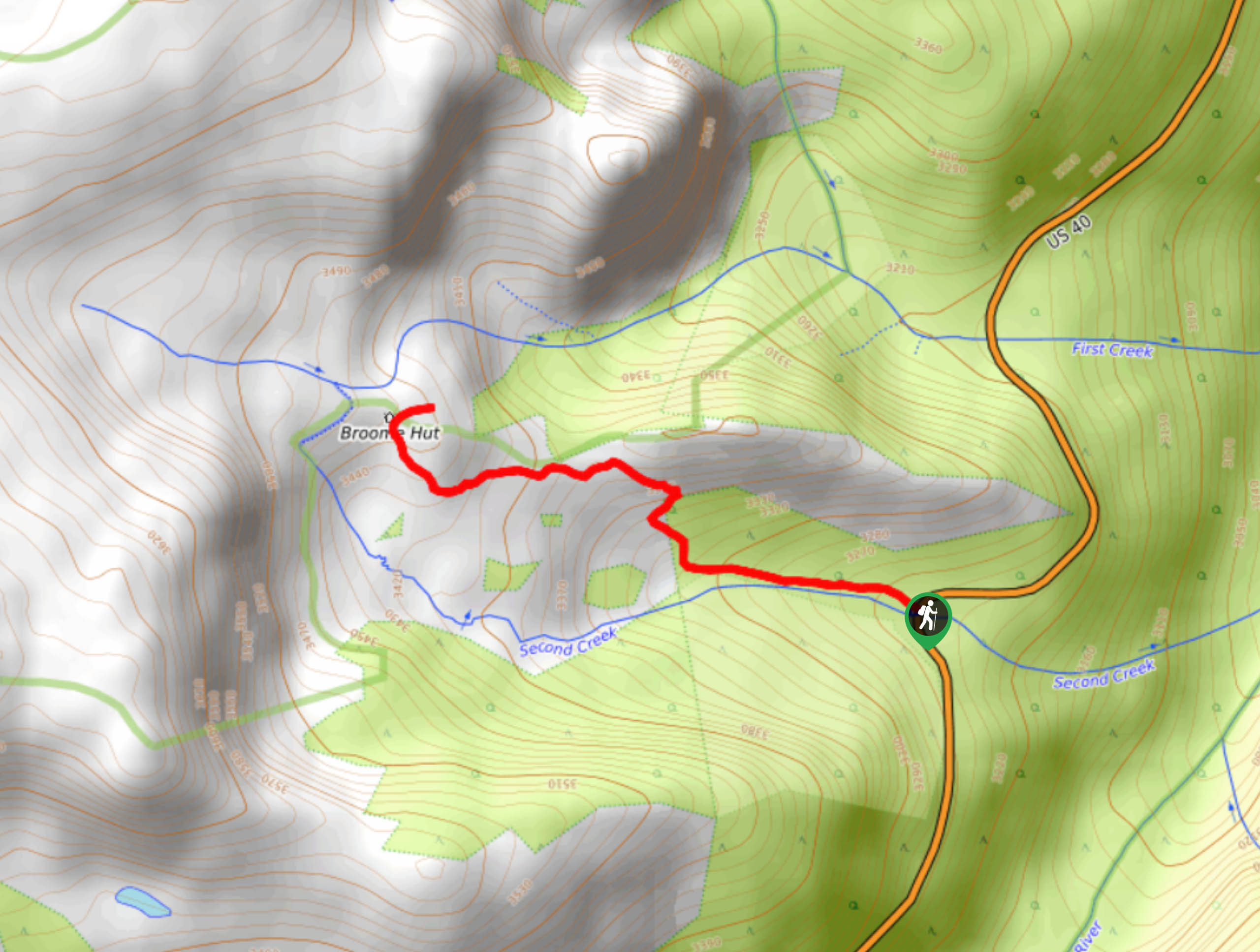
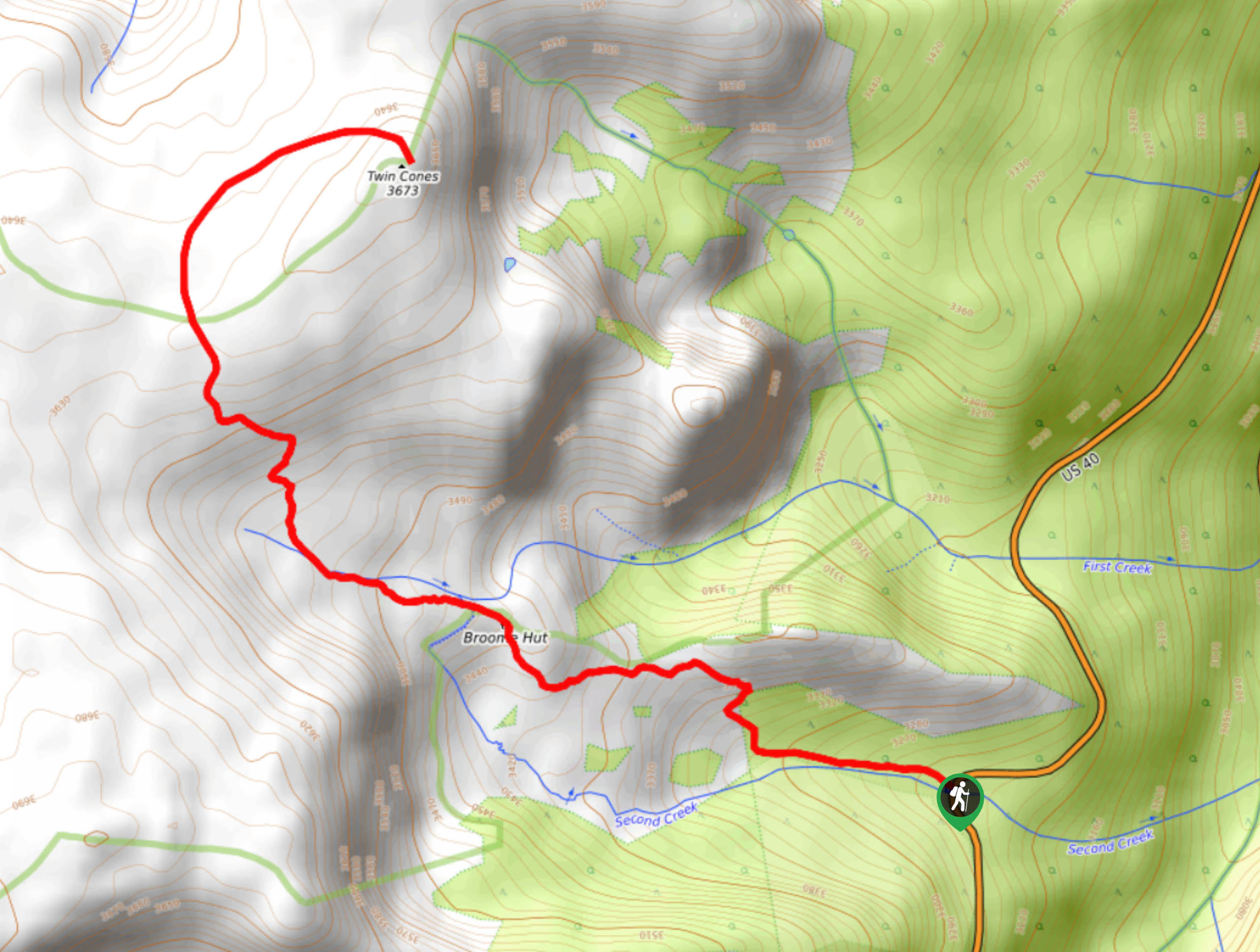
71. Broome Hut Hike
Difficulty
Hike the Broome Hut Hike Trail through the Arapaho National Forest to the Broome Hut.… Read More
72. Gilpin Tramway Trail
Difficulty
The Gilpin Tramway Trail is a hike that will please outdoor enthusiasts and history buffs… Read More
73. Chinns Lake Hike
Difficulty
The Chinns Lake Trail is a short, but sweet hike up to the lakes. This… Read More
74. Silverdale Trail
Difficulty
Hike the Silverdale Trail through the stunning aspen forests and past several old mines. Adults… Read More
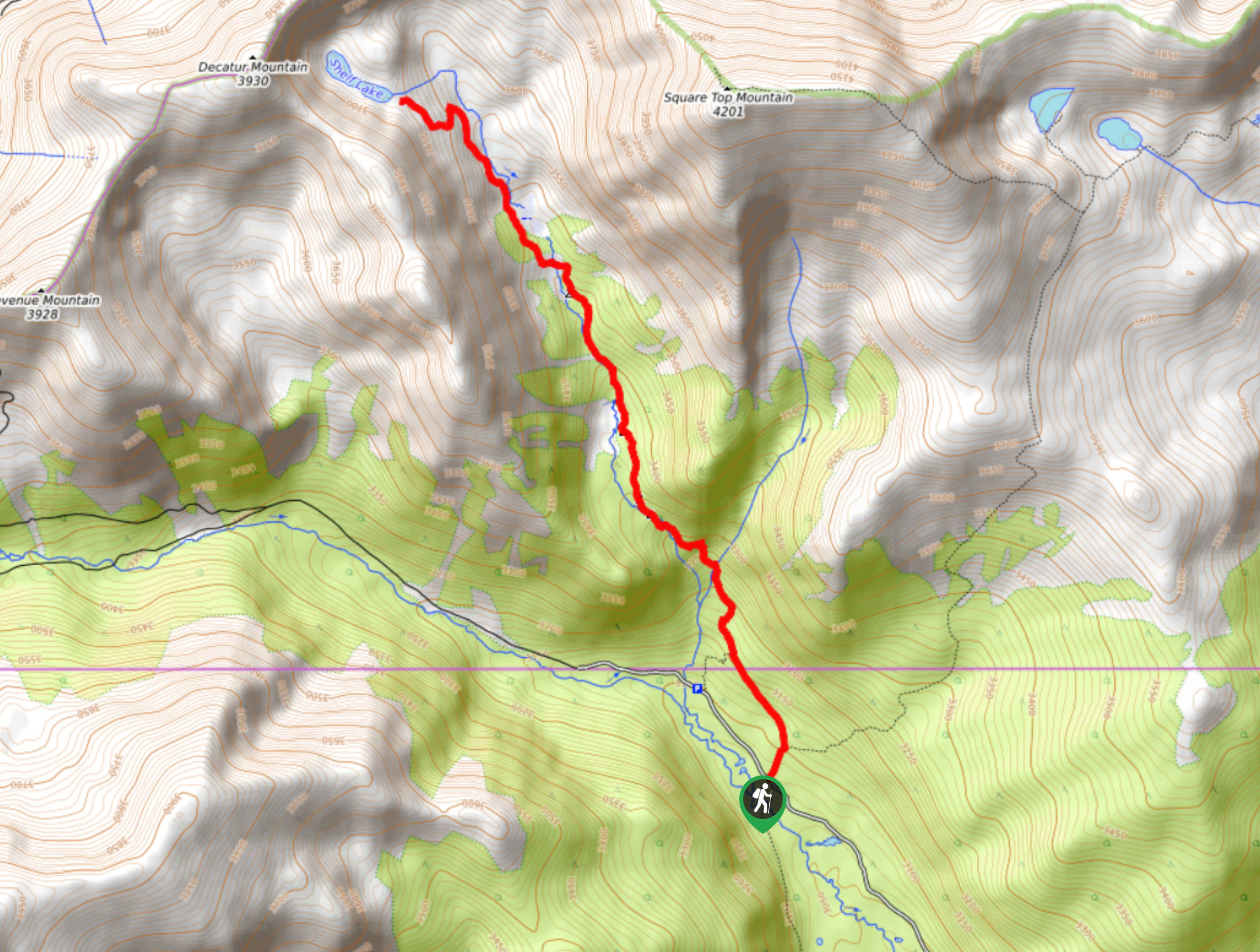
75. Shelf Lake Hike
Difficulty
The Shelf Lake Hike is a crowd-favorite, and there is no dispute as to why.… Read More
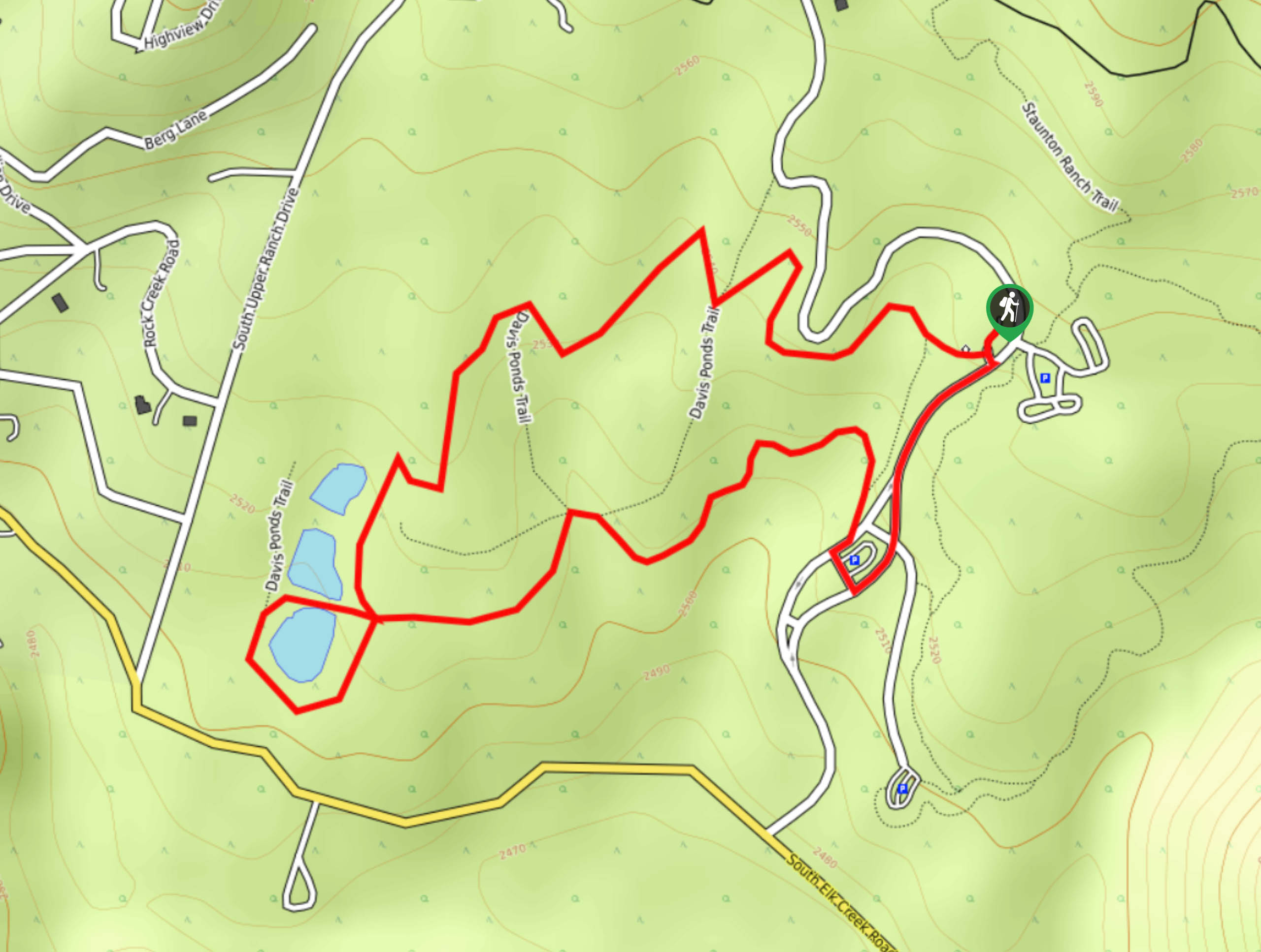
76. Davis Ponds Trail
Difficulty
Hike through Colorado’s wilderness on this family-friendly trek along the Davis Ponds Trail. These paths… Read More
77. Burning Bear Trail
Difficulty
The Burning Bear Hike is a lovely, forested walk through the Pike National Forest. Walk… Read More
78. Beartrack Lakes Trail
Difficulty
Hiking the Beartrack Lakes Trail will lead to not one, not two, but four small… Read More
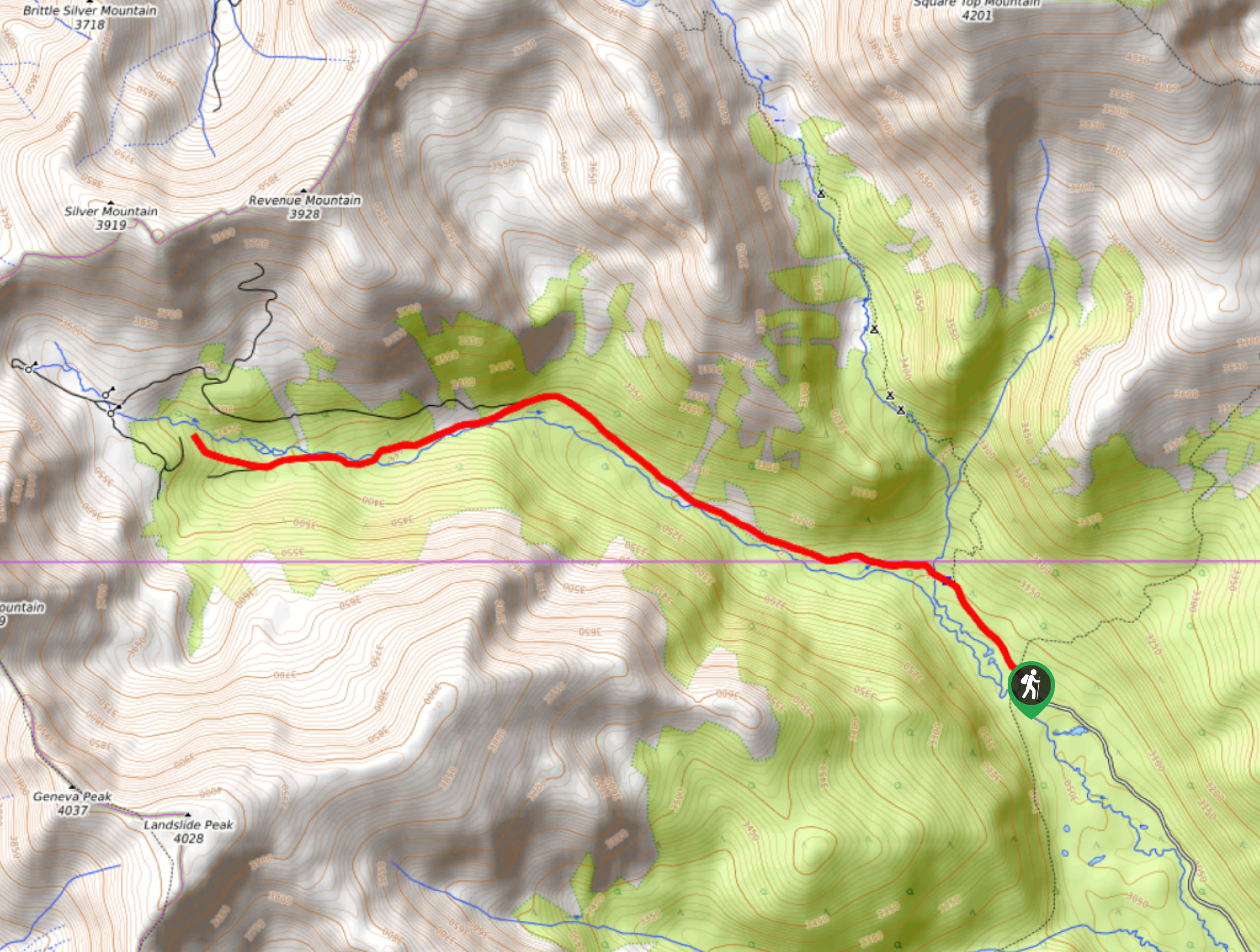
79. Square Top Lakes Hike
Difficulty
The Square Top Lakes Trail is a scenic adventure through the Arapaho National Forest to… Read More
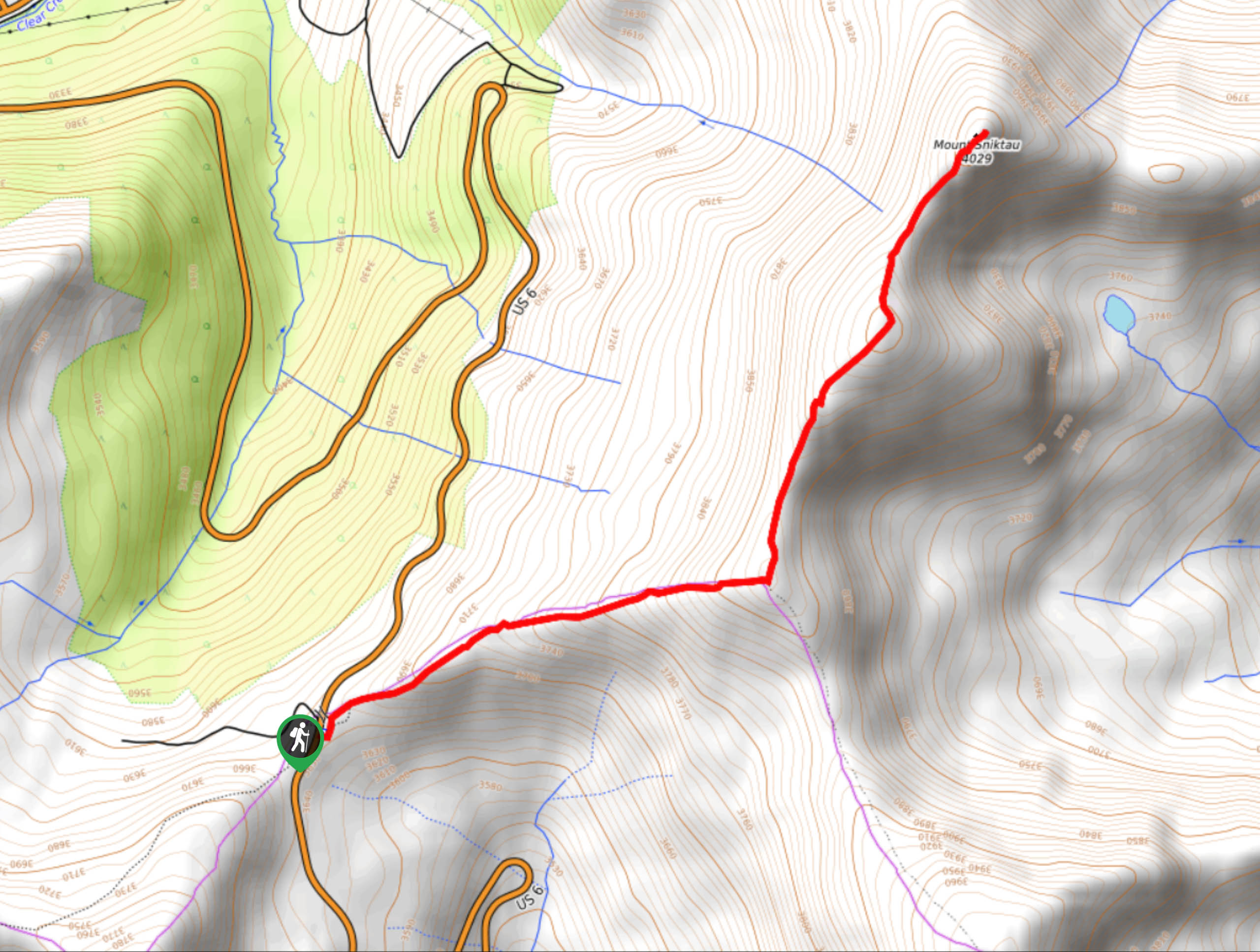
80. Mount Sniktau Trail
Difficulty
The Mount Sniktau Trail is a demanding hike up the east side of the Continental… Read More
81. West Ridge Trail via Loveland Pass
Difficulty
You will feel as though you are on top of the world as when you… Read More
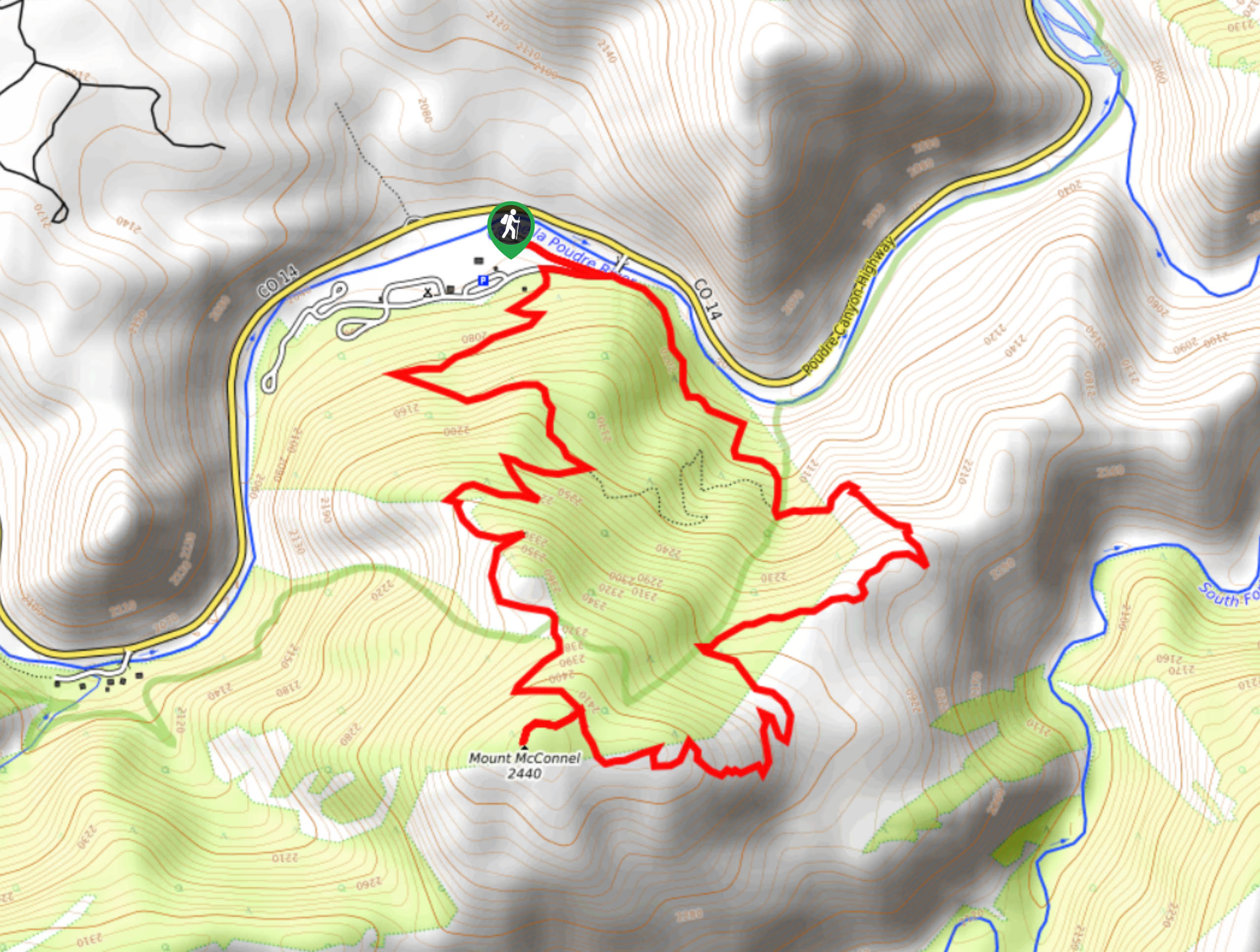
82. Mount McConnel Trail
Difficulty
Lace those hiking boots and fill your water bottles because we are heading out on… Read More
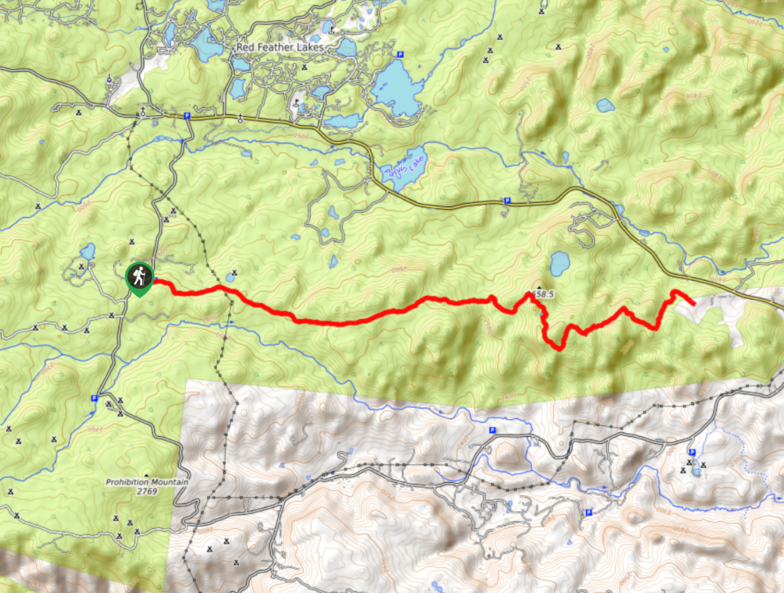
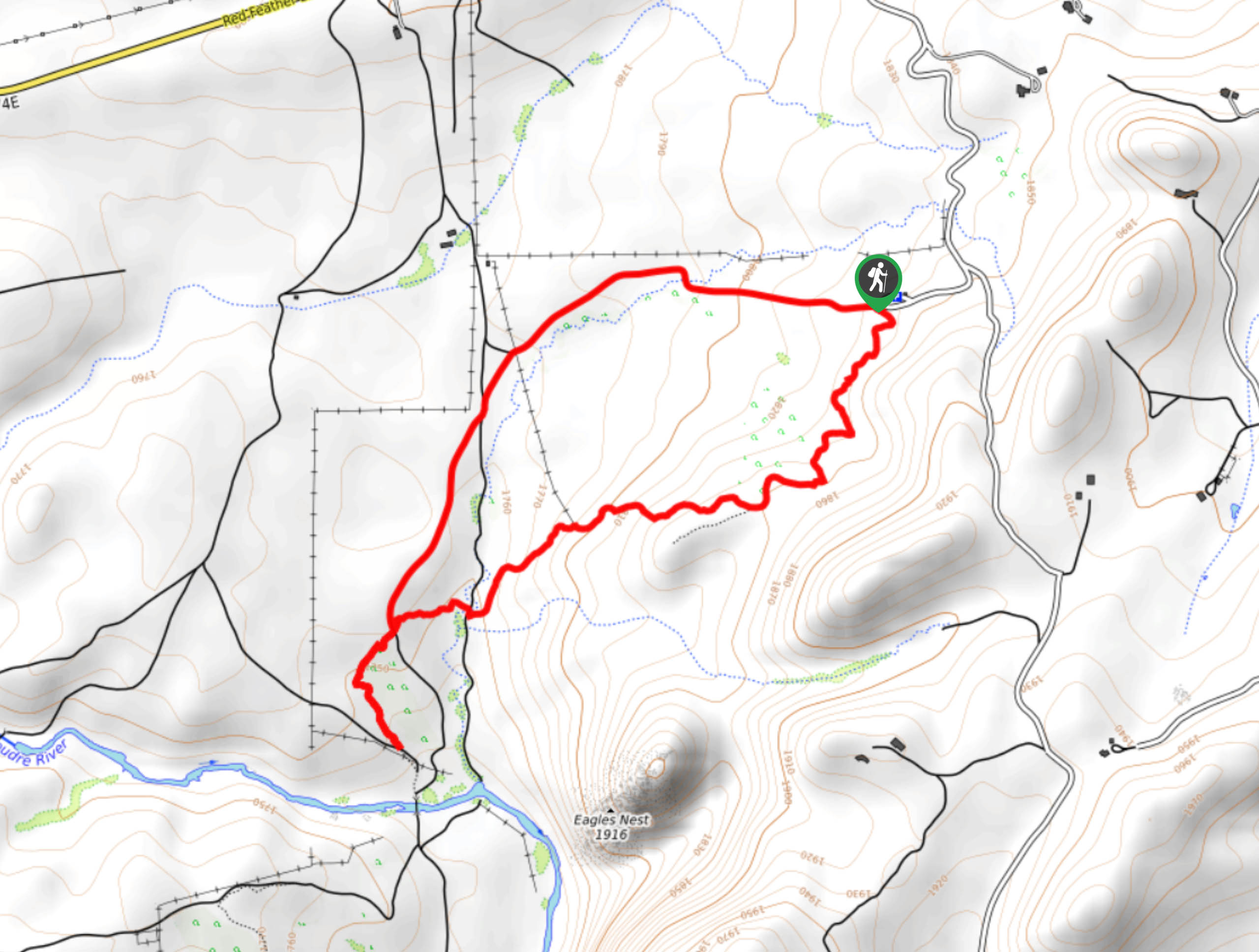
83. Red Feather Falls
Difficulty
The hike up to the Red Feather Falls, otherwise known as Disappointment Falls, is a… Read More
84. Bulwark Ridge Trail
Difficulty
There is no doubt about it, you will surely break a sweat as you ascend… Read More
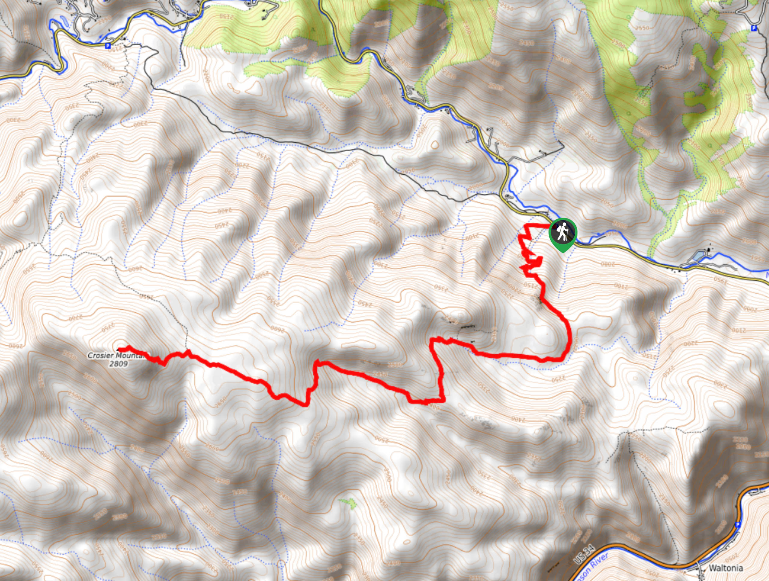
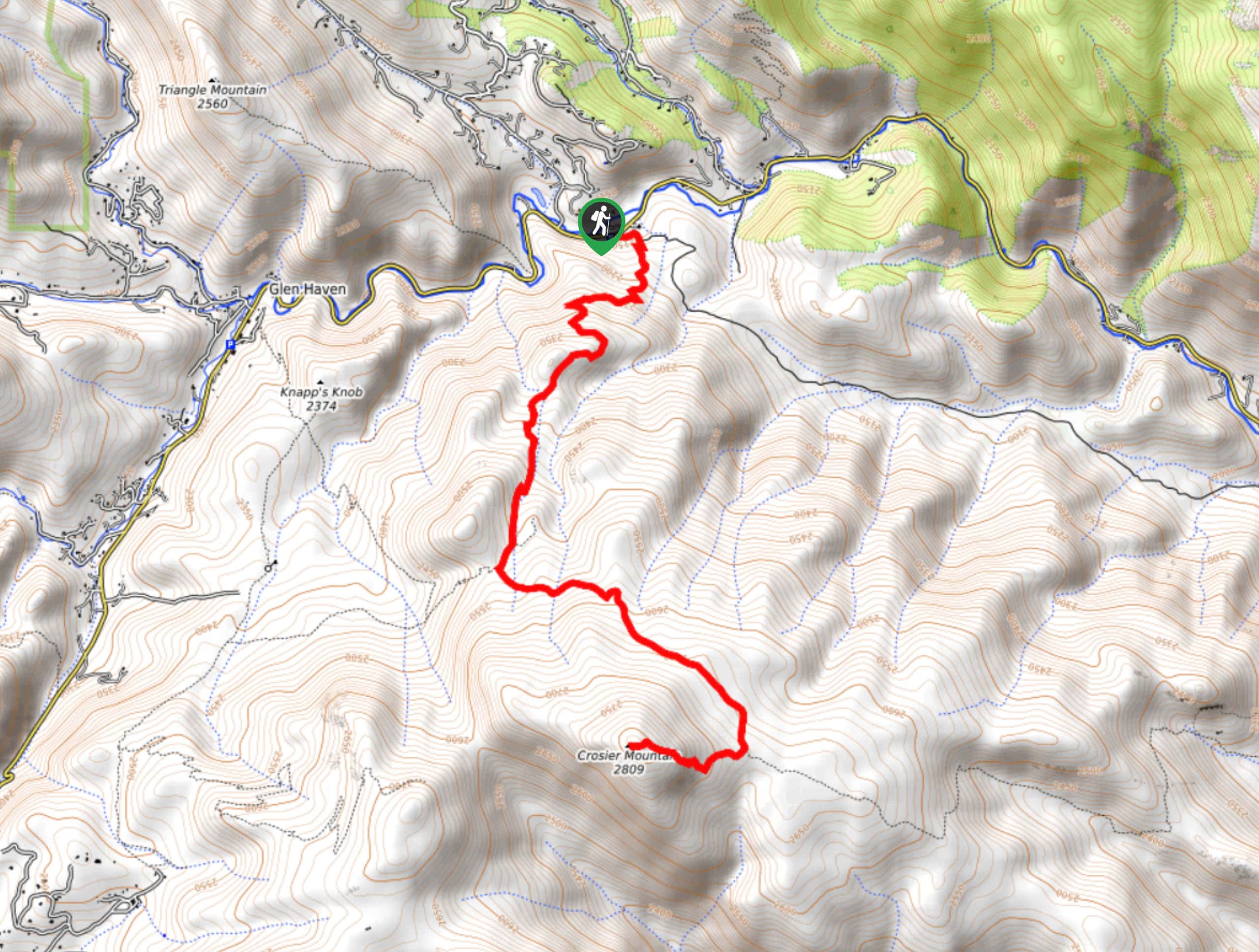
85. Crosier Mountain Trail
Difficulty
The Crosier Mountain Trail is an incredibly scenic adventure through the Colorado Wilderness. Hike up… Read More
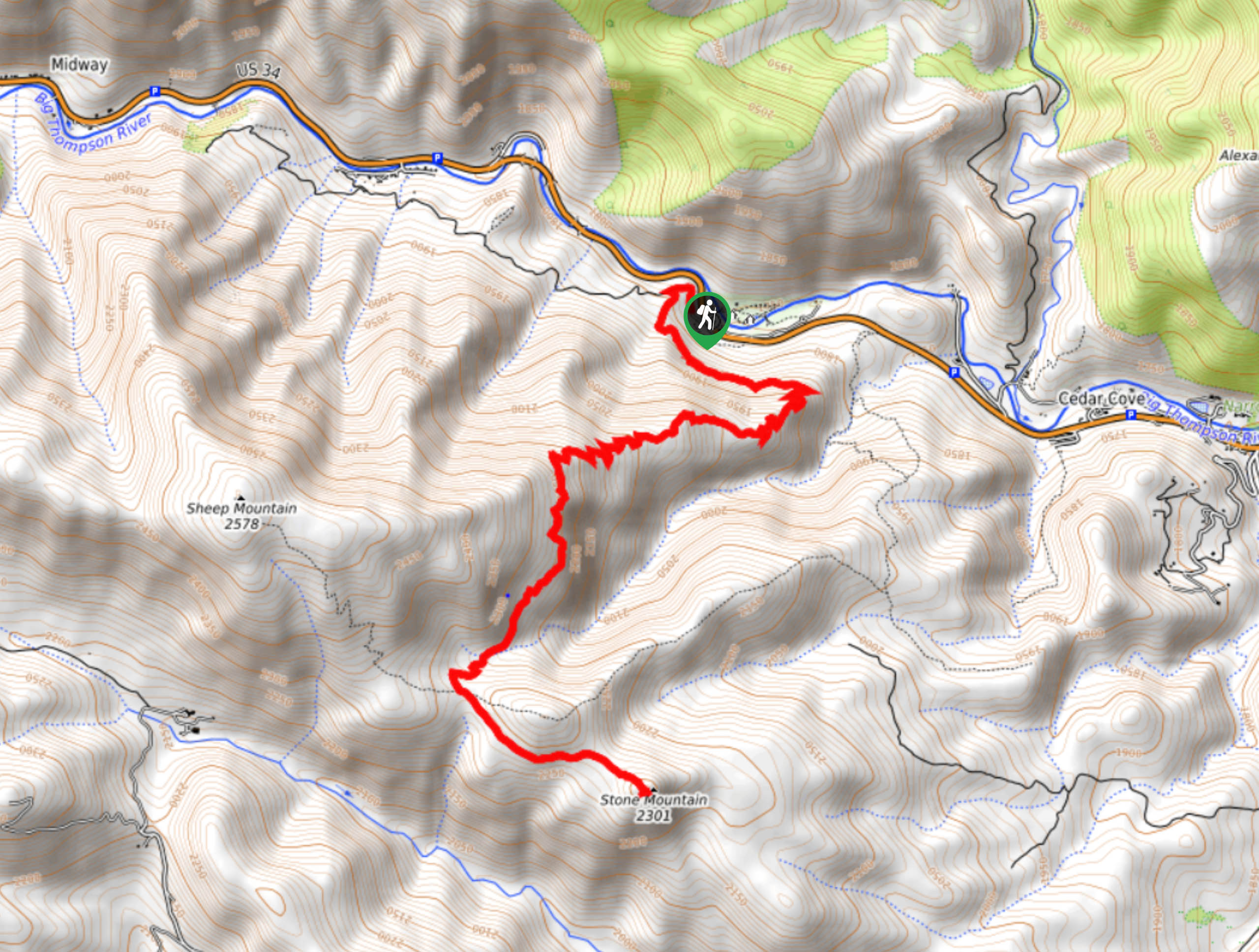
86. Stone Mountain Hike
Difficulty
The Stone Mountain Hike is a rockin’ good time. Get it? Anyways, hike up the… Read More
87. Abyss Lake Trail
Difficulty
The Abyss Lake Trail is an adventurer’s oasis. Though crowded, this hike provides some of… Read More
88. Helms Lake via Abyss Trail
Difficulty
Hike through vibrant aspens up to the picturesque Helms Lake. The Helms Lake via Abyss… Read More
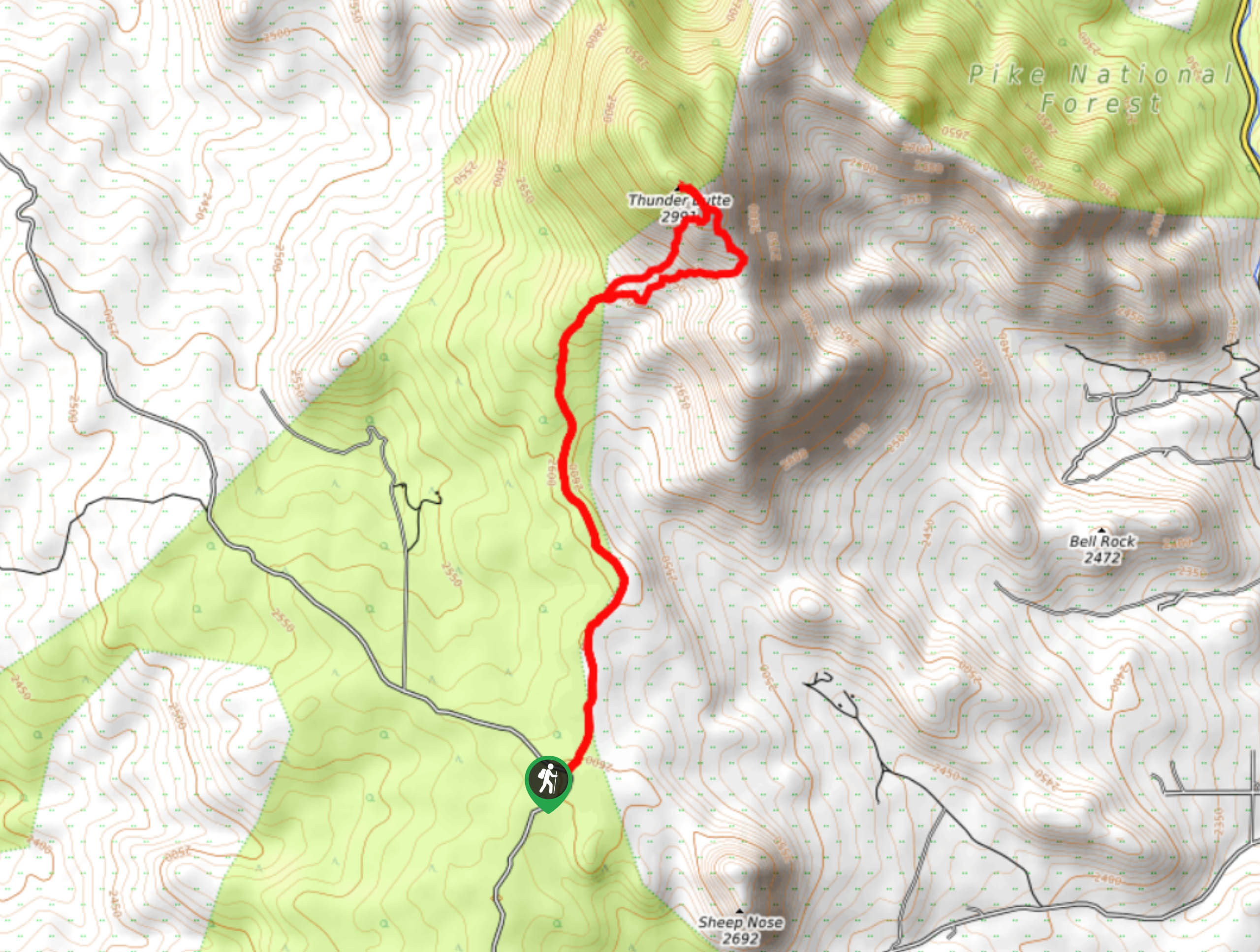
89. Thunder Butte Hike
Difficulty
The Thunder Butte Hike is an epic outdoor excursion for those who don’t mind blazing… Read More
90. Craig Creek Trail
Difficulty
Hike, bike, or horseback ride the Craig Creek Trail in the Pike National Forest. This… Read More
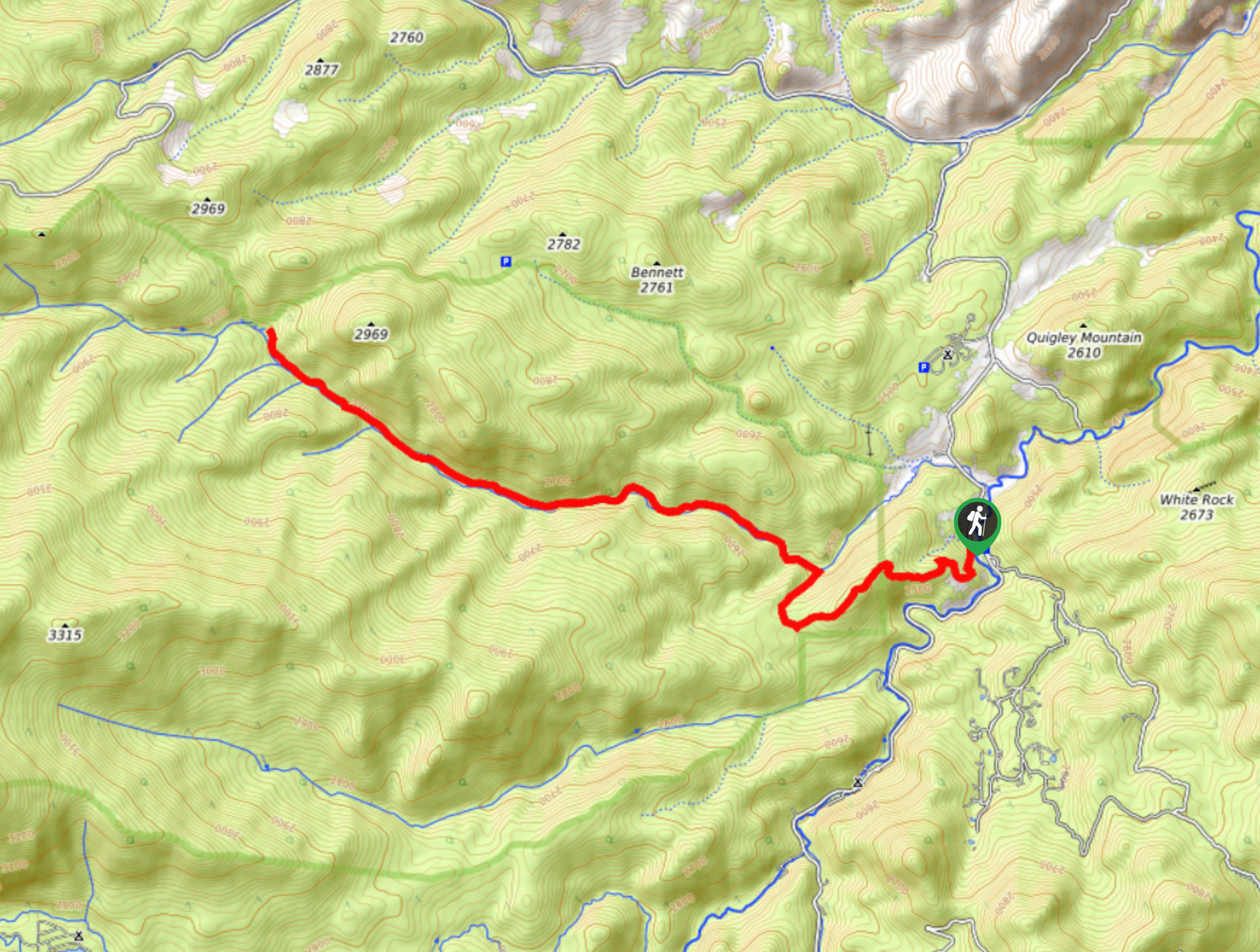
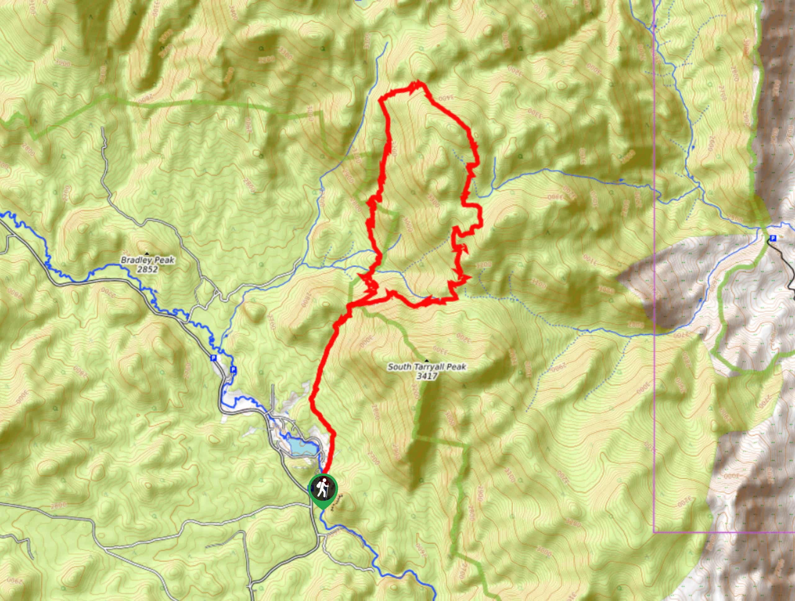
91. South Chicago Creek Hike
Difficulty
Hike up the South Creek Trail to a stunning overlook of a mountain cirque. This… Read More
92. Wildcat Canyon Trail
Difficulty
The Wildcat Canyon Trail is an outdoor excursion that all sorts of outdoor enthusiasts can… Read More
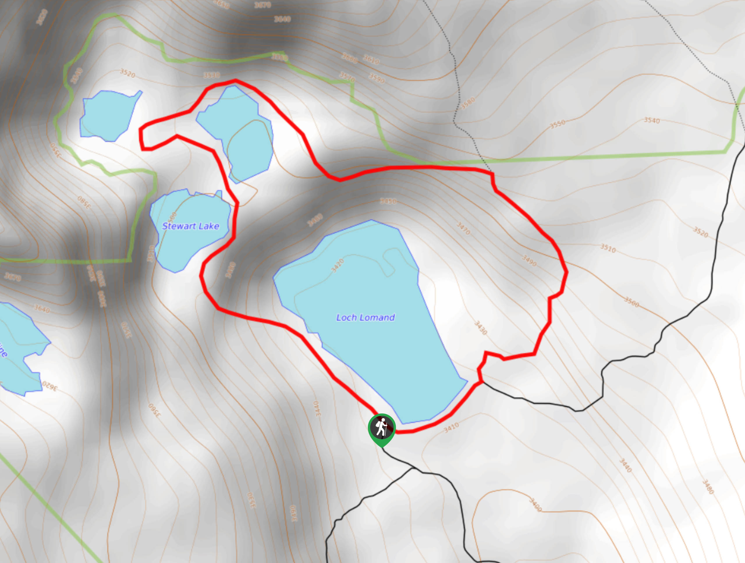
93. Loch Lomond Loop Trail
Difficulty
The Loch Lomond Loop Trail is a stunningly scenic circuit trail around a bunch of… Read More
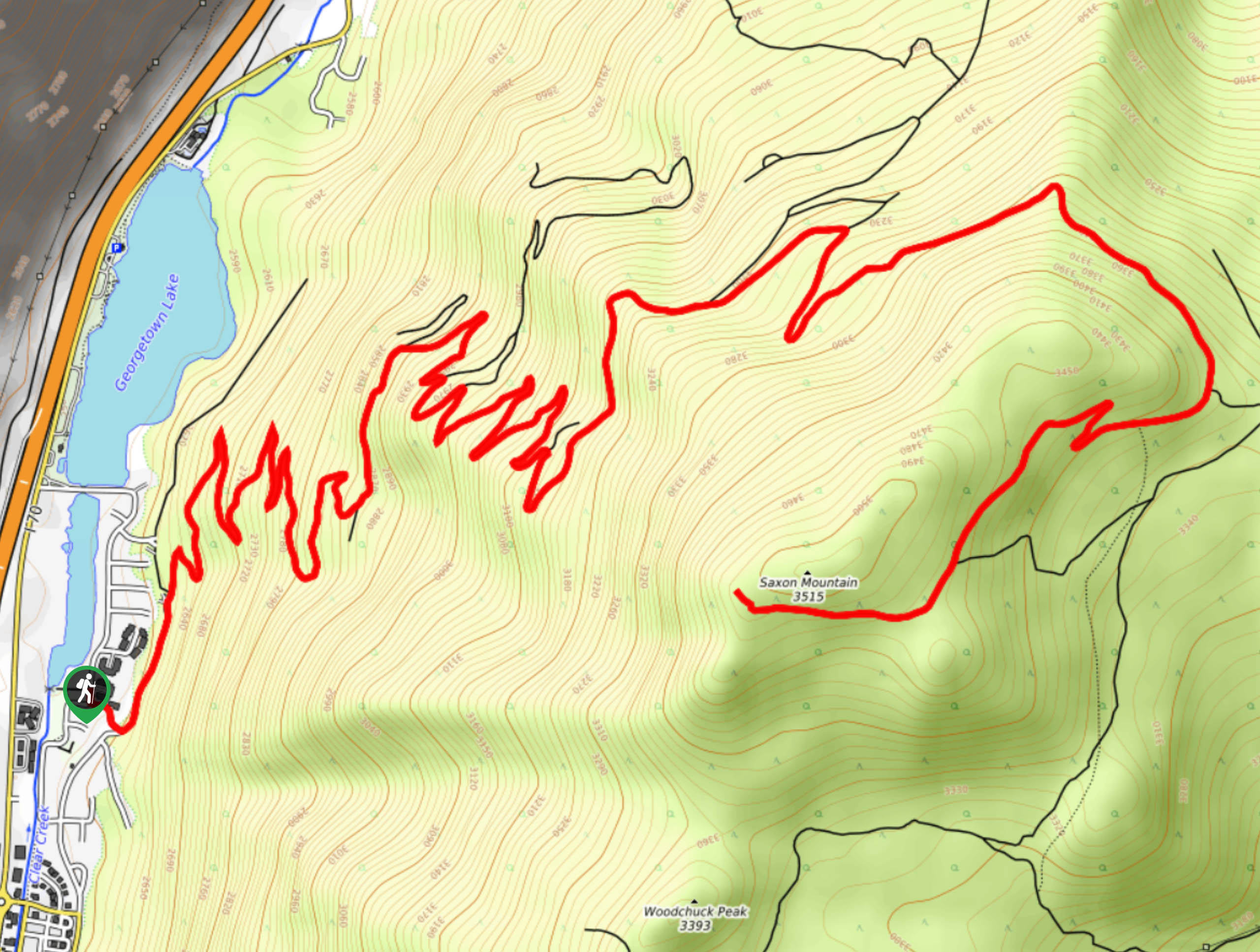
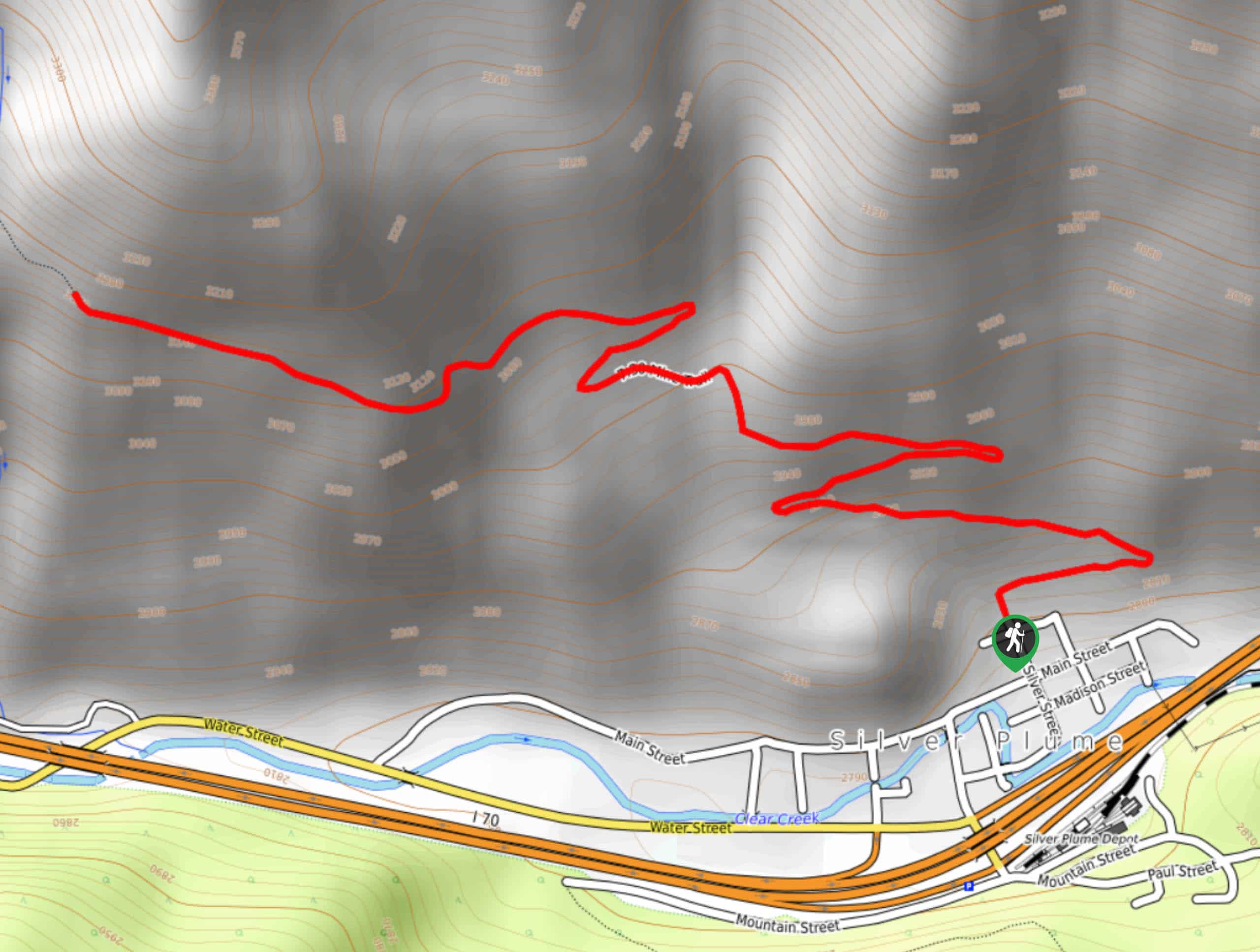
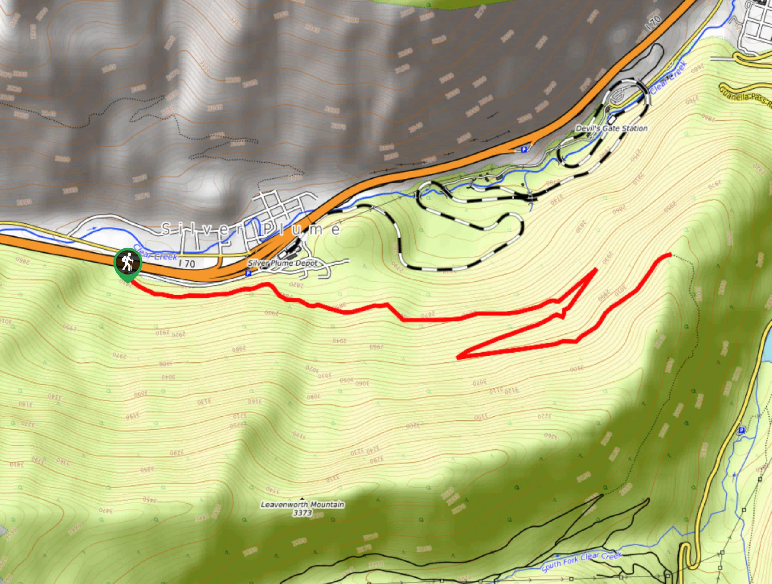
94. Saxon Mountain Hike
Difficulty
Share the summit trail with mountain bikers and off-roading vehicles. The Saxon Mountain Hike is… Read More
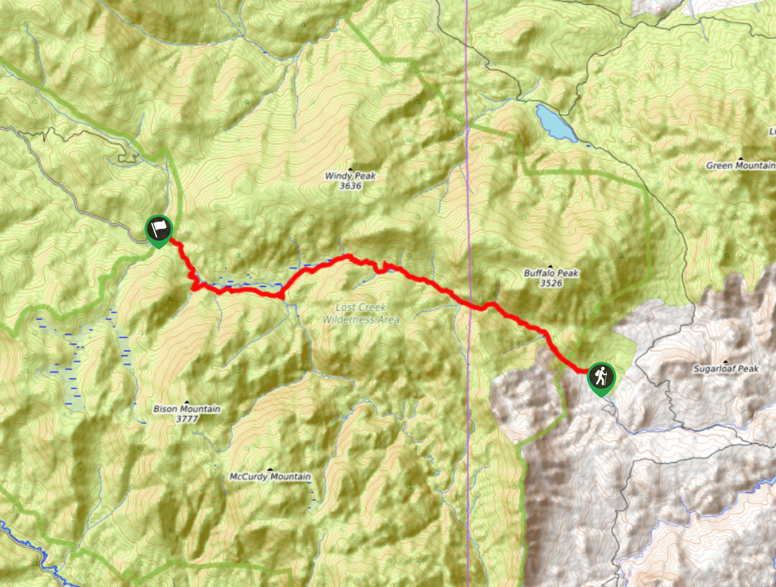
95. Wigwam Trail
Difficulty
Hike from one end of the Lost Creek Wilderness to the other on the Wigwam… Read More
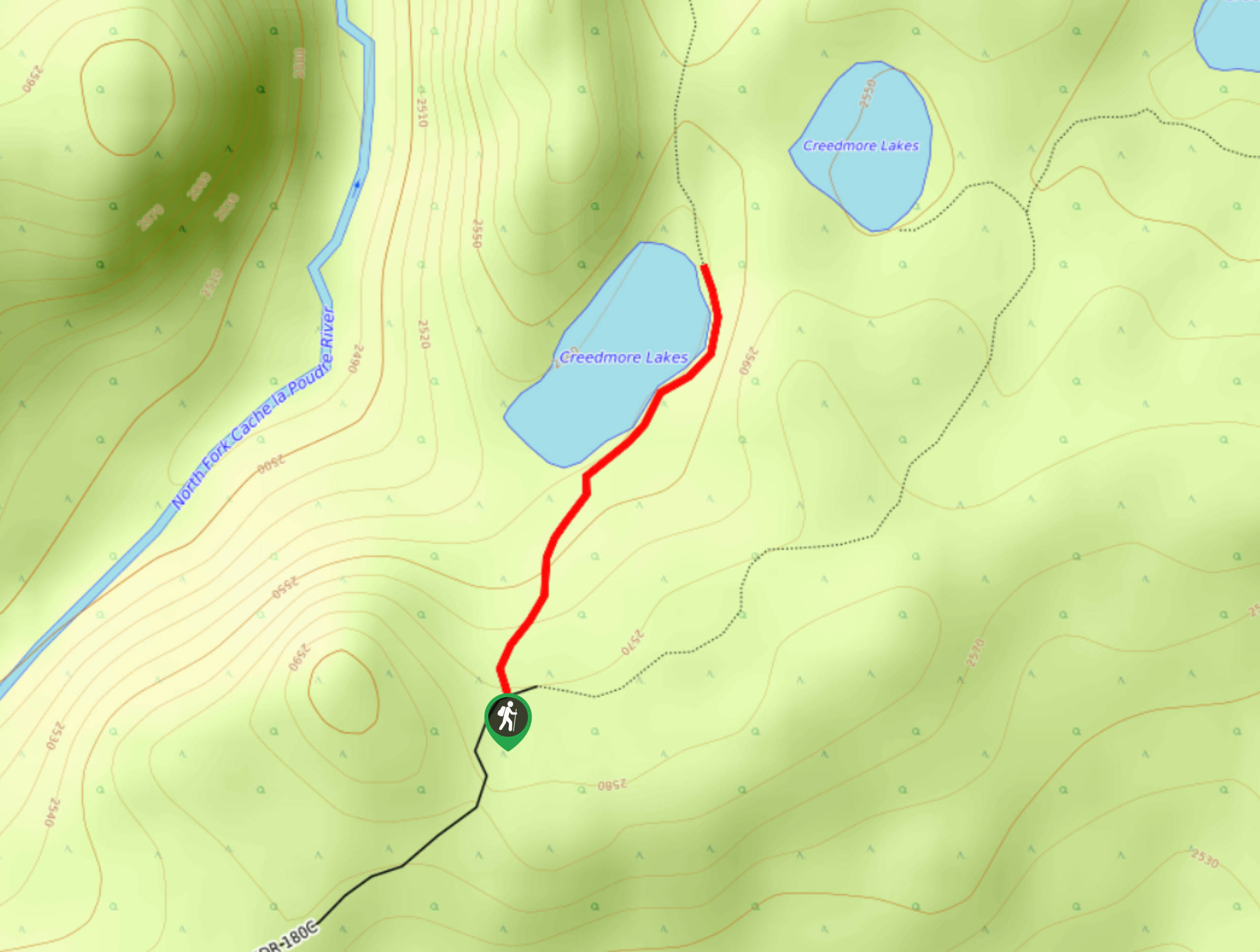
96. Creedmore Lakes Trail
Difficulty
Follow the primitive path around the lakes on the Creedmore Lakes Trail. This popular fishing… Read More
97. Granite Ridge Trail
Difficulty
The Granite Ridge Trail lived up to its name. Hike the meadowland trail past several… Read More
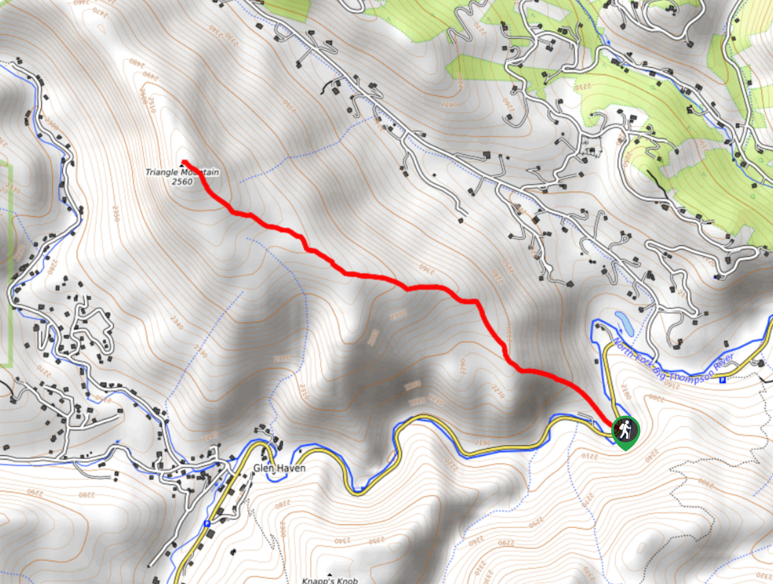
98. Triangle Mountain Hike
Difficulty
Immerse yourself in nature and leave the city in the rear-view mirror as you travel… Read More
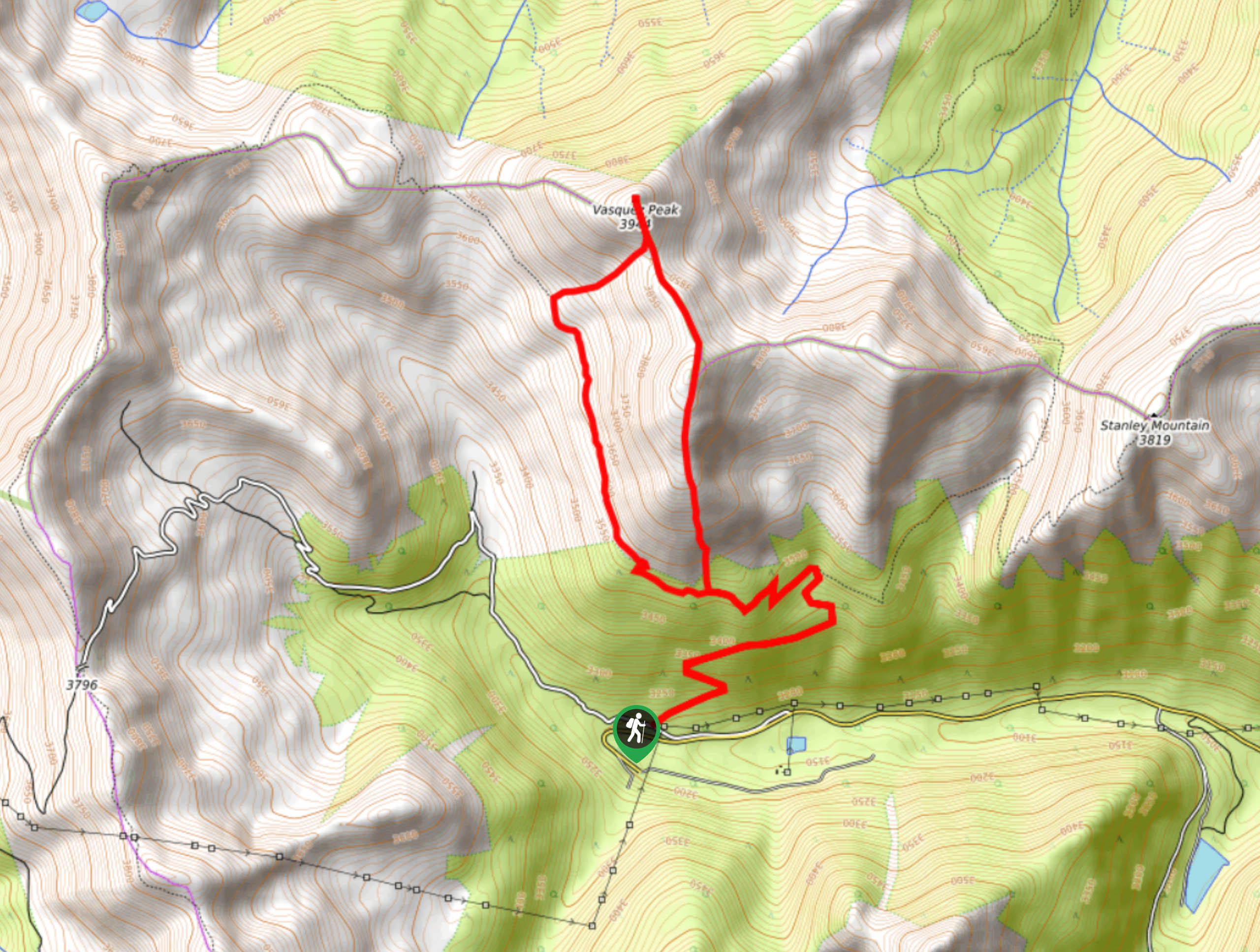
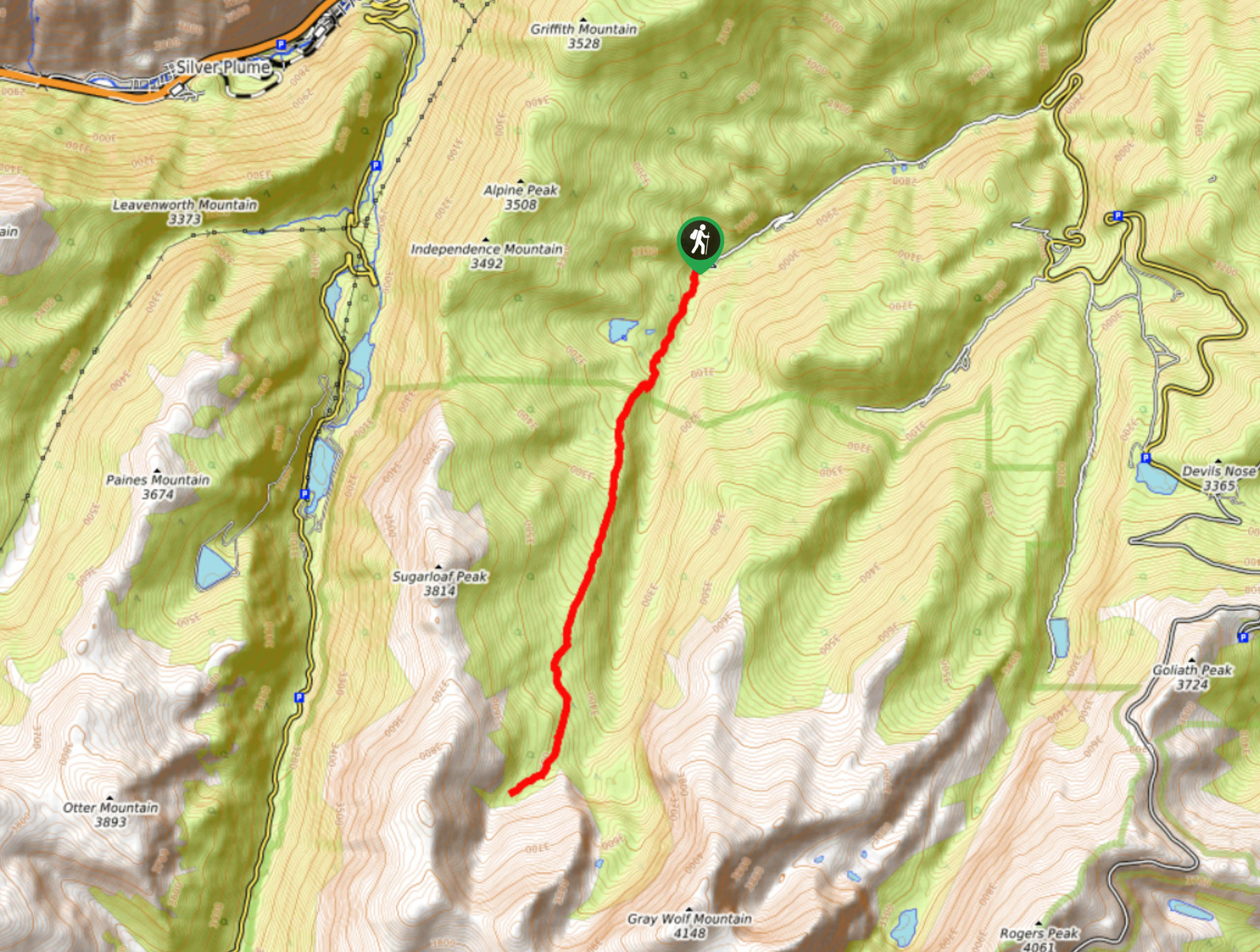
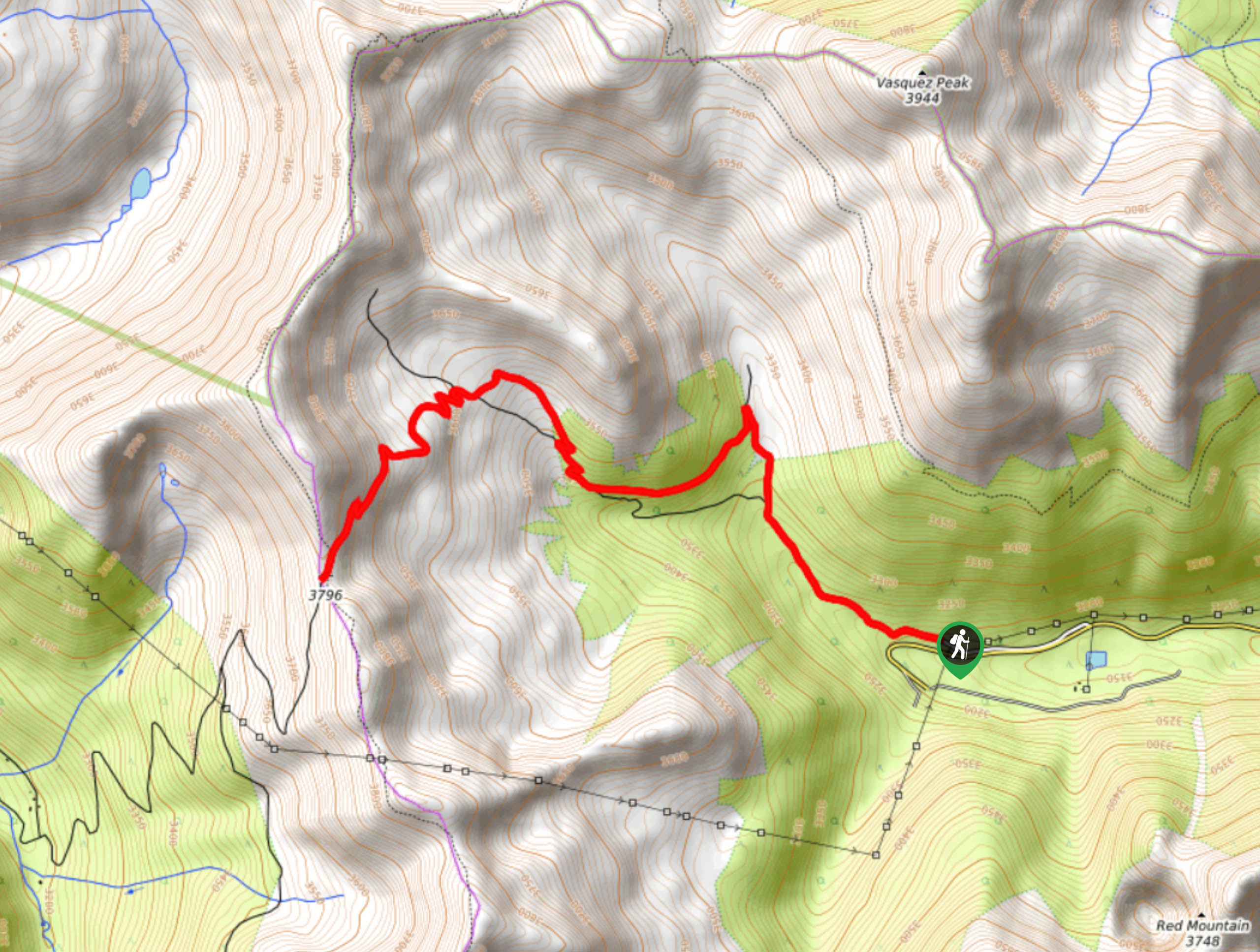
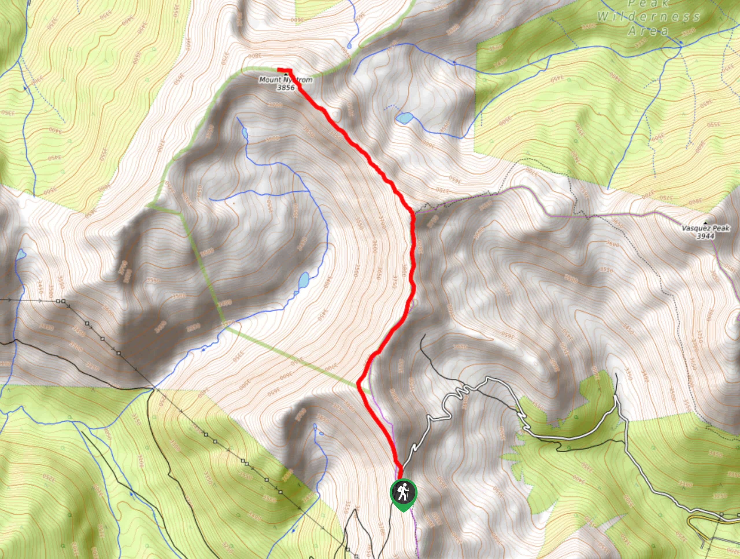
99. Vasquez Peak Hike
Difficulty
Immerse yourself in nature and travel up the Vasquez Peak Hike. This stunning outdoor adventure… Read More
100. Harmonica Arch Trail
Difficulty
The Harmonica Arch Trail is a crowd-favourite; locals and visitors are impressed by this scenic… Read More
101. Mason Creek Trail
Difficulty
The Mason Creek Trail is an awesome day-hike through Staunton State Park. If you are… Read More
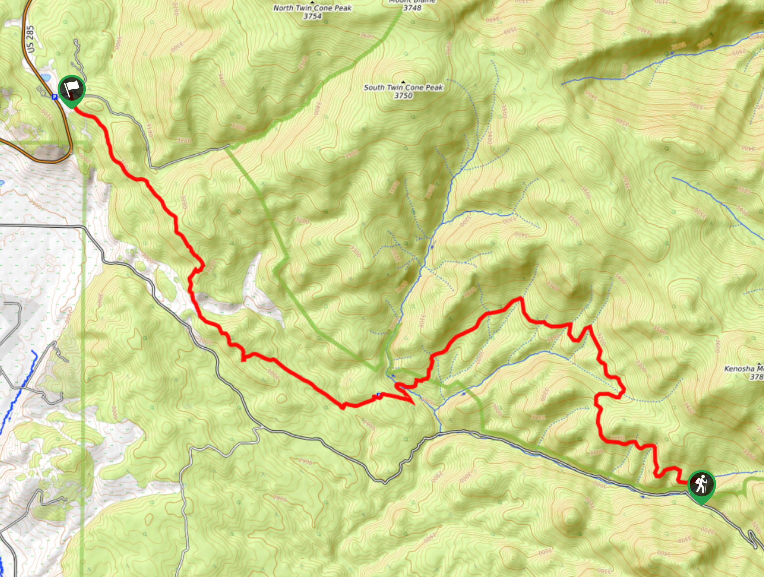
102. Kenosha Pass to Georgia Pass via the Colorado Trail
Difficulty
Hike across the Colorado Wilderness as you travel along the Colorado Trail from Kenosha Pass… Read More
103. Bristlecone Loop Trail
Difficulty
The Bristlecone Loop Trail is a wonderful family-friendly adventure in the Mount Goliath Natural Area.… Read More
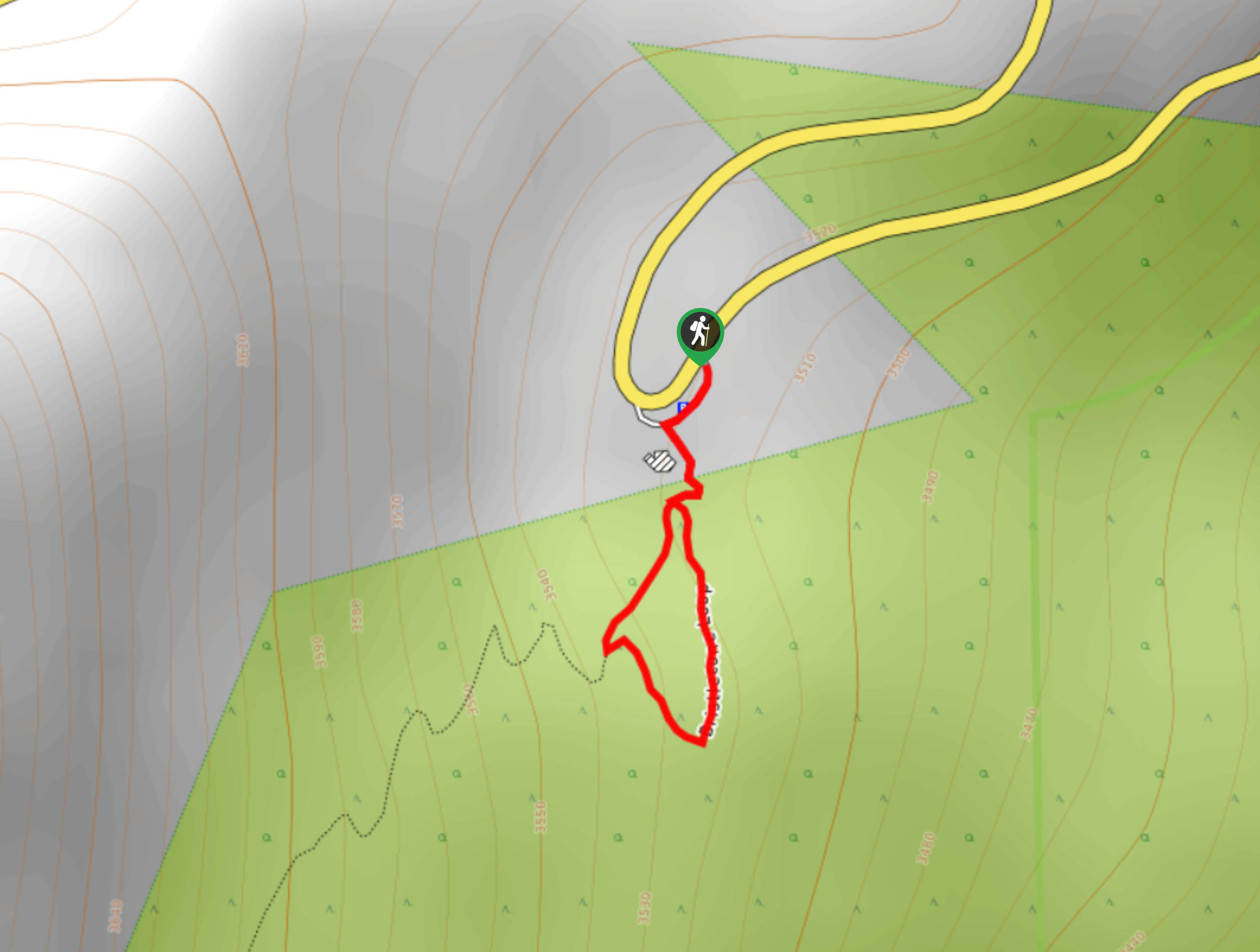
104. Citadel Mountain Hike
Difficulty
Hike the Citadel Mountain Trail on your next journey into the Arapaho National Forest. This… Read More
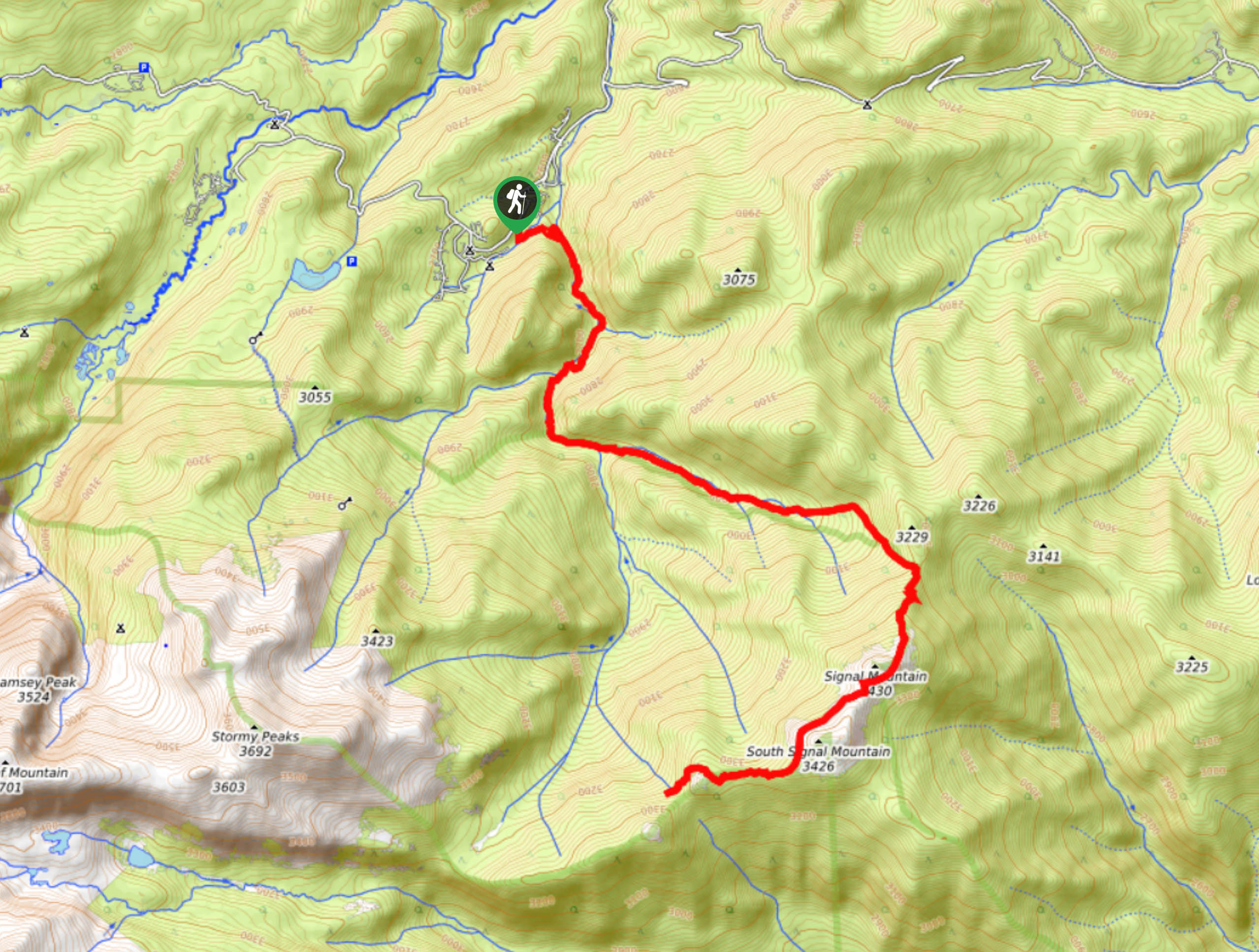
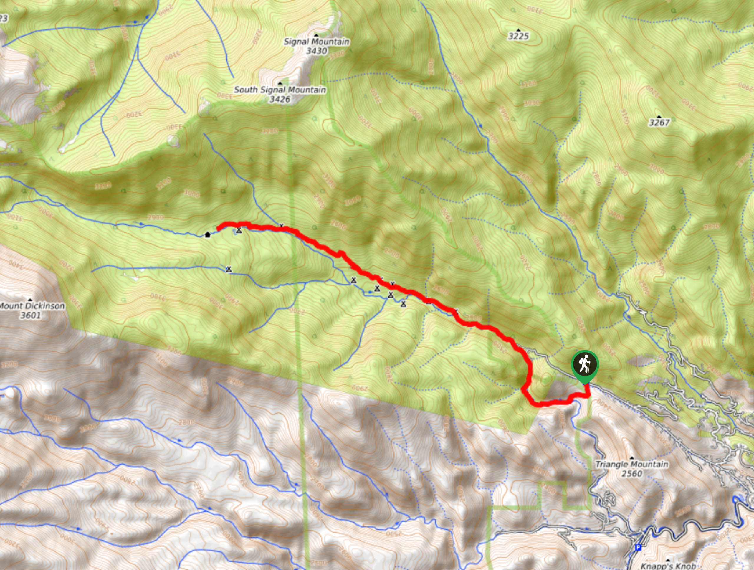
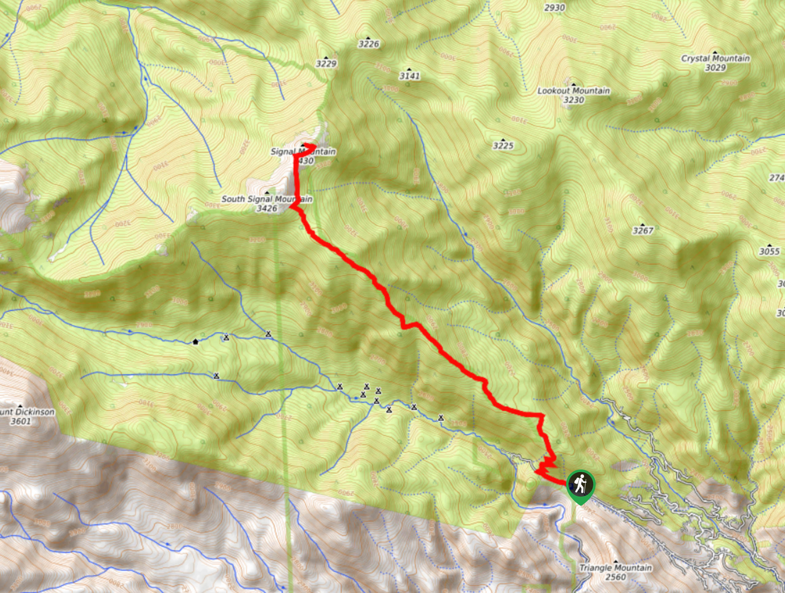
105. Signal Mountain Hike
Difficulty
The Signal Mountain Hike is one of the most beautiful adventures through the Front Range.… Read More
106. Lower Dadd Gulch Trail
Difficulty
Hidden amongst the Front Range wilderness, the Lower Dadd Gulch Trail is a scenic and… Read More
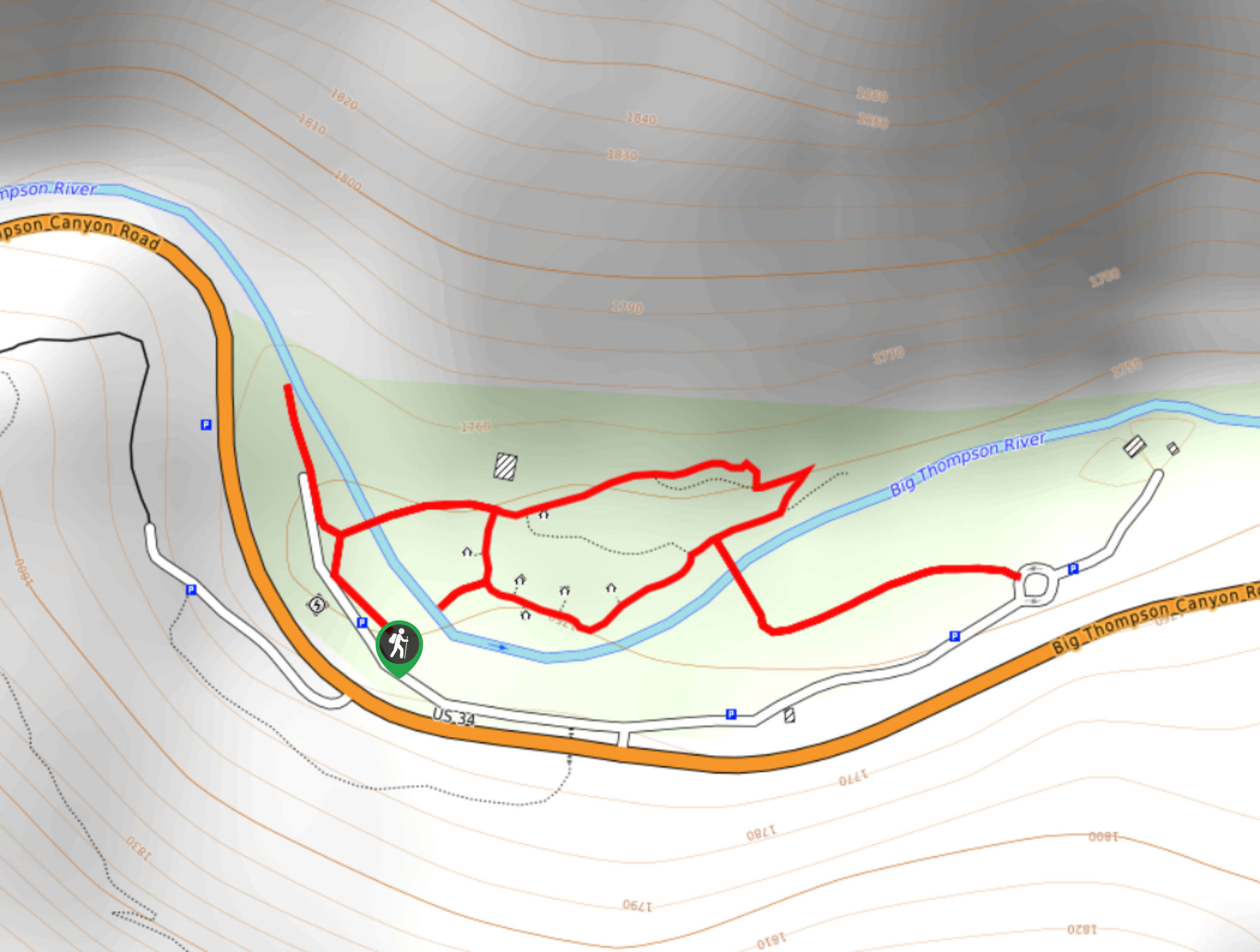
107. Viestenz-Smith Mountain Park Trail
Difficulty
Viestenz-Smith Mountain Park Trail is a scenic, but short adventure over the Big Thompson River… Read More
108. Lincoln Lake Hike
Difficulty
The Lincoln Lake Trail is a stunning nature walk through the woodlands. Hike up through… Read More
109. Watrous Gulch Trail
Difficulty
The Watrous Gulch trail is a demanding adventure through the Arapaho National Forest. With the… Read More
110. Ruby Gulch Trail
Difficulty
Escape the city and head out into the Colorado wilderness. The Ruby Gulch Trail is… Read More
111. Payne Creek Trail
Difficulty
Escape the hustle and bustle of the city and escape into the Lost Creek Wilderness.… Read More
112. Kelso Mountain Hike
Difficulty
The Kelso Mountain Hike is an awesome introductory summit hike in the Front Range. Short,… Read More
113. Young Gulch Trail
Difficulty
The Young Gulch Trail is an incredibly scenic adventure through diverse Colorado terrains. Cross dozens… Read More
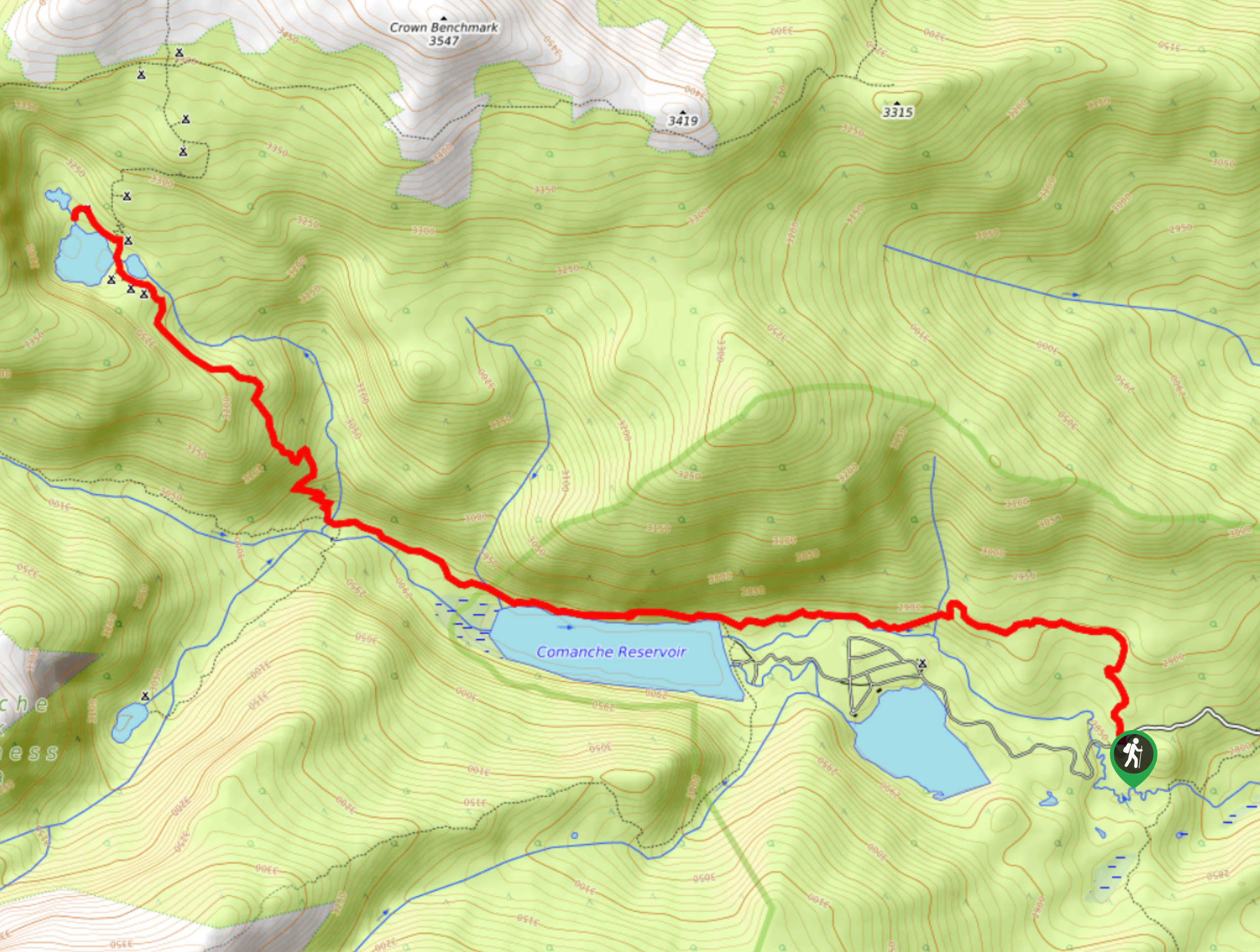
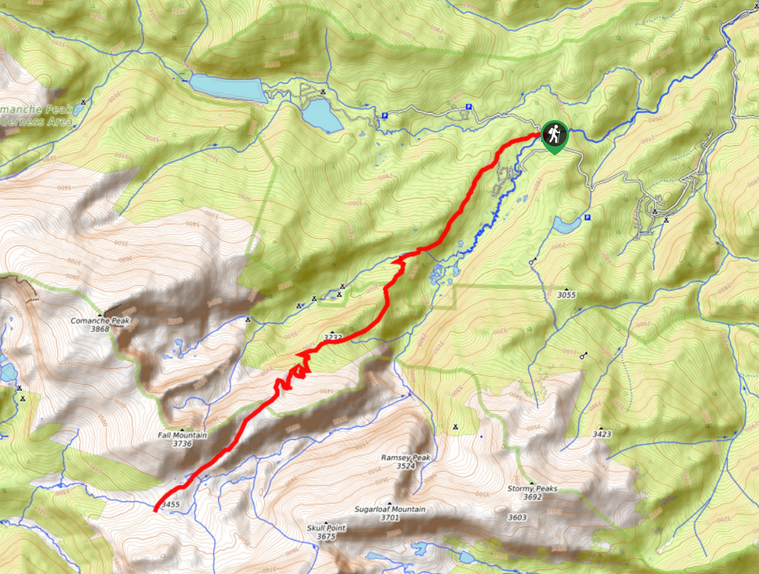
114. Comanche Reservoir Trail
Difficulty
The Comanche Reservoir Trail is a beautiful, forested hike through the Comanche Peak Wilderness. Trek… Read More
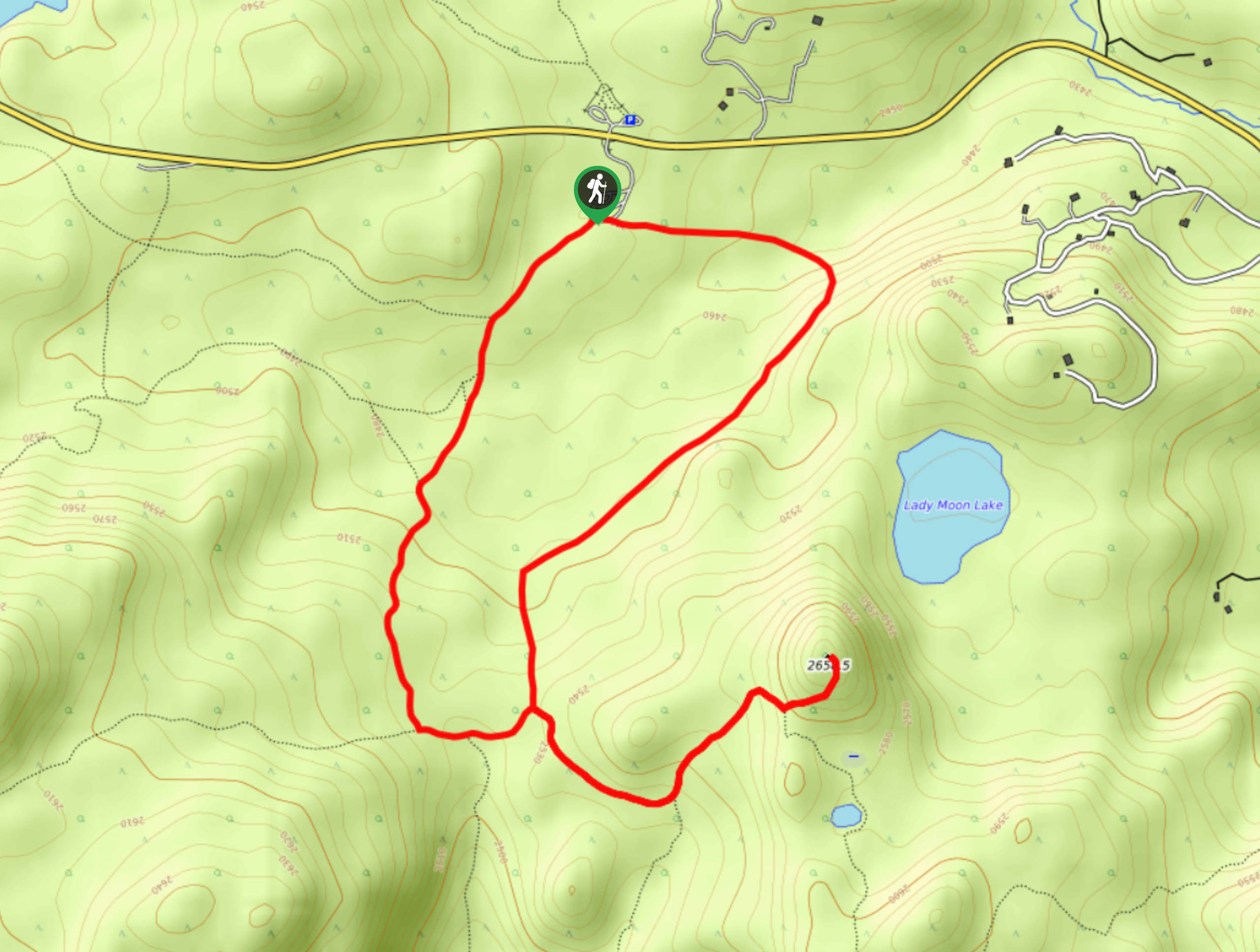
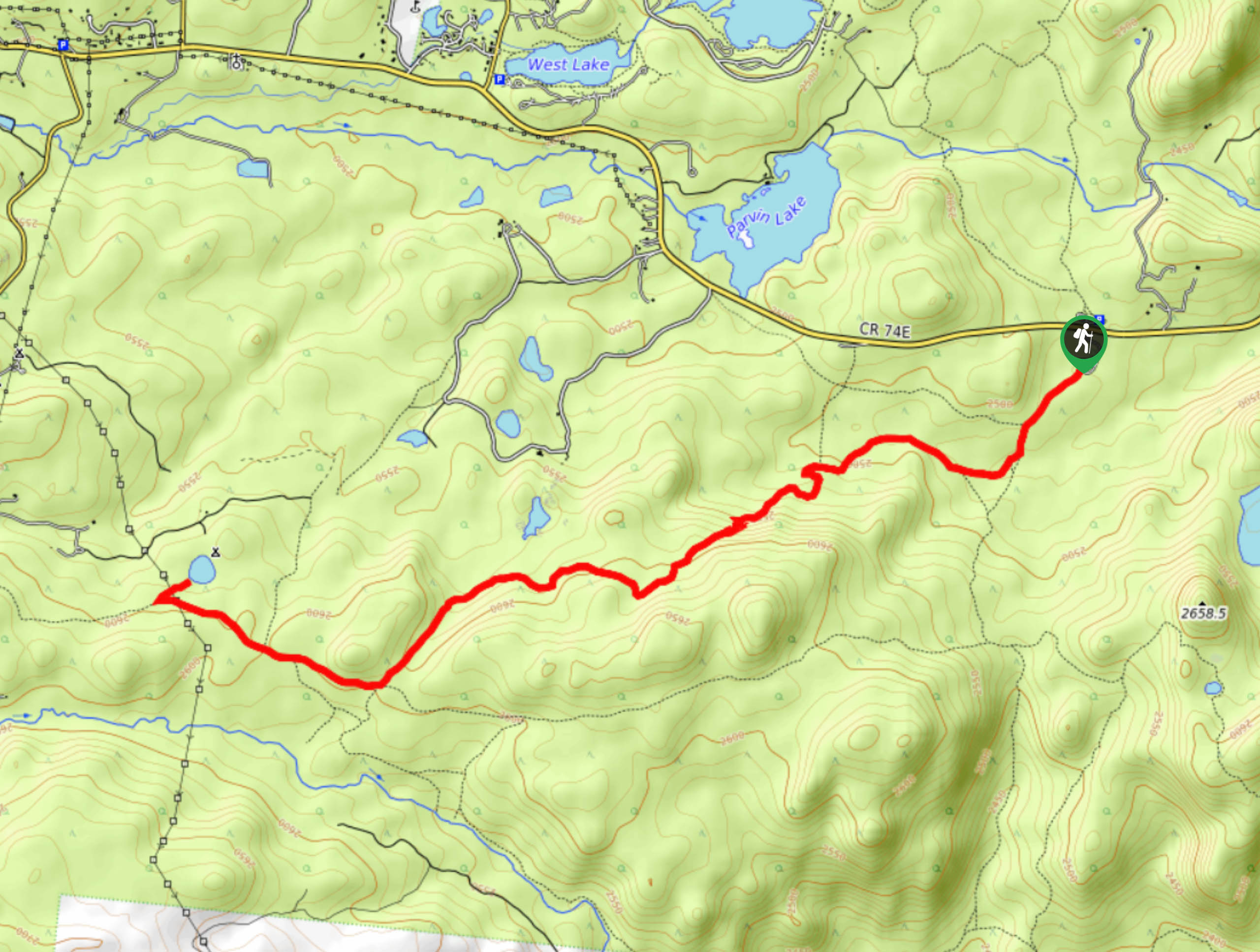
115. Lady Moon Trail
Difficulty
Lace up those hiking shoes and head out along the Lady Moon Trail in the… Read More
116. Lion Gulch Trail
Difficulty
Don’t worry, this trail isn’t as scary as it seems. The Lion Gulch Hike is… Read More
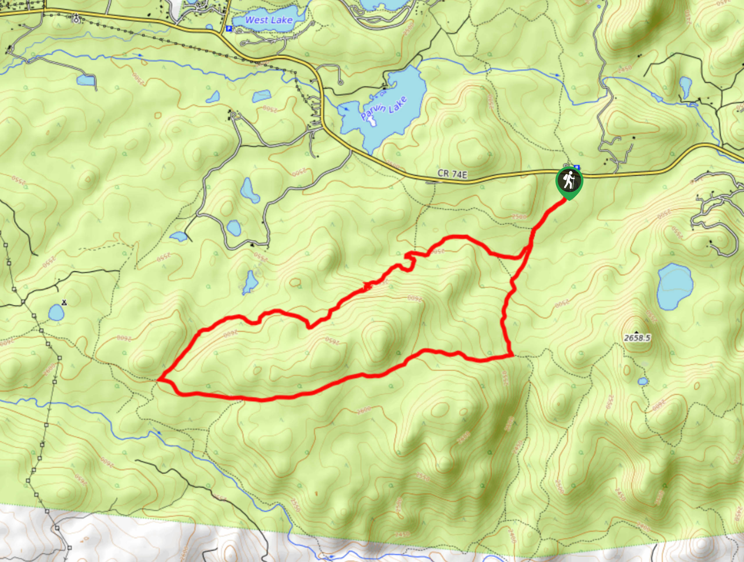
117. Second Creek Trail
Difficulty
The Second Creek Trail is an epic adventure for the whole family. Travel up the… Read More
118. Rolling Creek via Colorado Trail
Difficulty
Hike into the Lost Creek Wilderness along the Rolling Creek via Colorado Trail. Travel through… Read More

119. Rosalie Trail via Tanglewood
Difficulty
The Rosalie Trail via Tanglewood adventure is reserved for the intrepid spirits. This primitive trail… Read More
120. Rosalie Trail
Difficulty
The Rosalie Trail is reserved for experienced and adventurous hikers. Travel from the east end… Read More
121. Colorado Trail Segment 5
Difficulty
The Colorado Trail Segment 5 adventure is truly one for the books. Travel through the… Read More
122. Geneva Creek Iron Fens Hike
Difficulty
The Geneva Creek Iron Fens Hike is a unique trail through the Colorado Wilderness. The… Read More
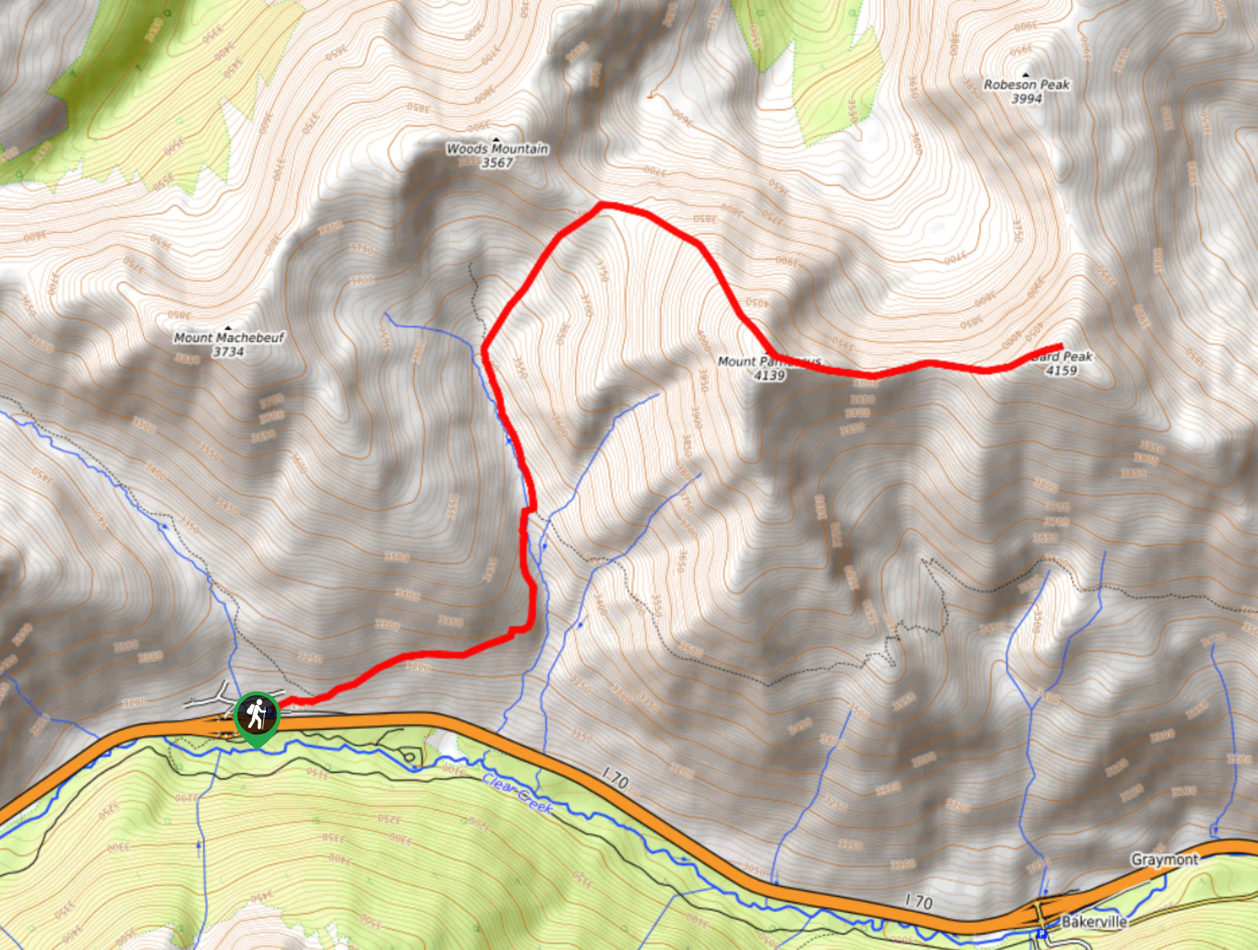
123. Bard Peak Hike
Difficulty
The Bard Peak Hike is a challenging adventure in the Arapaho National Forest. Immerse yourself… Read More
124. Fish Creek Trail
Difficulty
The Fish Creek Trail is a peaceful nature walk through the Roosevelt National Forest. This… Read More
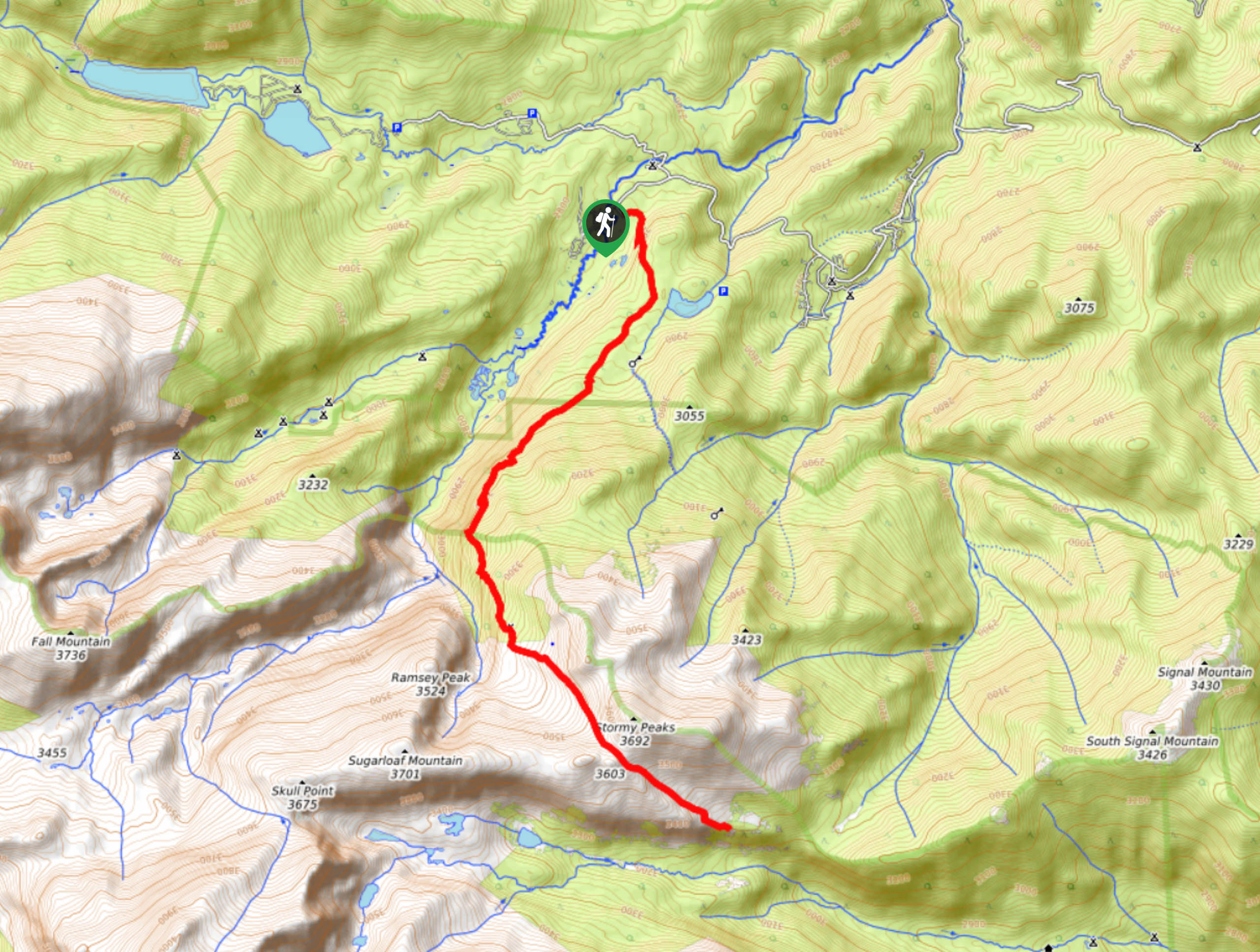
125. Stormy Peaks Hike
Difficulty
The Stormy Peaks hike will guide you from the Comanche Peak Wilderness into the northern… Read More
126. Mummy Pass Trail
Difficulty
Hike the Mummy Pass Hike through the diverse Colorado wilderness. Hike from the wilderness, through… Read More
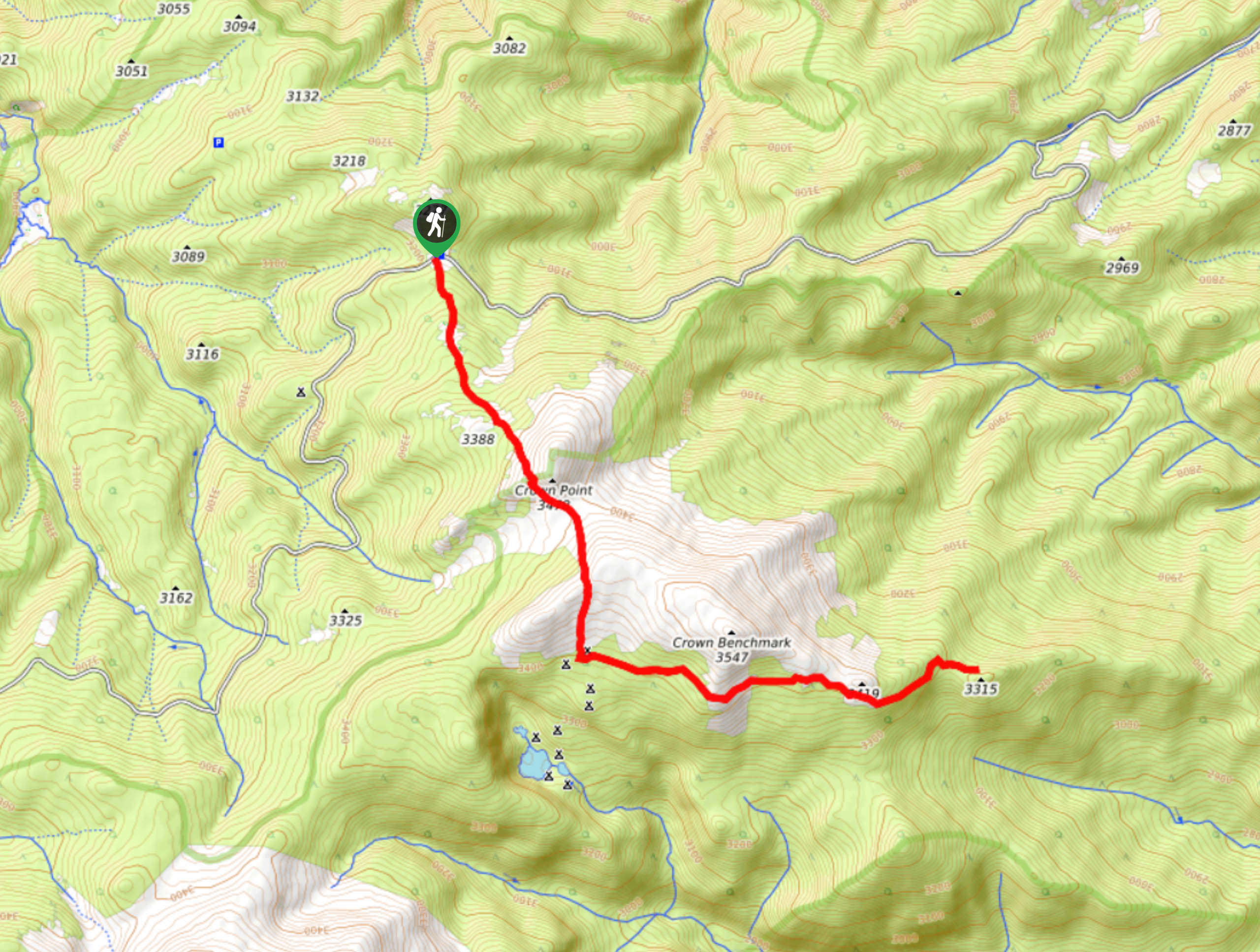
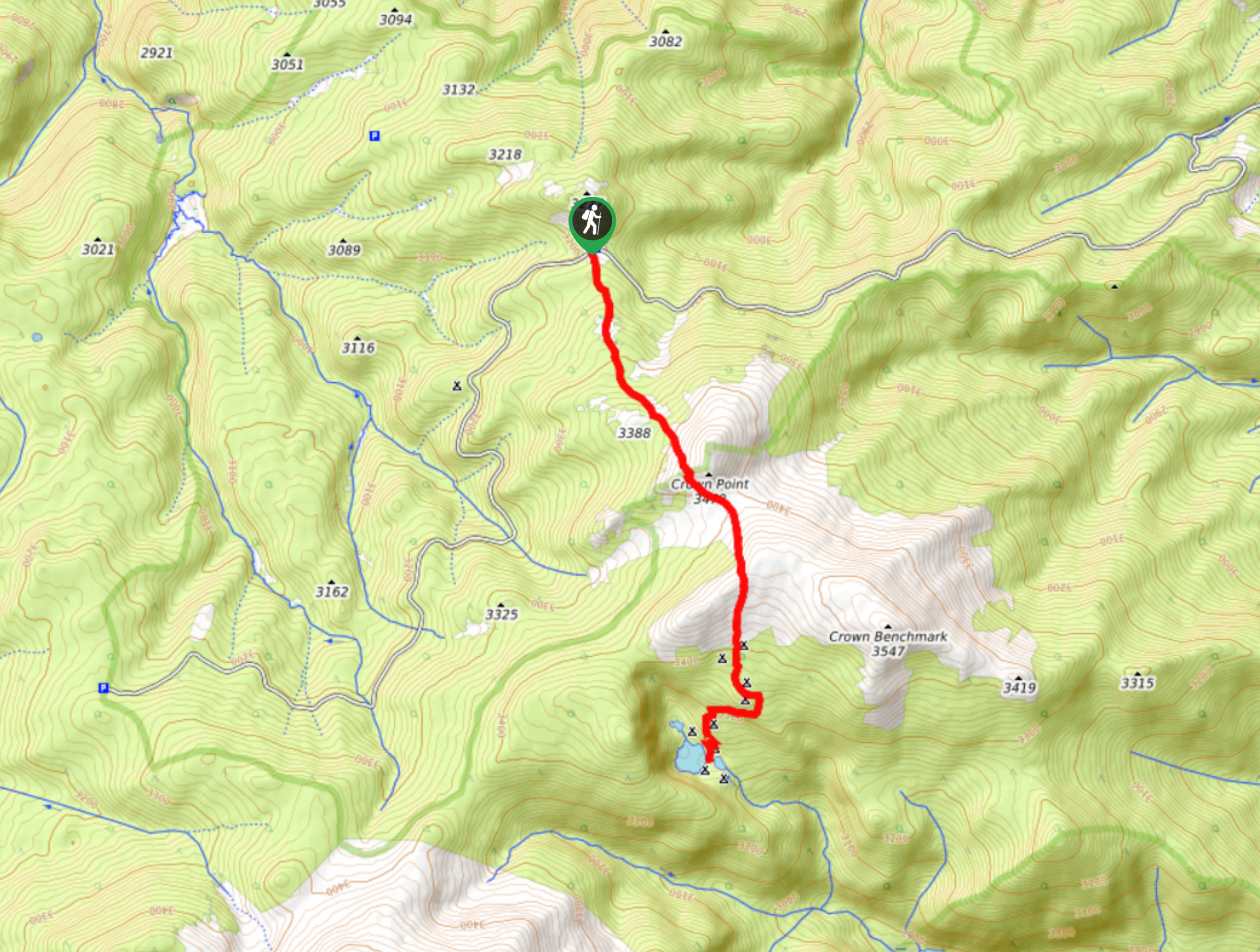
127. Crown Point Trail to B-17 Crash Site
Difficulty
Hike the forestland path, up to Crown Point before descending to the remains of the… Read More
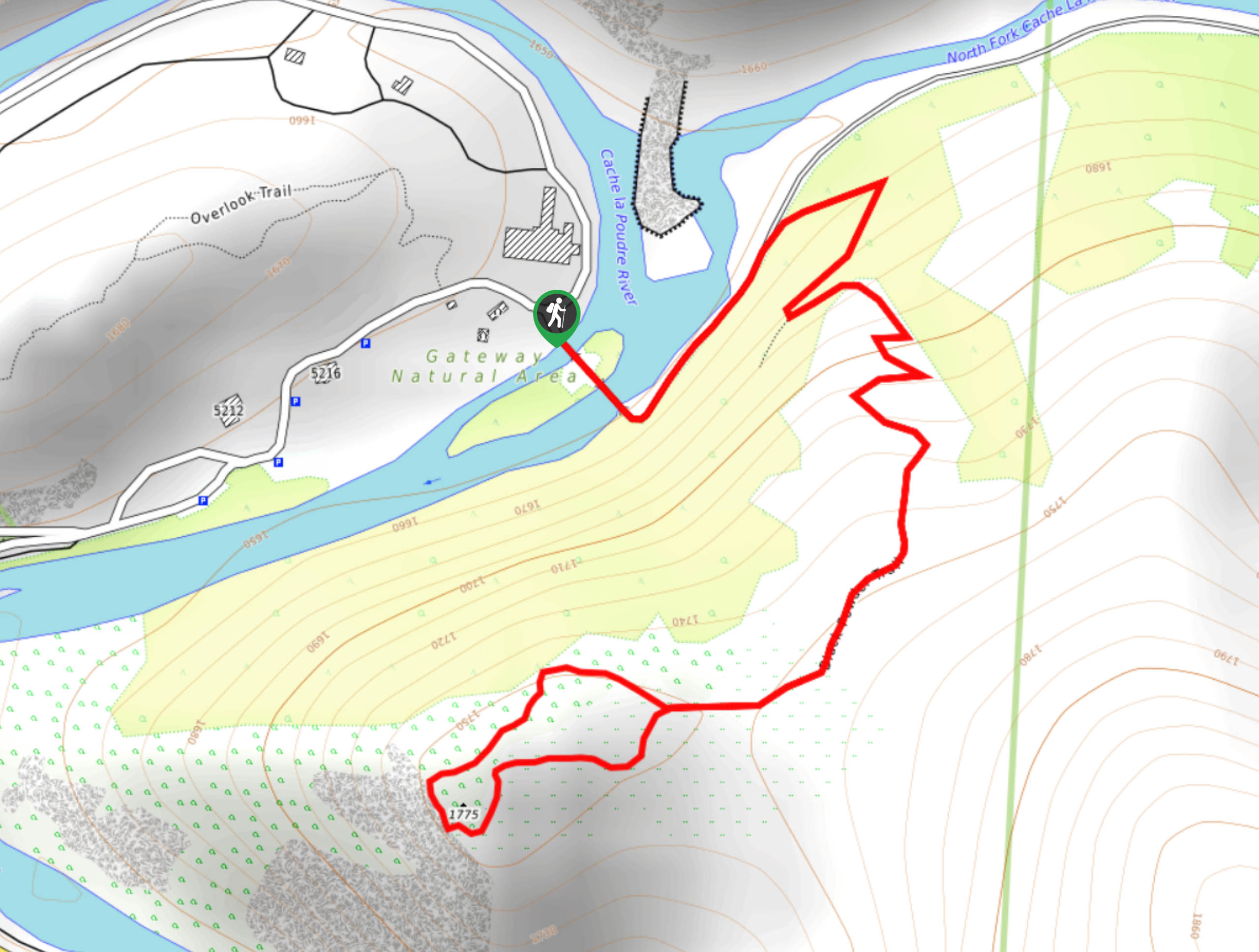
128. Black Powder Trail
Difficulty
The Black Powder Trail is an epic family-friendly nature hike in the Gateway Natural Area.… Read More
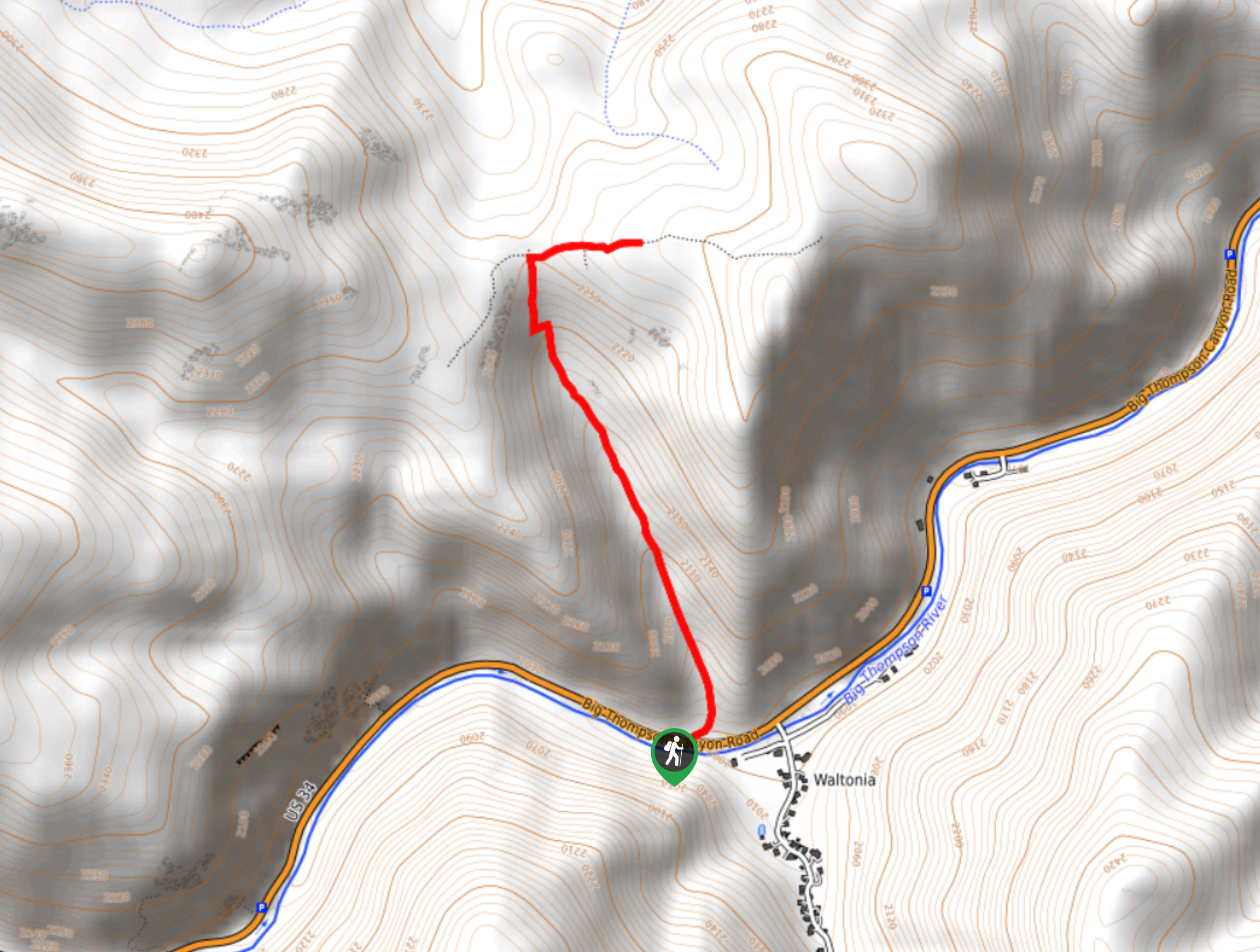
129. Sullivan Gulch Trail
Difficulty
The Sullivan Gulch Trail is an awesome introductory hike to summit hikes in the Front… Read More
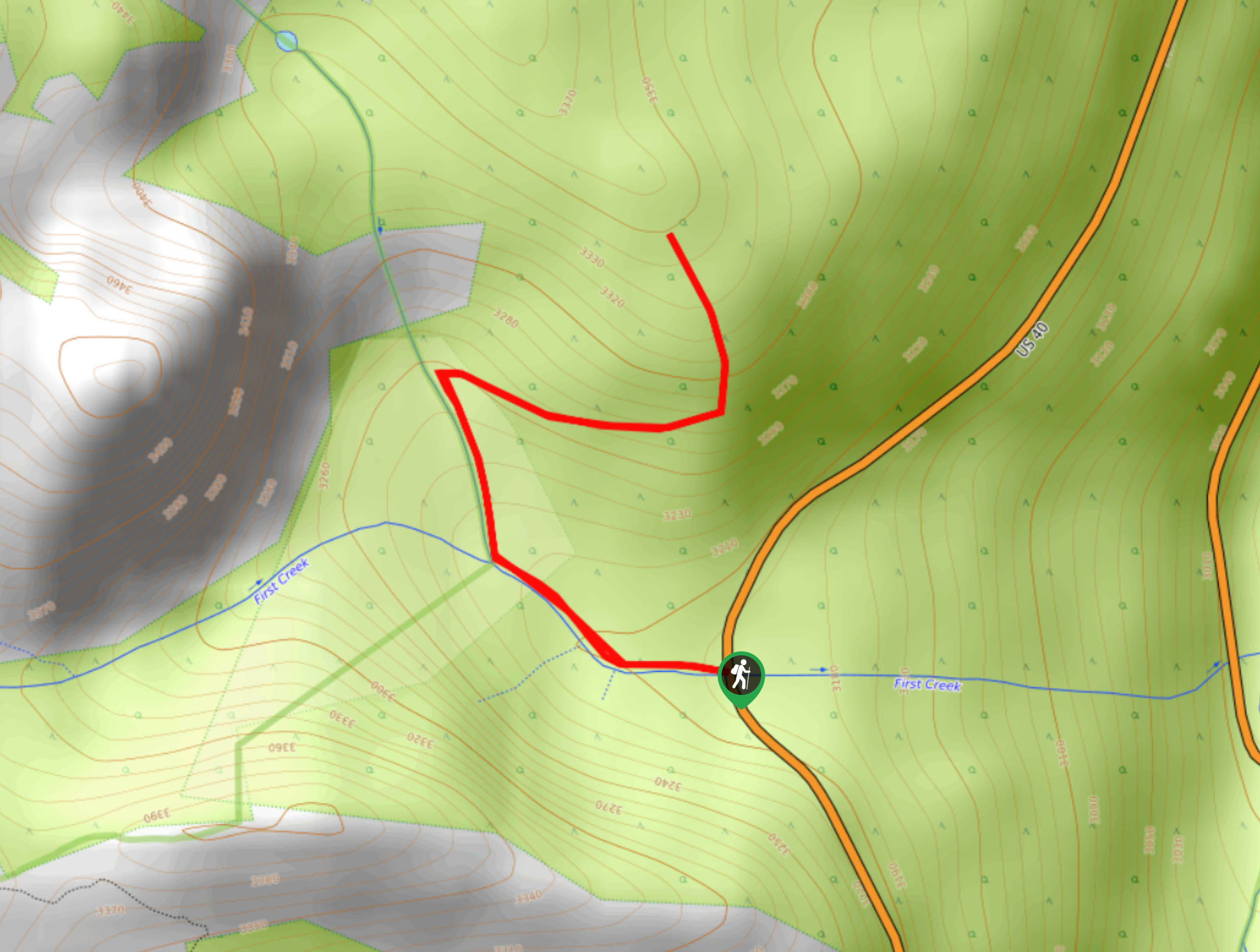
130. First Creek Cabin Trail
Difficulty
The First Creek Cabin Trail is a hidden gem along the Berthoud Pass. Hike through… Read More
131. Henderson Spur Hike
Difficulty
Hike up the Henderson Spur Trail to the Berthoud Pass. Travel along the famous Continental… Read More
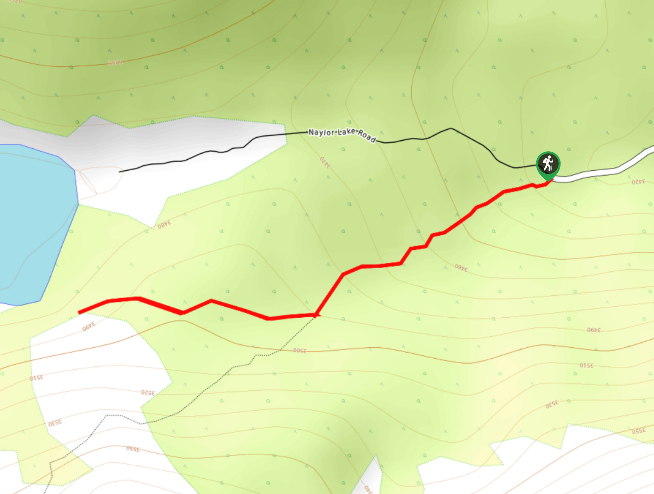
132. Naylor Lake Trail
Difficulty
The Naylor Lake Trail is a scenic adventure up to a shimmering alpine lake. This… Read More
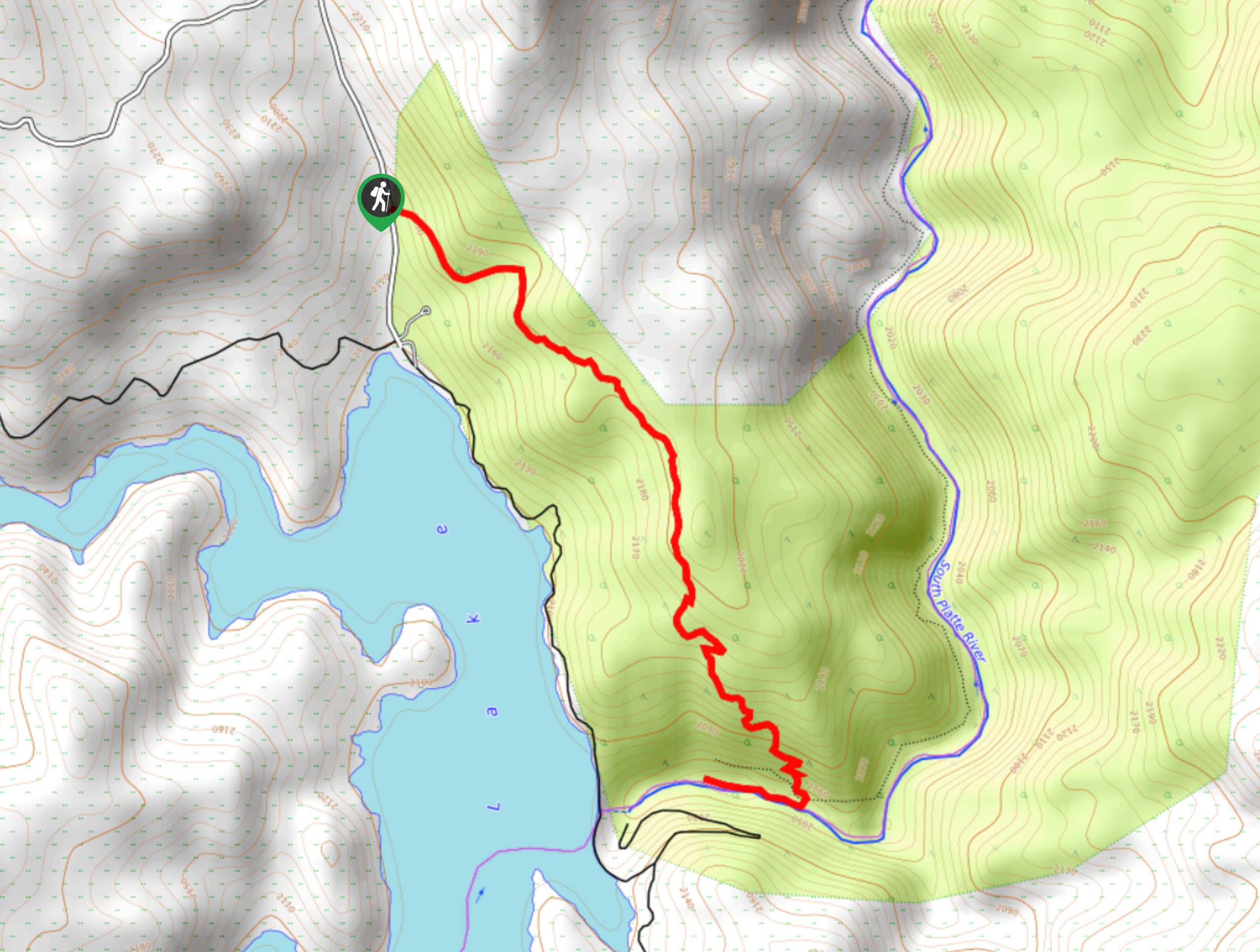
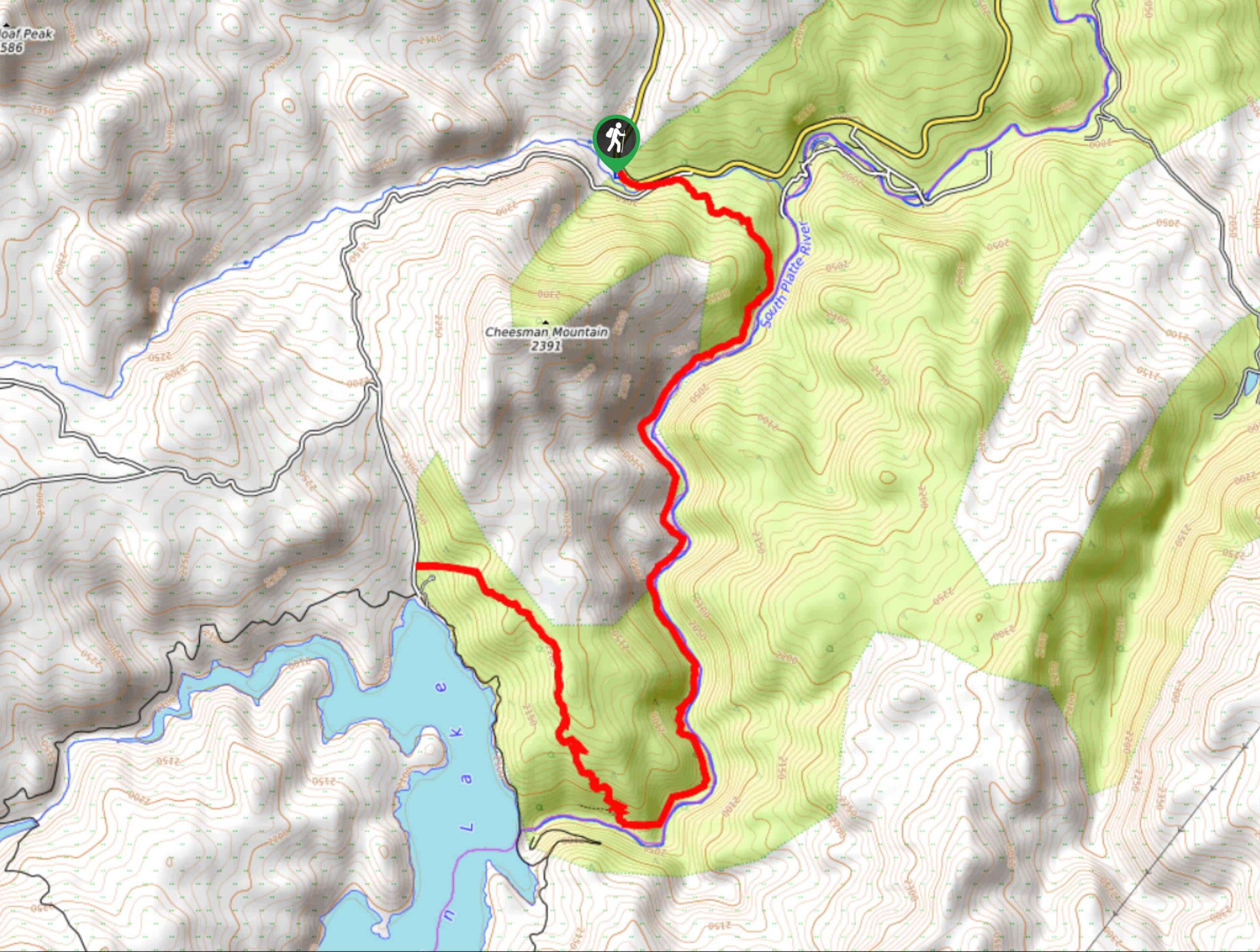
133. Upper Cheesman Canyon Trail
Difficulty
Head out into the wilderness and reconnect with nature as you travel the Upper Cheesman… Read More
134. Ben Tyler Trail
Difficulty
The Ben Tyler Trail exhibits all the best of what the Colorado wilderness has to… Read More
135. Top of the World Hike
Difficulty
Adventure the Top of the World Hike in the Colorado wilderness. This excursion lives up… Read More
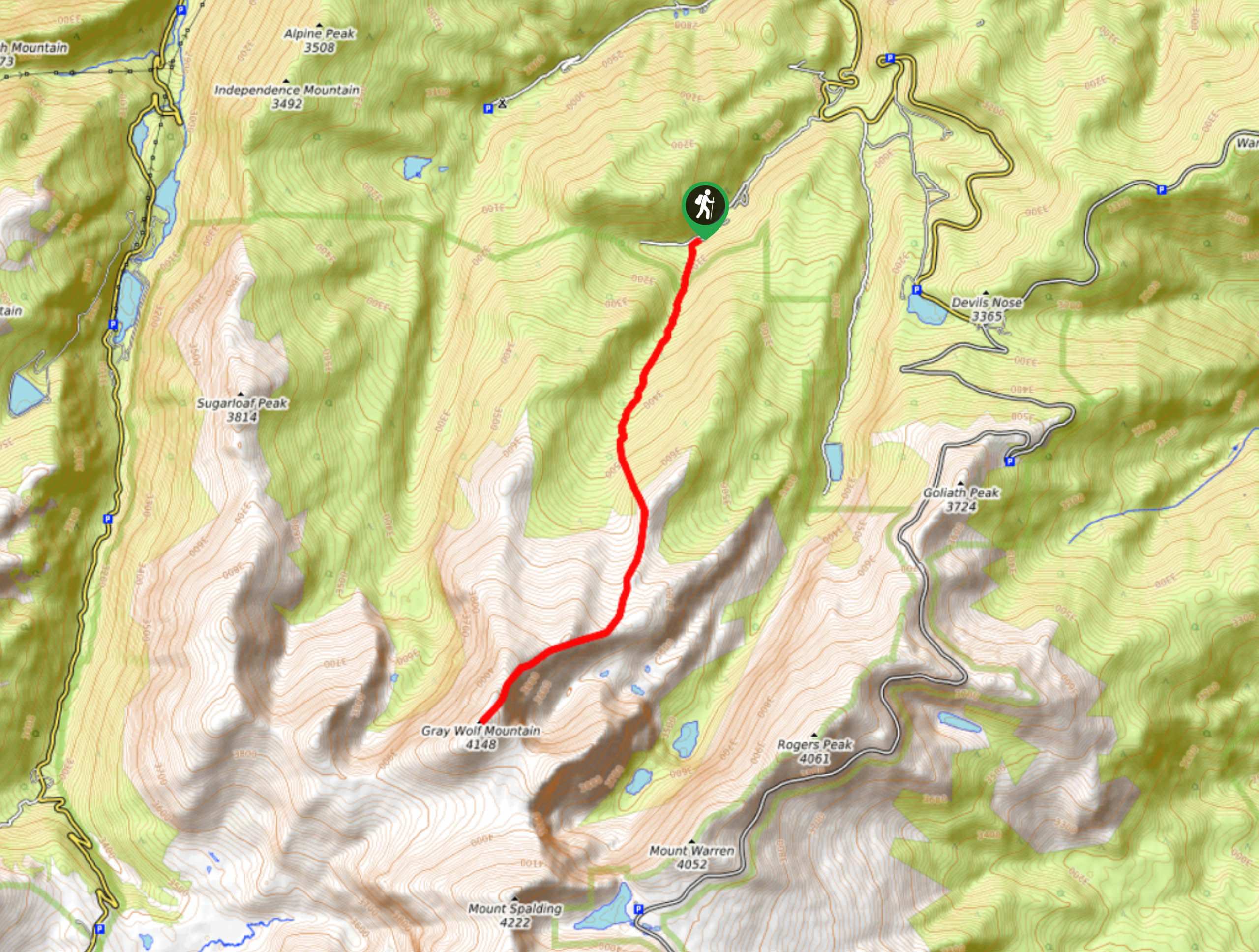
136. Gray Wolf Mountain via South Chicago Creek Trail
Difficulty
The Gray Wolf Mountain via South Chicago Creek is an epic adventure through the Mount… Read More
137. Three Bar Trail
Difficulty
The Three Bar Hike is an epic nature walk through the Eagle’s Nest Open Space.… Read More
138. Kreutzer Trail
Difficulty
The Kreutzer Trail is an awesome family-friendly nature hike. Walk along the base of Mount… Read More
139. Granite Ridge Ranked Peak Hike
Difficulty
The Granite Ridge Ranked Peak Hike does not disappoint. Living up to its name, this… Read More
140. Molly Lake Hike
Difficulty
The Molly Lake Hike is an awesome, family-friendly adventure in the Cache La Poudre Wilderness.… Read More
141. Disappointment Falls via Molly Lake Road
Difficulty
The Disappointment Falls via Molly Lake Road Hike is a stunning adventure through the Cache… Read More
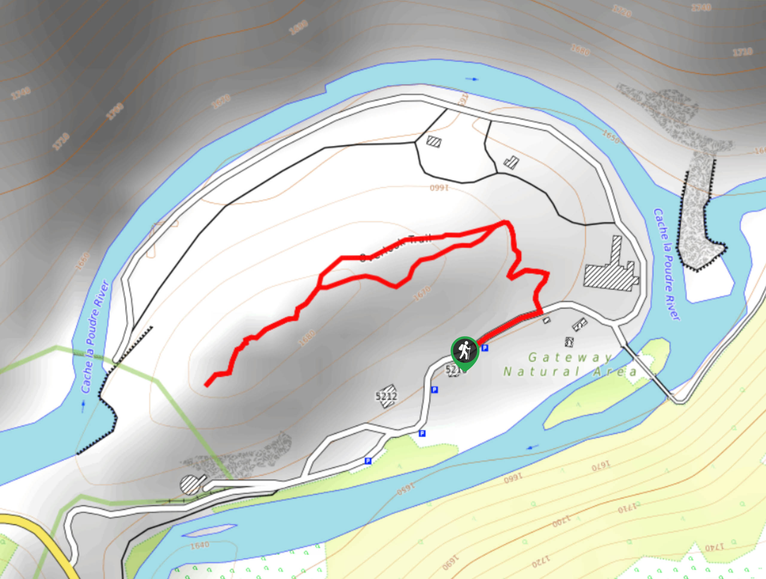
142. Gateway Natural Area Overlook Trail
Difficulty
The Gateway Natural Area Overlook Trail is a short but sweet walk to a scenic… Read More
143. Wintersteen Trail
Difficulty
The WIntersteen Trail is an impressively diverse adventure that the whole family will enjoy. Hike… Read More
144. Cirque Meadows Hike
Difficulty
The Cirque Meadows Hike is a stunning woodland adventure through the Comanche Peak Wilderness. Hike… Read More
145. Limber Pine Trail
Difficulty
The Limber Pine Trail is a stunning nature hike through diverse landscapes to a breathtaking… Read More
146. Pole Hill Hike
Difficulty
Shared with off-road vehicles and mountain bikers, the Poll Hill Trail is an epic adventure… Read More
147. Moose Meadows Hike
Difficulty
Leave the city in the rear-view mirror and escape into nature as you adventure the… Read More
148. Lion Gulch to Irvin Homestead Hike
Difficulty
Lion Gulch to Irvin Homestead Hike is a scenic adventure up a forested gulch to… Read More
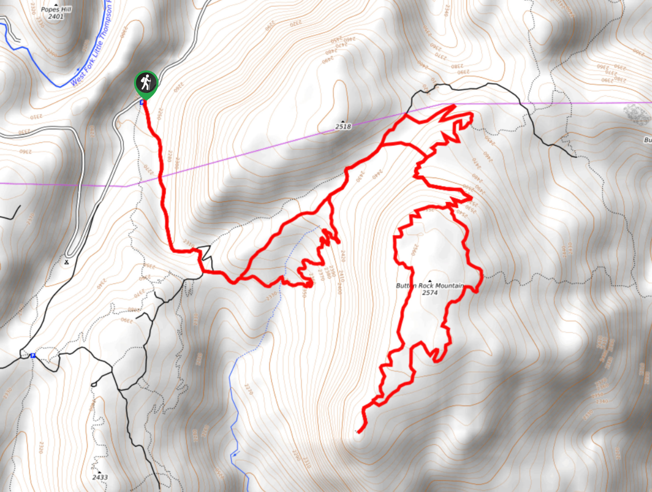
149. Saddle Rock via Button Rock Trail
Difficulty
If you are seeking an exciting adventure in the Colorado wilderness, then you may have… Read More
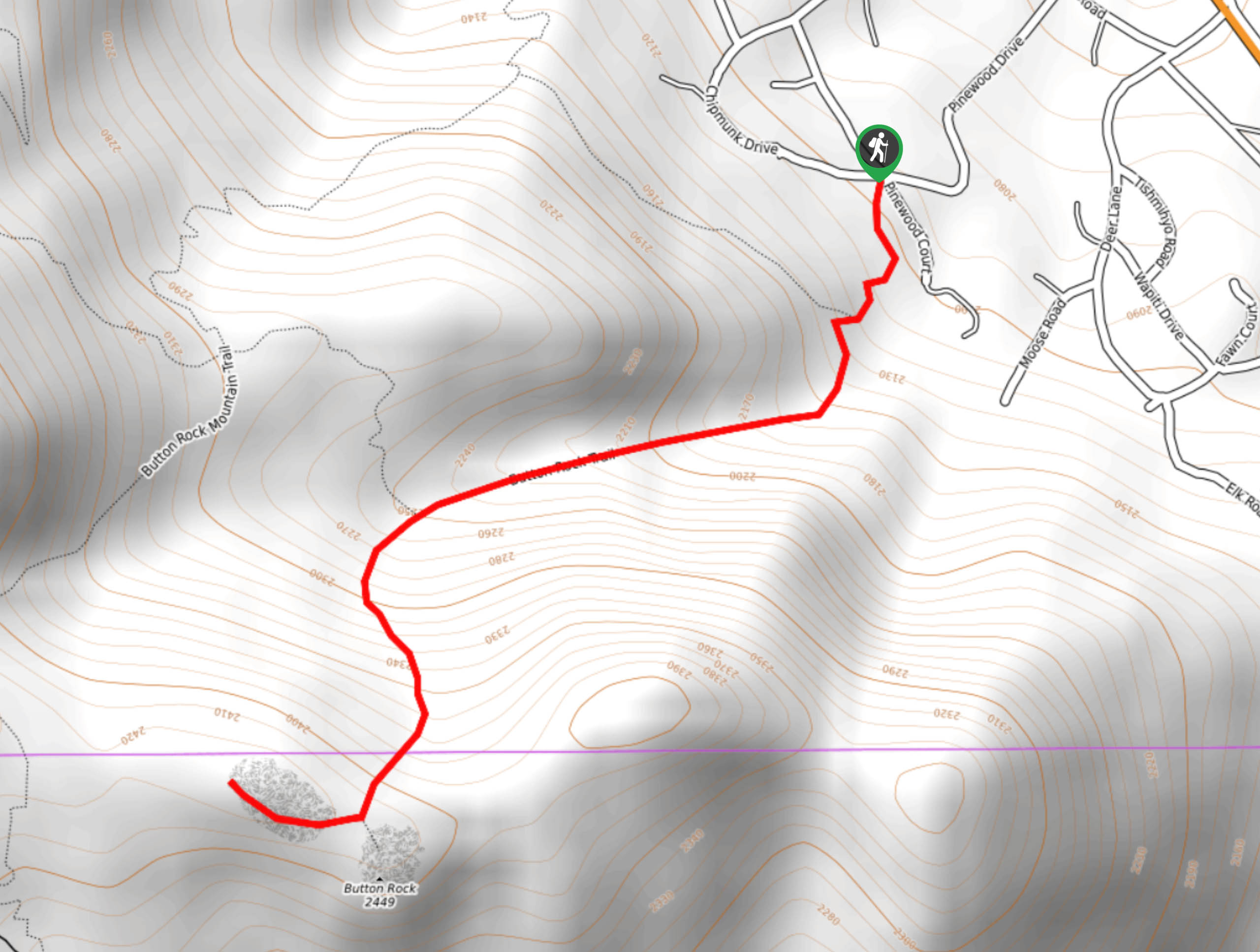
150. Button Rock Mountain Trail
Difficulty
Put your navigational skills to the test as you maneuver the network off trails that… Read More
151. Stout Loop Trail
Difficulty
The Stout Loop Trail is one of many adventure opportunities in the Horsetooth Mountain Open… Read More
152. Shoreline Loop Trail
Difficulty
The Shoreline Loop Trail is a wonderful excursion that the whole family will enjoy. Hike… Read More
153. Horsetooth Rock via Wathan Trail
Difficulty
The Horsetooth Rock vis Wathan Trail is a diverse hike through several types of terrains.… Read More

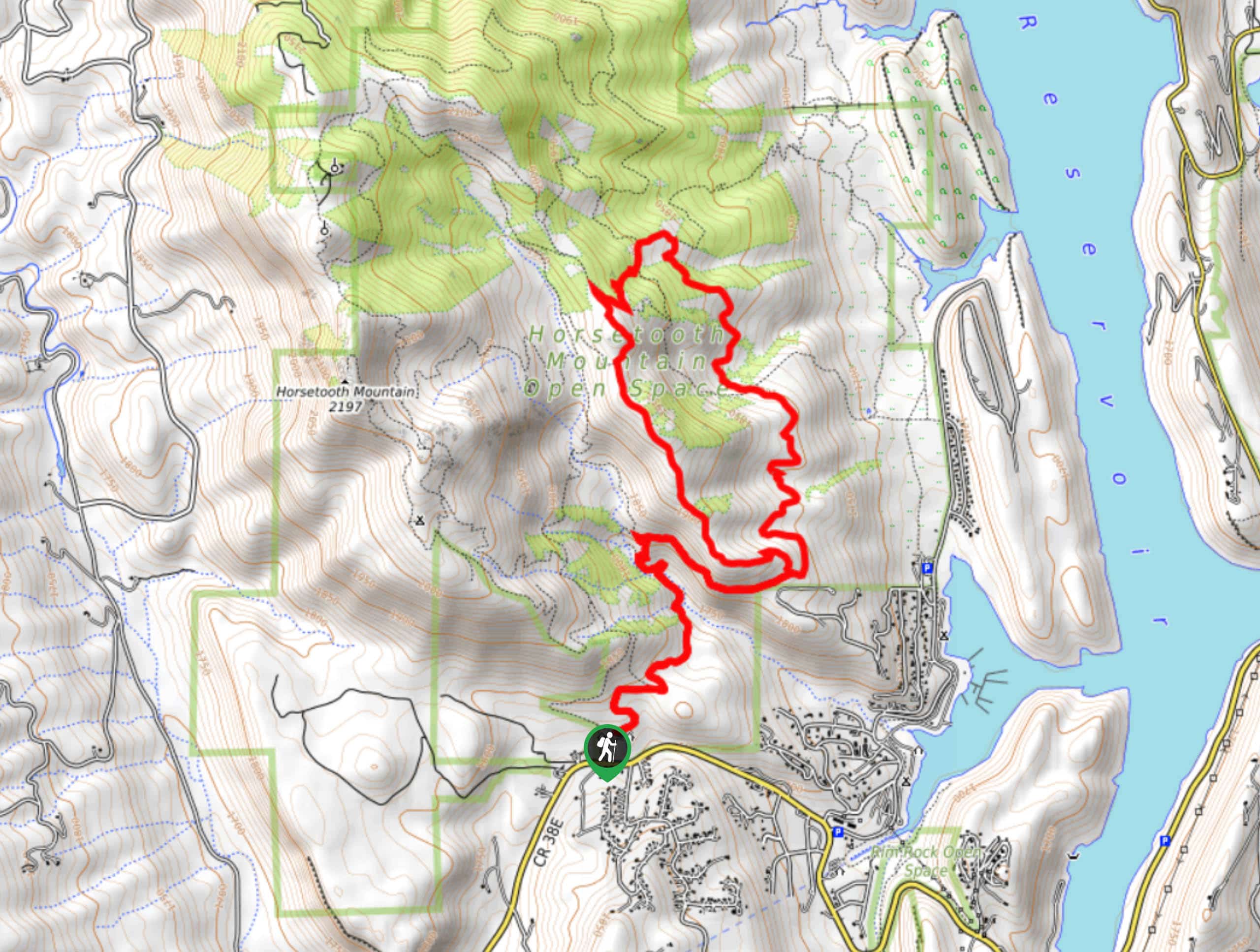
154. Horsetooth Rock Loop Trail
Difficulty
Hike through the Horsetooth Mountain Open Space and through a network of trails up to… Read More
155. Stout Trail via Horsetooth Falls
Difficulty
Travel through all the best scenery that the Horsetooth Mountain Open Space has to offer.… Read More
156. South Ridge Hike
Difficulty
The South Ridge Hike is a more technical adventure in the Horsetooth Mountain Open Space.… Read More
157. South Ridge and Audra Culver Hike
Difficulty
The South Ridge and Audra Culver Hike is an awesome introductory hike for those seeking… Read More
158. Inlet Bay Trail
Difficulty
The Inlet Bay Trail is an easy out-and-back excursion in the Horsetooth Mountain Open Space.… Read More
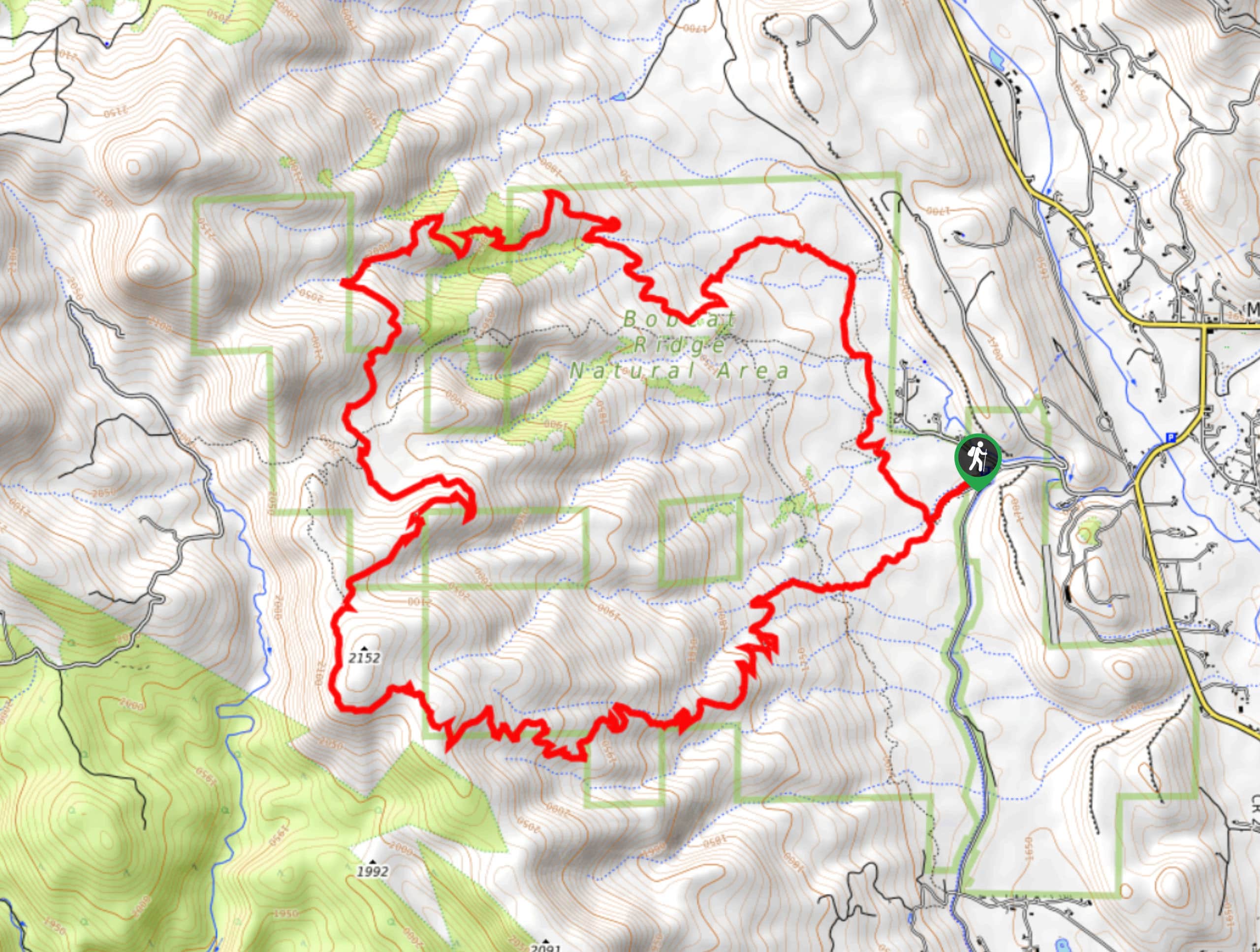
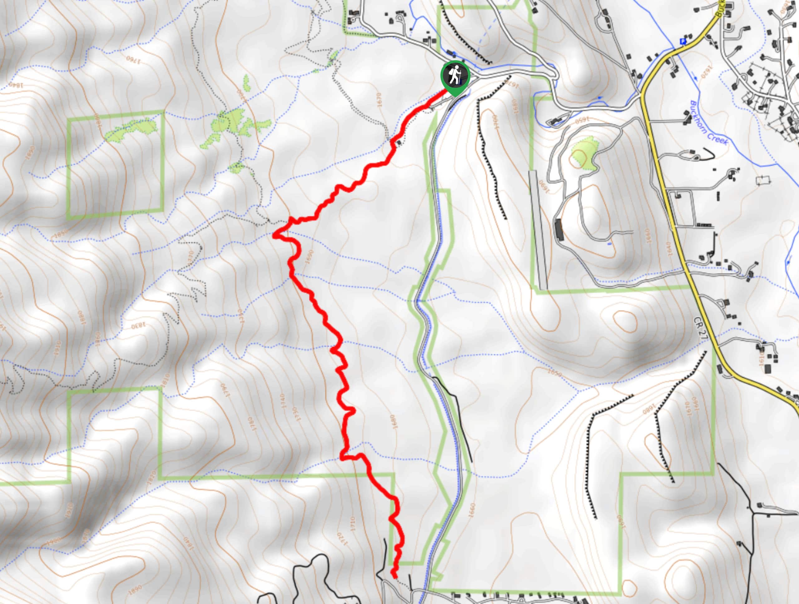
159. Ginny and D.R Trail
Difficulty
The Ginny and D.R Hike is an exciting adventure through the Bobcat Ridge Natural Area.… Read More
160. Eden Valley Hike
Difficulty
The Eden Valley Hike is an undulating path that will guide you across the Bobcat… Read More
161. Valley Loop Trail
Difficulty
The Valley Loop Trail is a wonderful family-friendly nature walk in the Bobcat Ridge Natural… Read More
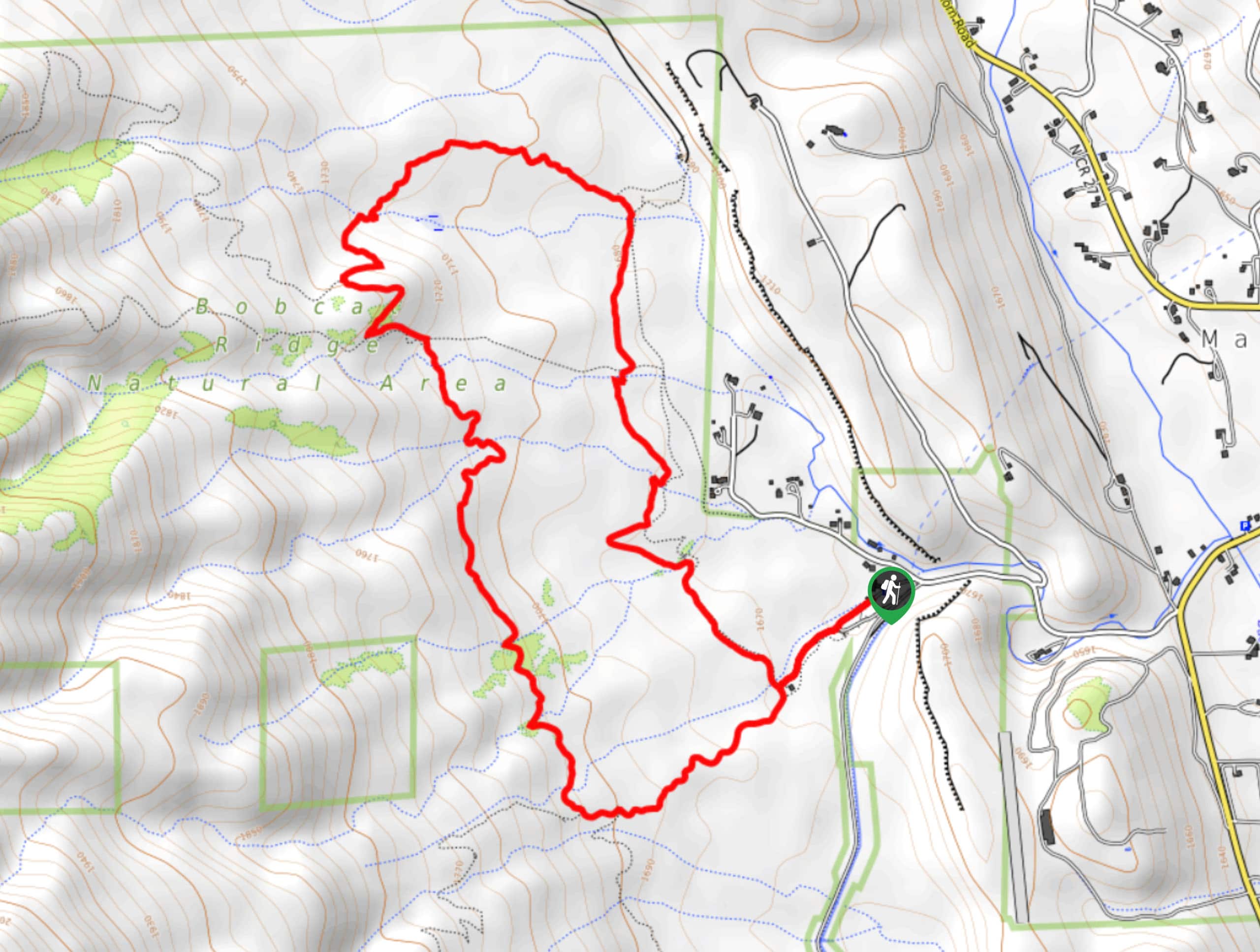
162. Ginny and Valley Loop Trail
Difficulty
Lace up your hiking shoes or throw on a helmet, because the Ginny and Valley… Read More
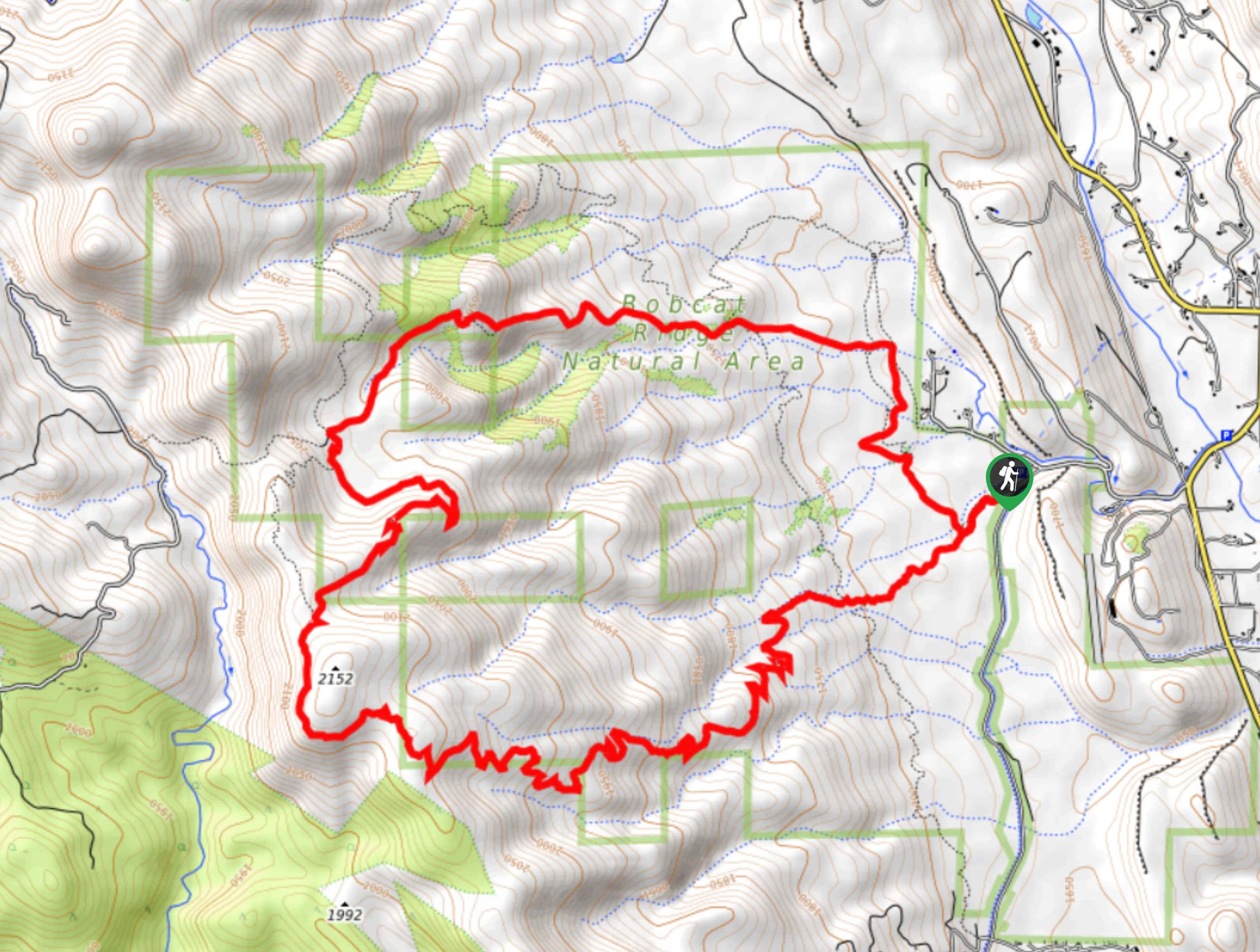
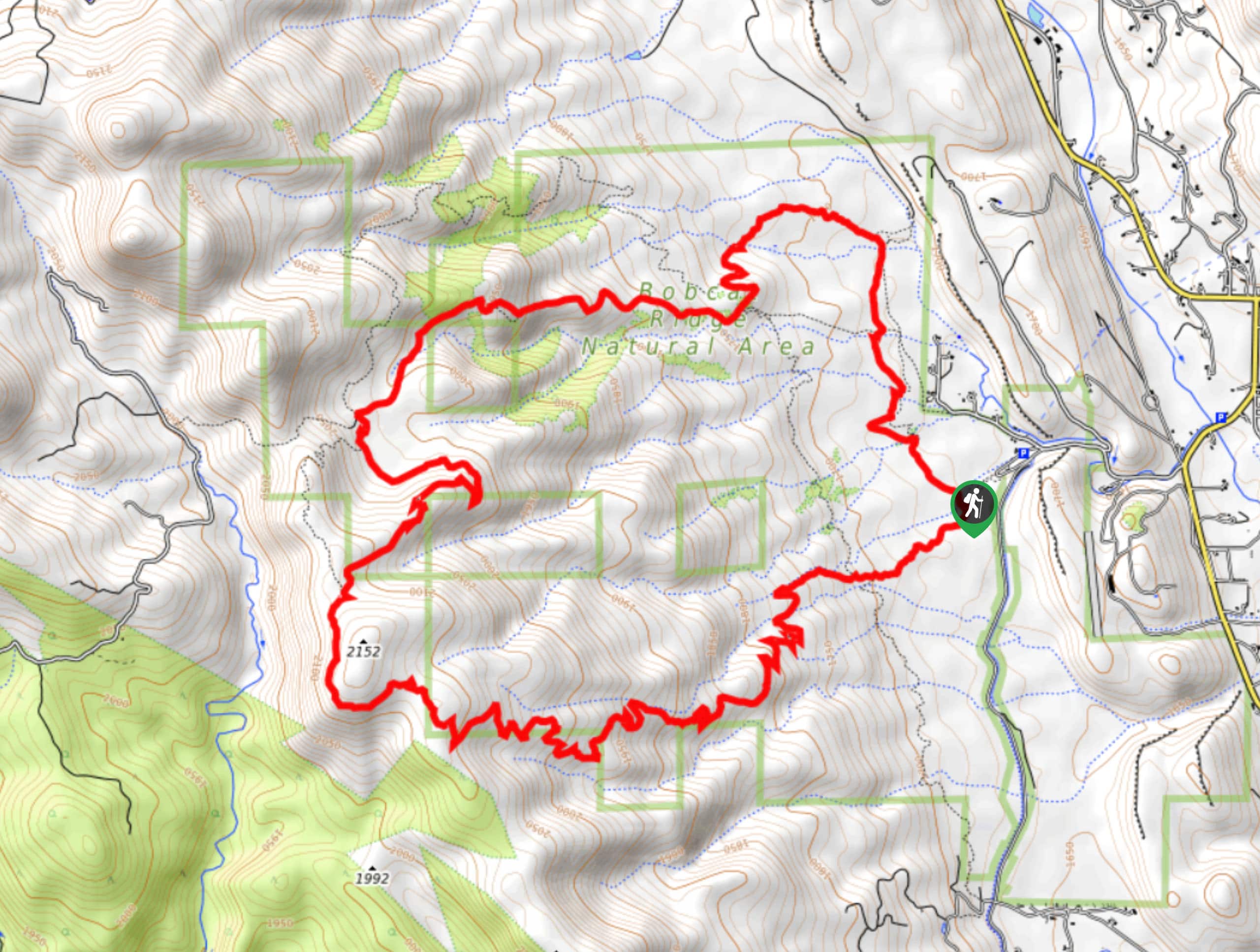
163. Ginny and Powerline Trail
Difficulty
The Ginny and Powerline Hike packs the perfect amount of strenuity and scenery. Get your… Read More
164. Crosier Mountain via Rainbow Trail
Difficulty
The Crosier Mountain via Rainbow Trail is an amazing adventure in the Roosevelt National Forest.… Read More
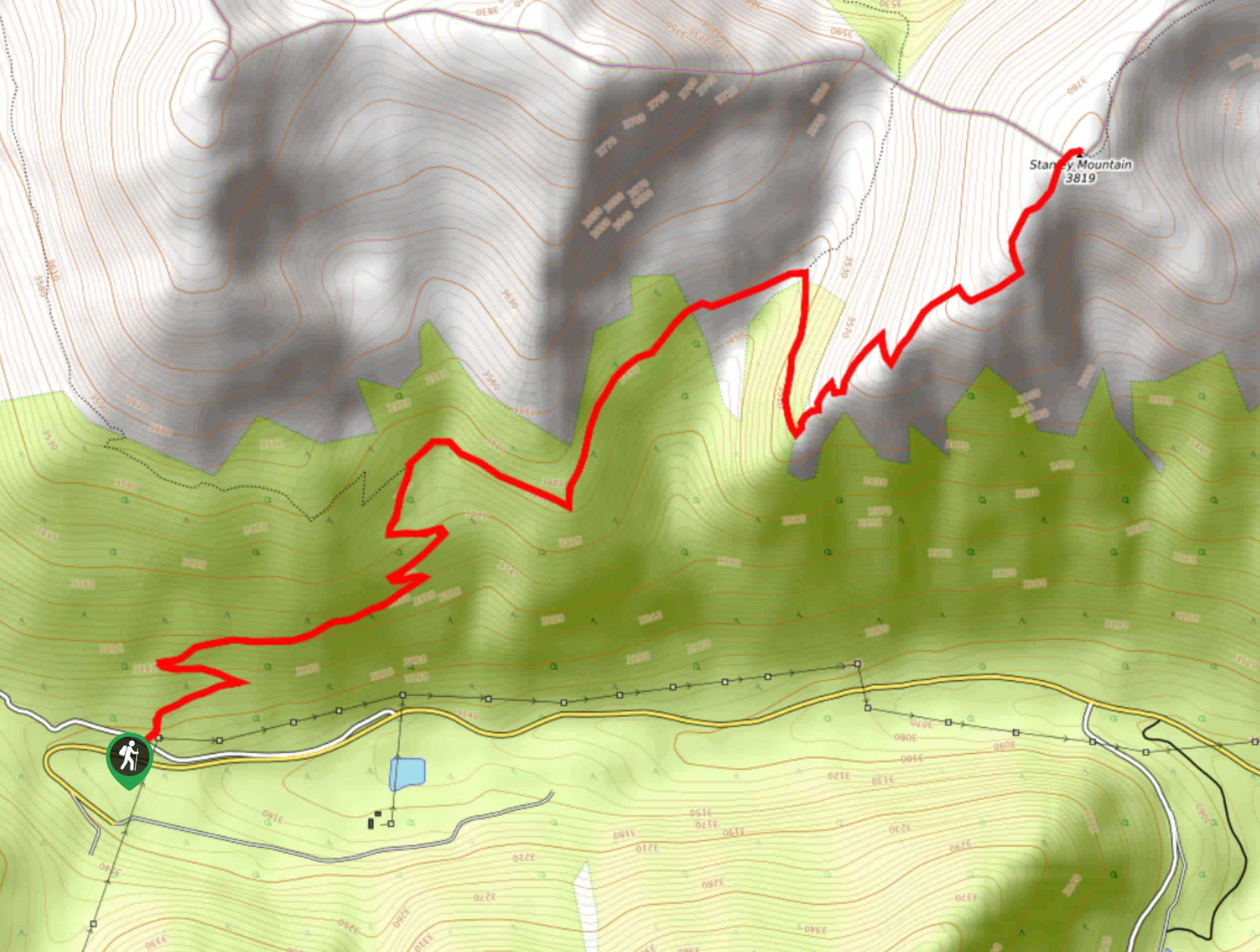
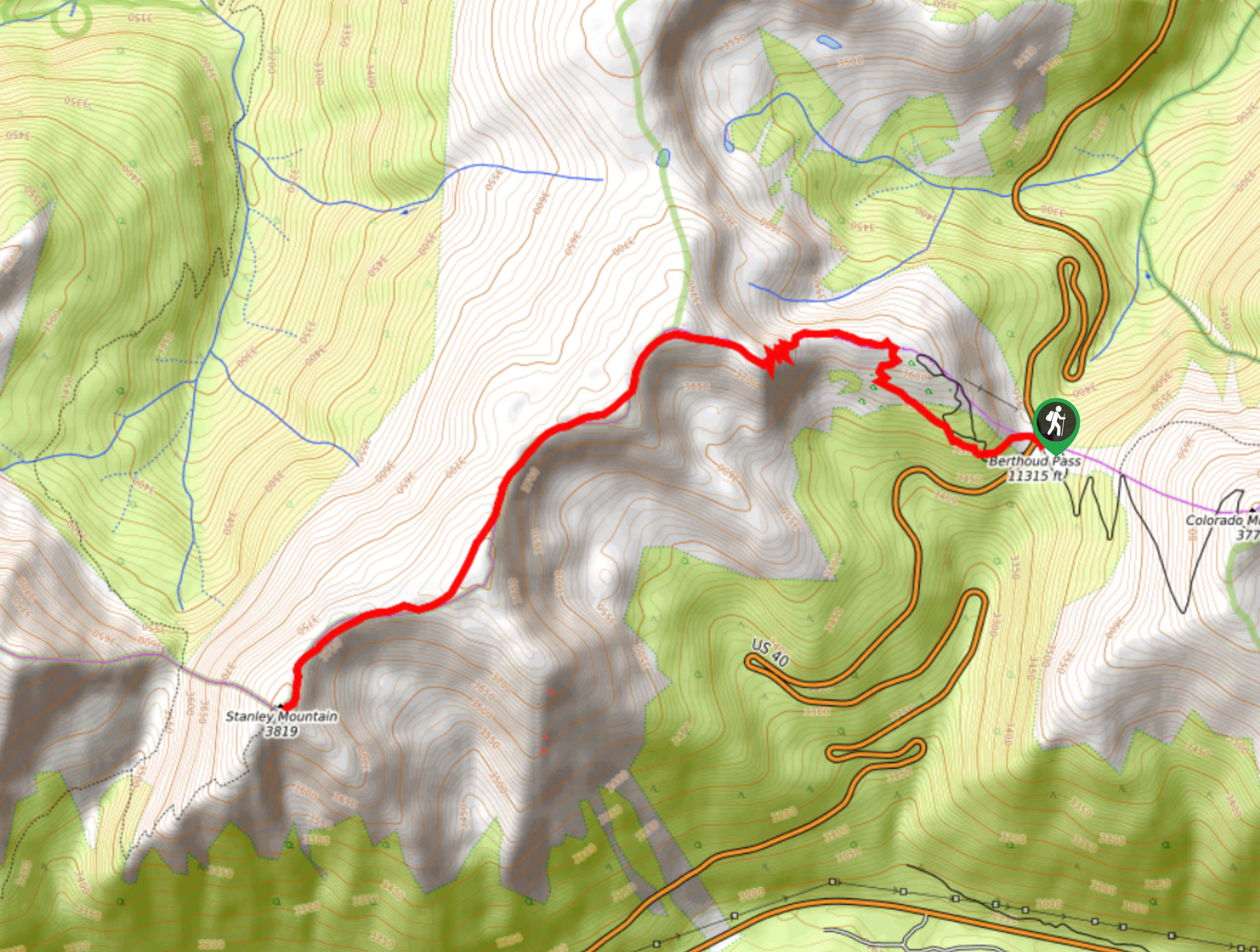
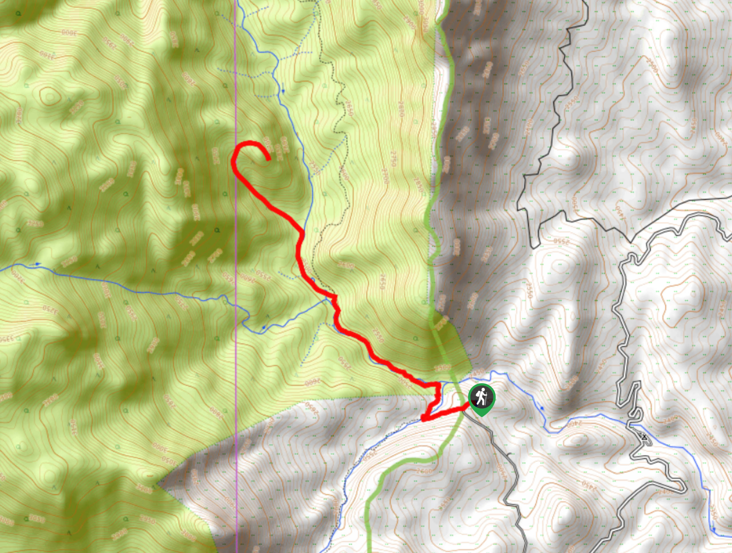
165. Stanley Mountain Hike
Difficulty
Ascend the Berthoud Pass to the summit of Stanley Mountain. The Stanley Mountain hike is… Read More
166. Grays Peak via I-70 Hike
Difficulty
The Grays Peak via I-70 Hike is a demanding adventure to the summit of a… Read More
167. Griffin Memorial Trail
Difficulty
The Griffin Memorial Hike is a historical adventure up to a memorial. Scramble up the… Read More
168. M. Walter Pesman Trail
Difficulty
The M. Walter Pesman Trail is a scenic adventure that borders the Mount Evans Wilderness.… Read More
169. Slater Lake Hike
Difficulty
We love a good mountain adventure, and the Slater Lake Hike delivers just that. Hike… Read More
170. James Peak Loop Trail
Difficulty
The James Peak Loop Trail will reveal the diversity of the Colorado Wilderness. Travel through… Read More
171. Loch Lomond to Berthoud Pass Hike
Difficulty
The Loch Lomond to Berthoud Pass is an unforgettable excursion along the famous Continental Divide.… Read More
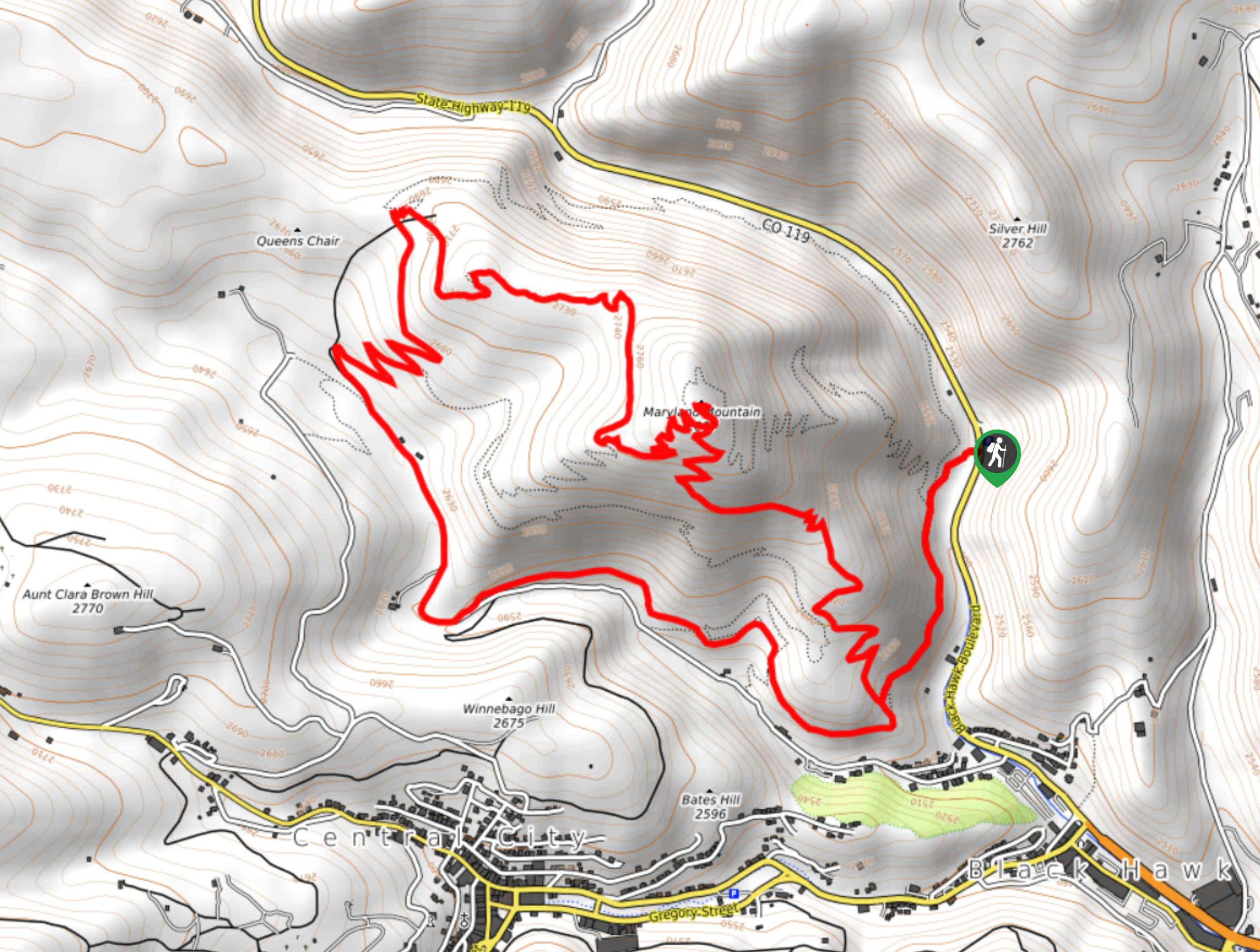
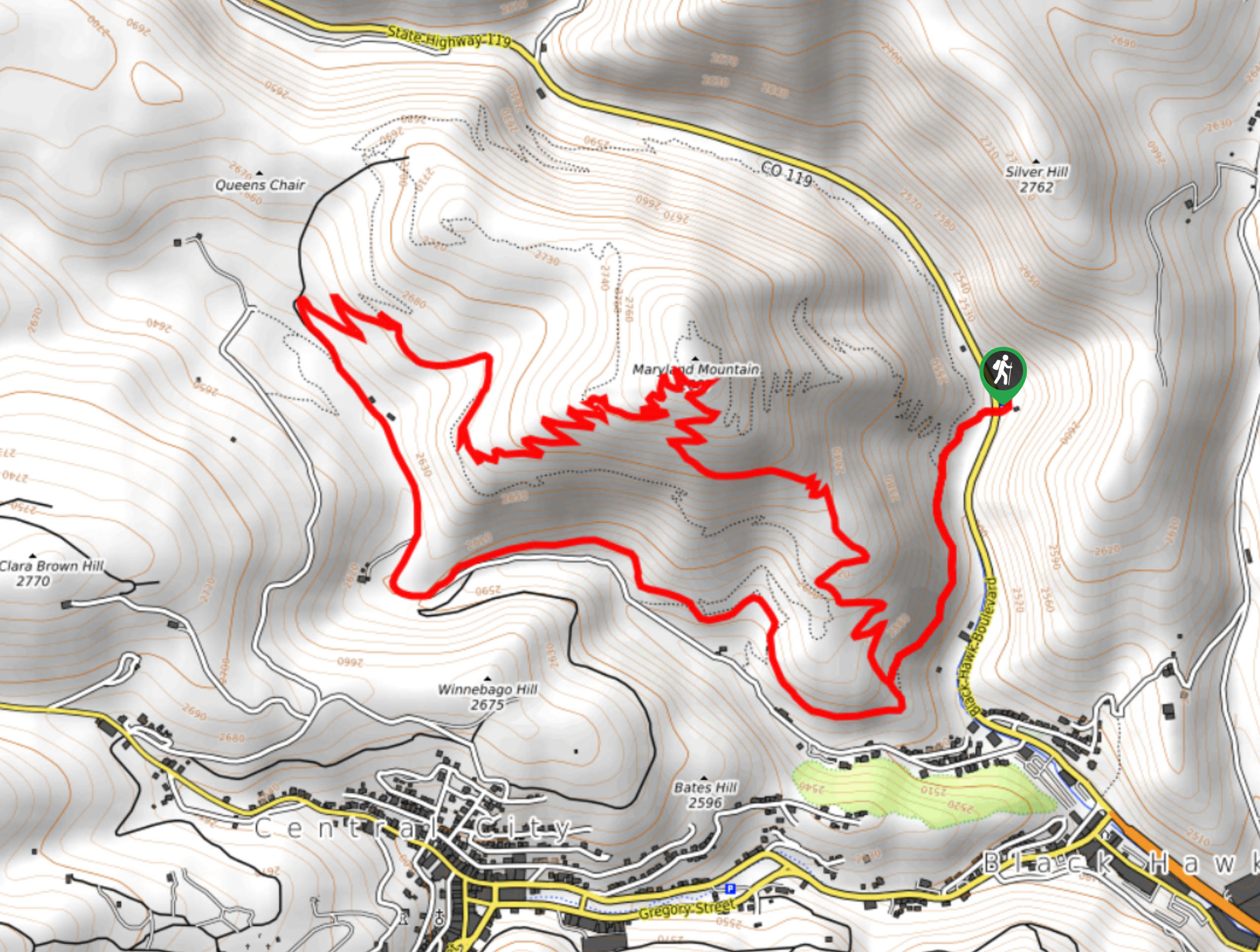
172. Maryland Mountain Hike
Difficulty
The Maryland Mountain Hike is a scenic adventure up to the summit of Maryland Mountain.… Read More
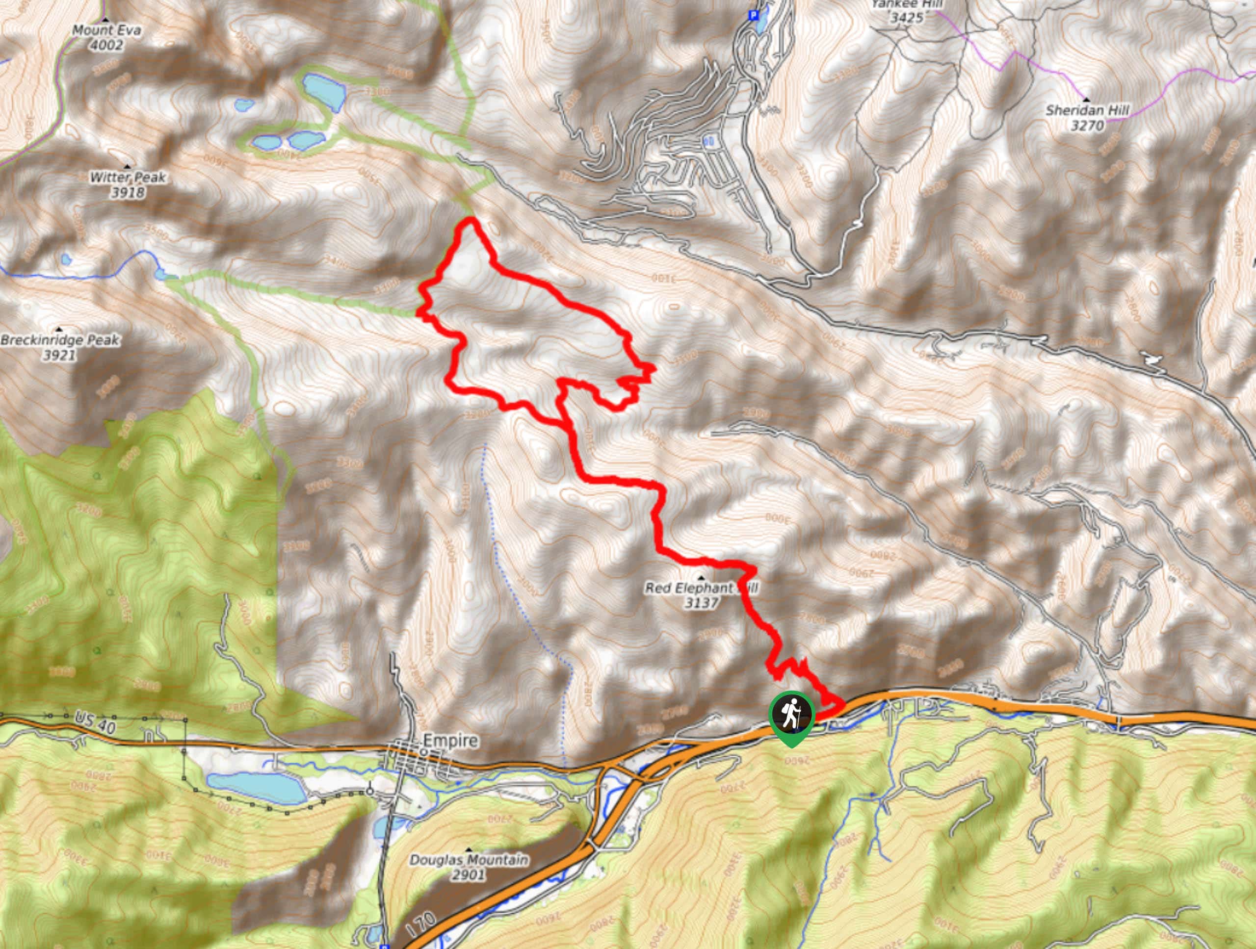
173. Red Elephant Hill Hike
Difficulty
We know what you’re thinking… are we going to see a red elephant? Unfortunately, no,… Read More
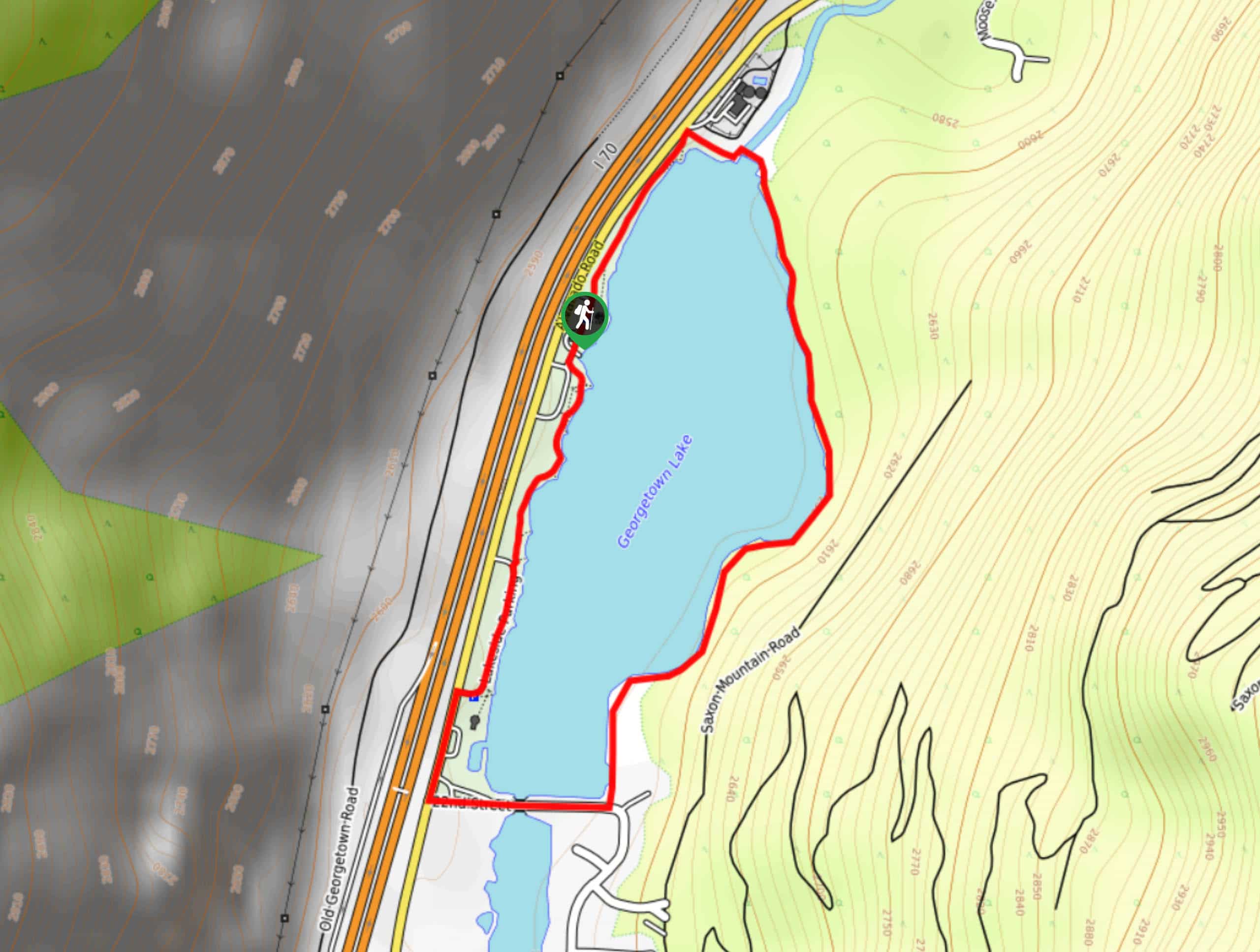
174. Tom Benoff Lake Trail
Difficulty
The Tom Benoff Lake Trail is an awesome nature walk near Georgetown, Colorado, that the… Read More
175. Democrat Mountain Hike
Difficulty
The Democrat Mountain Hike is demanding, but the vistas from atop the summit are well… Read More
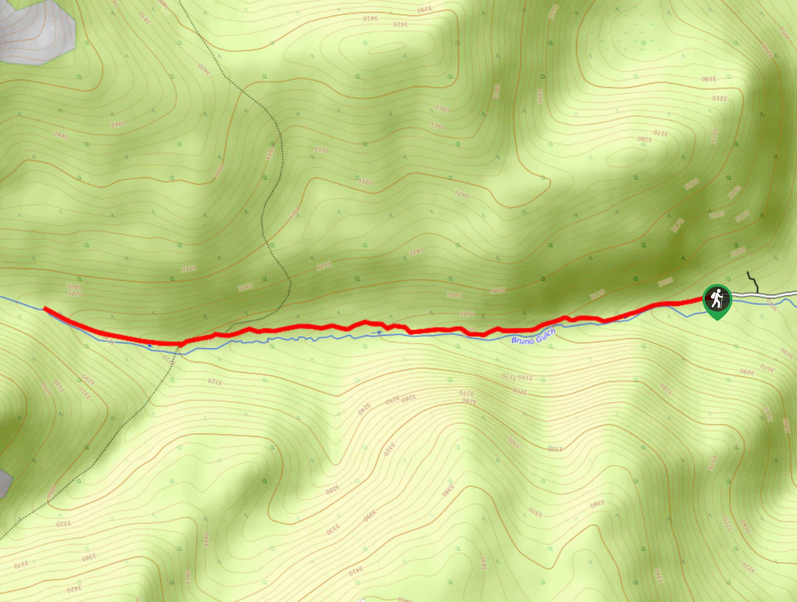
176. Bruno Gulch Trail
Difficulty
The Bruno Gulch Trail is a secluded escape amongst the surrounding highly trafficked summit hikes.… Read More
177. Red Rock Hike
Difficulty
The Red Rock Hike is a popular adventure in Staunton State Park, and there is… Read More
178. Staunton Ranch and Bugling Elk Hike
Difficulty
The Staunton Ranch and Bugling Elk Hike is a scenic adventure through the Staunton State… Read More
179. Staunton Ranch to Mason Creek Hike
Difficulty
The Staunton Ranch to Mason Creek Hike is another stunning network of trails in the… Read More
180. Marmot Passage Trail
Difficulty
The Marmot Passage Trail exhibits all the best features that the Colorado Wilderness has to… Read More
181. Elk Falls Pond Hike
Difficulty
Leave the stressors of the city in the rear-view mirror and escape into the wilderness.… Read More
182. Old Mill Hike
Difficulty
The Old Mill Hike is one of dozens adventure opportunities in Staunton State Park, and… Read More
183. Scoutline Trail
Difficulty
The Scoutline Trail is a wonderful excursion through the Staunton State Park that the whole… Read More
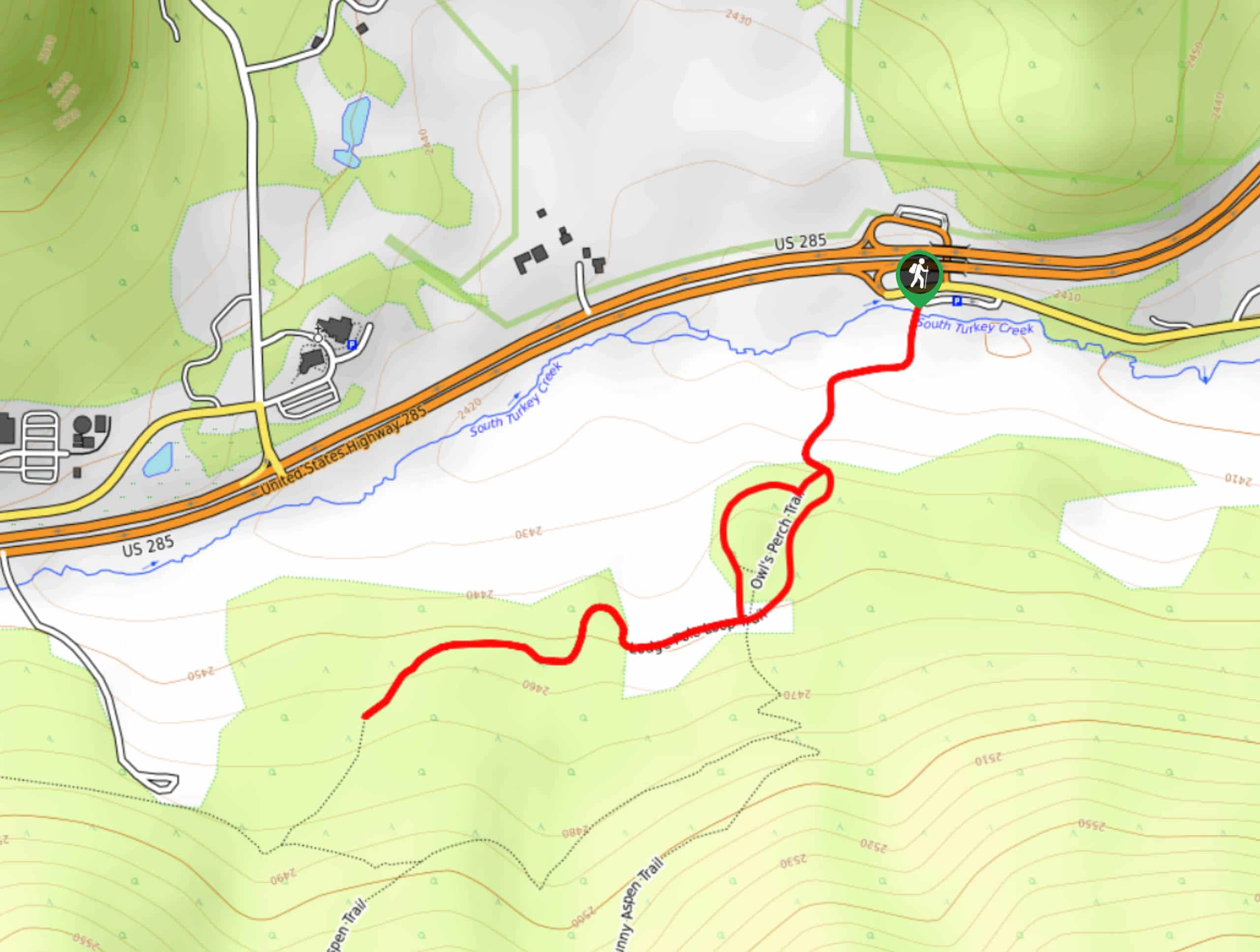
184. Owl’s Perch Hike
Difficulty
The Owl’s Perch Trail is an epic nature walk that is sure to impress the… Read More
185. Green Mountain Loop Trail
Difficulty
If you are craving a secluded forestland hike, away from the hustle and bustle, then… Read More
186. Chair Rocks Hike
Difficulty
The Chair Rocks Hike is a unique excursion in the Pikes National Forest. Trek through… Read More
187. Gill Trail
Difficulty
Intrepid adventurers will appreciate the escapade up the Gill Trail. Hike along the South Platte… Read More
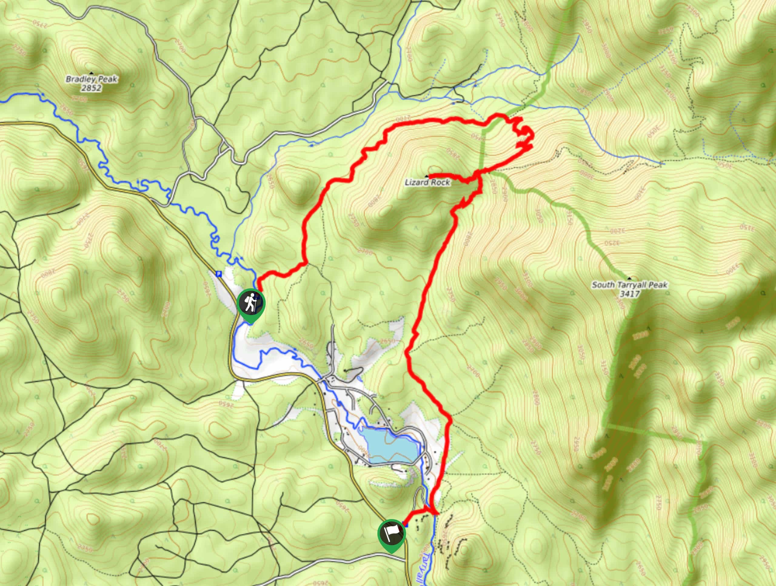
188. Lizard Rock Hike
Difficulty
The Lizard Rock Hike is a scenic adventure that borders the Lost Creek Wilderness. Hike… Read More
189. Lake Park Loop Trail
Difficulty
Hike the Lake Park Loop Trail to satisfy your movement goals for the whole week!… Read More
190. Juniper Valley Hike
Difficulty
The Juniper Valley Trail is a scenic, family-friendly adventure through the Sandstone Ranch Open Space.… Read More
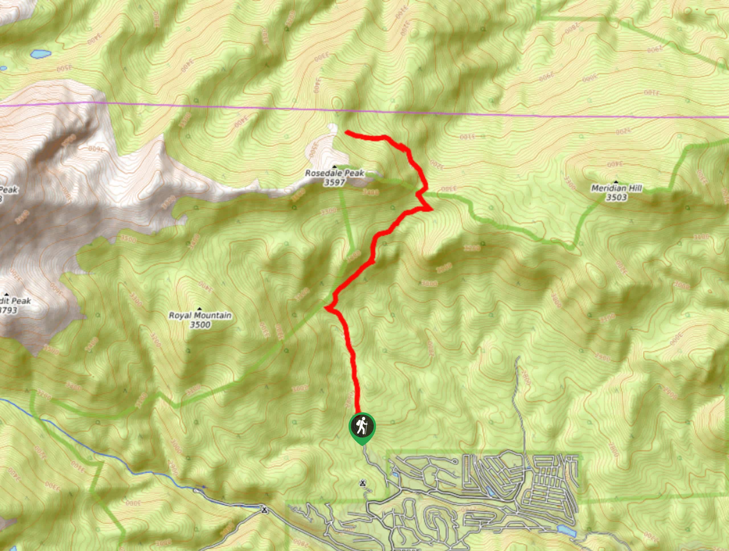
191. Meridian Trail
Difficulty
The Meridian Trail ascends aspen groves all the way to the base of Rosedale Peak.… Read More
192. Black Canyon Hike
Difficulty
The Black Canyon Hike is a scenic escapade along the Colorado Trail to Black Canyon.… Read More
193. Cupid Peak Hike
Difficulty
The Cupid Peak Hike is a wonderful introductory hike. A Colorado 13er, the easy-to-navigate terrain… Read More
194. Mount Sniktau to Grizzly Peak Hike
Difficulty
The Mount Sniktau to Grizzly Peak Trail will guide you along a trail to summit… Read More
195. Bard Creek Trail
Difficulty
The Bard Creek Trail is a popular backpacking adventure through the Arapaho National Forest, but… Read More
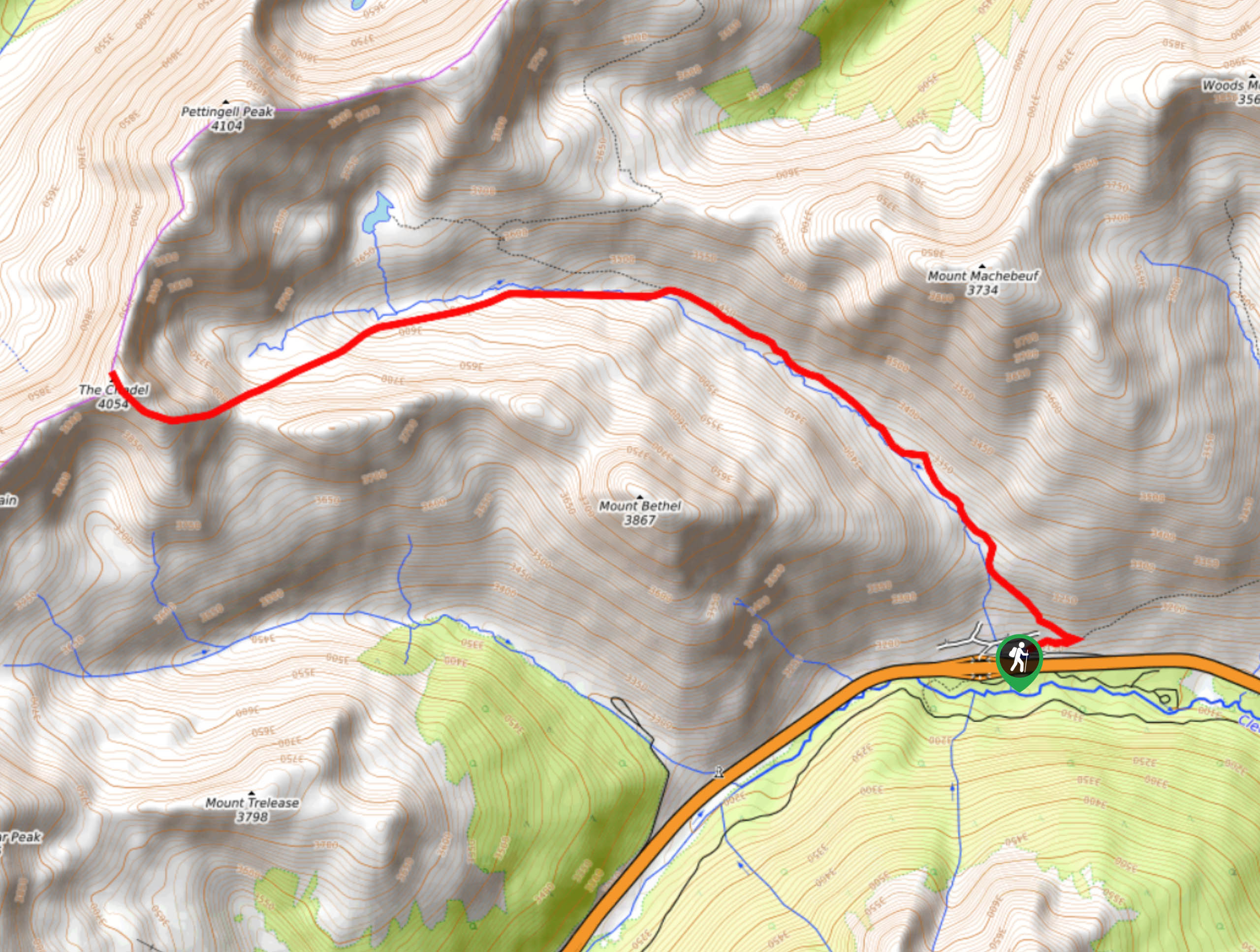
196. Pettingell Peak via Herman Gulch Trail
Difficulty
The Pettingell Peak via Herman Gulch Trail is a stimulating hike up to mesmerizing Front… Read More
197. Mount Nystrom Trail
Difficulty
The Mount Nystrom Trail is an exciting adventure above the clouds. Hike the exposed path… Read More
198. Pavilion Point Hike
Difficulty
The Pavilion Point Hike is an awesome adventure that the whole family can enjoy. Near… Read More

199. Rutherford Trail
Difficulty
The Rutherford Hike is a charming nature walk in Georgetown Colorado. This secluded trail is… Read More
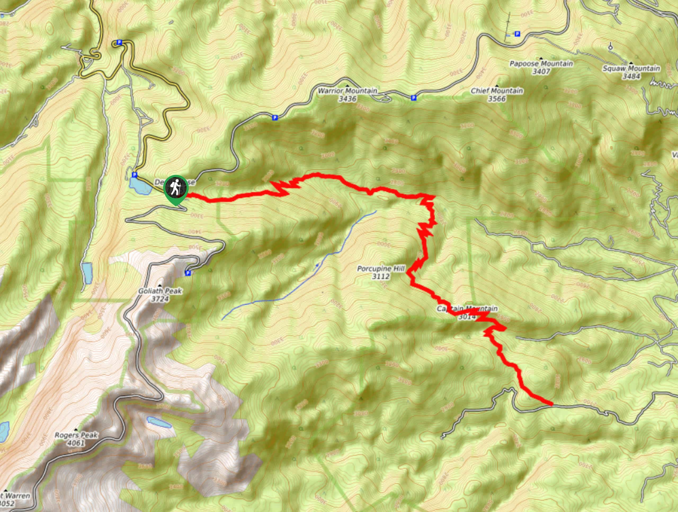
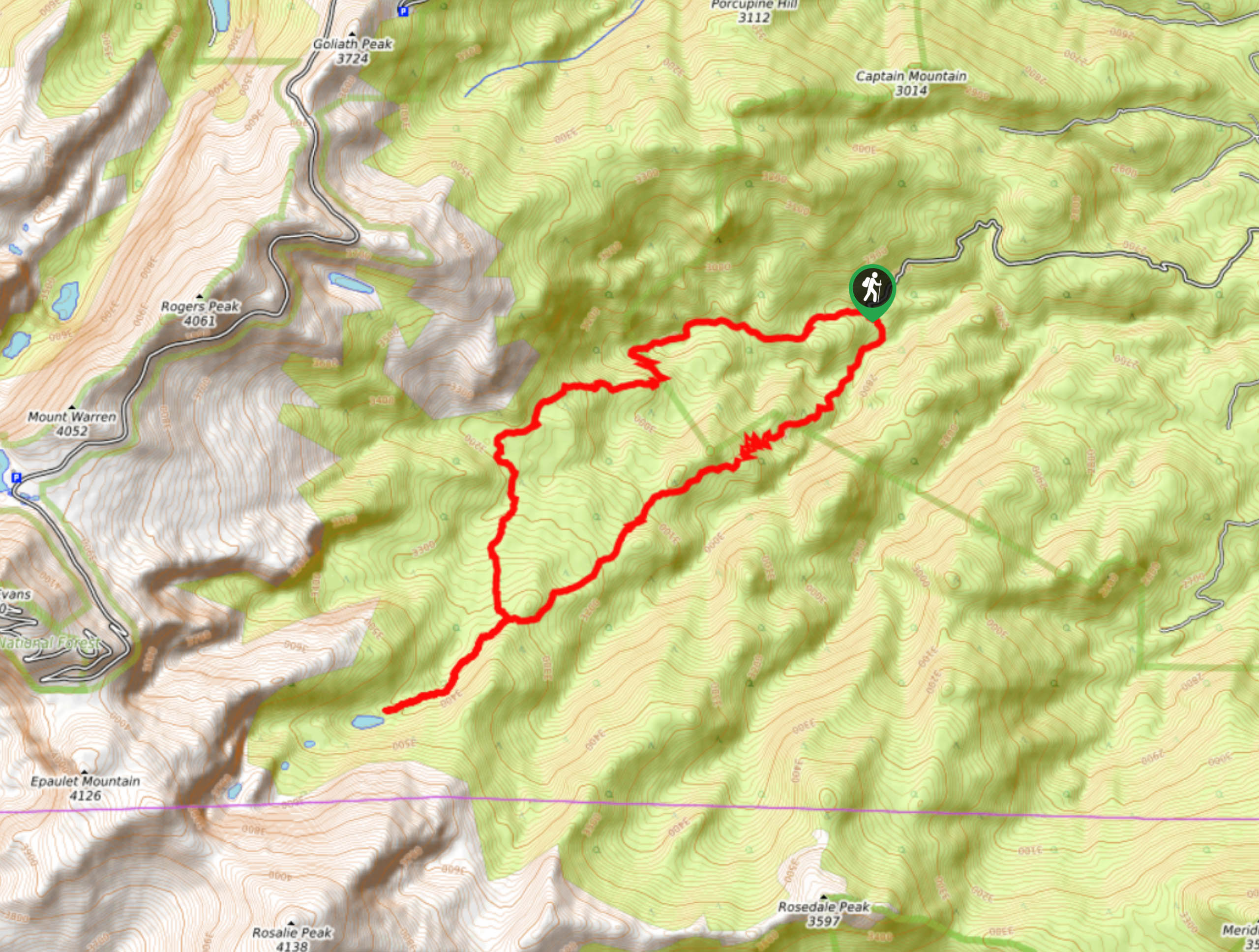
200. Captain Mountain Hike
Difficulty
The Captain Mountain Hike is a demanding excursion in the Mount Evans Wilderness. Hike through… Read More

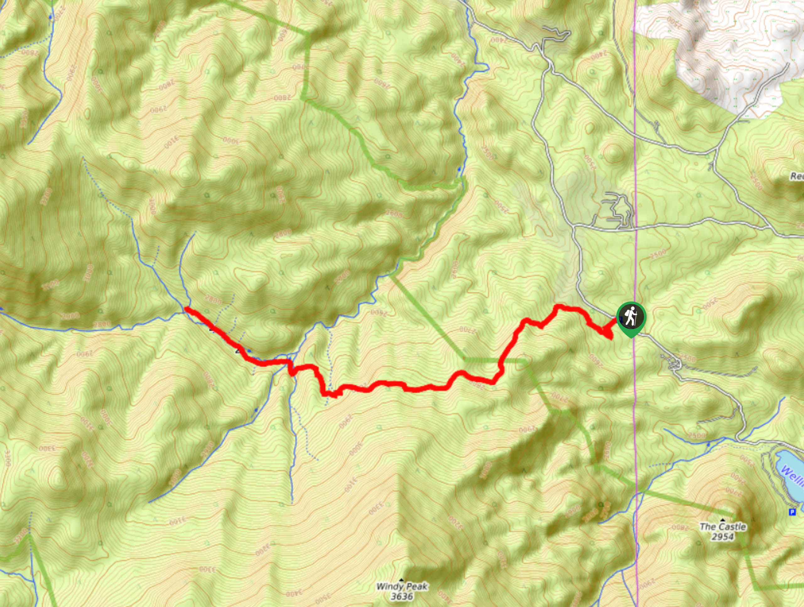
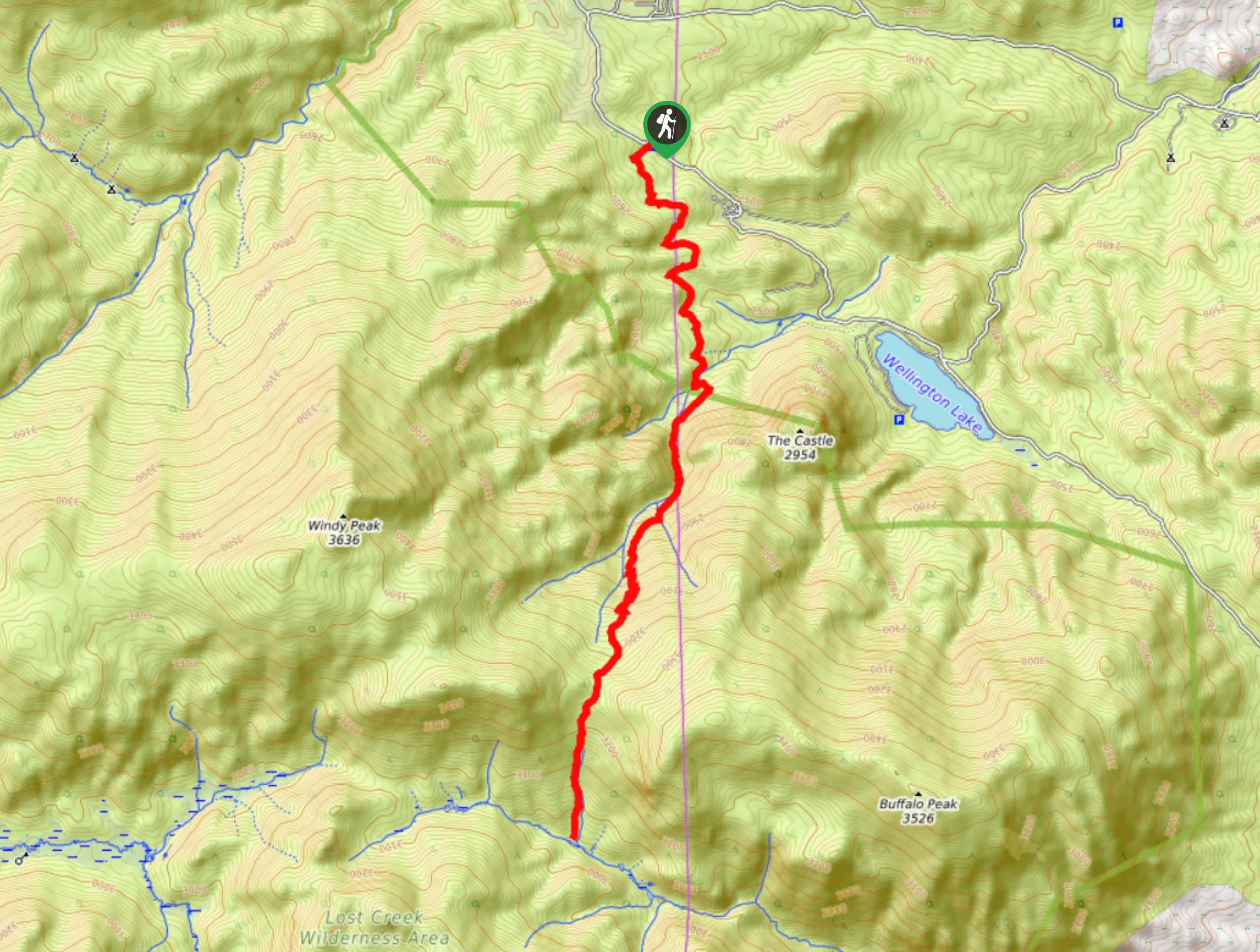
201. The Castle Hike
Difficulty
The Castle Hike is an exciting adventure up the steep, forested terrain to The Castle… Read More

202. Miller Gulch Loop Trail
Difficulty
The Miller Gulch Loop Trail is a scenic meadowland adventure in the Pike National Forest.… Read More

203. Hankins Pass Hike
Difficulty
The Hankins Pass Hike is a quintessential adventure across the Lost Creek Wilderness. The hike… Read More
Are we missing your favourite hike?
Tell us! If you've got photos, a GPS track and know the hike, we'd love to share your favourite hike with the rest of the 10Adventures community.