
Squaw Mountain Hike
View Photos
Squaw Mountain Hike
Difficulty Rating:
The Squaw Mountain Hike is an awesome and accessible hike up to the summit of a Colorado Mountain. Adventure up the well-marked path to an old fire tower that has been converted into a rental property! Enjoy the panoramic views from the overlook and take yourself back in time to when this tower was an essential structure to safeguard the surrounding wilderness.
Getting there
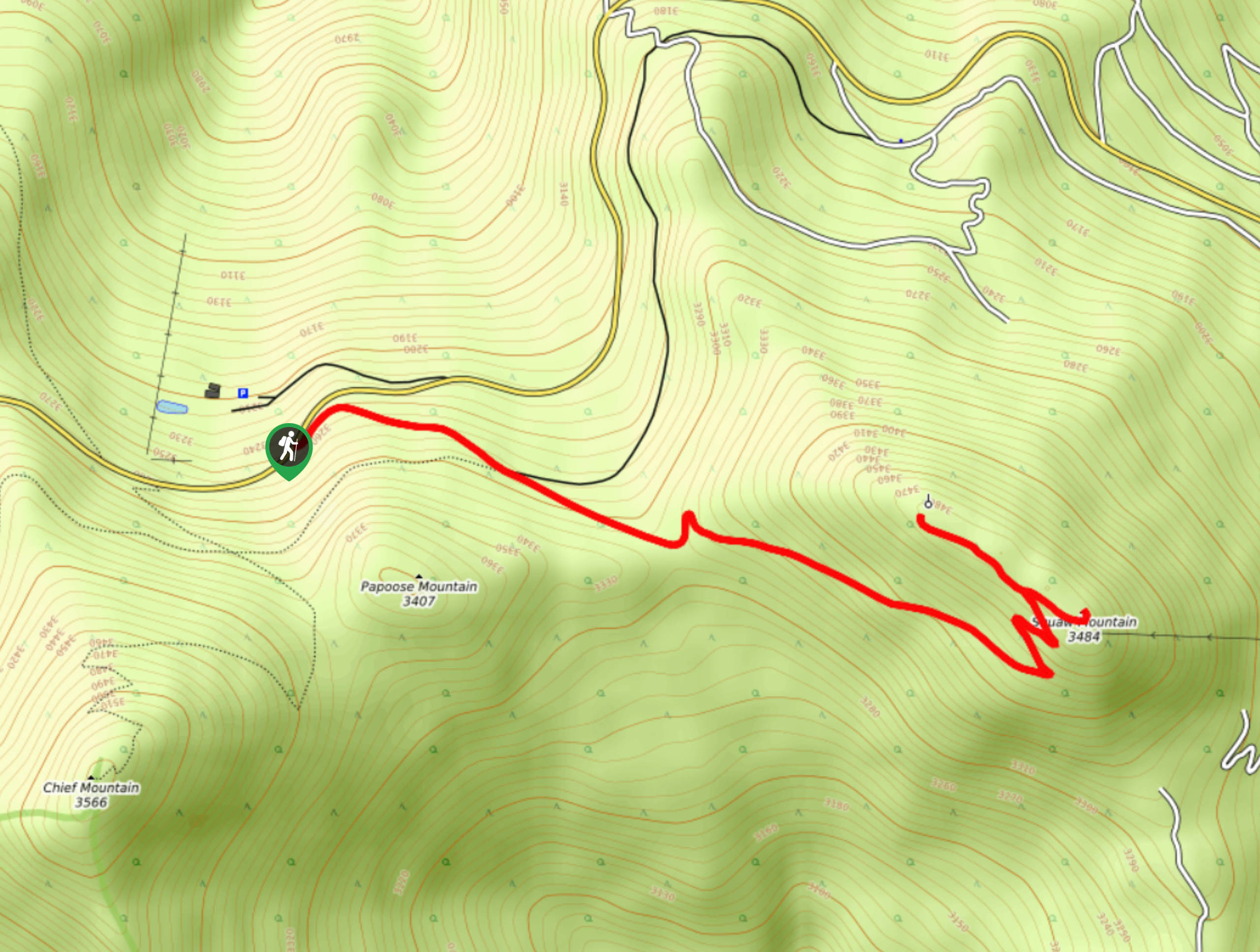
The Squaw Mountain Hike is off of highway CO-103.

About
| Backcountry Campground | Yes, dispersed camping permitted, see rules and regulations. |
| When to do | March-October |
| Pets allowed | Yes - On Leash |
| Family friendly | Yes |
| Route Signage | Average |
| Crowd Levels | High |
| Route Type | Out and back |
Squaw Mountain Hike
Elevation Graph
Weather
Squaw Mountain Hike Description
Outdoor adventurers and historic buffs alike will enjoy the hike up Squaw Mountain. Follow the easy terrain up to the historic fire lookout that protected the forested valleys below from destruction. This path is gradual and follows along a wide marked road, so it is manageable for all-skill level and families alike. Note that there is a shooting range approximately halfway up the trail, so do not be surprised if you hear the odd shot. If you want to avoid the noise, consider hiking in the early morning or in the evening. If you wish to extend your adventure up Squaw Mountain, consider renting out the converted tower and bask in the 360-degree views all weekend long. Note you will have visitors hiking around the cabin in the daytime.
Embark on your adventure up the Squaw Mountain Trail from the carpark off CO-103. From the parking lot, track the Fire Tower Trail northeast. The path follows along an old dirt road, so it is easy to navigate. Continue along the route lined with pine trees as it curves southeast. As you hike along the trail you will see Papoose Mountain in the south. Hike this path as it guides you through the towering trees and up the ridge of Squaw Mountain. Navigate a few switchbacks to summit the peak.
Explore the fire tower and the summit’s ridge. Enjoy the expansive views of the forests below and the Rocky Mountains that line the horizon. On a clear day you might even be able to see Mount Evans in the southwest. Bask in the impressive vistas before beginning your descent. Simply backtrack and retrace your steps all the way back to the parking lot.
Similar hikes to the Squaw Mountain Hike hike

Miller Gulch Loop Trail
The Miller Gulch Loop Trail is a scenic meadowland adventure in the Pike National Forest. Hike through grassy meadows laden…

The Castle Hike
The Castle Hike is an exciting adventure up the steep, forested terrain to The Castle Rock. From atop the summit,…

Rutherford Trail
The Rutherford Hike is a charming nature walk in Georgetown Colorado. This secluded trail is a wonderful adventure the whole…
Comments