
Payne Creek Trail
View Photos
Payne Creek Trail
Difficulty Rating:
Escape the hustle and bustle of the city and escape into the Lost Creek Wilderness. The Payne Creek Trail is an epic adventure for avid hikers through the quintessential Colorado terrains. Hike through meadowlands, along creeks, up ridges and through aspen groves all the while enjoying views of the encompassing mountainous landscape.
Getting there
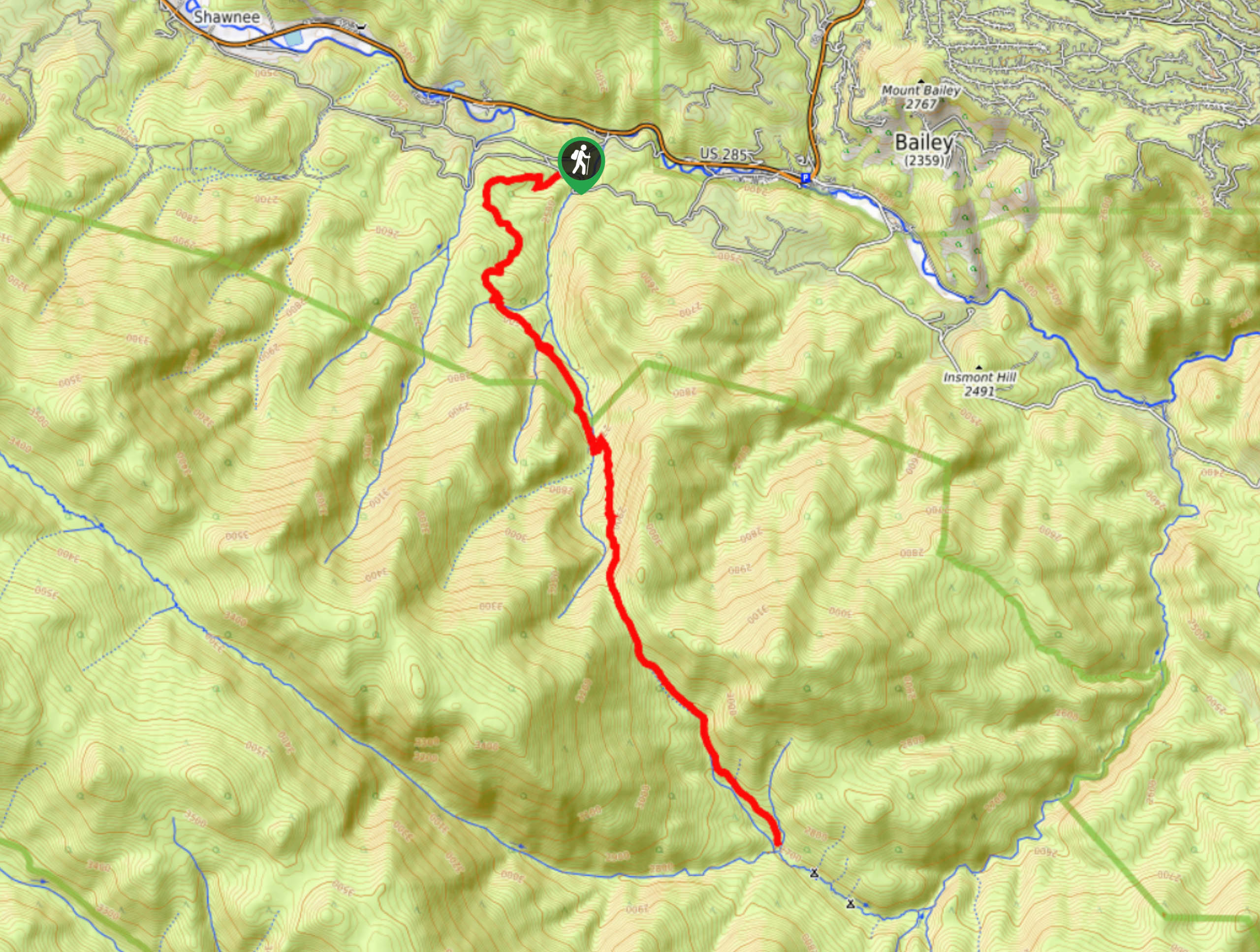
The Payne Creek Trailhead is off County Road 64.

About
| Backcountry Campground | Dispersed backcountry camping, restrictions apply. |
| When to do | May-October |
| Pets allowed | Yes - On Leash |
| Family friendly | No |
| Route Signage | Average |
| Crowd Levels | Moderate |
| Route Type | Out and back |
Payne Creek Trail
Elevation Graph
Weather
Payne Creek Hike Description
Lace up your hiking boots and head out into the Lost Creek Wilderness along the Payne Creek Trail. This exciting excursion can be completed as a lengthy day hike or an epic backpacking expedition. Note that this trail requires a self-issued permit. These permits can be found at the trailhead and must be kept with you for the entirety of your journey. To get the best out of this experience, make sure you have sturdy hiking boots and wear layers as the weather will change as you trek the undulating path.
When you are packed up and ready to roll, take the trail signposted for Brookside McCurdy Trail. Hike this route through the meadowlands and enjoy the expansive vistas. You will encounter a junction. Here, stay left on the Brookside McCurdy Trail. This path will guide you across Payne Creek and through an aspen grove. This section of the path is steep as you ascend an old logging road. The route will then descend into a drainage and an open meadow. You will shortly meet your turnaround point when Craig Creek and Payne Creek intersect.
At this point, there are plenty of dispersed campsites for those who wish to stay overnight and continue their journey in the morning. If you are ready to return, retrace your steps back to the trailhead.
Similar hikes to the Payne Creek Trail hike

Hankins Pass Hike
The Hankins Pass Hike is a quintessential adventure across the Lost Creek Wilderness. The hike demonstrates the diversity of the…

Miller Gulch Loop Trail
The Miller Gulch Loop Trail is a scenic meadowland adventure in the Pike National Forest. Hike through grassy meadows laden…

The Castle Hike
The Castle Hike is an exciting adventure up the steep, forested terrain to The Castle Rock. From atop the summit,…
Comments