
Kelso Mountain Hike
View Photos
Kelso Mountain Hike
Difficulty Rating:
The Kelso Mountain Hike is an awesome introductory summit hike in the Front Range. Short, sweet, but steep, this path is a real leg-burner. Leave the city and its stressors in the rear-view mirror and head out into the wilderness. Explore the quintessential Colorado terrain and revel in the stunning vistas.
Getting there
The Kelso Mountain Hike is located at the end of Stevens Gulch Road.

About
| Backcountry Campground | Dispersed Backcountry Camping, restrictions apply. |
| When to do | June-October |
| Pets allowed | Yes - On Leash |
| Family friendly | Older Children only |
| Route Signage | Poor |
| Crowd Levels | Low |
| Route Type | Out and back |
Kelso Mountain Hike
Elevation Graph
Weather
Kelso Mountain Hike Description
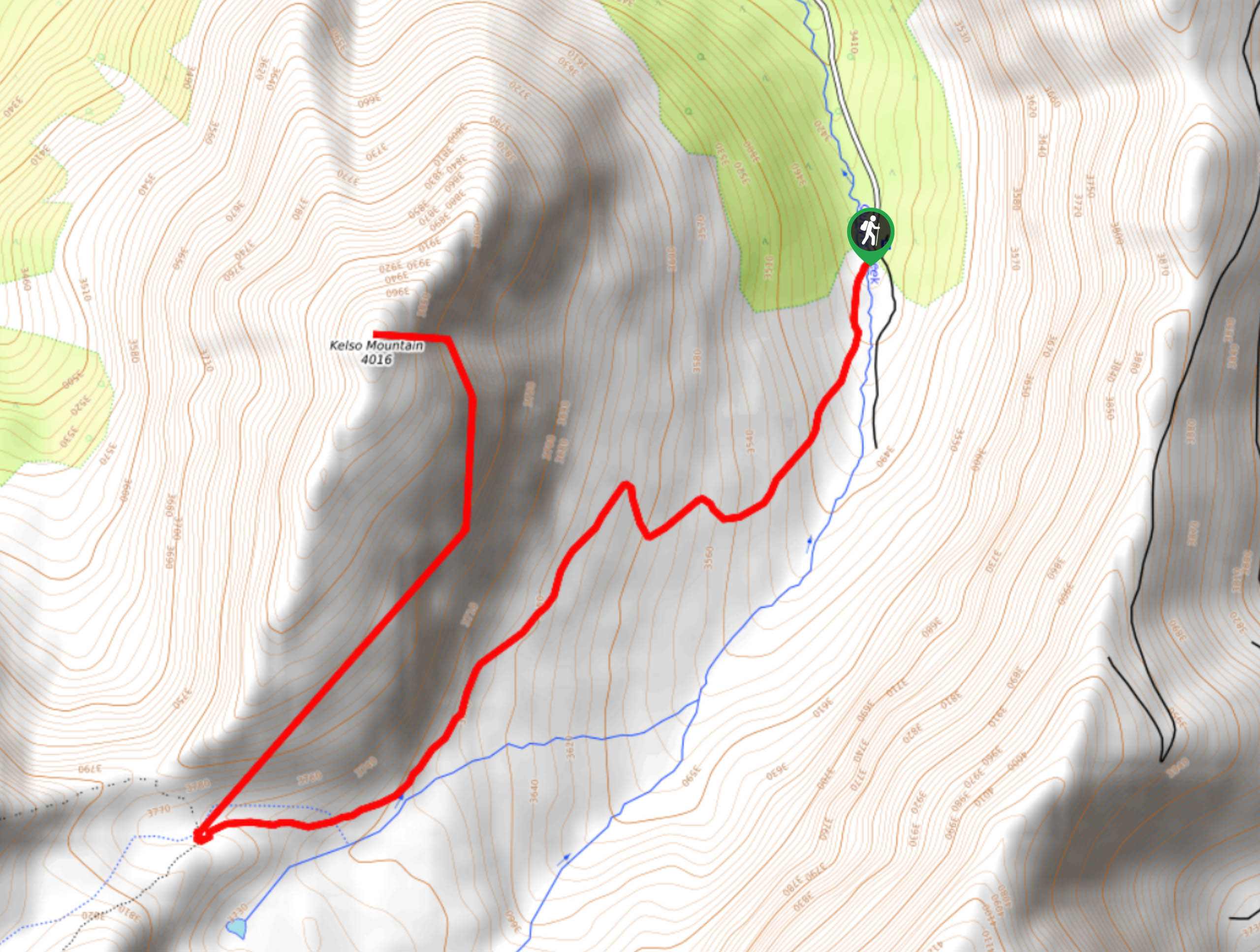
Satisfy your inner adventurer and travel up the primitive Kelso Mountain Trail. If you don’t mind off-roading, then we would recommend trekking the Kelso Mountain Hike. Bring the trail GPS along to mitigate the chances of taking a wrong turn in the Arapaho National Forest. This primitive trail is a secluded adventure in the otherwise trafficked trails of the Front Range. Note that parking for this path is limited. If you want to secure a parking spot, we recommend arriving early. Additionally, check the weather prior to setting out to avoid inclement weather at the summit and wear plenty of layers to keep warm.
Embark on your adventure from the path signposted: Grays Peak Trail. Hike this path past several historic mines and along Quayle Creek. The trail will then divert you under tree coverage and away from the creek. Hike up the rocky terrain through the woodlands. Eventually, you will meet back up with the creek and encounter a junction. At this point, the route will be exposed and windy. At the intersection, take a hard right up the primitive, unmarked, Kelso summit trail. Hike up the path along the rocky ridge.
Track northeast and you will summit Kelso Mountain. From the summit, enjoy the awe-inspiring views of the encompassing snow-capped peaks. Appreciate the scenery and take a break prior to beginning your descent. When you are ready to return to the trailhead, retrace your steps along the route.
Similar hikes to the Kelso Mountain Hike hike

Hankins Pass Hike
The Hankins Pass Hike is a quintessential adventure across the Lost Creek Wilderness. The hike demonstrates the diversity of the…

Miller Gulch Loop Trail
The Miller Gulch Loop Trail is a scenic meadowland adventure in the Pike National Forest. Hike through grassy meadows laden…

The Castle Hike
The Castle Hike is an exciting adventure up the steep, forested terrain to The Castle Rock. From atop the summit,…
Comments