
South Ridge and Audra Culver Hike
View Photos
South Ridge and Audra Culver Hike
Difficulty Rating:
The South Ridge and Audra Culver Hike is an awesome introductory hike for those seeking to train for more intense summit hikes in the Front Range. Hike through the Horsetooth Mountain Open Space and ascend the rocky ridge to the summit Horsetooth Mountain. The rewarding views will make up for the effort.
Getting there
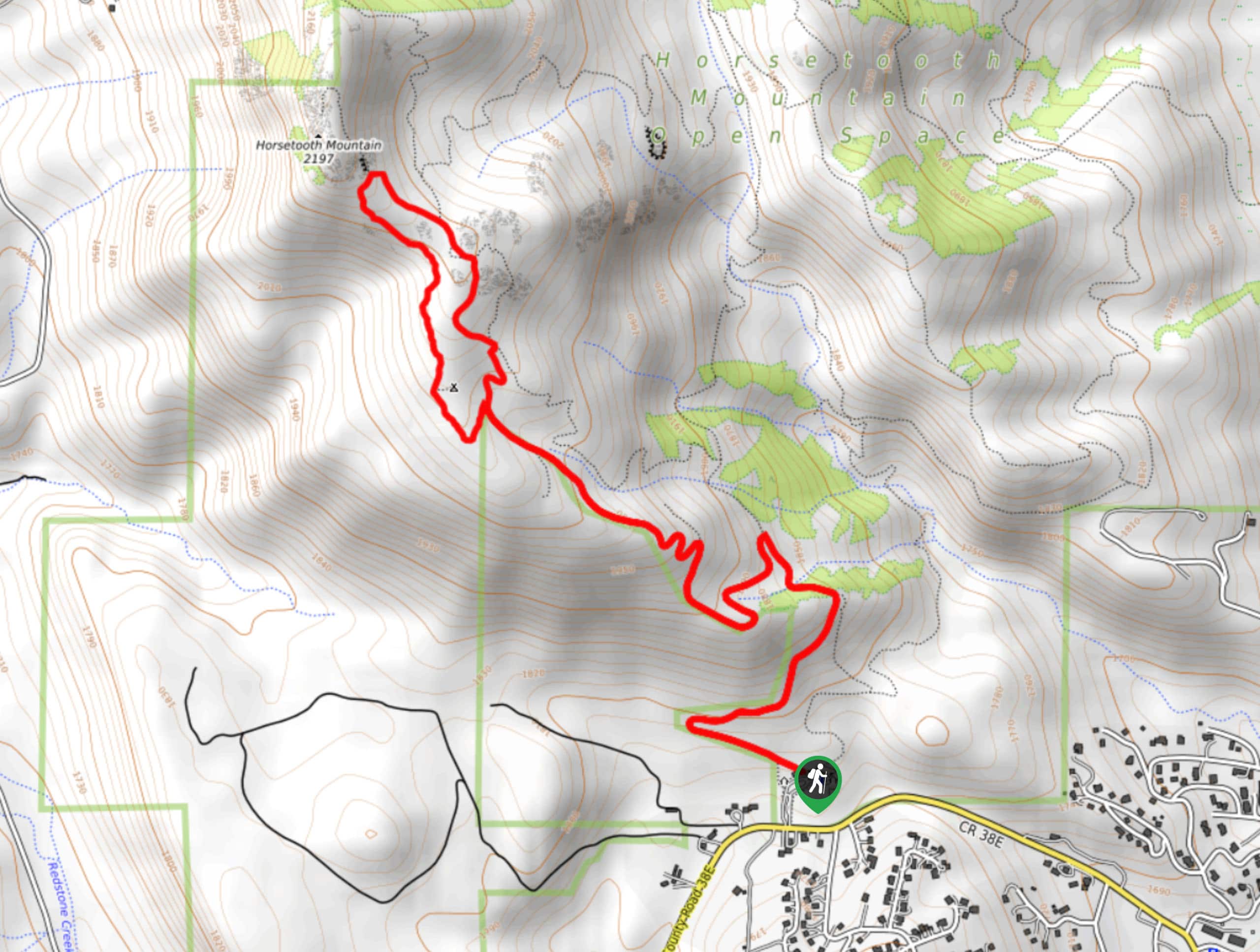
The South Ridge and Audra Culver Hike is located within the Horsetooth Mountain Open Space off W County Road 38E.

About
| Backcountry Campground | Yes, only at designated backcountry campsites. See rules and regulations. |
| When to do | May-September |
South Ridge and Audra Culver Hike
Elevation Graph
Weather
South Ridge and Audra Culver Hike Description
Lace up those hiking shoes, and let’s head out into the Horsetooth Mountain Open Space. The South Ridge and Audra Culver Hike is a great excursion for novice hikers and intrepid adventures alike. Ascend the rocky terrain along the South Ridge to a Mountain Summit. Even the most experienced explorers will enjoy this venture. Be sure to wear sturdy hiking shoes as the rocky terrain is known to cause the odd rolled ankle. It is also worth noting that there have been Rattlesnakes spotted along this trail. Be sure to listen out for them and mind your footing as you traverse the grassy meadow. Visitors must purchase a $9USD day pass for the Open Space from the gateway’s toll booth.
Begin your journey up the South Ridge and Audra Culver from the Horsetooth Mountain Trailhead. Track the South Ridge Trail from here and head northwest. This path will intersect with a few streams before diverting you up the rocky ridge. Ascend the trail and ignore intersecting and merging routes until you meet the intersection with Audra Culver. Veer left, and you will be diverted onto the Audra Culver Trail. Hike along the rocky ridge past a dispersed campsite. Notice the dozens of Front Range peaks that dot the landscape in the west. Continue up the trail to the summit of Horsetooth Mountain.
Enjoy the incredible views from the summit and see the Horsetooth Reservoir and Fort Collins in the east. Revel in the mountainous vista and explore the rocky peak before beginning your descent. When you are ready, take the Horsetooth Rock Trail and then merge onto the South Ridge Trail. Follow the South Ridge Trail, retracing your steps all the way down to the parking lot.
Similar hikes to the South Ridge and Audra Culver Hike hike

Hankins Pass Hike
The Hankins Pass Hike is a quintessential adventure across the Lost Creek Wilderness. The hike demonstrates the diversity of the…

Miller Gulch Loop Trail
The Miller Gulch Loop Trail is a scenic meadowland adventure in the Pike National Forest. Hike through grassy meadows laden…

The Castle Hike
The Castle Hike is an exciting adventure up the steep, forested terrain to The Castle Rock. From atop the summit,…
Comments