
South Ridge Hike
View Photos
South Ridge Hike
Difficulty Rating:
The South Ridge Hike is a more technical adventure in the Horsetooth Mountain Open Space. Ascend the rocky terrain up the south side of Horsetooth Mountain and revel in the expansive scenery along the way. If you are seeking a more challenging excursion in the Open Space, then consider the South Ridge Trail.
Getting there
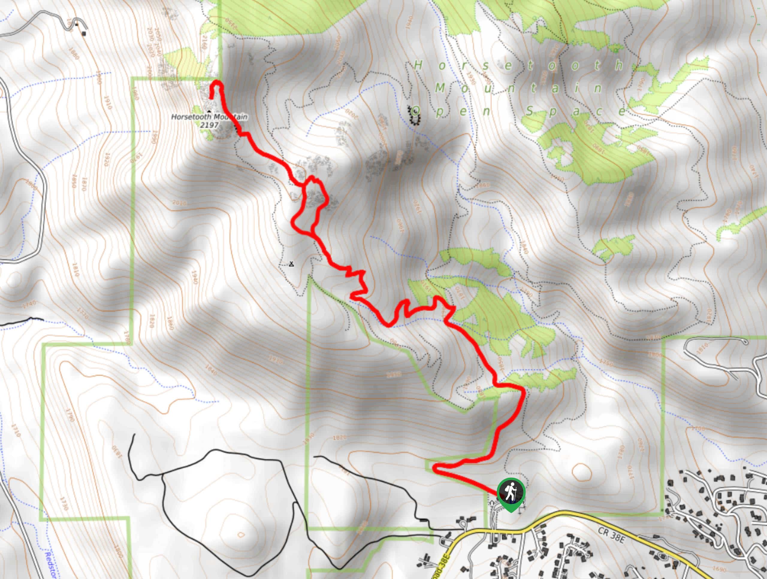
The South Ridge Hike is located within the Horsetooth Mountain Open Space off W County Road 38E.

About
| Backcountry Campground | Yes, only at designated backcountry campsites. See rules and regulations. |
| When to do | May-September |
| Pets allowed | Yes - On Leash |
| Family friendly | Older Children only |
| Route Signage | Average |
| Crowd Levels | High |
| Route Type | Out and back |
South Ridge Hike
Elevation Graph
Weather
South Ridge Hike Description
The South Ridge Trail is an awesome introductory hike for adventurers seeking to make their way up to summit hikes. Hike the short, but steep path up to the summit of Horsetooth Mountain. Though not the most technical terrain, it is rocky. A good pair of sneakers or hiking shoes are highly recommended. It is also worth noting that there is little tree shade on this trail, so ensure to prepare accordingly based on the forecast. There have also been plenty of Rattlesnakes spotted on this path, keep your eyes and ears peeling for these creatures and give them plenty of space if you confront one. Located within the Horsetooth Mountain Open Space, visitors are required to purchase a permit which costs typically around $9USD.
Begin your journey up the South Ridge Trail from the Horsetooth Mountain Trailhead. Take the route signposted as the South Ridge Trail. Hike along the path as it intersects with a set of small creeks. Ignore intersecting and merging routes and continue hiking along the South Ridge Trail. Ascend the rocky ridge and be mindful of loose rocks, especially if there is a hiker behind you. Enjoy the sights of Fort Collins and the Horsetooth Reservoir in the east and a river canyon in the west as you scramble up the exposed ridge. Trek up the rocky terrain along the South Ridge Trail until you summit Horsetooth Mountain.
From atop the mountain, enjoy panoramic vistas of the surrounding wilderness and peaks. Explore Horsetooth Rock which necessitates plenty of photo opportunities. Take a rest and enjoy the scenery before retracing your steps down the path all the way back to the trailhead.
Similar hikes to the South Ridge Hike hike

Hankins Pass Hike
The Hankins Pass Hike is a quintessential adventure across the Lost Creek Wilderness. The hike demonstrates the diversity of the…

Miller Gulch Loop Trail
The Miller Gulch Loop Trail is a scenic meadowland adventure in the Pike National Forest. Hike through grassy meadows laden…

The Castle Hike
The Castle Hike is an exciting adventure up the steep, forested terrain to The Castle Rock. From atop the summit,…
Comments