Rolling Creek via Colorado Trail
View Photos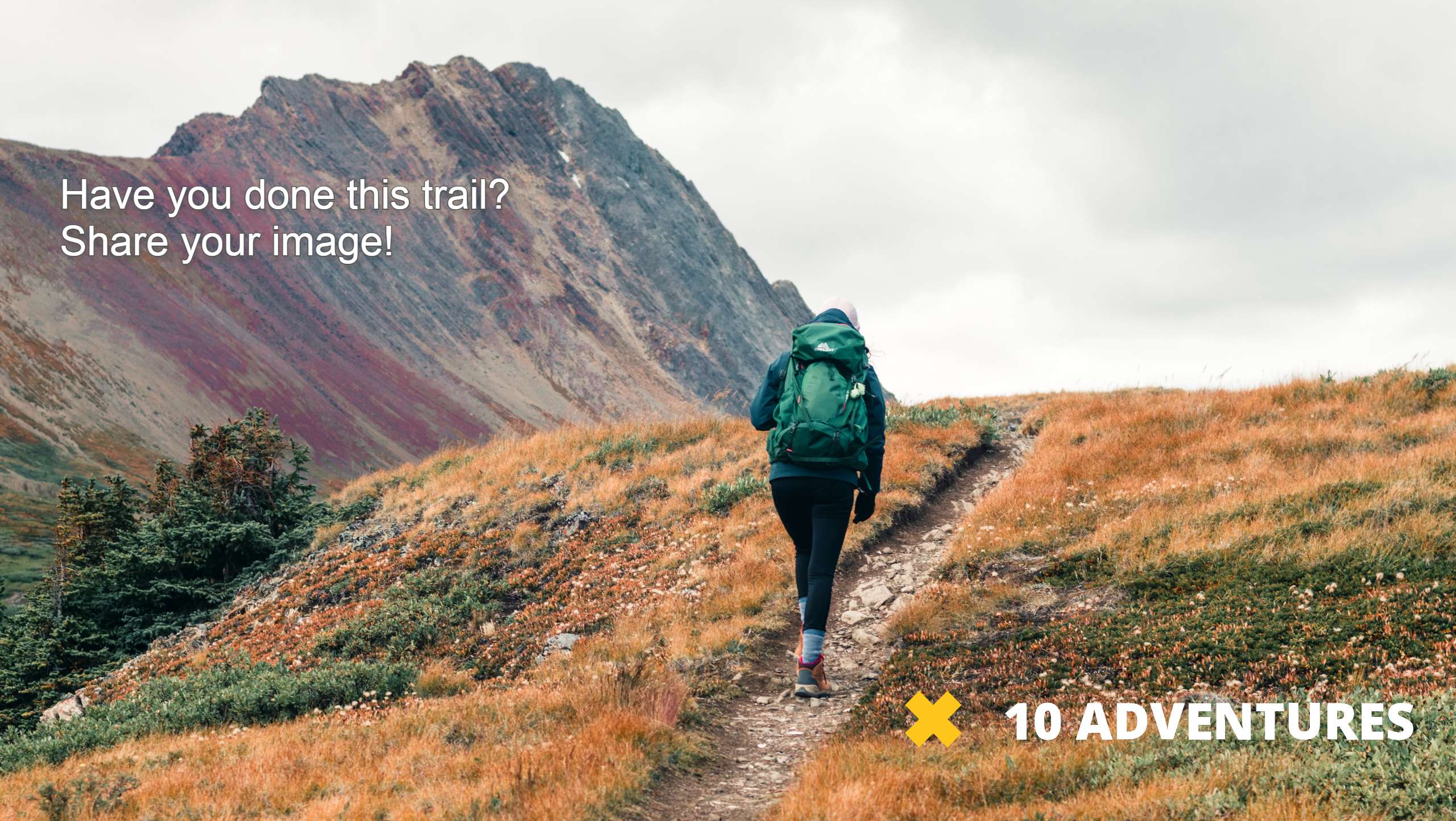
Rolling Creek via Colorado Trail
Difficulty Rating:
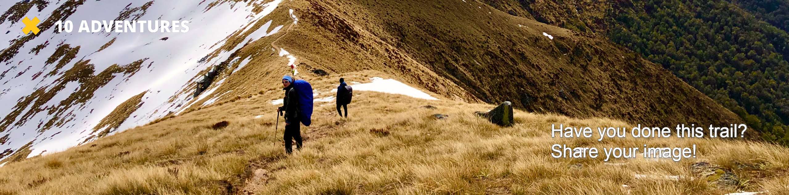
Hike into the Lost Creek Wilderness along the Rolling Creek via Colorado Trail. Travel through diverse terrain and get out of your comfort zone as you navigate the technical path. Trek the Rolling Creek via Colorado Trail as a lengthy day-hike or an epic backpacking adventure. Either way we guarantee you will enjoy the stunning journey.
Getting there
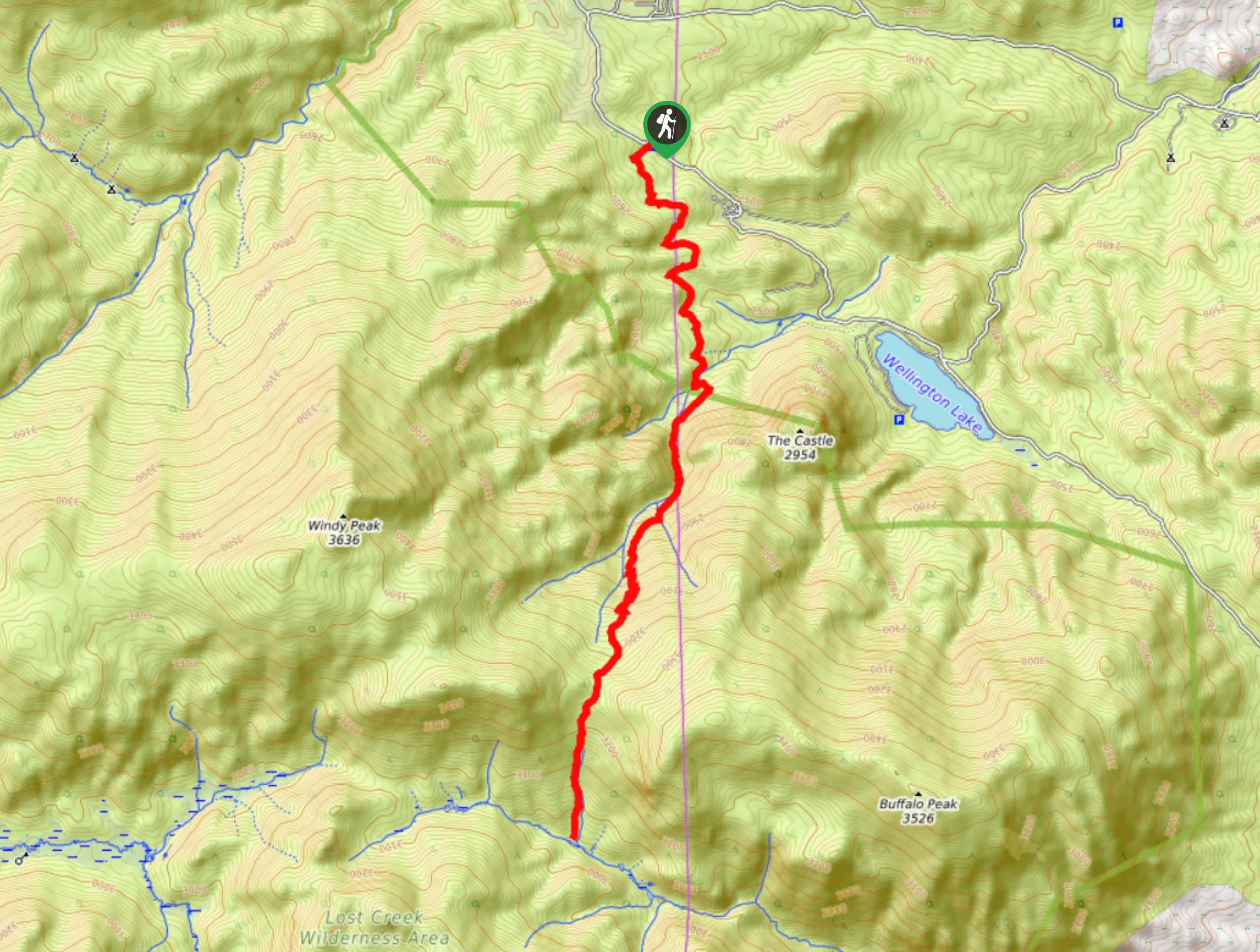
THe Rolling Creek via Colorado Trailhead is located off County Road 68.

About
| Backcountry Campground | Designated Dispersed Backcountry Campsites |
| When to do | May-October |
| Pets allowed | Yes - On Leash |
| Family friendly | No |
| Route Signage | Average |
| Crowd Levels | Moderate |
| Route Type | Out and back |
Rolling Creek via Colorado Trail
Elevation Graph
Weather
Rolling Creek via Colorado Trail Hike Description
The Rolling Creek via Colorado Trail is a moderately traffic trail in the Lost Creek Wilderness. With plenty of connecting routes, you can personalize this excursion to your liking! Hike the secluded path out and back or choose to take one of the many merging trails to loop around. This trail is a popular backpacking trail, but you can easily complete it in a day if you set out early from the trailhead. Note that the Lost Creek Wilderness requires self-issued permits. These permits can be found at the trailhead and must be kept with you for the entirety of your journey. It is also worth noting that this path weaves between tree shade and meadows, so prepare accordingly for sunny or windy conditions in the plains.
When you are ready to embark on your adventure along the Rolling Creek via Colorado Trail, set out on the Rolling Creek Trail. This path will guide you south along level terrain. Hike through the woods, admiring the towering aspens above. Soon the route will merge with Rolling Creek. Trek along the curves of the creek and the terrain will become increasingly intense. Hike up the steep path and notice the Castle Peak on your left. Climb up the path and navigate the rocky switchbacks. Soon you will ascent the saddle between Buffalo Peak and Windy Peak before the path drops dramatically down into a forested canyon.
Descend the steep terrain to Wigwam Creek. This is your end point. Here you will find several dispersed campsites along the creek. Set up shop for the night or retrace your steps along the route all the way back to the trailhead.
Similar hikes to the Rolling Creek via Colorado Trail hike

Hankins Pass Hike
The Hankins Pass Hike is a quintessential adventure across the Lost Creek Wilderness. The hike demonstrates the diversity of the…

Miller Gulch Loop Trail
The Miller Gulch Loop Trail is a scenic meadowland adventure in the Pike National Forest. Hike through grassy meadows laden…

The Castle Hike
The Castle Hike is an exciting adventure up the steep, forested terrain to The Castle Rock. From atop the summit,…
Comments