hikes in Shasta-Trinity National Forest
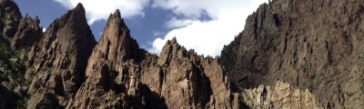
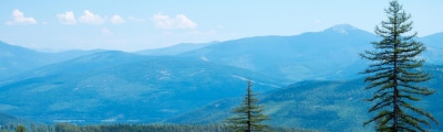
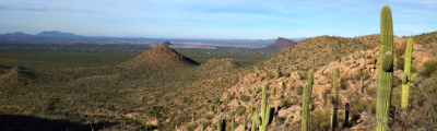
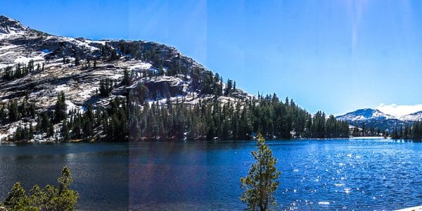
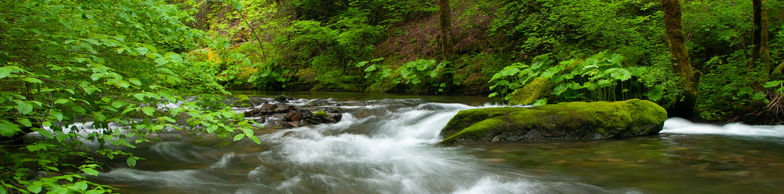
Discover the beauty of the Shasta-Trinity National Forest on foot—along one of the many trails within the area’s extensive network of hiking routes. Encompassing over 2,210,485 acres of combined forestlands, 6278.0mi of rivers and streams, and five wilderness areas: Castle Crags, Chanchelulla, Mount Shasta, Trinity Alps, and Yolla Bolly-Middle Eel, the outdoor opportunities are abundant. Full of wonderment, a trip to the largest National Forest in California is a staple, attracting thousands of annual adventurers from around the globe.
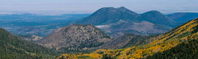
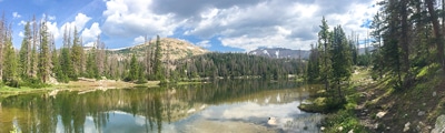
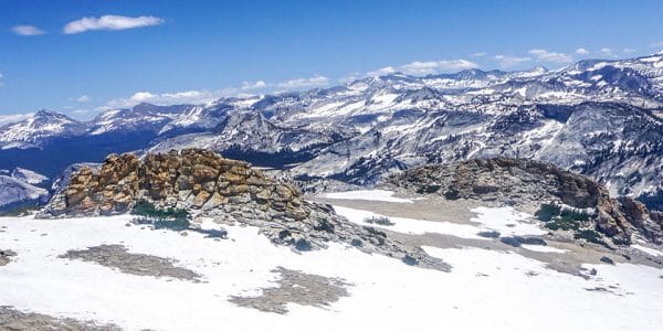
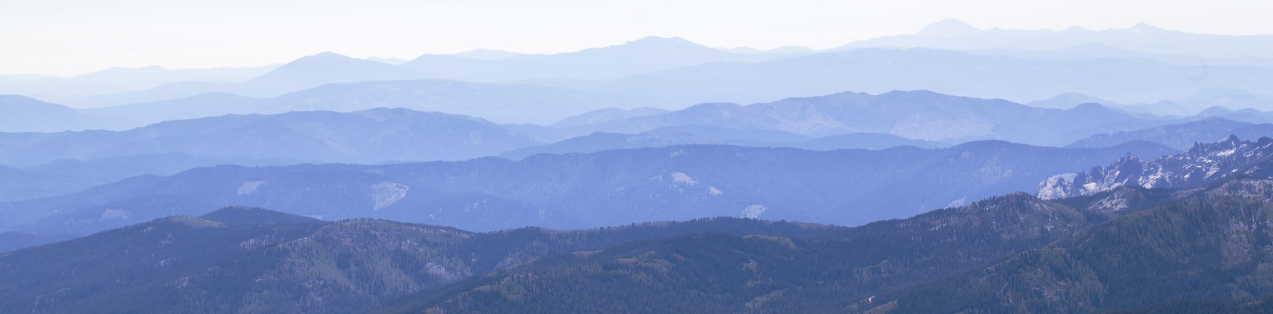
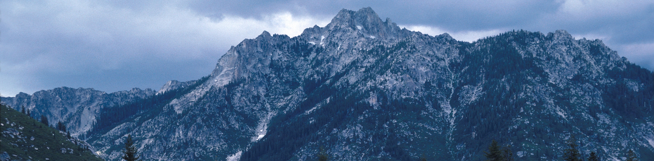
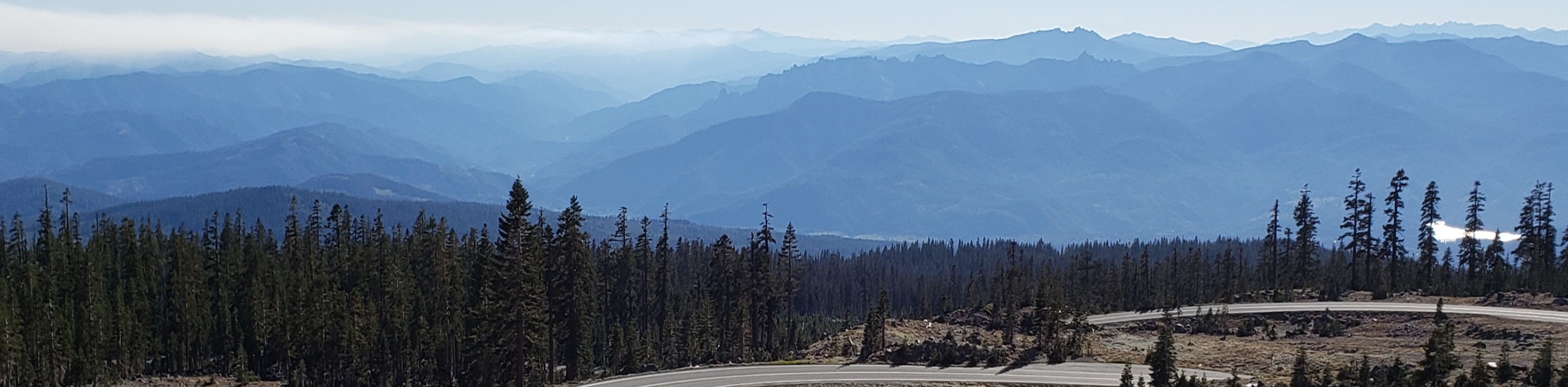
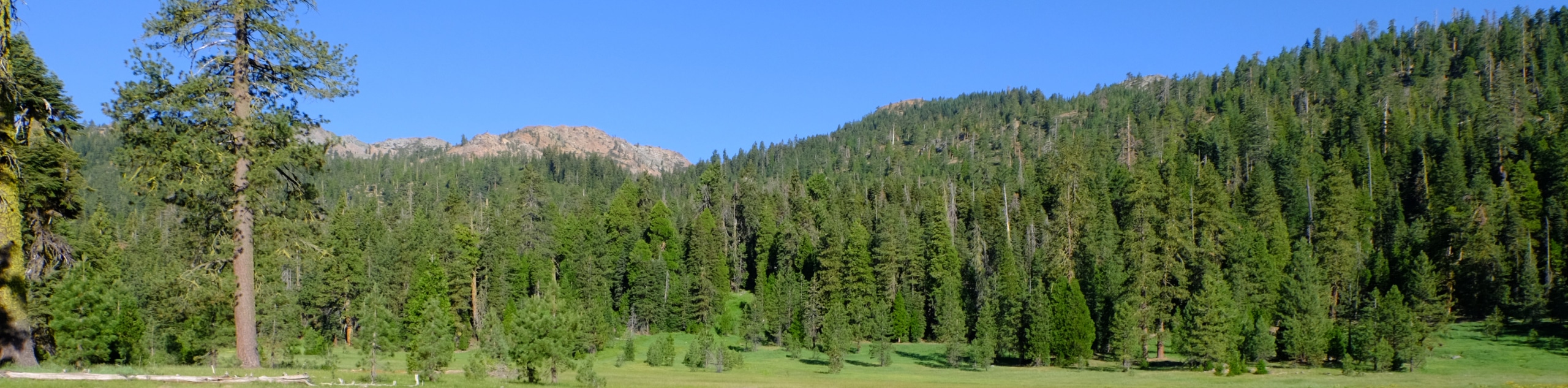
A landscape characterized by the sky-scraping crests of the Klamath Mountains and the Cascade Range, rolling foothills, subalpine forests, montane meadows, and numerous alpine lakes, the combined National Forest boasts epic hiking possibilities. This wonderful natural sanctuary is relatively undiscovered in Northern California compared to Yosemite and Lake Tahoe. Enjoy the tranquility as you explore the landscape ranging from 1000ft to over 14100ft of elevation, exhibiting the diversity of the area’s native flora and fauna.
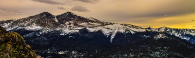
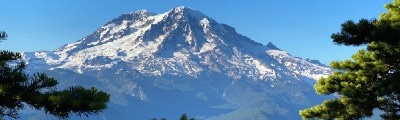
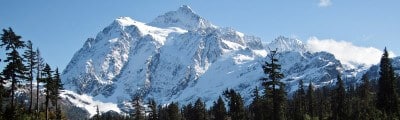
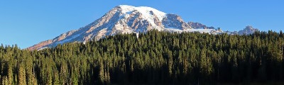
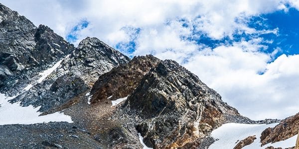
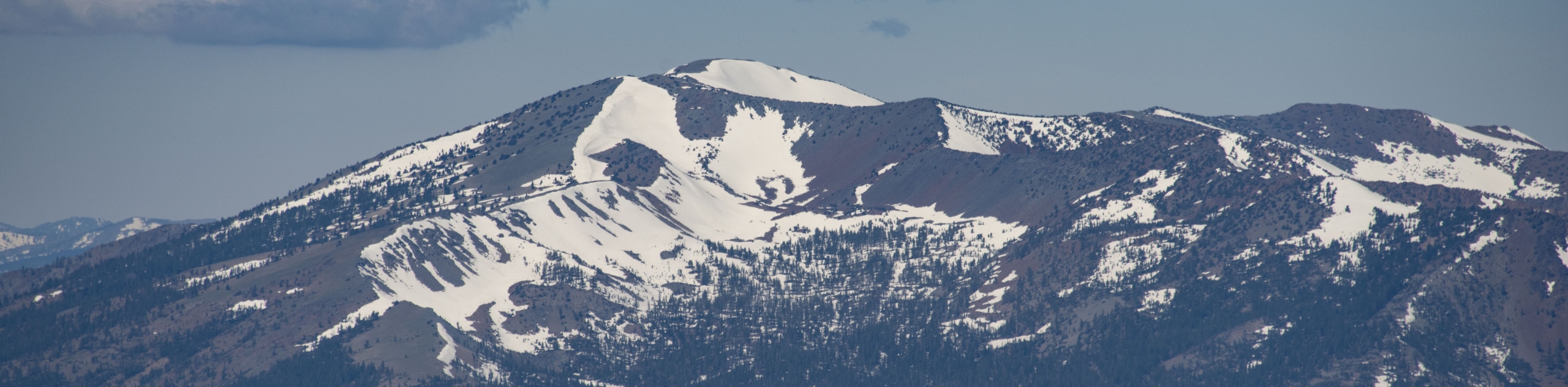
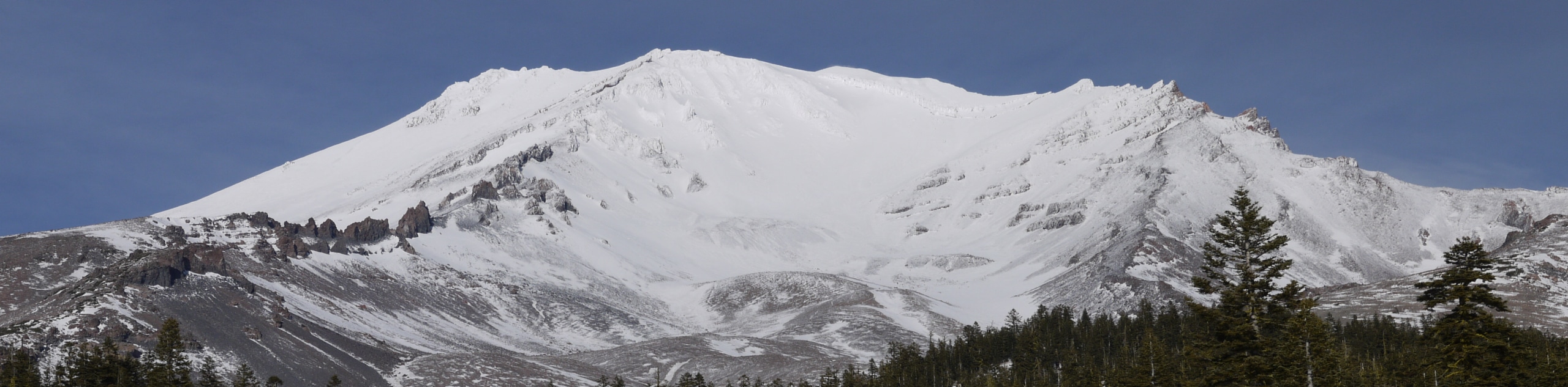
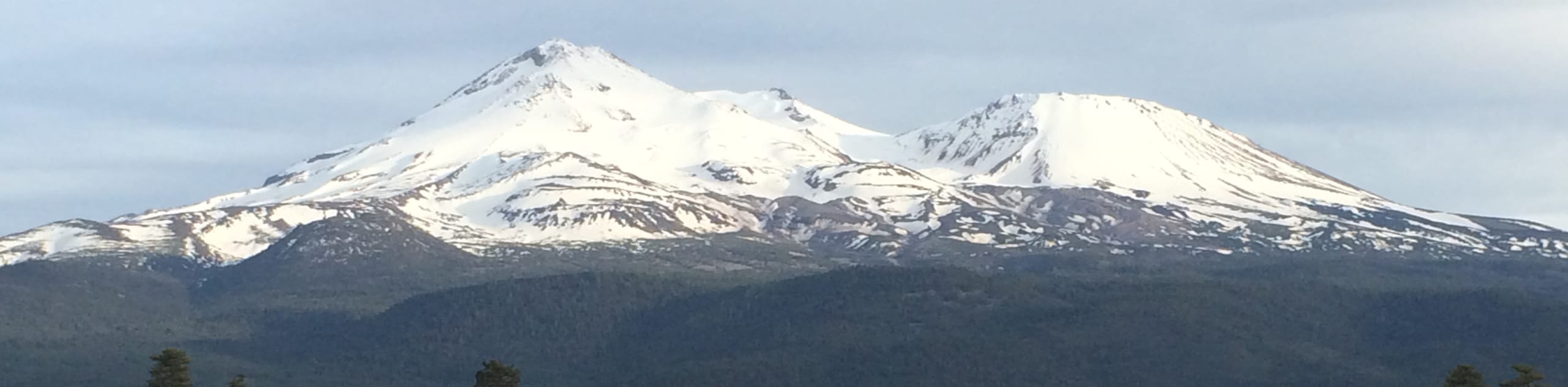
Offering family-friendly nature walks and technical summit treks, the Shasta-Trinity National Forest caters to almost all adventurers. Intrepid spirits flock to the trophy and namesake of one of the wilderness areas—Mount Shasta, a potentially active volcano that stands at 15180ft, boasting a challenging backpacking expedition. Families and novice hikers can also enjoy the grandeur of the second-highest peak in the Cascade Range from the Lake Siskiyou Trail or one of the several other subalpine trails. Boasting a trek for outdoor enthusiasts of all skill levels, ages, and preferences, the Shasta-Trinity National Forest is a hiker’s haven awaiting your exploration.
The 12 Greatest Hiking Routes in the Shasta-Trinity National Forest
The topographic diversity and beauty of the Shasta-Trinity National Forest is unparalleled. Whether you are seeking an easy-going adventure to a waterfall or a technical ascent to the summit of a Trinity Alp, this wilderness area delivers. As self-proclaimed adventure experts, we took it upon ourselves to curate a list of the 12 best hiking routes in the combined National Forest; enjoy!
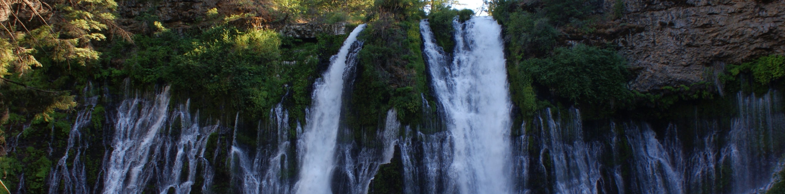
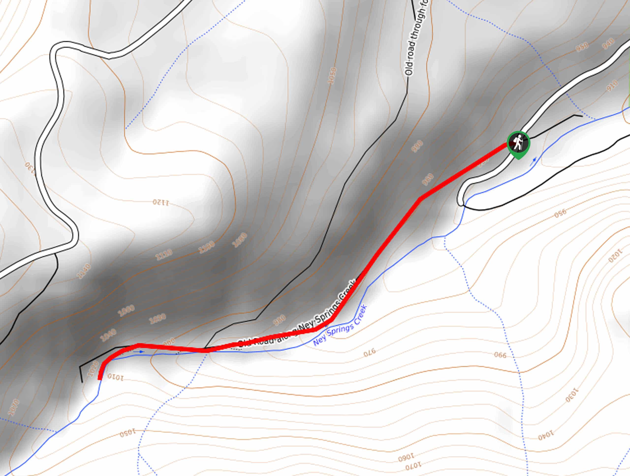
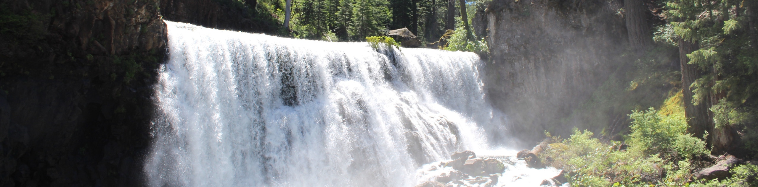
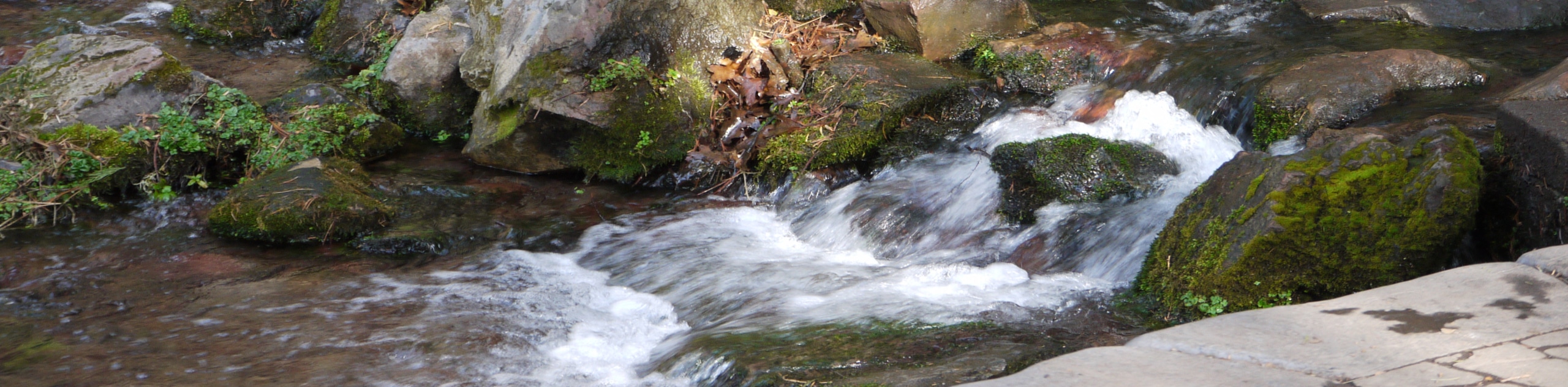
- Burney Falls Loop - The Burney Falls Loop is a family-friendly adventure to a picturesque waterfall flowing over 129ft from the snowmelt of encompassing mountains and through underground springs of porous volcanic rocks. This easy-going hike is a must-add to your itinerary.
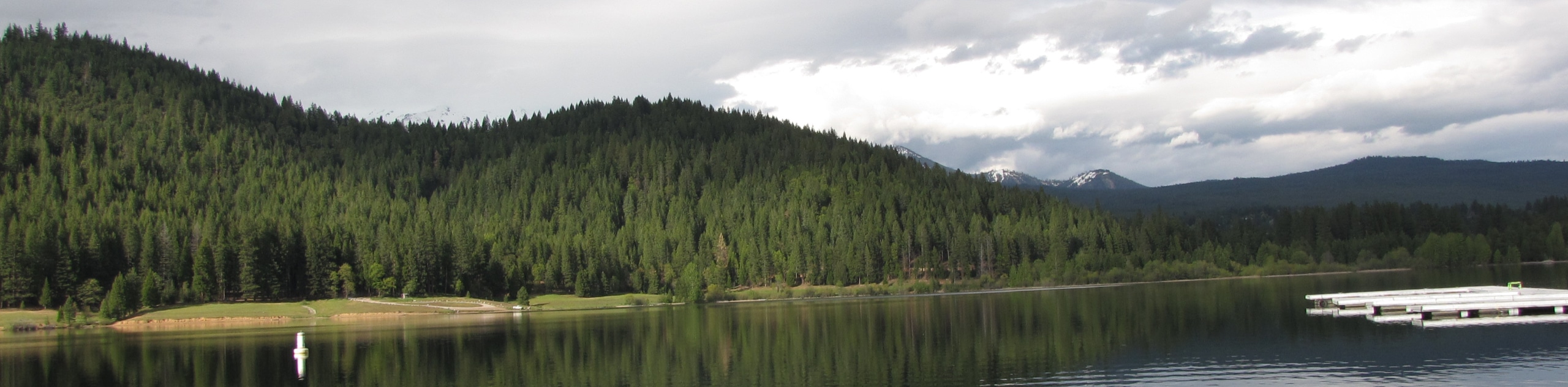
- Lake Siskiyou Trail - Indulge in the commanding views of Mount Shasta dominating the skyline along the Lake Siskiyou Trail. This charming lakeside adventure can be enjoyed by hikers of all skill levels and ages.
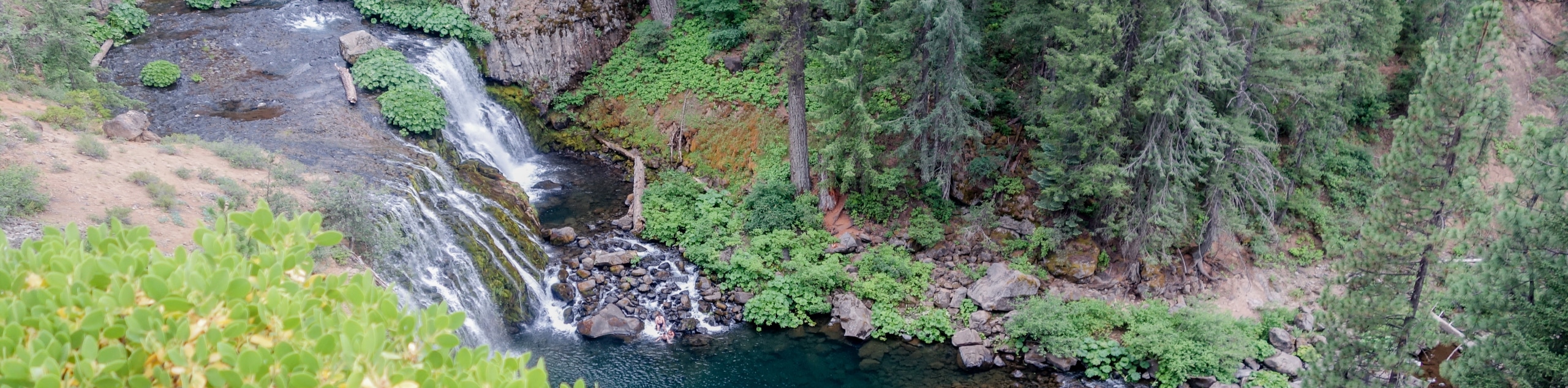
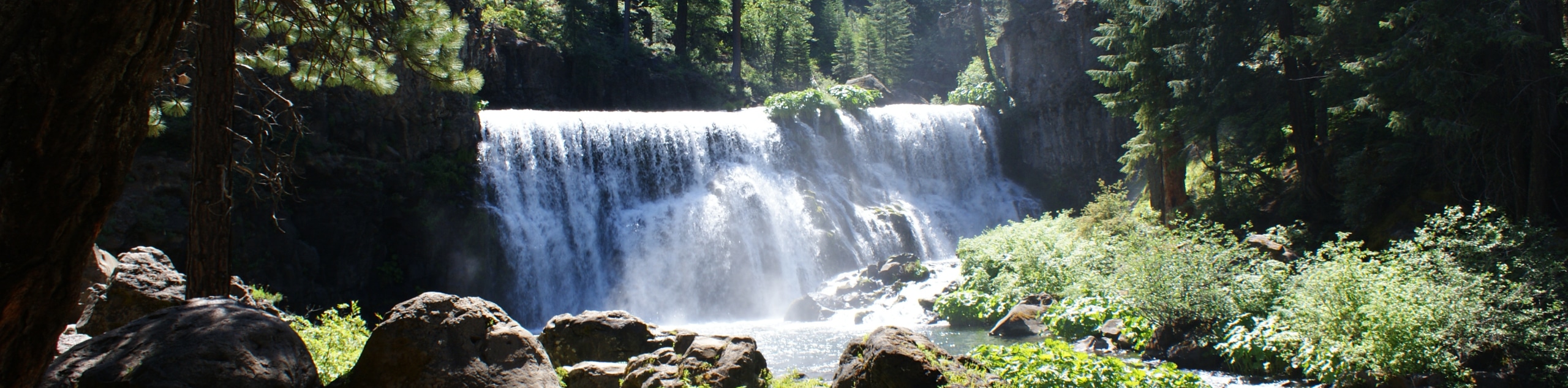
- McCloud Falls Trail - There is nothing better than a waterfall hike, and the McCloud Falls Trail exceeds all expectations—offering a collection of three picturesque cascades. In the summer months, hikers can cool off in the slow-moving pool along the McCloud River.
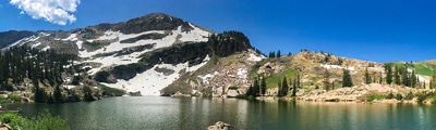
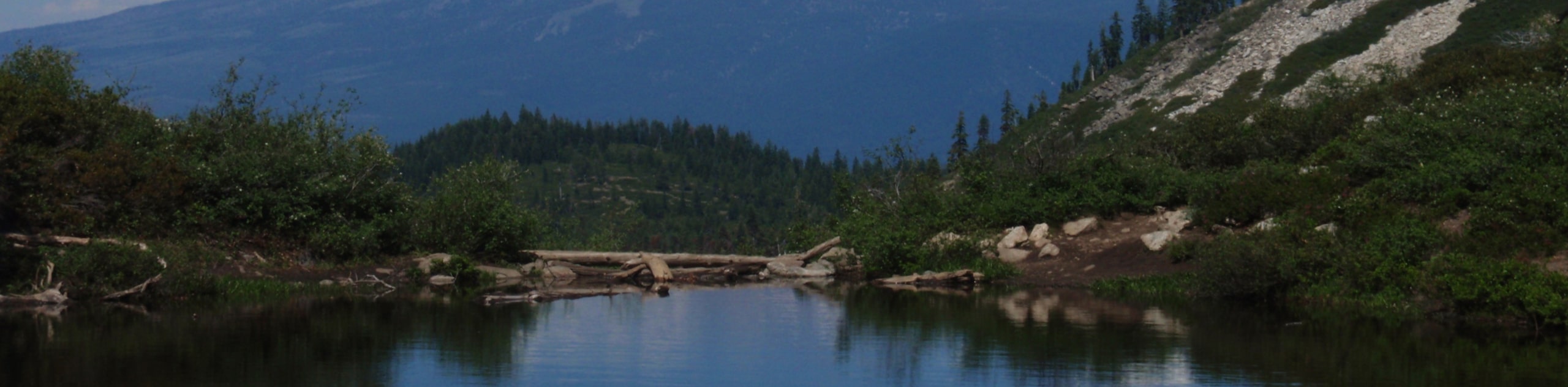
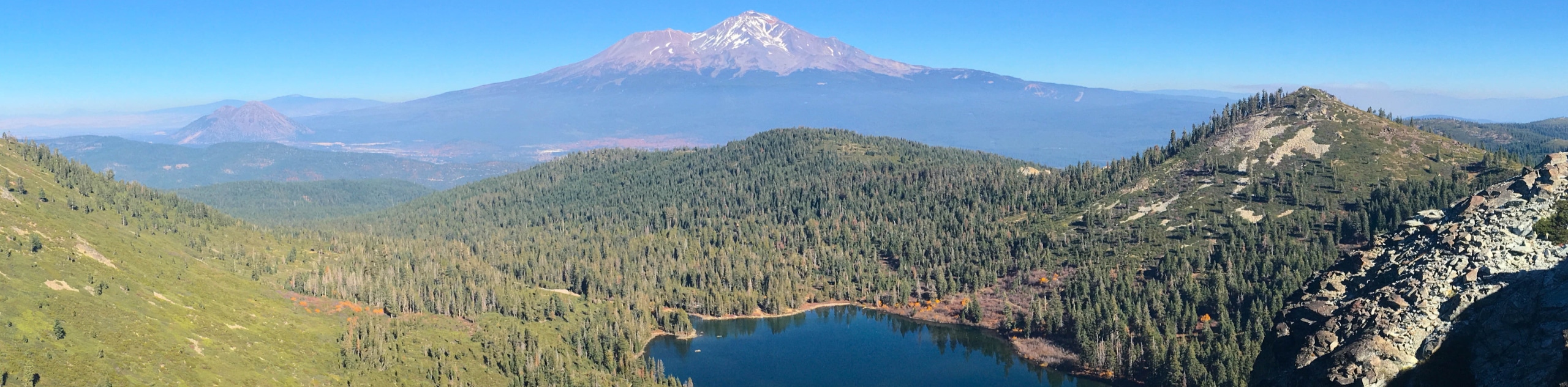
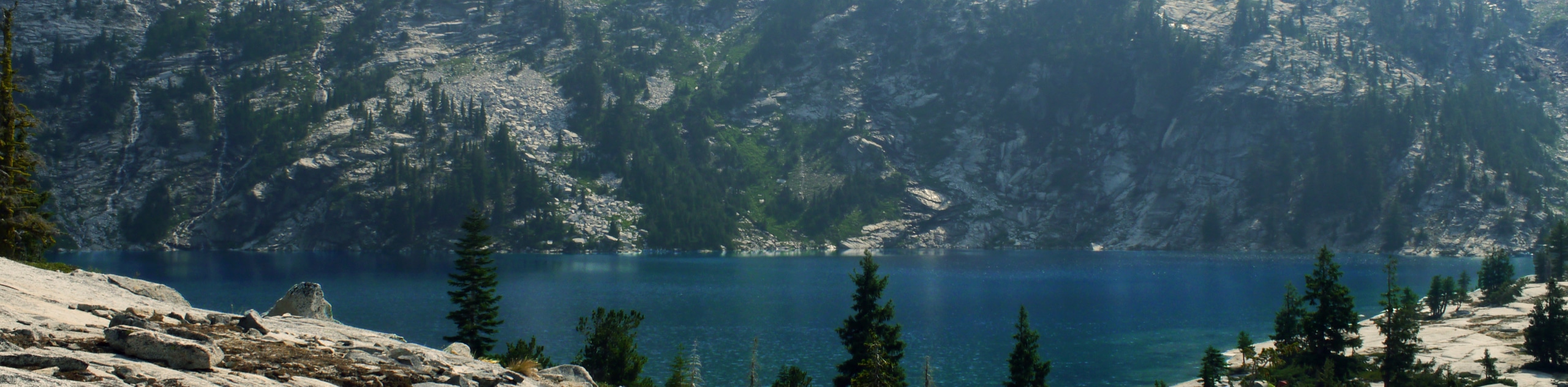
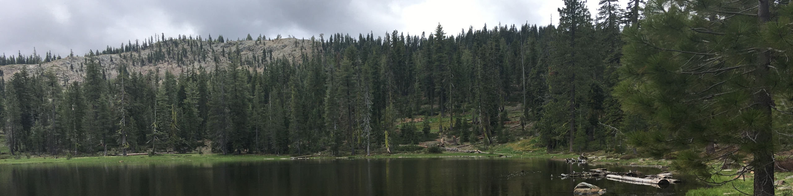
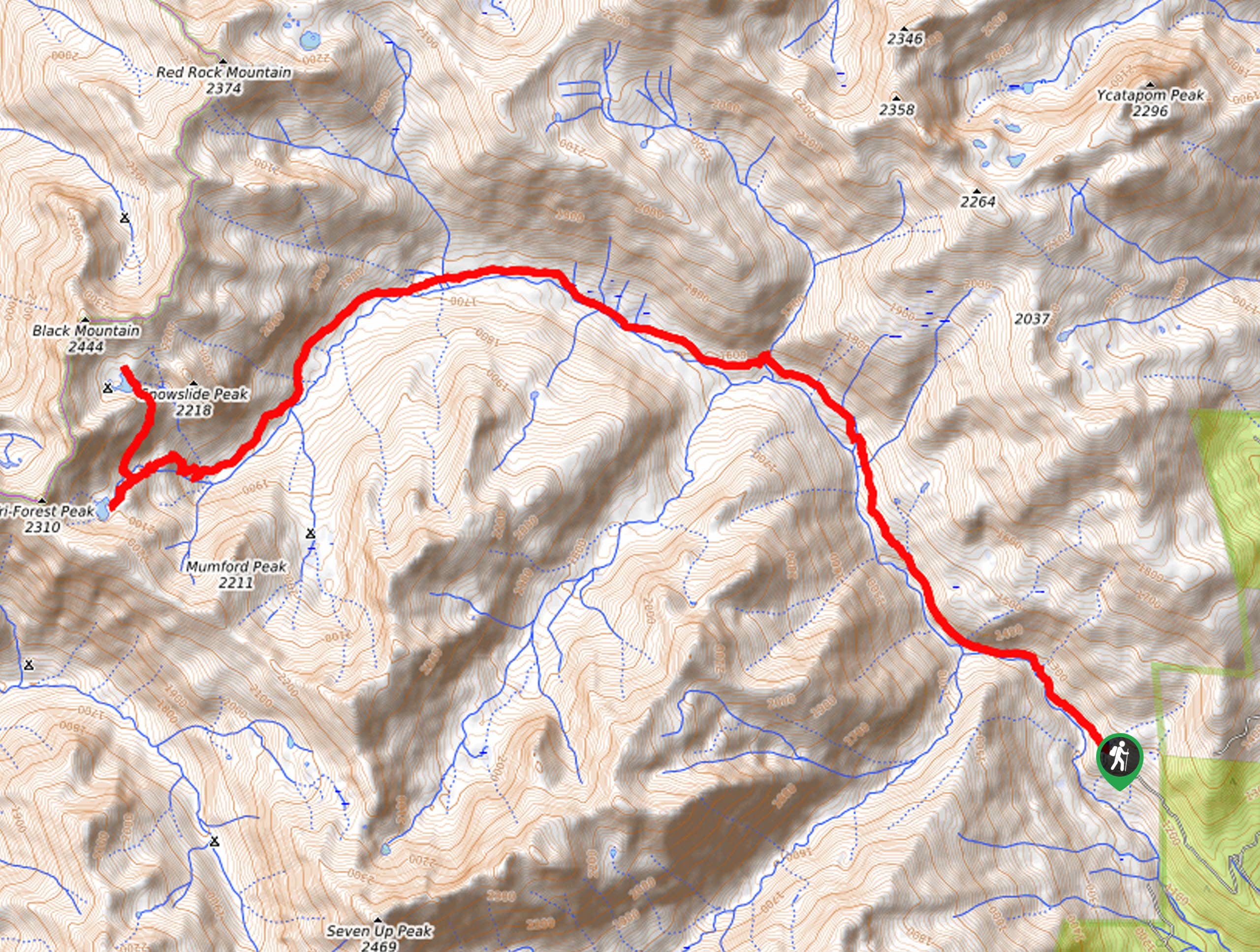
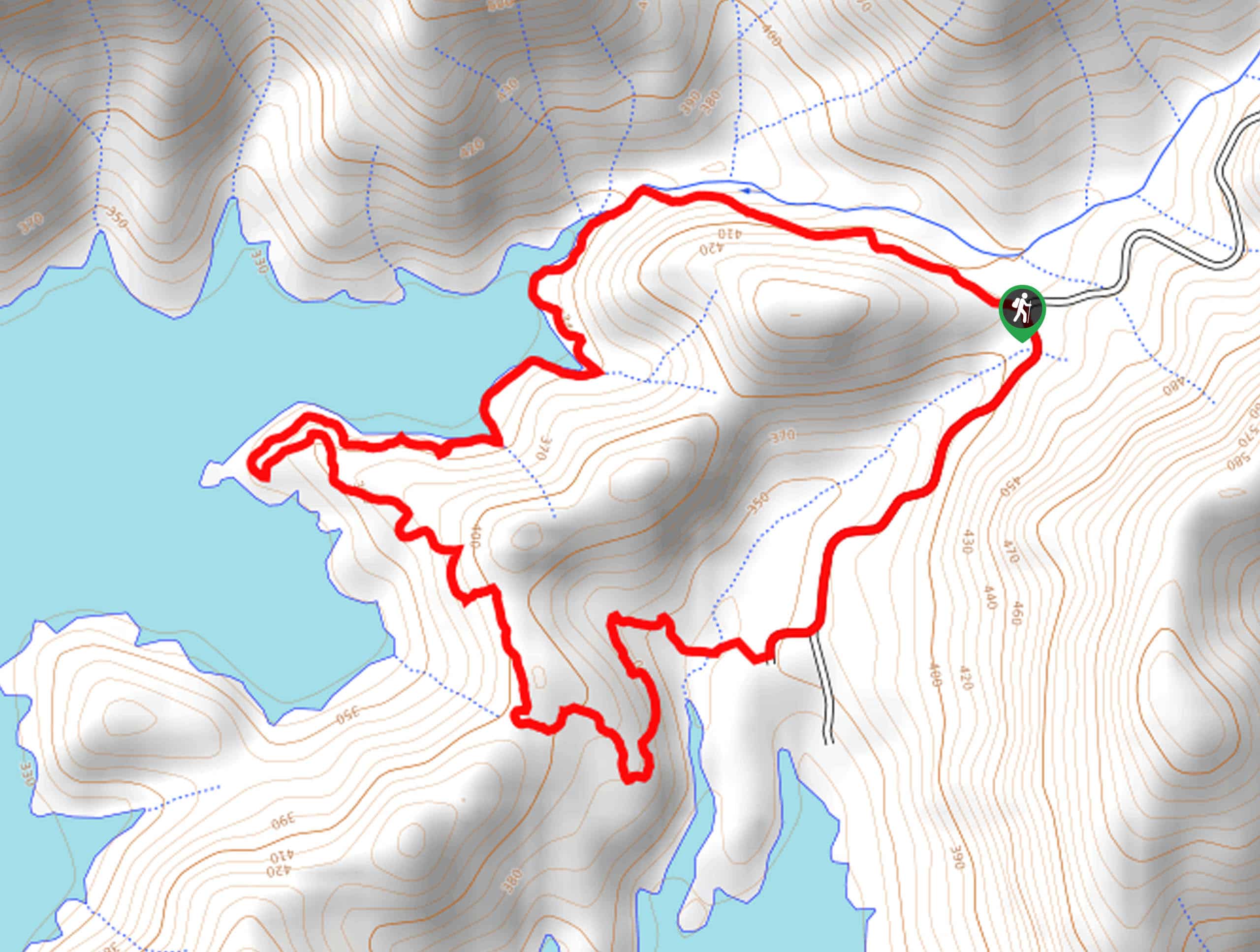
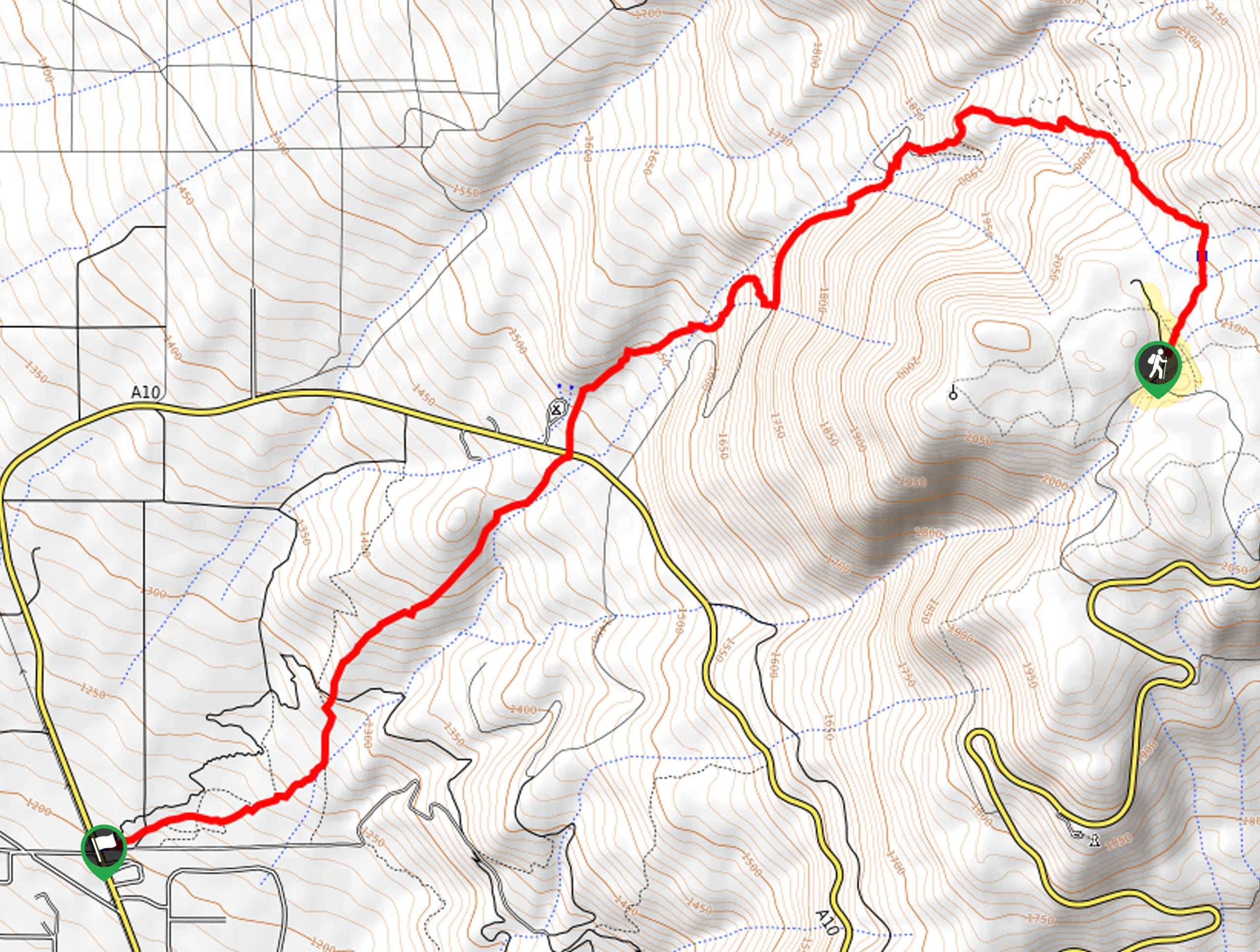
- Heart Lake Trail - Explore the high country and marvel in panoramic views of the Klamath Mountains along the Heart Lake Trail. This wonderful adventure climbs up the granite cliffs of Castle Lake before reaching the small, heart-shaped alpine pool.
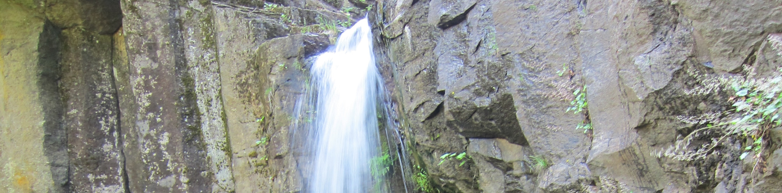
- Potem Falls Trail - The Potem Falls Trail is a short but scenic trek to a charming cascade in the National Forest. Offering a wonderful swimming hole, intrepid adventurers can swing into the refreshing waters via a rope swing. This hike beckons adventurers seeking an escape from the Californian summer heat.
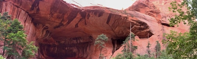
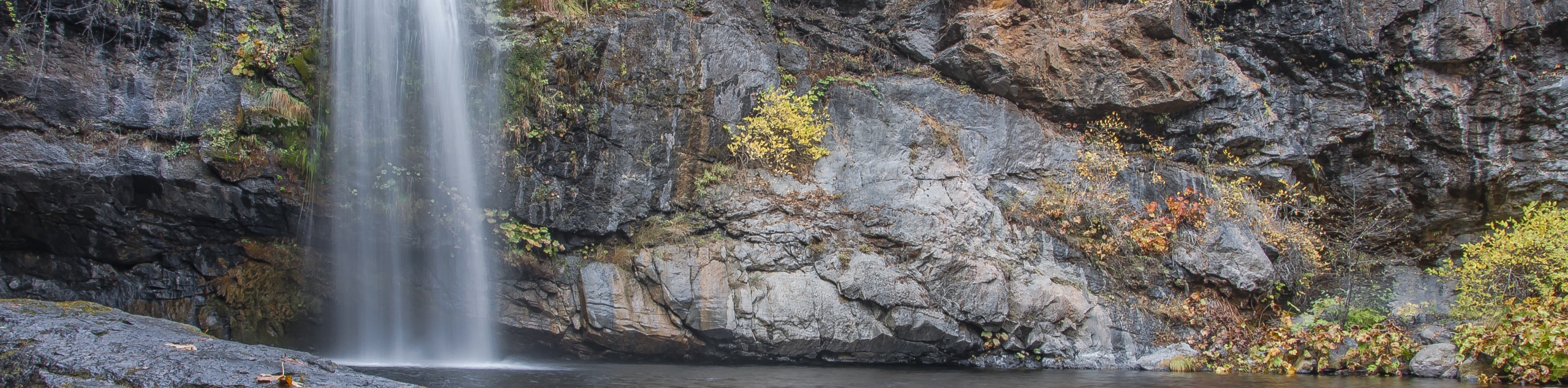
- Hedge Creek Falls Trail - Another waterfall adventure? Of course! The Hedge Creek Falls Trail is a unique excursion that travels to a charming veil that surges over an overhang. Explore the cave behind the cascades then hike down to the Sacramento River and indulge in views of Mount Shasta.
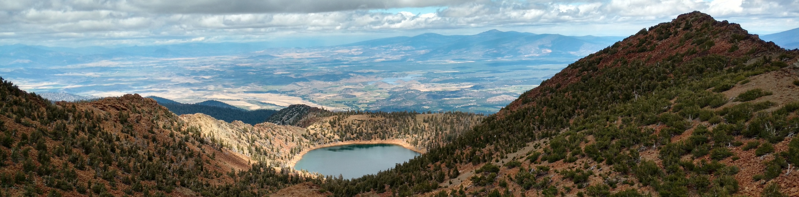
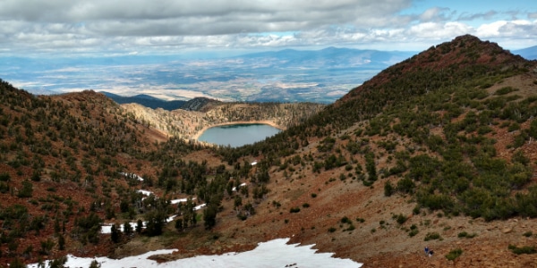
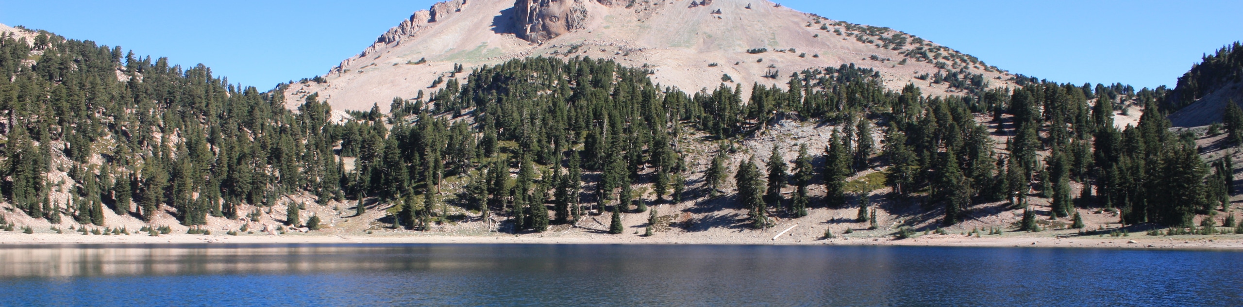
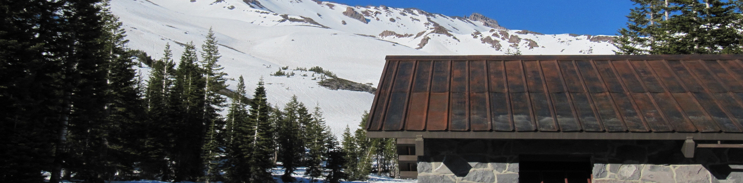
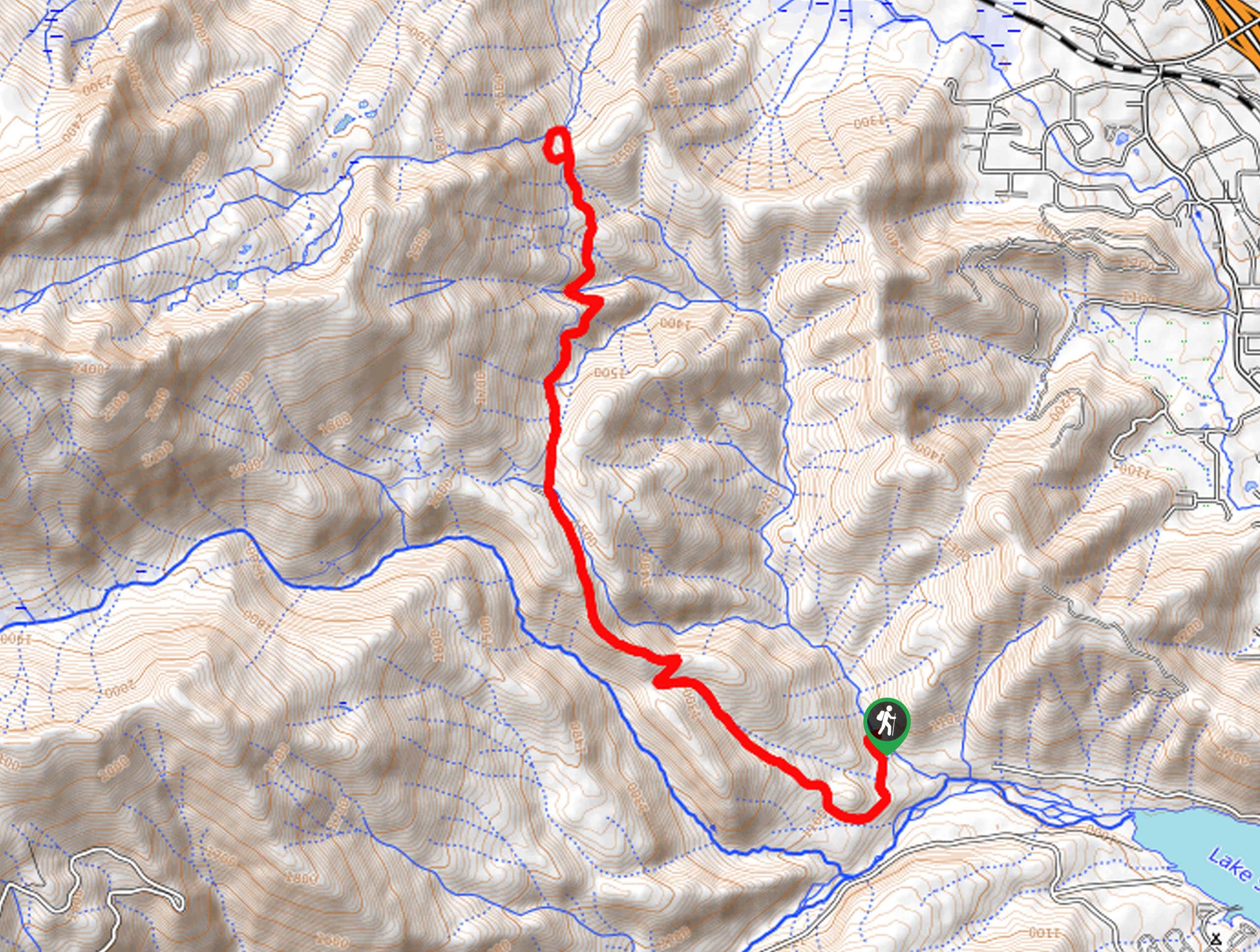
- Lake Helen Hike - The Lake Helen Hike is a demanding adventure up the southwestern slope of the famous Mount Shasta. Intrepid adventurers can climb halfway up the potentially active volcano to an often bare glacial lake and high camp.
- Pluto’s Cave Trail - Explore a lava tunnel along the skirts of Mount Shasta along Pluto’s Cave Trail. This epic expedition into the cavern is sure to impress with its 50ft tall ceilings and skylights that illuminate the cave.
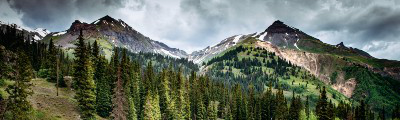
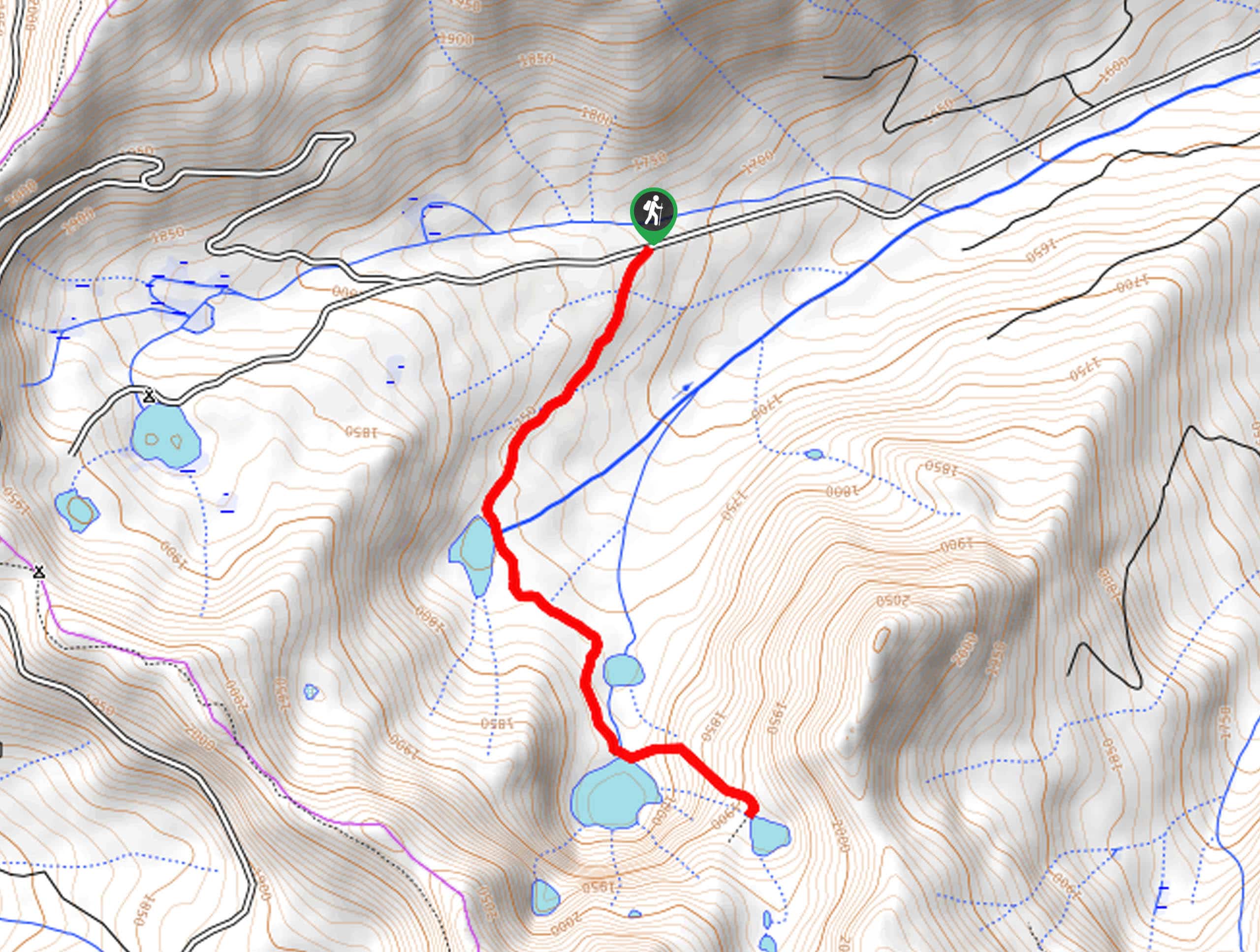
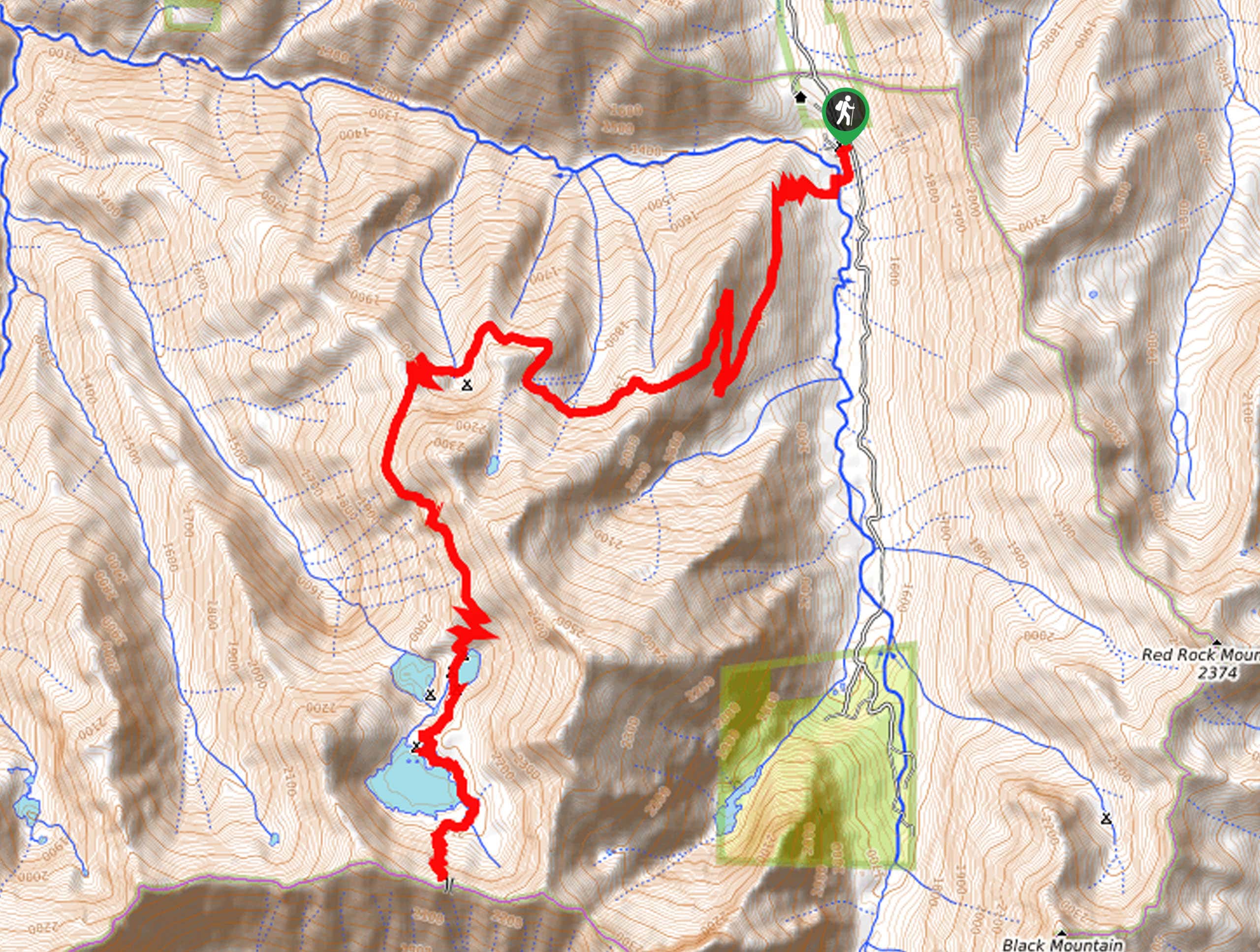
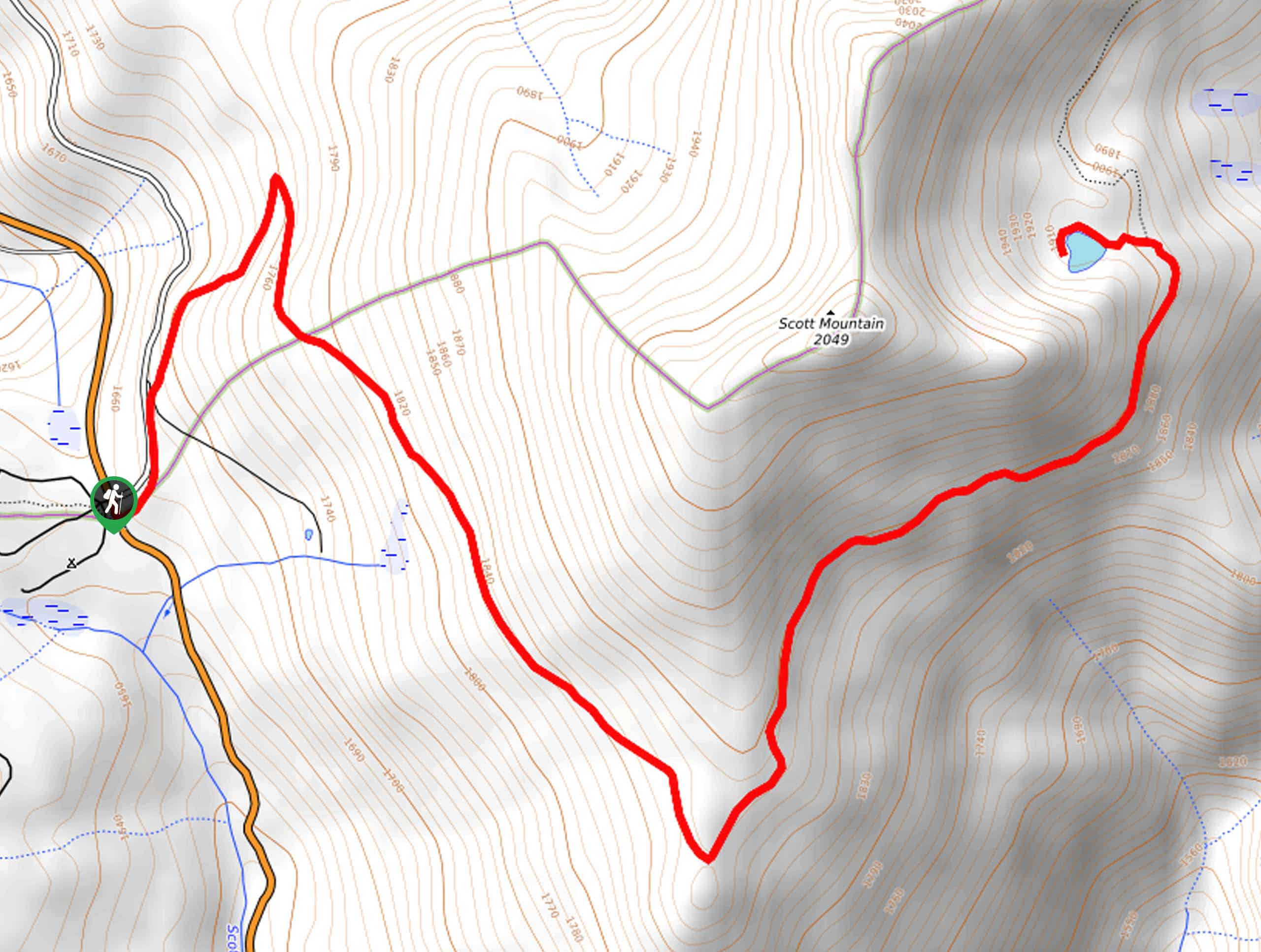
- Landers Lake Loop - Put your endurance to the test and indulge in the topographic diversity of the area along the Landers Lake Loop. This awesome adventure culminates at a crystalline alpine bounded by the Trinity Alps—boasting a postcard-perfect scene.
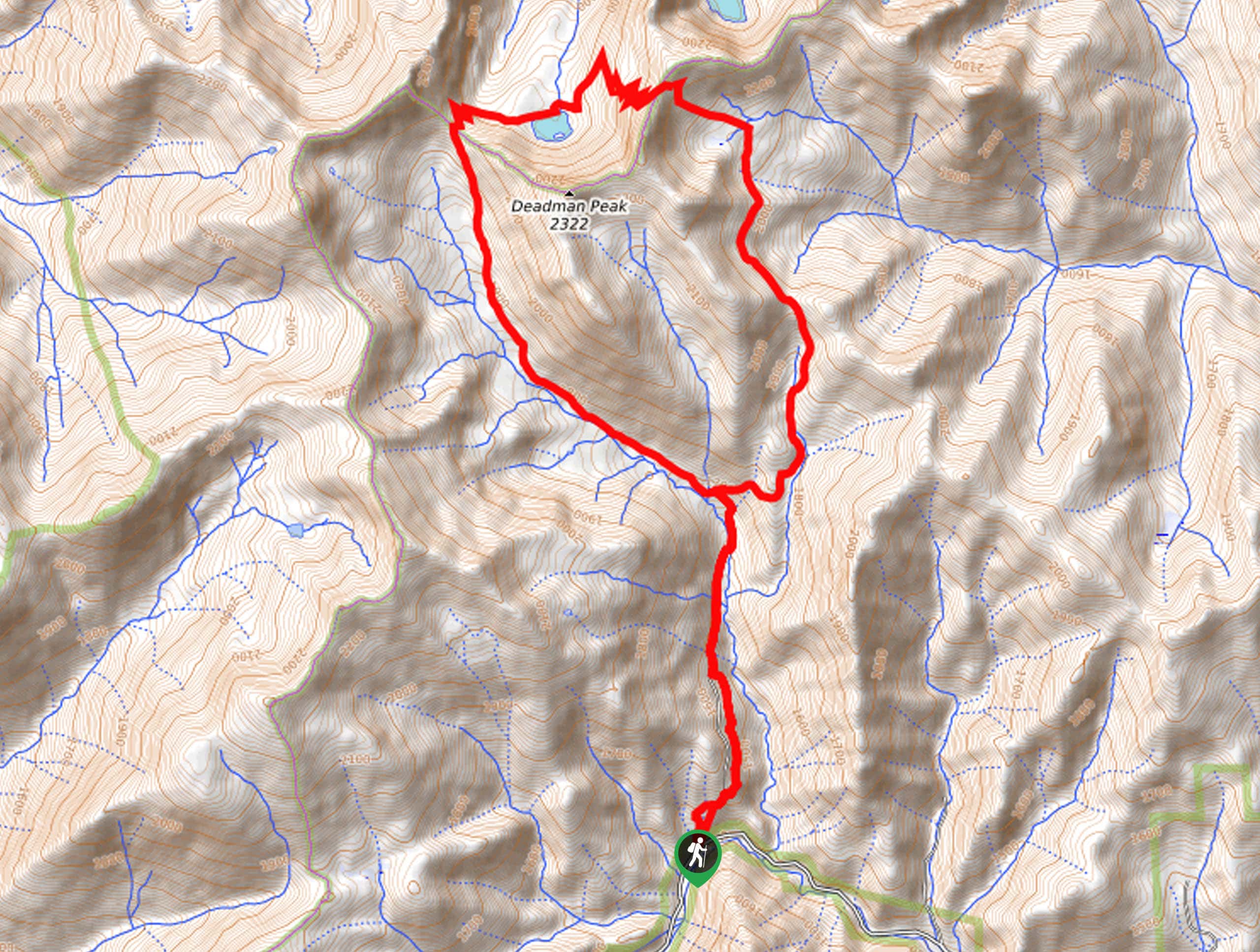
- Mount Eddy via Deadfall Lakes Trail - Immerse yourself in the alpine terrain along Mount Eddy via Deadfall Lakes Trail. Explore alpine pools before summiting Mount Eddy, which offers panoramic vistas of the Klamath Mountains and commanding views of Mount Shasta.
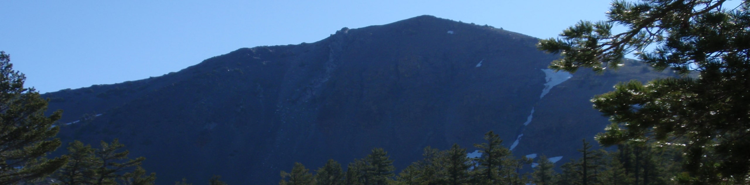
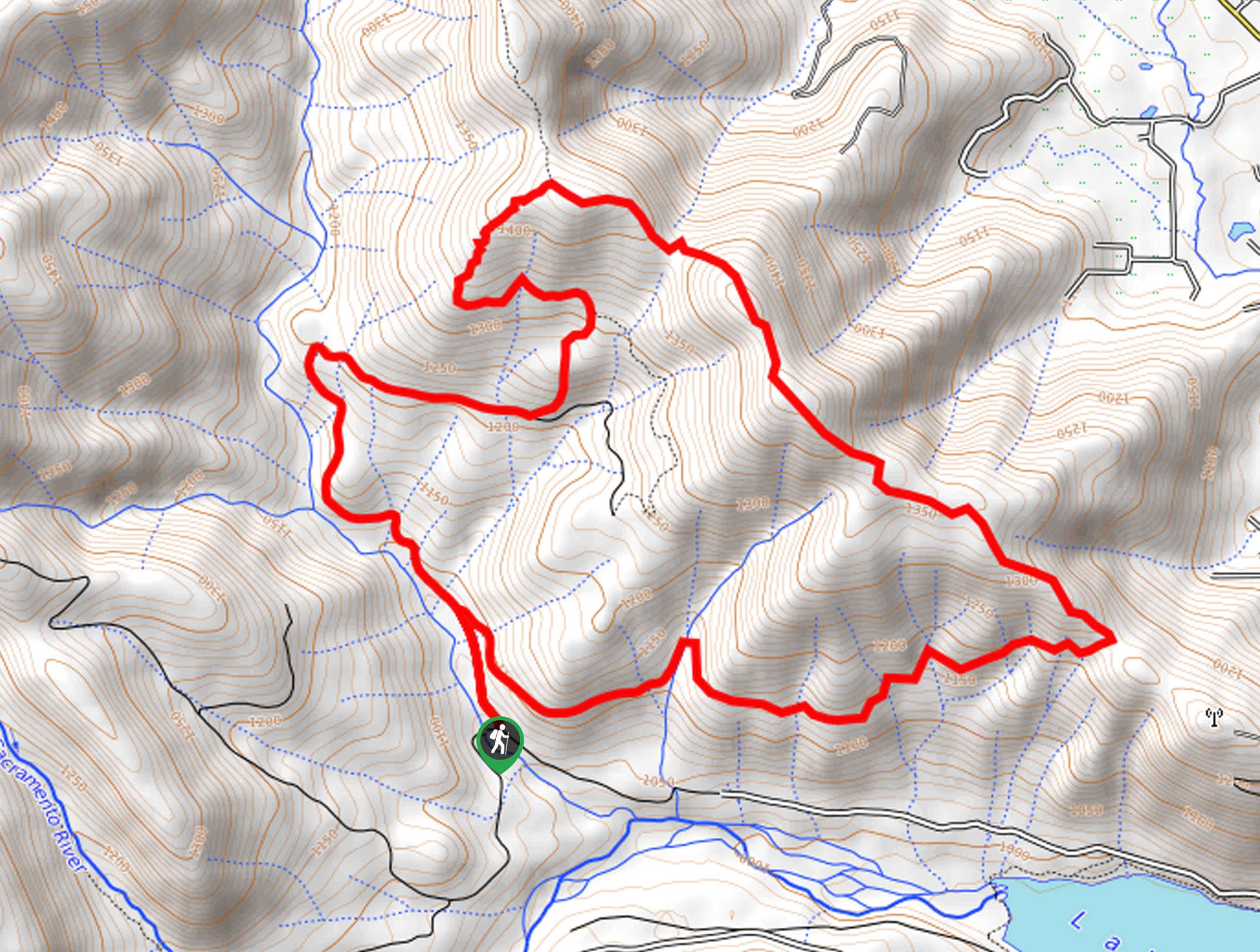
- Black Butte Trail - Reserved for experienced hikers, the Black Butte Trail is a demanding adventure that reveals wonderful panoramas of Mount Shasta from the summit. Note the terrain is incredibly rocky, so wear a pair of ankle bracing footwear—you'll thank us later.
- Kangaroo Lake Trail - With a name like that, how could it not be fun? The Kangaroo Lake Trail is a fun family hike along the shoreline of a crystalline lake hemmed by craggy granite bluffs. In the summer months, this is a great place to cool off!
When is the Best Time to Visit the Shasta-Trinity National Forest?
The beauty of the Shasta-Trinity National Forest is that it can be explored year-round. Though open and accessible to adventurers all year, we argue the best time to visit the National Forest is from May through September. The summer months are the warmest and driest, boasting wonderful outdoor opportunities, from hiking and biking to abundant water recreation activities. When exploring the high country in the winter months, it is important to be aware of the possibility of avalanches and winter storms—which have proven extremely dangerous. No matter the season, be sure to check the forecast before exploring!
Other Outdoor Activities in the Shasta-Trinity National Forest
The Shasta-Trinity National Forest is awaiting your exploration. Offering an abundance of hiking routes through the five wilderness areas and two National Forests, this area is undoubtedly a hiker’s haven. Explore the diverse topography on foot for the most immersive experience! Adorned with numerous streams, rivers, and alpine lakes, the National Forest offers wonderful water recreation opportunities. Fishing, swimming, paddle boarding, boating, tubing, and water skiing are all popular activities in the summer months.
In addition to hiking and water recreation, the wilderness area is a popular camping and nature viewing destination. Visitors don’t even have to leave the comforts of their cars—though we encourage you to do so— as there are nationally designated scenic byways within the Shasta-Trinity National Forest! When exploring in the winter months, cross country skiing, snowshoeing, backcountry skiing, and snowmobiling opportunities are plentiful. Though the outdoor pursuits are abundant, the unrivaled scenery and grandeur of the combined National Forest are reason enough to visit.
Frequently Asked Questions About the Shasta-Trinity National Forests
Is Shasta Lake in the Shasta-Trinity National Forest?
Yes, Shasta Lake, which is the largest man-made lake in California, is located within the Shasta-Trinity National Forest.
Are there redwoods in the Shasta-Trinity National Forest?
No, there are no redwoods in the Shasta-Trinity National Forest. Redwoods are common to the coastal region of Northern California, specifically in the Redwoods National and State Parks.
Can you camp in the Shasta-Trinity National Forest?
Yes, there are dispersed backcountry camping and designated camping opportunities in the Shasta-Trinity National Forest.
What state is the Shasta-Trinity National Forest in?
The Shasta-Trinity National Forest is located in Northern California.
Is Mount Shasta active?
Mount Shasta is a potentially active volcano in the Shasta-Trinity National Forest.
Awesome Adventure Tours near the Shasta-Trinity National Forest
Unfortunately, we have yet to curate a specific adventure tour for the Shasta-Trinity National Forest. Keep checking back as we are always adding to our repertoire. Until then, we encourage you to check our California adventure tours. If you have a trip in mind, don’t hesitate to contact us! We can customize an adventure for you—giving you exactly what you want.
Find Other Amazing Hiking Regions in California
- Death Valley
- Inyo National Forest
- Joshua Tree National Park
- Lassen
- North Bay
- Yosemite National Park
- Stanislaus National Forest
- Sierra National Forest
- Redwood National and State Parks
- Point Reyes National Seashore
The best hikes in Shasta-Trinity National Forest
01. Burney Falls Loop
Difficulty
The Burney Falls Loop is a great adventure for hikers of all skill levels and… Read More
02. Lake Siskiyou Trail
Difficulty
Indulge yourself with beautiful lakeside views along the Lake Siskiyou Trail. Located at the foot… Read More
03. McCloud Falls Trail
Difficulty
The McCloud Falls Trail offers a collection of three cascades in one quick nature walk.… Read More
04. Heart Lake Trail
Difficulty
The Heart Lake Trail is a picturesque adventure in the Shasta National Forest that intermediate… Read More
05. Castle Lake Trail
Difficulty
The Castle Lake Trail is a picturesque adventure in the Shasta-Trinity National Forest. This revered… Read More
06. Potem Falls Trail
Difficulty
Potem Falls is a hidden gem in the Greater Redding Area that affords anyone a… Read More
07. Hedge Creek Falls Trail
Difficulty
The Hedge Creek Falls Trail boasts wonderful scenery and intriguing geological features. Flowing 35ft Read More
08. Lake Helen Hike
Difficulty
The hike up to Lake Helen is a classic adventure in the Shasta-Trinity National Forests… Read More
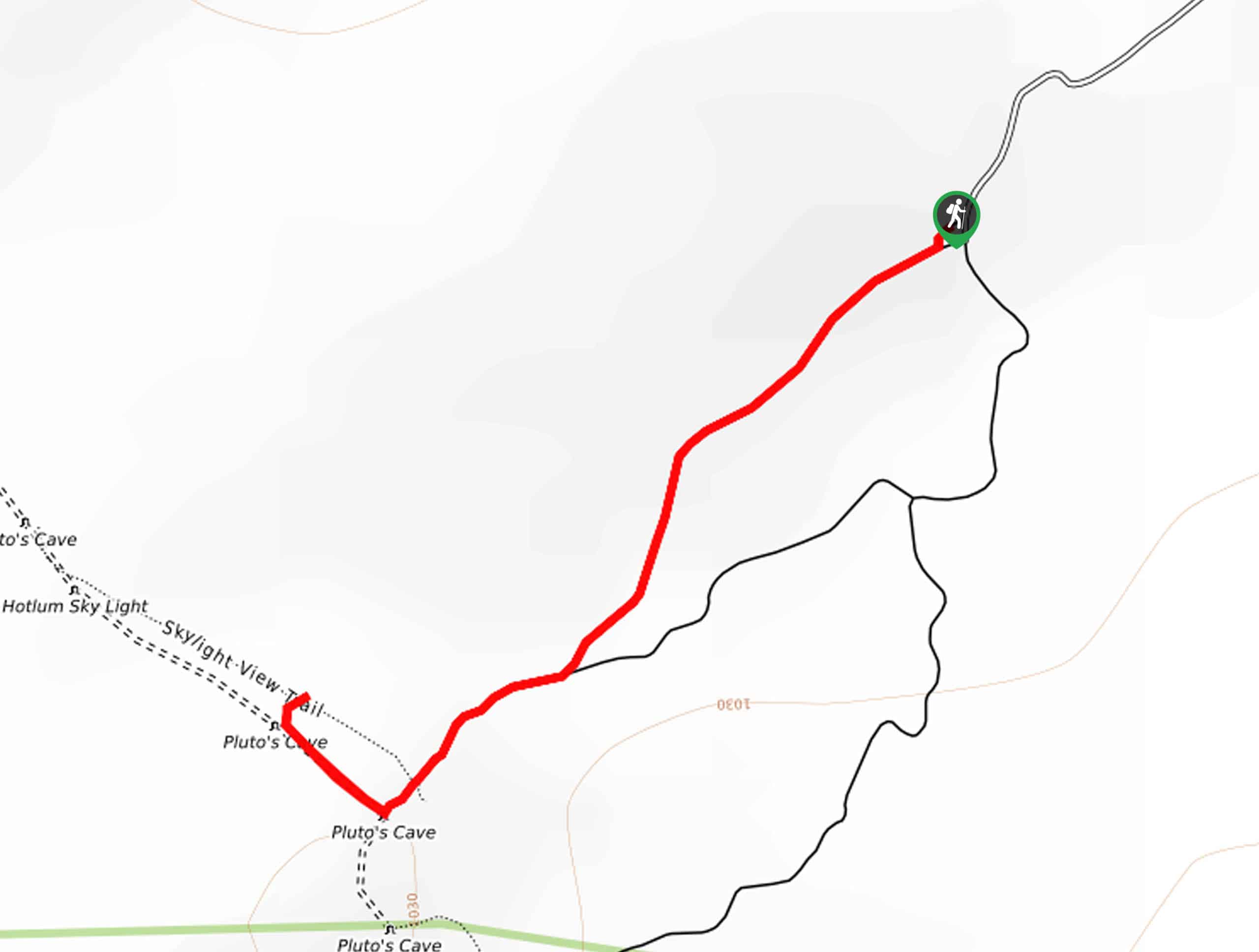
09. Pluto's Cave Trail
Difficulty
Beckoning explorers from all over the state, Pluto’s Cave Trail boasts a unique experience in… Read More
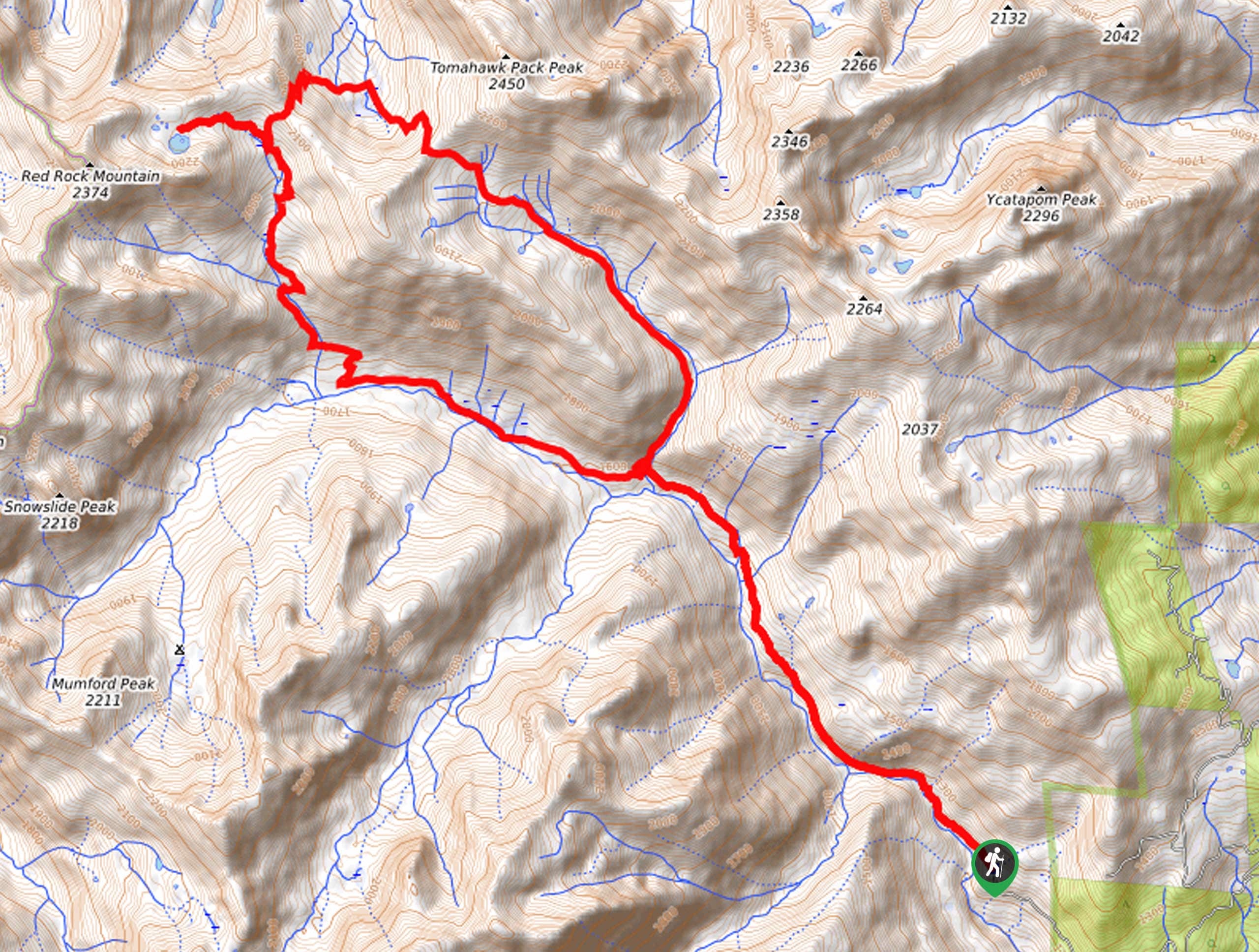
10. Landers Lake Loop
Difficulty
Beckoning intrepid spirits and experienced hikers, the Landers Lake Loop is awaiting your exploration. Wander… Read More
Yes, there are more than 10
Shasta-Trinity National Forest is so beautiful that we can not give you only 10 hikes. So here is a list of bonus hikes in Shasta-Trinity National Forest that you should take a look at as well
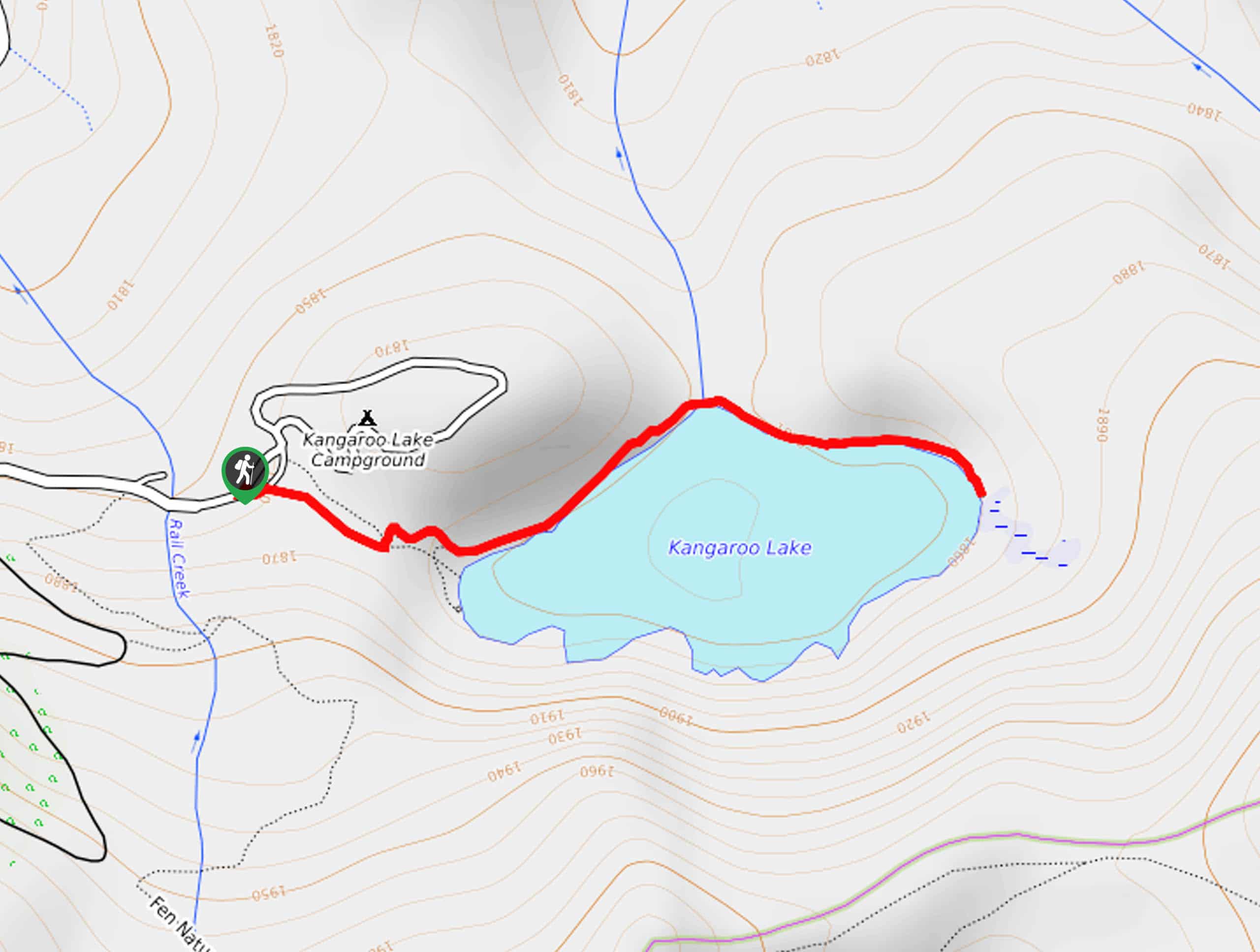
11. Kangaroo Lake Trail
Difficulty
Leading you along the shoreline of a crystalline alpine lake, the Kangaroo Lake Trail boasts… Read More
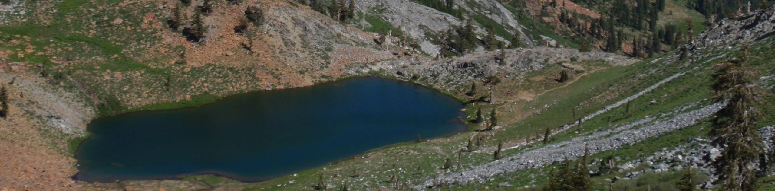
12. Seven Lakes Basin Hike
Difficulty
Immerse yourself in the backcountry along the Seven Lakes Basin Hike. Traveling at high elevations… Read More
13. Faery Falls Trail
Difficulty
The Faery Falls Trail travels along a wide dirt route to a stunning cascade that… Read More
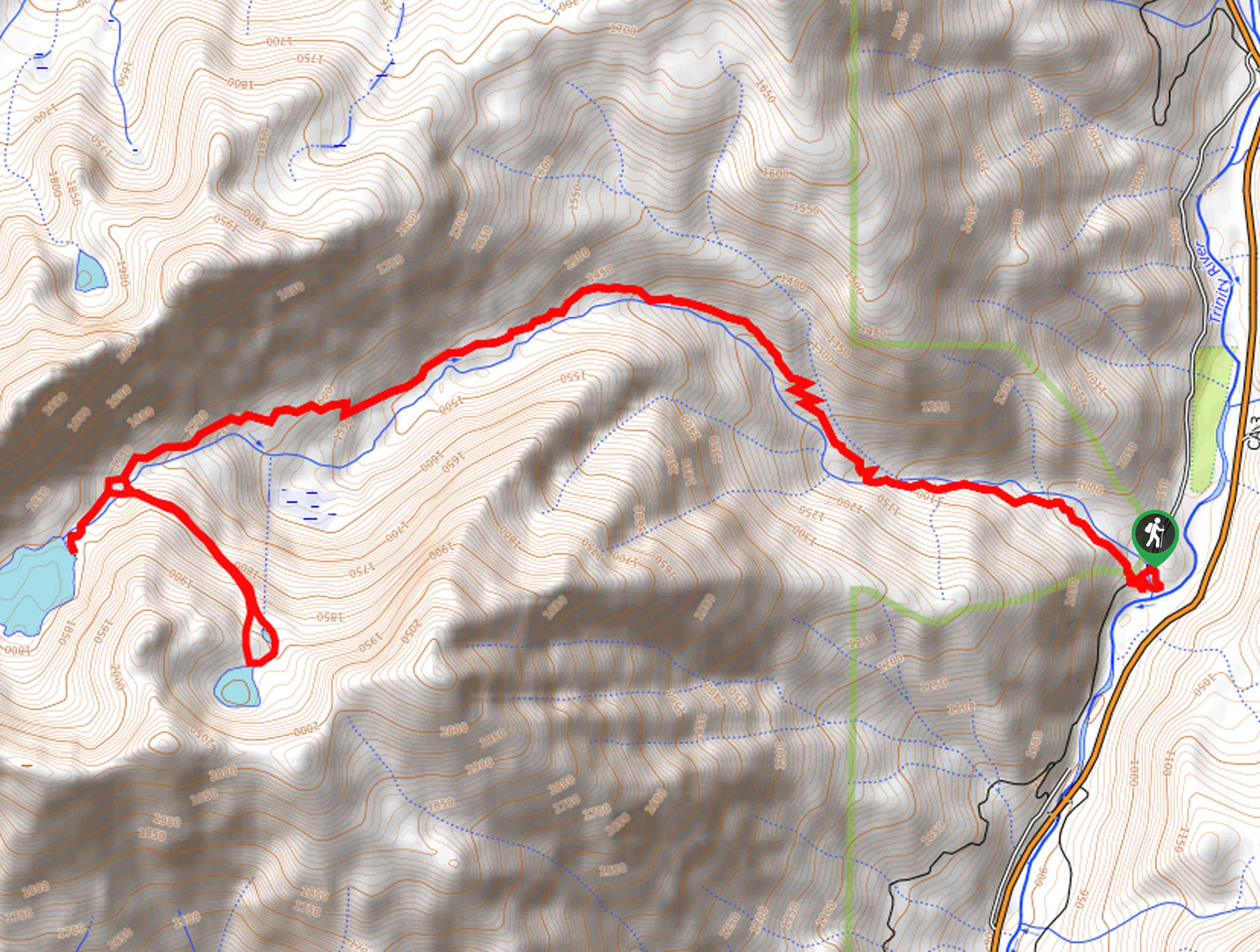
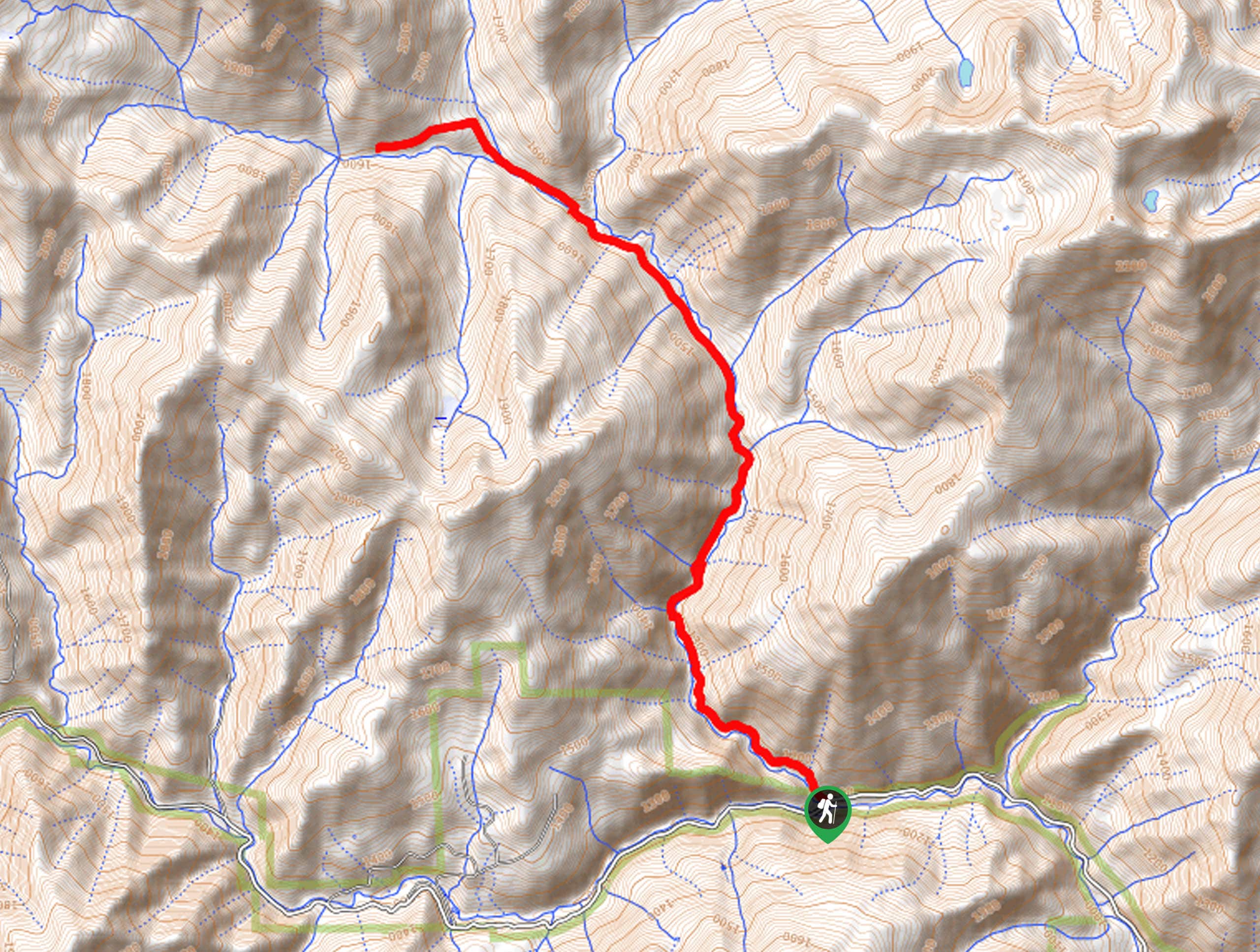
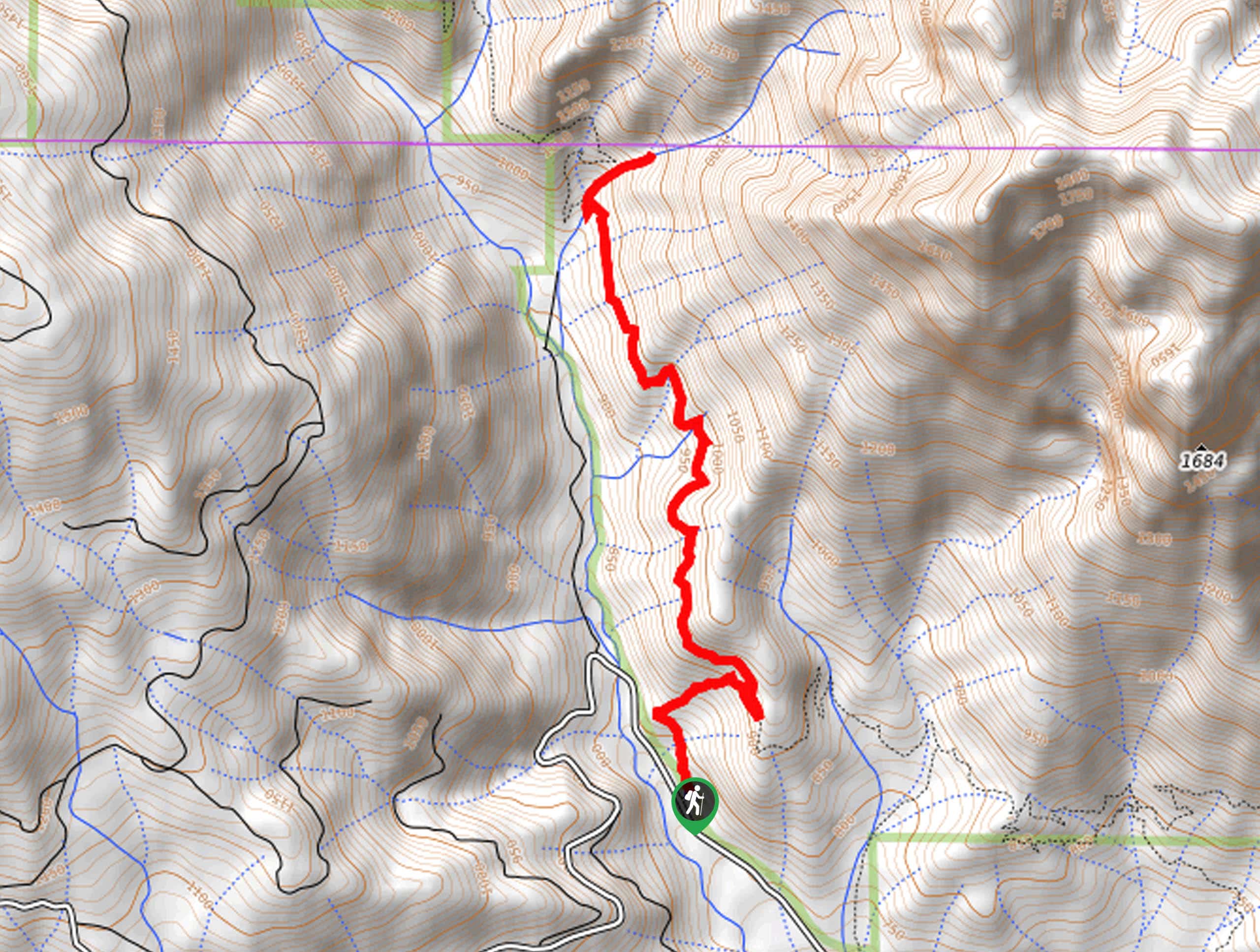
14. Grizzly Lake Hike
Difficulty
Put your stamina to the test along the Grizzly Lake Hike. Explore the Trinity Alps… Read More
15. Mount Eddy via Deadfall Lakes Trail
Difficulty
The Mount Eddy via Deadfall Lakes Trail is no walk in the park, but the… Read More
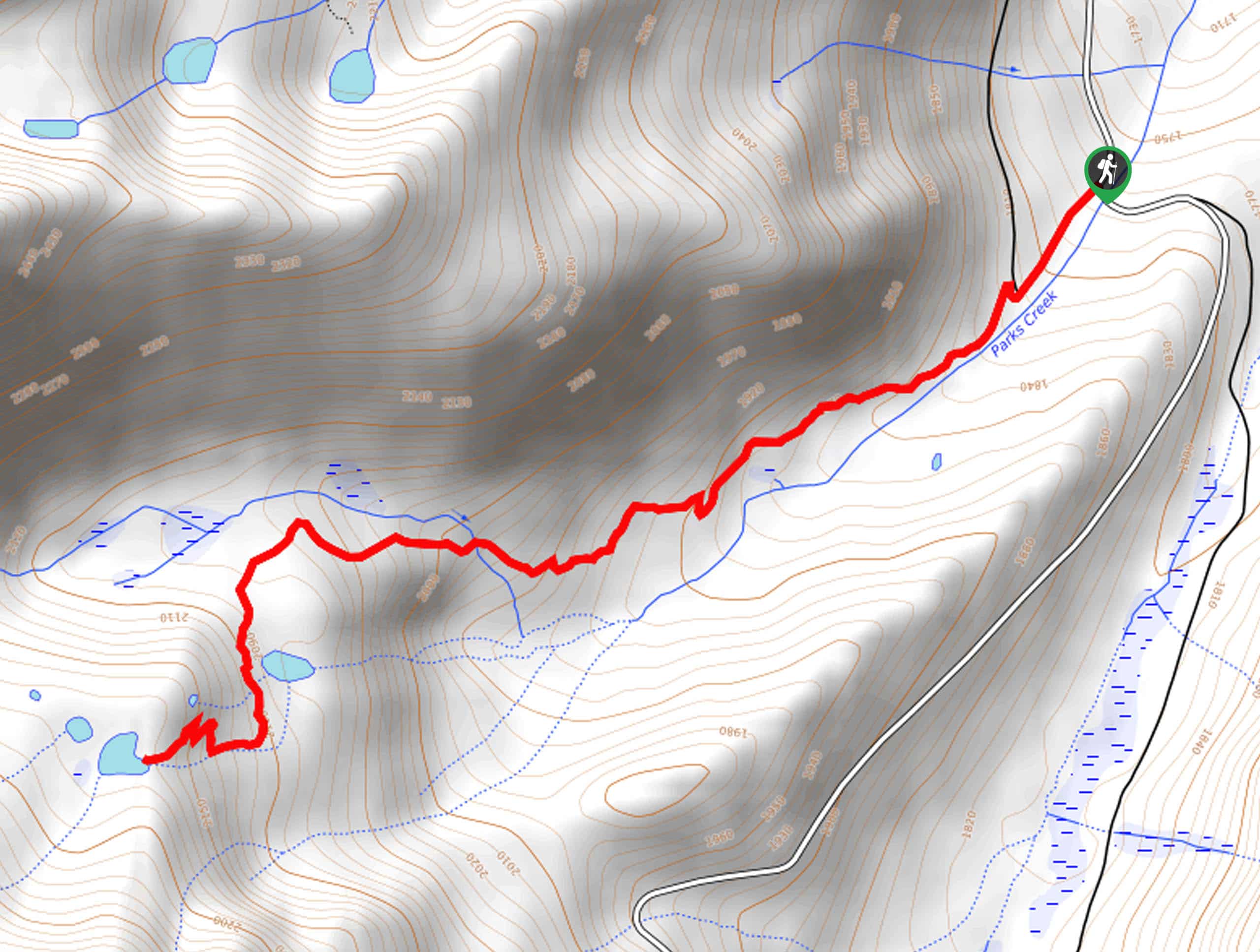
16. Mount Eddy via Parks Creek Hike
Difficulty
The Mount Eddy via Parks Creek Hike is an awesome adventure into the high-country that… Read More
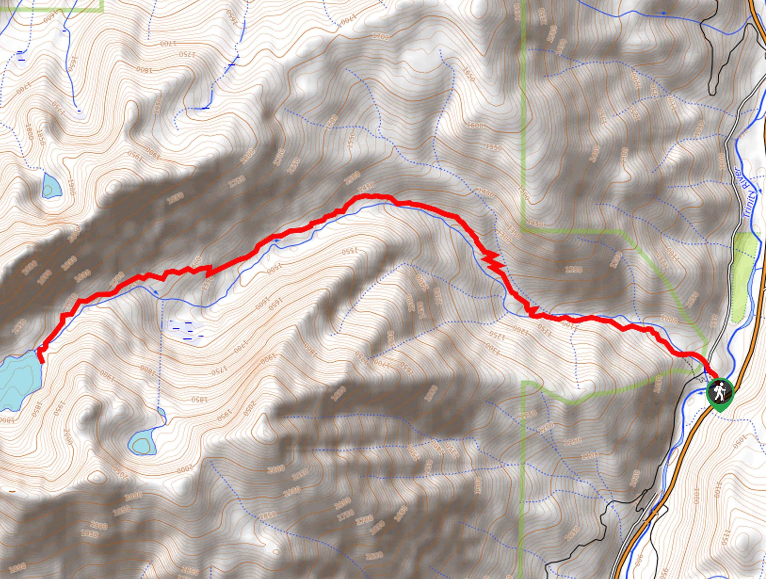
17. Trinity Lakeshore Trail
Difficulty
The Trinity Lakeshore Trail offers incredible views of the shimmering lake and the majestic mountains… Read More
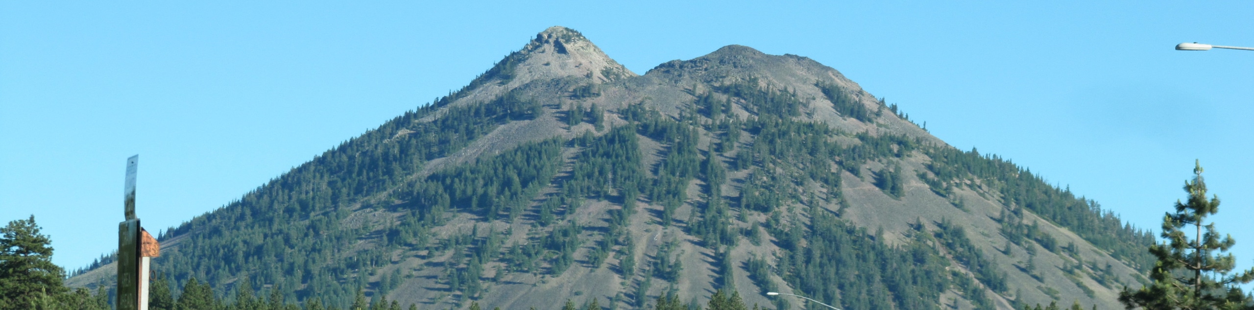
18. Black Butte Trail
Difficulty
Though demanding, the Black Butte Trail is an amazing adventure in the Shasta National Forest.… Read More
19. McCloud Middle Falls Hike
Difficulty
The McCloud Middle Falls Hike is a wonderful adventure in the Shasta National Forest that… Read More
20. Panther Meadows Trail
Difficulty
The Panther Meadows Trail is a scenic adventure through an alpine meadow abundant with vibrant… Read More
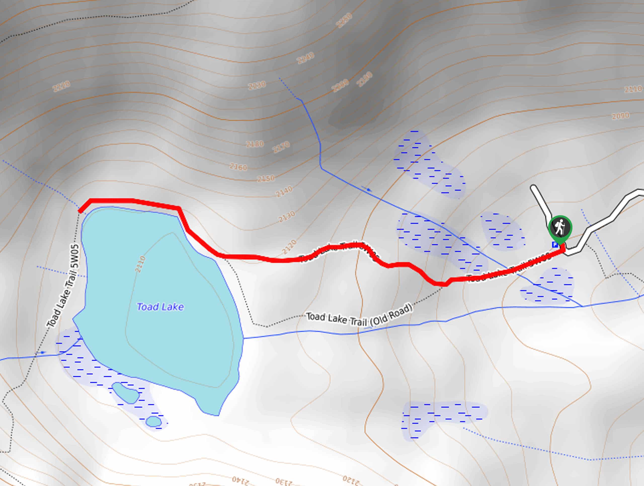
21. Toad Lake Trail
Difficulty
Leading hikers through meadows and tree stands to a charming alpine lake, the Toad Lake… Read More
22. Mount Shasta City Park Loop
Difficulty
Reconnect with nature and stretch your legs along the Mount Shasta City Park Loop. This… Read More
23. Bear Lakes Hike
Difficulty
The Bear Lakes Hike is a demanding adventure through the high-country that offers a diversity… Read More
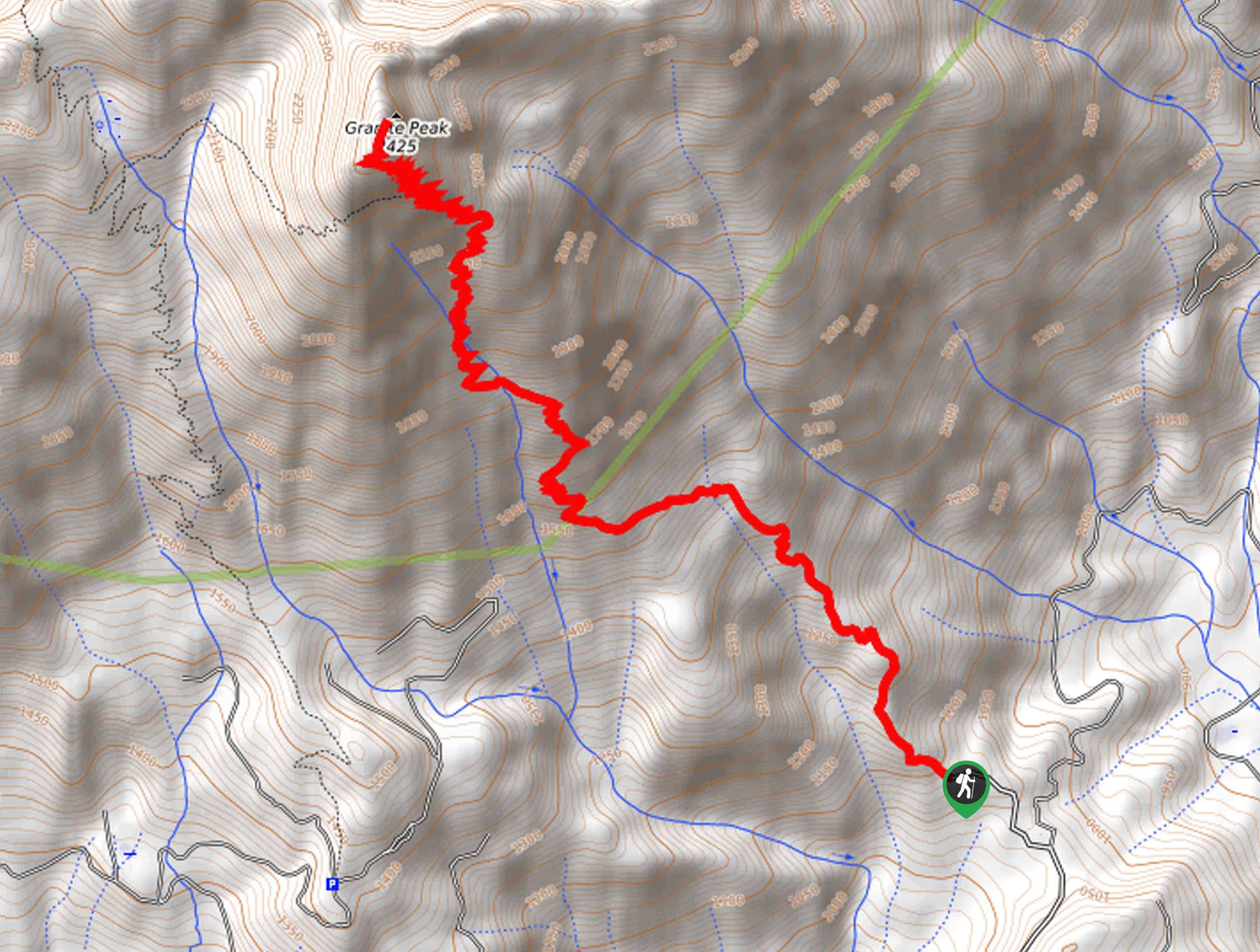
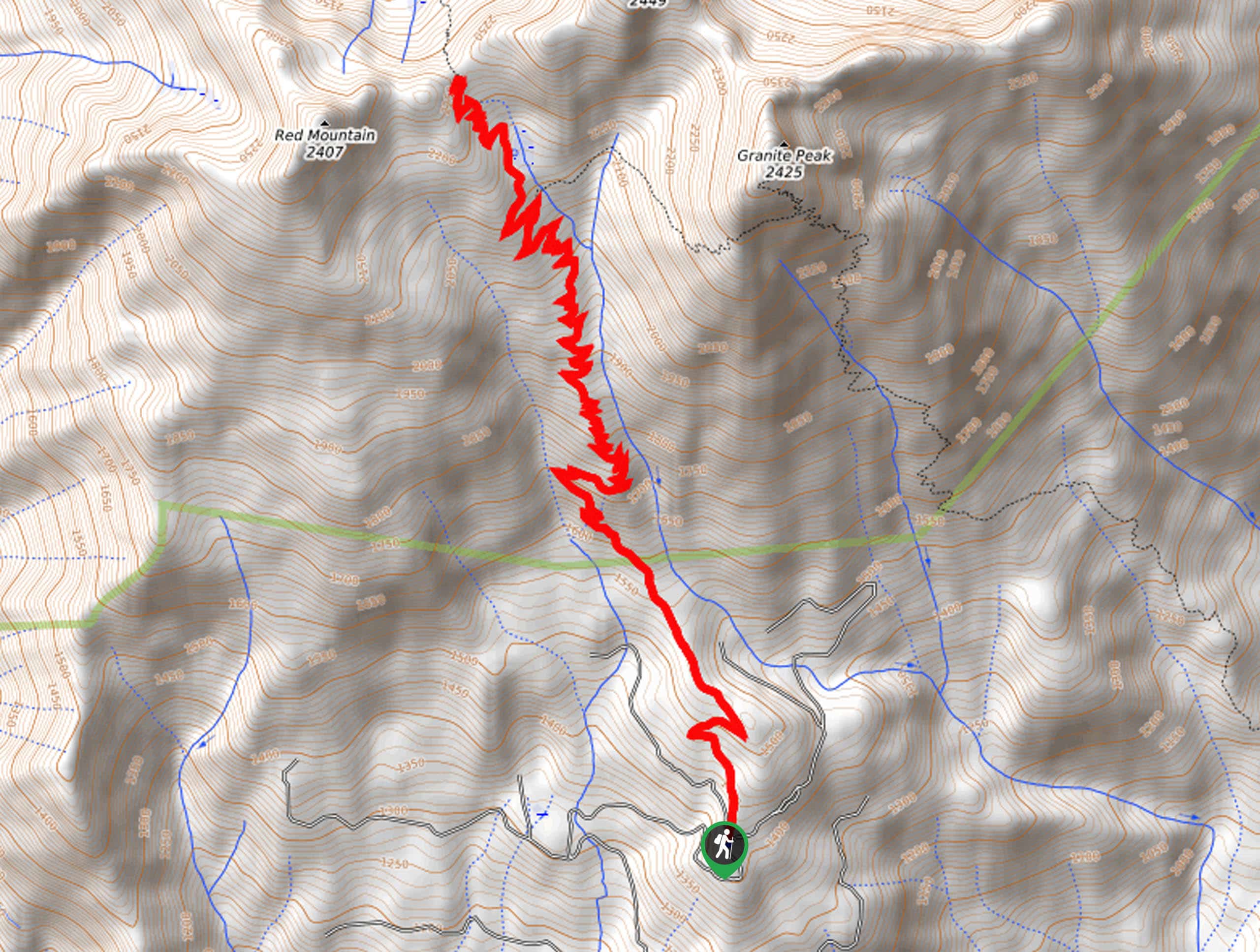
24. Granite Peak Trail
Difficulty
The Granite Peak Trail is a high-effort, high-reward type of adventure in the Shasta-Trinity National… Read More
25. Porcupine Lake Trail
Difficulty
The Porcupine Lake Trail leads intrepid adventurers through diverse topographies up to a charming alpine… Read More
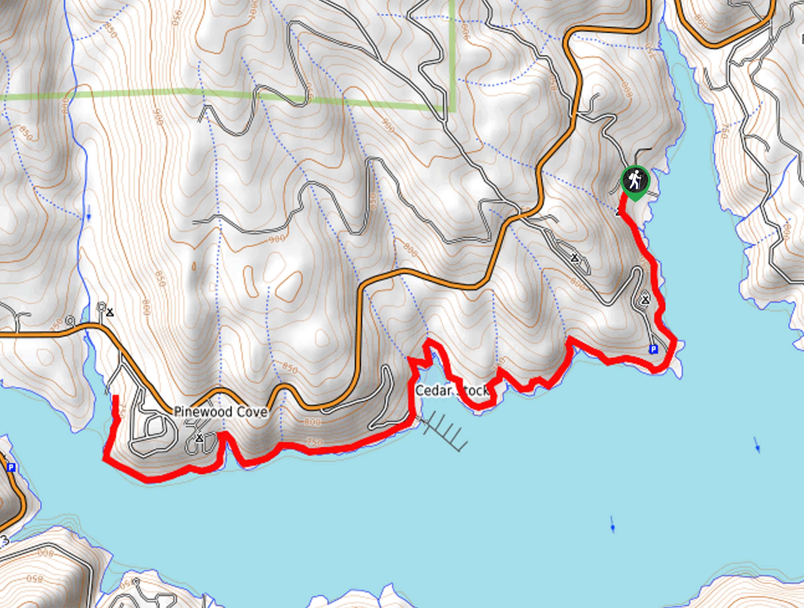
26. Bailey Cove Loop
Difficulty
Wander along the shoreline of Shasta Lake and marvel in the sights of the vibrant… Read More
27. Terrace and Cliff Lakes Hike
Difficulty
Immerse yourself in the picture-perfect terrain along the Terrace and Cliff Lakes Hike. This incredibly… Read More
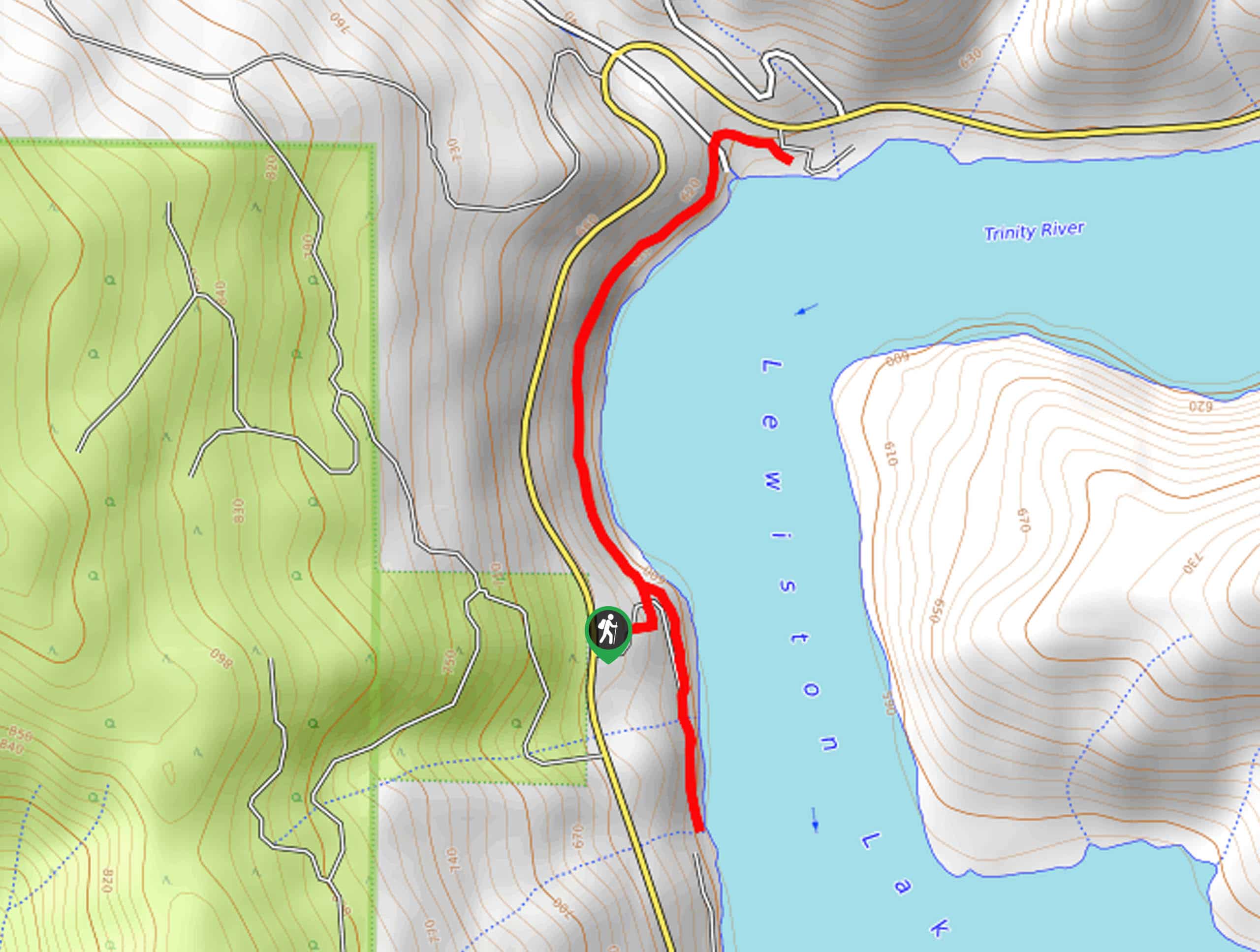
28. Lewiston Lake Trail
Difficulty
The Lewiston Lake Trail is an amazing nature trail along the shoreline of Lewiston Lake… Read More
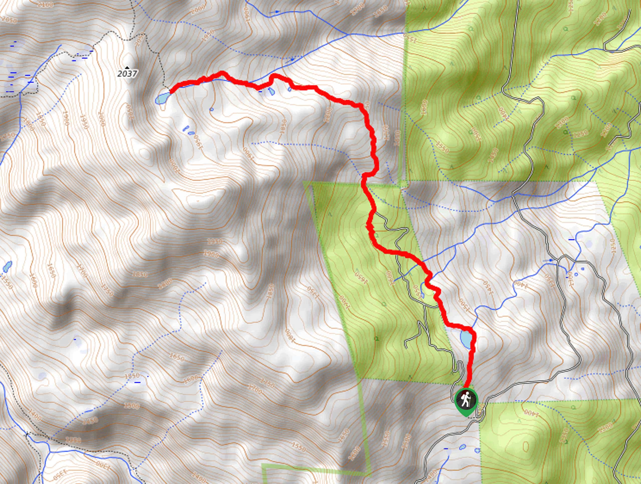
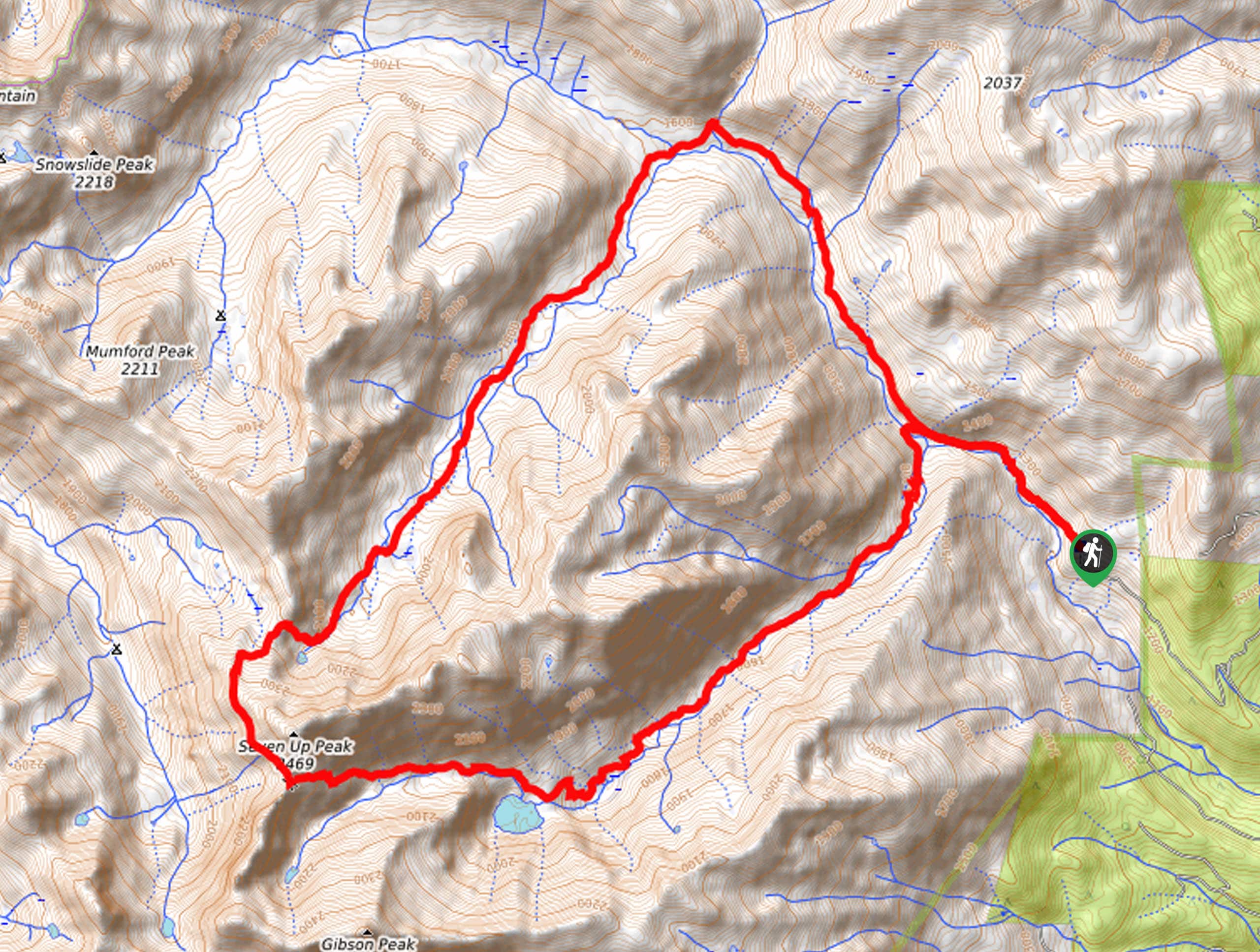
29. Caribou Lakes Trail
Difficulty
The Caribou Lakes Trail is a demanding feat in the Trinity Alps Wilderness that requires… Read More
30. Boulder Lakes Hike
Difficulty
The Boulder Lakes Hike is a family-friendly adventure into the high country that culminates at… Read More
31. Swift Creek Trail
Difficulty
The Swift Creek Hike is a wonderful adventure that beckons intrepid spirits and experienced hikers… Read More
32. Granite Lake via Swift Creek Trail
Difficulty
The Granite Lake via Swift Creek Trail is an ideal adventure for intermediate hikers and… Read More
33. Old Ski Bowl Trail
Difficulty
The Old Ski Bowl Trail is a scenic adventure along the southern slope of Mount… Read More
34. Caldwell Lakes Trail
Difficulty
Indulge yourself in the beauty of the Shasta-Trinity National Forest along the Caldwell Lakes Trail.… Read More
35. Big Bear Lake Trail
Difficulty
The Big Bear Lake Trail is a beautiful adventure through the alpine environment. Explore lush… Read More
36. Boulder Lakes Loop
Difficulty
The Boulder Lakes Loop is an awesome hike ideal for intermediate hikers and families with… Read More
37. East Boulder Lake via PCT
Difficulty
Immerse yourself in the high country and marvel in the beauty of the alpine environment… Read More
38. South Fork Coffee Creek Loop
Difficulty
Discover the untouched backcountry along the South Fork Coffee Creek Loop. This primitive adventure through… Read More
39. North Fork Coffee Creek Trail
Difficulty
A good hike is the best kind of medicine. Immerse yourself in the wilderness, let… Read More
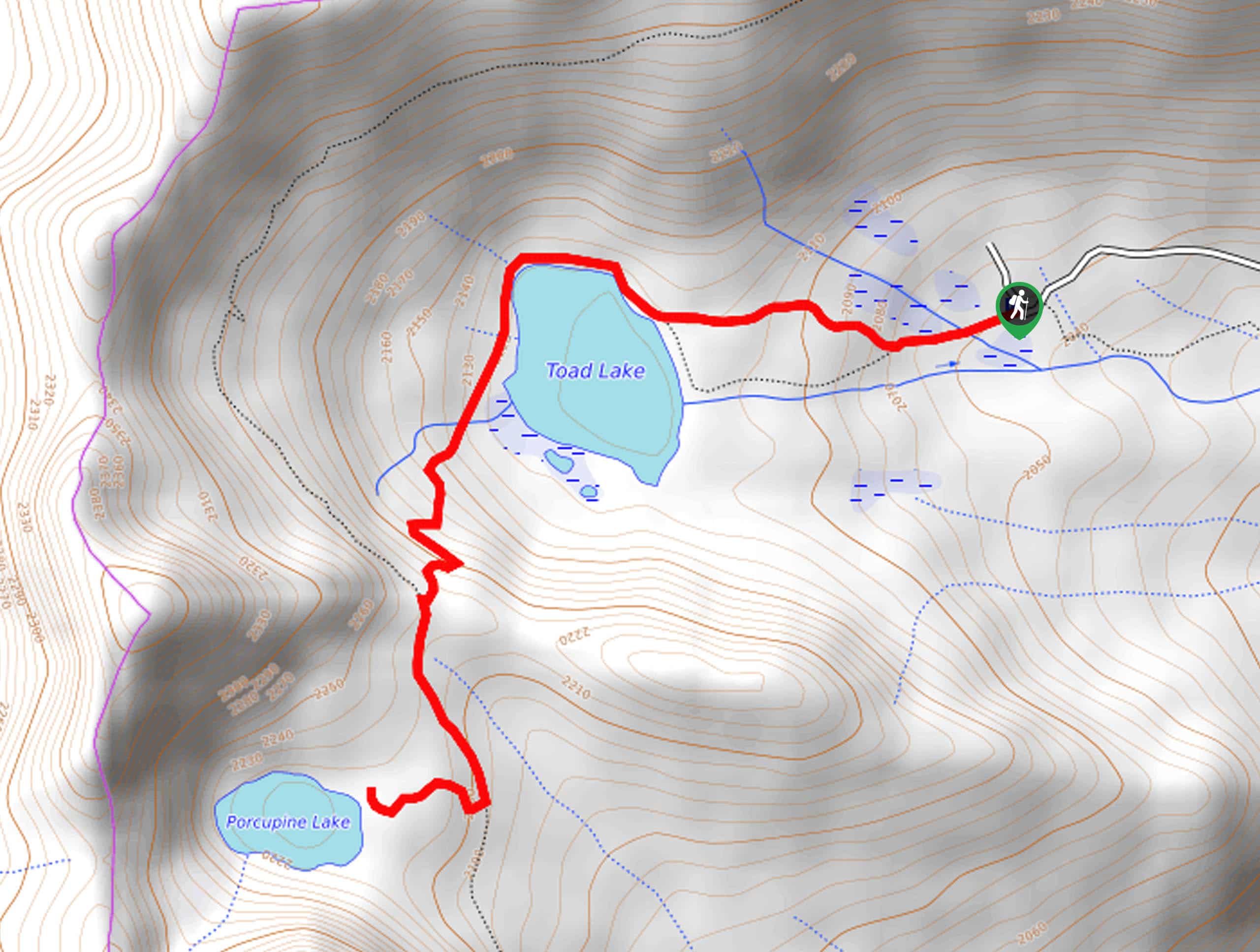
40. Porcupine and Toad Lakes Hike
Difficulty
Short, steep, and scenic are three words that best describe the Porcupine and Toad Lakes… Read More
41. Great Shasta Rail Trail
Difficulty
The Great Shasta Rail Trail is a scenic nature walk along the old rail bed.… Read More
42. Burstarse Falls Hike
Difficulty
The Burstarse Falls Trail is an awesome adventure in the Castle Crags Wilderness that intermediate… Read More
43. Long Canyon Trail to Deer Lake
Difficulty
Leading hikers through mixed conifer forests, montane meadows, through a granite bound valley, and up… Read More
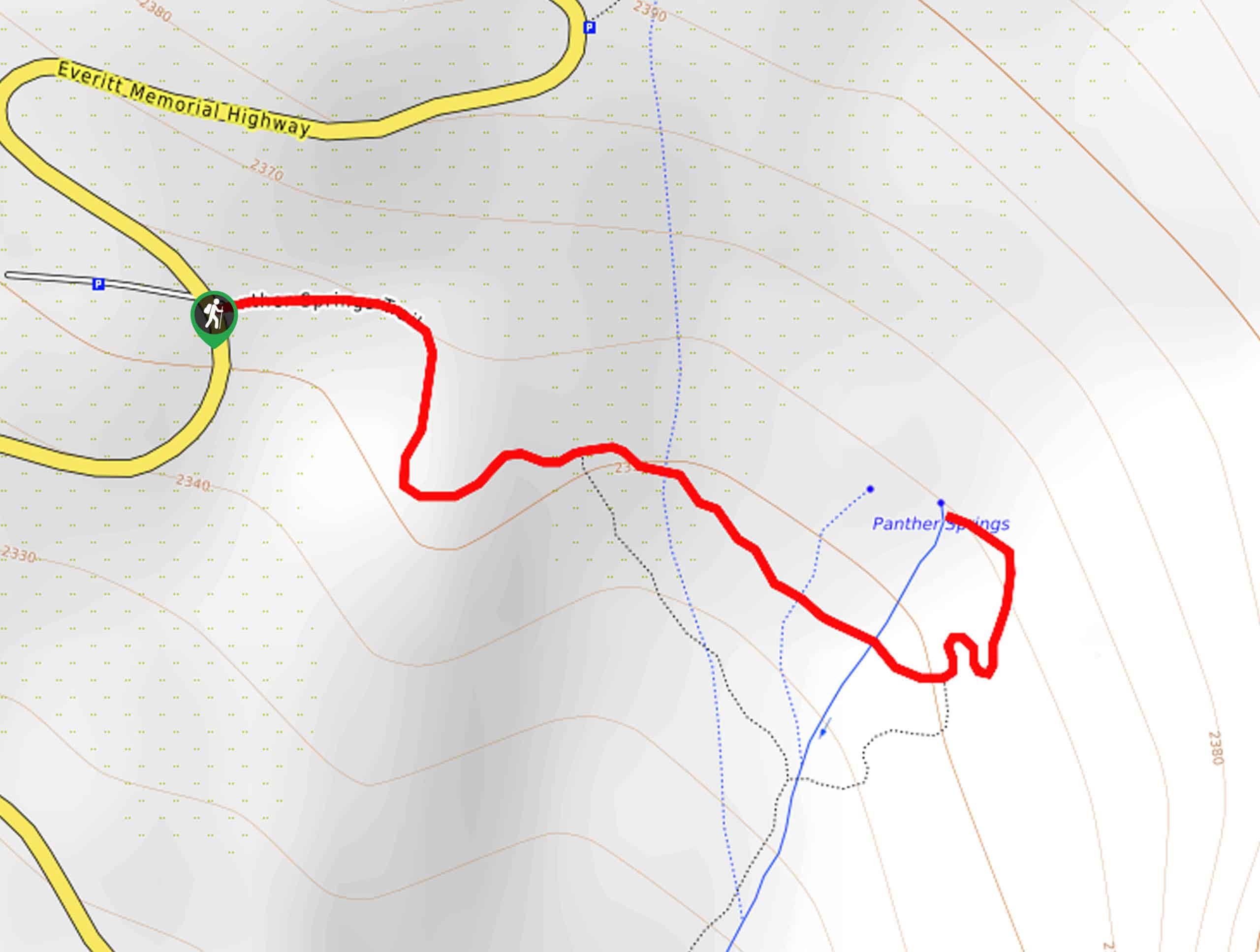
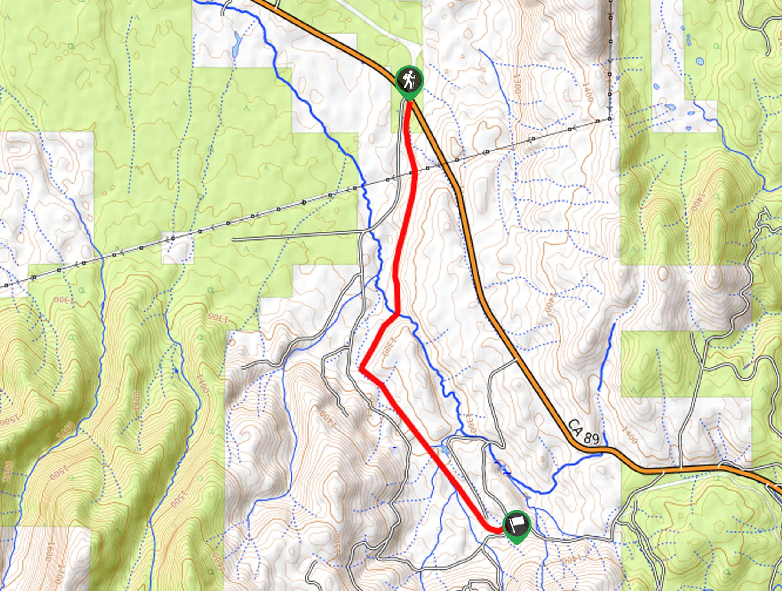
44. Panther Springs Trail
Difficulty
The Panther Springs Trail is an awesome adventure through the montane meadows on the outskirts… Read More
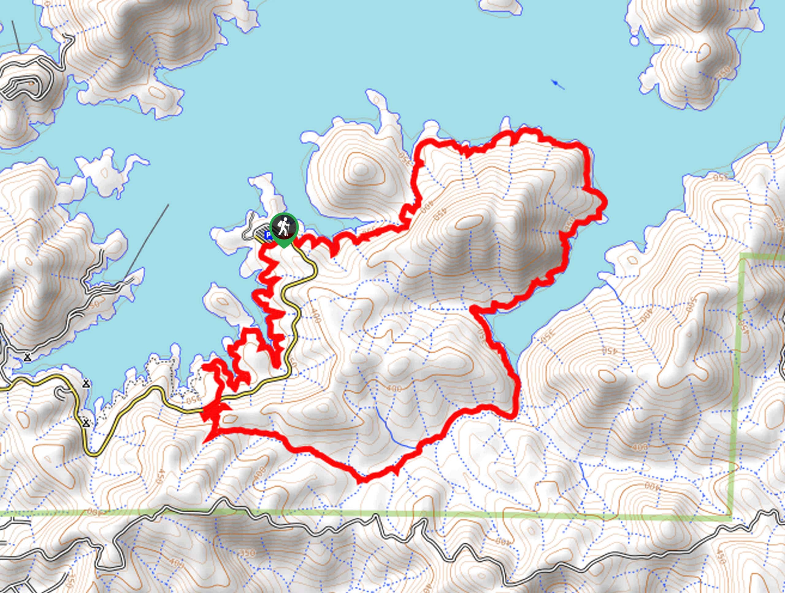
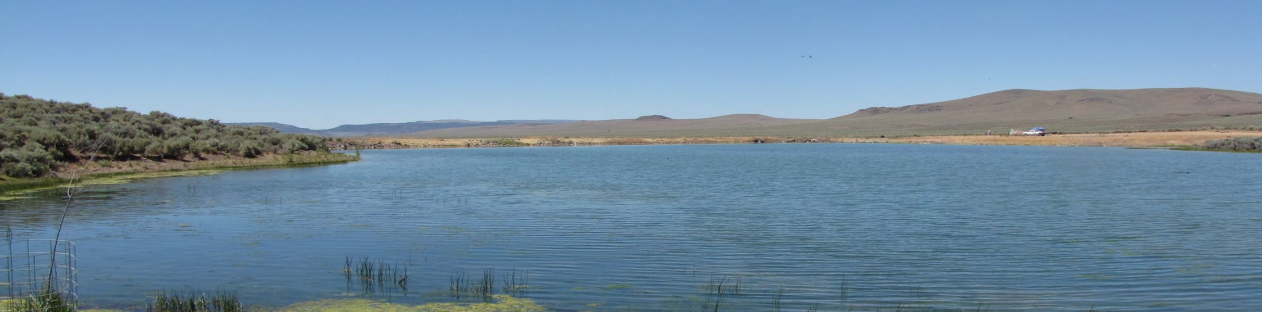
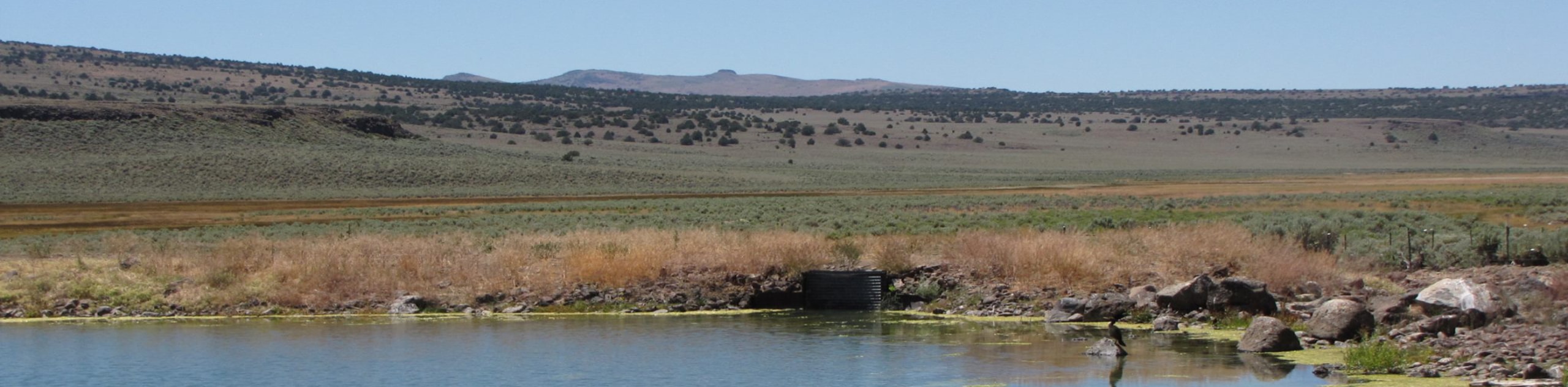
45. Clikapudi Trail
Difficulty
The Clikapudi Trail is a scenic shared route that traces the shoreline of California’s largest… Read More
46. Eleanor and Shimmy Lakes Hike
Difficulty
The Eleanor and Shimmy Lakes Hike boasts unrivaled scenes of the Trinity Alps for its… Read More
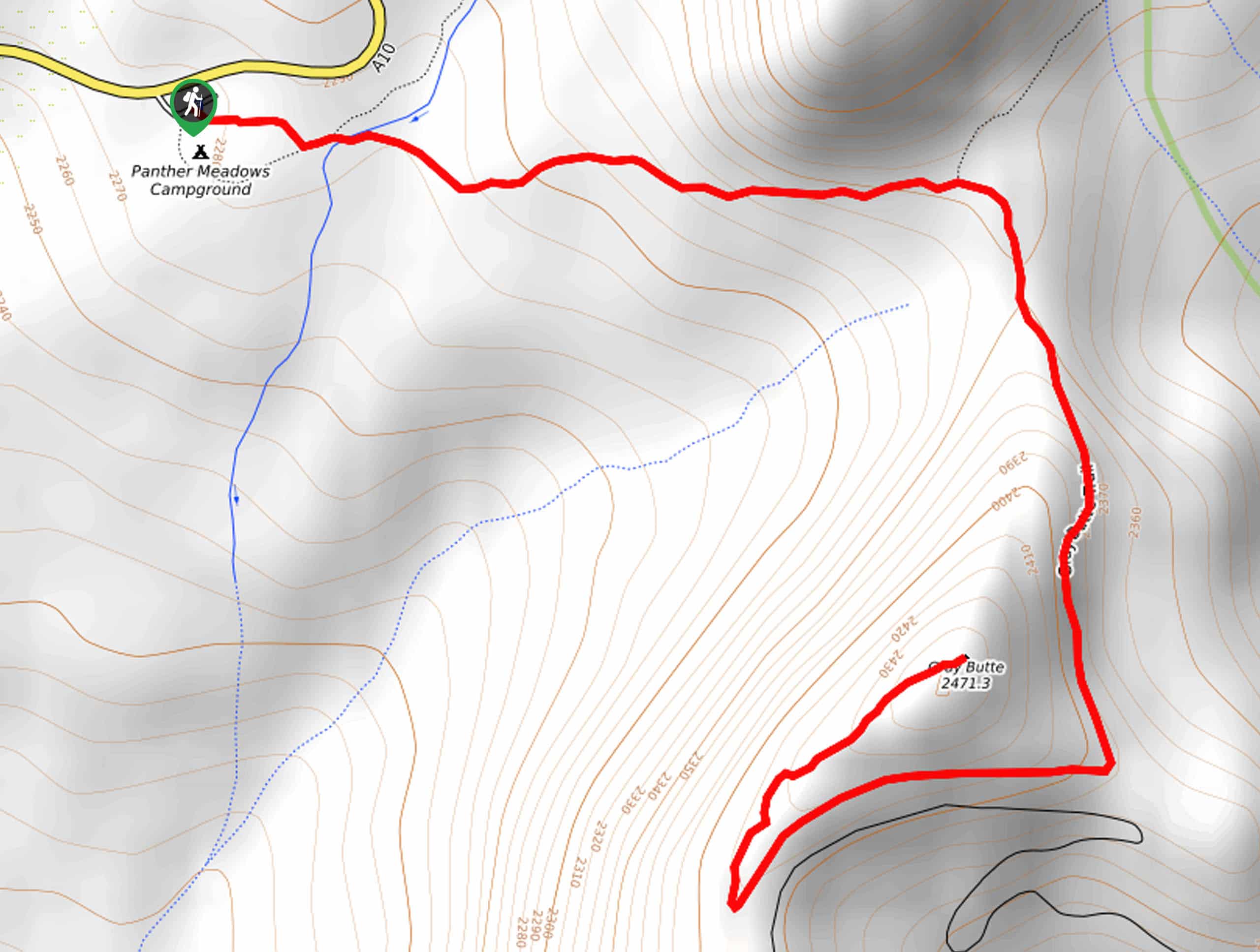
47. Gray Butte Trail
Difficulty
The Gray Butte Trail is an easy-going adventure on the outskirts of Mount Shasta that… Read More
48. Bear Basin Loop
Difficulty
Seeking a day hike in the Trinity Alps Wilderness that checks all the boxes—long, scenic,… Read More
49. Horse Camp Trail
Difficulty
Indulge in the beauty and grandeur of Mount Shasta along the Horse Camp Trail. Traveling… Read More
50. Waters Gulch Loop Trail
Difficulty
The Waters Gulch Loop Trail exhibits the beauty and diversity of Lake Shasta. Explore the… Read More
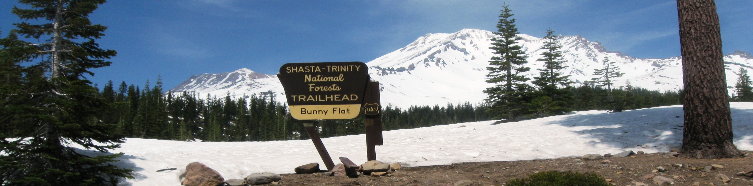
51. Dog Trail via Bunny Flat
Difficulty
Seeking a taste of what Mount Shasta is all about? Well, the Dog Trail via… Read More
52. Stonewall Pass via Stoney Ridge Trail
Difficulty
Immerse yourself in the Trinity Alps and marvel in the beauty of the mountainous landscape… Read More
53. Sisson Southern Trail
Difficulty
The Sisson Southern Trail is a wonderful one-way expedition along the outskirts of Mount Shasta… Read More
54. Wagon Creek Falls via Deer Creek Hike
Difficulty
The Wagon Creek Falls via Deer Creek Hike beckons intrepid explorers who won’t shy away… Read More
55. East Weaver Creek Hike
Difficulty
Let the pleasant sounds of the gurgling waters lull you into a state of relaxation… Read More
56. Masterson Meadow Lake Hike
Difficulty
The Masterson Meadow Lake Trail is a wonderful adventure in the Trinity National Forest that… Read More

57. Bluff Lake via PCT
Difficulty
The Bluff Lake via PCT is a secluded adventure in the Shasta-Trinity National Forest that… Read More
58. McKenzie Gulch Loop
Difficulty
The McKenzie Gulch Loop is a fun family adventure in the Shasta-Trinity National Forest that… Read More
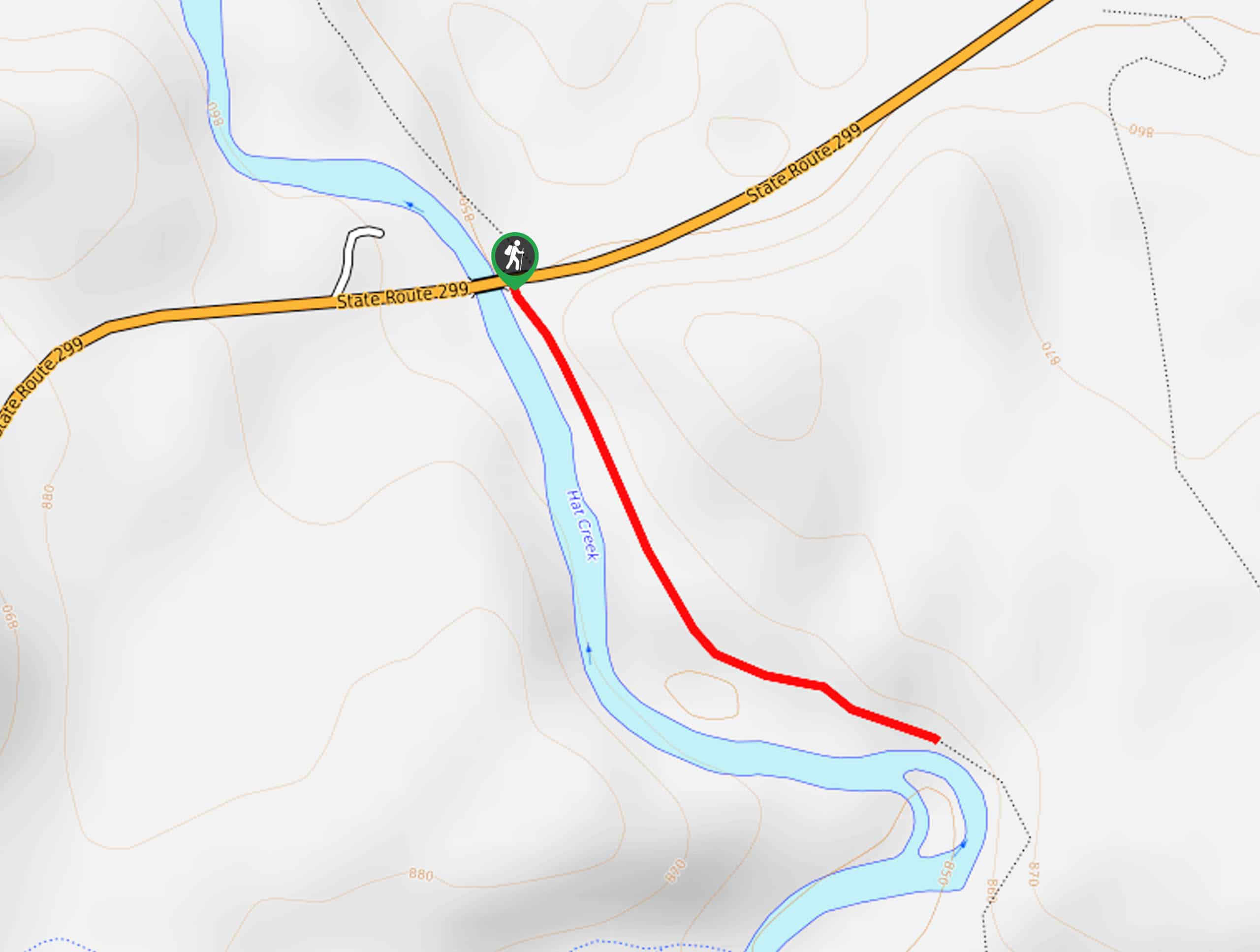
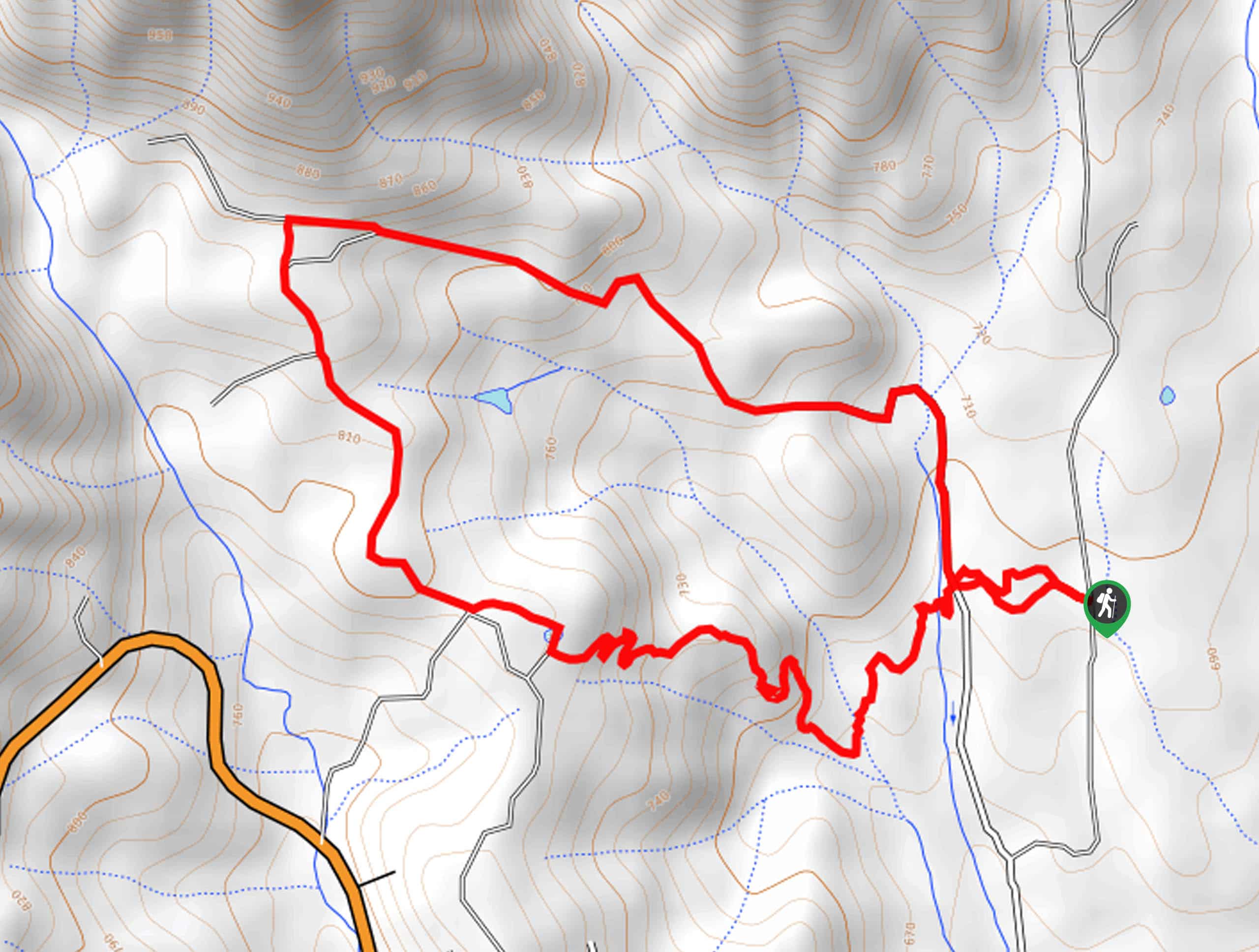
59. Lower Hat Creek Trail
Difficulty
Hikers of all skill levels, ages, and ability levels can enjoy the Lower Hat Creek… Read More
60. Swift Creek to Mumford Meadow Hike
Difficulty
The Swift Creek to Mumford Meadow Hike is a beautiful adventure that attracts plenty of… Read More
61. Hazel Creek Road Hike
Difficulty
The Hazel Creek Road Hike is a memorable adventure in the Shasta-Trinity National Forest that… Read More
62. Sisson Callahan Trail
Difficulty
The Sisson Callahan Trail is an awesome one-way expedition through the Trinity Alps Wilderness that… Read More
63. Rainbow Ridge Loop
Difficulty
The Rainbow Ridge Loop is an excellent adventure for intermediate hikers and families with older… Read More
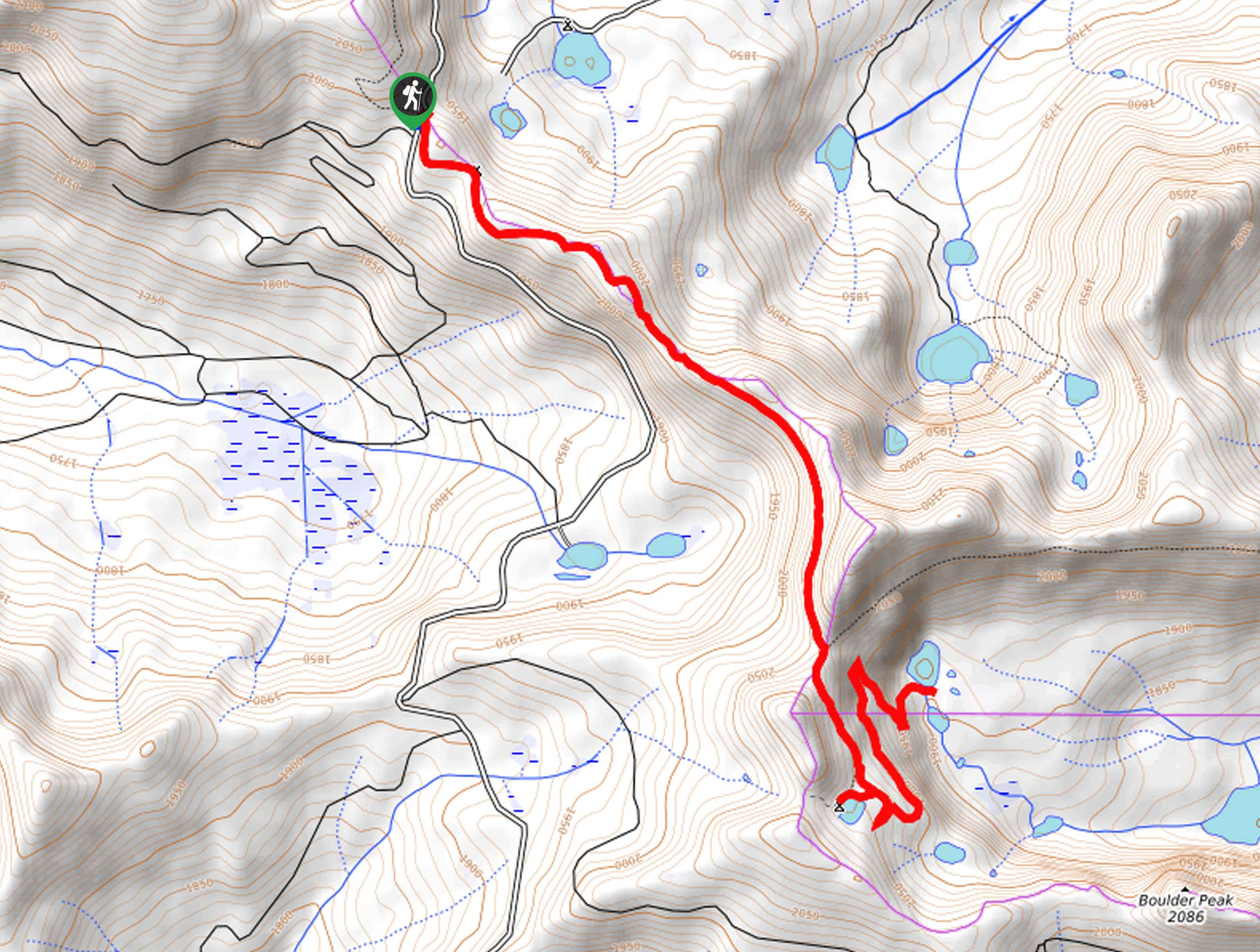
64. Hotlum Loop
Difficulty
The Hotlum Loop is a wonderful adventure along the outskirts of Mount Shasta that outdoor… Read More
65. McCloud River Trail
Difficulty
The McCloud River Trail is an epic one-way adventure in the Shasta-Trinity National Forest that… Read More
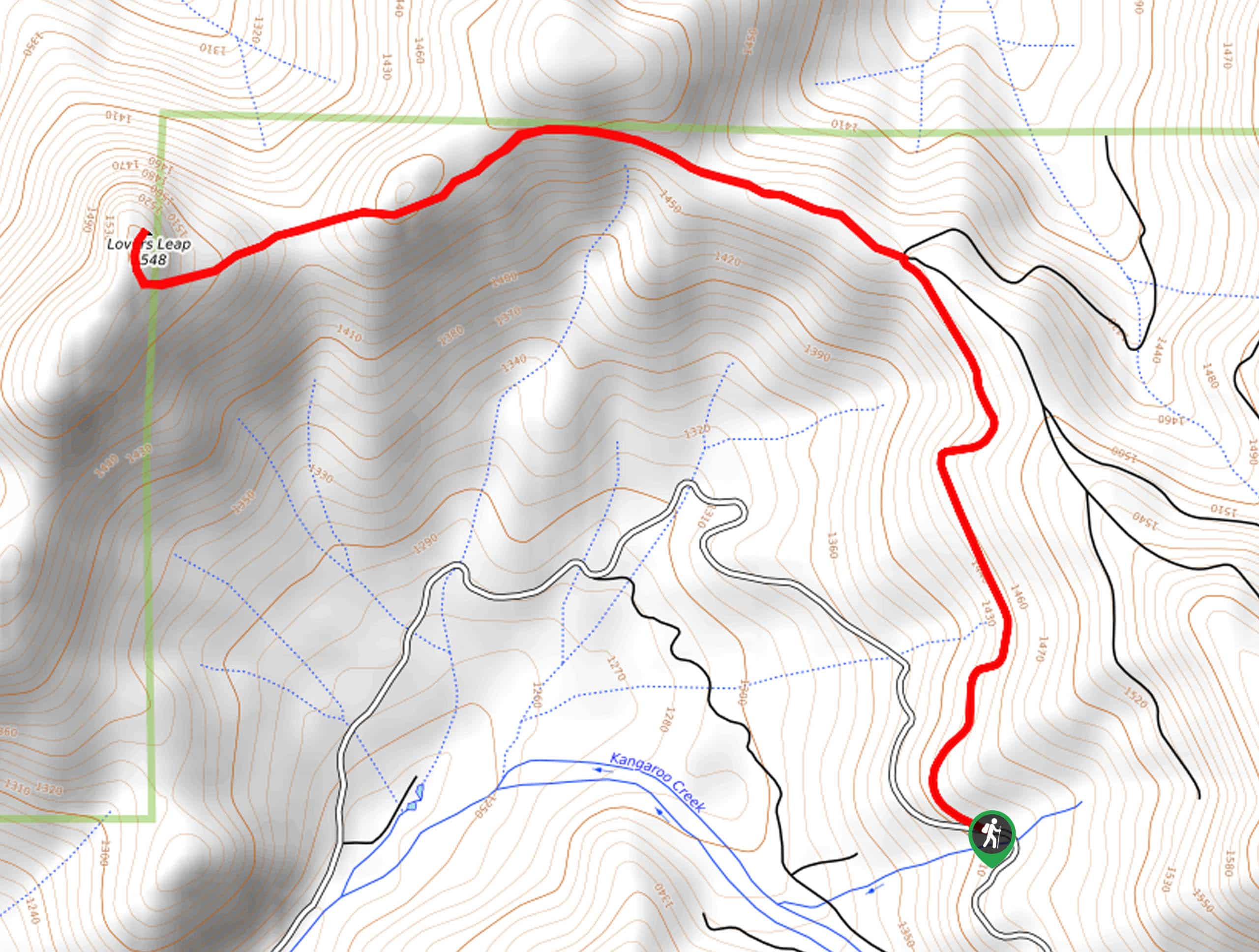
66. Lover’s Leap Hike
Difficulty
The Lover’s Leap Hike is an awesome adventure up to the summit of a granite… Read More
67. Bull Lake via PCT
Difficulty
Immerse yourself in the high country and reward yourself with awe-inspiring panoramas of the Klamath… Read More
68. Elsa Rupp Nature Trail
Difficulty
The Elsa Rupp Nature Trail is a wonderful escape from the hustle and bustle of… Read More

69. East Weaver Lake Trail
Difficulty
The East Weaver Lake Trail is a wonderful adventure on the boundary of the Trinity… Read More
Are we missing your favourite hike?
Tell us! If you've got photos, a GPS track and know the hike, we'd love to share your favourite hike with the rest of the 10Adventures community.