
Panther Springs Trail
View Photos
Panther Springs Trail
Difficulty Rating:
The Panther Springs Trail is an awesome adventure through the montane meadows on the outskirts of Mount Shasta. This nature walk can be enjoyed by hikers of all skill levels and ages year-round. What are you waiting for? Get out there and explore!
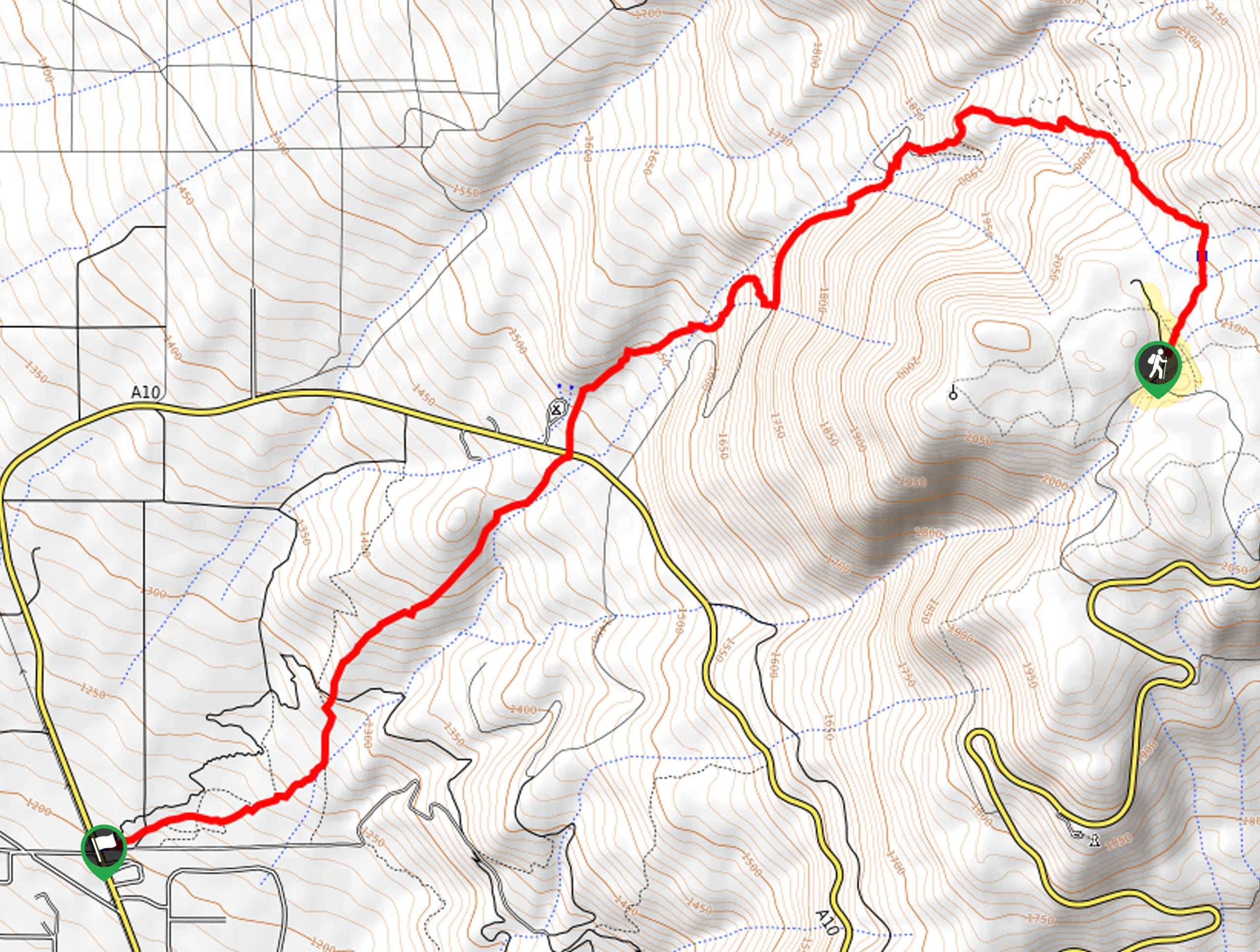
Getting there
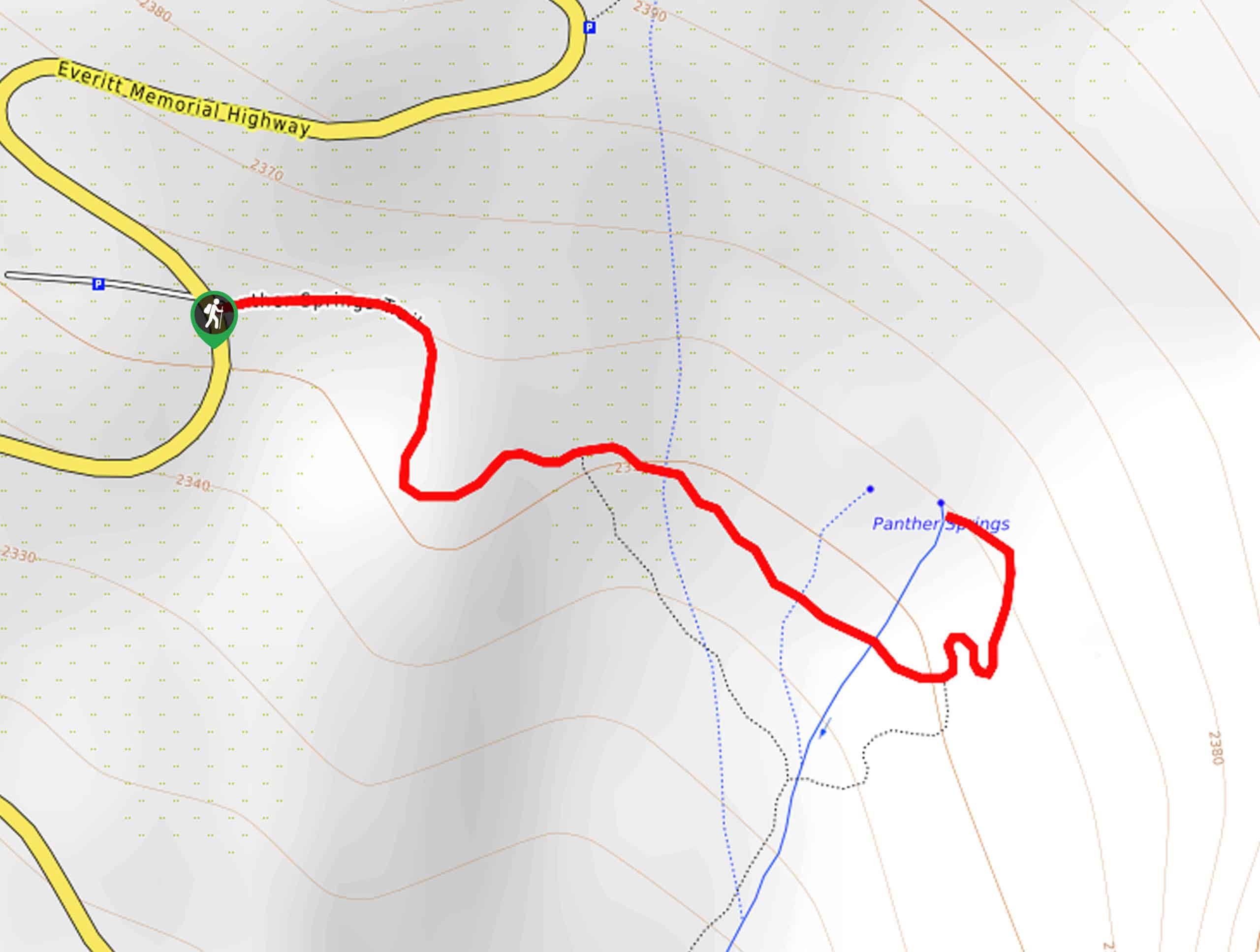
The Panther Springs Trail is accessed via the trailhead off Everitt Memorial Highway.

About
| Backcountry Campground | No |
| When to do | Year-round |
| Pets allowed | No |
| Family friendly | Yes |
| Route Signage | Average |
| Crowd Levels | High |
| Route Type | Out and back |
Panther Springs Trail
Elevation Graph
Weather
Panther Springs Trail Description
Treat yourself to unparalleled vistas of the Cascade Range and the Klamath Mountains along the Panther Springs Trail. This fun family adventure wanders along the outskirts of Mount Shasta, offering families and novice hikers the opportunity to indulge in the grandeur of the volcano without needing to tackle a technical trek. The well-marked path is rocky and uneven, so be mindful of your footing. Note the road to the trailhead is subject to seasonal closure, though the trail remains open year-round.
Setting out from the trailhead off Everitt Memorial Highway, the Panther Springs Trail wanders east, gently descending into the meadowlands. In the spring in summer, the meadow blossoms with vibrant wildflowers, boasting a truly magical scene. No matter the season, you will be rewarded with wonderful views of the Klamath Mountains and Trinity Alps in the west.
Continue exploring the alpine meadows via the Panther Springs Trail, and you will intersect with the springs that decorate the terrain. You will ultimately reach the trail’s end—turn around and retrace your footing back to the trailhead. If you are seeking a longer hike, meander along the Panther Meadows Trail too.
Similar hikes to the Panther Springs Trail hike
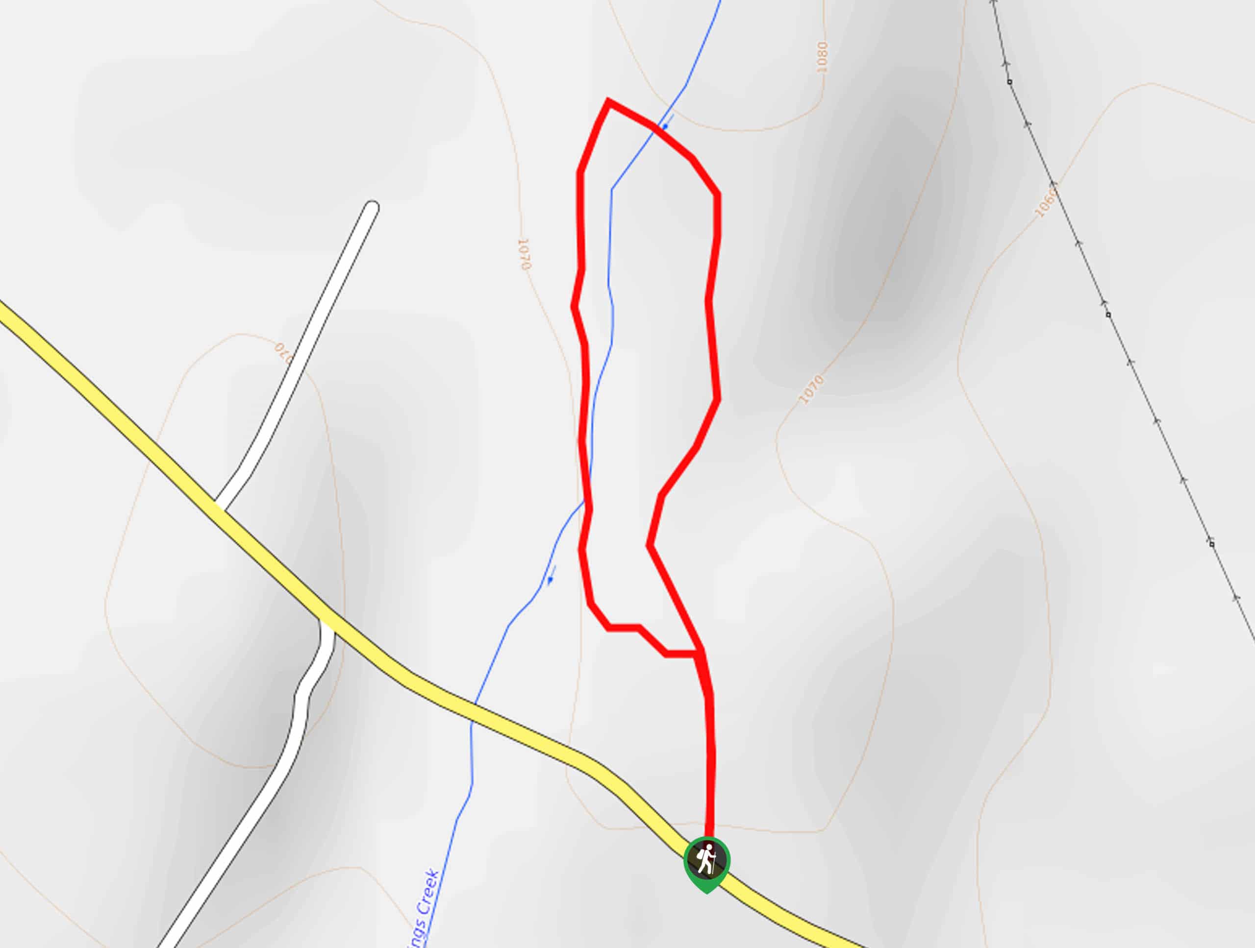
Elsa Rupp Nature Trail
The Elsa Rupp Nature Trail is a wonderful escape from the hustle and bustle of the city. Reconnect with nature…
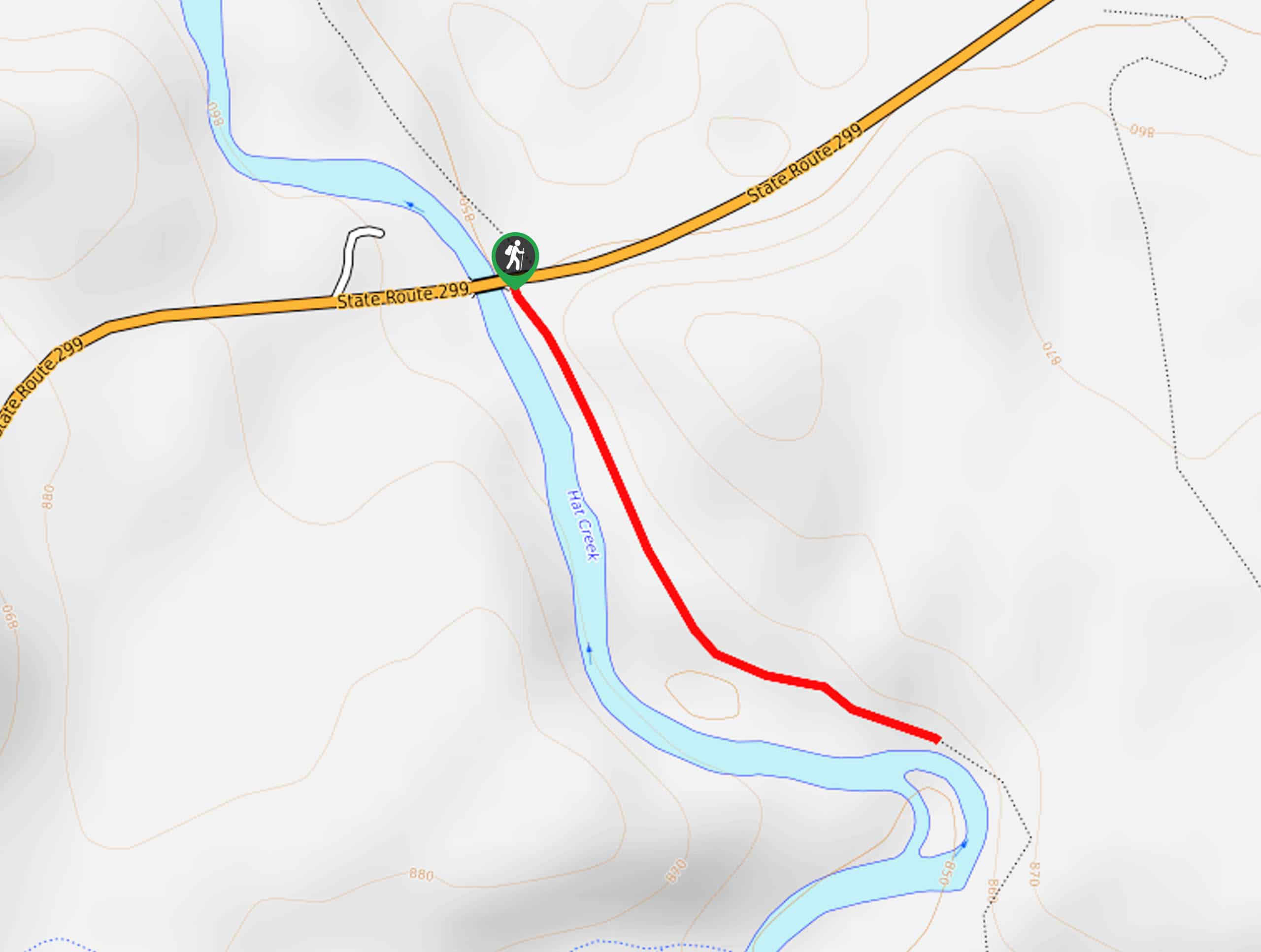
Lower Hat Creek Trail
Hikers of all skill levels, ages, and ability levels can enjoy the Lower Hat Creek Trail. This wonderful nature path…
Sisson Southern Trail
The Sisson Southern Trail is a wonderful one-way expedition along the outskirts of Mount Shasta that connects the Sand Flats…
Comments