Sisson Southern Trail
View Photos
Sisson Southern Trail
Difficulty Rating:
The Sisson Southern Trail is a wonderful one-way expedition along the outskirts of Mount Shasta that connects the Sand Flats to the city of Mount Shasta below. Easy-going and impressively scenic, hikers of all skill levels and ages can enjoy this adventure.
Getting there
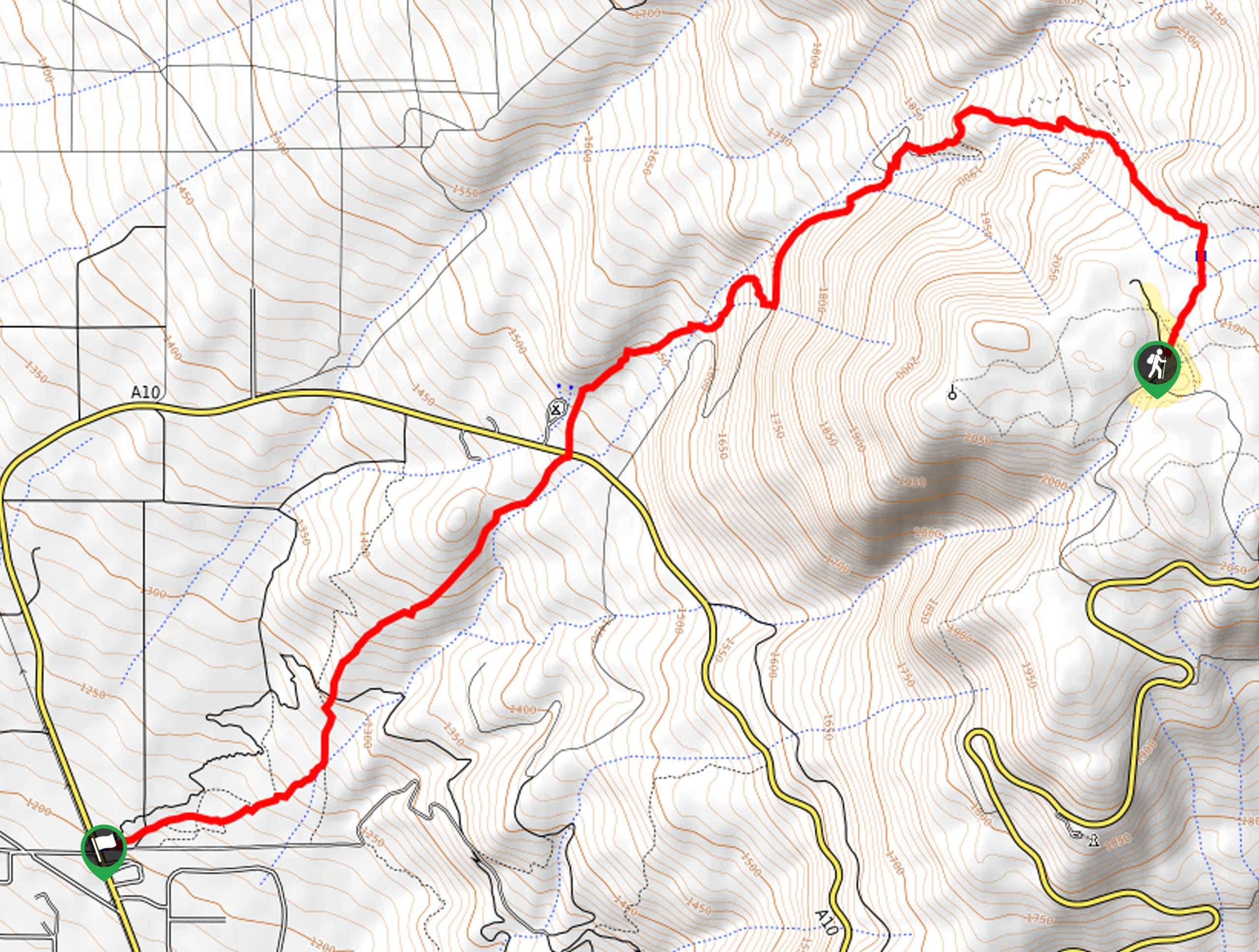
This hike departs from the Sand Flat Trailhead off Sand Flat Road.

About
| Backcountry Campground | |
| When to do | Year-round |
| Pets allowed | Yes - On Leash |
| Family friendly | Yes |
| Route Signage | Average |
| Crowd Levels | Moderate |
| Route Type | One Way |
Sisson Southern Trail
Elevation Graph
Weather
Sisson Southern Trail Description
Leading hikers from the Sand Flats down to the city of Mount Shasta, this route boasts an unparalleled experience. Open year-round and accessible to adventurers of all skill levels; you will likely encounter fellow adventurers on the weekend. If you seek a more secluded adventure, we encourage you to head out in the early morning! Don’t forget to arrange for pickup or leave a vehicle at the trail’s end if you are completing this hike as a one-way adventure. Note this route can be easily transformed into an out-and-back adventure.
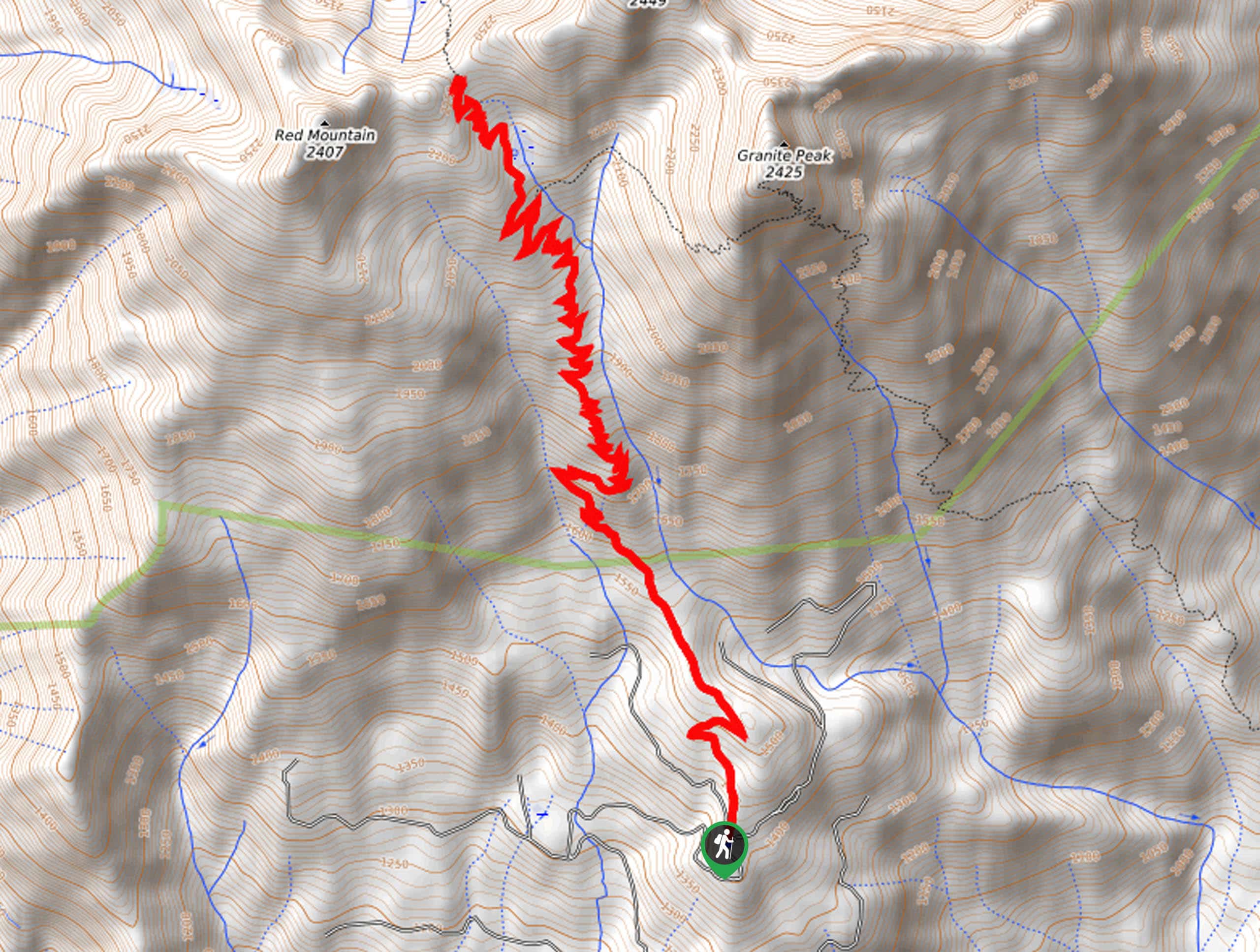
Setting out from the trailhead, the Sisson Southern Trail travels northwest along the Sisson Southern Trail. This route will guide you into the mixed conifer forests, redirecting adventurers west down the Cascade Gulch. Here you will merge onto Forest Road 41N56 briefly before reconnecting with the Southern Sisson Trail. Passing the McBride Springs Campground, you will intersect with the Everitt Memorial Highway.
The Sisson South Trail will gently descend to the trail’s end in Mount Shasta. If you have transportation, this is your adventure’s end. If not, retrace your footing back up the path to the trailhead.
Similar hikes to the Sisson Southern Trail hike
Elsa Rupp Nature Trail
The Elsa Rupp Nature Trail is a wonderful escape from the hustle and bustle of the city. Reconnect with nature…
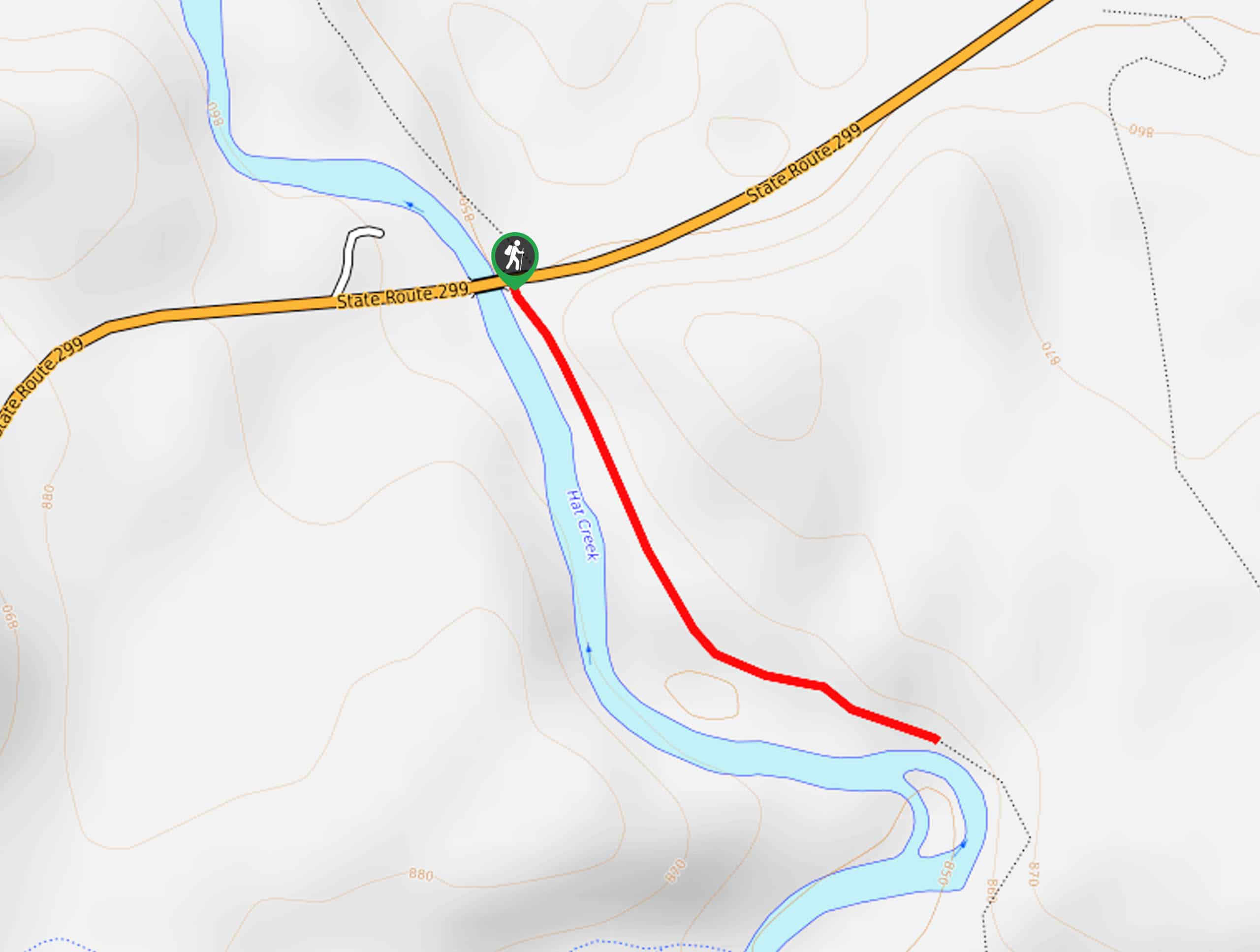
Lower Hat Creek Trail
Hikers of all skill levels, ages, and ability levels can enjoy the Lower Hat Creek Trail. This wonderful nature path…
Stonewall Pass via Stoney Ridge Trail
Immerse yourself in the Trinity Alps and marvel in the beauty of the mountainous landscape along the Stonewall Pass via…
Comments