
Lower Hat Creek Trail
View Photos
Lower Hat Creek Trail
Difficulty Rating:
Hikers of all skill levels, ages, and ability levels can enjoy the Lower Hat Creek Trail. This wonderful nature path wanders along the banks of the crystalline creek prolific with trout and through the woodlands abundant with wildlife.
Getting there
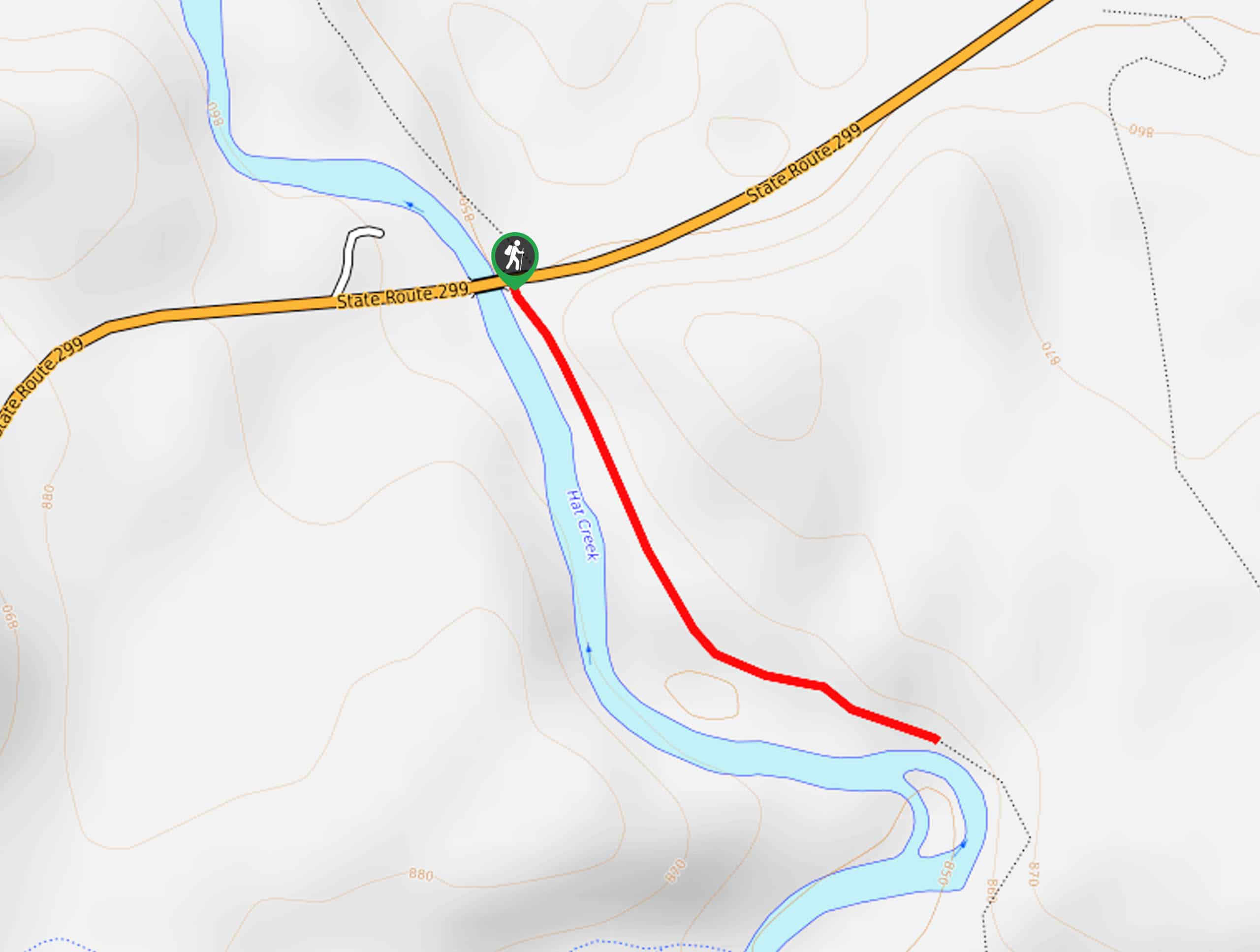
Access the Lower Hat Creek Hike from the trailhead off State Route 299.

About
| Backcountry Campground | No |
| When to do | Year-round |
| Pets allowed | No |
| Family friendly | Yes |
| Route Signage | Average |
| Crowd Levels | Low |
| Route Type | Out and back |
Lower Hat Creek Trail
Elevation Graph
Weather
Lower Hat Creek Trail Description
Those seeking an easy-going fresh air escape will enjoy the Lower Hat Creek Trail. This lovely adventure wanders along the curves of Lower Hat Creek and through the lush woodlands. This versatile trek can be enjoyed year-round, though the best season to explore is in the autumn when the foliage is changing, and the aspens are vibrant! As you wander, be sure to keep an eye out for wildlife, such as deer, rehydrating in the creek.
Setting out from the trailhead, the Lower Hat Creek Trail travels south along the crystal-clear waters. The further you progress along the creek, the more muffled will the traffic sounds become. Enjoy the picturesque scenery, and on a calm day, you may even be able to spot trout in the water!
Continue hiking, and you will eventually reach a place where the stream is bisected by an island. If you still have some gas left in the tank, you are welcome to explore further. We turned around here, retracing our footsteps along the path back to the trailhead.
Similar hikes to the Lower Hat Creek Trail hike
Elsa Rupp Nature Trail
The Elsa Rupp Nature Trail is a wonderful escape from the hustle and bustle of the city. Reconnect with nature…
Sisson Southern Trail
The Sisson Southern Trail is a wonderful one-way expedition along the outskirts of Mount Shasta that connects the Sand Flats…
Stonewall Pass via Stoney Ridge Trail
Immerse yourself in the Trinity Alps and marvel in the beauty of the mountainous landscape along the Stonewall Pass via…
Comments