
Wagon Creek Falls via Deer Creek Hike
View Photos
Wagon Creek Falls via Deer Creek Hike
Difficulty Rating:
The Wagon Creek Falls via Deer Creek Hike beckons intrepid explorers who won’t shy away from a challenge. Put your navigational skills to the test as you meander the forested path through overgrowth and over technical terrain to a charming set of cascades. We love this trek, and so will you.
Getting there
The Wagon Creek Falls via Deer Creek Hike departs from the trailhead off North Shore Road 40N27.

About
| Backcountry Campground | No |
| When to do | Year-round |
| Pets allowed | Yes - On Leash |
| Family friendly | No |
| Route Signage | Poor |
| Crowd Levels | Low |
| Route Type | Out and back |
Wagon Creek Falls via Deer Creek Hike
Elevation Graph
Weather
Wagon Creek Falls via Deer Creek Hike Description
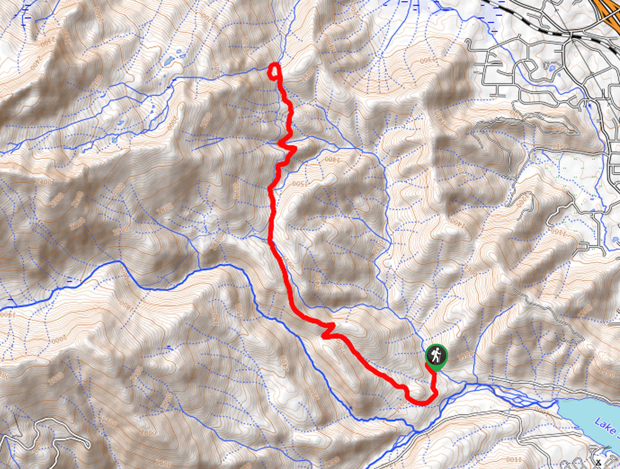
Discover the untouched backcountry along the Wagon Creek Falls via Deer Creek Hike. This epic expedition into the wilderness affords anyone a good time. Indulge in the wonderful scenery as you venture the shared route with mountain bikers and daring off-roaders. As you hike, it is important to be mindful of passers-by! Additionally, traveling deep into the wilderness, adventures must be aware of wildlife, including bears! Some trekkers choose to bring along a bear bell or canister. Use the trail GPS as this route is overgrown and poorly marked in sections.
Setting out from the trailhead, the Wagon Creek Falls via Deer Creek Hike follows the North Shore Road 40N27 heading southwardly. Soon after your departure from the trailhead, the path will redirect you northwest up a steep incline. Don’t let the vertiginous terrain discourage you; the path will eventually plateau near the falls. Climbing through the woodlands, you will eventually reach an intersection. Here, veer right, and you will be diverted onto Route 40N27D, traveling north. When you ultimately reach the route’s end, veer right, and you will be diverted onto the Rainbow Ridge Trail.
Using the trail GPS, this path will intersect with several streams before heading off-road, to the cascades on Wagon Creek. Admire the charm of the mesmerizing falls, then loop around back to the Rainbow Ridge Trail. At this point, simply head back the way you came to the trailhead.
Similar hikes to the Wagon Creek Falls via Deer Creek Hike hike

East Weaver Lake Trail
The East Weaver Lake Trail is a wonderful adventure on the boundary of the Trinity Alps Wilderness that features amazing…

Bluff Lake via PCT
The Bluff Lake via PCT is a secluded adventure in the Shasta-Trinity National Forest that offers wonderful scenery and makes…
Lover’s Leap Hike
The Lover’s Leap Hike is an awesome adventure up to the summit of a granite bluff overlooking the Cascade Range…
Comments