
Clikapudi Trail
View Photos
Clikapudi Trail
Difficulty Rating:
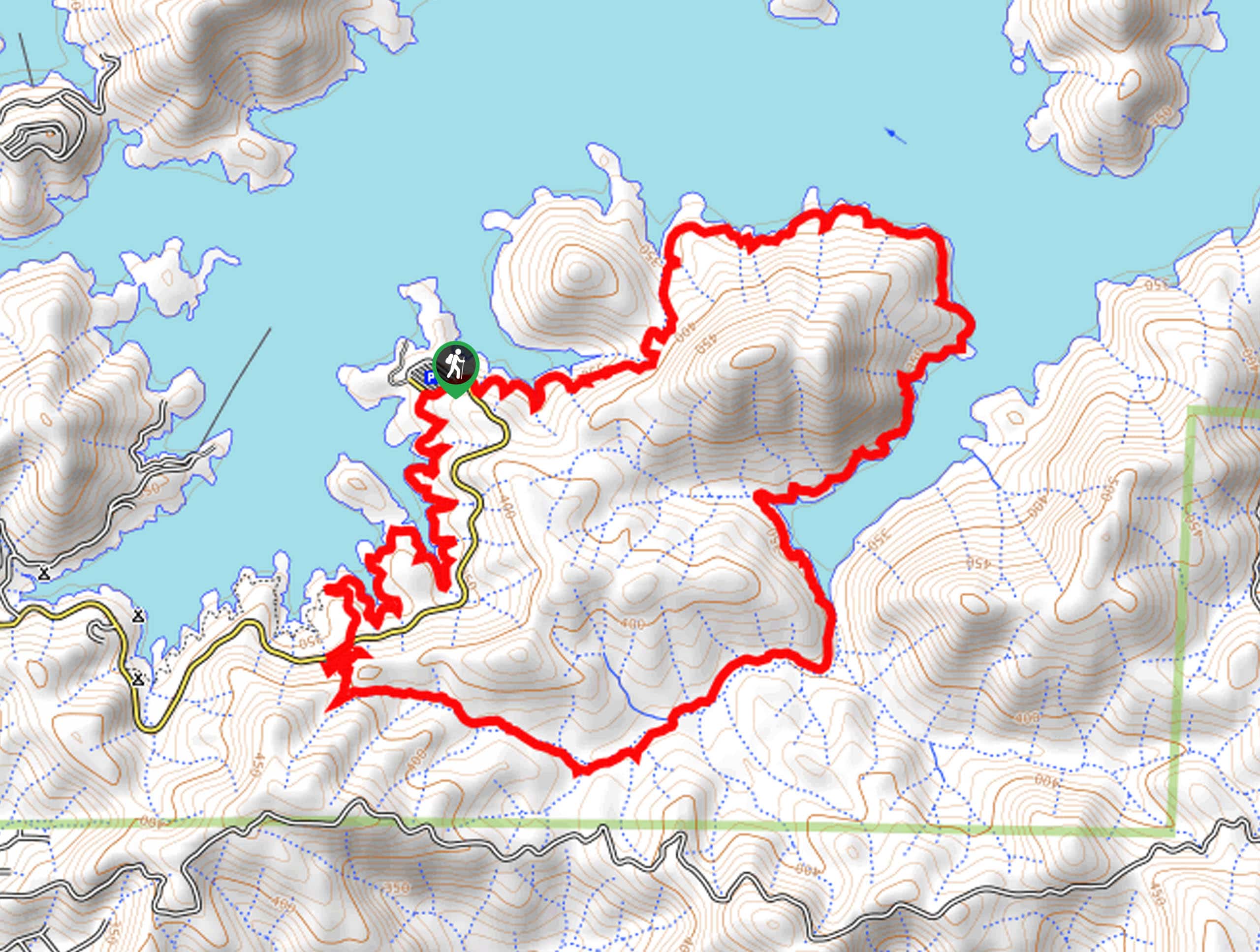
The Clikapudi Trail is a scenic shared route that traces the shoreline of California’s largest man-made lake—Shasta Lake. Offering adventure opportunities to explorers of all sorts, this trail attracts hikers, bikers, and horseback riders alike, eager to indulge in the wonderful scenery.
Getting there
Access this hike via the Whiskeytown National Recreation Area Route.

About
| Backcountry Campground | No |
| When to do | Year-round |
| Pets allowed | Yes - On Leash |
| Family friendly | Yes |
| Route Signage | Average |
| Crowd Levels | High |
| Route Type | Circuit |
Clikapudi Trail
Elevation Graph
Weather
Clikapudi Trail Description
Marvel at the views of the shimmering lake bounded by layers of sediment banks and rolling foothills as you wander this circuit trail. Offering incredible scenery and a good workout, this route would make a great addition to a hiker’s itinerary with navigational skills and a good sense of adventure. As much of the route is overgrown, it can be difficult to follow, so using the trail GPS is recommended. Additionally, we encourage explorers to wear long pants as there is poison oak along the circuit.
Setting out from the trailhead off of the parking lot, the Clikapudi Loop Trail travels northeastward if you are completing this loop in a clockwise direction as we did. Tracing the shoreline, the path will steeply descend before climbing into the forestlands away from the lake. The path will soon descend, nearing the shoreline again. Enjoy the scene of the shimmering waters and the bounding verdant foothills. Eventually, the route will curve southwest along the banks of Clikapudi Cove before diverting back into the forestlands.
As you wander, be mindful of poison oak and watch for wildlife. You will ultimately be guided back to the trailhead and parking lot, marking the end of your adventure.
Similar hikes to the Clikapudi Trail hike

East Weaver Lake Trail
The East Weaver Lake Trail is a wonderful adventure on the boundary of the Trinity Alps Wilderness that features amazing…
Elsa Rupp Nature Trail
The Elsa Rupp Nature Trail is a wonderful escape from the hustle and bustle of the city. Reconnect with nature…

Bluff Lake via PCT
The Bluff Lake via PCT is a secluded adventure in the Shasta-Trinity National Forest that offers wonderful scenery and makes…
Comments