
Lewiston Lake Trail
View Photos
Lewiston Lake Trail
Difficulty Rating:
The Lewiston Lake Trail is an amazing nature trail along the shoreline of Lewiston Lake on the Trinity River. Wander through a forest of mixed conifers and vibrant wildflowers whilst enjoying the sounds of the crashing waves on the shoreline below. This epic adventure is a must-add to your adventure itinerary.
Getting there
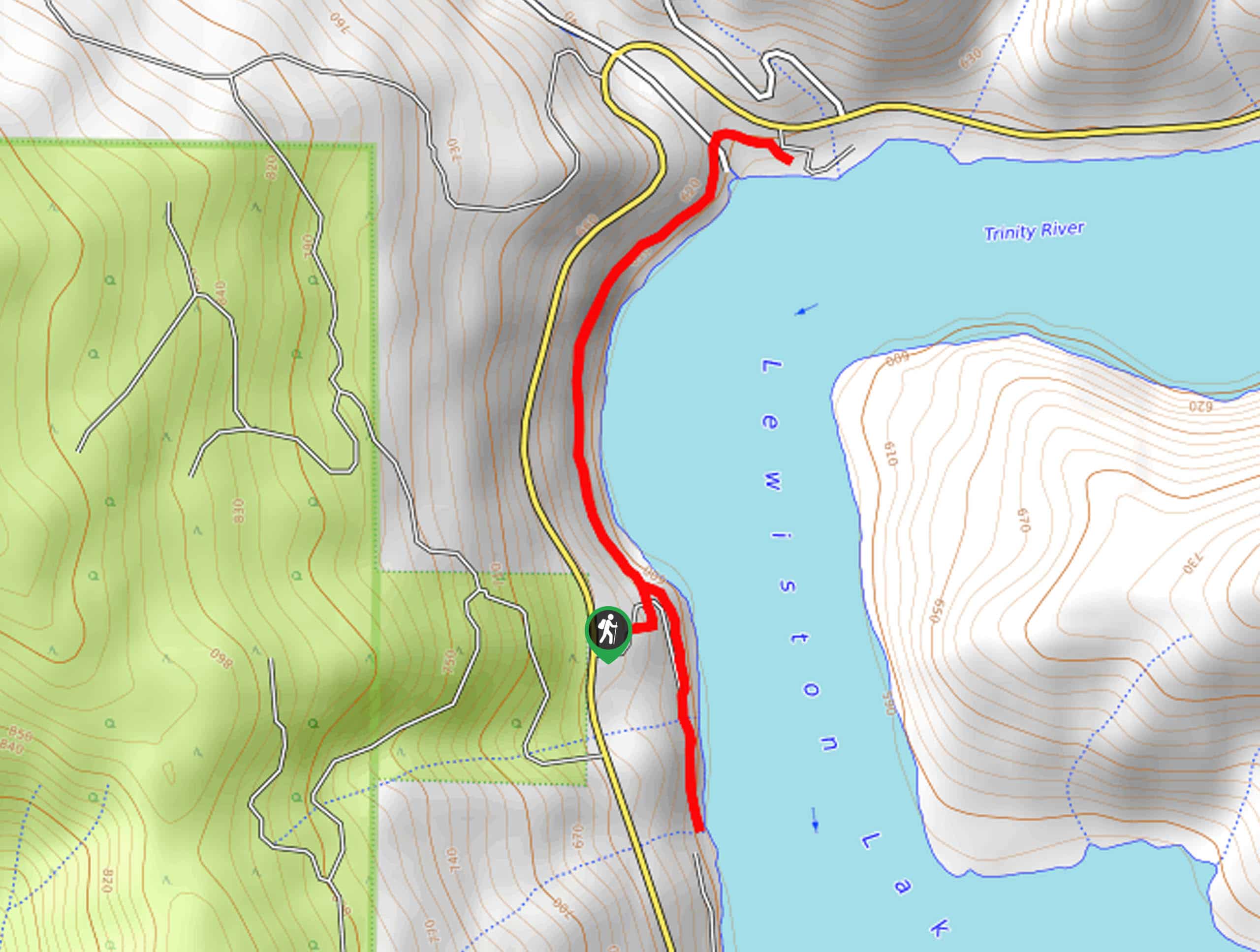
Access the Lewiston Lake Trailhead from off Trinity Dam Boulevard.

About
| Backcountry Campground | |
| When to do | Year-round |
| Pets allowed | Yes - On Leash |
| Family friendly | Yes |
| Route Signage | Poor |
| Crowd Levels | Moderate |
| Route Type | Out and back |
Lewiston Lake Trail
Elevation Graph
Weather
Lewiston Lake Trail Description
The Lewiston Lake Trail is a family-friendly adventure in the Shasta-Trinity National Forest that boasts picture-perfect scenery. Meander along the shoreline cliffs of the busy body of water and admire the beauty of the inviting waters bounded by rolling hills. On a clear day, you will even notice Mount Shasta looming in the distance. Accessible year-round, our favorite time to hike this route is in the autumn when the foliage is changing. No matter the season, make sure your camera is charged; this stunning trail warrants countless photo opportunities.
Using the trail GPS, the path Lewiston Lake Hike travels north along the shoreline of the Trinity River. As you weave between tree shade and exposed terrain, you will be granted inspiring views of Mount Shasta commanding the northeastern skyline on a clear day. Continue along this route all the way to Copper Gulch. At this point, turn around and retrace your footing along the path back to the trailhead, where you will continue south.
Follow this route past the parking lot and down towards the Mary Smith Campground. At the path’s end, backtrack to the trailhead, marking the end of your adventure.
Similar hikes to the Lewiston Lake Trail hike

East Weaver Lake Trail
The East Weaver Lake Trail is a wonderful adventure on the boundary of the Trinity Alps Wilderness that features amazing…
Elsa Rupp Nature Trail
The Elsa Rupp Nature Trail is a wonderful escape from the hustle and bustle of the city. Reconnect with nature…

Bluff Lake via PCT
The Bluff Lake via PCT is a secluded adventure in the Shasta-Trinity National Forest that offers wonderful scenery and makes…
Comments