
Faery Falls Trail
View Photos
Faery Falls Trail
Difficulty Rating:
The Faery Falls Trail travels along a wide dirt route to a stunning cascade that plunges over a sheer cliffside framed with lush moss. Open year-round, hikers of all skill levels and ages can head out into the fresh air and indulge in this beautiful oasis.
Getting there
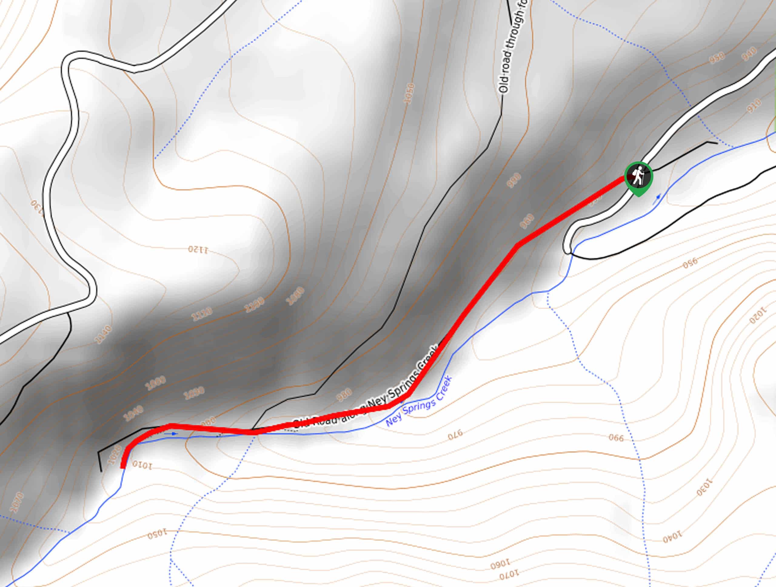
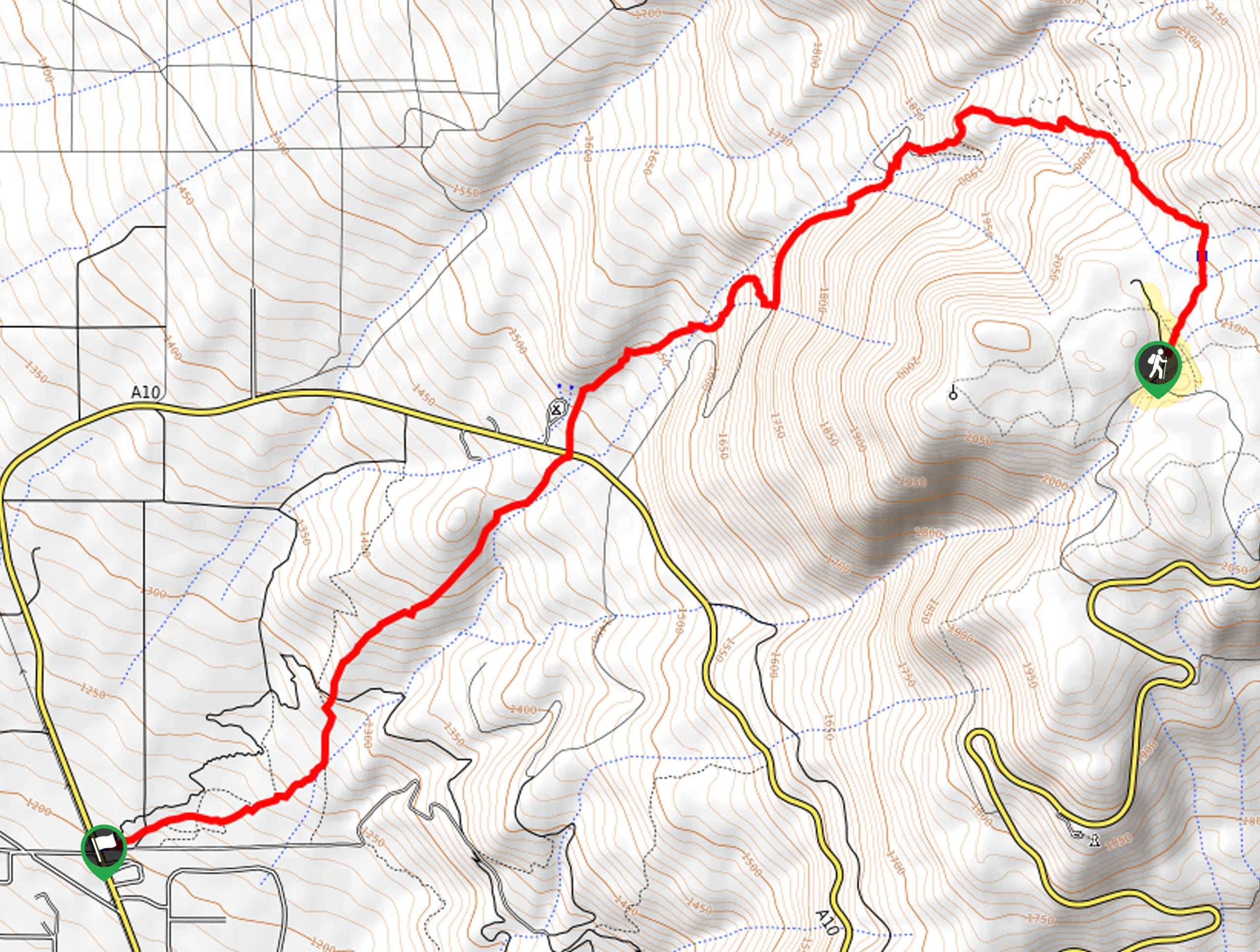
Access to the trailhead is located off Ney Springs Road.

About
| Backcountry Campground | No |
| When to do | Year-round |
| Pets allowed | Yes - On Leash |
| Family friendly | Yes |
| Route Signage | Average |
| Crowd Levels | High |
| Route Type | Out and back |
Faery Falls Trail
Elevation Graph
Weather
Faery Falls Trail Description
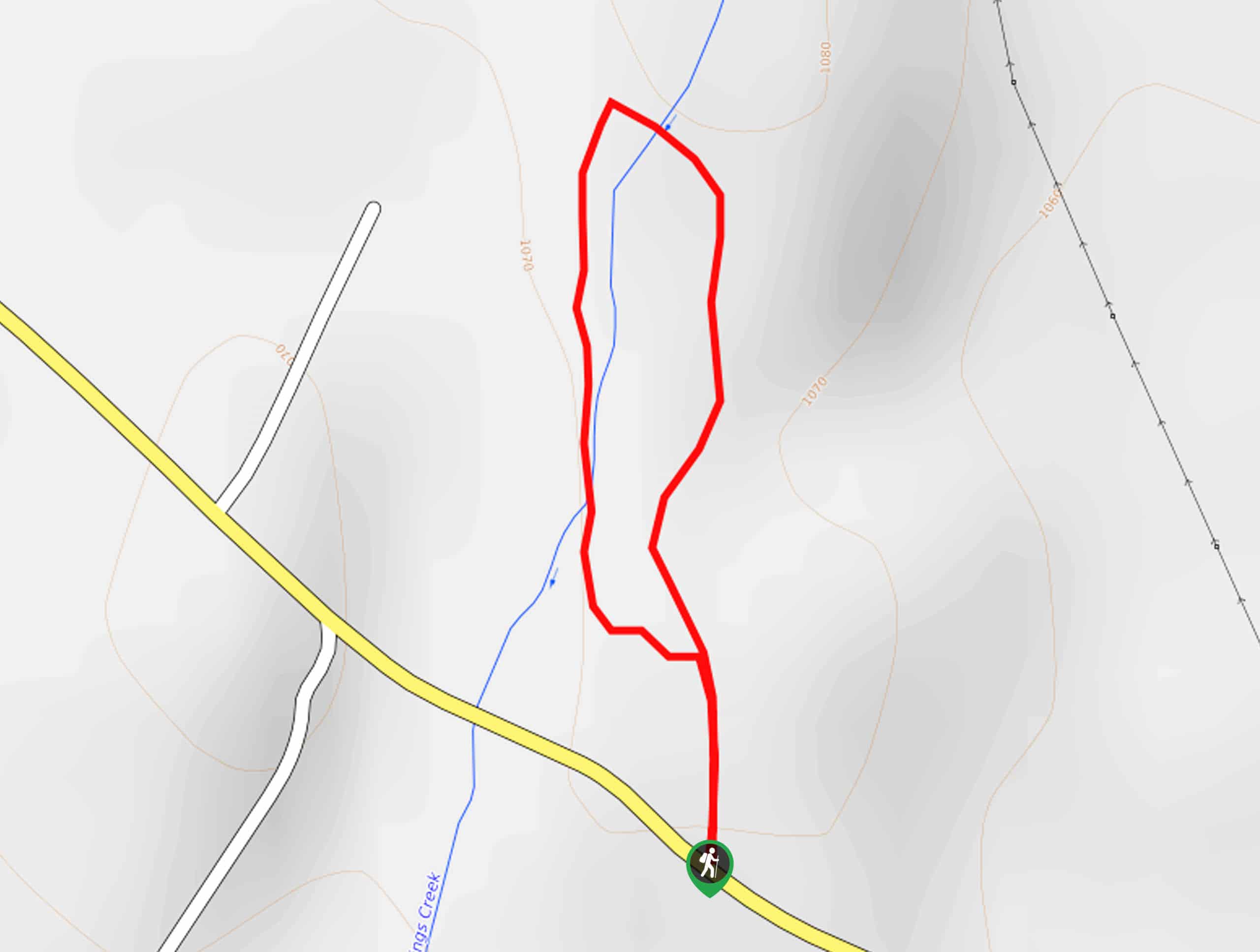
Hiking this route makes for a wonderful adventure. Though most would consider the summer to be the best time to head out, we encourage hikers to explore in the spring when the cascades surge with snowmelt or in the autumn, when the foliage along the path is changing. Though adventurers of all abilities can manage this trail, it is important to note that the final push up to the waterfall is rocky and often slippery—careful footing is required.
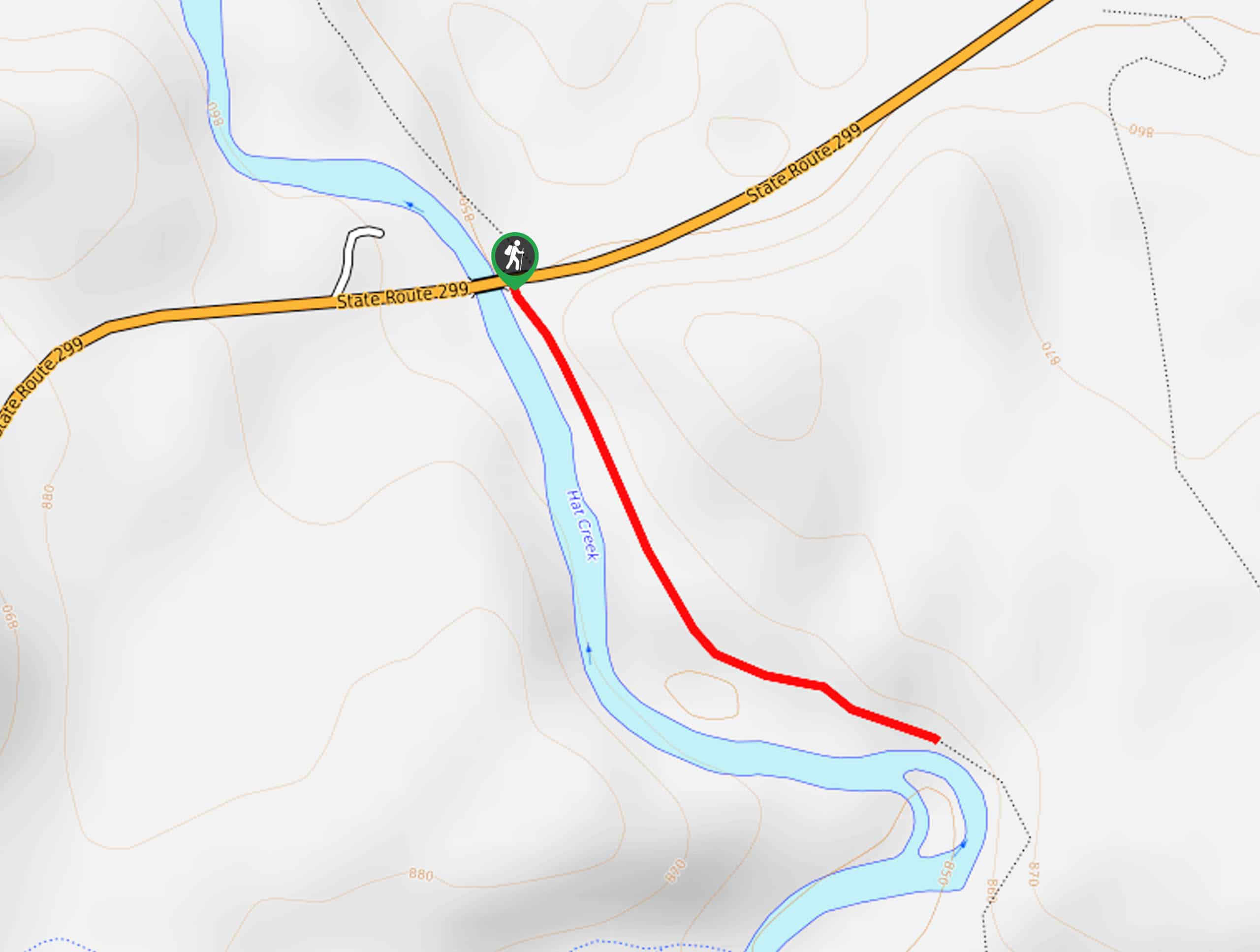
Embark on your walk along the Faery Falls Trail from the trailhead off Ney Springs Road. Setting out from here, the Faery Falls Trail travels southwestward, climbing into the ravine of Ney Springs. Enjoy the sounds of the rushing waters as you meander along the path. Marvel at the lush tree canopies that shade the path, and you will ultimately arrive at the waterfall.
The sights of the cascades will mesmerize you. Let the sound of the crashing waters soothe you as you gaze at the postcard-perfect setting. After reveling in the sight of the chute, retrace your footing along the route back to the trailhead.
Similar hikes to the Faery Falls Trail hike
Elsa Rupp Nature Trail
The Elsa Rupp Nature Trail is a wonderful escape from the hustle and bustle of the city. Reconnect with nature…
Lower Hat Creek Trail
Hikers of all skill levels, ages, and ability levels can enjoy the Lower Hat Creek Trail. This wonderful nature path…
Sisson Southern Trail
The Sisson Southern Trail is a wonderful one-way expedition along the outskirts of Mount Shasta that connects the Sand Flats…
Comments