Landers Lake Loop
View Photos
Landers Lake Loop
Difficulty Rating:
Beckoning intrepid spirits and experienced hikers, the Landers Lake Loop is awaiting your exploration. Wander along beautiful babbling creeks through mixed woodlands, alpine meadows, and granite gardens up to the crystalline lake bounded by the craggy cliffs of Red Rock Mountain. Exhibiting the diversity of flora and fauna, this adventure is well worth adding to your hiking itinerary.
Getting there
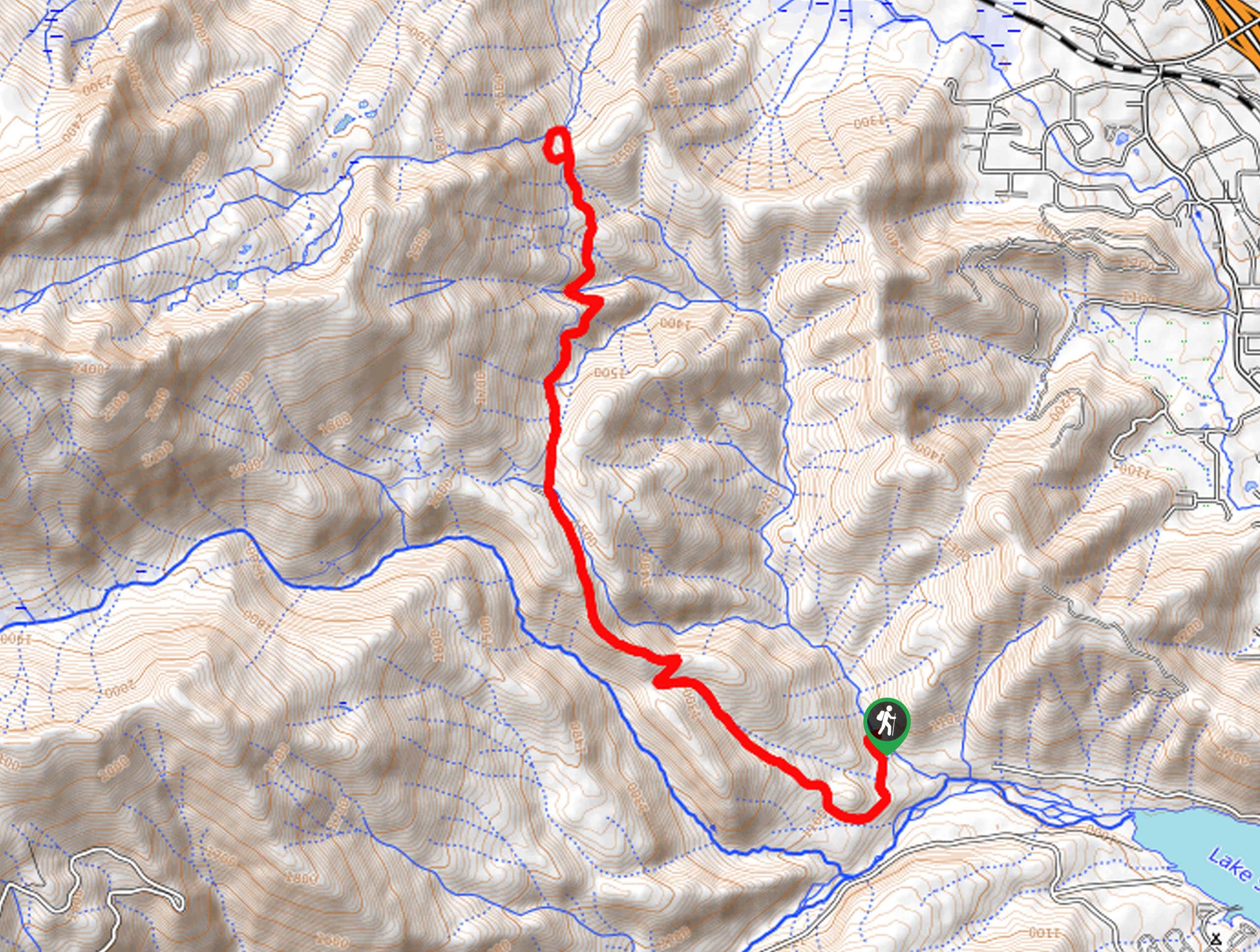
The Landers Lake Loop departs from the Swift Creek/Granite Lake Trailhead off Swift Creek Road.

About
| Backcountry Campground | Backcountry Camping, wilderness permit from either the Weaverville or Shasta Lake Ranger Station required |
| When to do | Year-round |
| Pets allowed | Yes - On Leash |
| Family friendly | No |
| Route Signage | Average |
| Crowd Levels | Moderate |
| Route Type | Lollipop |
Landers Lake Loop
Elevation Graph
Weather
Landers Lake Loop Description
Indulge in the beauty of the Trinity Alps along the Landers Lake Loop. This epic excursion into the high country offers marvelous scenery whilst providing a heart-pumping workout. Traveling through diverse topographies into the alpine terrain, we encourage you to check the forecast prior to your trek and dress in layers as insurance against changing conditions. Additionally, as you meander deep into the wilderness, it is important to be mindful of wildlife, including bears and deer. Wear a sturdy pair of footwear to safeguard your ankles on the rocky and uneven terrain—you’ll thank us later. Pack plenty of water, snacks, and gear in case of emergency.
The Landers Lake Loop boasts an unrivaled experience, offering a scenic and secluded adventure. This awesome adventure travels through lush woodlands, and alpine meadows to crystalline alpine lakes and along beautiful streams—the scenery along this route is unparalleled. Indulge in breathtaking views of the snow-capped craggy summits of the Klamath Mountains and the Cascade Range from the lakeshore and cool off in the chilly alpine waters in the summer months. Tackle this trek as a challenging day hike or overnight expedition—if you plan to camp, make sure to pick up a wilderness permit before heading out. No matter how or when you complete this hike, we know you will not be disappointed by the scenery.
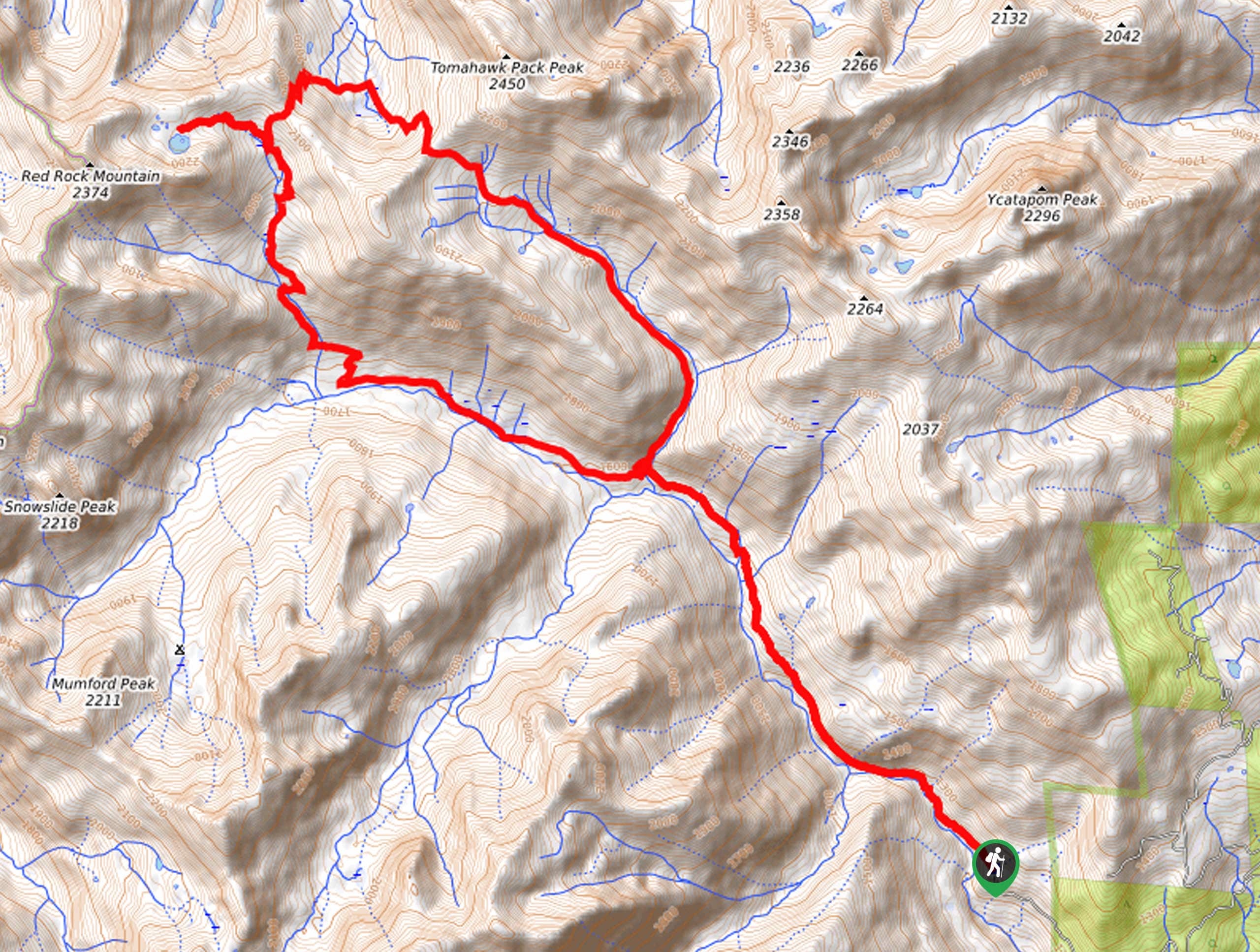
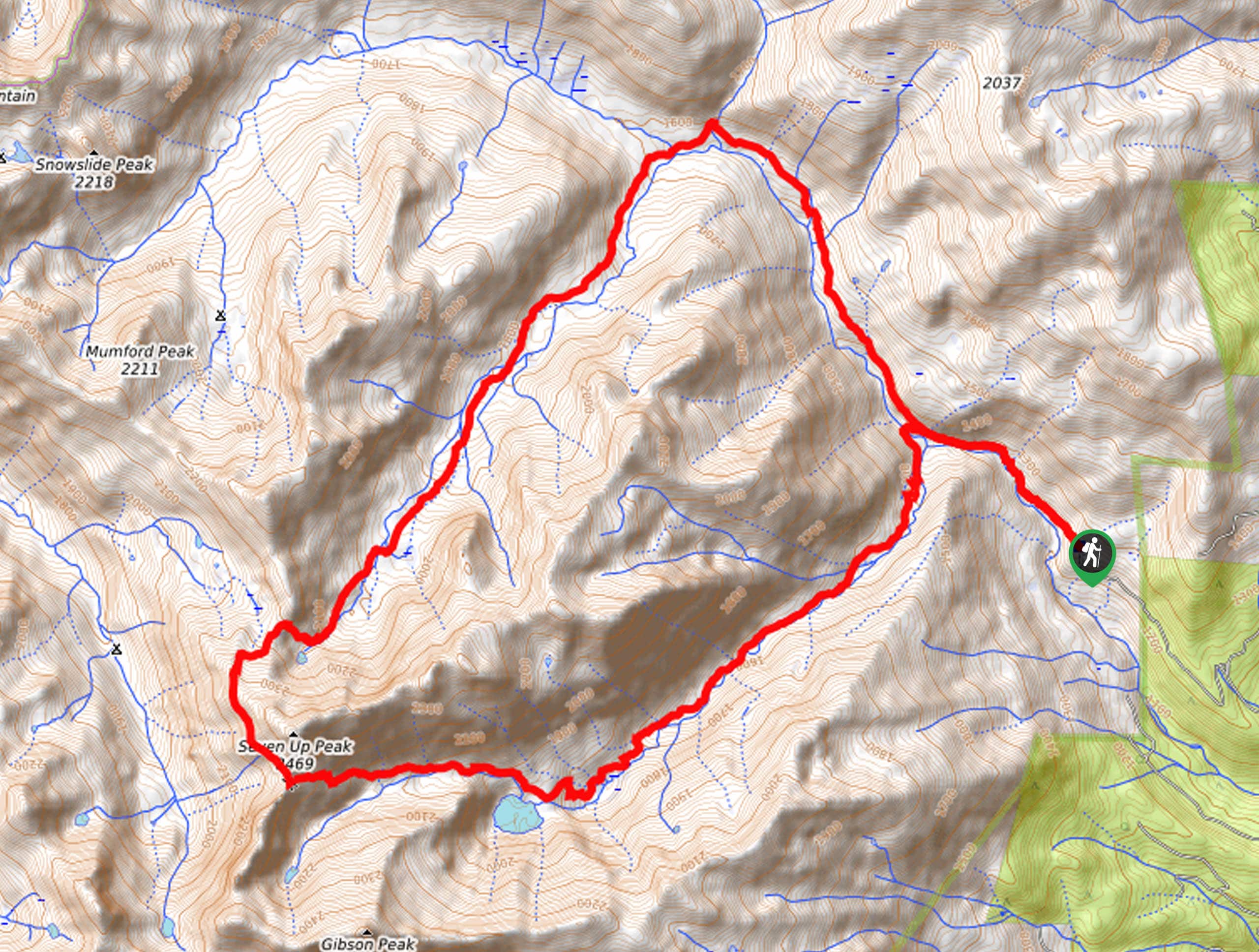
Embark on your adventure along the Landers Lake Loop from the Swift Creek/Granite Lake Trailhead. Setting out from here, hikers will be guided along the Swift Creek Trail, tracking northwest along the gurgling creek. You will eventually enter the wilderness area by wandering through the forested valley of ponderosa pines and Douglas firs. Climbing further into the high country, the forest of mixed conifers will include red fir, incense cedar, and western white pines. Intersecting with Parker Creek, the terrain will transform into marshy meadowlands. Keeping along the Swift Creek Trail, you will pass Fosters Cabin in an alpine meadowland.
Eventually, you will reach Landers Creek. At this junction, veer right, and you will be diverted onto the Landers Lake Trail. Hiking north, the incline will increase in intensity. Explore the granite gardens up to Landers Lake via the Landers Lake Spur Trail. Admire the beauty of the crystalline alpine lake bounded by the red-hued craggy cliffs of Red Rock Mountain. If weather and time permit, rejuvenate your tired body in the chilly waters. When you are ready to head back, wander east along the Landers Lake Trail before merging onto the Parker Creek Trail. Follow this path along Parkers Creek and back down to Swifts Creek. Here, turn left and retrace your footing east along the Swift Creek Trail all the way back to the trailhead.
Frequently Asked Questions
How long is the Landers Lake Loop Trail?
The Landers Lake Loop is a 15.4mi hike in the Shasta-Trinity National Forest.
Is the Landers Lake Loop a difficult hike?
The Landers Lake Loop Hike is a moderately difficult hike in the Trinity Alps.
Are dogs permitted on the Landers Lake Loop?
Yes, dogs are permitted on the Landers Lake Loop. Sections of the route require dogs to remain on leash, so please respect the signposts.
Insider Hints
This route is buggy, so pack some bug spray
In the winter months, a pair of microspikes is needed
Pack plenty of water and snacks to stay fueled
Download the trail GPS before heading out
Be mindful of wildlife, including deer and bears along this route
Get a wilderness permit and spend the night in the backcountry
Mind your footing on the rocky terrain
Similar hikes to the Landers Lake Loop hike
Sisson Callahan Trail
The Sisson Callahan Trail is an awesome one-way expedition through the Trinity Alps Wilderness that boasts incredible views of the…
Wagon Creek Falls via Deer Creek Hike
The Wagon Creek Falls via Deer Creek Hike beckons intrepid explorers who won’t shy away from a challenge. Put your…
Bear Basin Loop
Seeking a day hike in the Trinity Alps Wilderness that checks all the boxes—long, scenic, diverse, and well maintained? Well,…
Comments