
Bear Basin Loop
View Photos
Bear Basin Loop
Difficulty Rating:
Seeking a day hike in the Trinity Alps Wilderness that checks all the boxes—long, scenic, diverse, and well maintained? Well, the Bear Basin Loop satisfies all those requirements, adding in a few bonuses too! This amazing adventure into the high country will not disappoint.
Getting there
The Bear Basin Trail departs from the Swift Creek Trailhead off Swift Creek Road.

About
| Backcountry Campground | |
| When to do | Year-round |
| Pets allowed | Yes - On Leash |
| Family friendly | No |
| Route Signage | Average |
| Crowd Levels | High |
| Route Type | Lollipop |
Bear Basin Loop
Elevation Graph
Weather
Bear Basin Loop Description
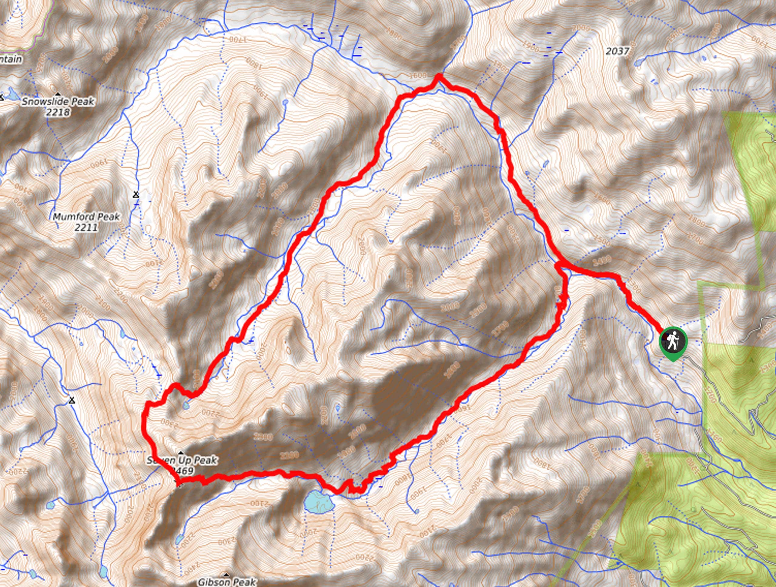
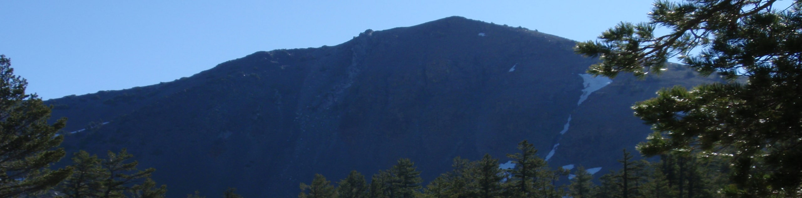
The Bear Basin Loop Trail is an unassumingly beautiful adventure in the Shasta Trinity National Forest that offers views of the craggy Klamath Mountains and Mount Shasta. Exhibiting the grandeur and diversity of the terrain, you will pass through dense forestlands, montane meadows, alpine lakes, and up granite cliffs along this adventure. Be sure to wear a comfy pair of footwear and dress in layers as insurance against changing conditions. Additionally, though not necessary, the trail GPSP may prove useful, especially when trekking in the winter months.
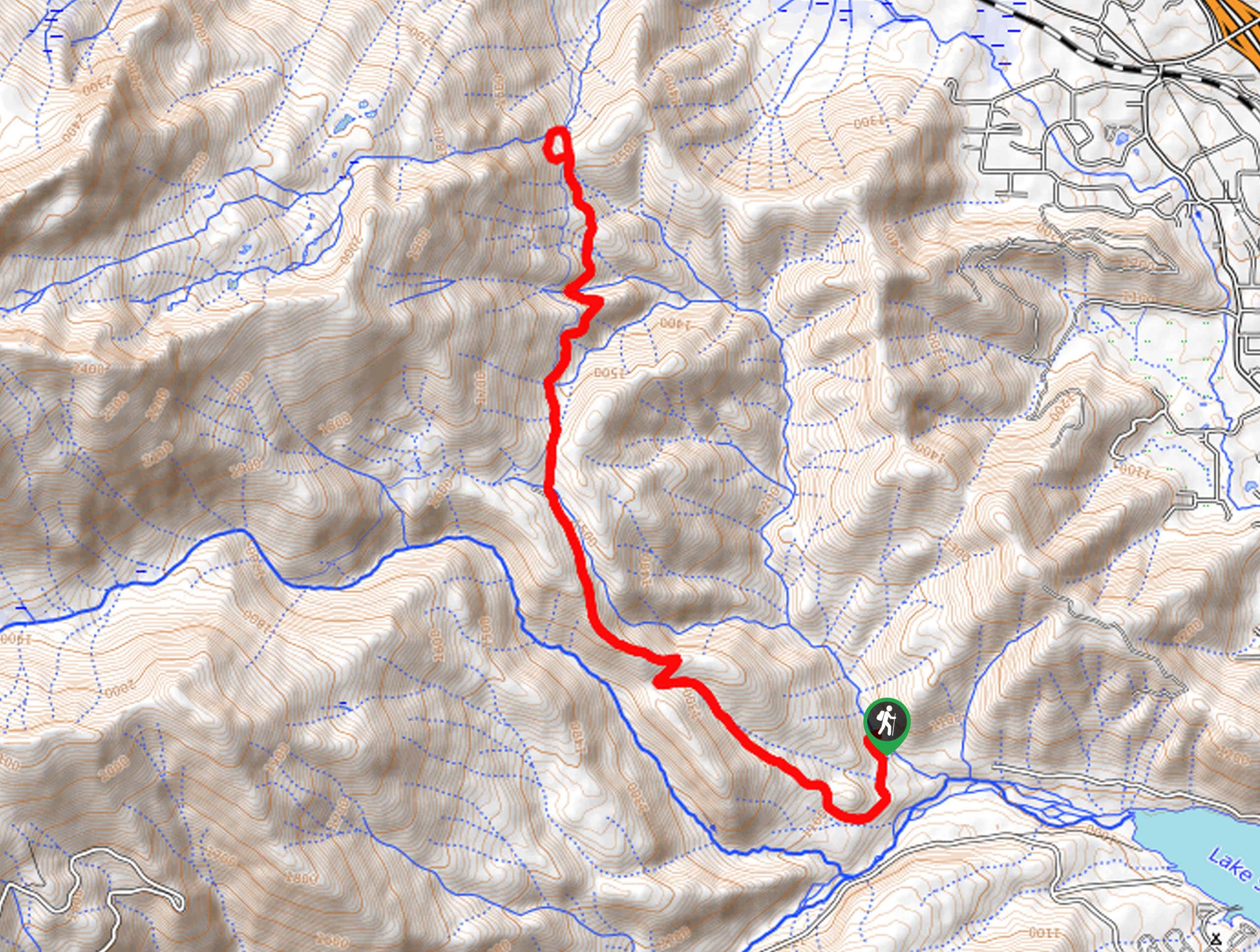
Embark on your adventure along the Bear Basin Loop from the Swift Creek Trailhead. Setting you from here, you will be guided northwest along the Swift Creek Trail, which follows the curve of the gurgling creek. Enjoy the relaxing ambiance of the stream and the sights of the encompassing vegetation. Gradually climbing higher into the alpine terrain, you will eventually reach an intersection with the Bear Basin Trail; keep left here. This route will divert you southwest, traveling along Bear Creek and up to a saddle. Here, veer left, and you will be diverted onto the Seven-Up Peak Trail. You will be granted expansive views of the mountainous landscape from this route.
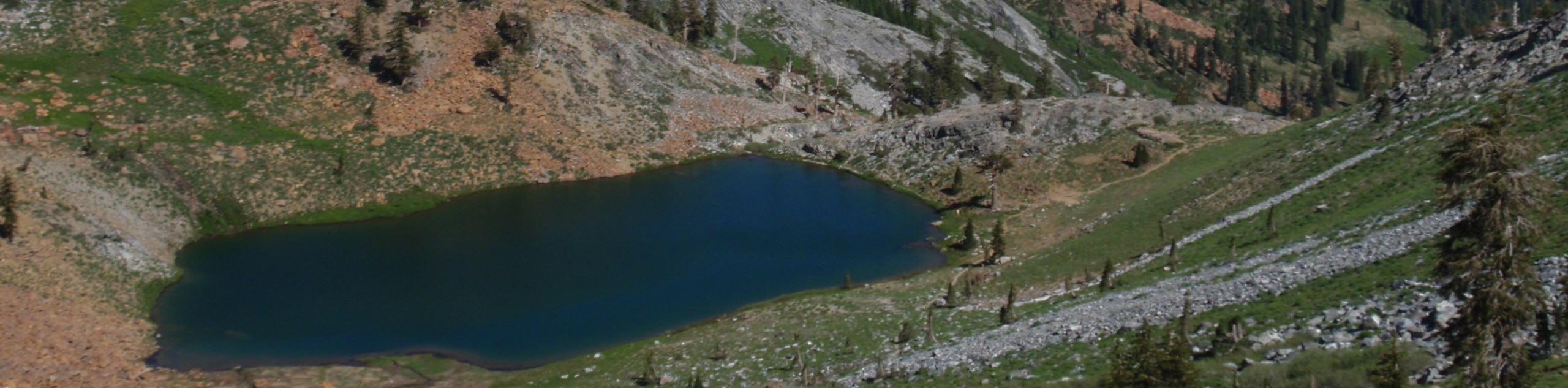
Continue hiking, merging onto the eastward traveling Granite Lake Trail. This path will guide you down to the charming alpine lake bounded by granite bluffs. Admire the scene, then continue east along the route, eventually reconnecting with the Swift Creek Trail. Keep right and retrace your steps along the Swift Creek Trail back to the trailhead.
Similar hikes to the Bear Basin Loop hike
Sisson Callahan Trail
The Sisson Callahan Trail is an awesome one-way expedition through the Trinity Alps Wilderness that boasts incredible views of the…
Wagon Creek Falls via Deer Creek Hike
The Wagon Creek Falls via Deer Creek Hike beckons intrepid explorers who won’t shy away from a challenge. Put your…
Long Canyon Trail to Deer Lake
Leading hikers through mixed conifer forests, montane meadows, through a granite bound valley, and up to an alpine pool, the…
Comments