hikes in Mount Baker-Snoqualmie National Forest
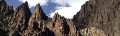
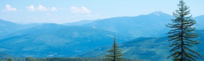
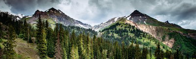
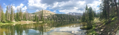
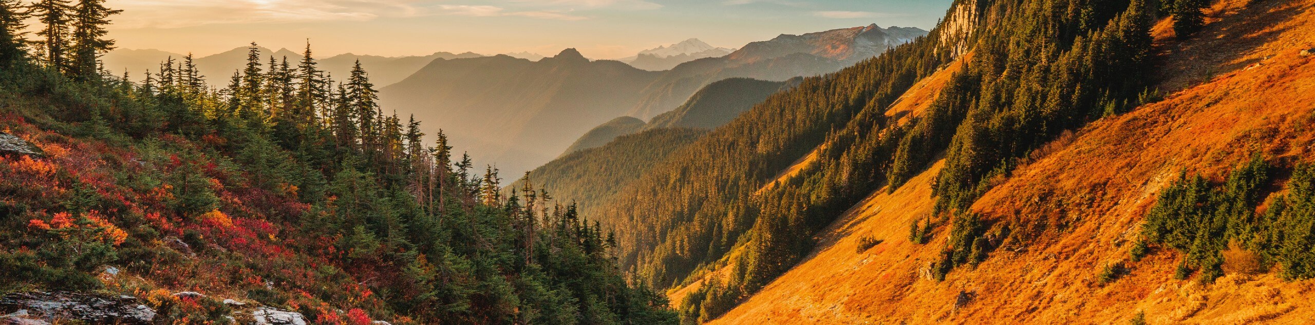
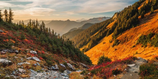
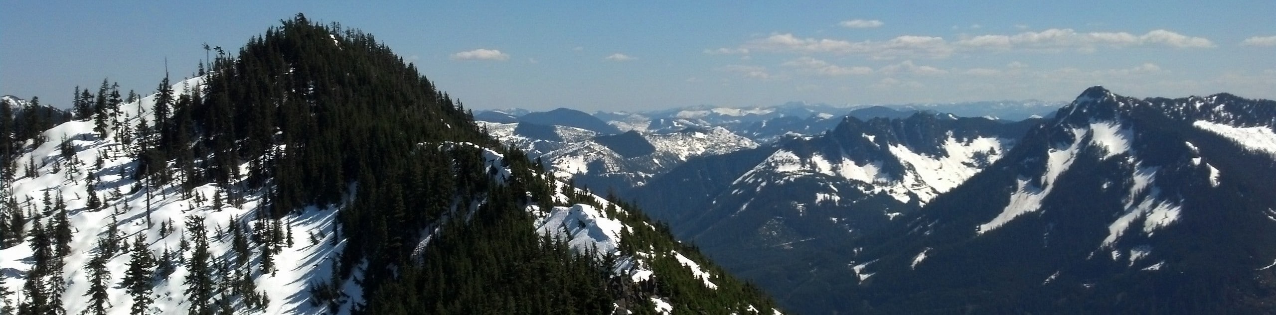
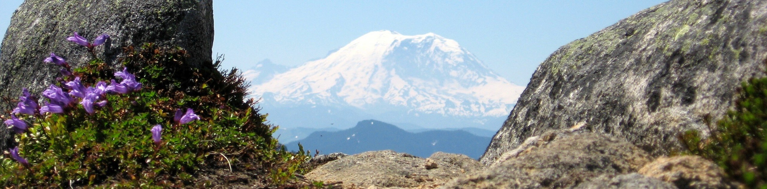
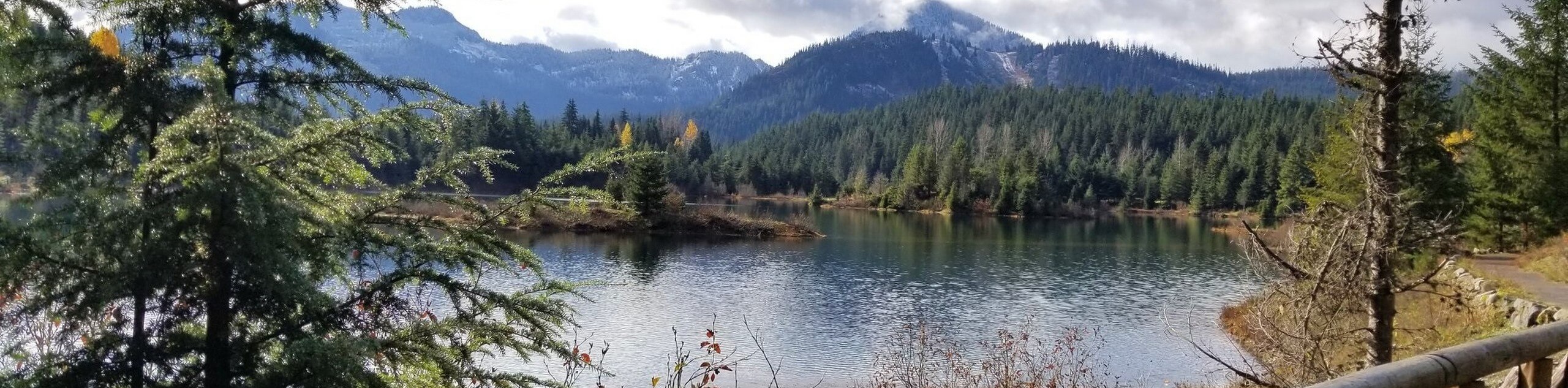
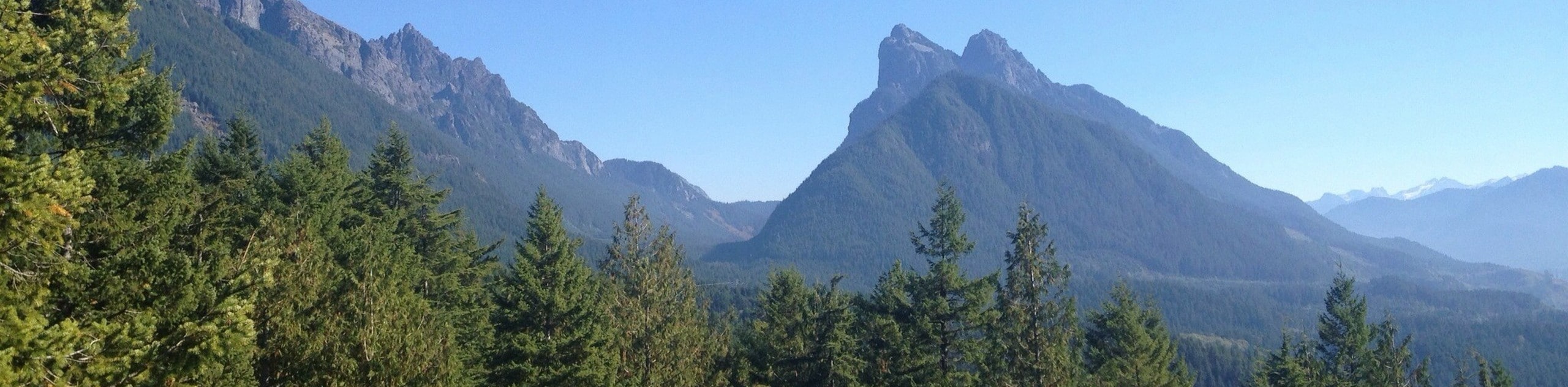
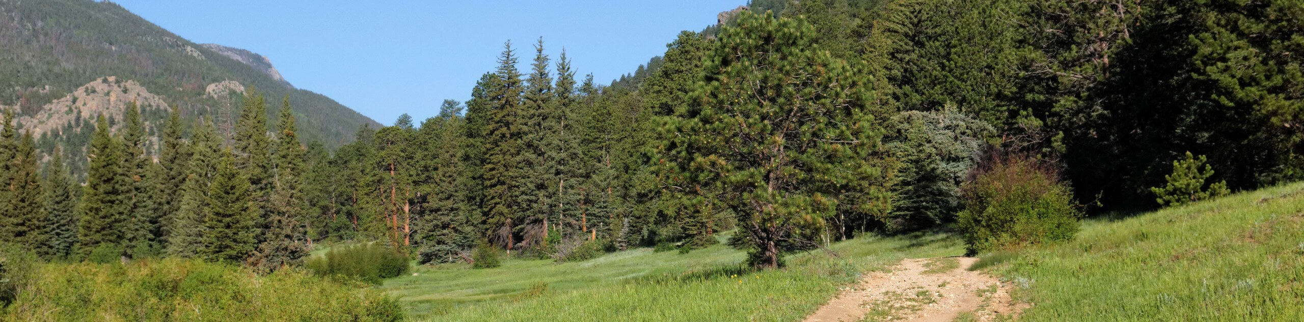
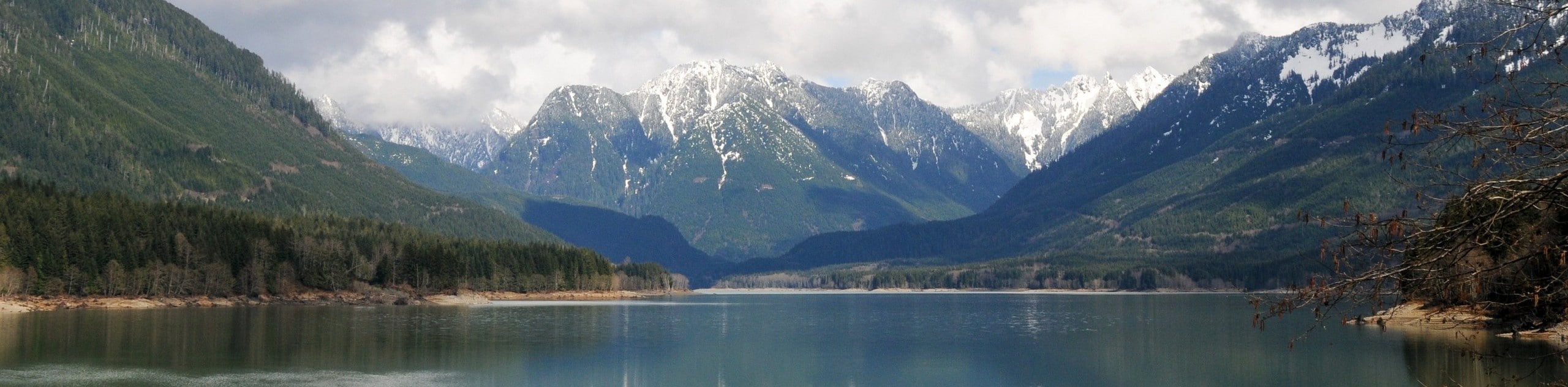
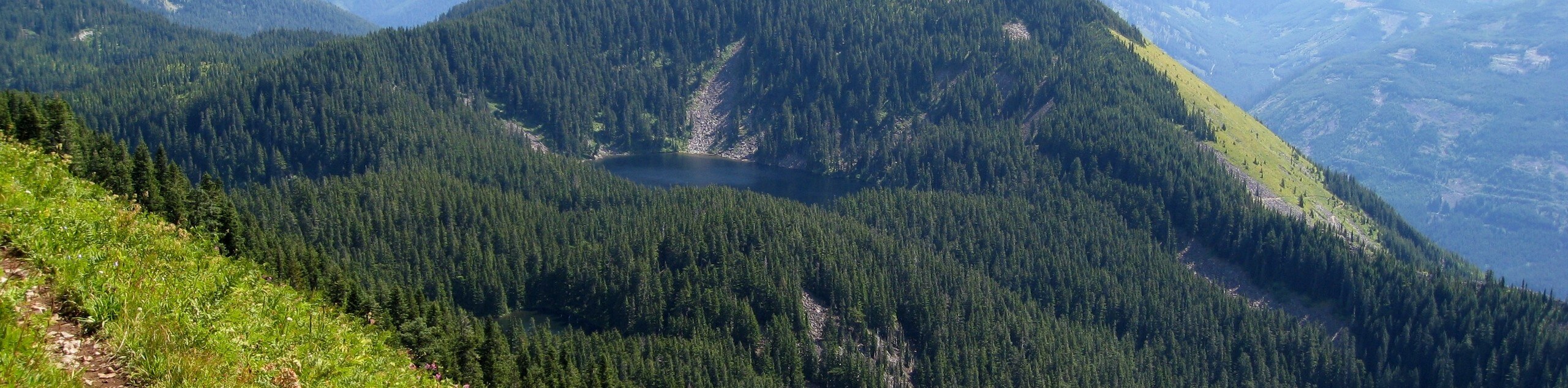
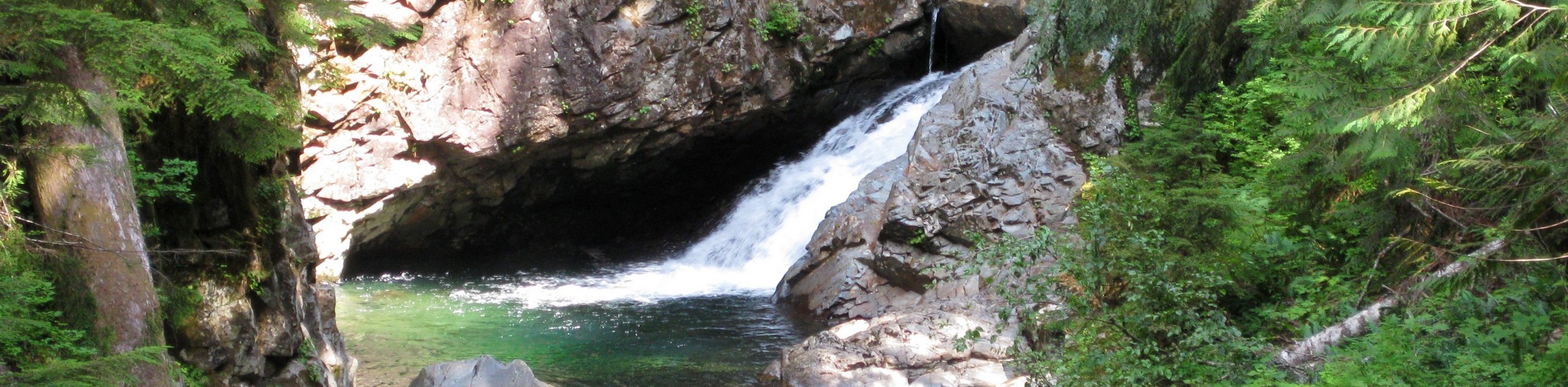
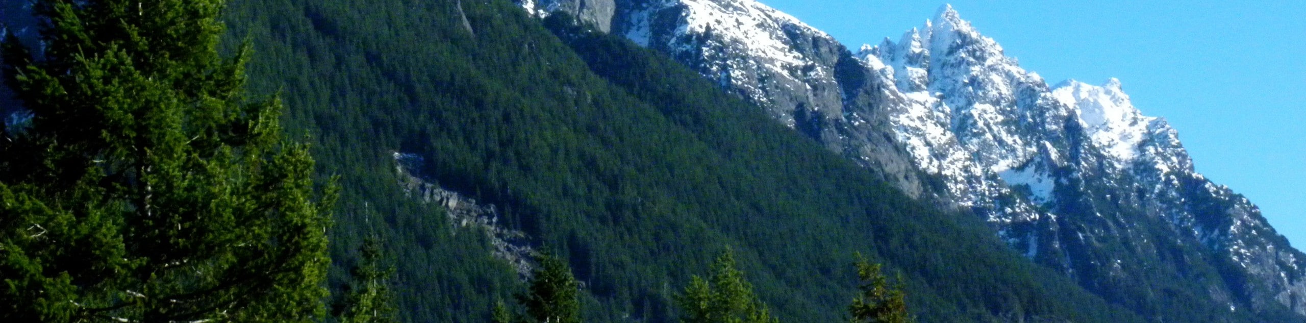
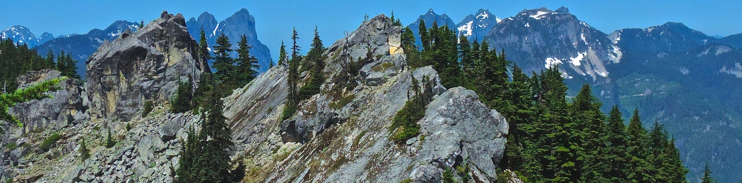
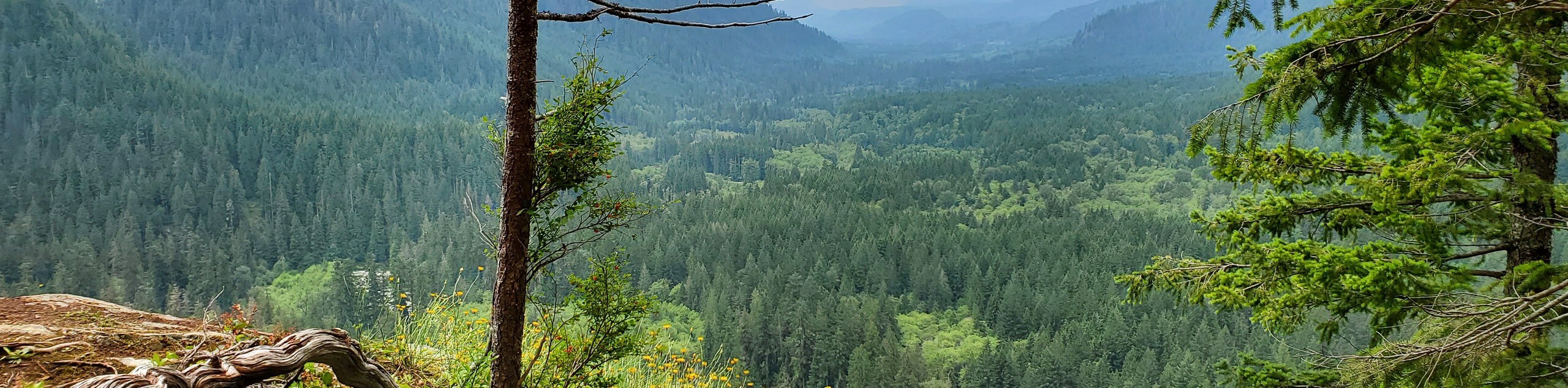
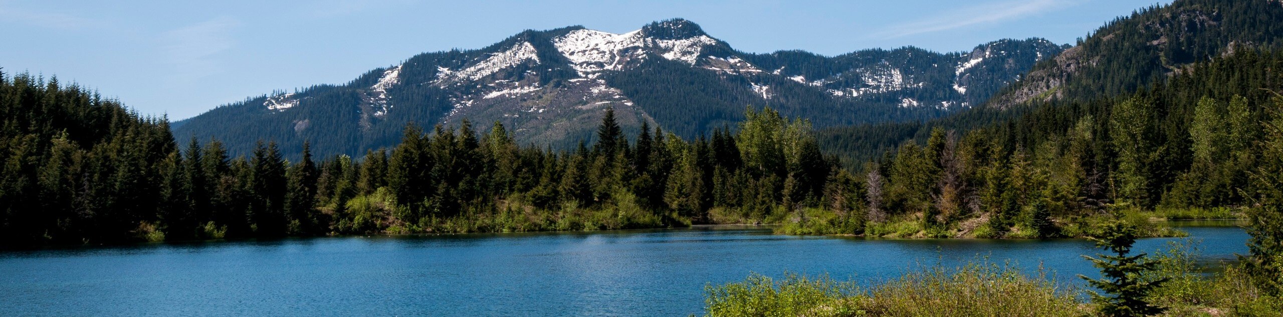
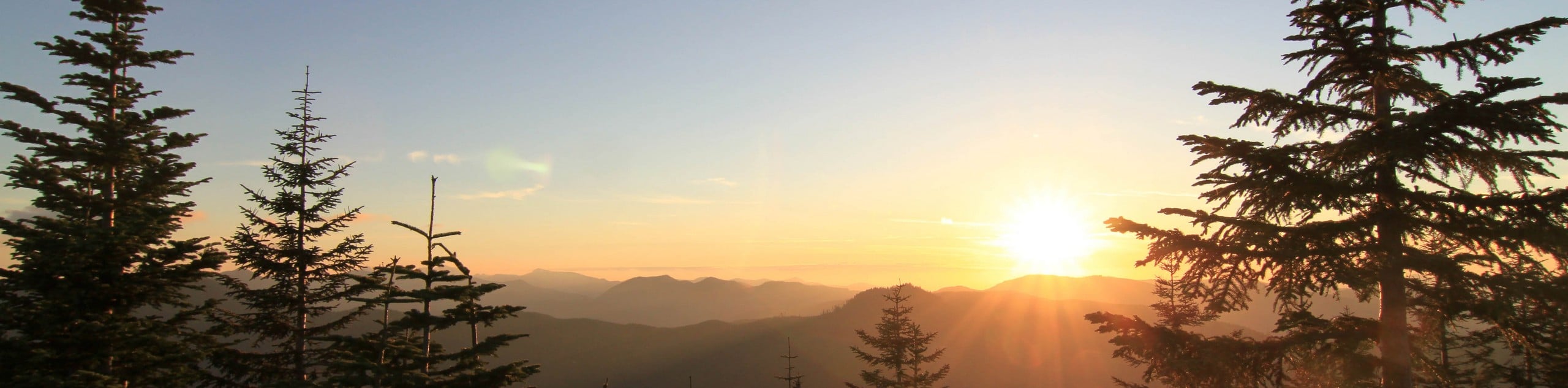
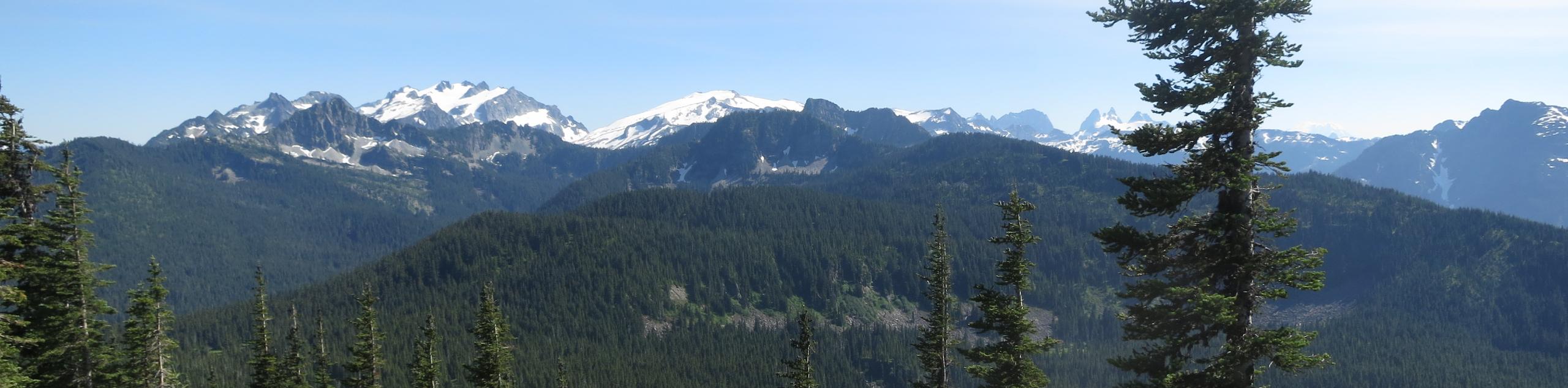
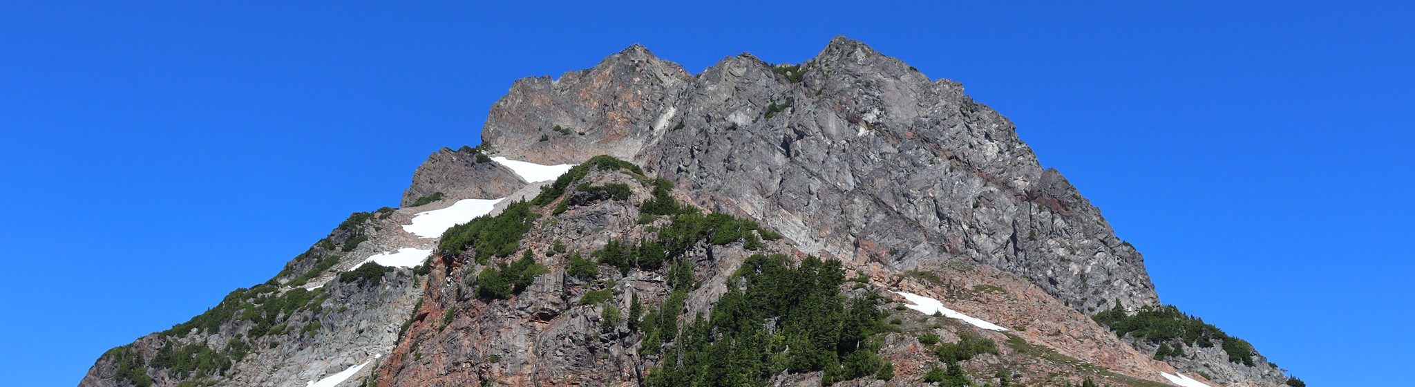
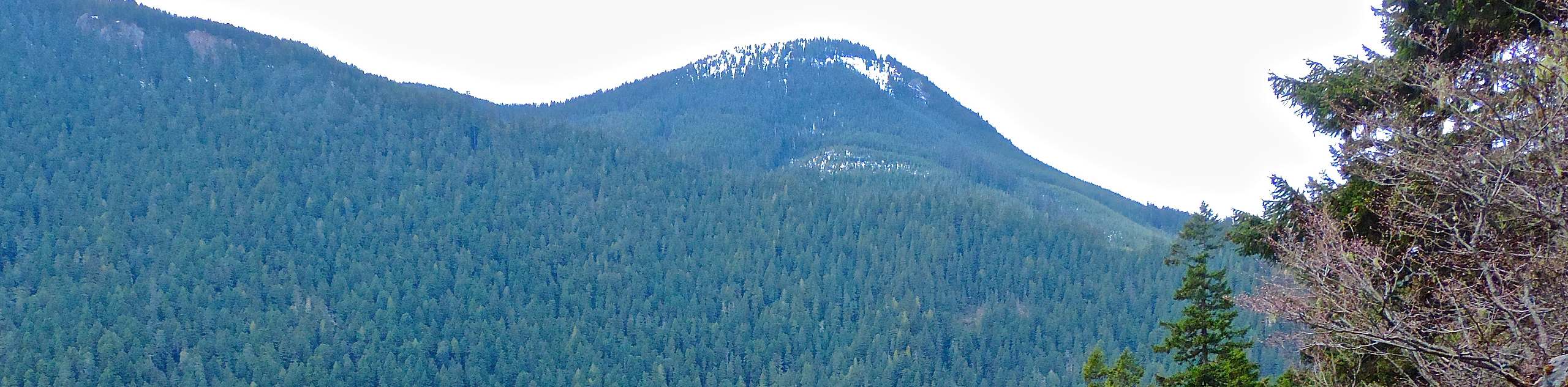
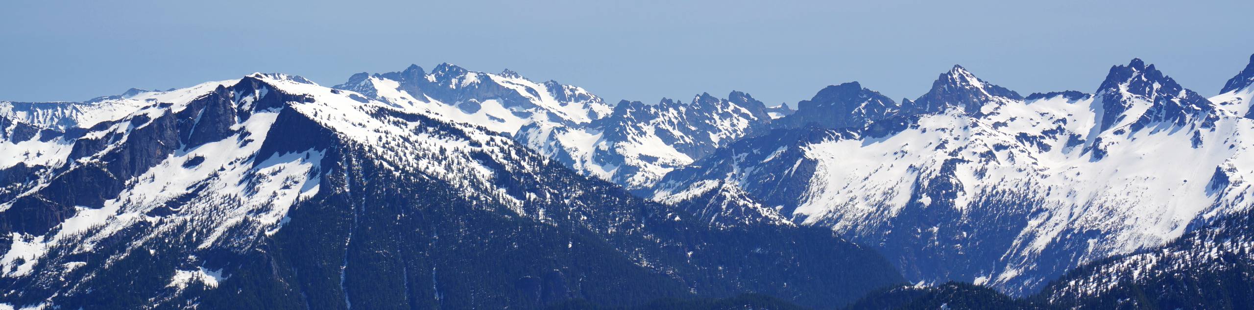
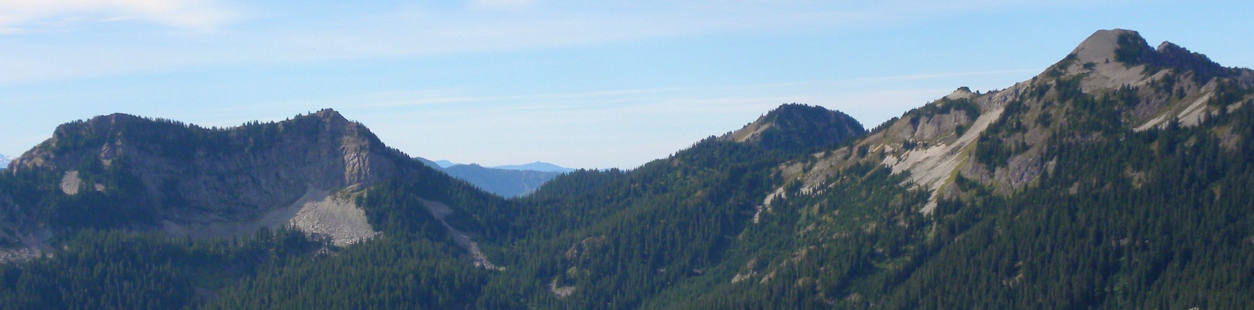
Mount Baker-Snoqualmie National Forest is one of the premier outdoor adventure destinations of Washington State, comprising over 1.7 million acres of pristine scenery. The forests are anchored by the towering Mount Baker and Glacier Peak, which rise thousands of feet above the adjacent peaks. With wide carpets of colorful wildflowers, cascading waterfalls, and old-growth forests, this park is a dream for hikers and adventurers of all ages and one of the most visited sites in the Pacific Northwest. With 62% of the state’s population living within a 70.0mi drive of the forest, Mount Baker-Snoqualmie National Forest is the most visited national forest in the country. Hikers, bikers, snowshoers, and campers flock here.
Mount Baker-Snoqualmie National Forest was established beginning in 1897 and finalized in 1974. Sections of the park, mostly the north and east, are exceptionally rugged and protect over 600,000 acres of old-growth forest. With protected wilderness areas covering nearly half of the forest’s area, the natural beauty of Mount Baker-Snoqualmie can be preserved for generations to come and the flora and fauna of the region can enjoy a permanent haven.
All you have to do now is pick your adventure! With a wide array of trails to hike, we’ve put together a list of our favorite hikes in Mount Baker-Snoqualmie National Forest to help you plan your trip. This is just the start, though- there’s so much to see here!
12 Epic Hikes in Mount Baker-Snoqualmie National Forest
There are so many hikes to choose from in Mount Baker-Snoqualmie National Forest, it can be daunting to try and choose! We’ve picked out some of our favorite trails in all corners of the park to help you start to plan your adventure.
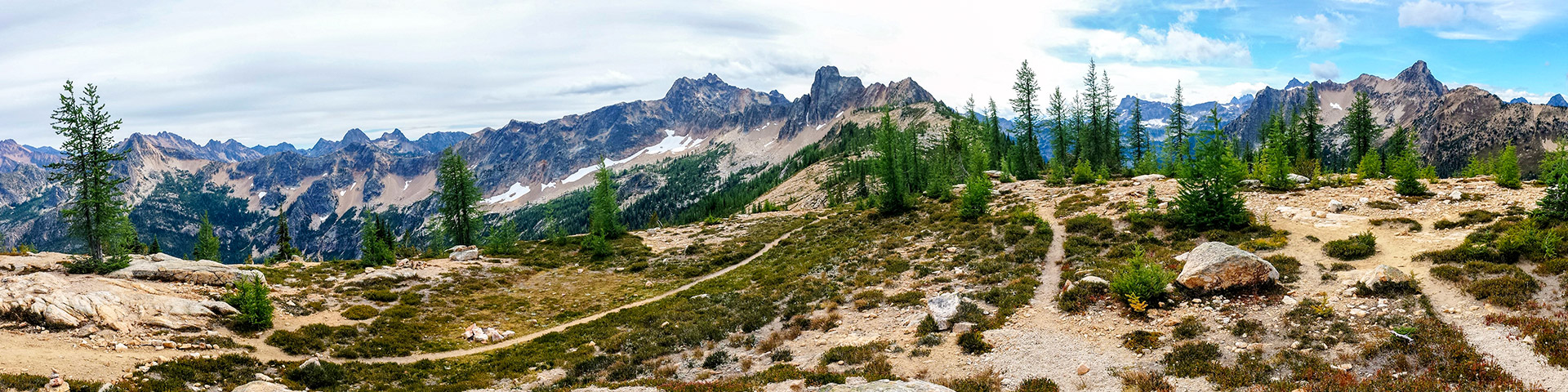
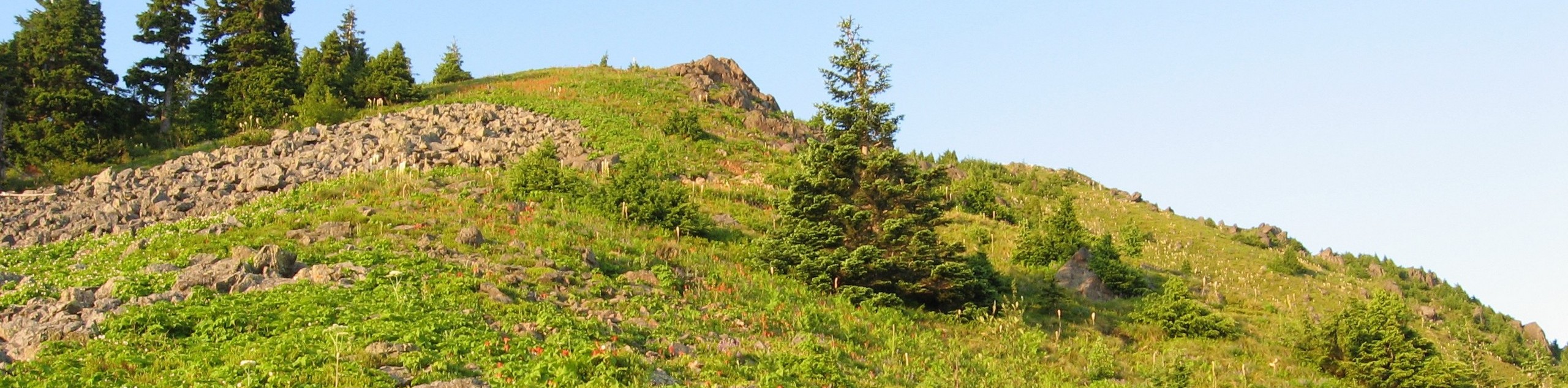
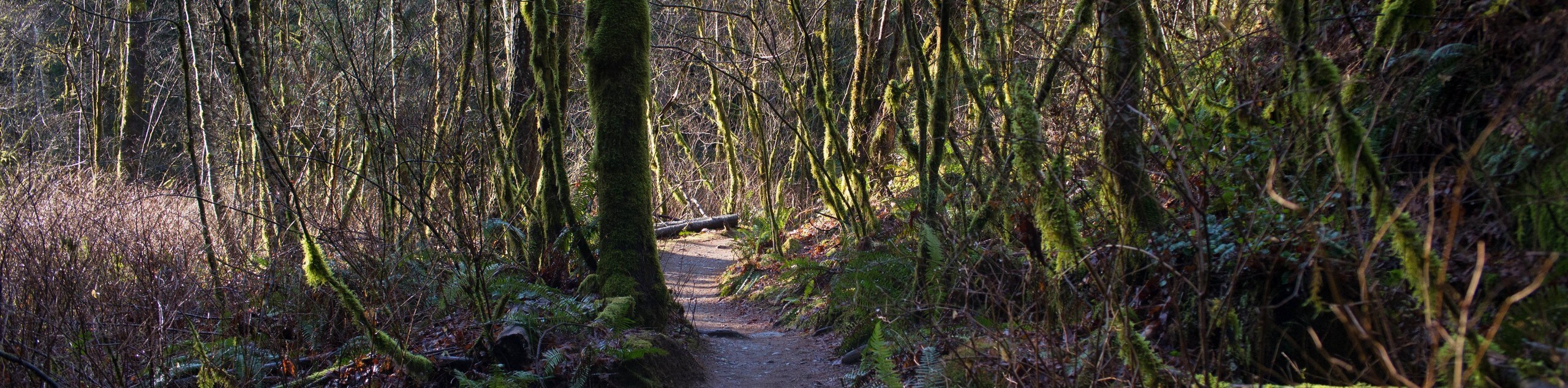
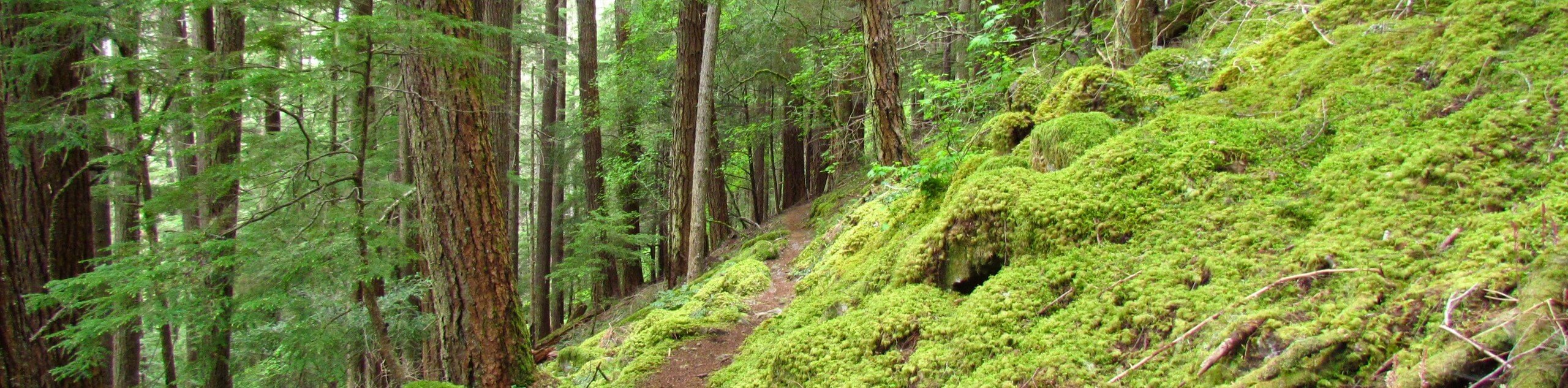
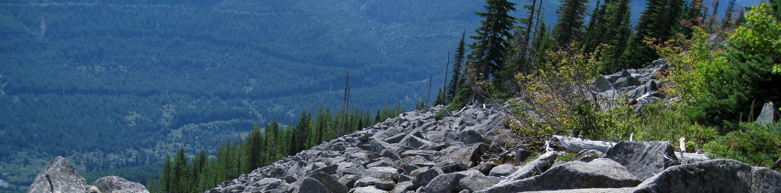
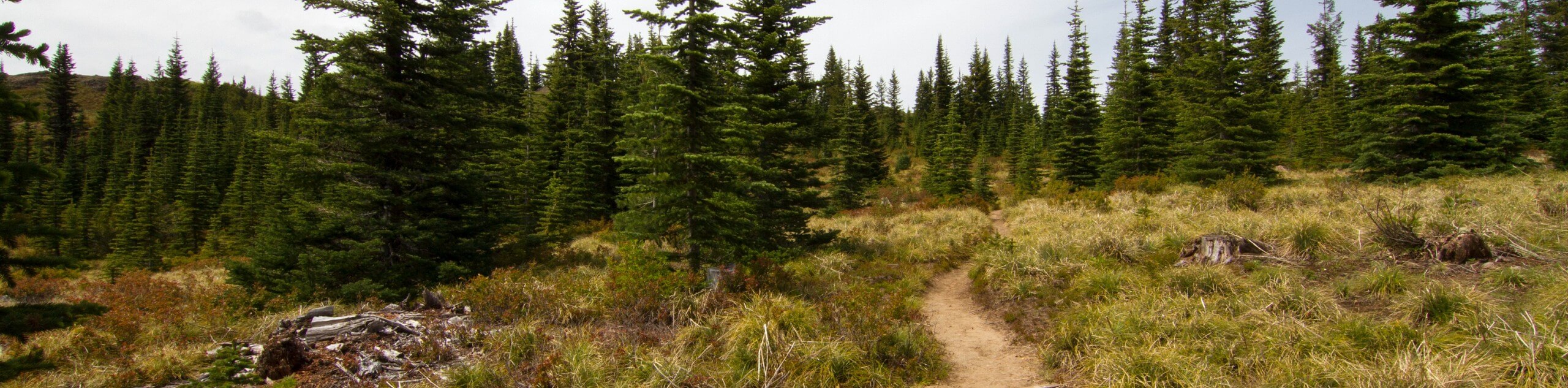
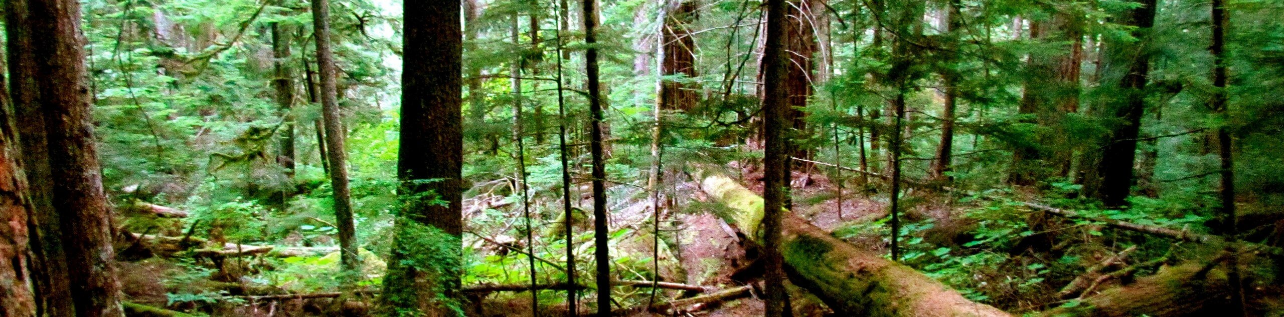
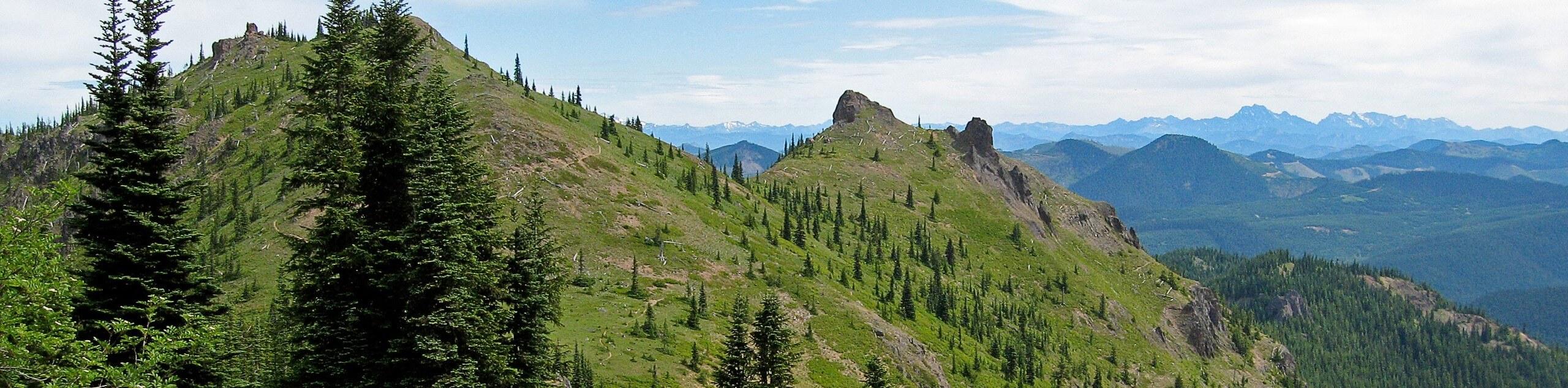
There is a trail for every hiker here. There are family-friendly trails, ADA-accessible trails, more challenging hikes, and long multi-day backpacking trips on offer, so you’ll be able to choose the right one no matter what you’re seeking. With lots of ancient trees to see and plenty of waterfalls hidden in the forests, you’ll enjoy a distinctly Pacific Northwest feel on most of these hikes. If you’re looking for an epic summit ascent, you can find that too! Or, if you’re just wanting to get some steps in with a stroller, you can do just that.
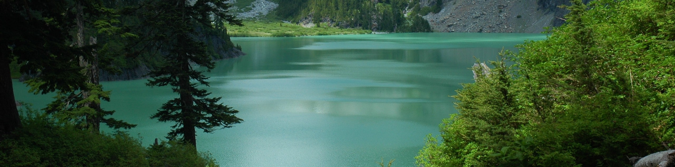
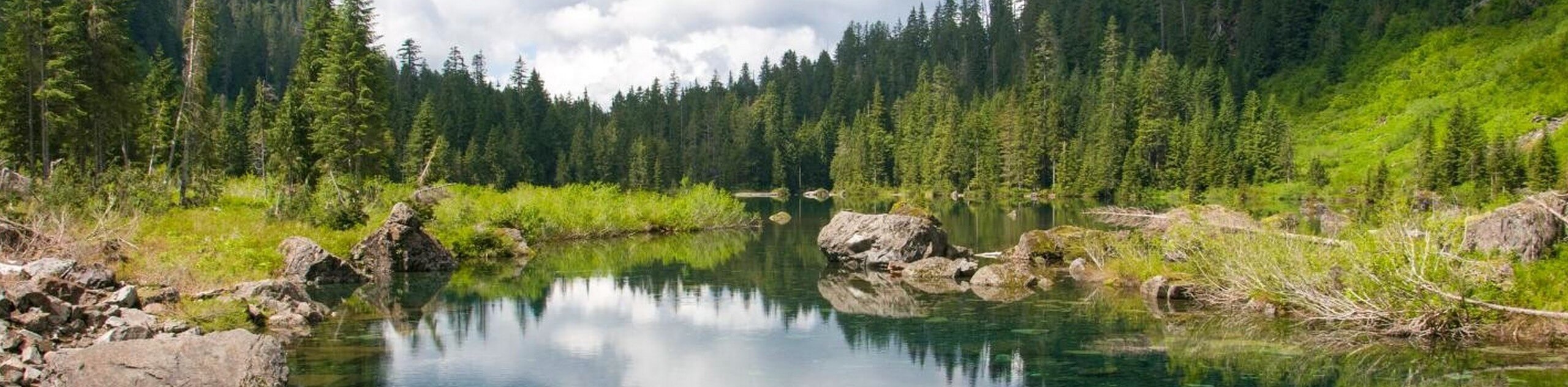
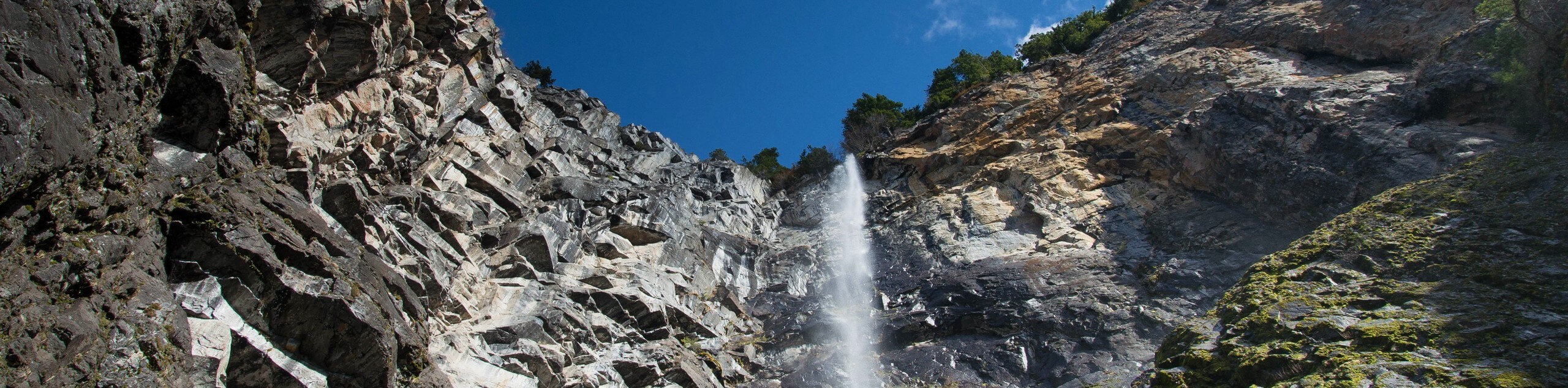
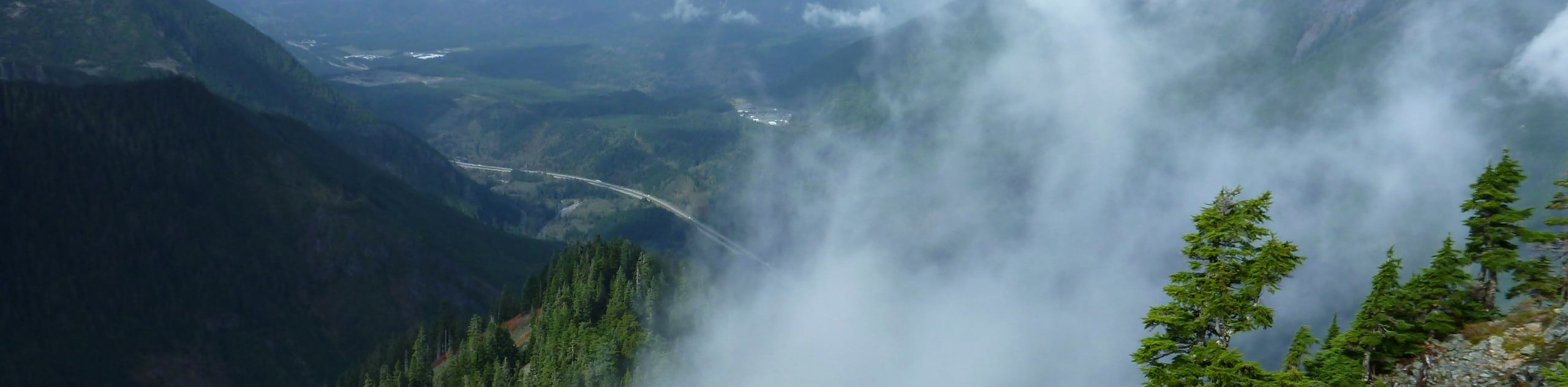
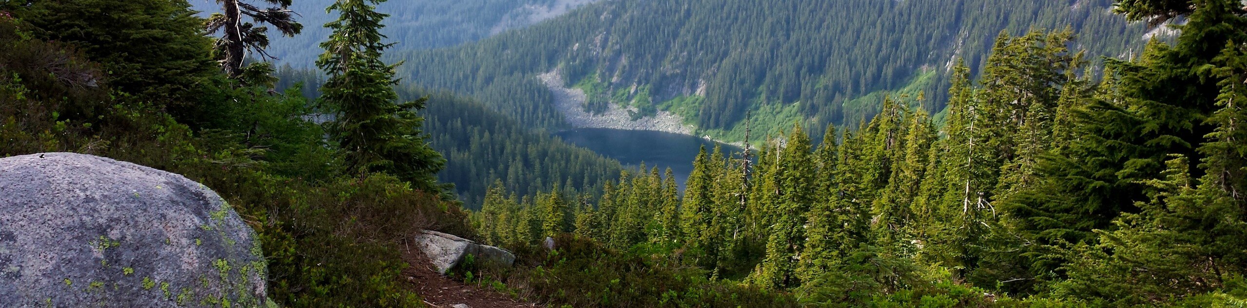
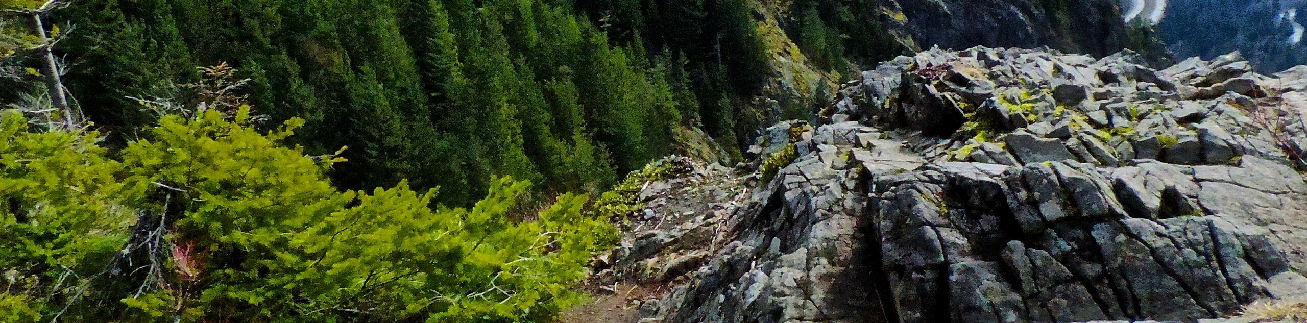
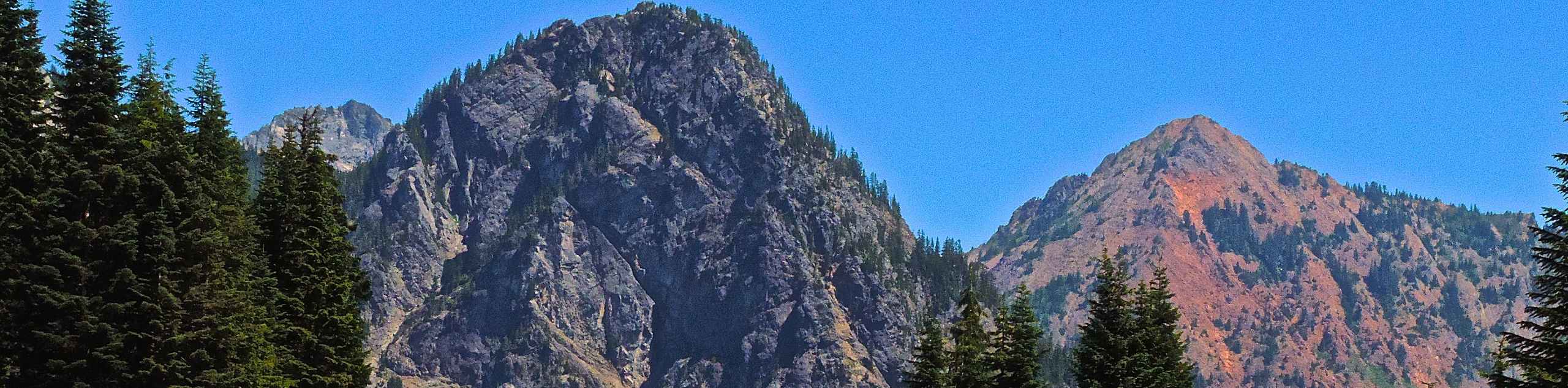
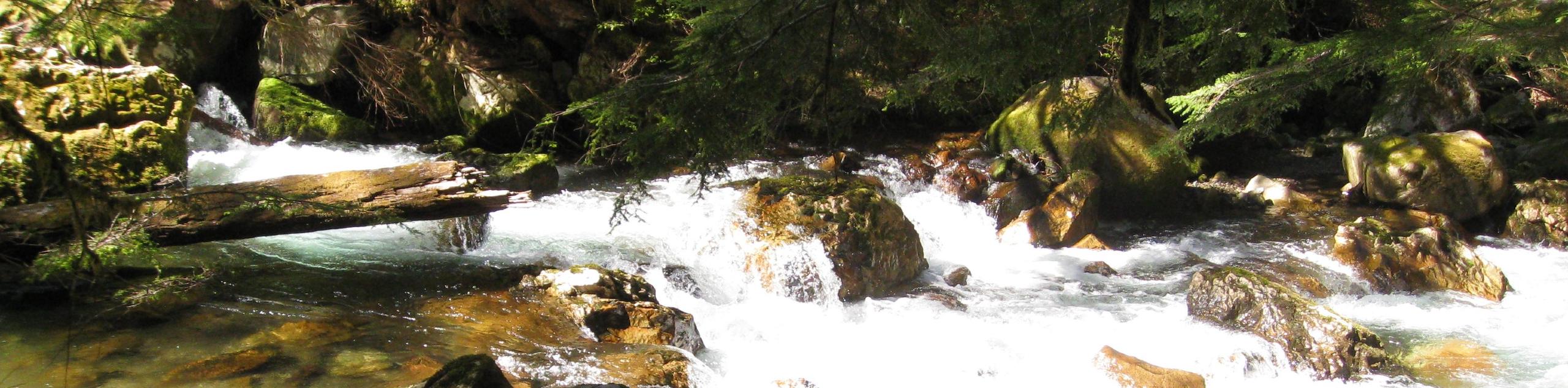
No matter which hike you take, you’ll be treated to splendid views of the Cascades, countless flowers, waterfalls, clear lakes, and mossy forests.
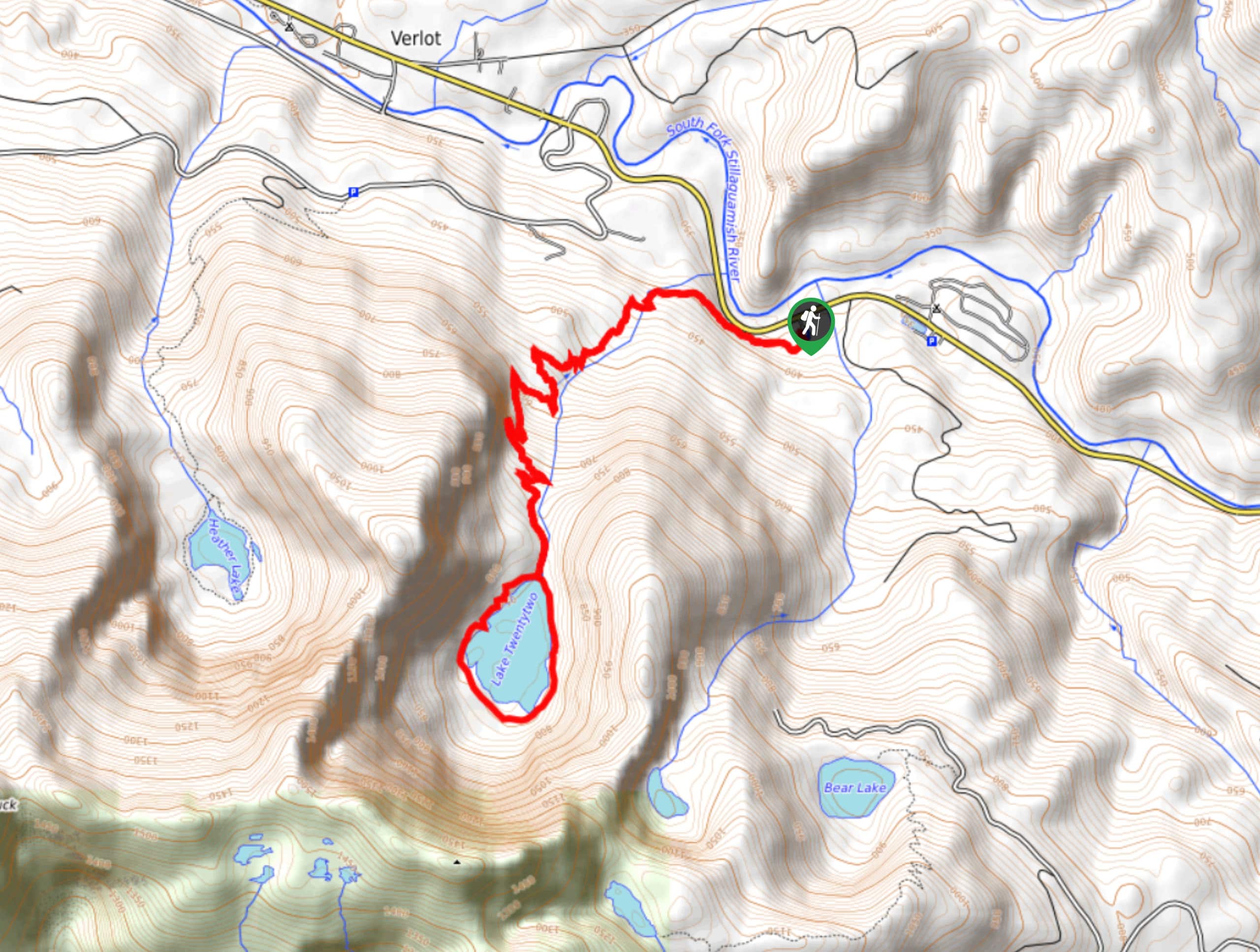
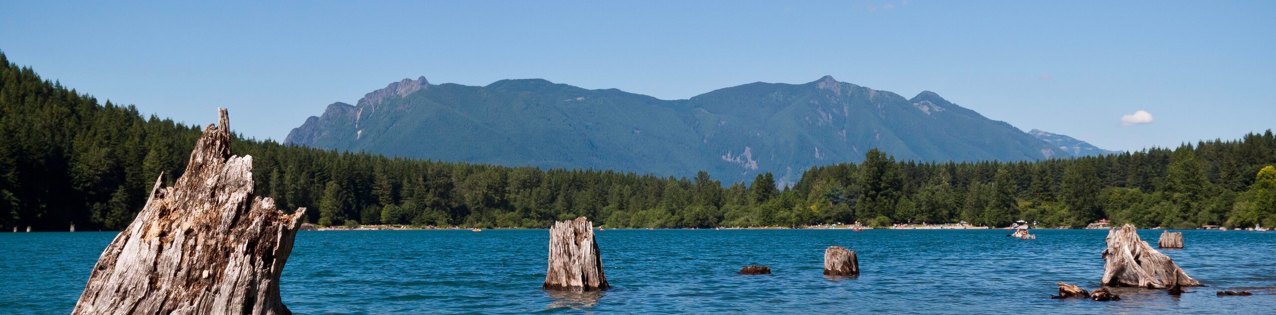
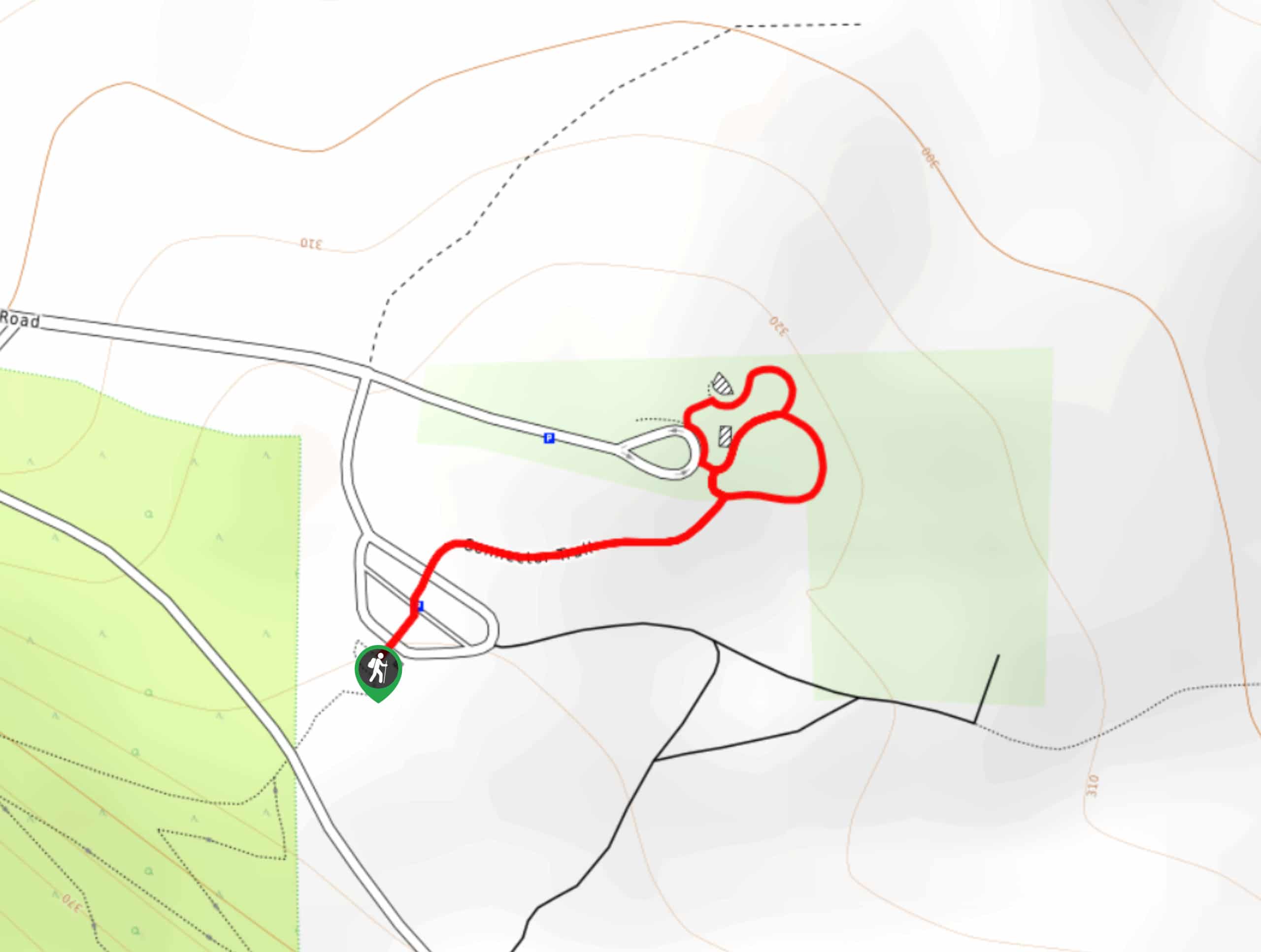
- Lake 22 Trail: The hike on Lake 22 is a popular choice in Mount Baker-Snoqualmie, and for good reason. This moderate hike is doable for many skill levels, the lake is serene, and the forest leading up to the lake is mature and beautiful.
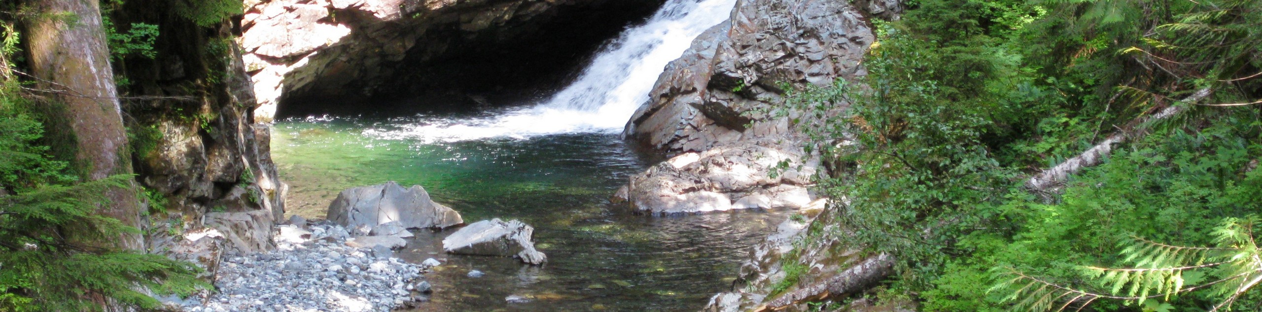
- Franklin Falls Trail: Waterfall hikes are some of the best to enjoy in Washington, and Franklin Falls Trail is hugely popular with locals and visitors to the area alike. This simple, quick trail is a joy for families and hikers of all levels. With no difficult or technical sections and only modest elevation gain, little ones and beginners are especially likely to enjoy this trail.
- Rattlesnake Ledge Trail: This trail begins at the calm shores of Rattlesnake Lake and climbs up the side of Rattlesnake Mountain to a ledge with a jaw-dropping view. The Rattlesnake Ledge Trail is a bang-for-your-buck outing and a great choice for hikers who want elevated views. While delivering a great viewpoint, you won’t need to contend with any technically difficult sections.
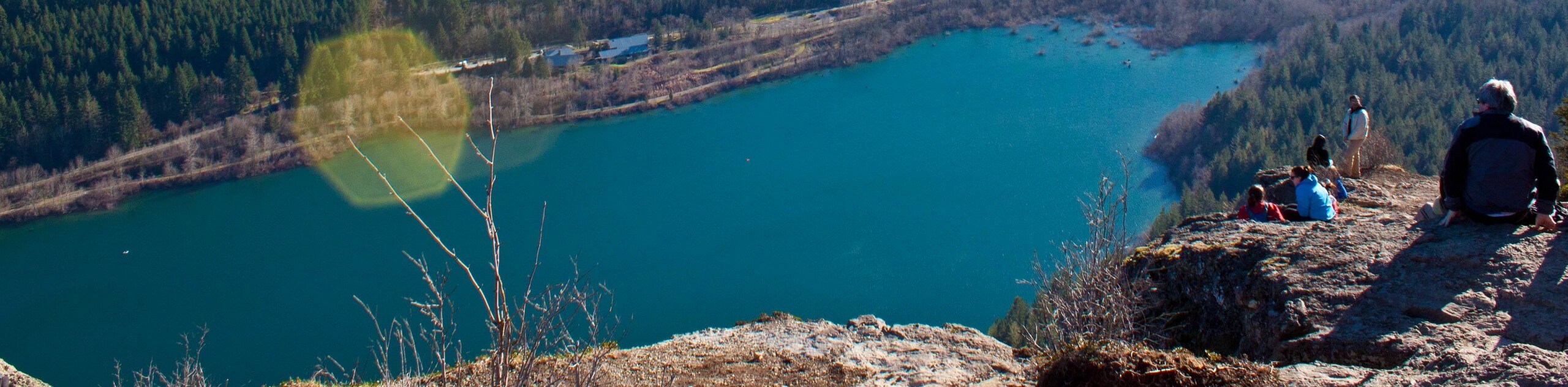
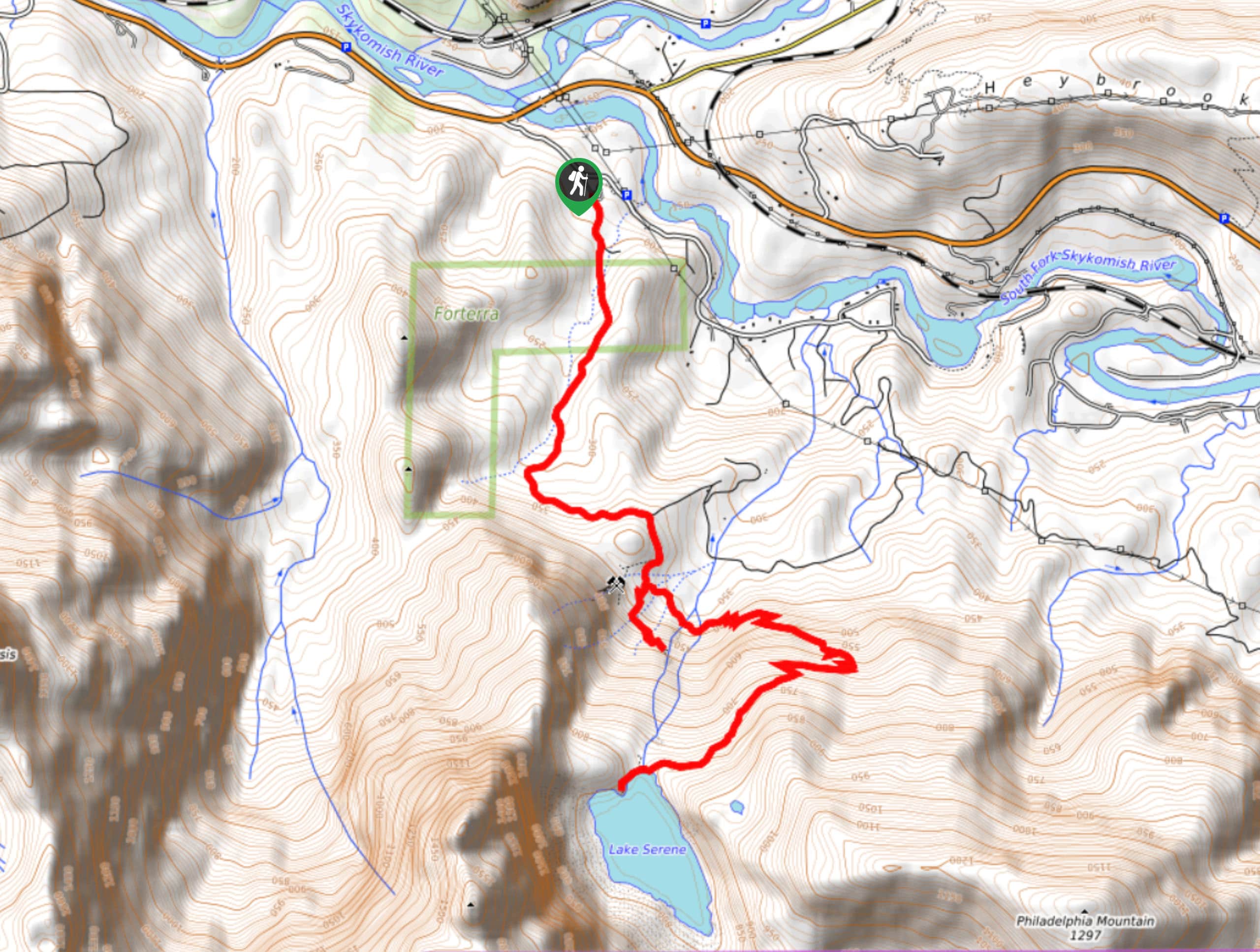
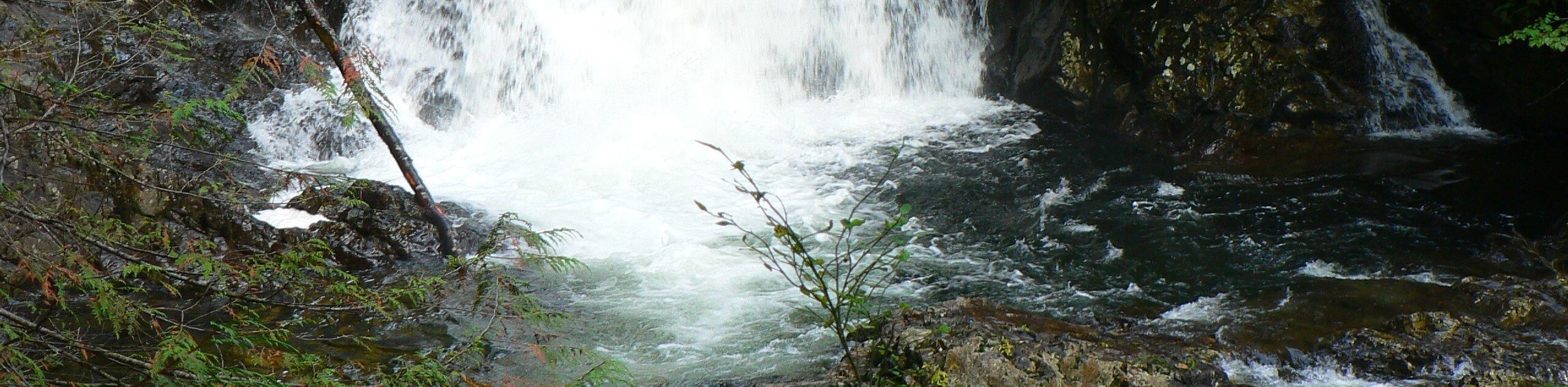
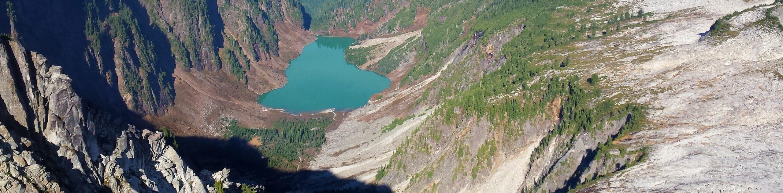
- Bridal Veil Falls and Lake Serene: Bridal Veil Falls and Lake Serene are two stunning viewpoints that occupy the same trail, making for a very impressive hike. While this hike is considered strenuous by many, the cascading falls and the peaceful lakeshore are worth the effort.
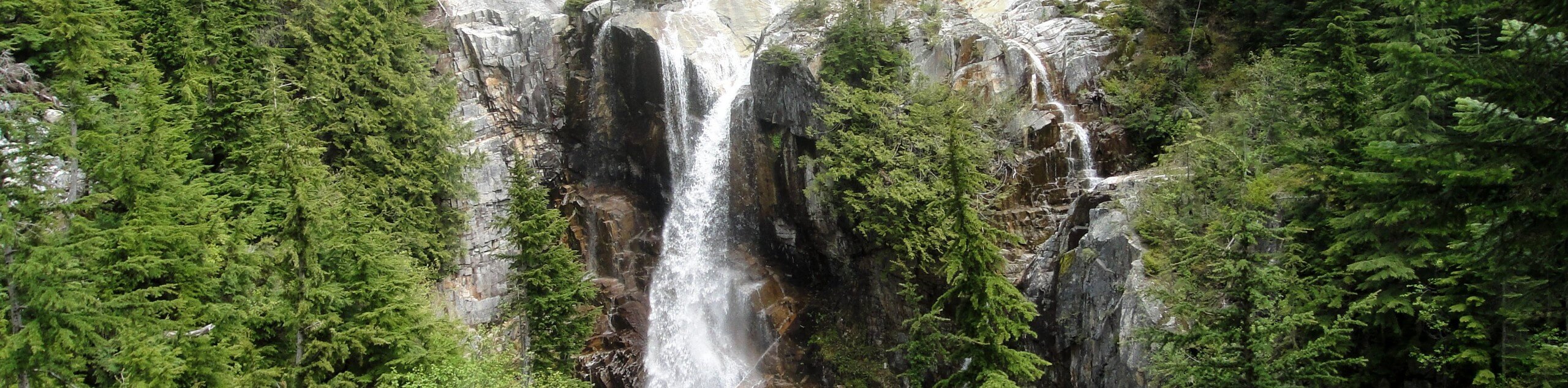
- Wallace Falls via Woody Trail: Wallace Falls is a gorgeous set of 9 waterfalls in the lush forest, offering a tranquil slice of paradise. The falls are a massively popular destination in the state, and they see plenty of visitors each week as a result. Don’t let this sway you- if you’re able to go outside of peak hours, you’re almost guaranteed to have a wonderful trip.
- Mailbox Peak Trail: What’s in the mailbox? Besides the trail register, sometimes it’s toys, sometimes it’s beer, sometimes it’s just some ants looking for shelter. The Mailbox Peak Trail leads you to a viewpoint adorned with a sticker-clad mailbox where hikers from all over leave goodies for the next groups up.
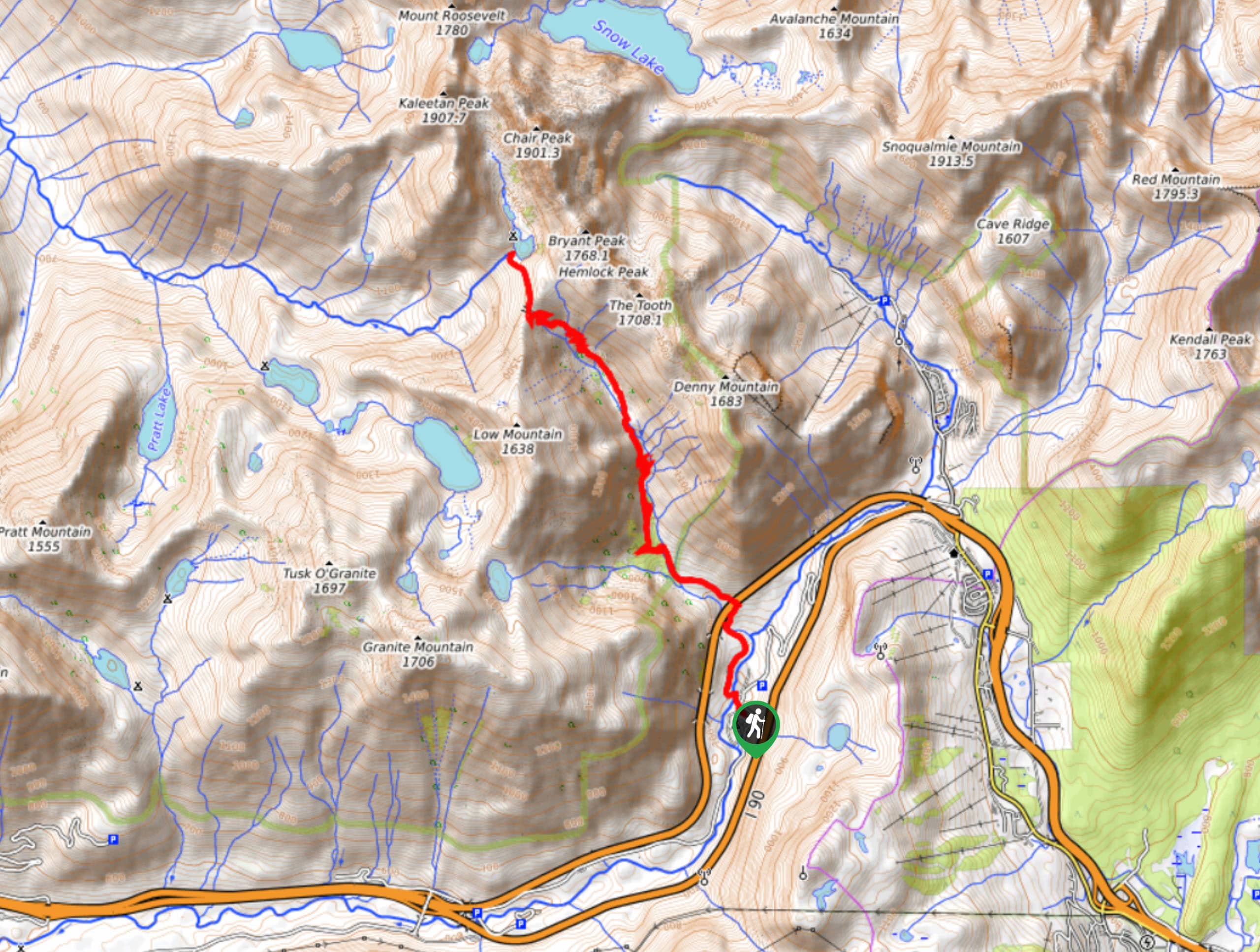
- Snow Lake: Some days you want to sweat it out, but some days you just want the views without needing to exhaust yourself, right? Snow Lake is perfect for hikers who want a maximum reward for a moderate effort. This is the most visited lake in the region, and its crystalline waters flanked by a mountain ridge will enchant you.
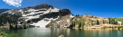
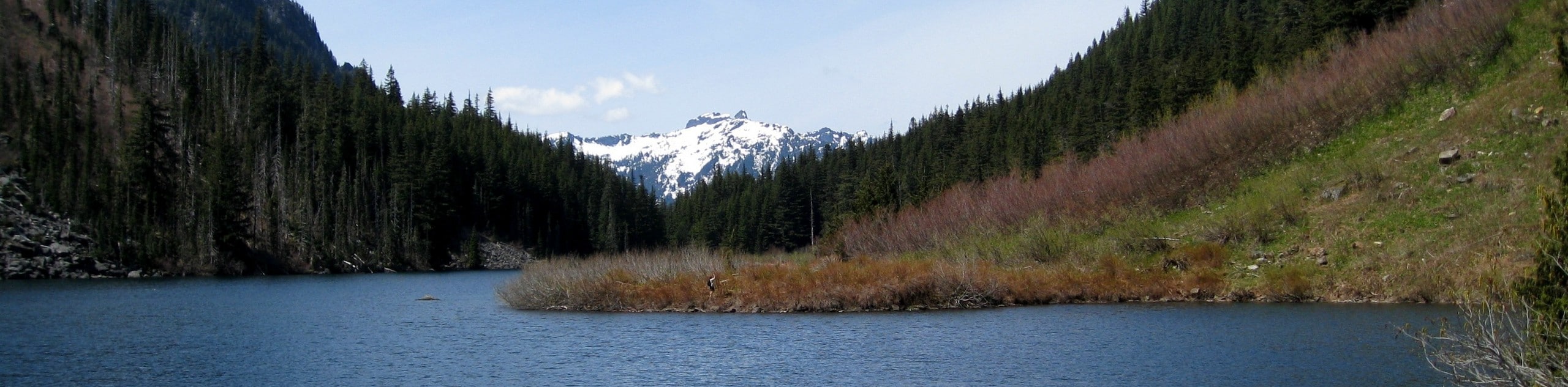
- Blanca Lake: Blanca Lake is mesmerizing, with that classic alpine opaque aqua-green color (thanks to the minerals in the water) and a grand frame of mountains behind it, including Monte Cristo, Columbia, and Keyes mountains. It’s a beautiful spot that draws plenty of hikers.
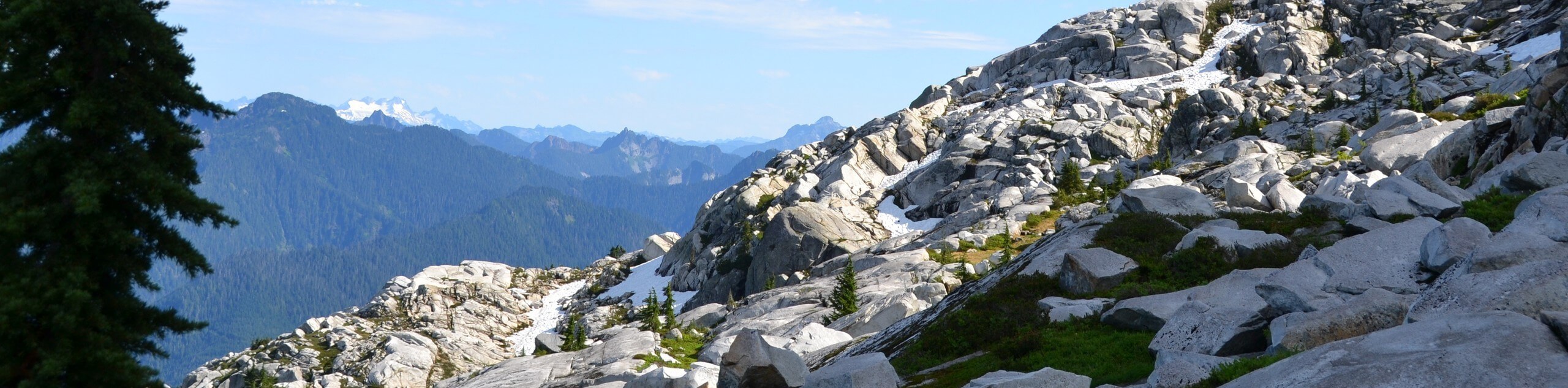
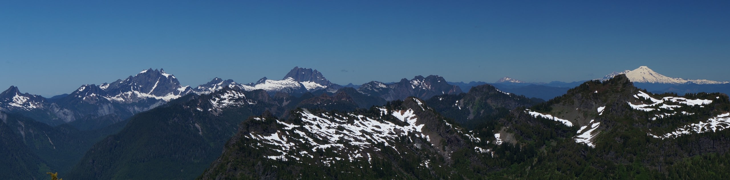
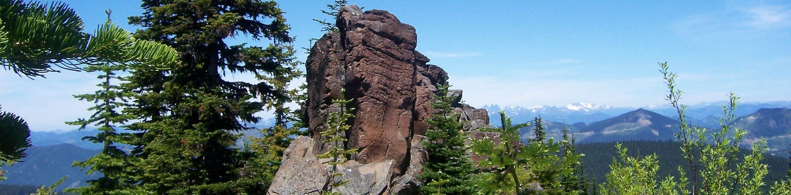
- Granite Mountain: The summit of Granite Mountain offers excellent views, and the trail to the top is sure to deliver in terms of a workout. While we don’t recommend this trail for newer hikers because of the consistent, hefty elevation gain, if you’re ready to sweat, you’ll be rewarded.
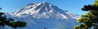
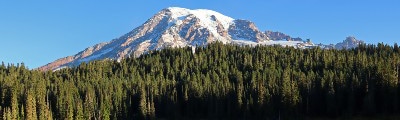
- Summit Lake Trail: Summit Lake is a local go-to for hikers looking to take their visiting friends and family out, a testament to its accessible but still rewarding nature. With a moderate effort required, you can savour views of Mount Rainier rising over the blue waters of the lake. An endless panorama of peaks surrounds this view, making it a knockout objective.
- Mount Si Trail: A truly staggering number of people hike Mount Si Trail every year, and for good reason- it’s beautiful, and it’s reasonably close to Seattle. This hike is a solid workout, gaining 3100ft in just under 4.0mi. It’s enough of a challenge for stronger hikers, but many novice hikers choose Mount Si as their first “hard” hike.
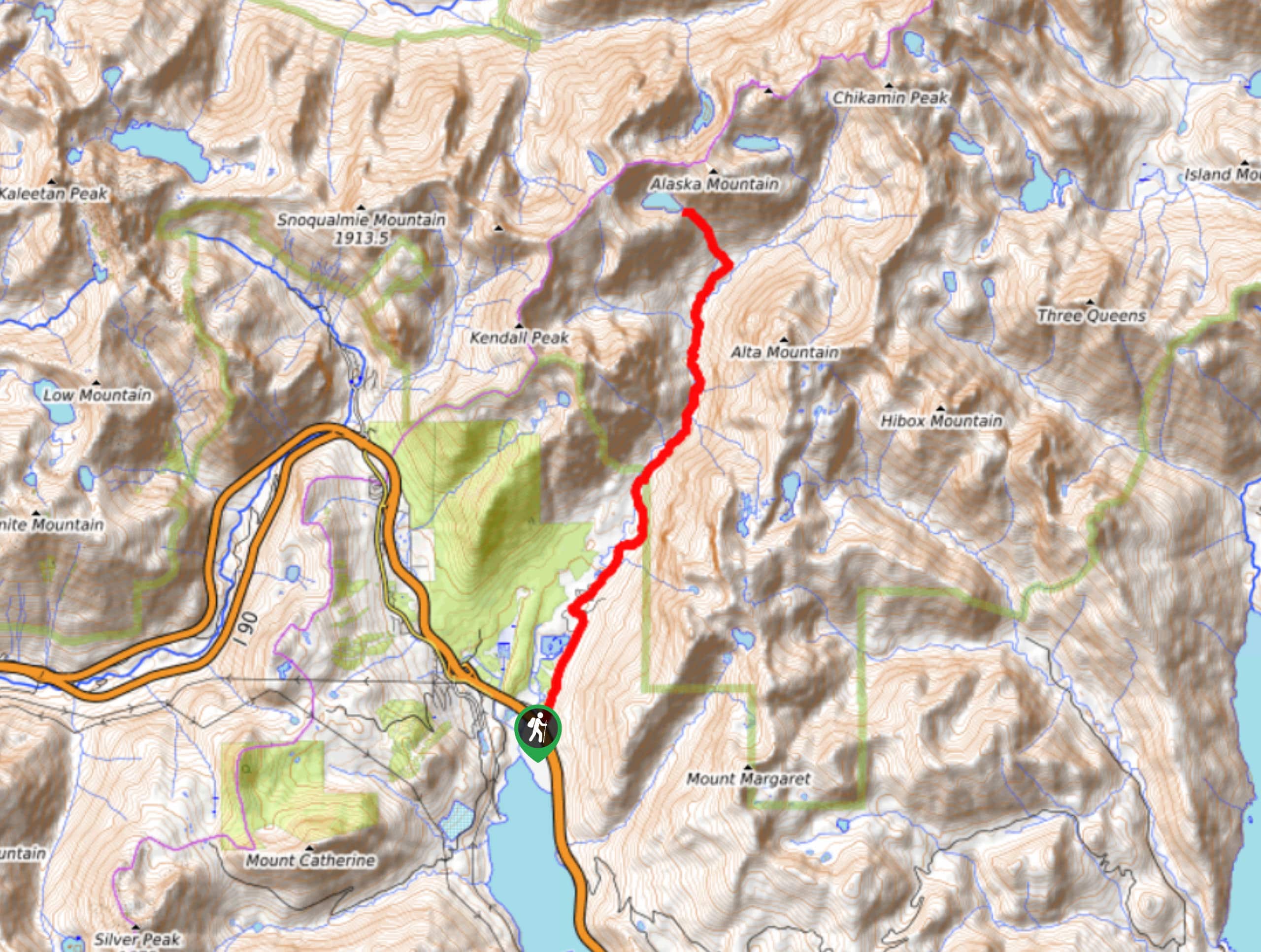
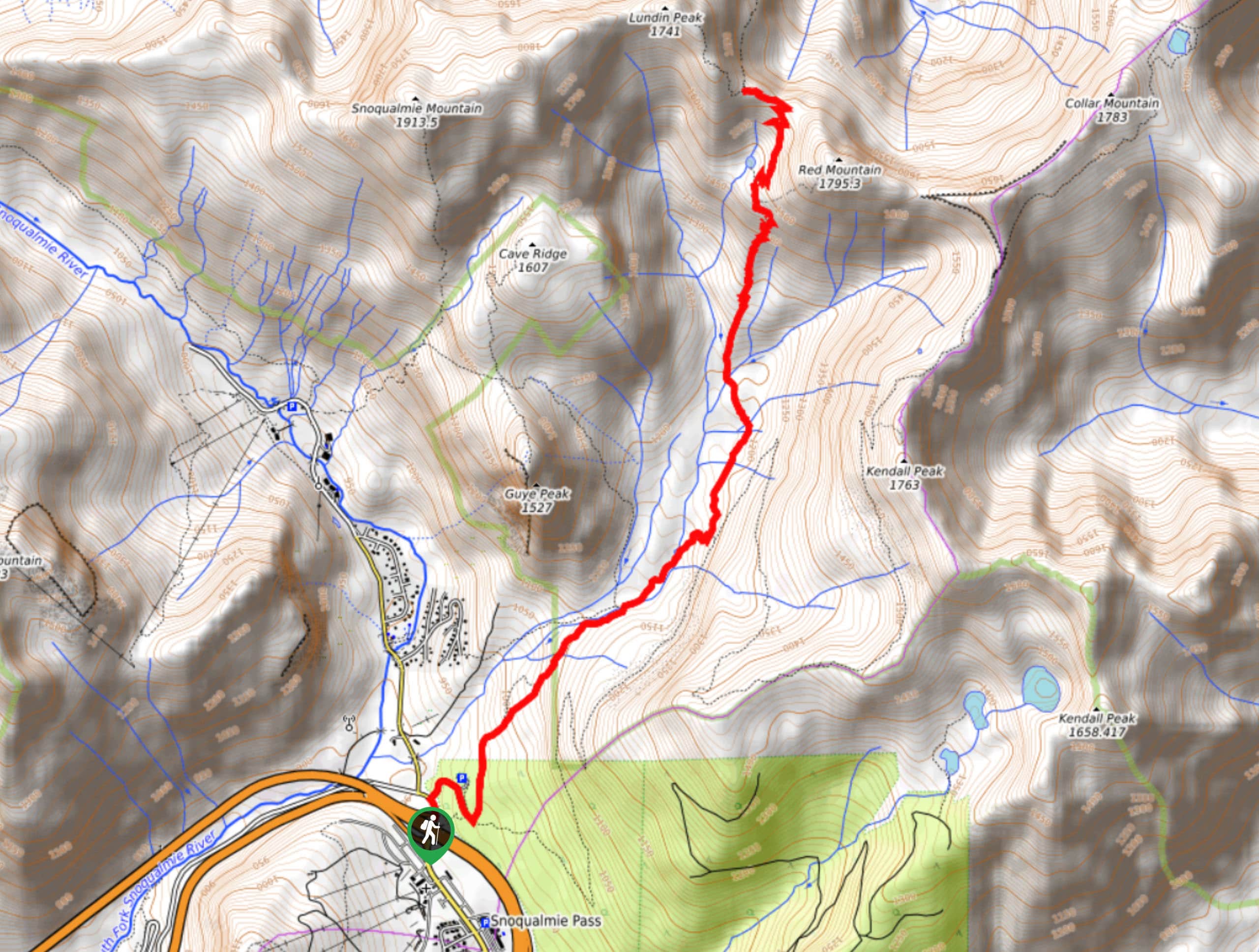
- Kendall Katwalk Trail: Kendall Katwalk Trail is an undeniably impressive hike. This 12.0mi trail climbs a catwalk (er, katwalk) blasted onto the side of a mountain for unbelievable views of Gold Creek Valley and the Alpine Lakes Wilderness. It’s a favorite for adrenaline junkies and hikers perpetually on the hunt for the next-best views.
Scroll down to see the full list of hiking trails in Mount Baker-Snoqualmie National Forest.
When is the Best Time to Hike in Mount Baker-Snoqualmie National Forest?
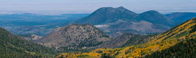
Mount Baker-Snoqualmie National Forest experiences warm, mild summers and cool winters with lots of precipitation. Certain roads in the park close in the late fall and remain closed through the spring, so we recommend visiting in the summer months of June through September for most hikes, unless you’re seeking snowshoeing routes. If you’re hoping to catch the wildflower blooms in their full glory, a trip between mid-July and mid-August tends to be the best option.
While the summer months offer the best weather, they do also bring the heaviest crowds. If you’re okay with occasionally cooler or wetter conditions, visiting in June or mid-September can give you more privacy on the trails while still offering suitable hiking weather.
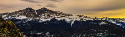
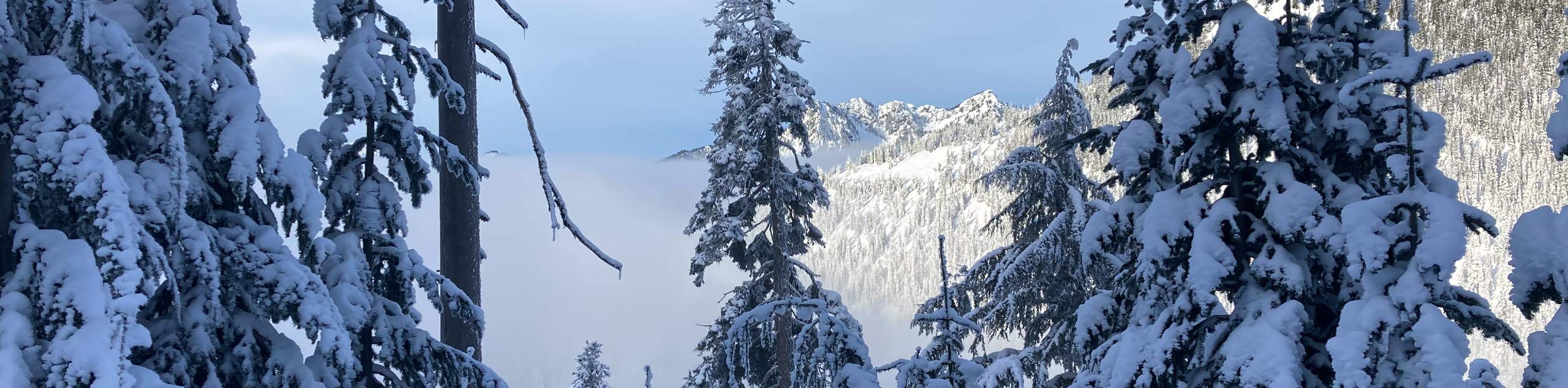
If you’re seeking to enjoy winter activities in the park, like snowshoeing, visiting between December and February will be your best bet. Just come prepared as certain services may be unavailable. Take care to plan your visit carefully since some roads in the park are subject to seasonal closures.
Other Outdoor Activities in Mount Baker-Snoqualmie National Forest
Hiking and walking are by far the most popular activities in Mount Baker-Snoqualmie National Forest, but they’re definitely not the only way to spend your time here. The park is a fantastic spot to camp, with a plethora of frontcountry and backcountry campsites available. Some should be pre-booked and some shouldn’t, giving you the flexibility to work around your plans.
In the winter months, snowshoeing is very popular. Many hiking trails are suitable for snowshoeing, and some have special winter routes to use.
For downhill skiing and snowboarding, Mount Baker Ski Area is a huge resort with great snow suitable for all levels. There are also over 119.0mi of cross-country ski trails to use in the forest.
How to Plan a Trip to Mount Baker-Snoqualmie National Forest
A hiking trip in Mount Baker-Snoqualmie National Forest is a must-do adventure, but you’ll want to put enough time and energy into planning to make sure your trip runs smoothly. Whenever you’re planning a trip to a national forest, there are fees, permits, transportation requirements, and day-to-day logistics to consider. The official website of the forest is a great resource for trip planning that also provides up-to-date info on passes, permits, closures, events, and more. If you plan on camping, make sure you plan out your campsites beforehand and check which ones are walk-up and which require advance booking.
Mount Baker-Snoqualmie National Forest Adventure Tours
Not so excited about hashing out the details of your itinerary? Letting the pros plan your adventure in Mount Baker-Snoqualmie National Forest takes the stress out of your trip, letting you focus on your experiences. Check out some incredible adventure tours in the Pacific Northwest, including Mount Baker-Snoqualmie.
Frequently Asked Questions About Mount Baker-Snoqualmie National Forest
Do I need a pass or permit to enter Mount Baker-Snoqualmie National Forest?
You’ll need a pass for most trailheads, picnic areas, and boat launches in the forest. The most commonly needed permit is the Northwest Forest Pass, but check the specific requirements of your destination as other passes may be required, like the Alpine Wilderness Pass.
How many days do you need in Mount Baker-Snoqualmie National Forest?
Most visitors come for one day or a weekend, but some devoted backpackers spend a week or more in the area. We recommend two full days to have the time to enjoy several different hikes in the park.
Which city is closest to Mount Baker-Snoqualmie National Forest?
The closest major city to Mount Baker-Snoqualmie National Forest is Seattle (73.0mi), which also has the closest international airport, the Seattle-Tacoma International Airport (SEA).
Can you camp in Mount Baker-Snoqualmie National Forest?
There are both frontcountry and backcountry campsites in the park. Make sure you book your spot ahead and get all the necessary permits before you pitch your tent.
Are dogs allowed in Mount Baker-Snoqualmie National Forest?
Dogs are allowed on most trails in the park but must be kept on a leash.
Do you need a car in Mount Baker-Snoqualmie National Forest?
We recommend either driving your own car, renting a car, or booking a tour that includes transportation. There are some public transportation options in the forest but they are largely focused on the towns inside the boundaries of the forest and may not service trailheads.
Explore other great hiking regions in Washington State:
Or check out other amazing hiking regions to explore in the United States.
Read MoreThe best hikes in Mount Baker-Snoqualmie National Forest
01. Lake 22 Trail
Difficulty
Lake 22 Trail is a 6.8mi heavily trafficked route in Mount Baker-Snoqualmie National… Read More
02. Franklin Falls Trail
Difficulty
Franklin Falls Trail is a 2.0mi heavily trafficked out and back trail in… Read More
03. Rattlesnake Ledge Trail
Difficulty
Rattlesnake Ledge Trail is an 5.3mi heavily trafficked out and back trail in… Read More
04. Rattlesnake Lake Trail
Difficulty
Rattlesnake Lake Trail is a 1.4mi moderately trafficked out and back trail in… Read More
05. Bridal Veil Falls and Lake Serene Hike
Difficulty
The hike to Bridal Veil Falls and Lake Serene is a heavily trafficked hike in… Read More
06. Wallace Falls via Woody Trail
Difficulty
The Wallace Falls via Woody Trail hike is a heavily trafficked out and back trail… Read More
07. Mailbox Peak Trail
Difficulty
The hike on Mailbox Peak Trail is no small task, but it’s a very popular… Read More
08. Mailbox Peak Loop
Difficulty
The hike on Mailbox Peak Loop is no small task, but it’s a popular pick… Read More
09. Blanca Lake Trail
Difficulty
The Blanca Lake Trail is a 8.1mi heavily trafficked out and back trail… Read More
10. Heather Lake Trail
Difficulty
The Heather Lake Trail is a heavily trafficked out and back trail that is rated… Read More
Yes, there are more than 10
Mount Baker-Snoqualmie National Forest is so beautiful that we can not give you only 10 hikes. So here is a list of bonus hikes in Mount Baker-Snoqualmie National Forest that you should take a look at as well
11. Granite Mountain Hike
Difficulty
The Granite Mountain hike is a heavily trafficked out and back trail near Snoqualmie Pass… Read More
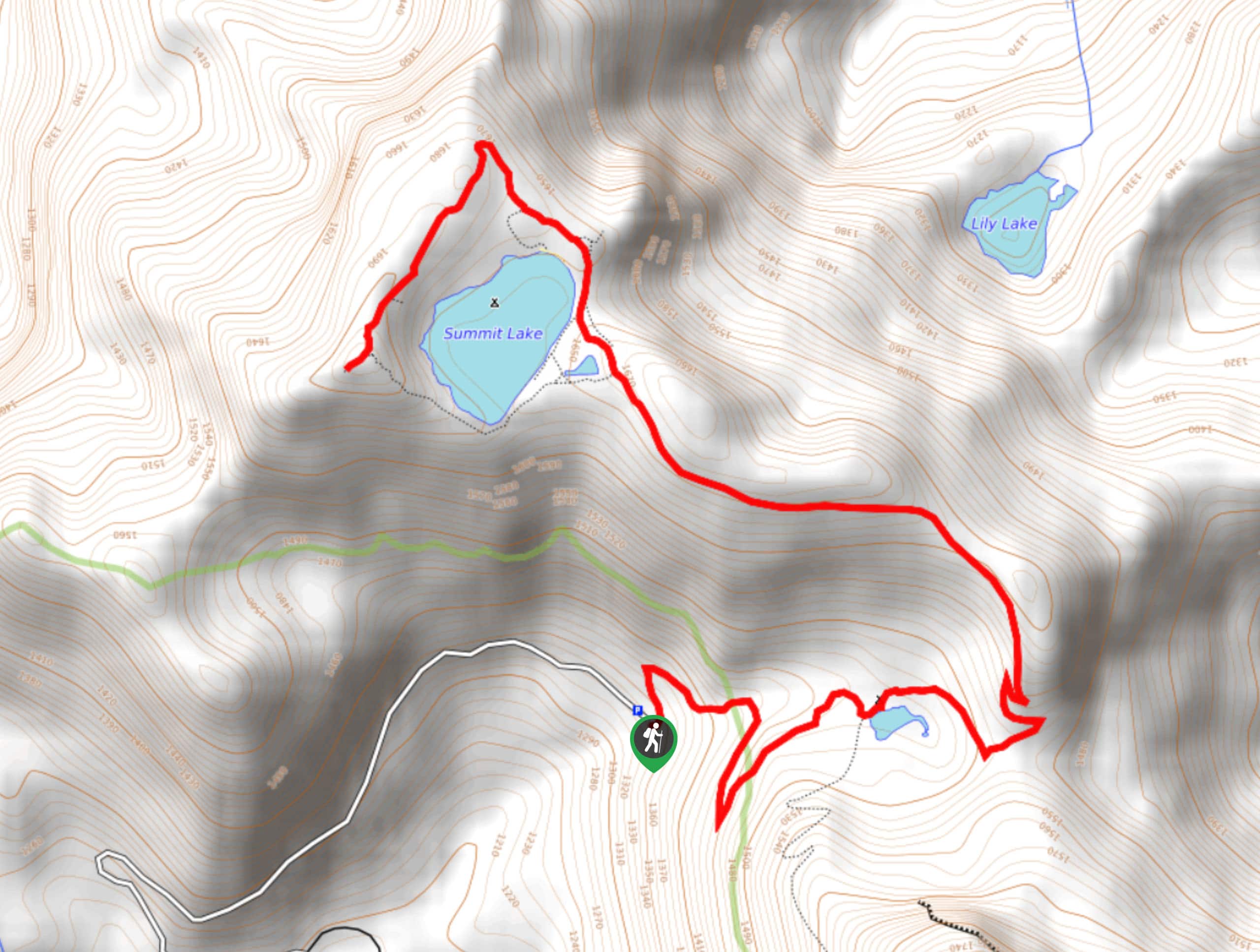
12. Summit Lake Trail
Difficulty
The Summit Lake Trail is a 5.7mi heavily trafficked out and back trail… Read More
13. Gold Creek Pond Loop
Difficulty
The Gold Creek Pond Loop is a 1.2mi heavily trafficked loop hike atop… Read More
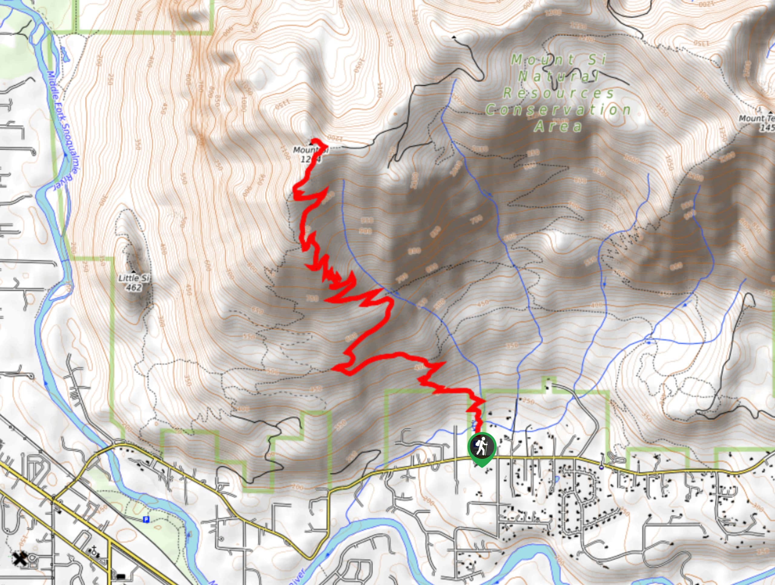
14. Mount Si Trail
Difficulty
The Mount Si Trail is a 7.5mi out and back trail that sees… Read More
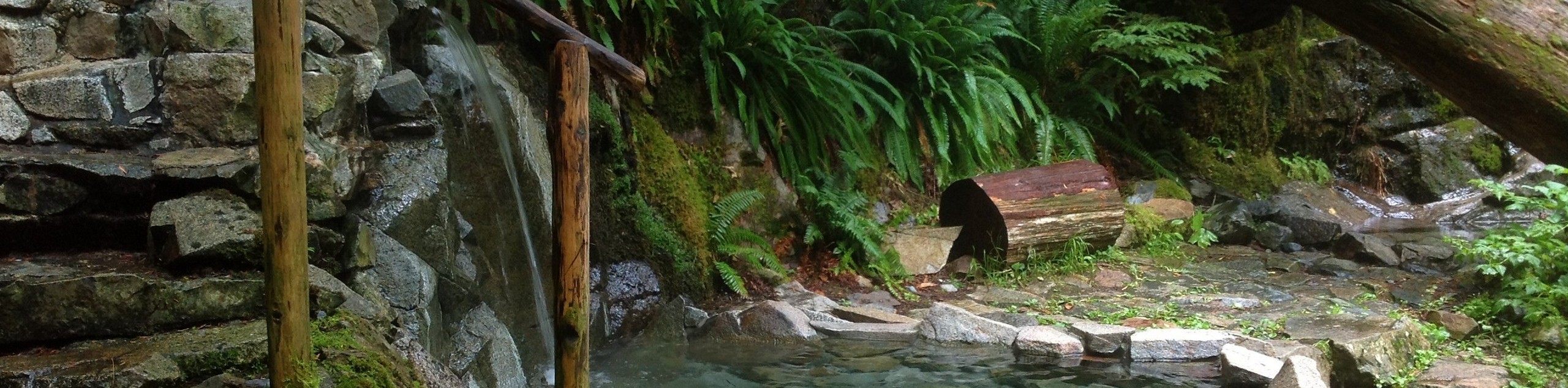
15. Goldmyer Hot Springs Trail
Difficulty
The Goldmyer Hot Springs Trail is an out-and-back trail near Snoqualmie Pass that is moderately… Read More
16. Little Si Trail
Difficulty
The Little Si Trail is a 3.6mi out and back trail that sees… Read More
17. Goat Lake Trail
Difficulty
Goat Lake Trail is a 10.5mi heavily trafficked out and back trail that… Read More
18. Iron Goat Trail
Difficulty
The Iron Goat Trail is a 5.9mi heavily trafficked out and back trail… Read More
19. Heybrook Lookout Trail
Difficulty
The Heybrook Lookout Trail is a 2.6mi heavily trafficked out and back trail… Read More
20. Lime Kiln Trail
Difficulty
Lime Kiln Trail is a 6.7mi heavily trafficked out and back trail in… Read More
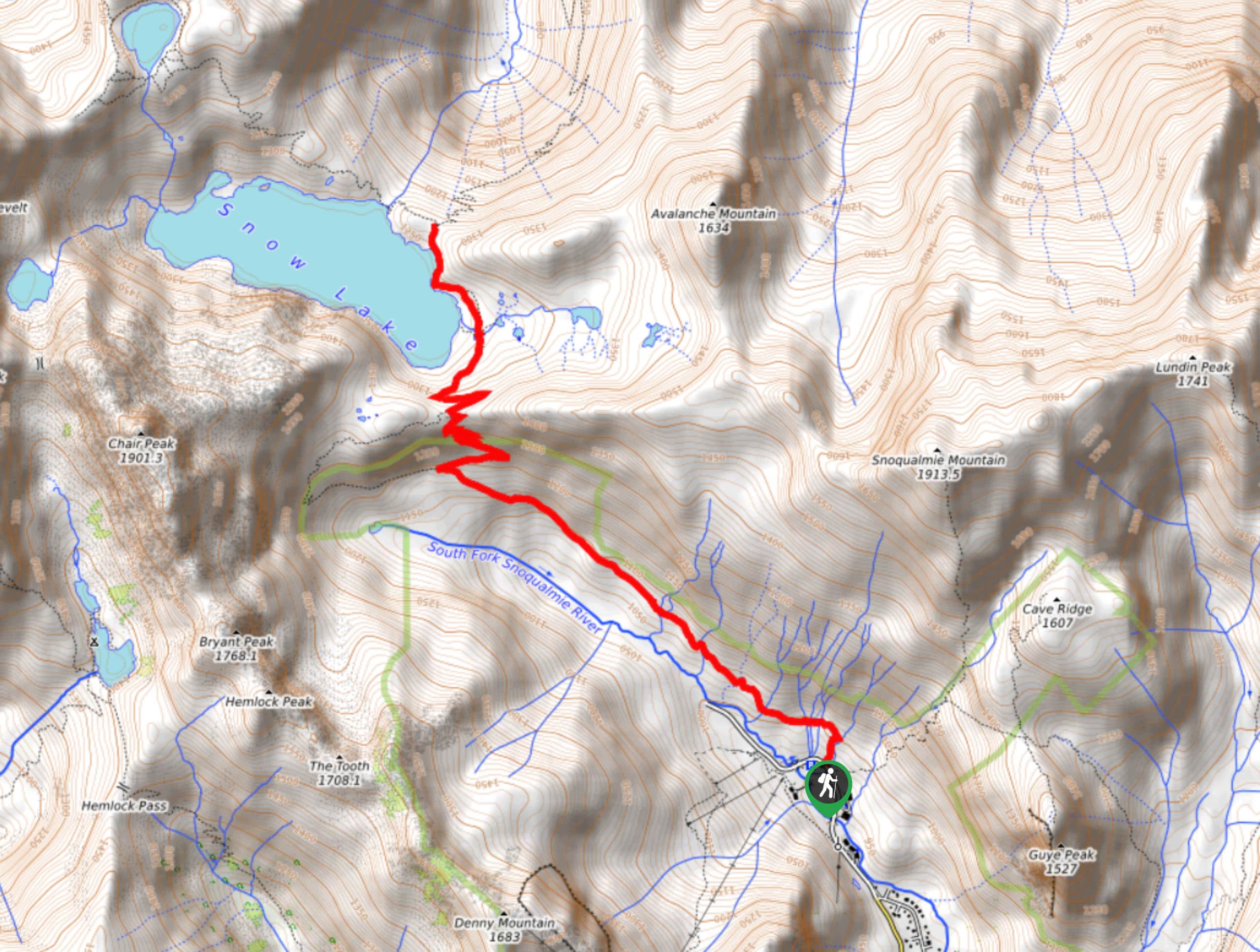
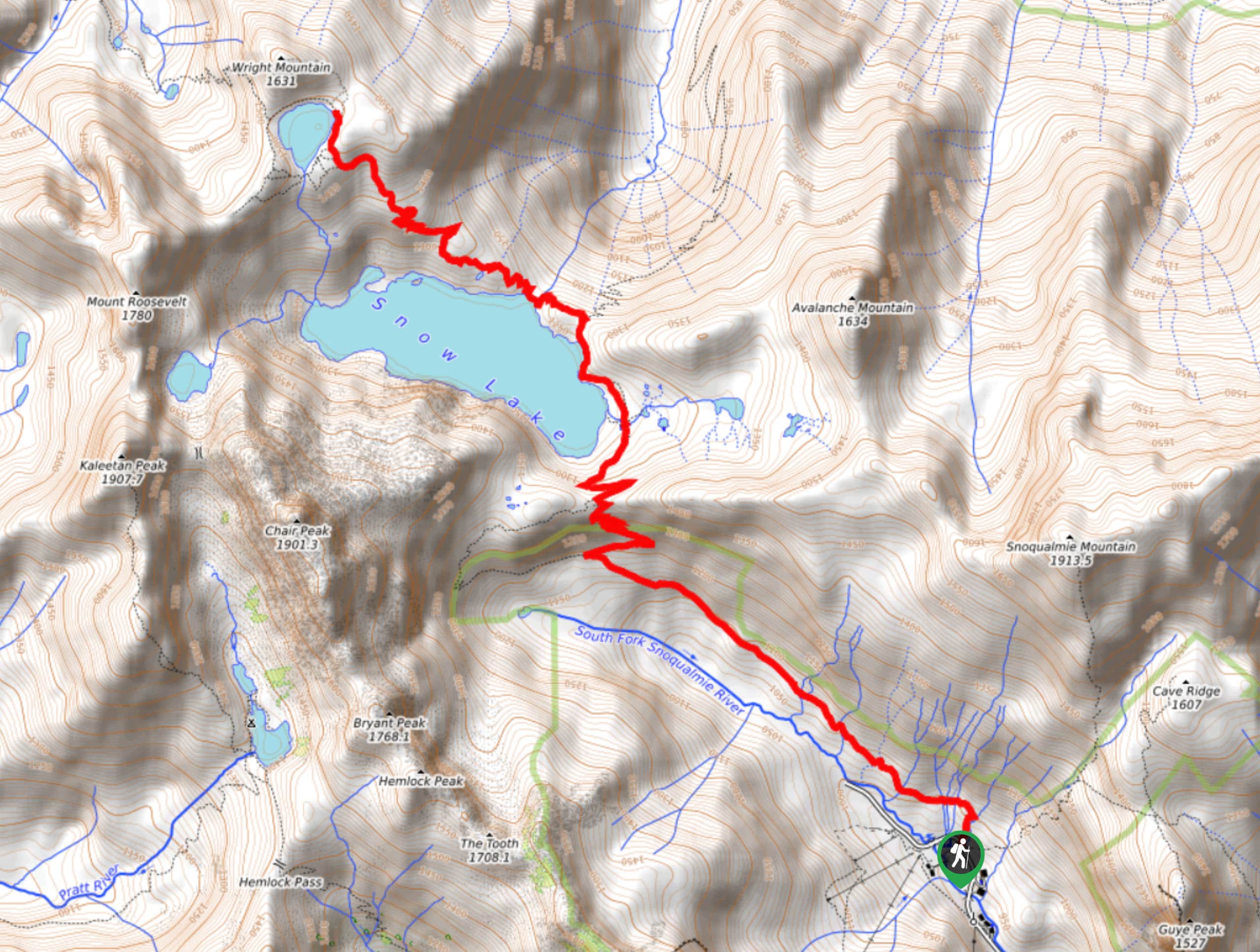
21. Snow Lake Hike
Difficulty
The Snow Lake hike is a heavily trafficked out-and-back trail in the Alpine Lakes Wilderness… Read More
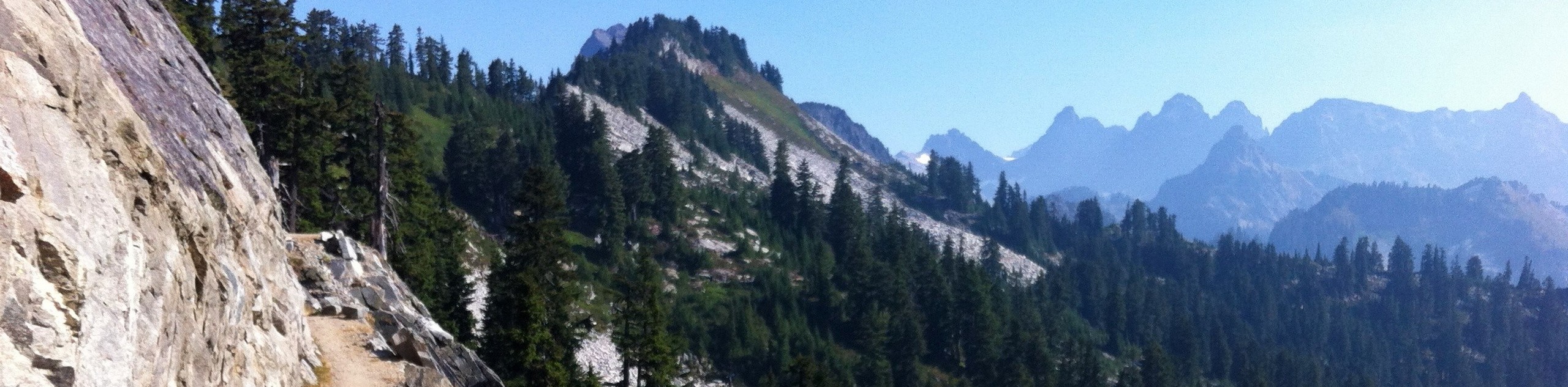
22. Kendall Katwalk Trail
Difficulty
Kendall Katwalk Trail is a 15.0mi heavily trafficked out and back trail in… Read More
23. Mason Lake via Ira Spring Trail
Difficulty
Mason Lake via Ira Spring Trail is a 6.8mi heavily trafficked out and… Read More
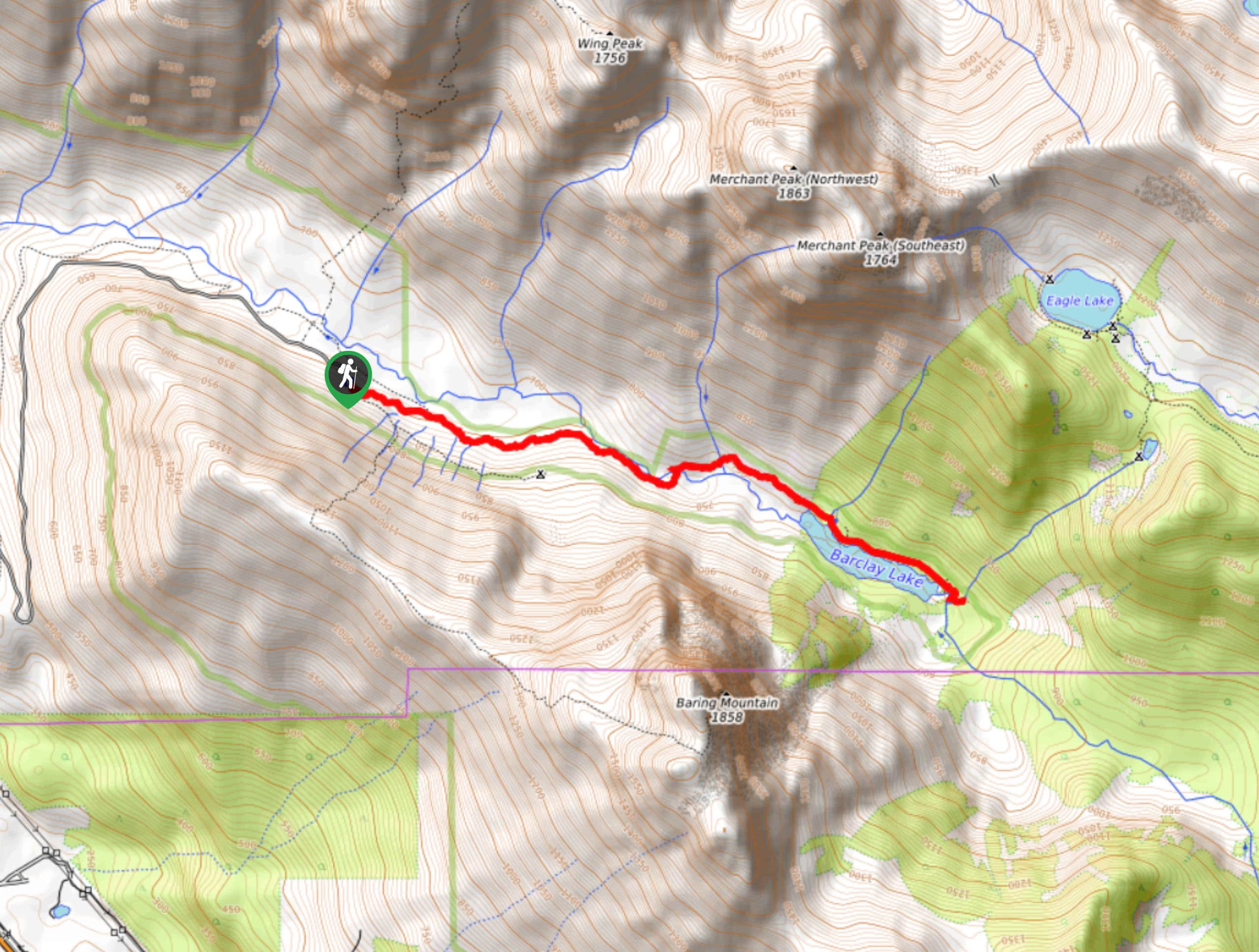
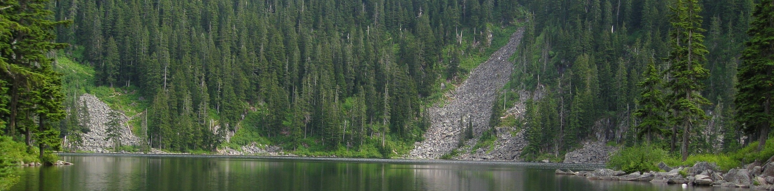
24. Barclay Lake Trail
Difficulty
Barclay Lake Trail is a 4.4mi heavily trafficked out-and-back trail that is rated… Read More
25. Mount Pilchuck Trail
Difficulty
The Mount Pilchuck Trail is an 5.2mi heavily trafficked out and back trail… Read More
26. Three Fingers Hike
Difficulty
The hike to Three Fingers is a 16.0mi lightly trafficked out and back… Read More

27. Talapus Lake Trail
Difficulty
Talapus Lake Trail is a heavily trafficked, easy-moderate hike in Mount Baker-Snoqualmie National Forest. This… Read More
28. Talapus Lake and Olallie Lake Hike
Difficulty
The Talapus Lake and Olallie Lake hike is a heavily trafficked moderate hike in Mount… Read More
29. Annette Lake Trail
Difficulty
Annette Lake Trail is a 7.8mi heavily trafficked out and back trail in… Read More
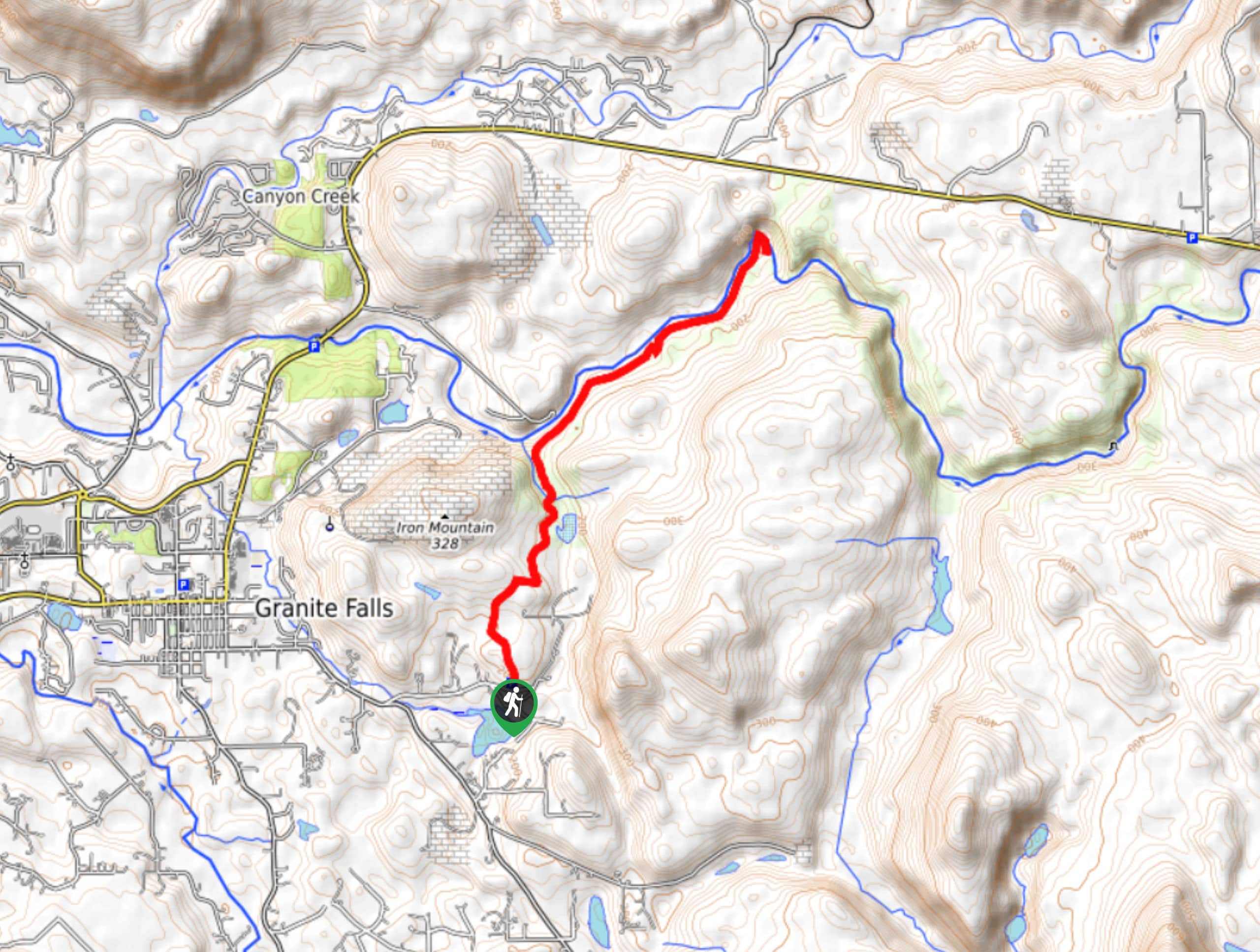
30. Granite Falls-Fish Ladder Trail
Difficulty
The Granite Falls-Fish Ladder Trail is a 0.7mi moderately trafficked out-and-back trail near… Read More
31. Keekwulee Falls via Denny Creek Trail
Difficulty
The hike to Keekwulee Falls on Denny Creek Trail is a 3.8mi heavily… Read More
32. Twin Falls Trail
Difficulty
Twin Falls Trail is a heavily trafficked out and back trail in Olallie State Park… Read More
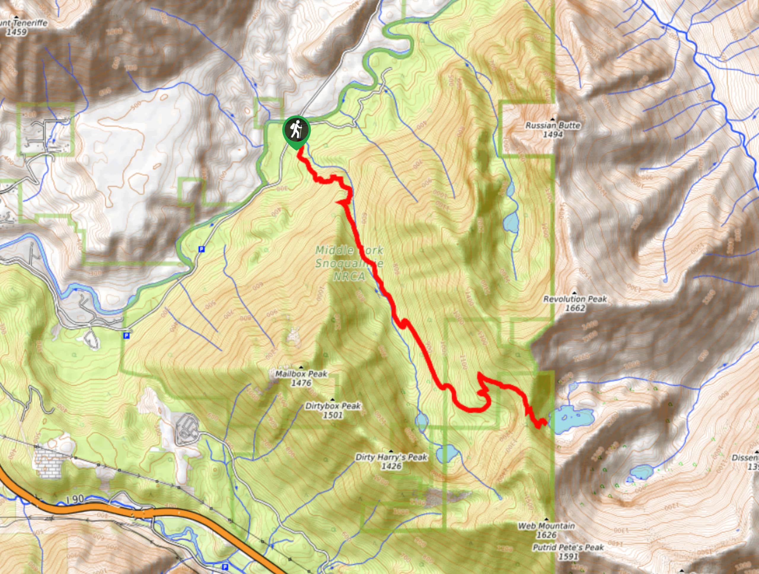
33. Thompson Lake Trail
Difficulty
Thompson Lake Trail is a 11.0mi moderately trafficked out-and-back trail in Middle Fork… Read More
34. Bandera Mountain Summit Trail
Difficulty
Bandera Mountain Summit Trail is a 7.6mi heavily trafficked out and back trail… Read More
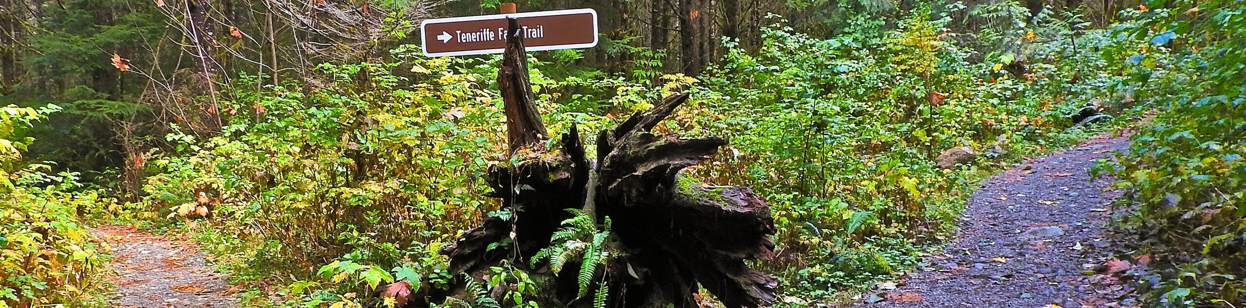
35. Teneriffe Falls via Mount Teneriffe Trail
Difficulty
Teneriffe Falls via Mount Teneriffe Trail is a heavily trafficked out-and-back trail in the Mount… Read More
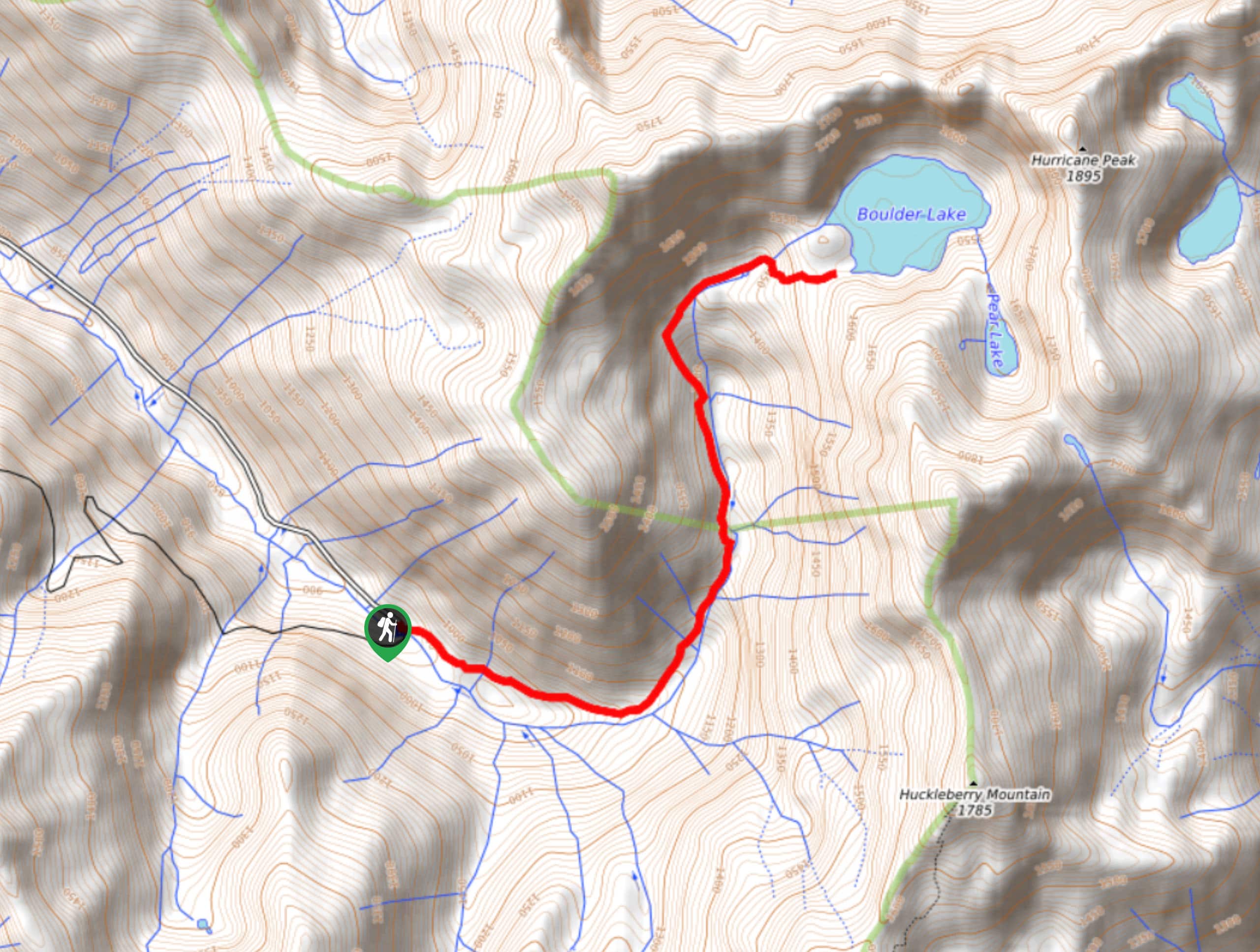
36. Boulder Lake Trail
Difficulty
Boulder Lake Trail is an 7.3mi lightly trafficked out and back trail in… Read More
37. Teneriffe Falls via Mount Si Trail
Difficulty
Teneriffe Falls via Mount Si Trail is a heavily trafficked lollipop trail in the Mount… Read More
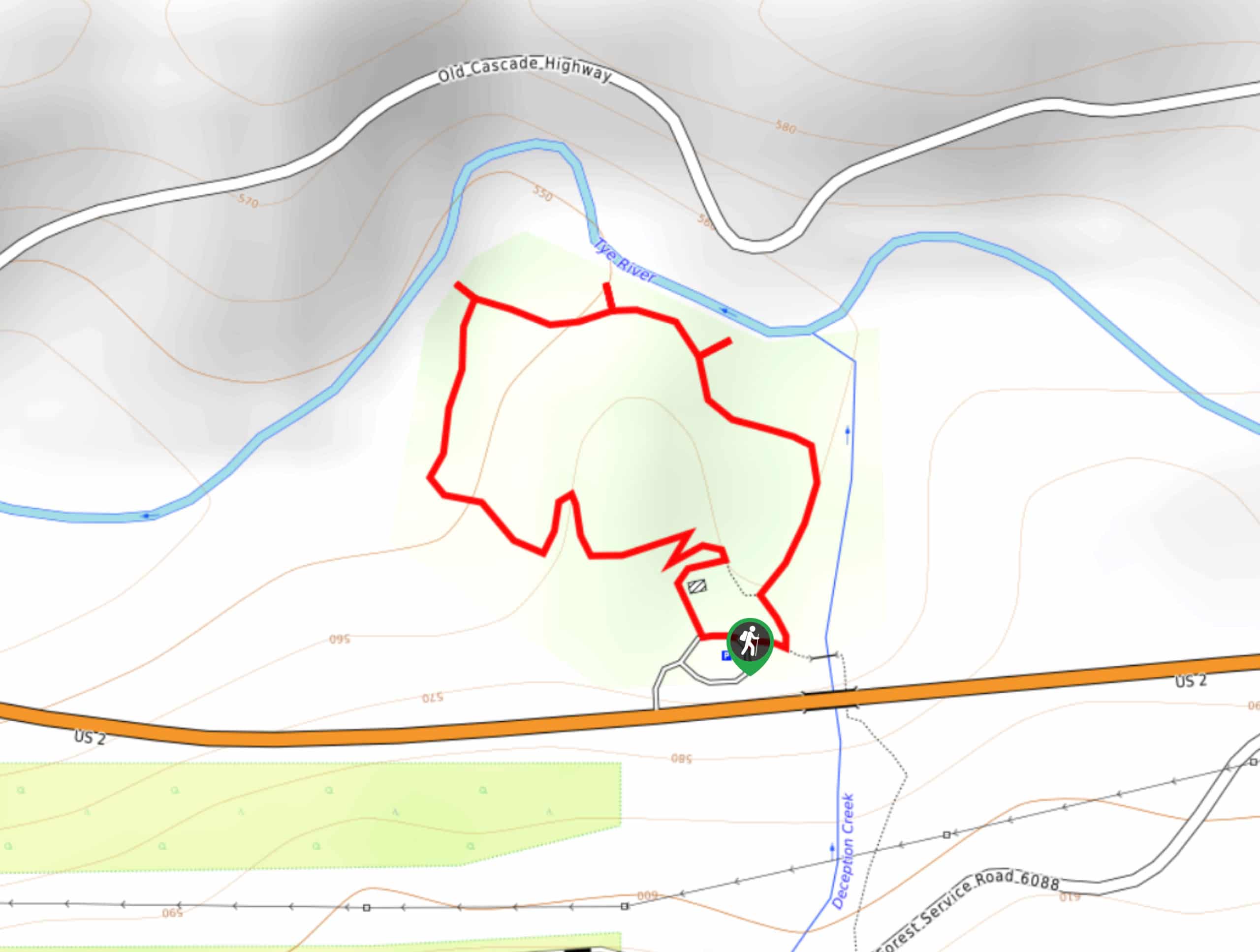
38. Deception Falls Interpretive Trail
Difficulty
The Deception Falls Interpretive Trail is a 0.6mi moderately trafficked loop trail in… Read More
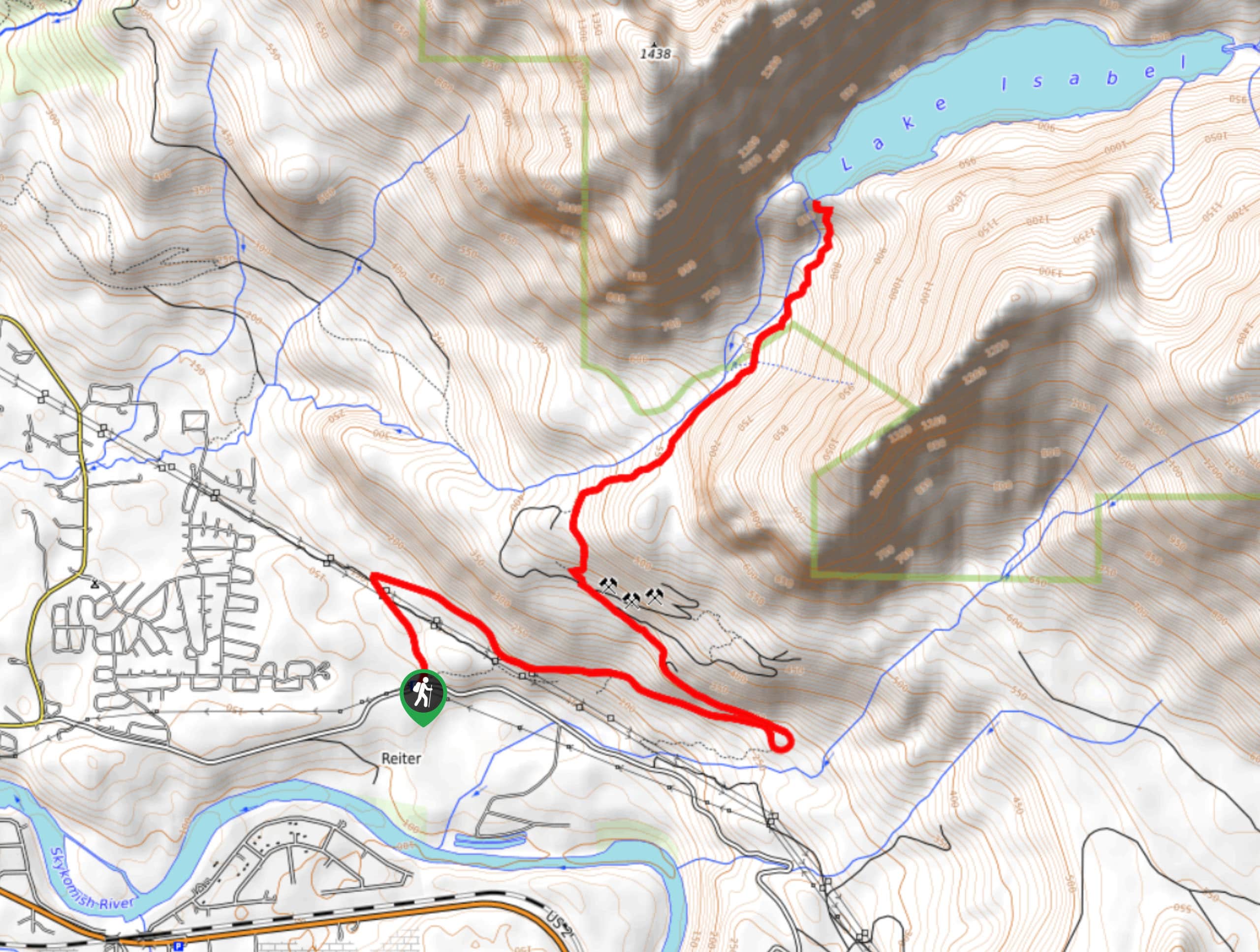
39. Lake Isabel Trail
Difficulty
Lake Isabel Trail is a lightly trafficked out-and-back trail in Wild Sky Wilderness that is… Read More
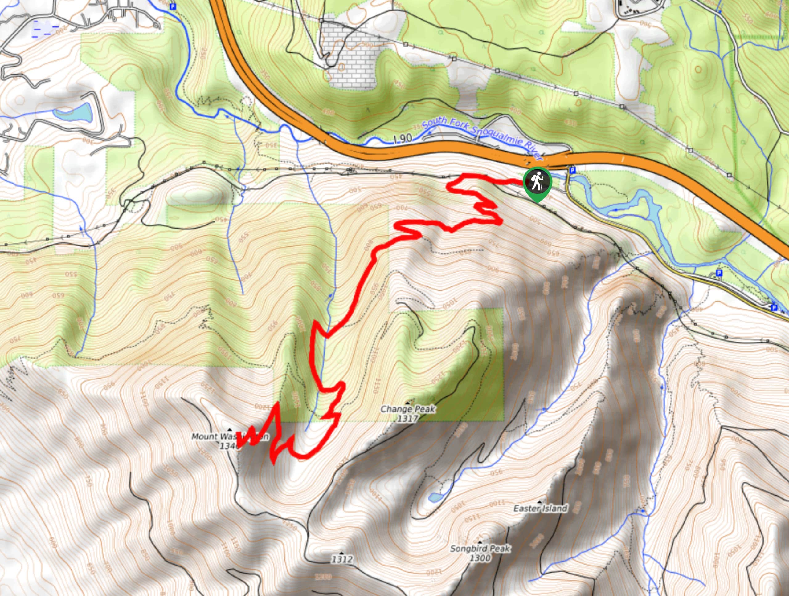
40. Mount Washington Hike
Difficulty
The hike to the summit of Mount Washington is a 9.0mi moderately trafficked… Read More
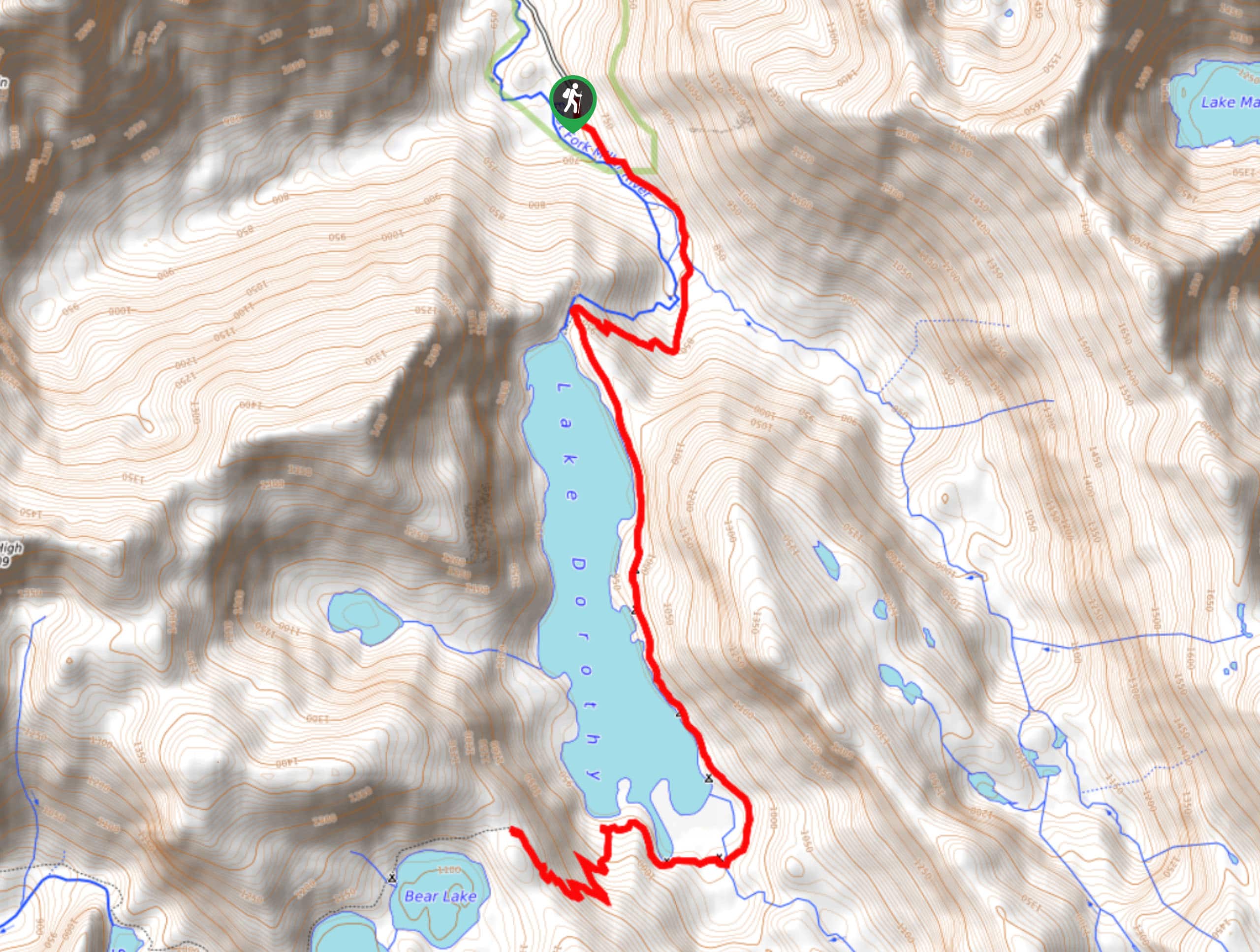
41. Lake Dorothy Trail
Difficulty
Lake Dorothy Trail is a moderately trafficked out-and-back trail in Mount Baker-Snoqualmie National Forest that… Read More
42. Otter Falls Hike
Difficulty
The hike to Otter Falls is a 8.2mi heavily trafficked out-and-back trail in… Read More
43. Boulder River Trail
Difficulty
Boulder River Trail is a 8.8mi moderately trafficked out and back trail in… Read More
44. Lost Lake Trail
Difficulty
Lost Lake Trail is a moderately trafficked out-and-back trail in Mount Baker-Snoqualmie National Forest that… Read More
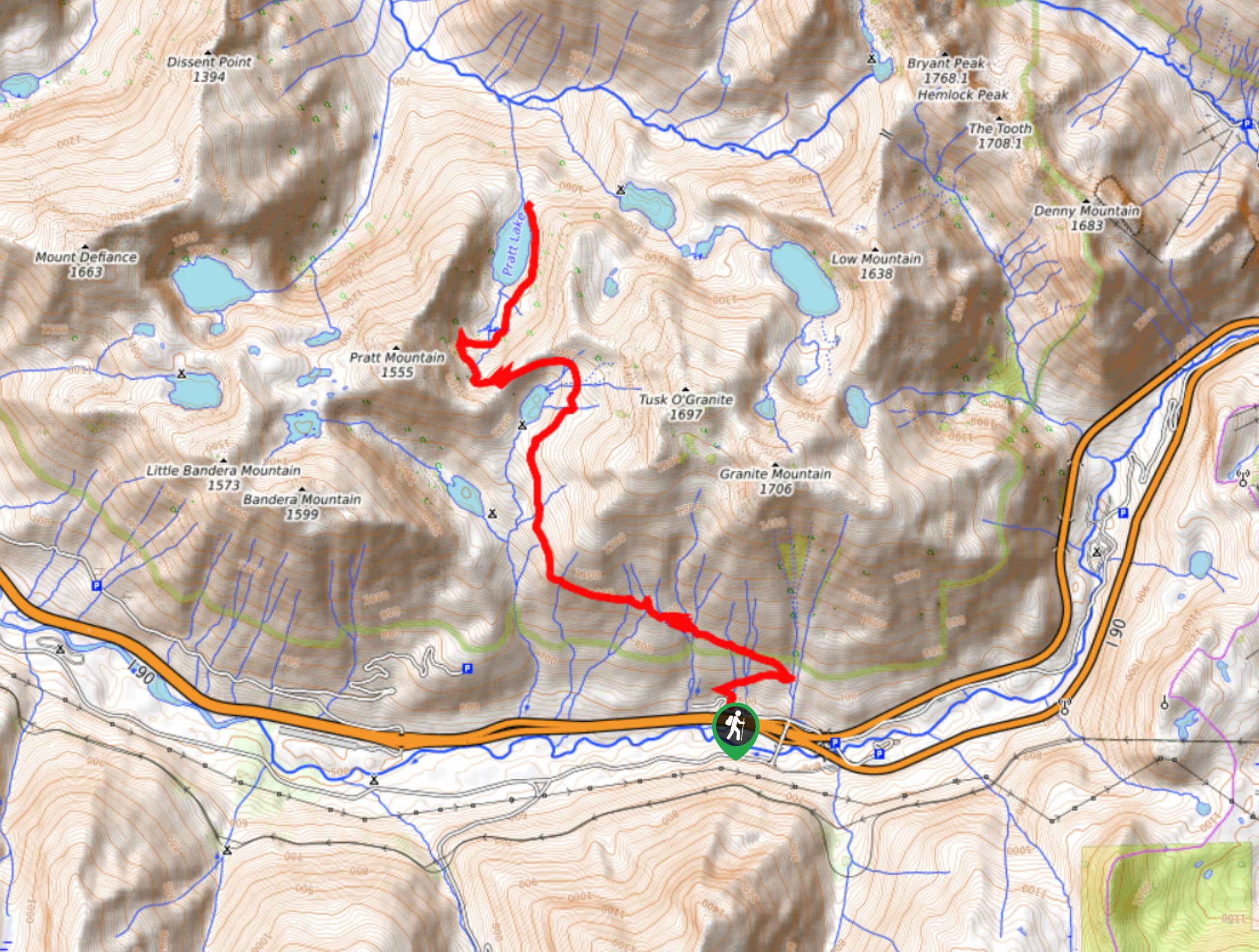
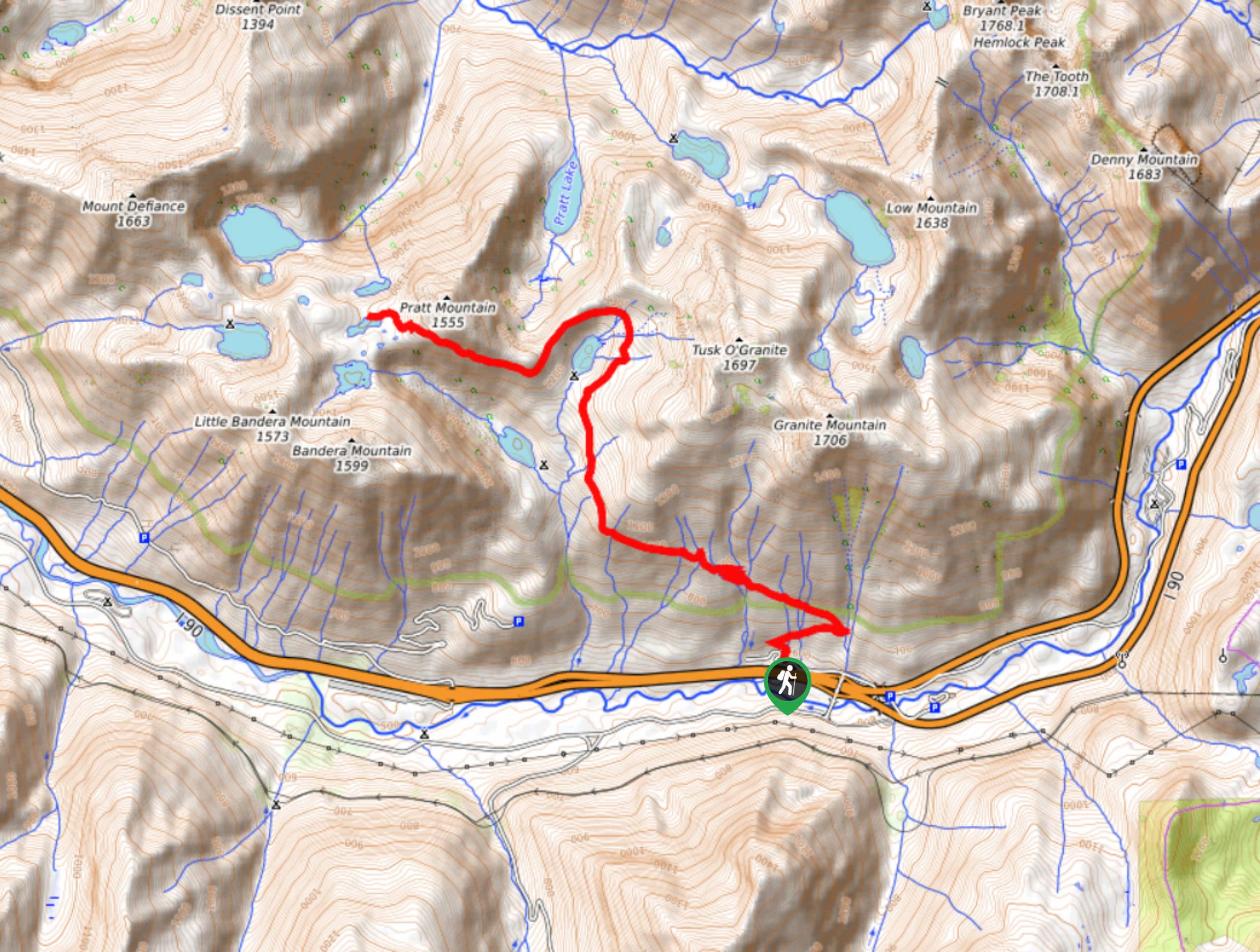
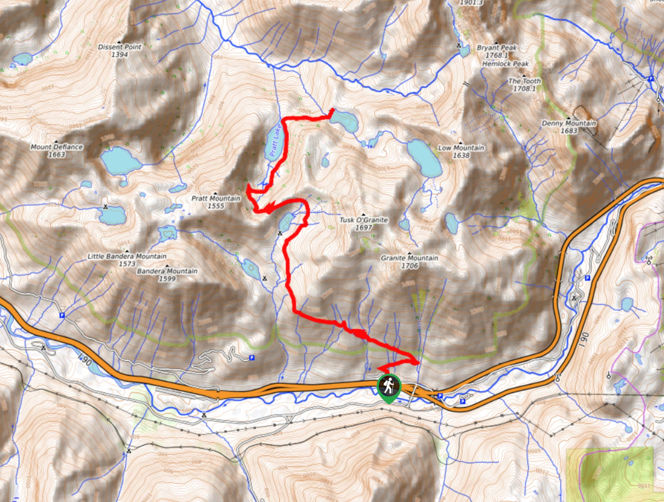
45. Pratt Lake Trail
Difficulty
Pratt Lake Trail is a heavily trafficked out-and-back trail in Mount Baker-Snoqualmie National Forest that… Read More

46. Talapus Lake via Pratt Lake Trail
Difficulty
Talapus Lake via Pratt Lake Trail is a heavily trafficked out-and-back trail in Mount Baker-Snoqualmie… Read More
47. Vesper Peak Trail
Difficulty
Vesper Peak Trail is a 7.6mi moderately trafficked out and back hike in… Read More

48. Talapus, Olallie, and Pratt Lakes Hike
Difficulty
Talapus, Olallie, and Pratt Lakes are all accessed on this hike, which is 12.3mi Read More
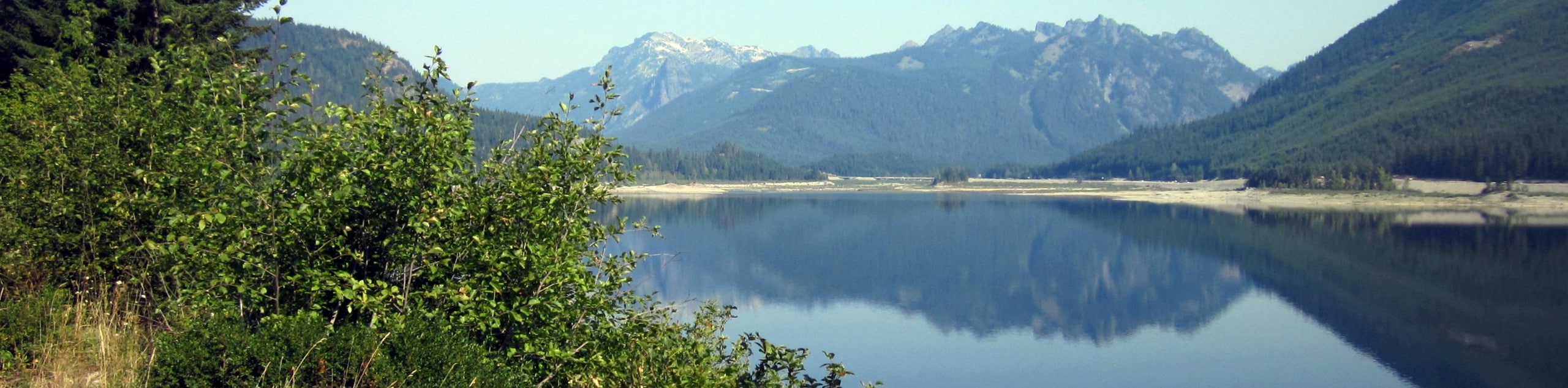
49. Keechelus Lake Shoreline Hike
Difficulty
The Keechelus Lake Shoreline Hike is a 12.3mi moderately trafficked out and back… Read More
50. Snoquera Falls Loop Trail
Difficulty
The Snoquera Falls Loop Trail is a heavily trafficked lollipop trail in Mount Baker-Snoqualmie National… Read More
51. Snoquera Falls Trail
Difficulty
The Snoquera Falls Trail is a 2.7mi heavily trafficked loop trail in Mount… Read More
52. Ira Spring Memorial Trail
Difficulty
Ira Spring Memorial Trail is a heavily trafficked out-and-back trail in the Alpine Lakes Wilderness… Read More
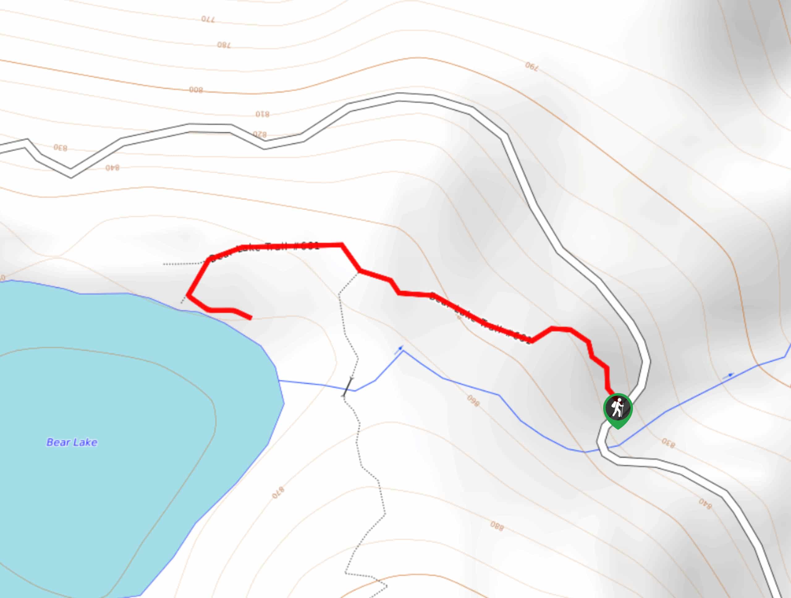
53. Bear Lake Trail
Difficulty
Bear Lake Trail is a 0.7mi heavily trafficked out-and-back trail in Mount Pilchuck… Read More
54. Melakwa Lake via Denny Creek Trail
Difficulty
The Melakwa Lake via Denny Creek Trail hike is a moderately trafficked out-and-back trail in… Read More
55. Snoqualmie Valley Trail
Difficulty
The Snoqualmie Valley Trail is a 18.4mi heavily trafficked point-to-point trail in Mount… Read More
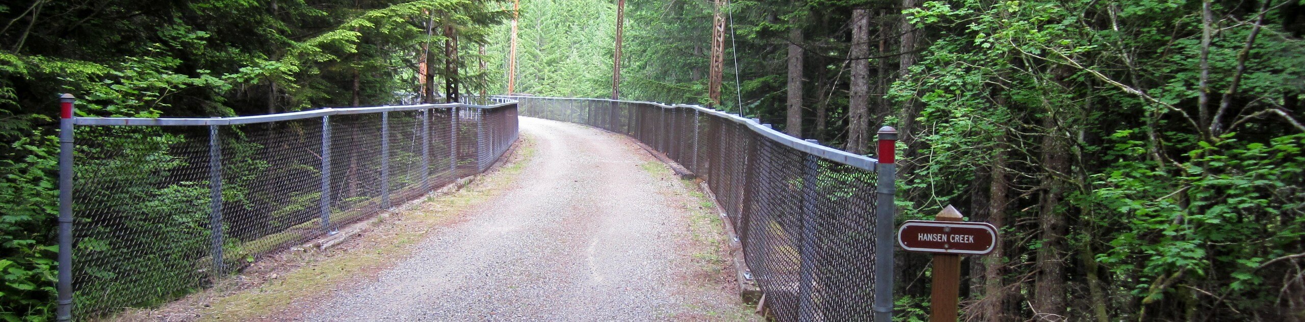
56. Hansen Creek Trail
Difficulty
Hansen Creek Trail is a moderately trafficked out and back trail in Mount Baker-Snoqualmie National… Read More
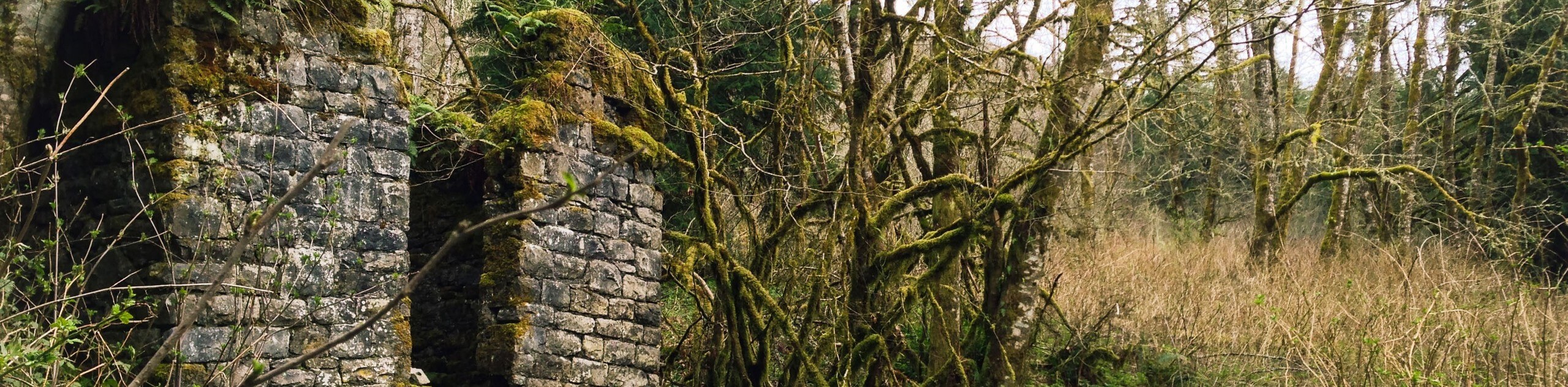
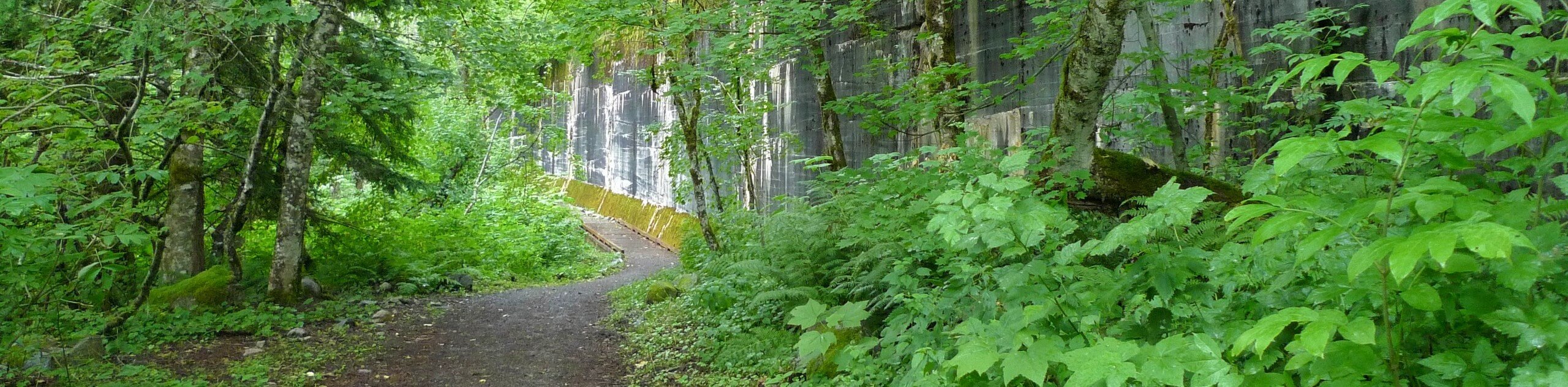
57. Melmont Ghost Town via Foothills Trail
Difficulty
The Melmont Ghost Town via Foothills Trail hike is a heavily trafficked out-and-back hike near… Read More
58. Bridal Veil Falls Trail
Difficulty
The Bridal Veils Falls Trail is a heavily trafficked out-and-back route in Mount Baker-Snoqualmie National… Read More
59. Sparda Lake Culmback Dam Trail
Difficulty
Sparda Lake Culmback Dam Trail is a moderately trafficked out-and-back trail near Startup, Washington that… Read More
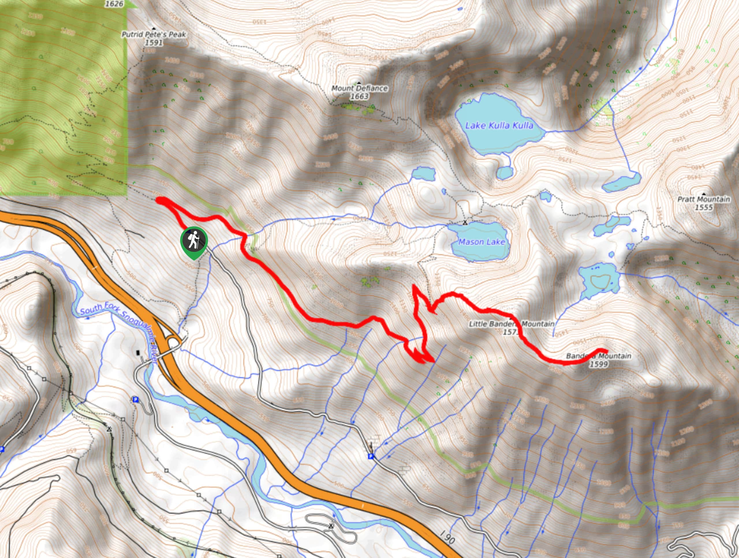
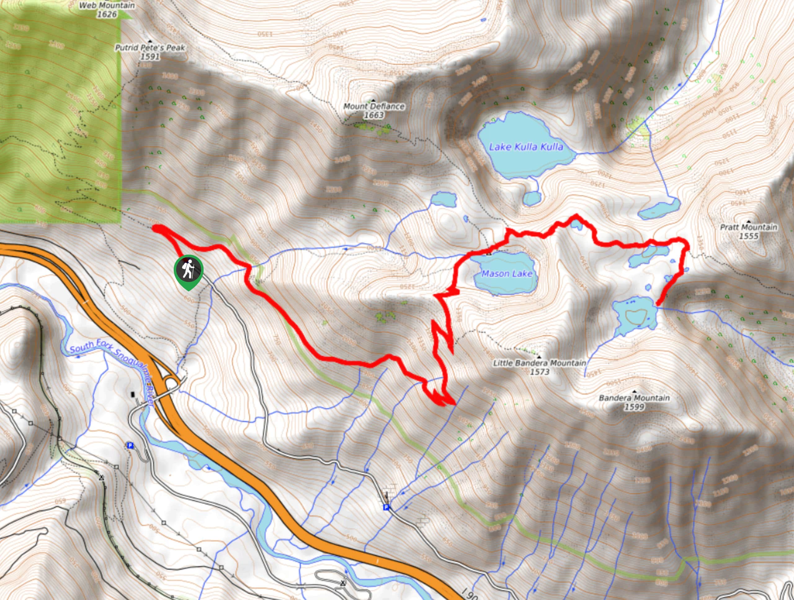
60. Mount Defiance and Mason Lake Hike
Difficulty
Mount Defiance and Mason Lake is a heavily trafficked out-and-back hike in Mount Baker-Snoqualmie National… Read More
61. Franklin Falls via National Forest Development Road 58
Difficulty
Franklin Falls via National Forest Development Road 58 is a heavily trafficked out-and-back trail in… Read More
62. Heybrook Ridge Trail
Difficulty
The Heybrook Ridge Trail is a heavily trafficked out-and-back trail in the Mount Baker-Snoqualmie National… Read More
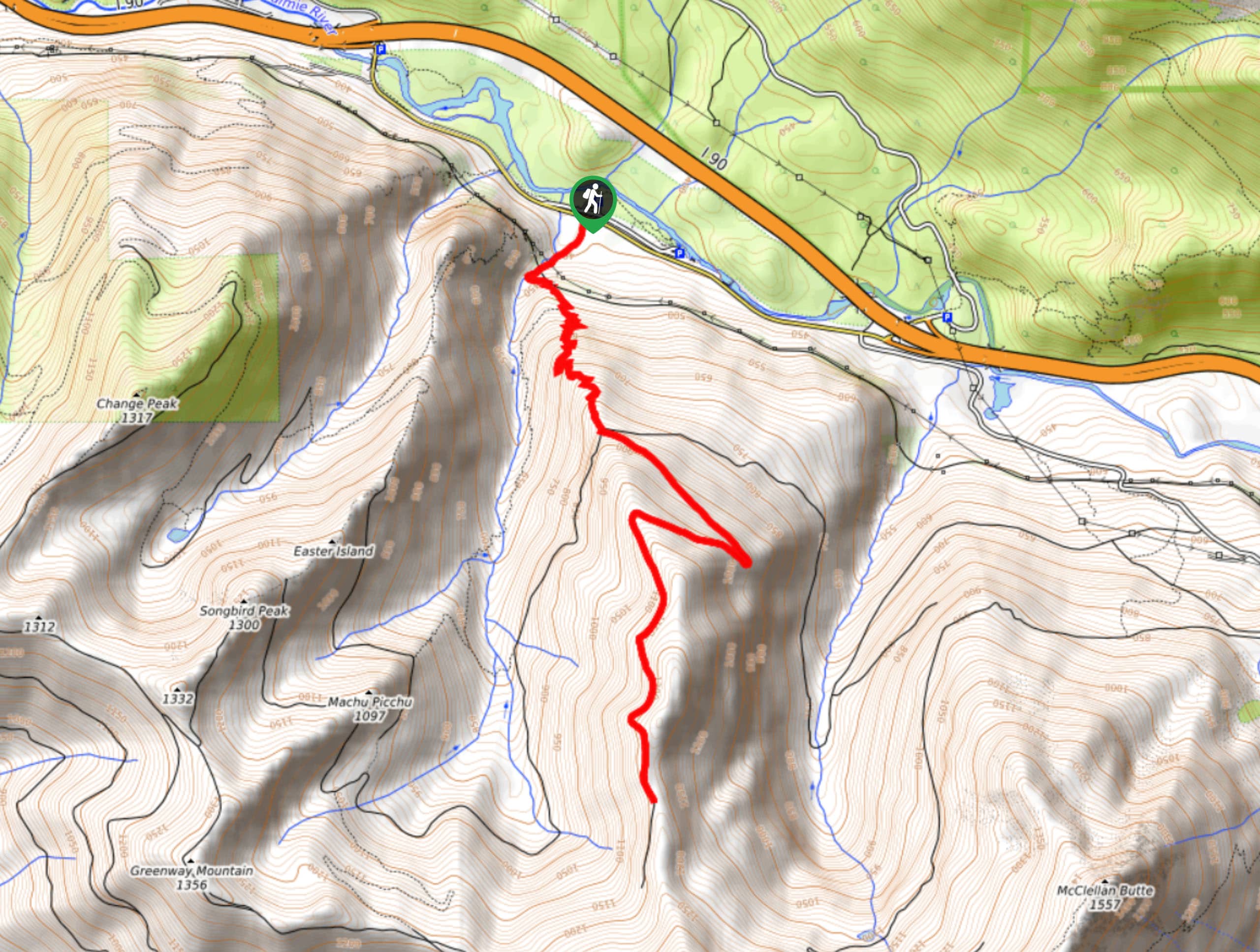
63. McClellan Butte Trail
Difficulty
McClellan Butte Trail is a heavily trafficked out-and-back trail in Mount Baker-Snoqualmie National Forest that… Read More
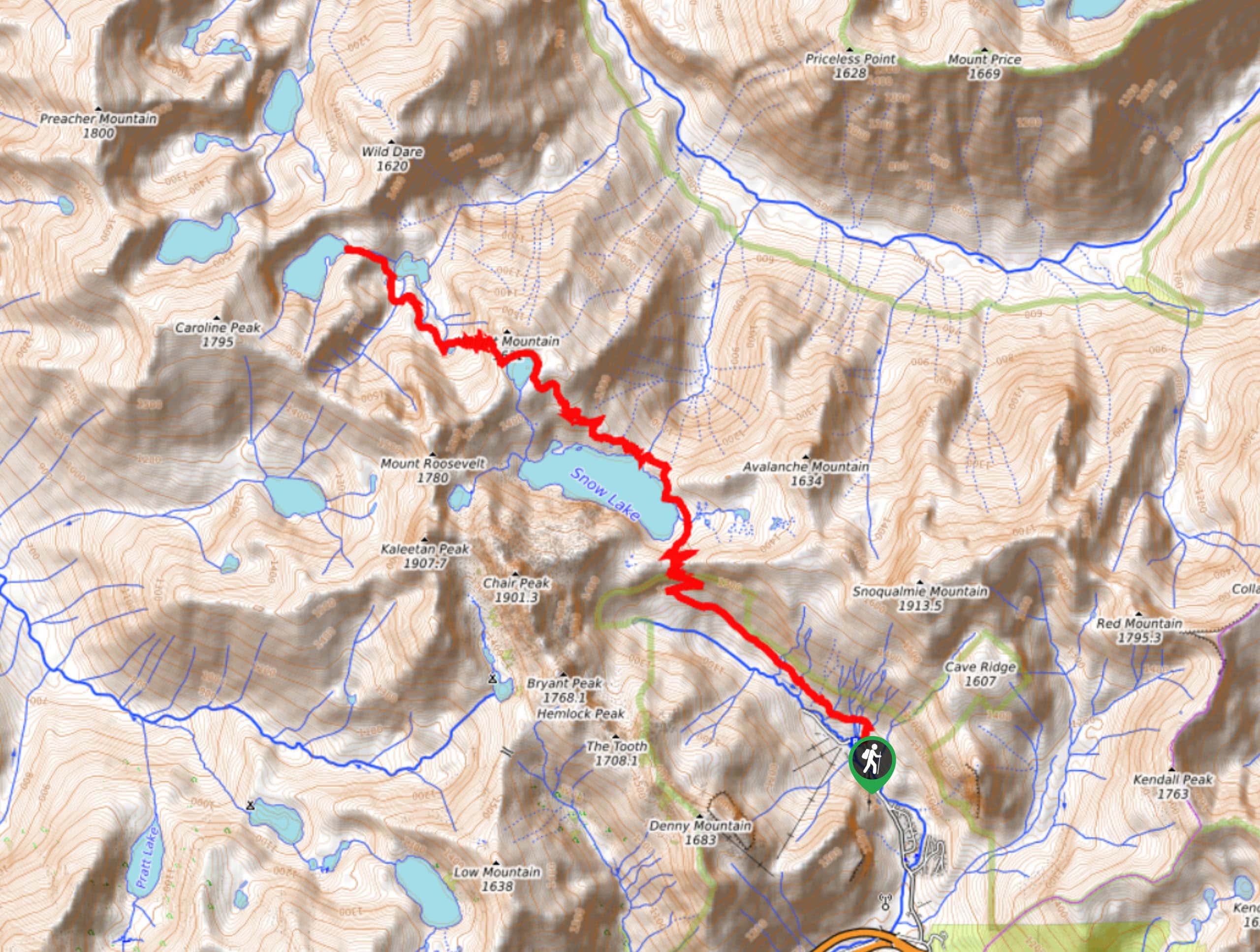
64. Kaleetan Peak Trail
Difficulty
Kaleetan Peak Trail is a 10.5mi moderately trafficked out and back trail in… Read More
65. Kelly Butte Trail
Difficulty
Kelly Butte Trail is a moderately trafficked out-and-back trail in Mount Baker-Snoqualmie National Forest that… Read More
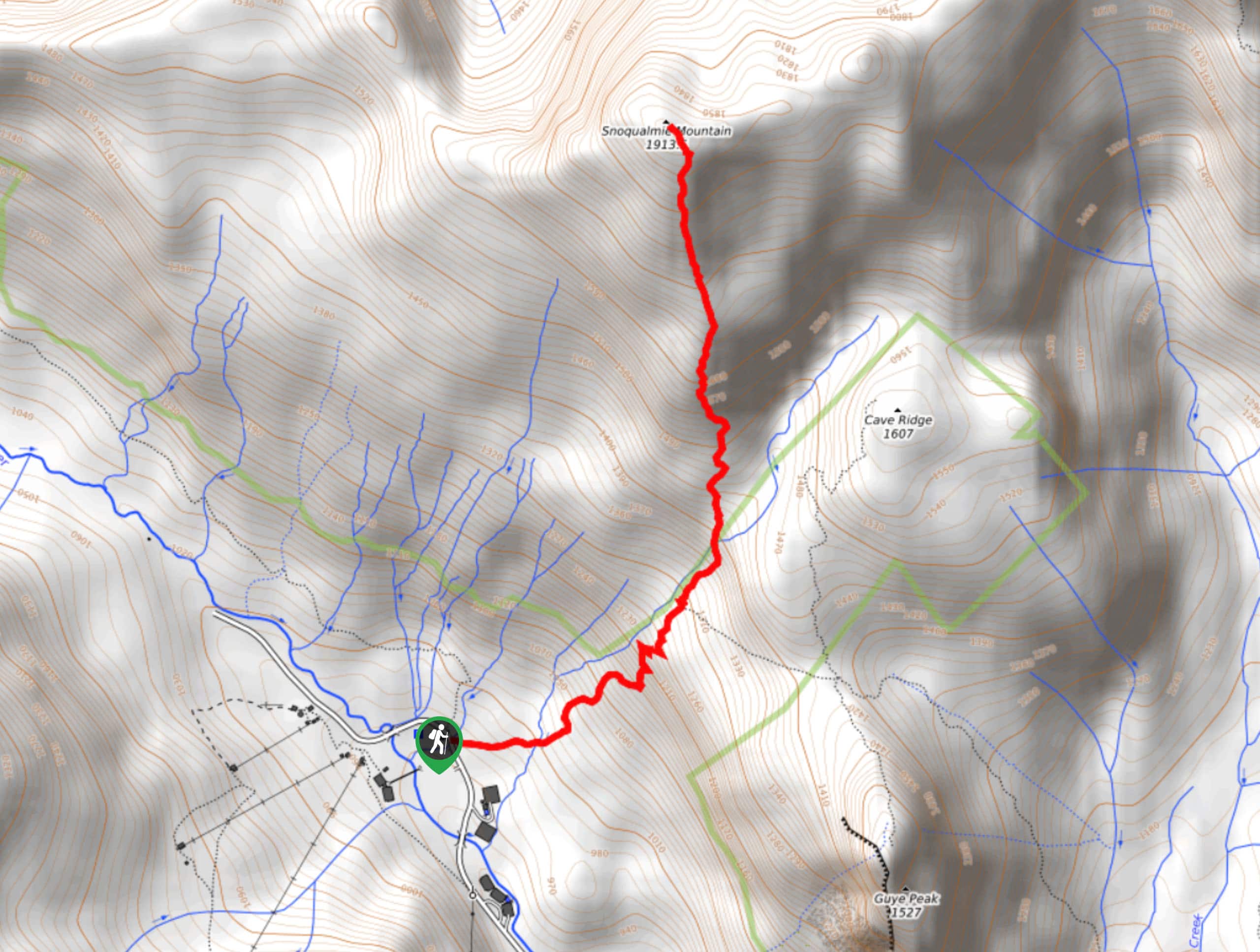
66. Snoqualmie Mountain Trail
Difficulty
Snoqualmie Mountain is a moderately trafficked out-and-back trail in Mount Baker-Snoqualmie National Forest that is… Read More
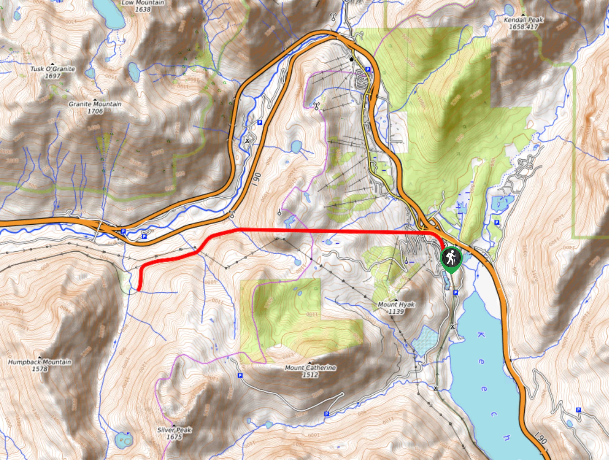
67. Snoqualmie Tunnel Trail
Difficulty
The Snoqualmie Tunnel Trail is a heavily trafficked out-and-back trail in Mount Baker-Snoqualmie National Forest… Read More
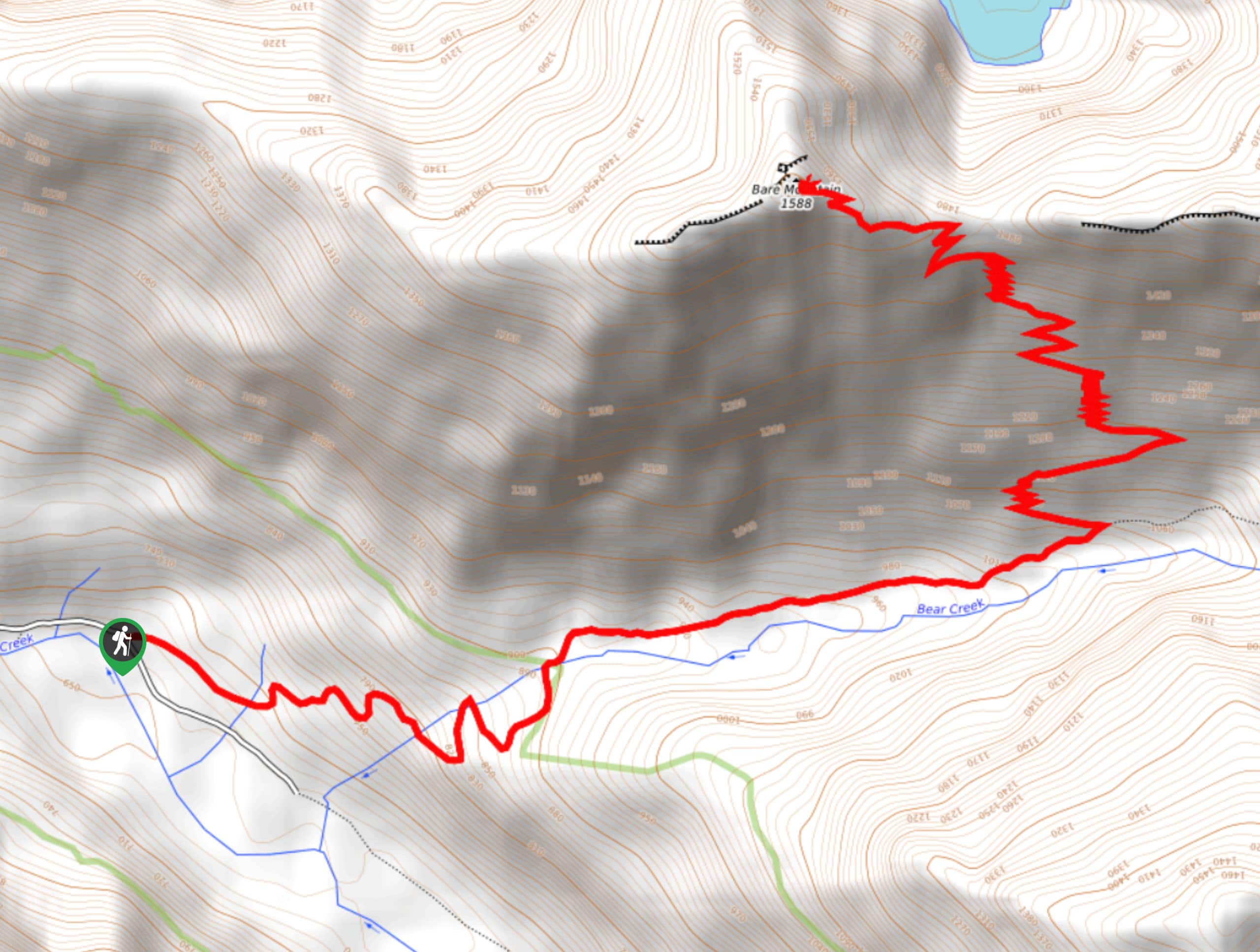
68. Bare Mountain Trail
Difficulty
Bare Mountain Trail is a 7.8mi moderately trafficked out and back trail in… Read More

69. Franklin Falls Trail Winter Route
Difficulty
Franklin Falls Trail is a heavily trafficked out-and-back trail in Mount Baker-Snoqualmie National Forest that… Read More
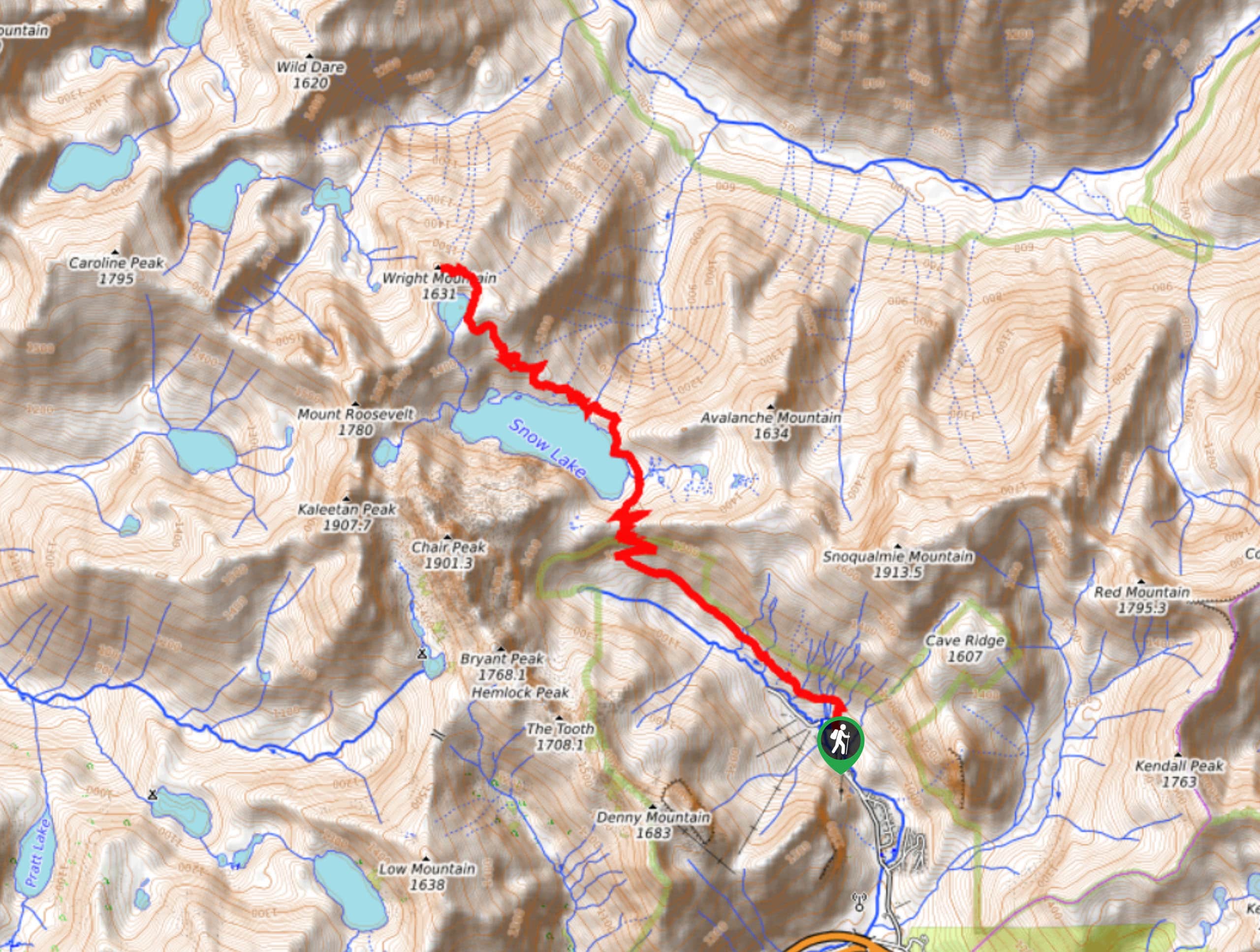
70. Wright Mountain Hike
Difficulty
Wright Mountain is a heavily trafficked out-and-back trail in Mount Baker-Snoqualmie National Forest that is… Read More
71. Beckler Peak Hike
Difficulty
Beckler Peak is a heavily trafficked out-and-back trail in Mount Baker-Snoqualmie National Forest that is… Read More
72. Garfield Ledges Hike
Difficulty
Garfield Ledges is a moderately trafficked out-and-back trail in Mount Baker-Snoqualmie National Forest that is… Read More
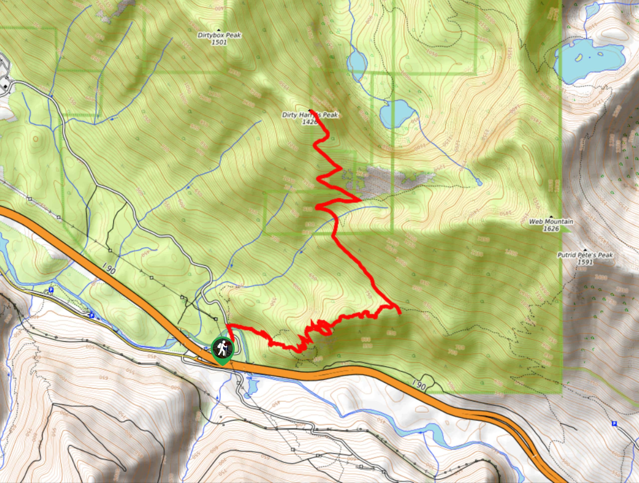
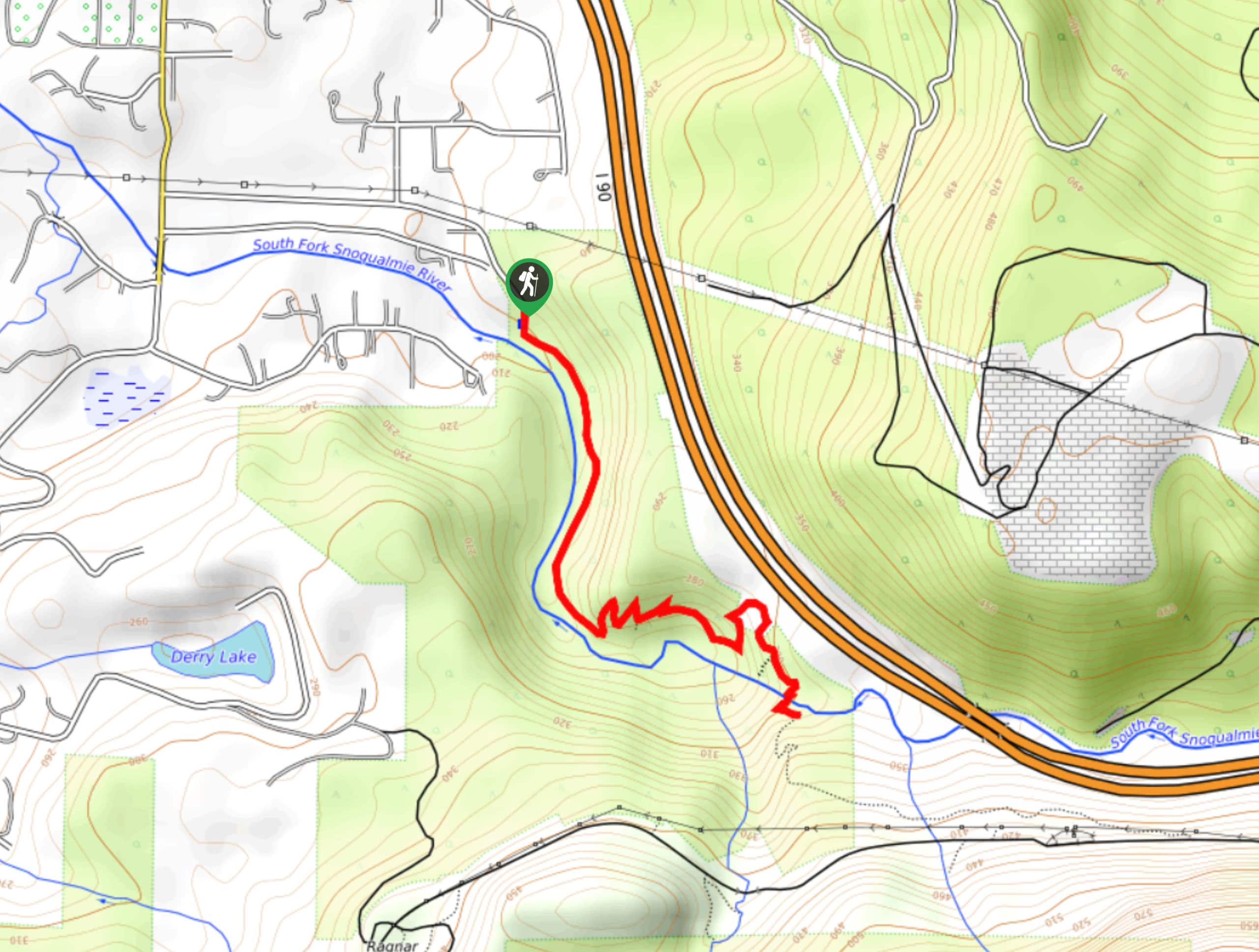
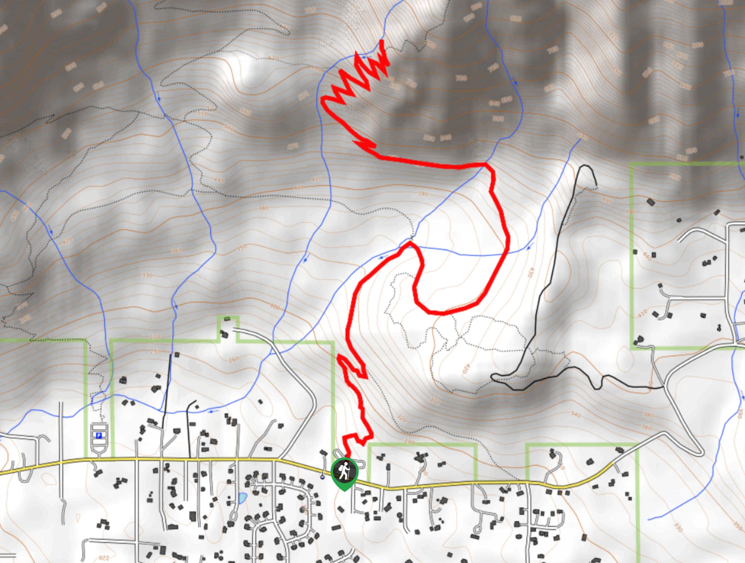
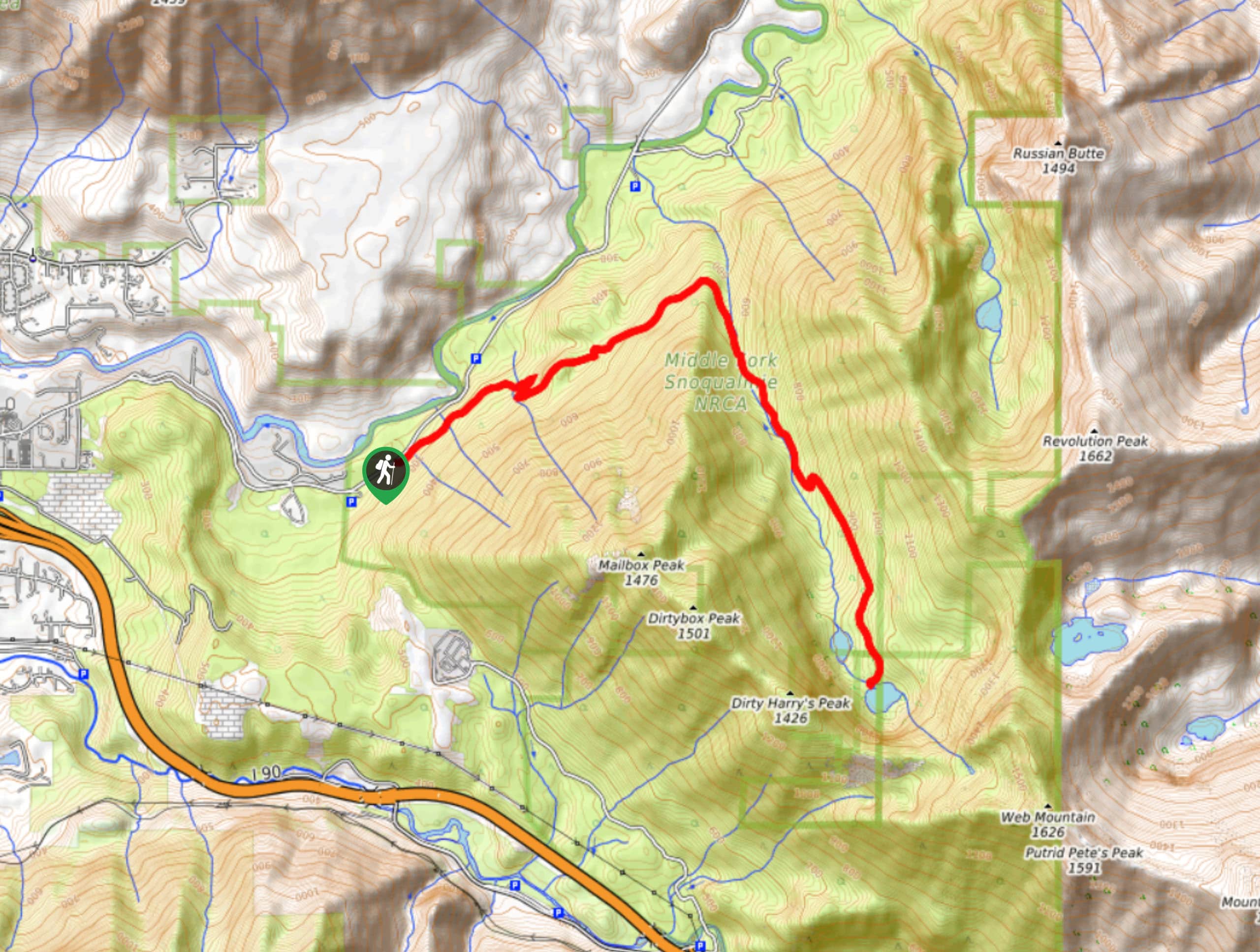
73. Dirty Harry’s Peak via Birdhouse Trail
Difficulty
Dirty Harry’s Peak via Birdhouse Trail is a heavily trafficked out-and-back trail near Snoqualmie Pass… Read More
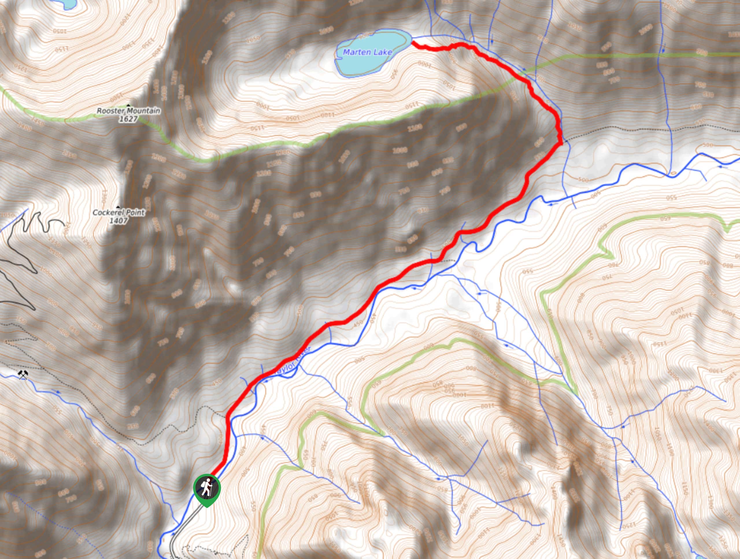
74. Marten Lake Trail
Difficulty
Marten Lake Trail is a lightly trafficked out-and-back trail in Mount Baker-Snoqualmie National Forest that… Read More
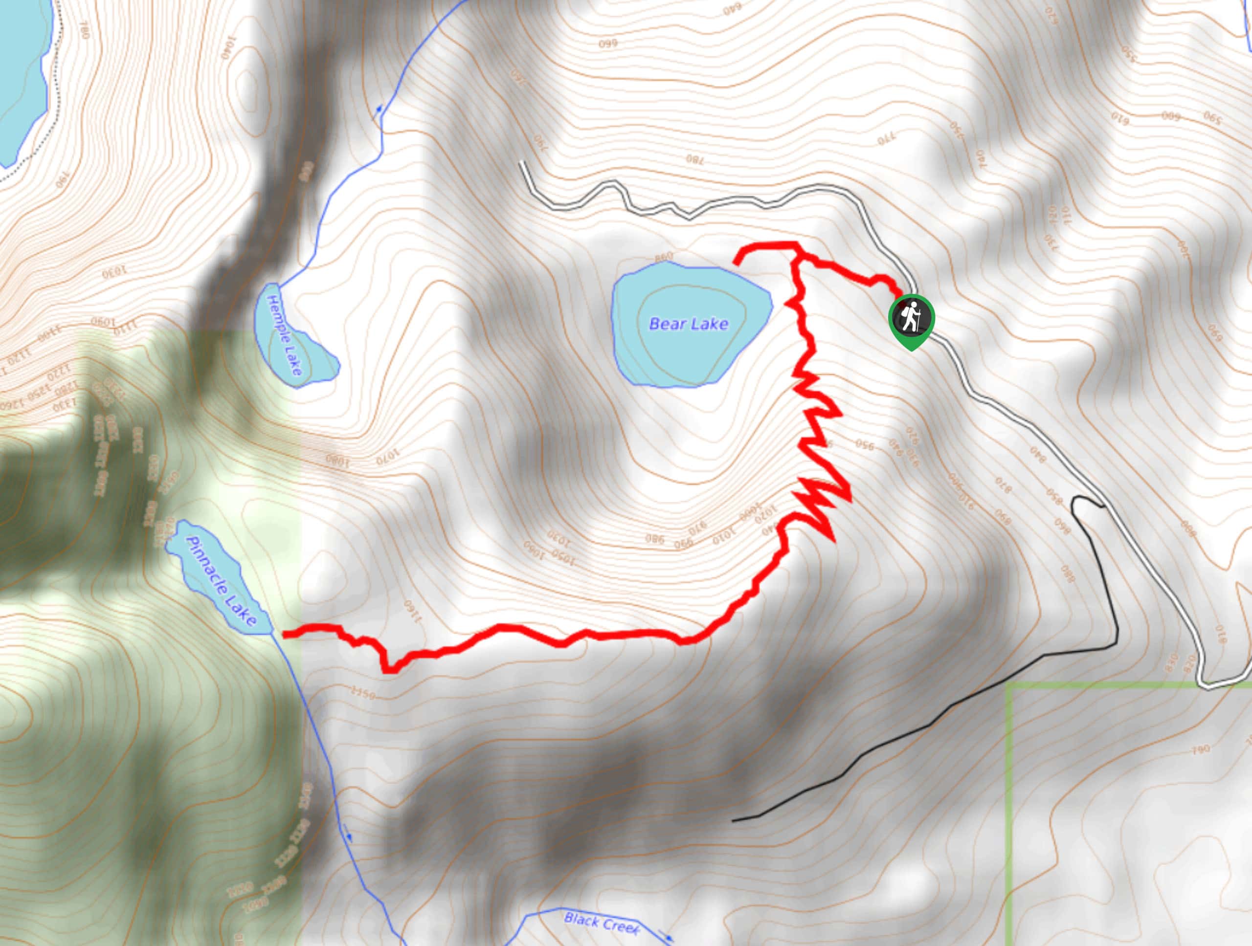
75. Pinnacle Lake Trail
Difficulty
Pinnacle Lake Trail is a lightly trafficked out-and-back trail in Mount Pilchuck State Park that… Read More
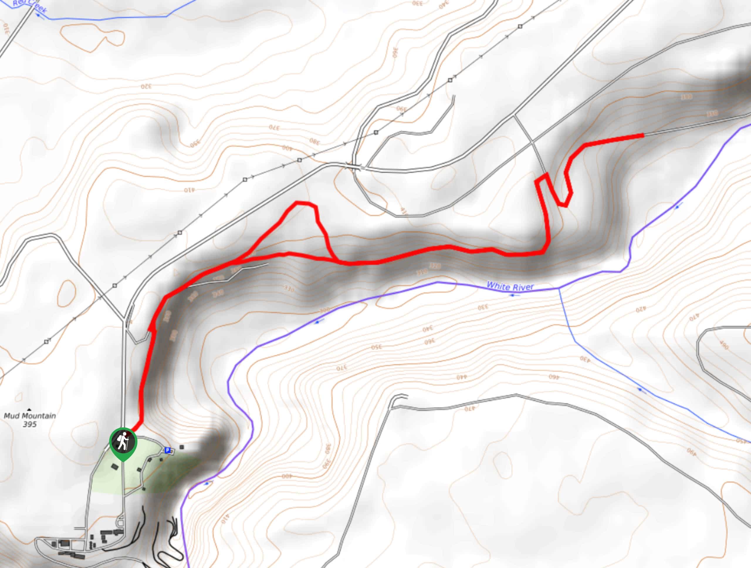
76. Mud Mountain Rim Trail
Difficulty
Mud Mountain Rim Trail is a heavily trafficked out-and-back trail in Mount Baker-Snoqualmie National Forest… Read More
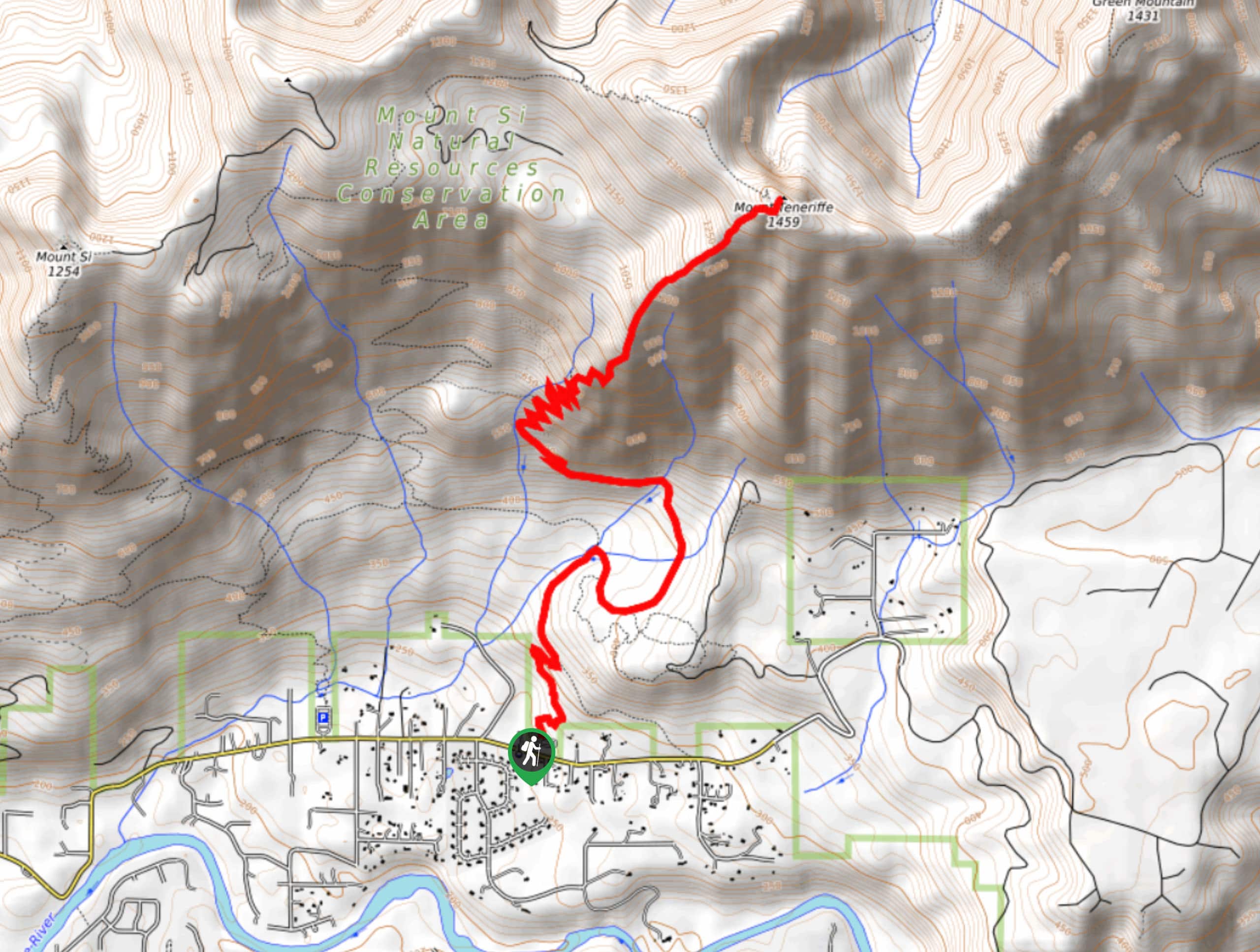
77. Mount Teneriffe via Kamikaze Trail
Difficulty
Mount Teneriffe via Kamikaze Trail is a heavily trafficked out-and-back trail that is rated as… Read More
78. Hansen Ridge Trail
Difficulty
Hansen Ridge Trail #1020 is a moderately trafficked loop trail in Mount Baker-Snoqualmie National Forest… Read More
79. Zig Zag Trail
Difficulty
Zig Zag Trail is a moderately trafficked out-and-back trail in Mount Baker-Snoqualmie National Forest that… Read More
80. Teneriffe Falls and Mount Teneriffe Loop
Difficulty
Teneriffe Falls and Mount Teneriffe heavily trafficked loop trail that is rated as hard. This… Read More
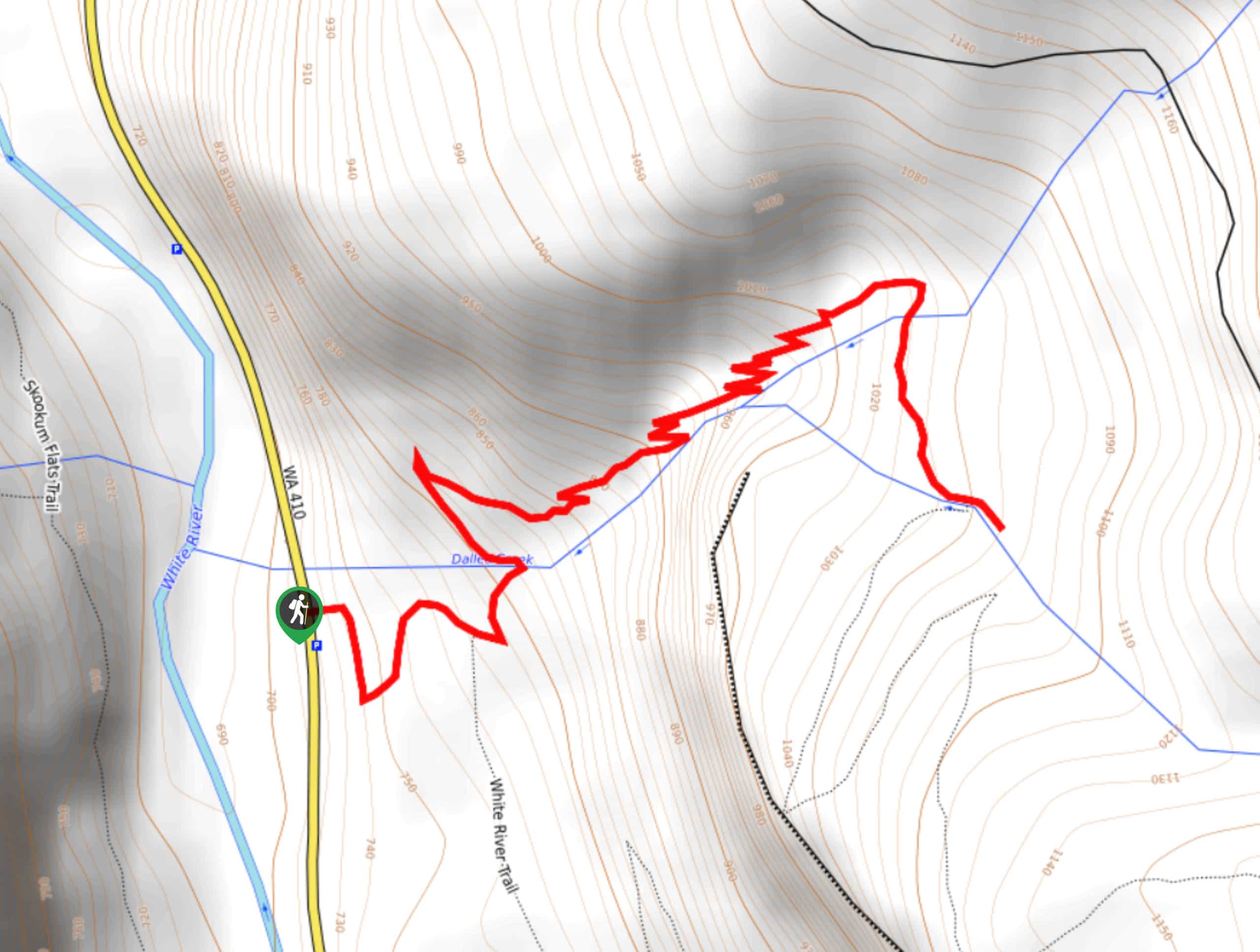
81. Dalles Falls Trail
Difficulty
The Dalles Falls Trail is a moderately trafficked out-and-back trail in Mount Baker-Snoqualmie National Forest… Read More
82. Granite Lakes Trail
Difficulty
The Granite Lakes Trail is a moderately trafficked out-and-back trail that is rated as moderate.… Read More
83. Snoqualmie Point Park Trail
Difficulty
The Snoqualmie Point Park walk is a very short, easy, family-friendly lollipop walk around a… Read More

84. Dirty Harry’s Balcony via Little Balcony
Difficulty
Dirty Harry’s Balcony via Little Balcony is a lightly trafficked out-and-back trail near Snoqualmie Pass… Read More
85. Dirty Harry’s Balcony via Birdhouse Trail
Difficulty
Dirty Harry’s Balcony via Birdhouse Trail is a heavily trafficked out-and-back trail near Snoqualmie Pass… Read More
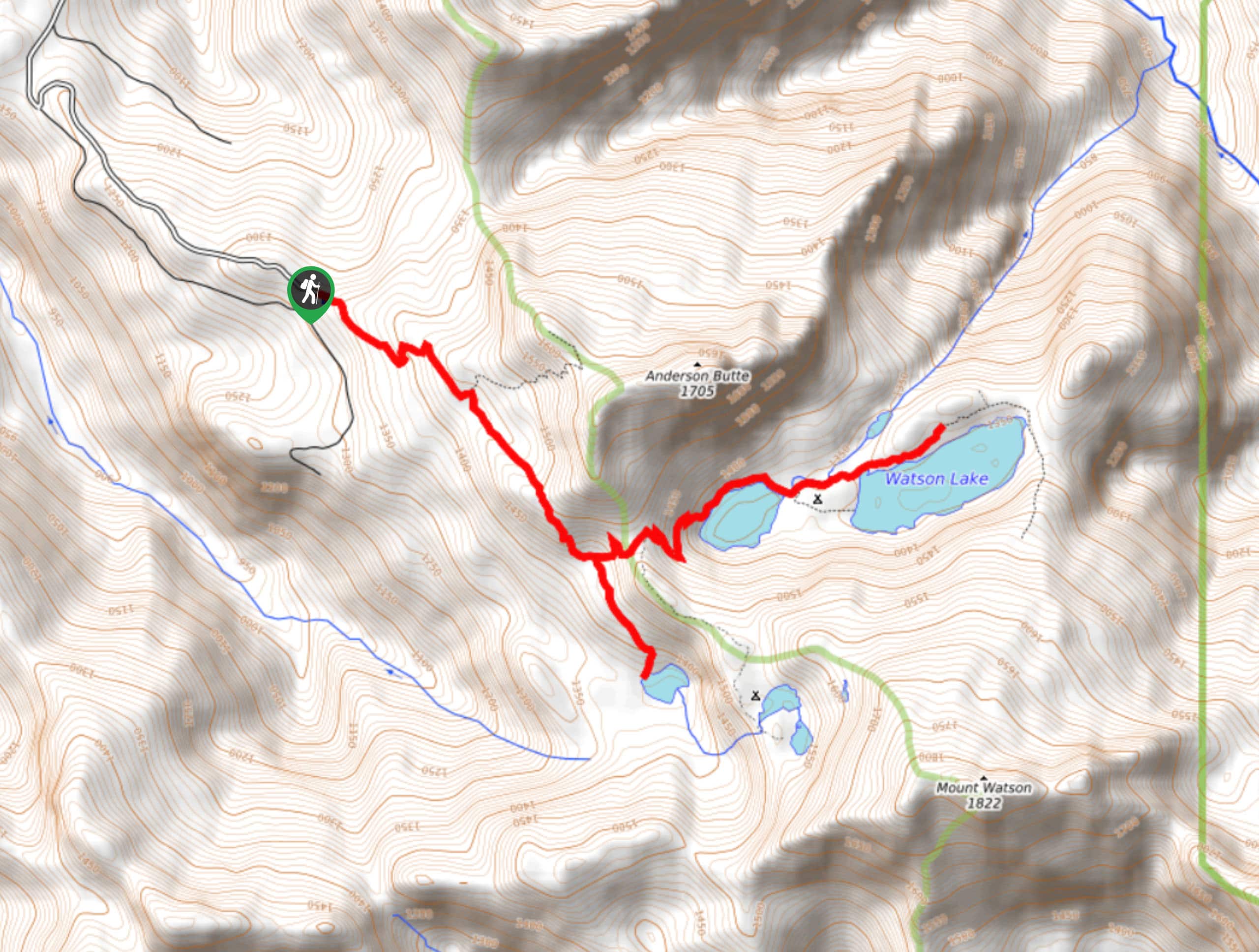
86. Anderson Lake and Watson Lake Hike
Difficulty
The hike to Anderson Lake and Watson Lake is an out-and-back trail in Mount Baker-Snoqualmie… Read More
87. Asahel Curtis Nature Trail
Difficulty
Asahel Curtis Nature Trail is a heavily trafficked lollipop trail in Mount Baker-Snoqualmie National Forest… Read More
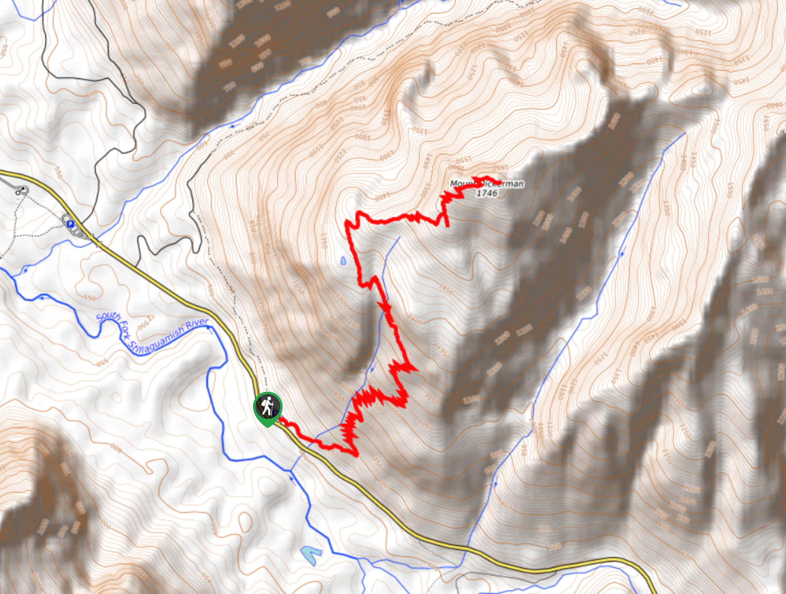
88. Mount Dickerman Trail
Difficulty
Mount Dickerman Trail is a moderately trafficked out-and-back trail in Mount Baker-Snoqualmie National Forest that… Read More
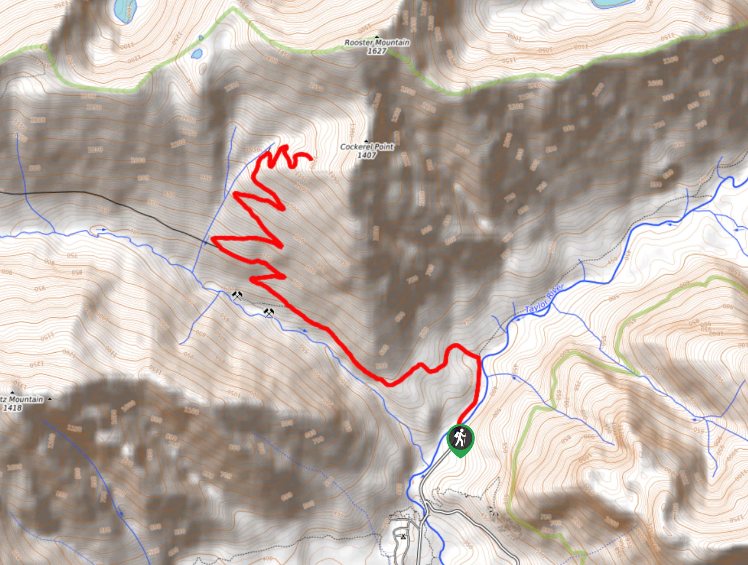
89. Quartz Creek Hike
Difficulty
Quartz Creek is a lightly trafficked out-and-back trail in Mount Baker-Snoqualmie National forest that is… Read More
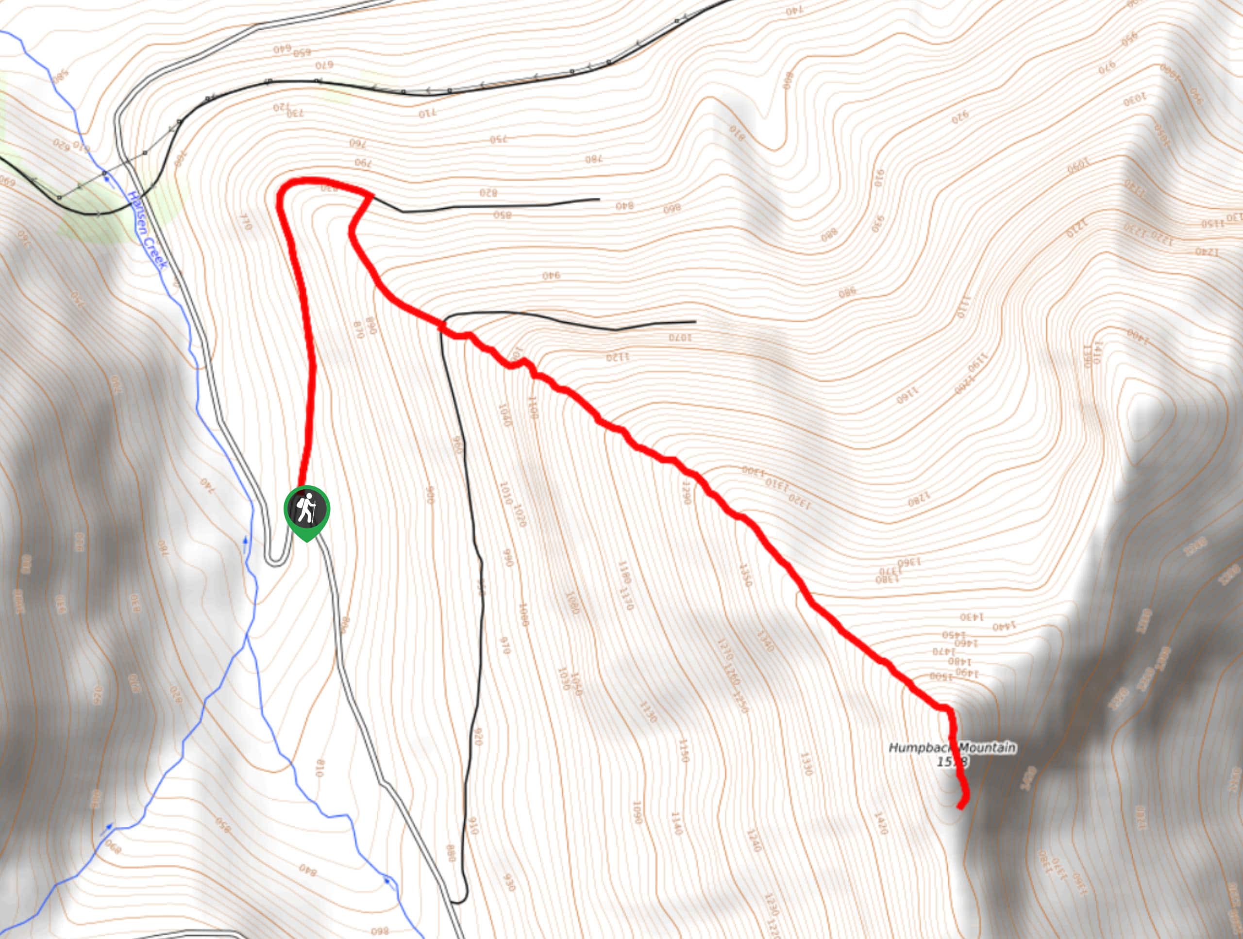
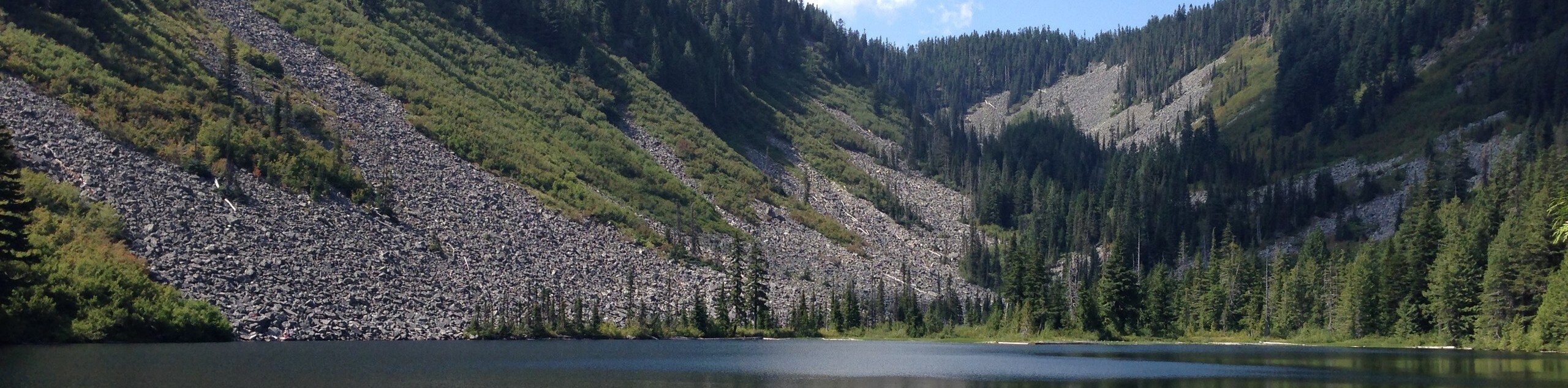
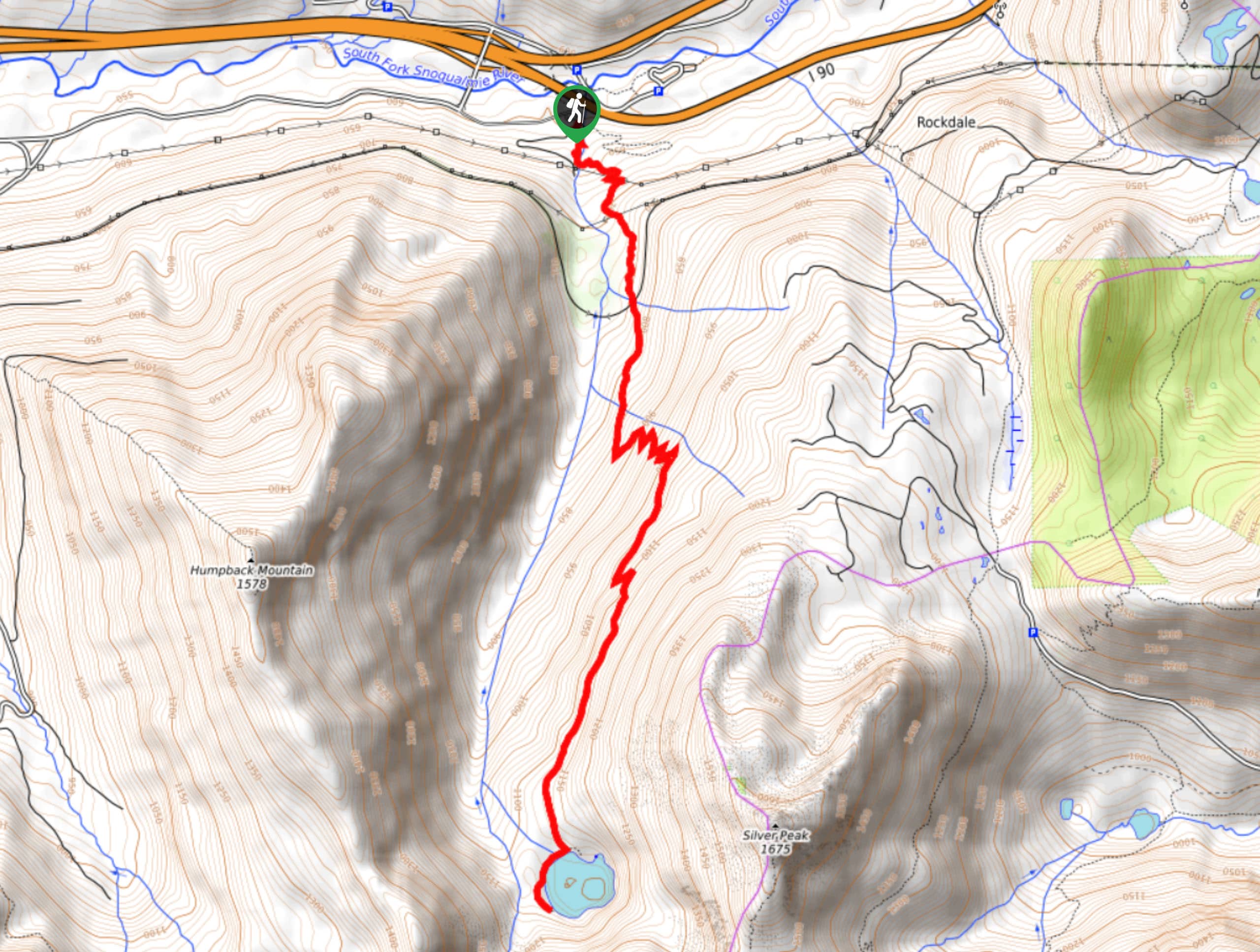
90. Humpback Mountain Trail
Difficulty
Humpback Mountain Trail is a moderately trafficked out-and-back trail in Mount Baker-Snoqualmie National Forest that… Read More
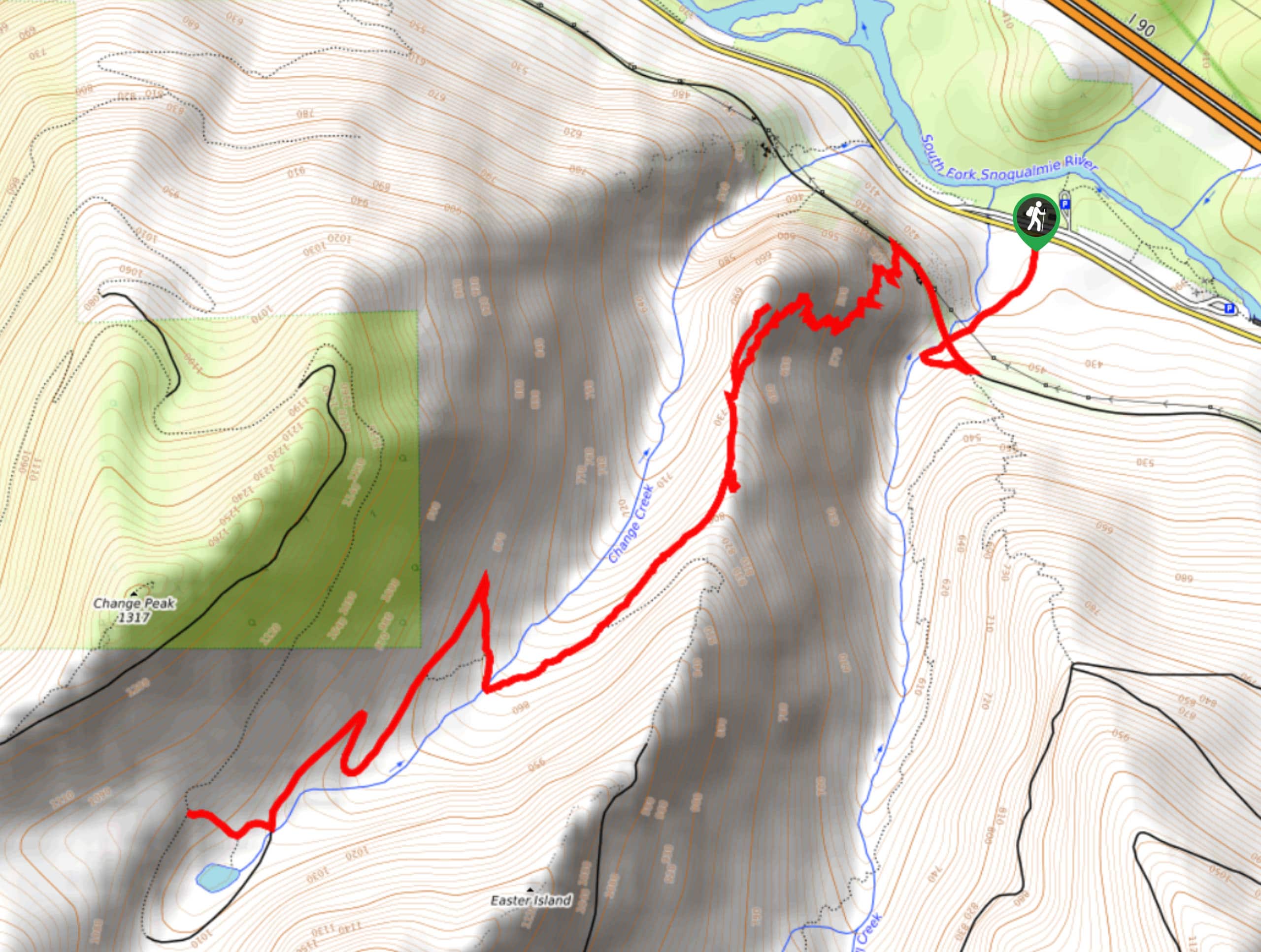
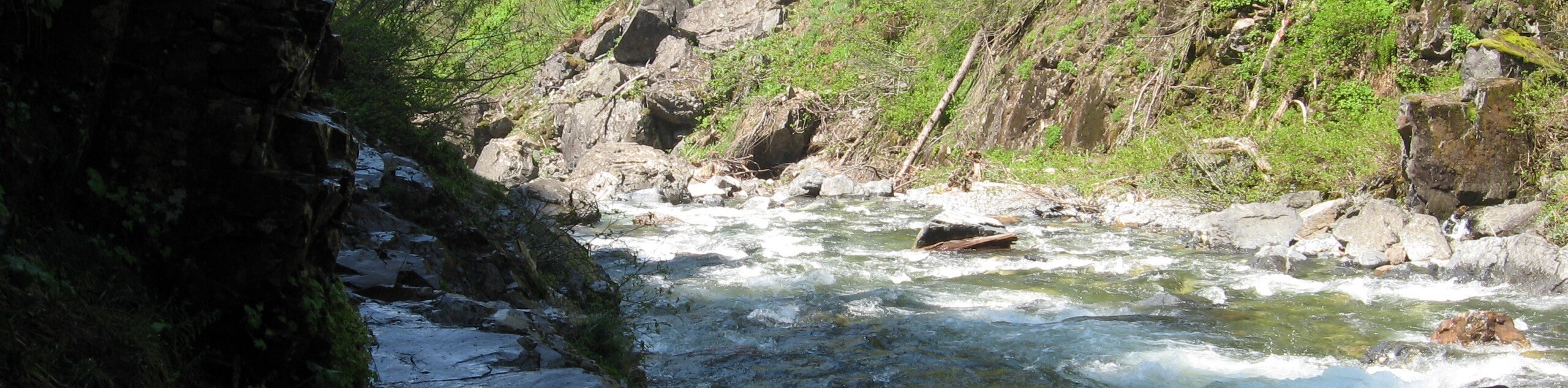
91. Change Creek Trail
Difficulty
The Change Creek Trail is a lightly trafficked out-and-back route in Mount Baker-Snoqualmie National Forest… Read More
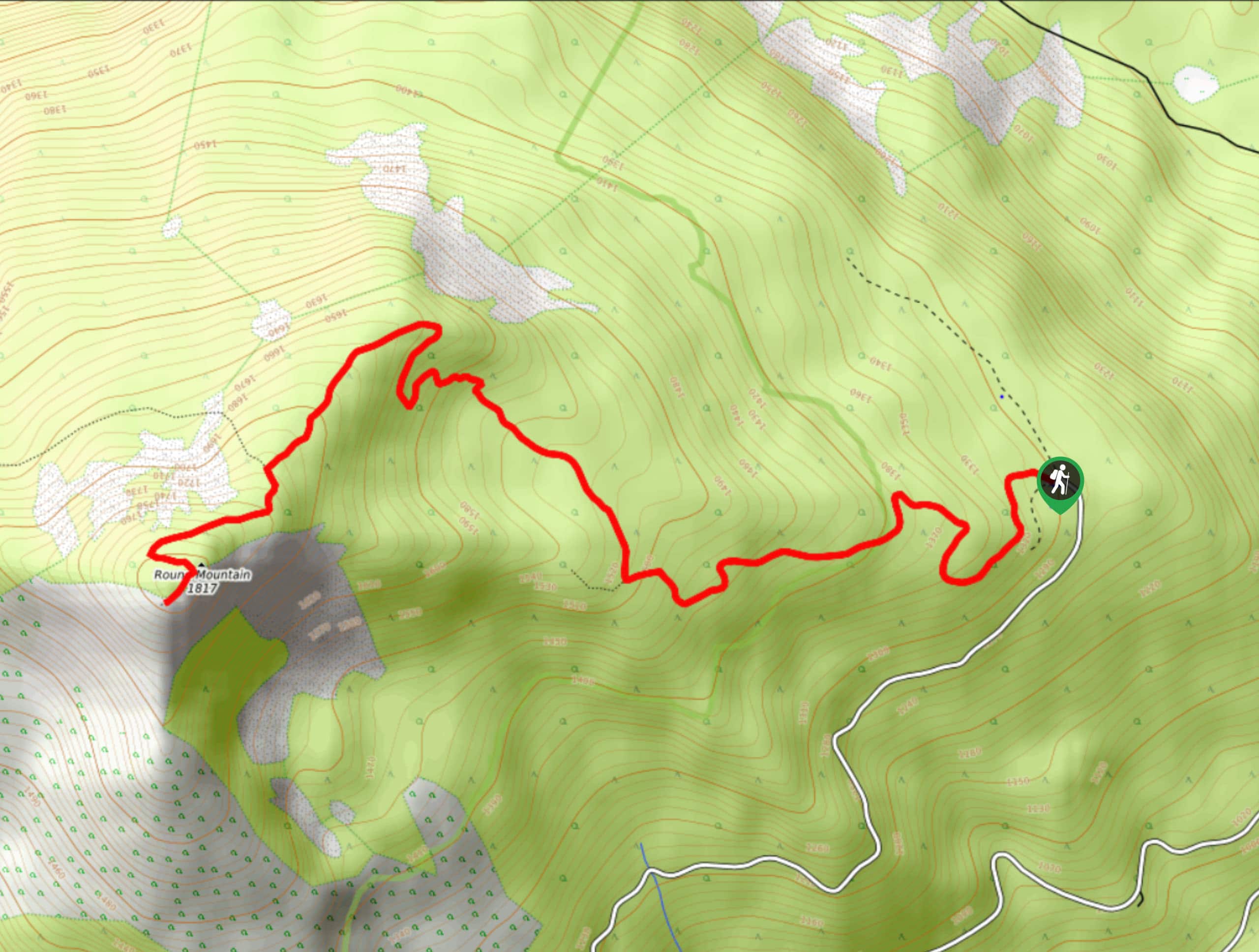
92. Round Mountain Trail
Difficulty
The Round Mountain Trail is a moderately trafficked out-and-back trail in Okanogan-Wenatchee National Forest that… Read More
93. Franklin Falls via Wagonroad Trail
Difficulty
Franklin Falls is a very popular destination in Mount Baker-Snoqualmie National Forest just north of… Read More
94. Mason Lake via Talapus Lake Trail
Difficulty
The hike to Mason lake on Talapus Lake Trail feels like the land of a… Read More
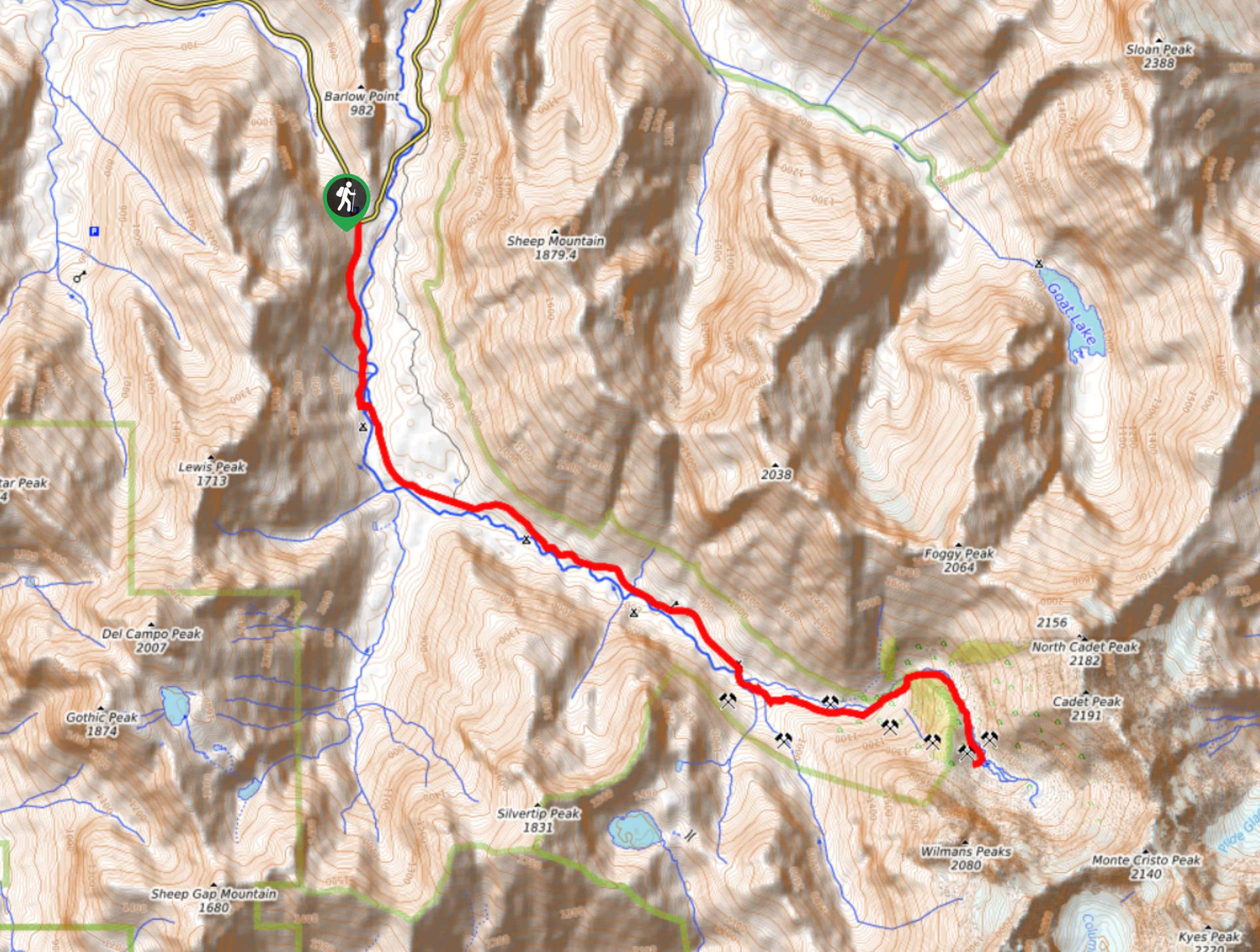
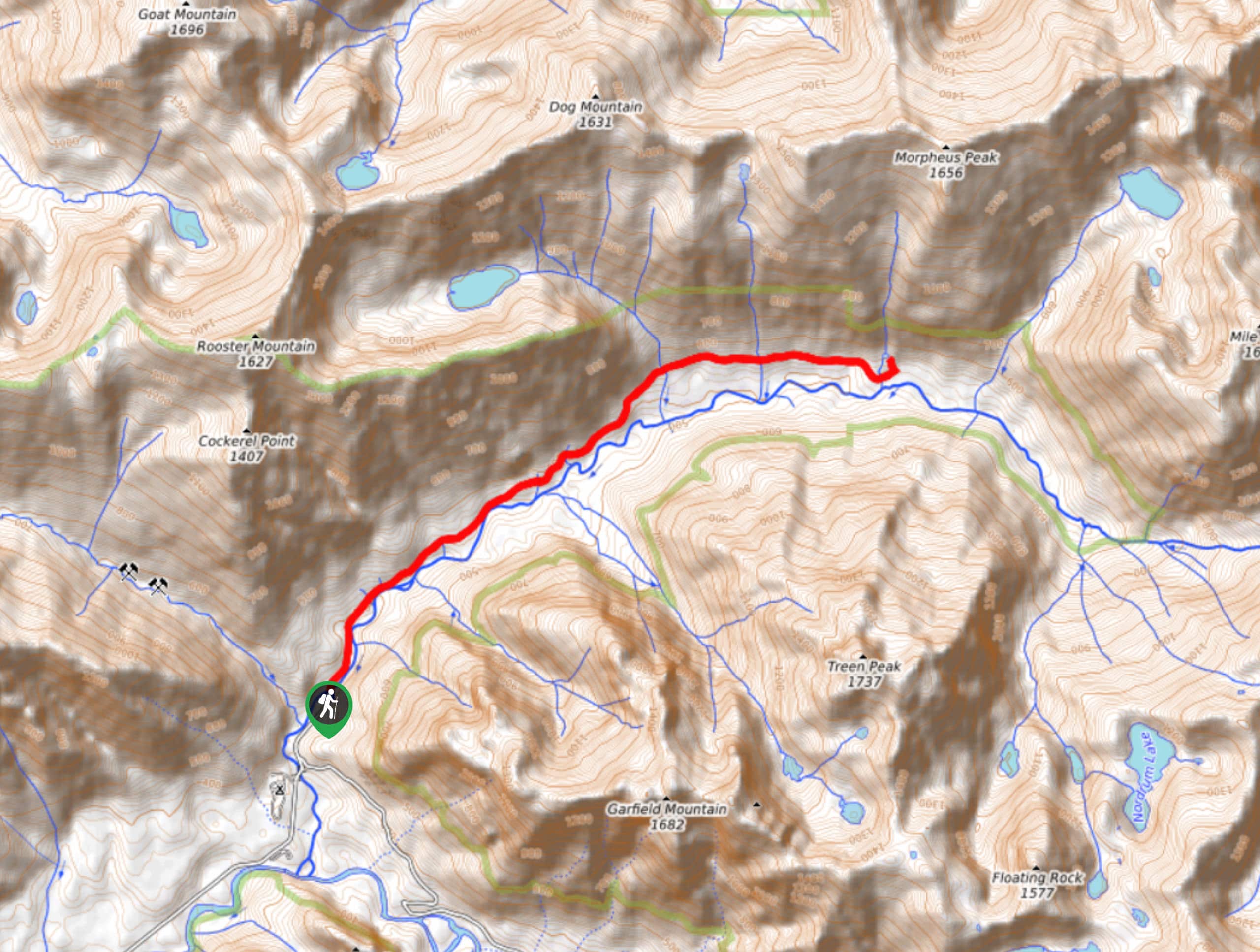
95. Glacier Basin via Monte Cristo Trail
Difficulty
Glacier Basin is a stunning spot, and the route to it via Monte Cristo Trail… Read More
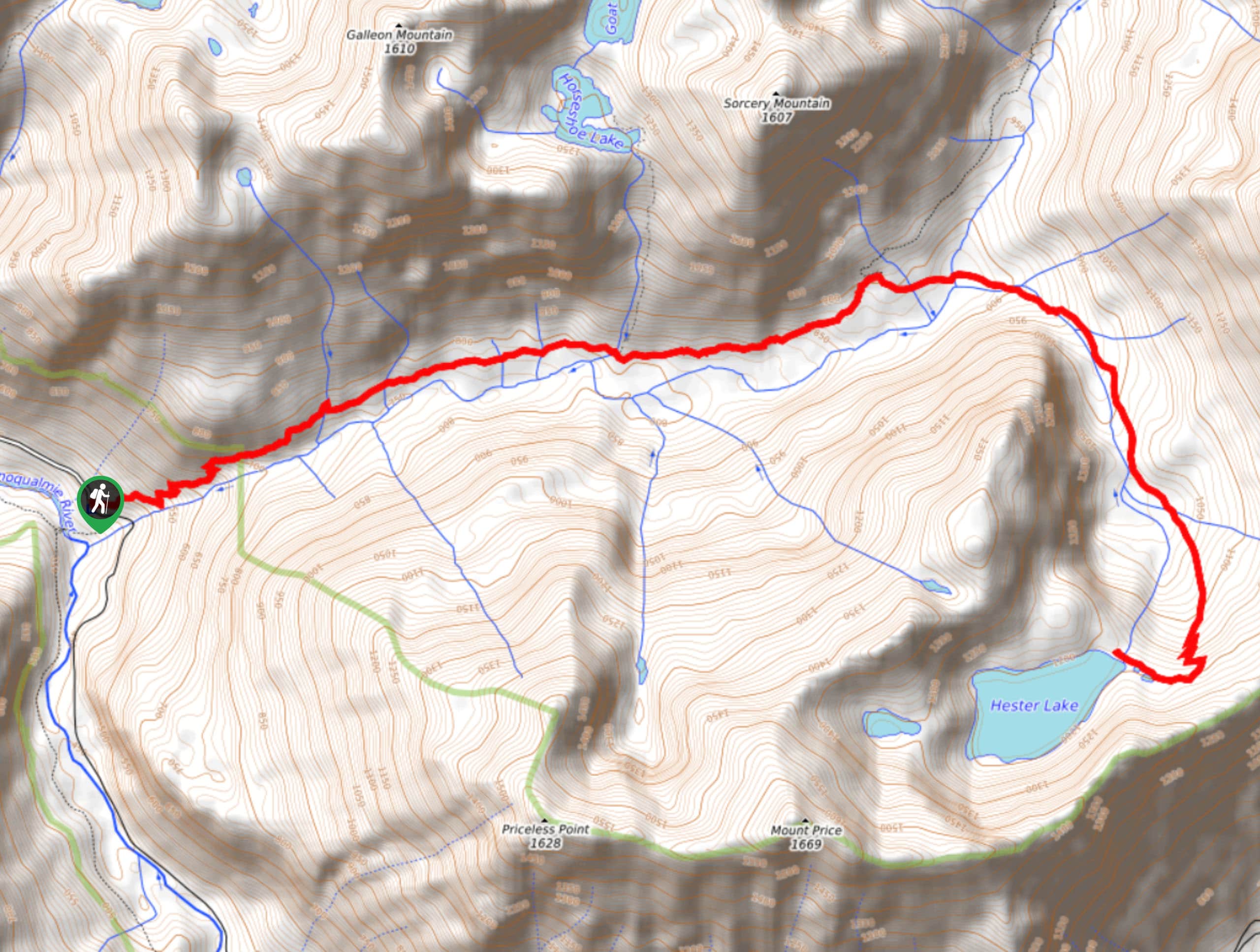
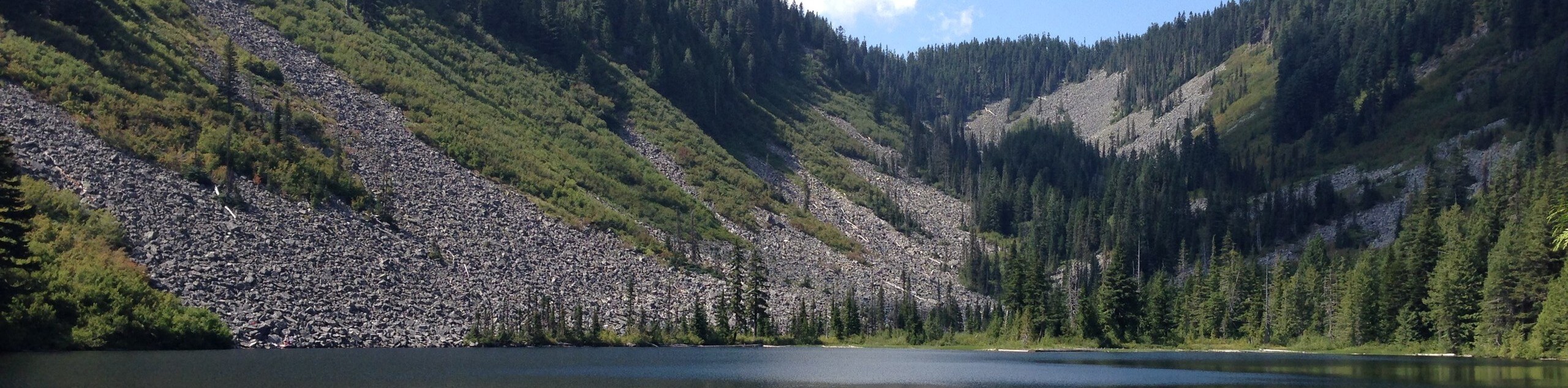
96. Hester Lake Trail
Difficulty
Hester Lake is a deep blue lake nestled into Mount Baker-Snoqualmie National Forest, seemingly far… Read More

97. Talapus, Olallie, and Island Lakes Trail
Difficulty
Talapus, Olallie, and Island Lakes are all accessed on this hike, which is a long,… Read More
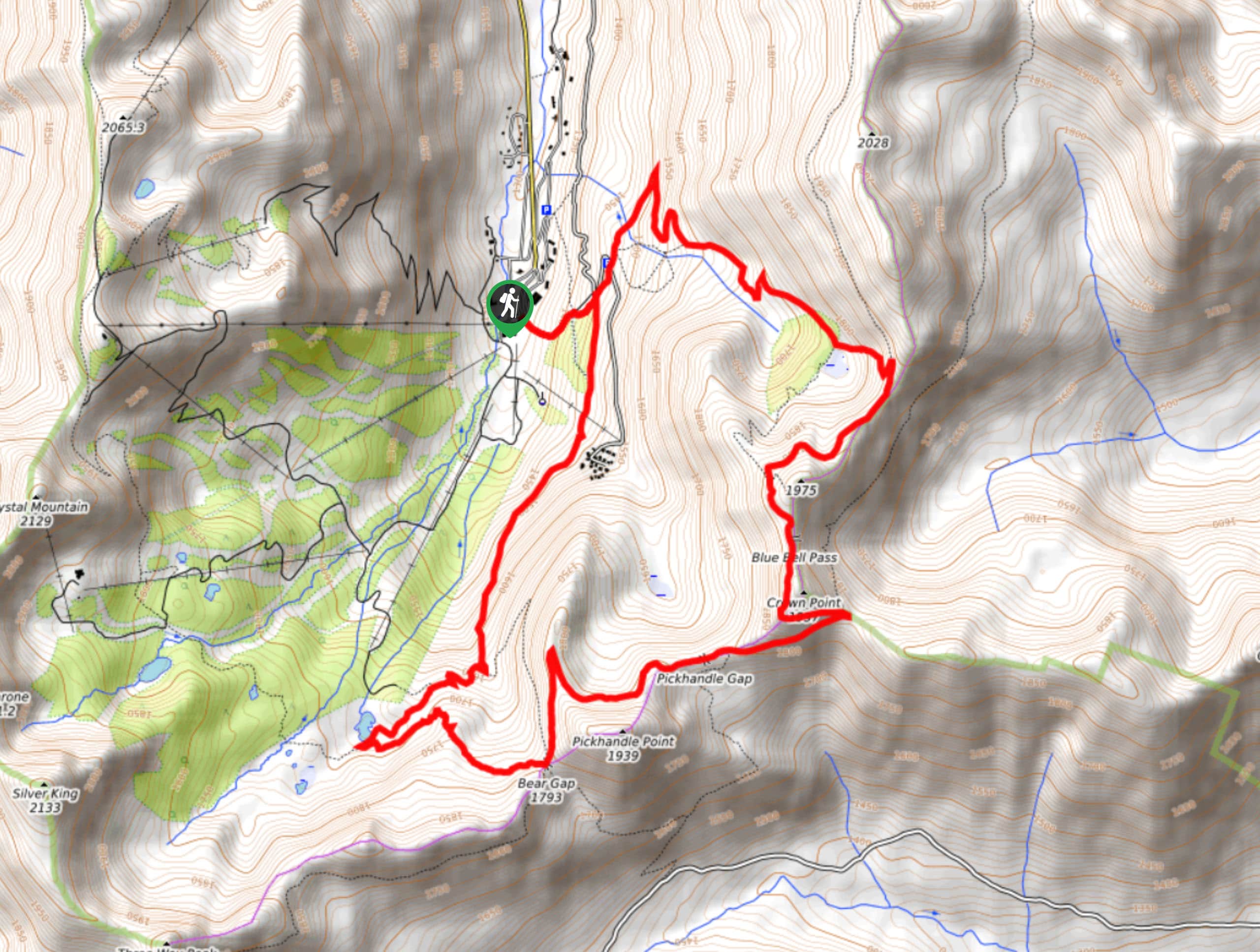
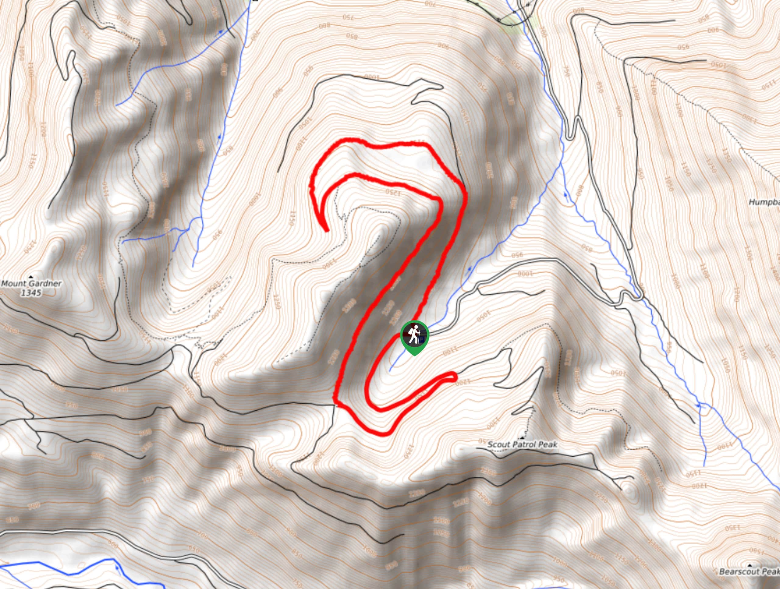
98. Bear Gap to Bullion Basin Hike
Difficulty
Bear Gap to Bullion Basin is a 7.6mi Read More
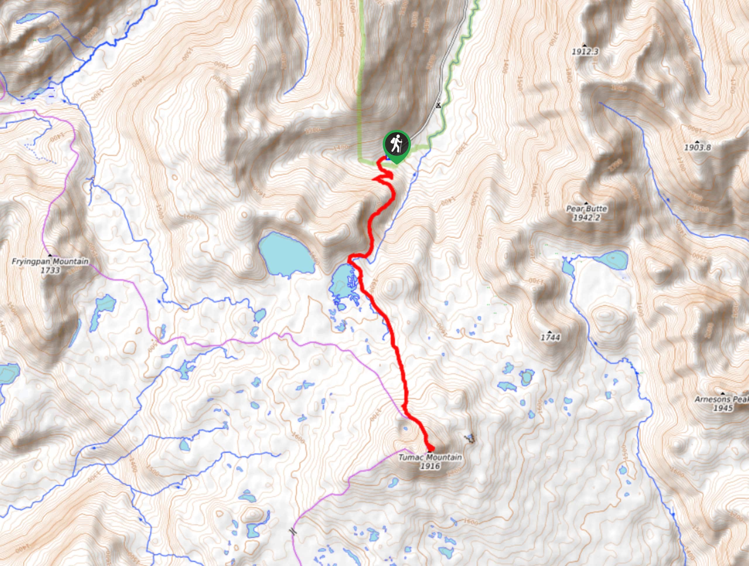
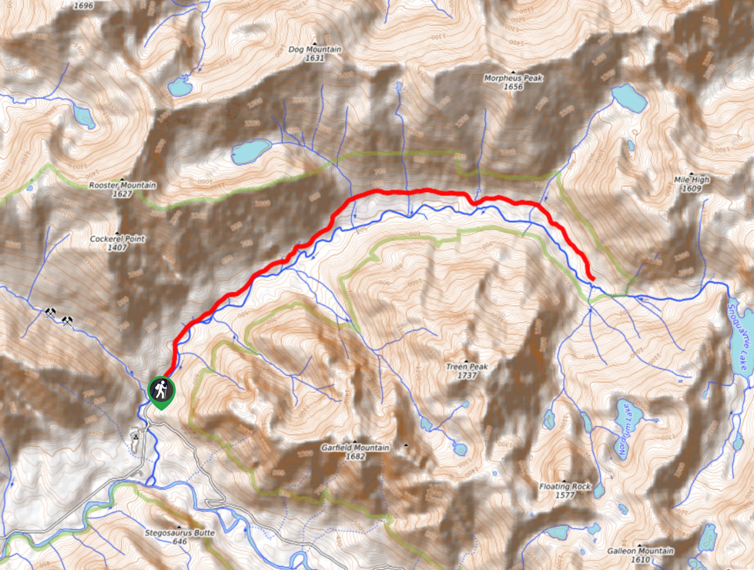
99. Twin Sisters Trail and Tumac Mountain
Difficulty
The hike along Twin Sisters Trail to Tumac mountain is a beautiful outing, traversing 7.1mi Read More
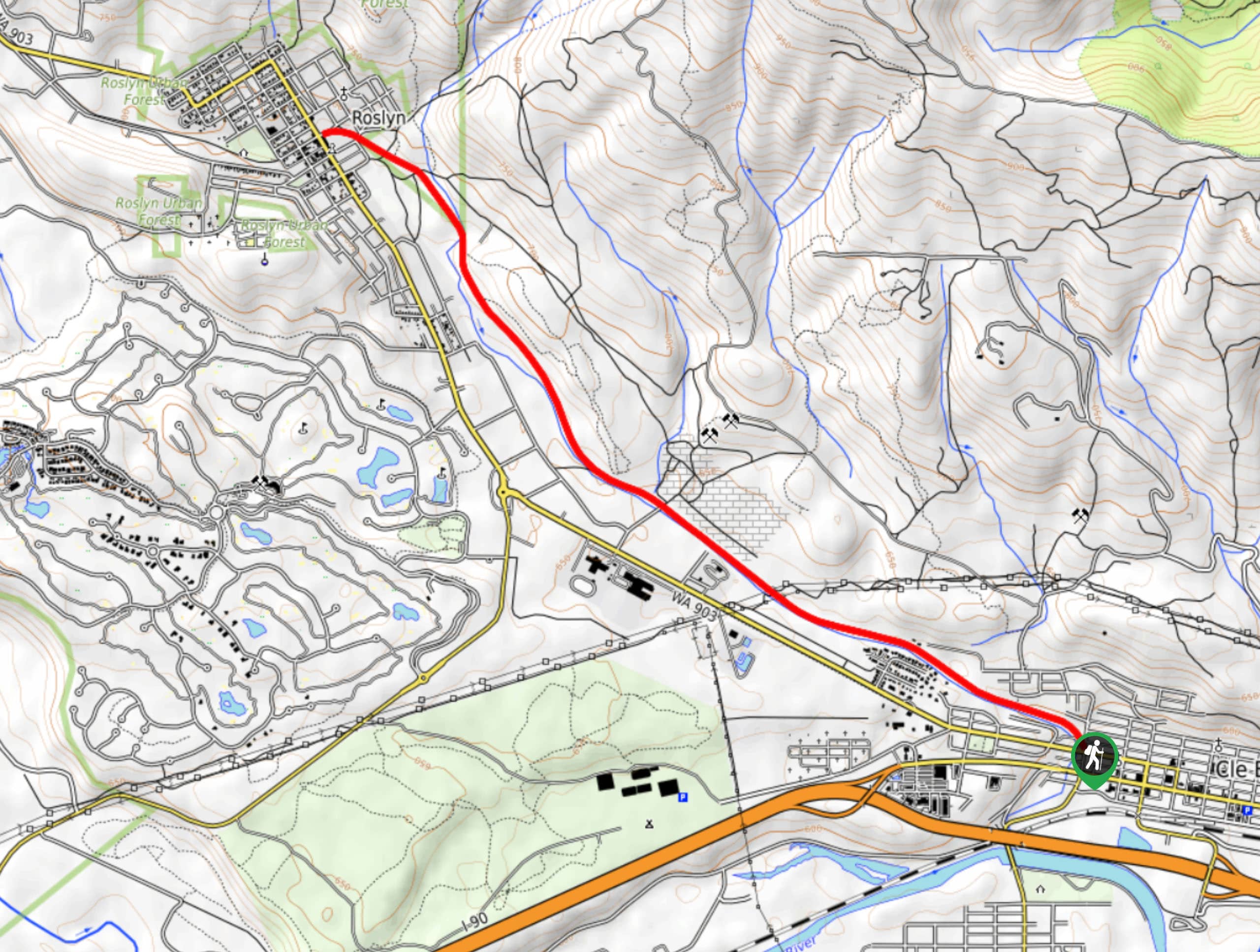
100. Coal Mines Trail
Difficulty
The Coal Mines Trail stretches 6.3mi between Roslyn and Cle Elum, offering many… Read More
101. Gold Creek Pond and Heli’s Pond Winter Route
Difficulty
The Gold Creek Pond and Heli’s Pond Winter Route is the best way to access… Read More
102. Noble Knob Northern Approach
Difficulty
The northern approach to Noble Knob is a fun way to enjoy a scenic trail… Read More
103. Weeks Falls Interpretive Trail
Difficulty
Weeks Fall Interpretive Trail is a lovely little walk suitable for the whole family. It’s… Read More
104. Snoqualmie Lake Trail
Difficulty
Snoqualmie Lake Trail is a moderately trafficked 15.0mi hike with pretty waterfalls, good… Read More
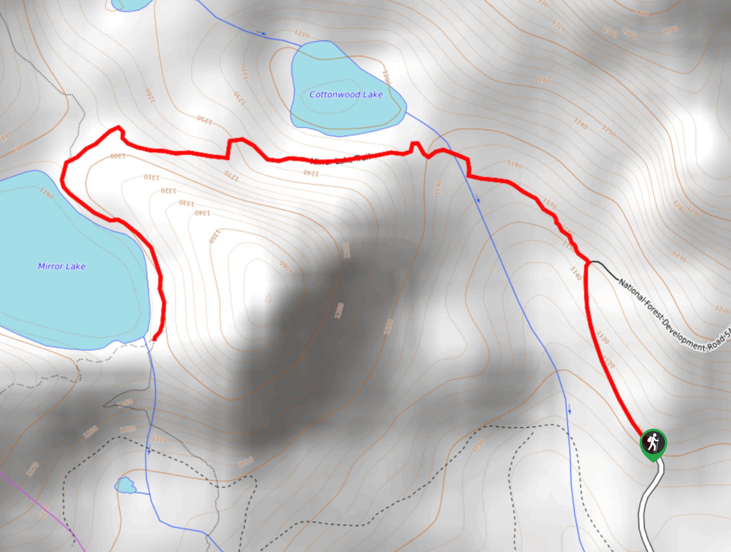
105. Mirror Lake Trail
Difficulty
Mirror Lake Trail is a busy trail in Mount Baker-Snoqualmie Forest that features two lakes.… Read More
106. Pratt River Trail
Difficulty
The Pratt River Trail makes for an interesting trip - most hikers don’t actually reach… Read More
107. Mirror Lake via PCT
Difficulty
Mirror Lake via the PCT is a busy trail in Mount Baker-Snoqualmie Forest that features… Read More
108. Lodge Lake Trail
Difficulty
The Lodge Lake Trail is a heavily trafficked trail in Mount Baker-Snoqualmie National Forest. This… Read More
109. Suntop Trail
Difficulty
Suntop Trail is a very short, very easy hike in Mount Baker-Snoqualmie National Forest with… Read More
110. Mount Sawyer via Tonga Ridge Trail
Difficulty
Mount Sawyer via Tonga Ridge Trail is a 5.6mi hike in Mount Baker-Snoqualmie… Read More
111. Del Campo Peak
Difficulty
Del Campo Peak is a long, technical hike. This is a great choice for hikers… Read More
112. Suntop Trail Longer Route
Difficulty
While most families and casual hikers take the short Suntop Trail, this 16.1mi… Read More
113. Alaska Lake via Gold Creek Trail
Difficulty
Alaska Lake on the Gold Creek Trail is a popular trail at 12.0mi… Read More
114. Evergreen Lookout Trail
Difficulty
Evergreen Lookout provides breathtaking views over Mount Baker-Snoqualmie National Forest, and at only 3.1mi Read More
115. Greenwater Lakes Trail
Difficulty
Greenwater Lakes Trail is a heavily trafficked trail that is rated as easy. This route… Read More
116. Noble Knob Trail
Difficulty
Noble Knob Trail is a moderate hike, with 6.9mi Read More
117. Index Town Wall Trail
Difficulty
Index Town Wall Trail is a short, steep 2.2mi hike in Mount Baker-Snoqualmie… Read More
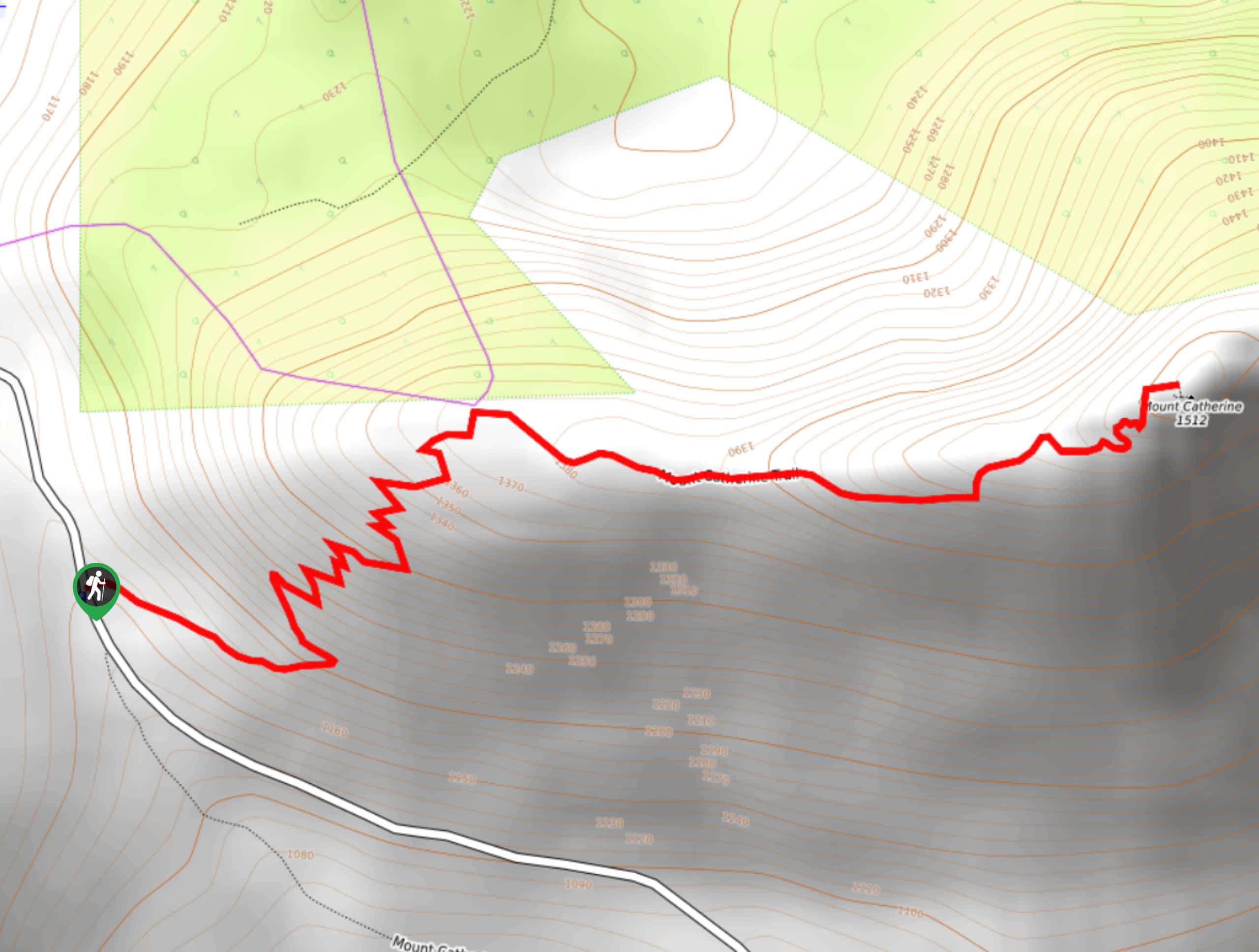
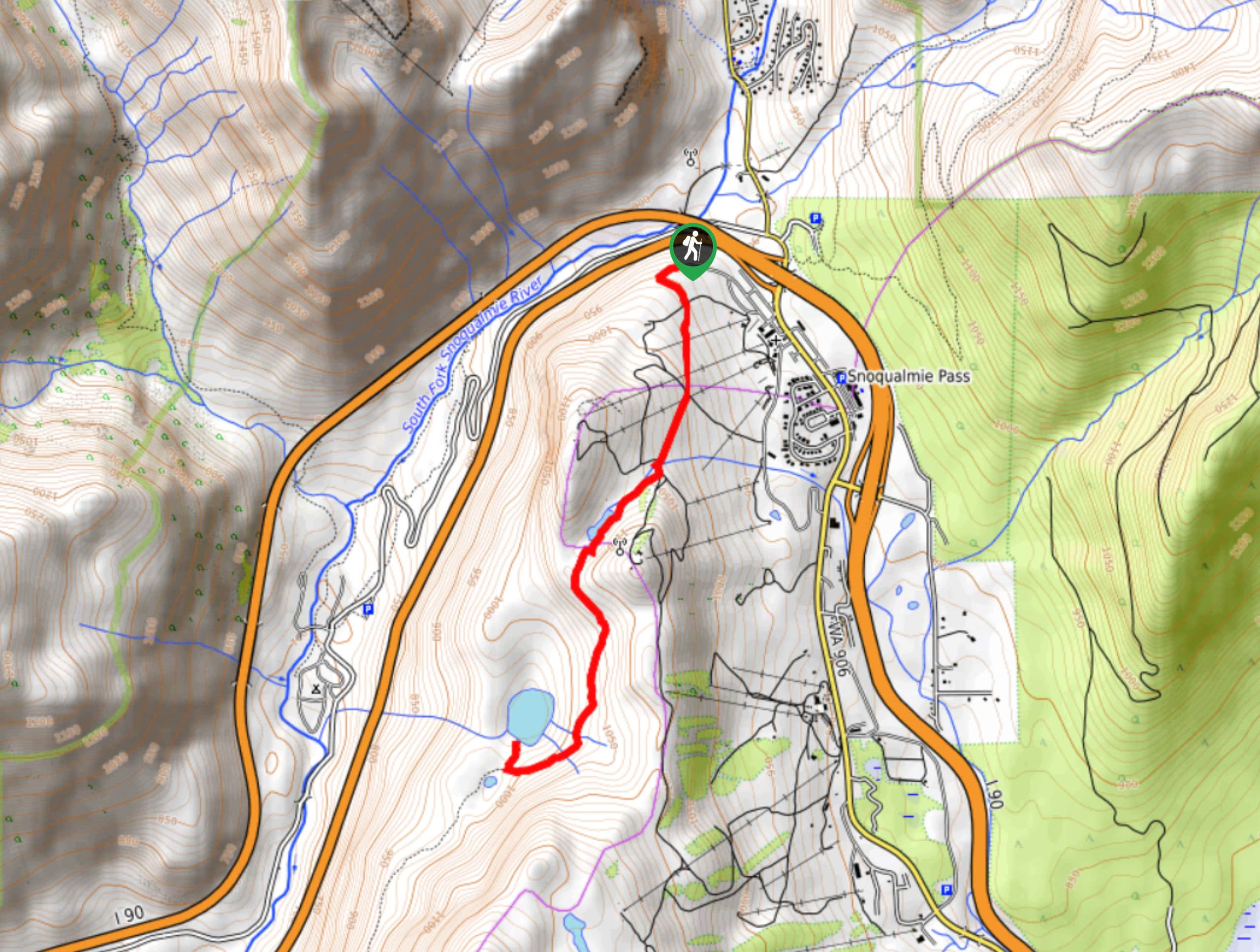
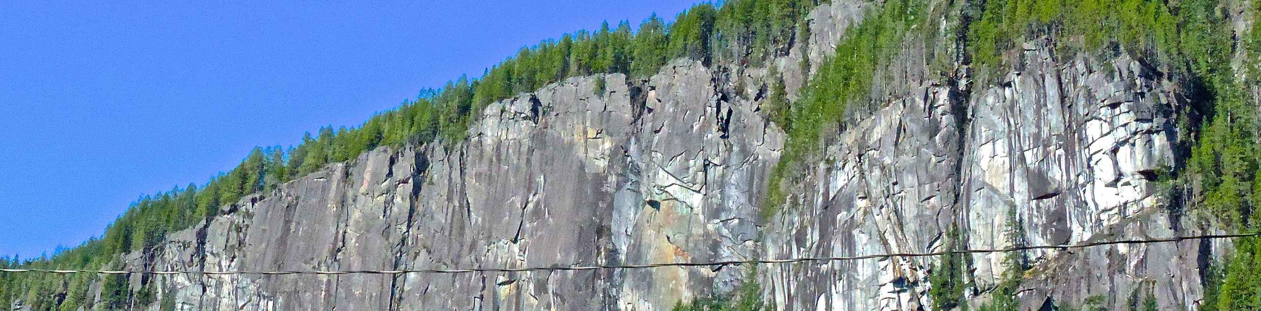
118. Mount Catherine Trail
Difficulty
Mount Catherine Trail is a moderate hike, with 3.1mi Read More
119. Norse Peak Trail
Difficulty
Norse Peak Trail is a hard day hike in Mount Baker-Snoqualmie National Forest. This trail… Read More
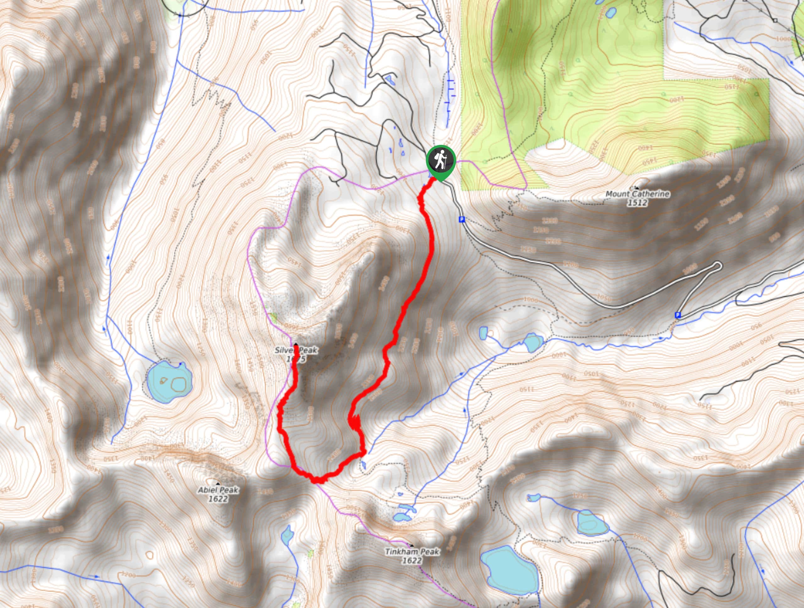
120. Silver Peak Trail
Difficulty
Silver Peak Trail is a hike in Mount Baker-Snoqualmie National Forest that is rated as… Read More
121. Rainbow Lake via Pratt Lake Trail
Difficulty
Rainbow Lake via Pratt Lake Trail is a heavily trafficked out-and-back trail in Mount Baker-Snoqualmie… Read More
122. Island Lake Trail
Difficulty
Island Lake Trail is a heavily trafficked out-and-back trail in Mount Baker-Snoqualmie National Forest that… Read More
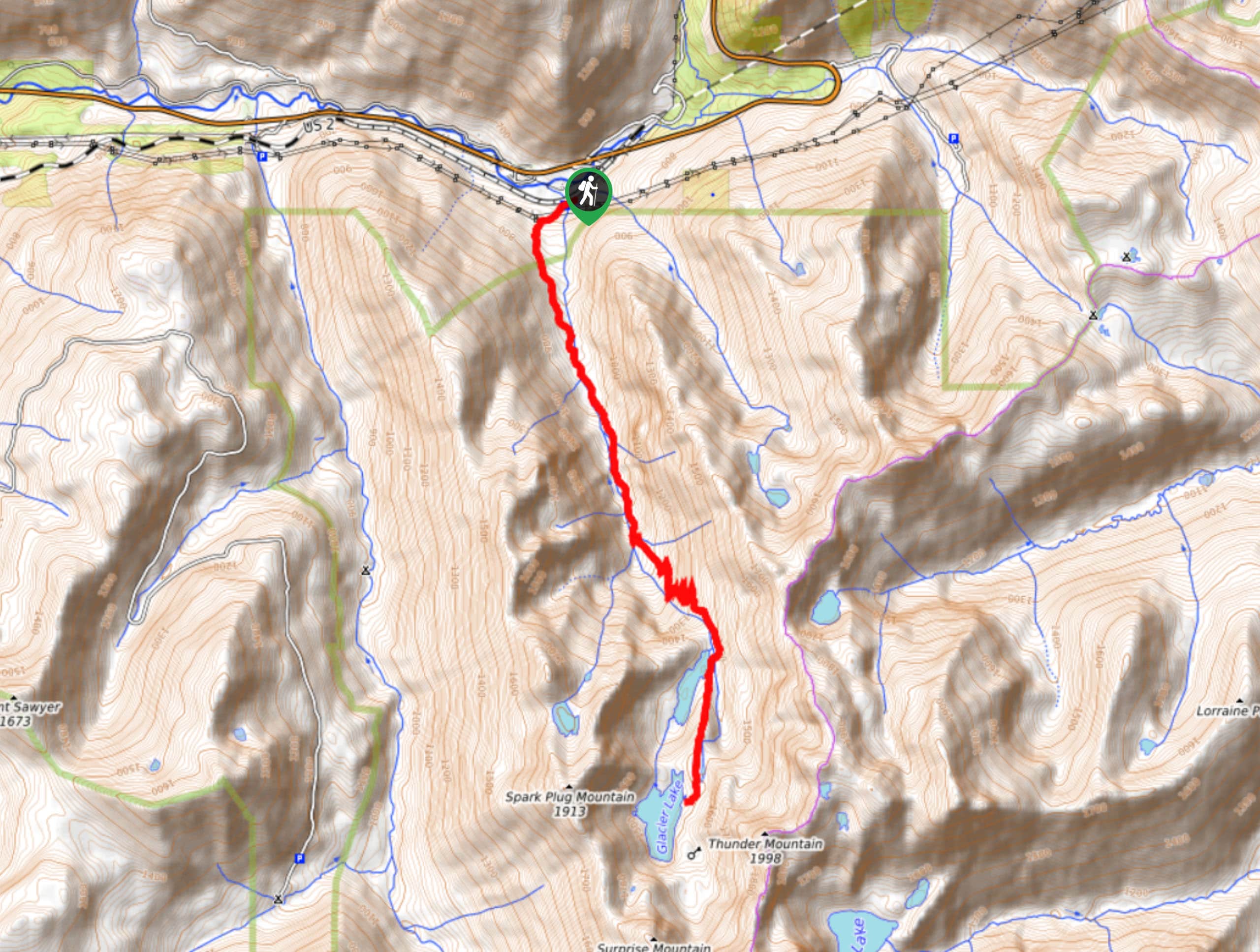
123. Surprise and Glacier Lakes via Surprise Creek Trail
Difficulty
Surprise Lake and Glacier Lakes are reached on Surprise Creek Trail on this hard hike.… Read More
124. Echo Lake via Greenwater Trail
Difficulty
The hike to Echo Lake via Greenwater Trail is an enjoyable trek with moderate traffic… Read More
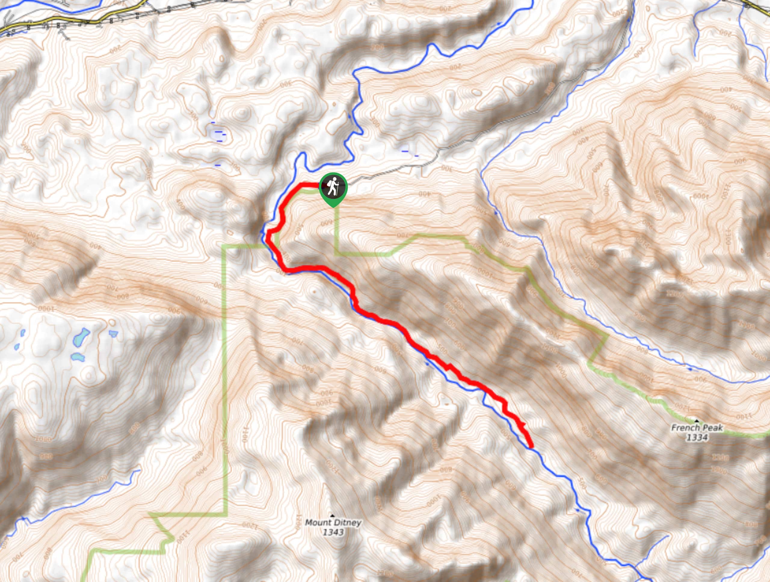
125. Dingford Creek Trail
Difficulty
Dingford Creek Trail is a lightly trafficked trail that offers a bit of adventure for… Read More
126. Guye Peak Trail
Difficulty
Guye Peak Trail is a short hike at 2.4mi, but it packs in… Read More
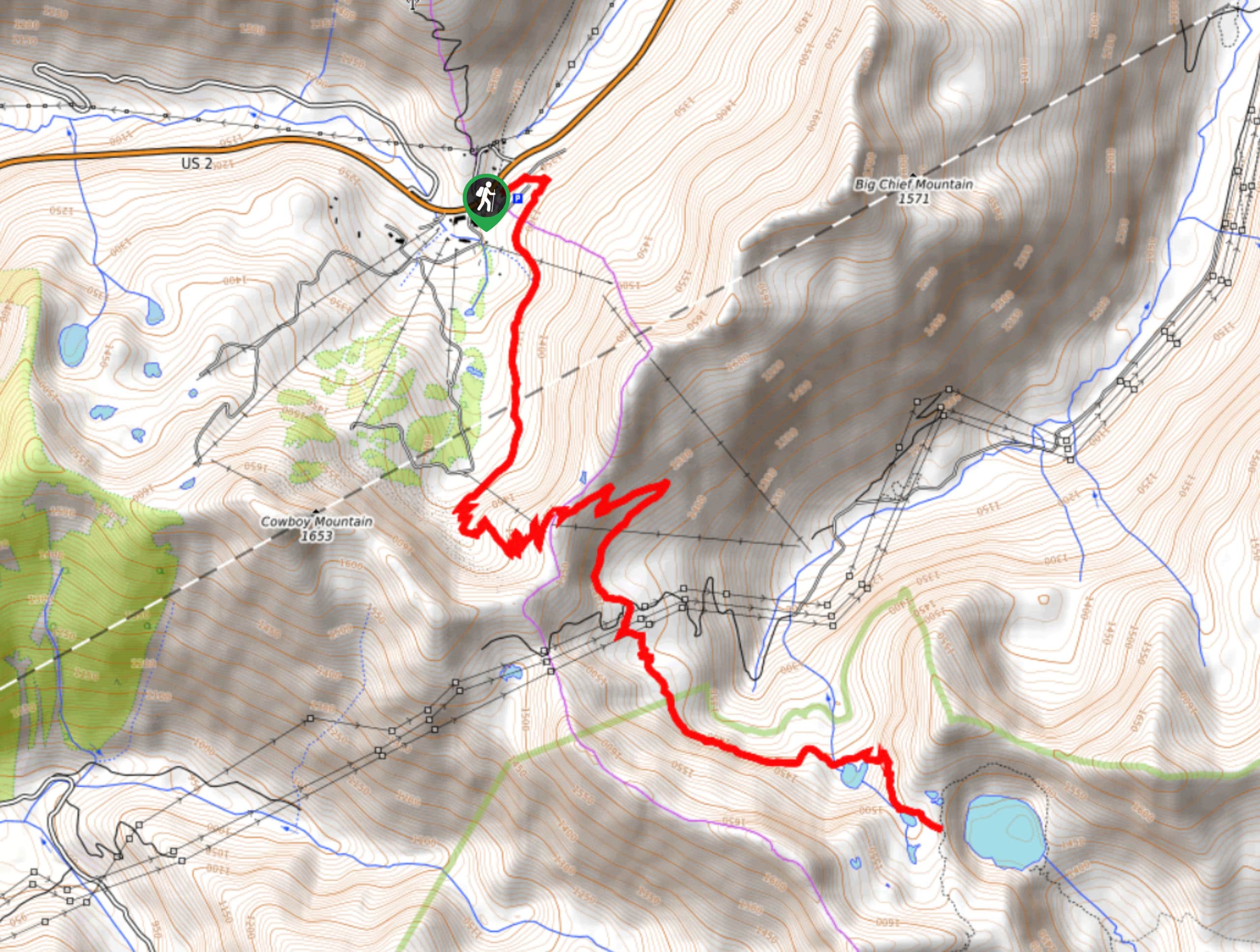
127. Old Commonwealth Trail
Difficulty
Old Commonwealth Trail is a hard hike in Mount Baker-Snoqualmie National Forest that is used… Read More
128. Kendall Peak Lakes Trail
Difficulty
Kendall Peak Lakes Trail is a moderate hike with generally light traffic in Mount Baker-Snoqualmie… Read More
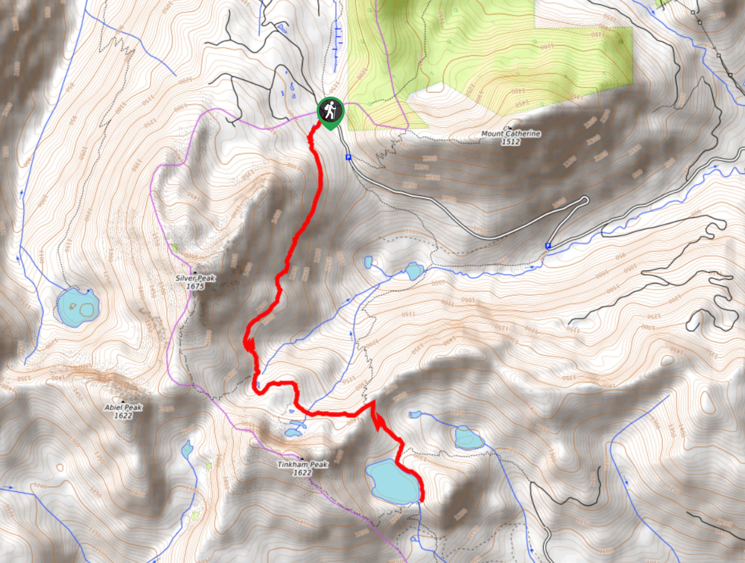
129. Tinkham Peak Trail
Difficulty
Tinkham Peak Trail is a lightly trafficked hard hike in Mount Baker-Snoqualmie National Forest. This… Read More
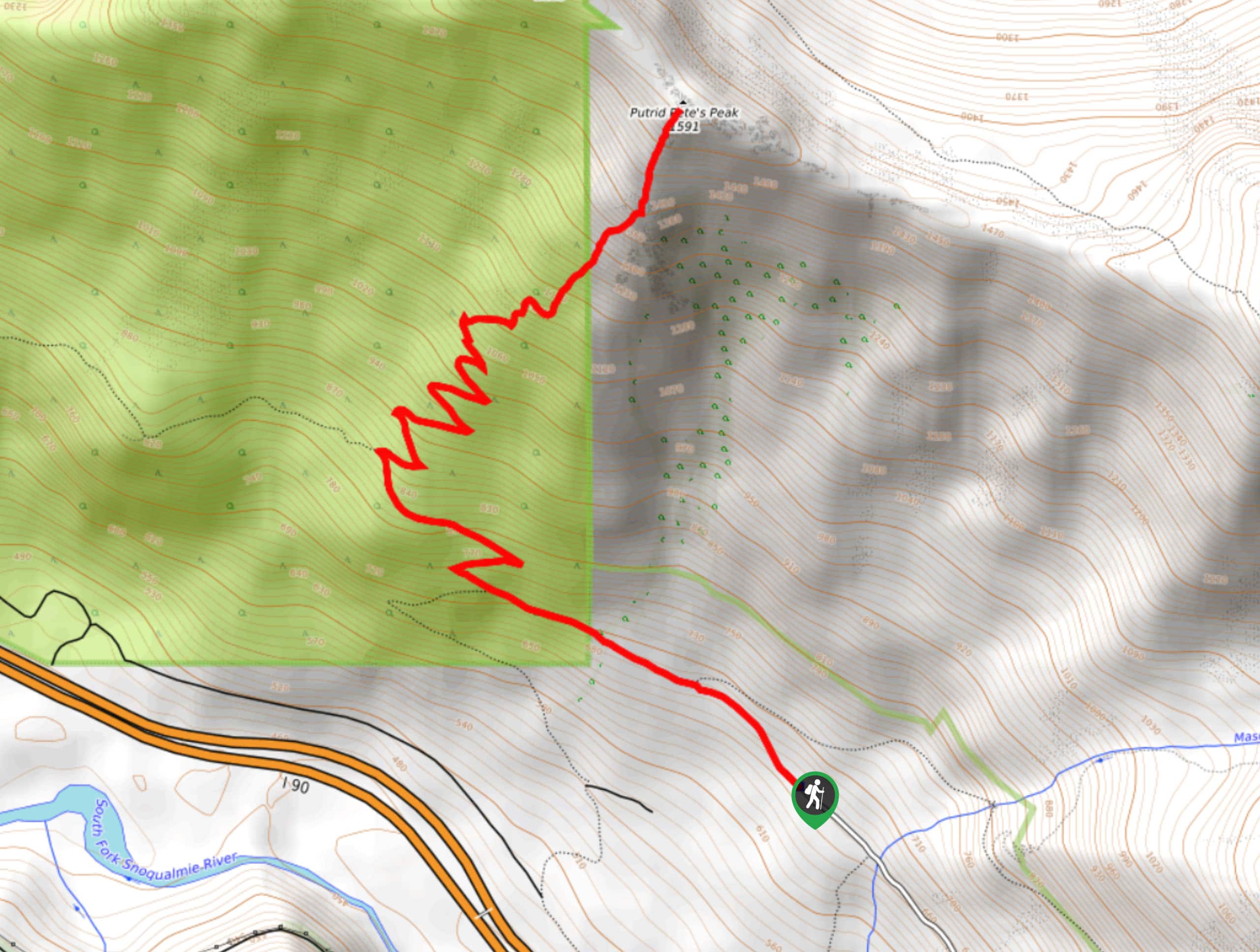
130. Putrid Pete’s Peak Trail
Difficulty
Putrid Pete’s Peak Trail (sometimes referred to as P3) is a fun hike in Mount… Read More
131. Elliot Creek Trail
Difficulty
Elliot Creek Trail is an 7.1mi trail in Mount Baker-Snoqualmie National Forest that… Read More
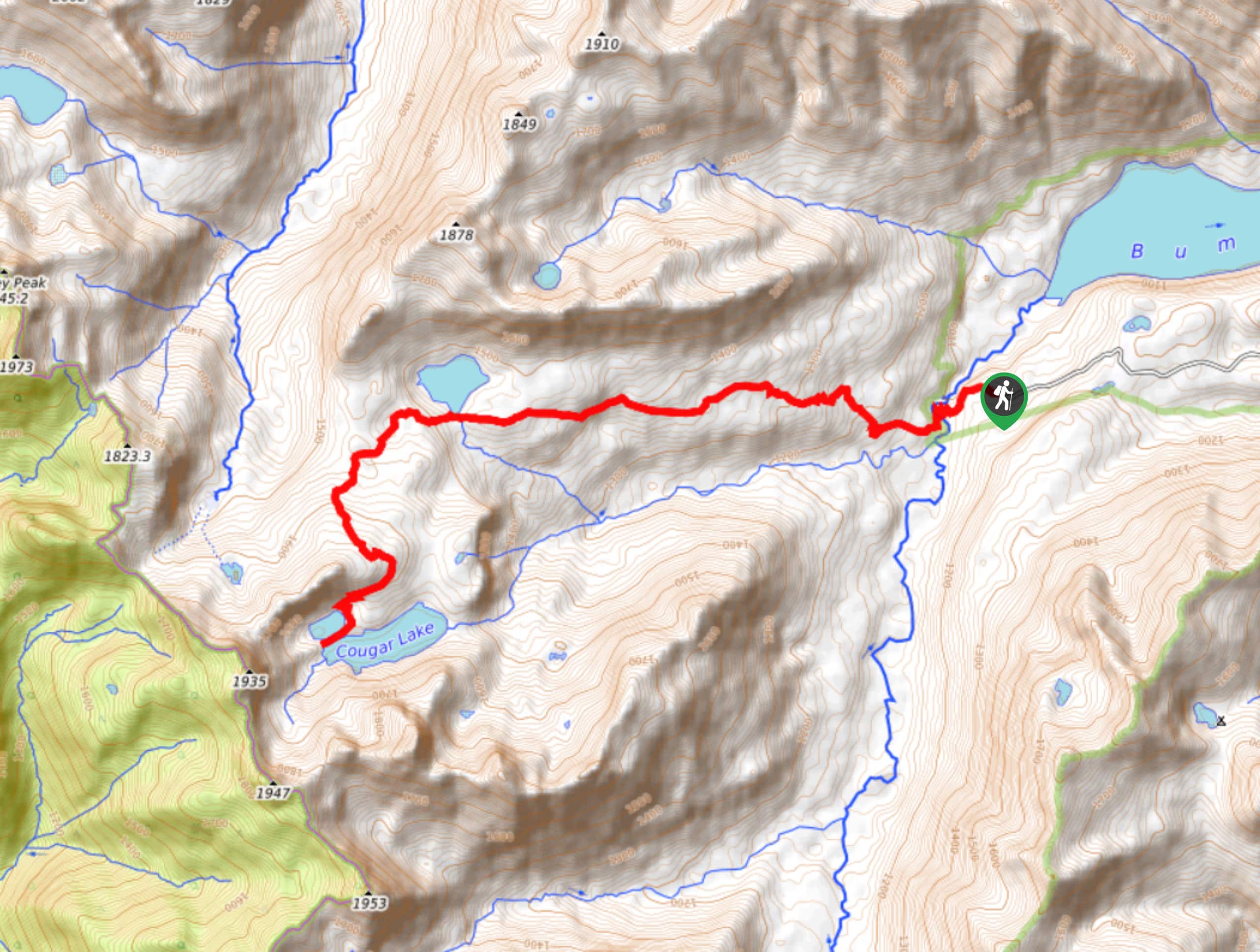
132. Cougar Lake and Little Cougar Lake Trail
Difficulty
Cougar Lake and Little Cougar Lake Trail is a pleasant, quiet hike. This 11.5mi Read More
133. Gem Lake via Snow Lake and High Lakes Trail
Difficulty
The Gem Lake via Snow Lake and High Lakes Trail is a heavily trafficked out-and-back… Read More
134. Snow Lake, Gem Lake, and Upper Wildcat Lake
Difficulty
Snow Lake, Gem Lake, and Upper Wildcat Lake is a heavily trafficked out-and-back trail in… Read More
135. Deception Creek Trail
Difficulty
Deception Creek Trail is an adventurous one. This 9.4mi out-and- back trail is… Read More
136. Lower Tuscohatchie Lake Hike
Difficulty
The hike to Lower Tuscohatchie Lake is a hard 12.1mi Read More
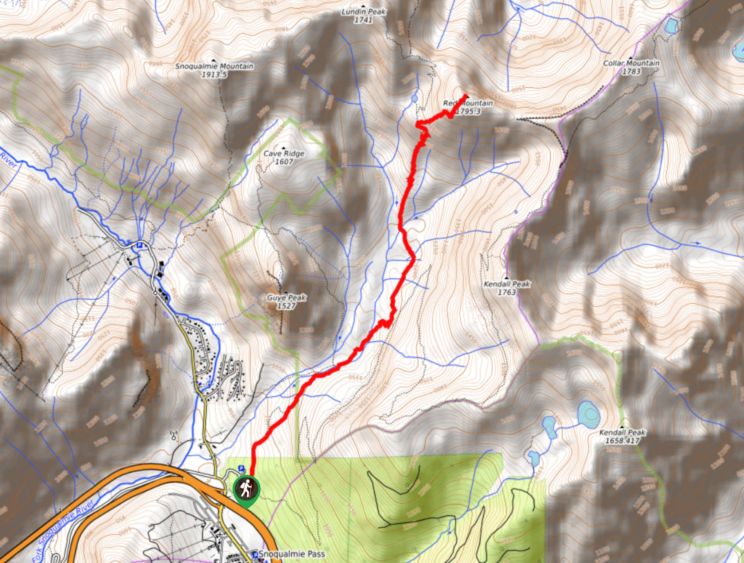
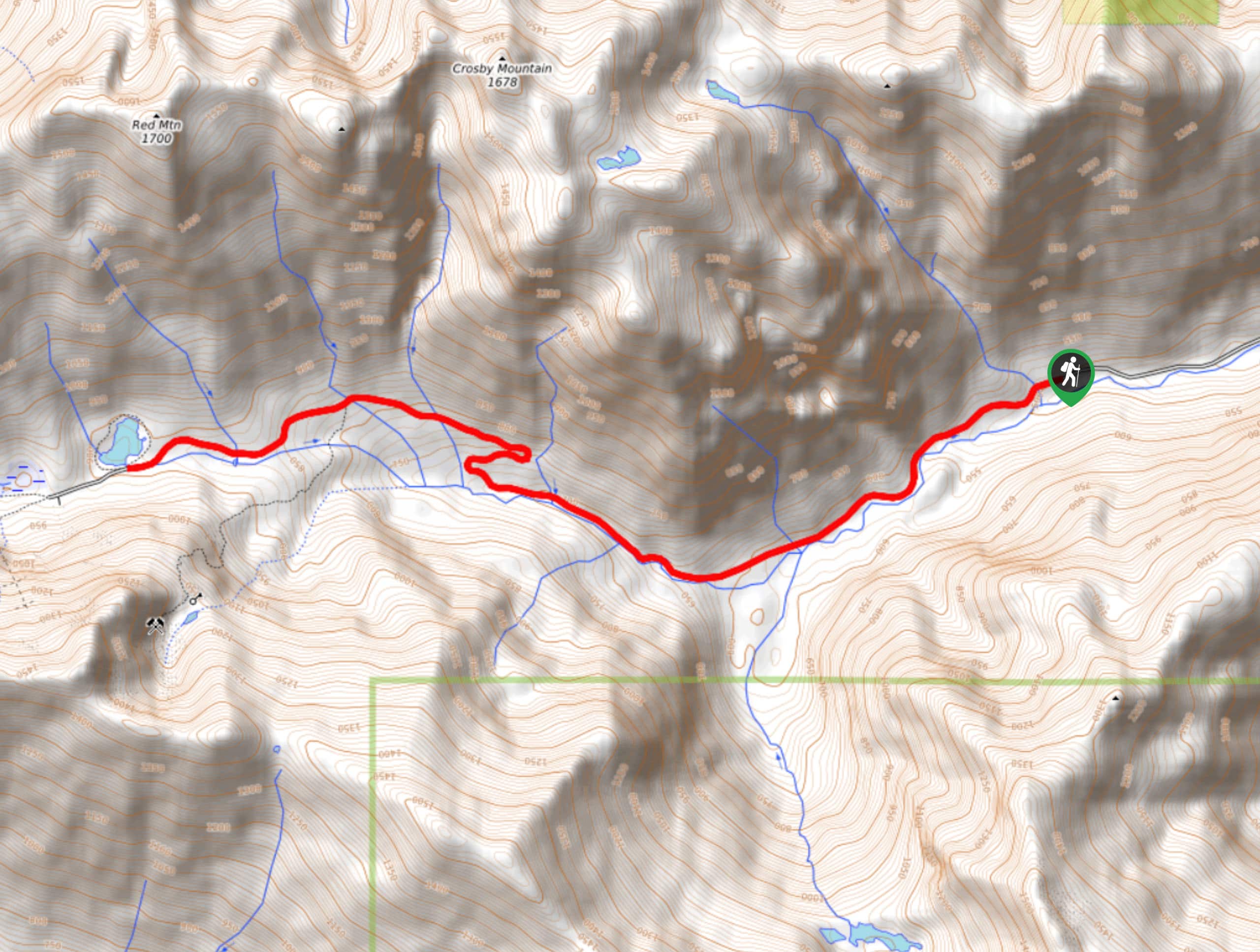
137. Red Mountain via Old Commonwealth Trail
Difficulty
Red Mountain via Old Commonwealth Trail is a 5.9mi hard hike in Mount… Read More
138. Josephine Lake View Trail
Difficulty
The Josephine Lake View Trail is a lovely moderate hike in Mount Baker-Snoqualmie National Forest.… Read More
139. Shoe Lake via PCT
Difficulty
Shoe Lake via the PCT is a wonderful full-day trip with quintessential Washington views to… Read More
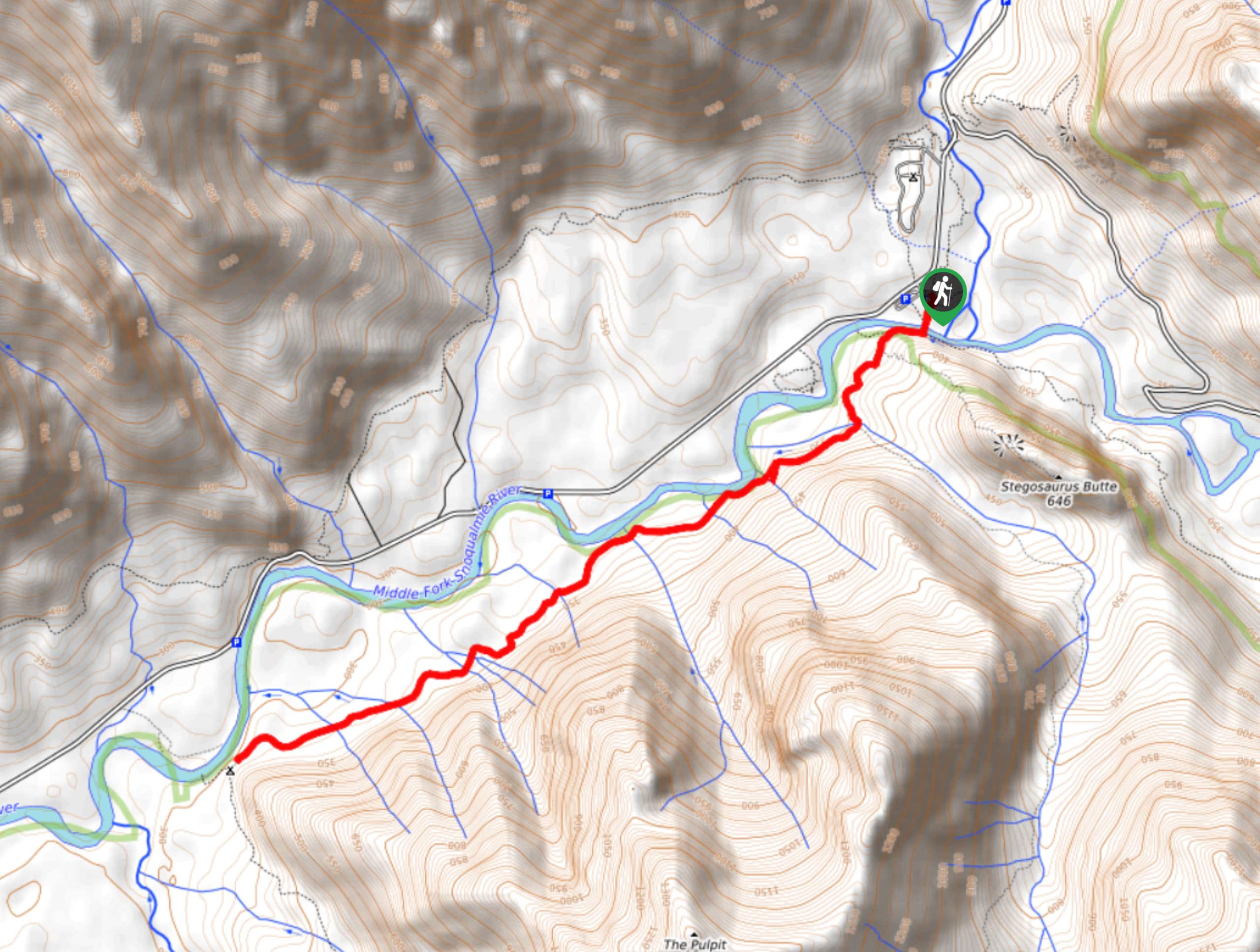
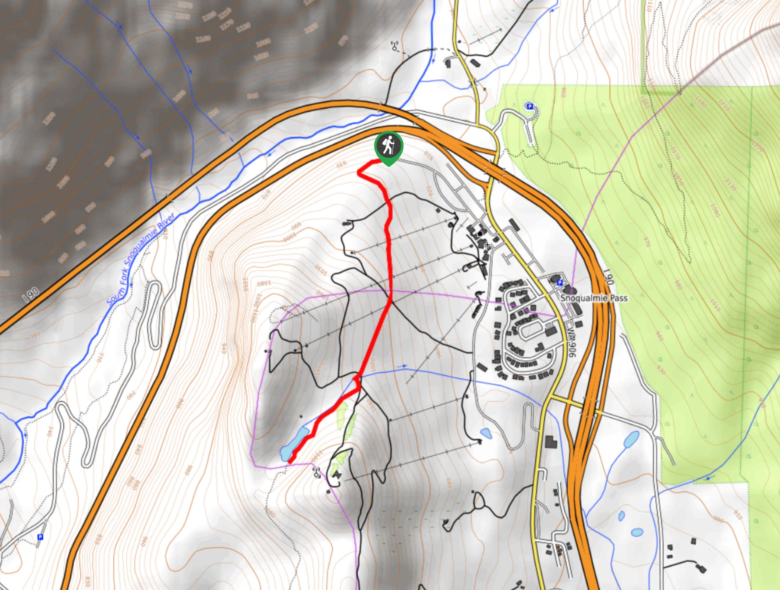
140. Stegosaurus Butte Trail
Difficulty
Stegosaurus Butte Trail is a lightly trafficked route that is only 1.9mi long,… Read More
141. Beaver Lake Trail
Difficulty
Beaver Lake Trail is a quick, pretty hike in the Snoqualmie Pass area. This hike… Read More
142. Taylor River Trail
Difficulty
Taylor River Trail is a long, mostly flat trail that is suitable for beginners and… Read More
143. Lundin Peak View and Red Mountain via Old Commonwealth Trail
Difficulty
Lundin Peak View and Red Mountain via Old Commonwealth Trail is a 8.6mi… Read More
144. Smithbrook Trail
Difficulty
Smithbrook Trail is a quick 2.4mi hike in Mount Baker-Snoqualmie National Forest that… Read More
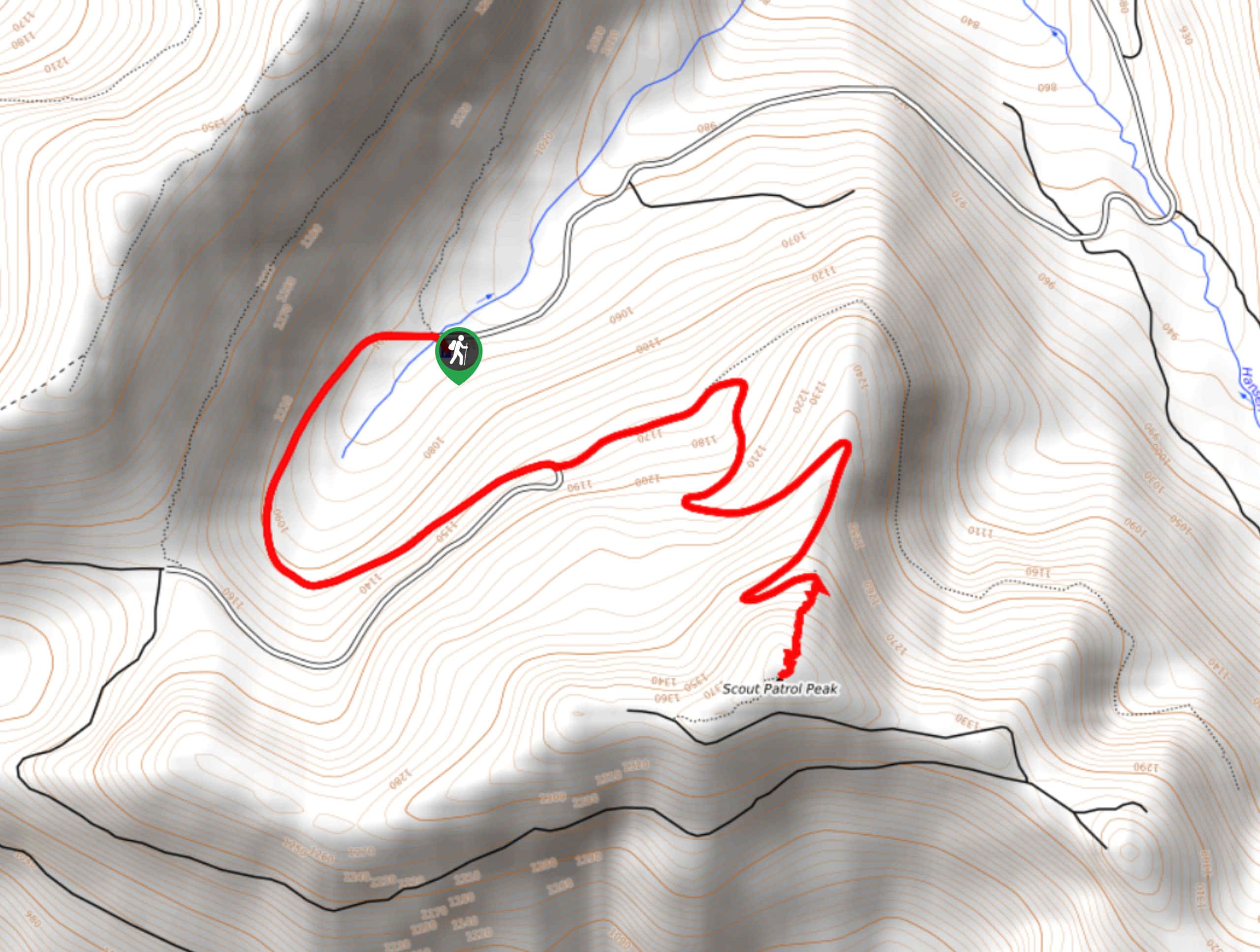
145. Scout Patrol Peak
Difficulty
Scout Patrol Peak is a trail that you can hike in all seasons, and it… Read More
146. Lake Elizabeth Trail
Difficulty
Lake Elizabeth Trail is more of a walk on the road to a gorgeous lake… Read More

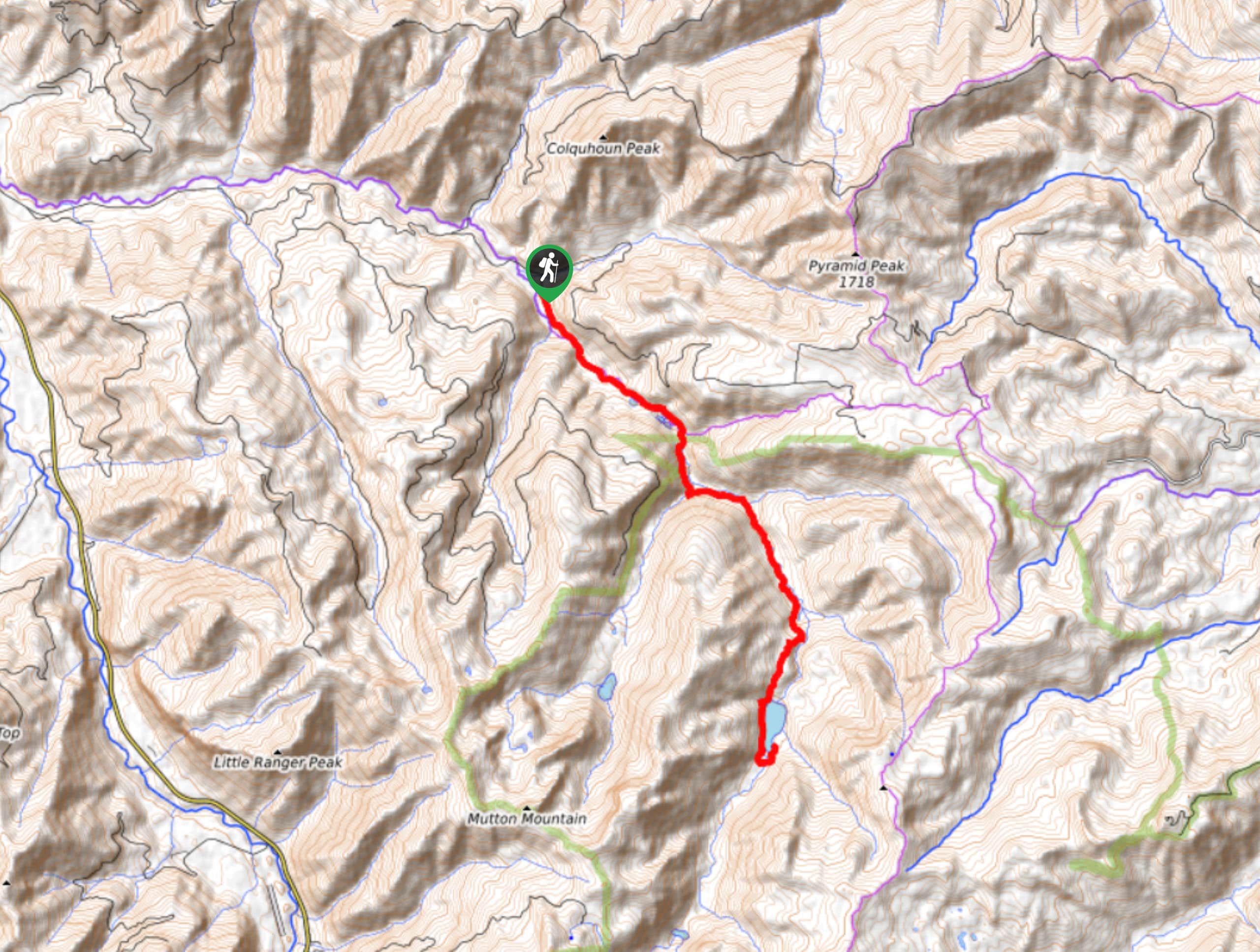
147. Gold Creek Trail to Joe Lake
Difficulty
Gold Creek Trail to Joe Lake is not a hike for the faint of heart.… Read More

148. Basin Lake via Bullion Basin Trail
Difficulty
Basin Lake via Bullion Basin Trail is a 12.2mi Read More
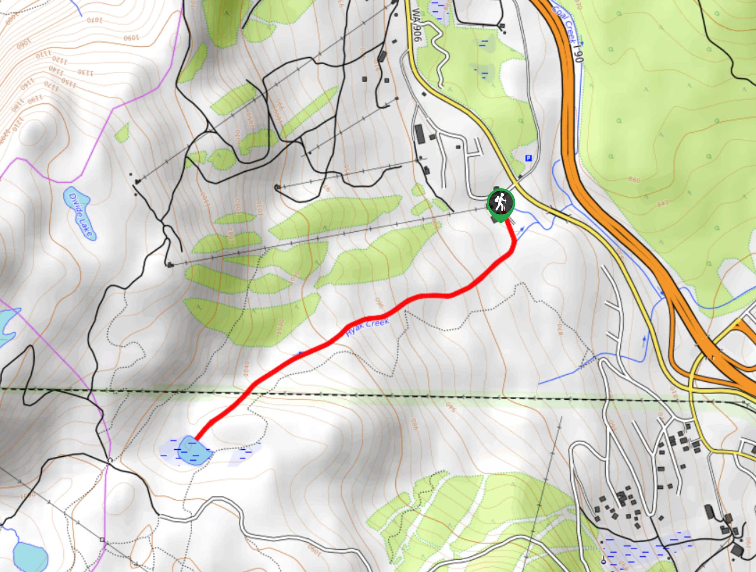
149. Hyak Creek Trail
Difficulty
Hyak Creek Trail is an easy 1.9mi trail in Mount Baker-Snoqualmie National Forest.… Read More

150. Lakes Dorothy, Bear, Deer, and Snoqualmie Hike
Difficulty
The Lakes Dorothy, Bear, Deer, and Snoqualmie Hike provides access to Lake Dorothy, Bear Lake,… Read More
Are we missing your favourite hike?
Tell us! If you've got photos, a GPS track and know the hike, we'd love to share your favourite hike with the rest of the 10Adventures community.