Garfield Ledges Hike
View Photos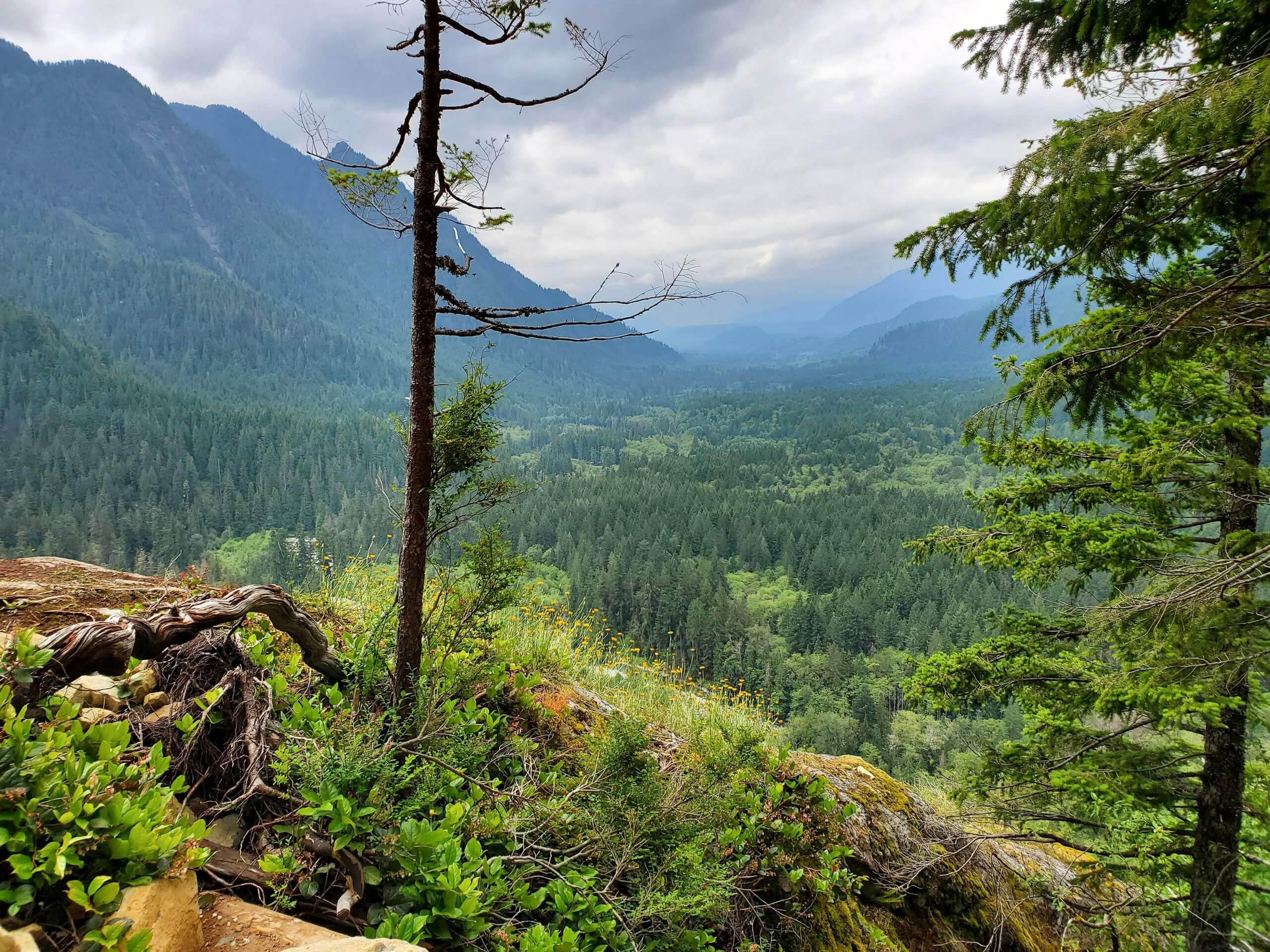
Garfield Ledges Hike
Difficulty Rating:
Garfield Ledges is a moderately trafficked out-and-back trail in Mount Baker-Snoqualmie National Forest that is rated as easy. This quick little hike offers a good view and is suitable for children. The trail itself tends to be smooth and well-maintained.
Getting there
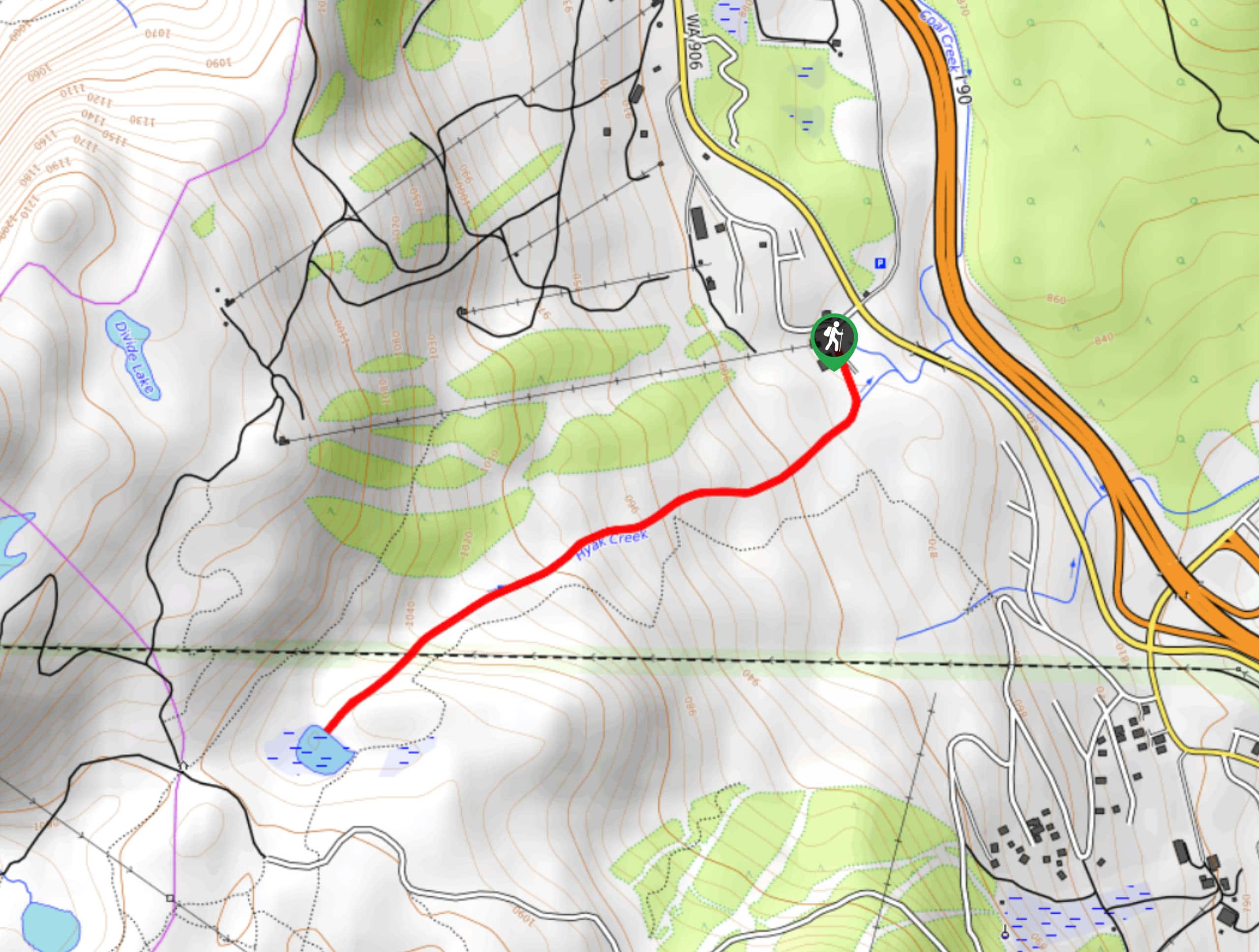
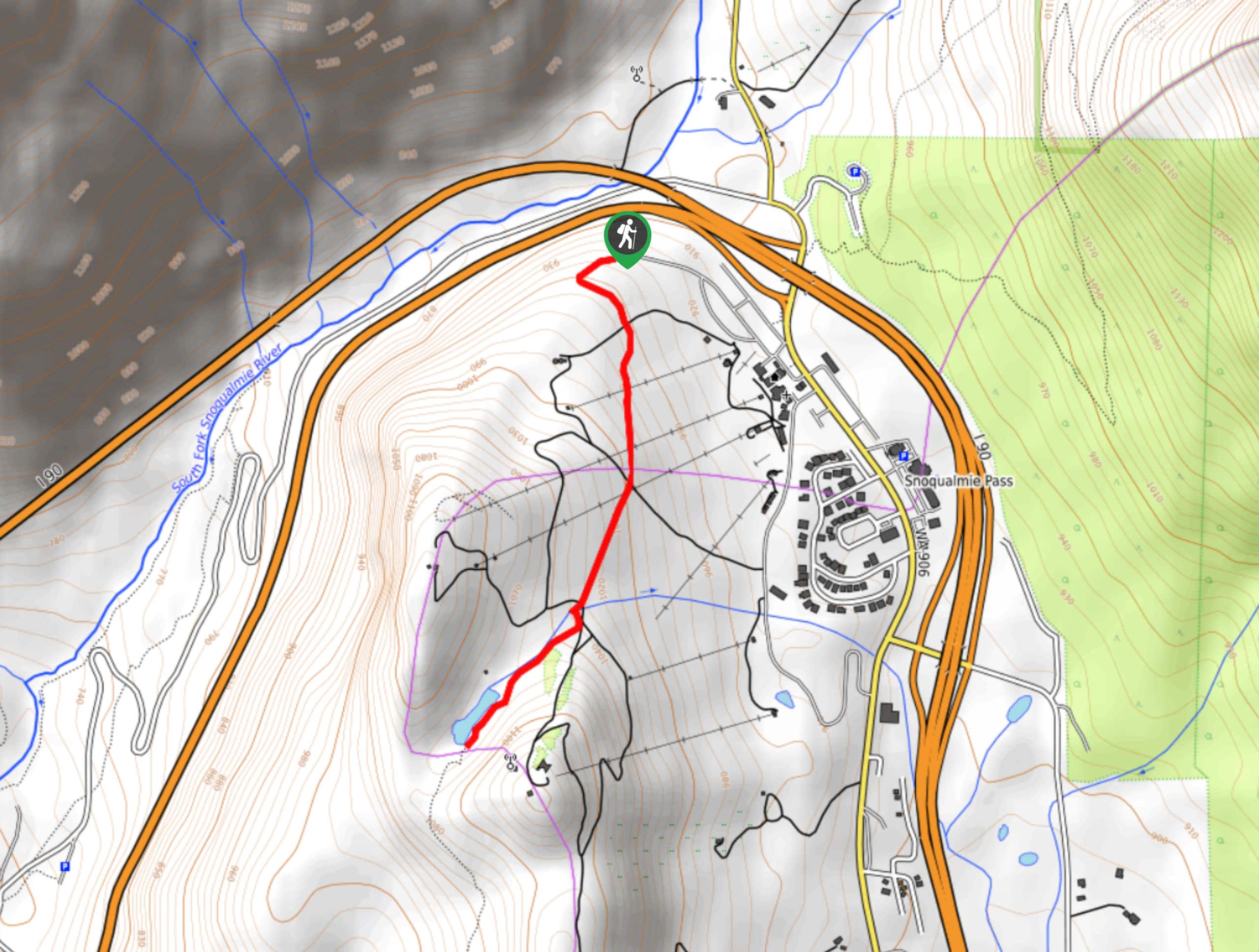
The trailhead for Garfield Ledges is on National Forest Development Road 56 just north of the Middle Fork Campground.

About
| Backcountry Campground | No |
| When to do | June-October |
| Pets allowed | Yes - On Leash |
| Family friendly | Yes |
| Route Signage | Average |
| Crowd Levels | Moderate |
| Route Type | Out and back |
Garfield Ledges Hike
Elevation Graph
Weather
Garfield Ledges Hike Description
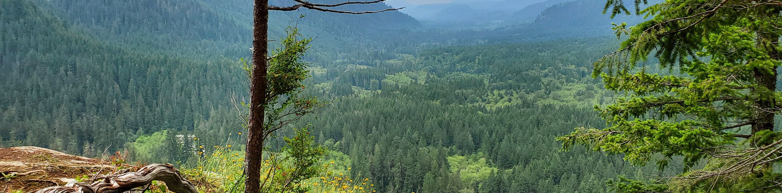
Garfield Ledges is a short, fairly easy hike to a nice viewpoint. The trailhead isn’t too far from Seattle and the route is family-friendly making it a popular choice on weekends. Try to arrive early to beat the crowds if you can.
The hike begins from the forest road near Middle Fork Campground, heading east from the parking area and immediately weaving in lazy switchbacks up the hill. The trail straightens out and gains some elevation, but it is never too steep.
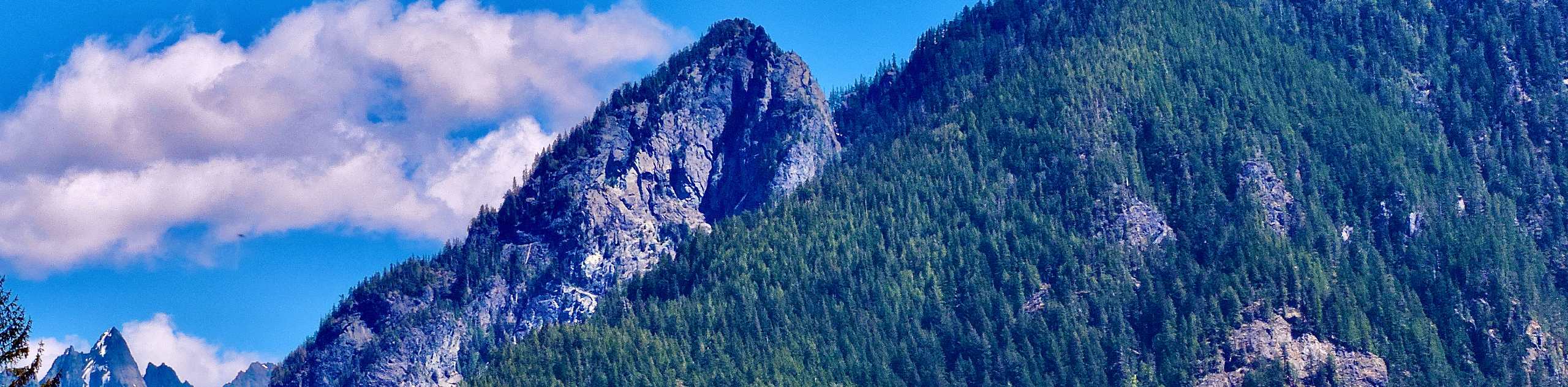
A wide turn to your left and then right leads you to the ledges, where you can look down over the campground, the river, and Quartz Mountain. When you’re done, retrace your steps back to the trailhead.
Similar hikes to the Garfield Ledges Hike hike
Hyak Creek Trail
Hyak Creek Trail is an easy 1.9mi trail in Mount Baker-Snoqualmie National Forest. This lightly trafficked trail is…
Stegosaurus Butte Trail
Stegosaurus Butte Trail is a lightly trafficked route that is only 1.9mi long, but that requires some climbing…
Beaver Lake Trail
Beaver Lake Trail is a quick, pretty hike in the Snoqualmie Pass area. This hike explores the ski area in…
Comments