
Boulder River Trail
View Photos
Boulder River Trail
Difficulty Rating:
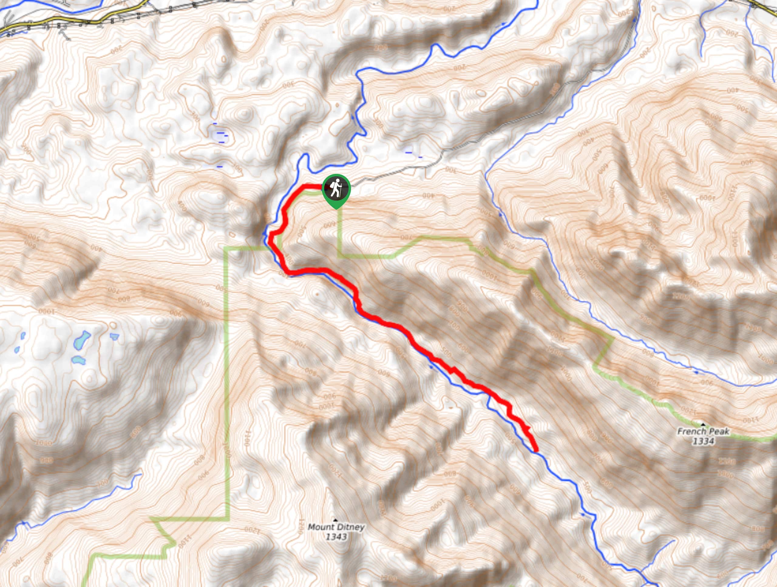
Boulder River Trail is a 8.8mi moderately trafficked out and back trail in Boulder River Wilderness that is rated as moderate. This hike delivers the best of Washington’s natural beauty: a hidden waterfall, old-growth trees, and a backdrop of mountains. You’ll need to be very careful on the road leading to the trailhead (potholes galore!), but this is a wonderful hike.
Getting there
The trailhead for the Boulder River Trail is at the end of French Creek Road off Highway 530.

About
| Backcountry Campground | No |
| When to do | March-October |
| Pets allowed | Yes - On Leash |
| Family friendly | No |
| Route Signage | Poor |
| Crowd Levels | Moderate |
| Route Type | Out and back |
Boulder River Trail
Elevation Graph
Weather
Boulder River Trail Description
Boulder River Trail is a splendid outing, leading through a moss-clad ancient forest to a hidden waterfall. The trail is a bit longer, but the elevation gain is moderate and gradual, and it sees less traffic than other nearby hikes. It can be overgrown in spots, but you should be able to find your way without incident.
The hike begins through a beautiful forest, paralleling its namesake river. You’ll pass a few falls on your hike, but Feature Show Falls are by far the most impressive, splitting into two streams over a mossy gorge wall. Some hikers swim here, but the water is cold!
The trail gets rocky and rooty after the first falls, so watch your step. There are occasionally downed trees on the trail, but you should be able to climb over them without too much trouble.
You can either turn around after the second falls, or continue a bit further to have a break on the shore of the river. Either way, you’ll retrace your steps to return to the trailhead.
Similar hikes to the Boulder River Trail hike

Lakes Dorothy, Bear, Deer, and Snoqualmie Hike
The Lakes Dorothy, Bear, Deer, and Snoqualmie Hike provides access to Lake Dorothy, Bear Lake, Deer Lake, and Snoqualmie Lake.…

Gold Creek Trail to Joe Lake
Gold Creek Trail to Joe Lake is not a hike for the faint of heart. This lightly trafficked trail is…

Basin Lake via Bullion Basin Trail
Basin Lake via Bullion Basin Trail is a 12.2mi hike that, with 2900ft of elevation gain,…
Comments