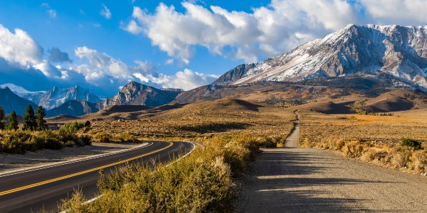
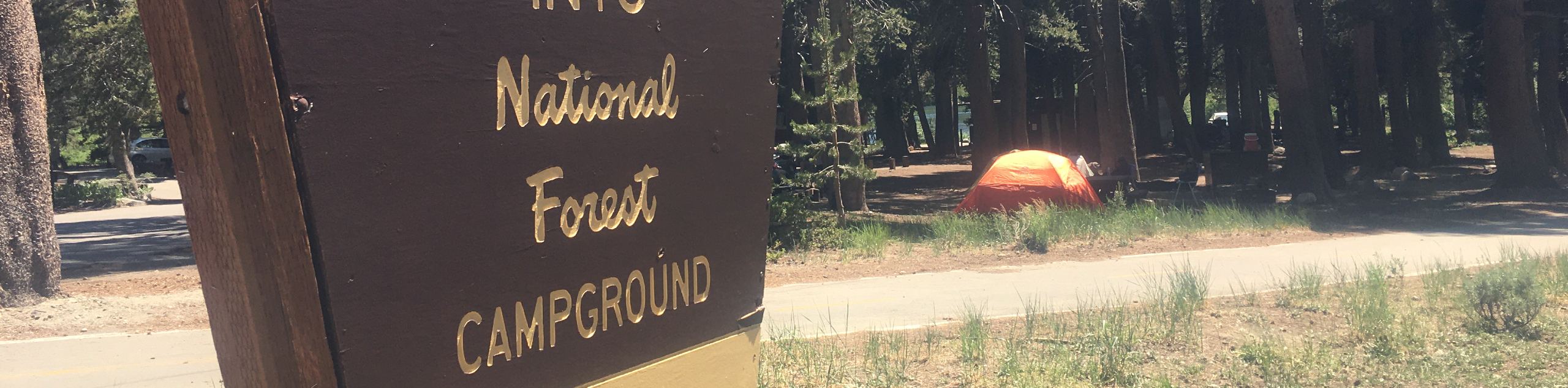
hikes in Inyo National Forest
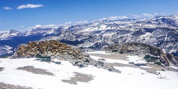
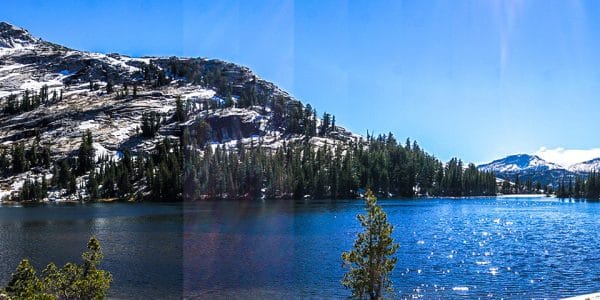
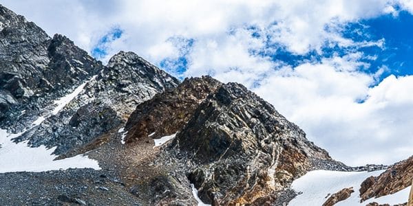
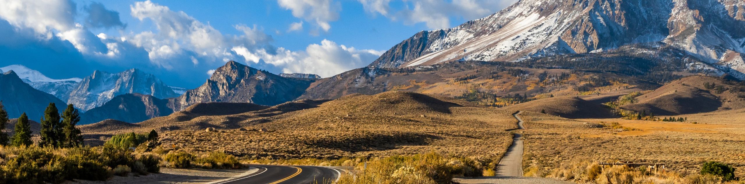
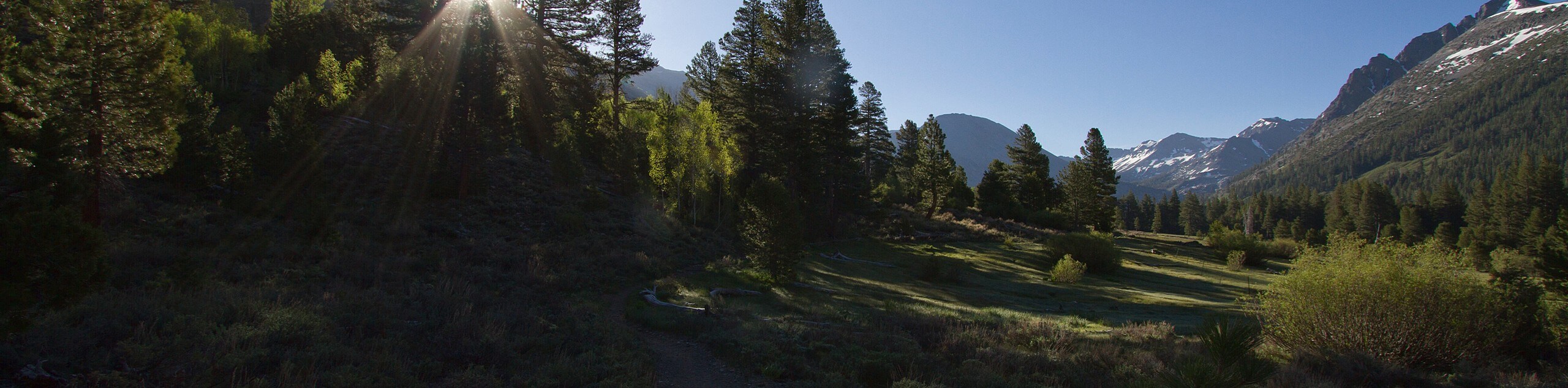
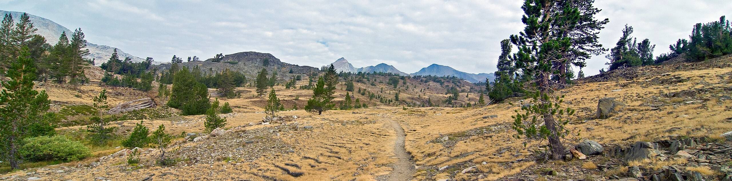
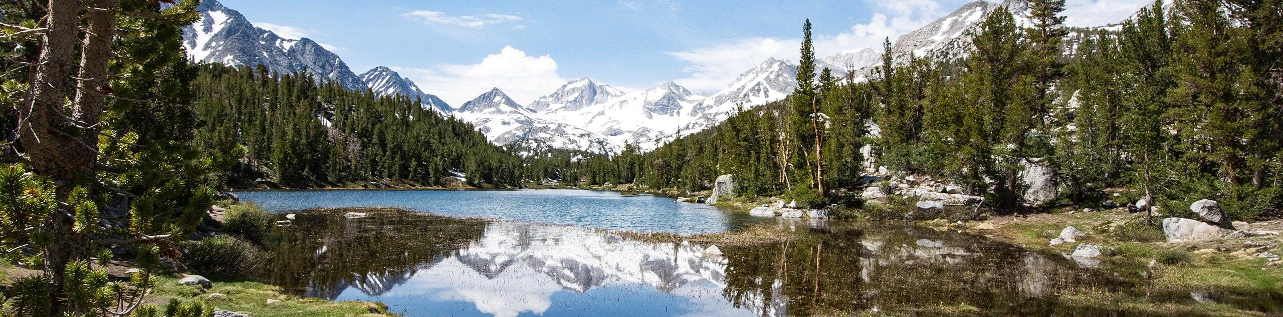
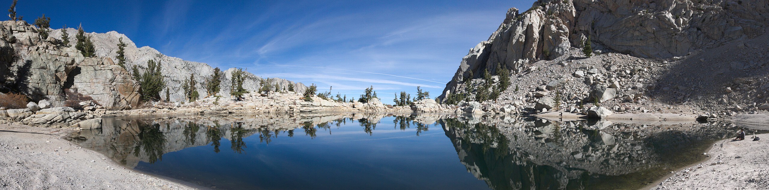
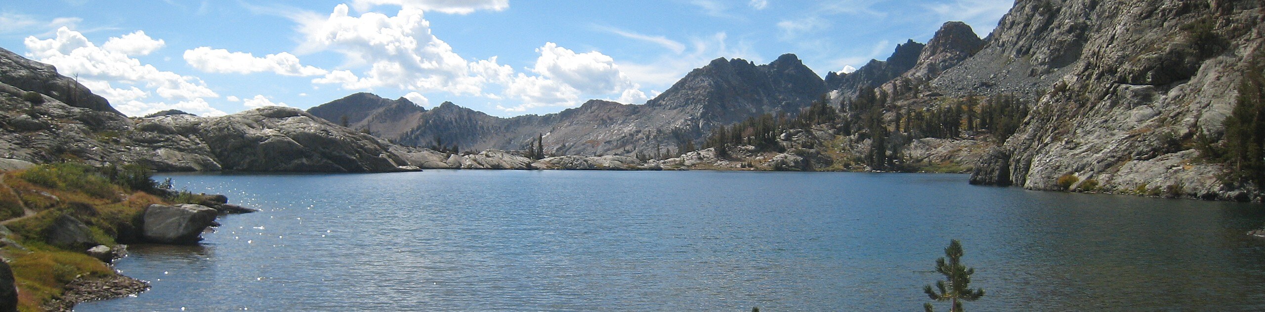
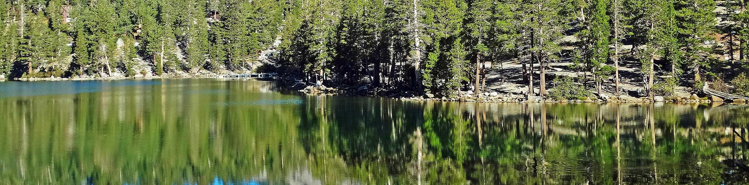
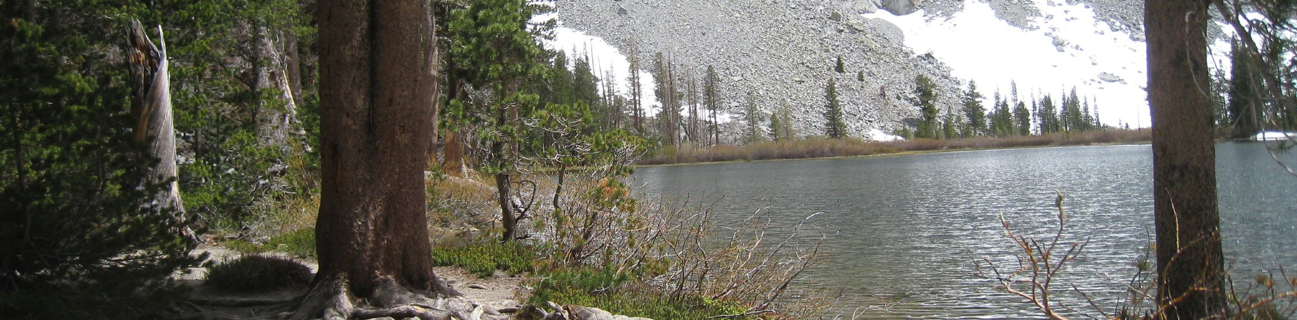
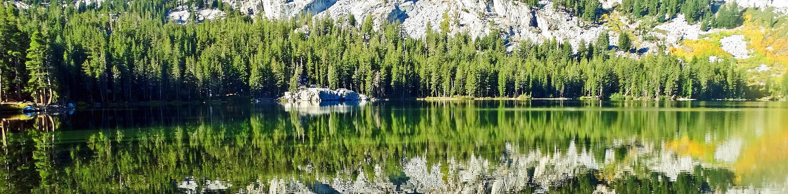
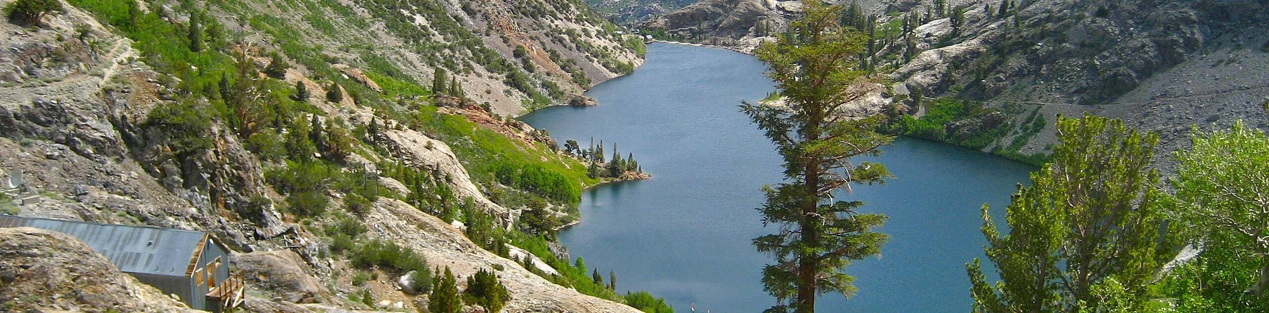
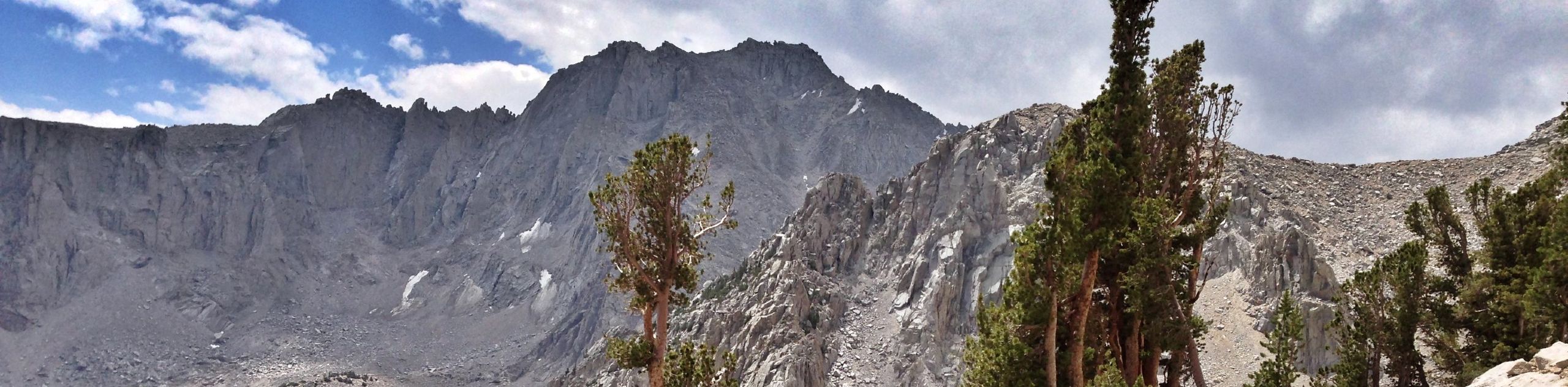
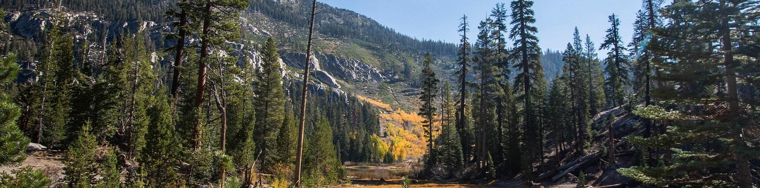
Inyo National Forest's biodiversity and imposing mountainous terrain make it an ideal wilderness area for hiking! At an impressive 800,000 acres, Inyo National Forest boasts an abundance of routes for all ability levels. Leading you to picturesque lakes, up the summits of grandiose mountains, and alongside charming creeks, Inyo National Forest's hiking network is incredible in its scenery and accessibility.
Since the options for hikes within Inyo National Forest are so copious, we have made a list of some of our favorite hiking routes. While every route stated below is incredible, this list just scratches the surface of the trail possibilities within Inyo National Forest!
The 10 Greatest Hikes In Inyo National Forest
- Mount Whitney Trail - The piece de resistance of Inyo National Forest, the Mount Whitney Trail is an incredibly challenging route that boasts amazing sightlines of the surrounding Eastern Sierra Nevada landscape.
- Rainbow Falls via Devils Postpile Trail - Taking you past the stunning geological formation of Devils Postpile before delivering you to beautiful Rainbow Falls, you won't want to miss this popular route within Inyo National Forest.
- Kennedy Meadow to the Bridge via PCT - A moderately difficult hike, Kennedy Meadow to the Bridge via PCT is regarded as an excellent route to see wildlife as it takes you alongside a charming river and through picturesque meadows.
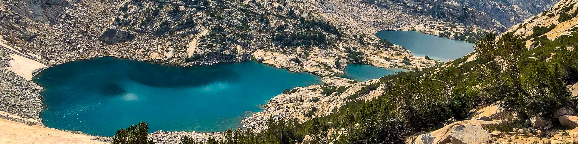
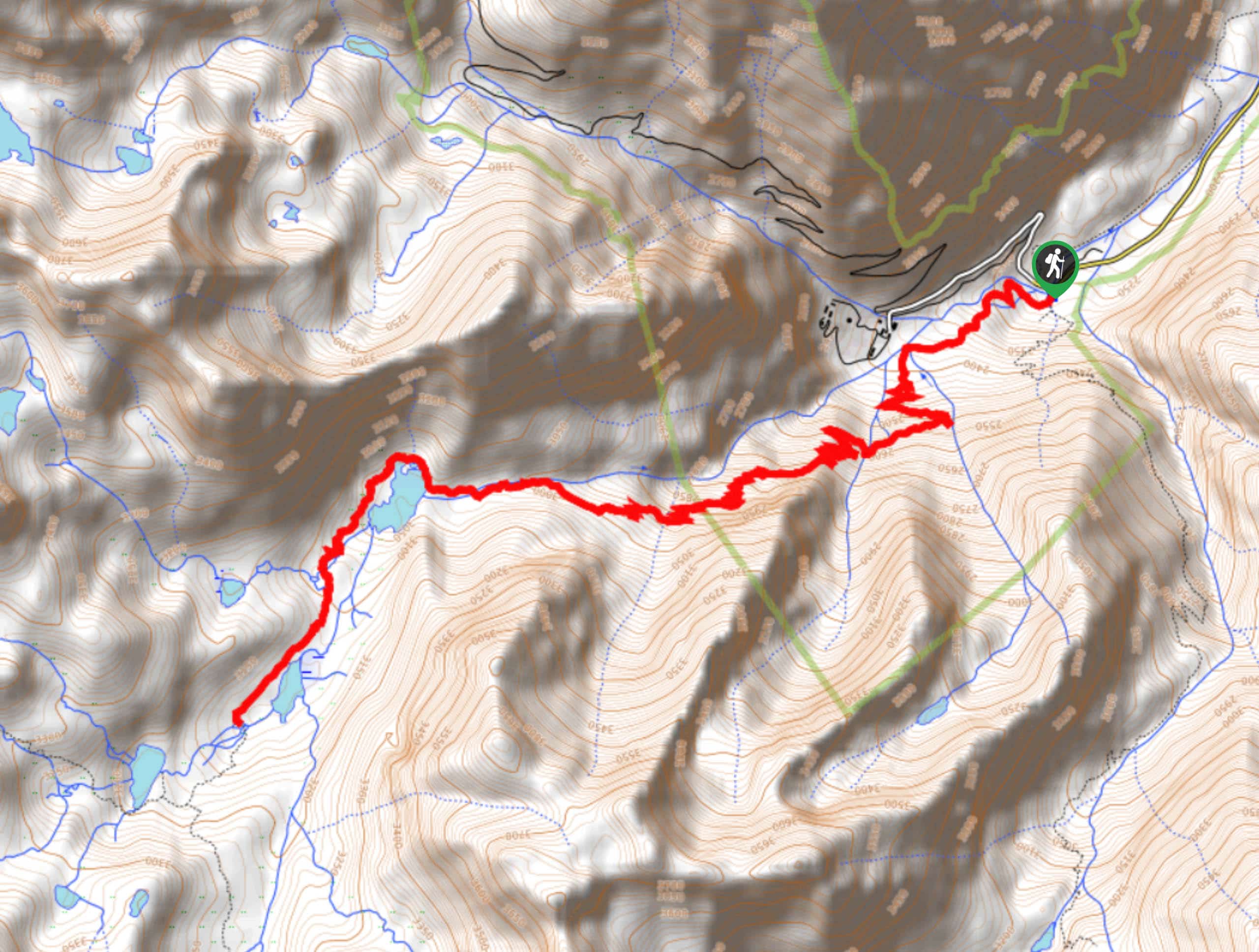
- Treasure Lake Trail - Ideal for intermediate hikers and families with older children, the Treasure Lake Trail delivers you to a pair of stunning lakes, where incredible sightlines can be enjoyed.
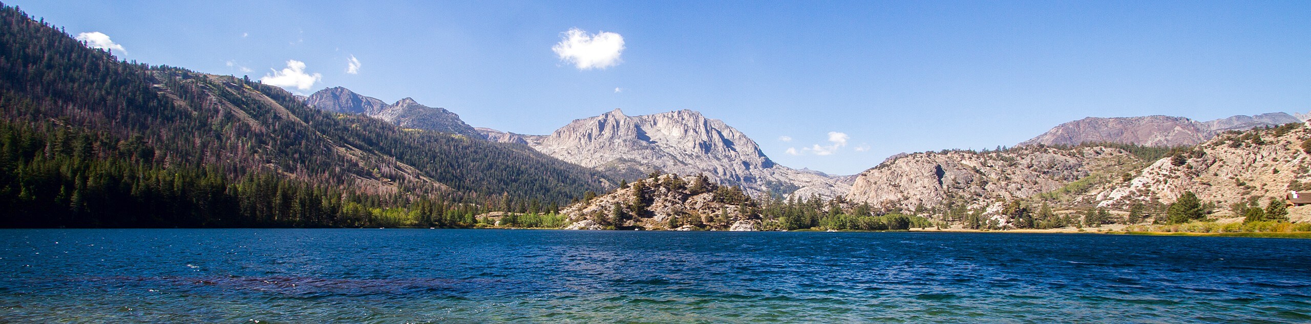
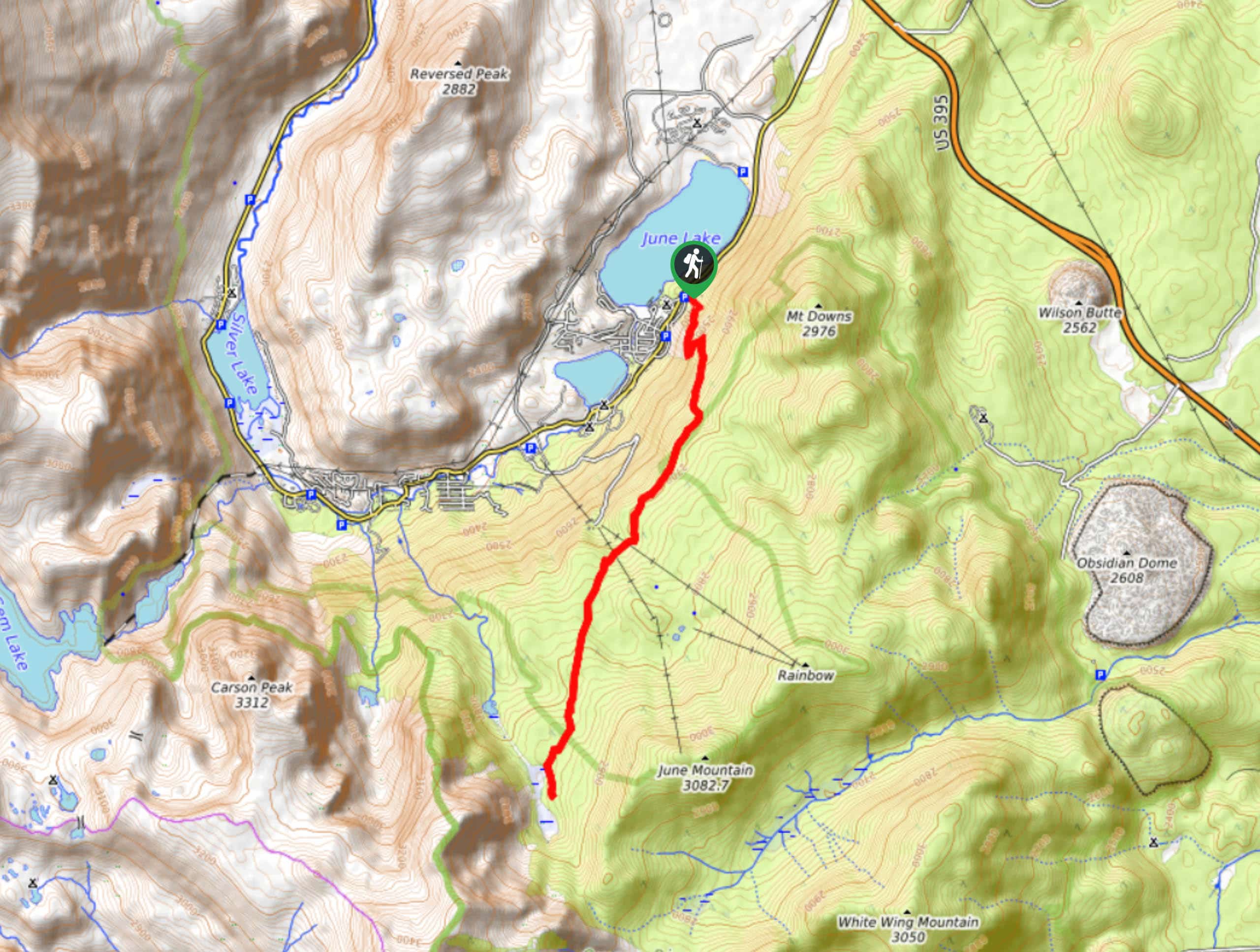
- June Lake Loop Trail - An excellent location for wildlife viewing, the June Lake Loop Trail is easily accessible and possesses great views of the surrounding Inyo National Forest landscape.
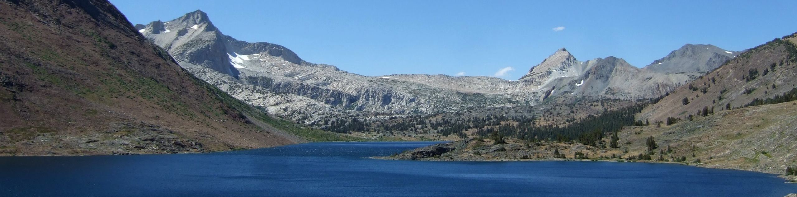
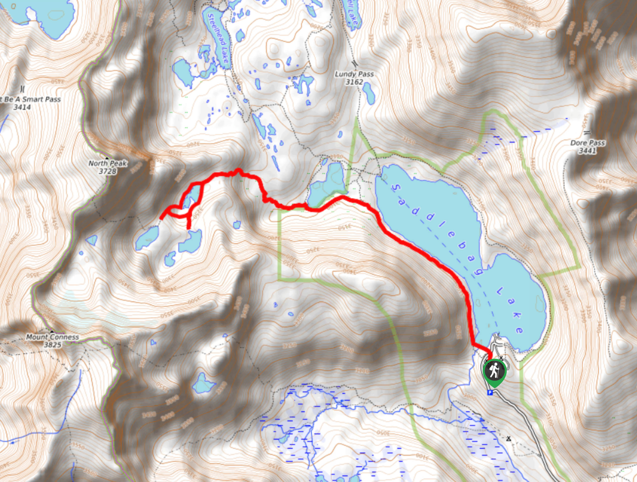
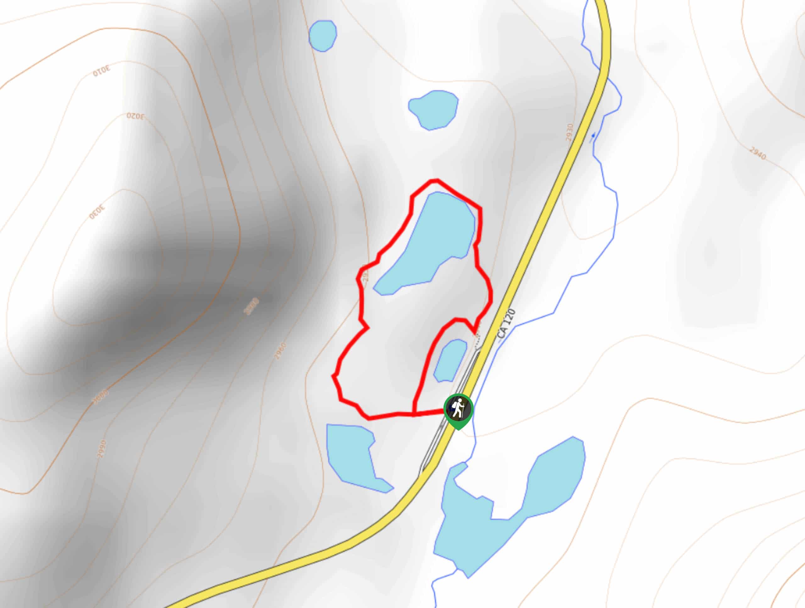
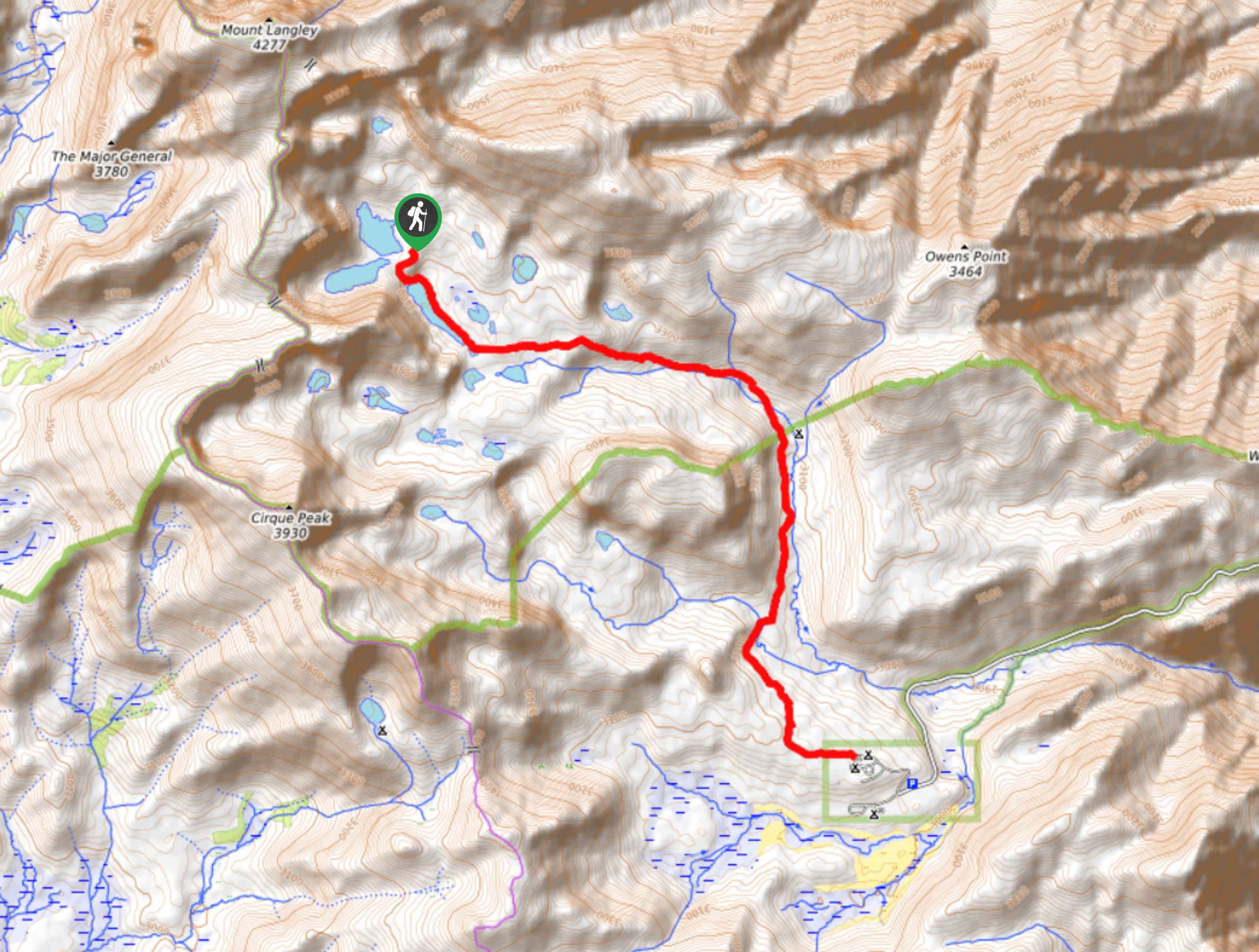
- Saddlebag Lake Trail - Circumventing the shoreline of an alluring alpine lake, the Saddlebag Lake Trail is a family-friendly route where you can take your time and enjoy!
- Hot Creek Interpretive Trail - The Hot Creek Interpretive Trail is a family-friendly route that takes you on an educational tour of a unique geothermally heated creek.
- Crystal Lakes Trail - After traversing a delightful forested section, the Crystal Lakes Trail arrives at a picturesque lake where you will want to stop and have a picnic!
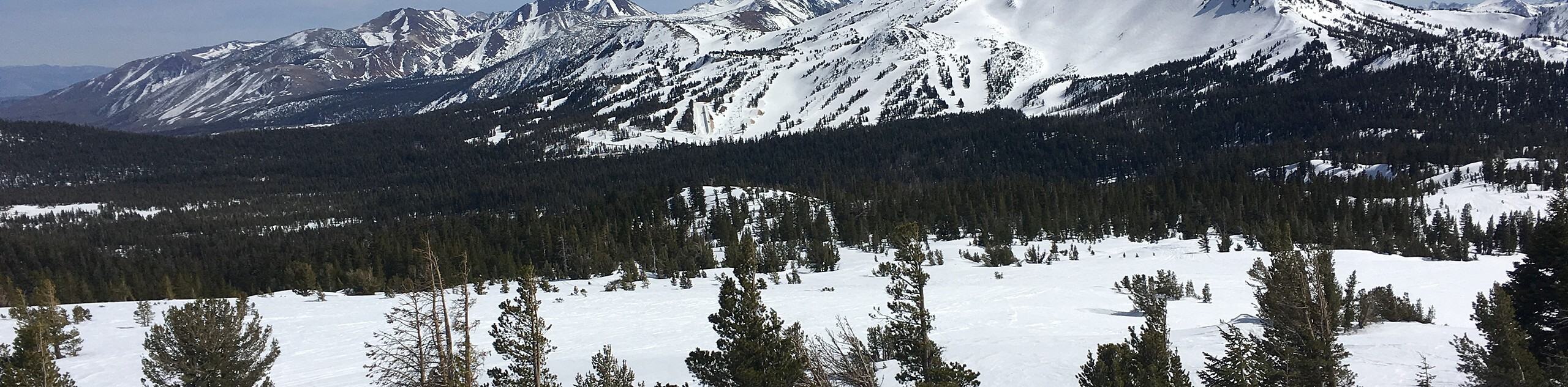
- Mammoth Mountain Trail - A trail that leads you up the backside of Mammoth Mountain - a popular ski hill within California - the route is easily accessible and an excellent choice for a day hike with older children.
- Sky Meadows Trail - Leading you to a gorgeous alpine meadow, the Sky Meadows Trail is perfect for beginner hikers and families with young children.
When Is The Best Time To Hike In Inyo National Forest?
Although Inyo National Forest is a year-round destination, the best time to hike within its beautiful landscape is during the warmer months - from June till October. During this time the alpine wildflowers bloom, and the cornucopia of life that inhabits the ecosystem is most active - making for an experience that won't soon be forgotten.
Other Outdoor Activities In Inyo National Park
Along with its extensive hiking trail network, Inyo National Forest has no shortage of fun outdoor activities to do! During the warmer months, cyclists bike along the scenic roadways and technical mountain bike paths. Kayakers, canoeists and stand up paddle boarders make their way to the many lakes throughout the area, while rock climbers ascend the imposing cliff faces of the Sierra Nevada Mountains. As fall turns into winter, people ski and snowboard at world famous ski resorts such as Mammoth Mountain, and snowshoe along Inyo National Forests many trails and frozen lakes.
Inyo National Forest Adventure Tours
The Sierra Nevada Mountain range has an amazing variety of professionally guided and planned tours. If interested, take a look at adventure tours in Sierra Nevada.
Frequently Asked Questions About Inyo National Forest
Do I need a permit for Inyo National Forest?
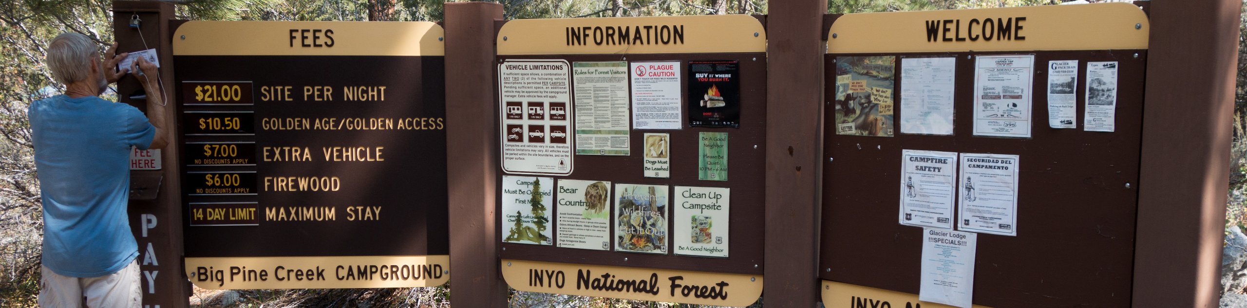
Permits are only required for overnight trips and any route along Mt. Whitney.
How much does it cost to climb Mt Whitney?
Mount Whitney Permits cost $6 to apply and another $15 per person once the permit is granted. Permits are given out through a lottery that takes place annually.
Are campfires allowed in Inyo National Forest?
Outside of designated Inyo National Forest recreational sites, campfires are not permitted.
How many people climb Mt. Whitney each year?
Although approximately 30,000 people attempt to summit Mt. Whiney each year, a fraction of that are actually successful as the route is technically and physically demanding.
Other great Hiking Regions in California
Read MoreThe best hikes in Inyo National Forest
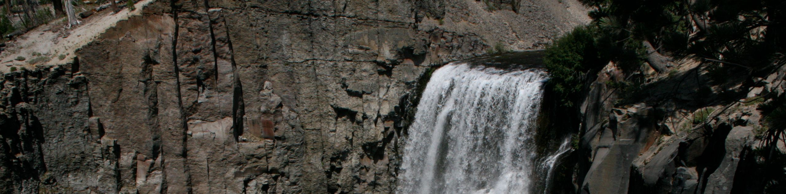
01. Rainbow Falls via Devils Postpile Trail
Difficulty
Regarded as one of the best routes within the eastern Sierra Nevada Mountain range, the… Read More
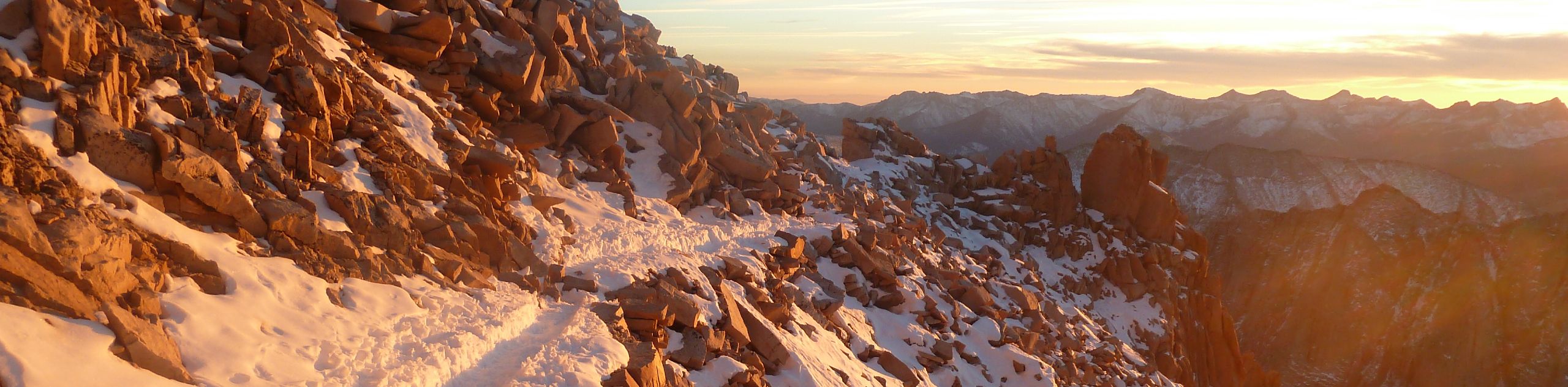
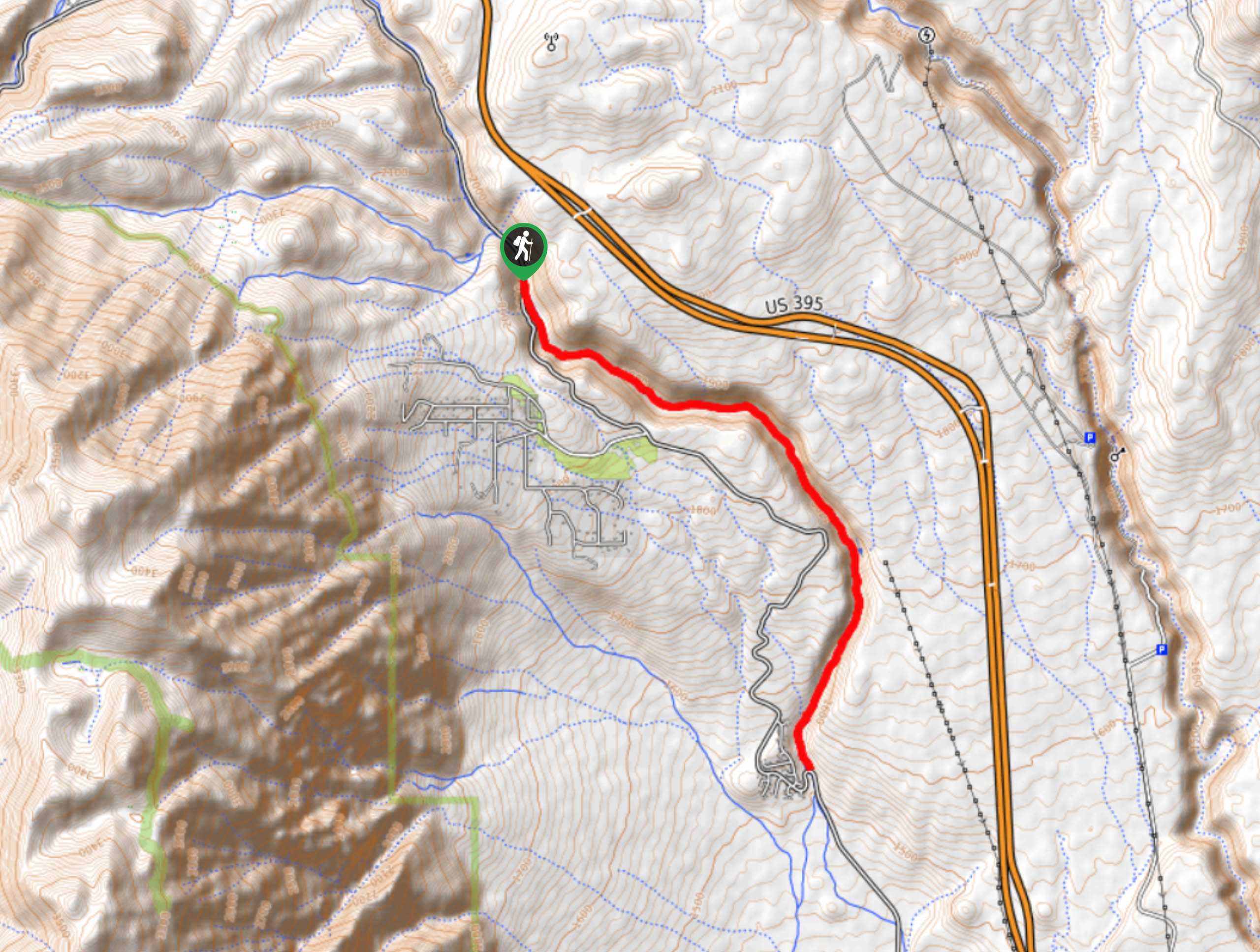
02. Mount Whitney Trail
Difficulty
A physically demanding and technically formidable route, the Mount Whitney Trail is a must-do for… Read More
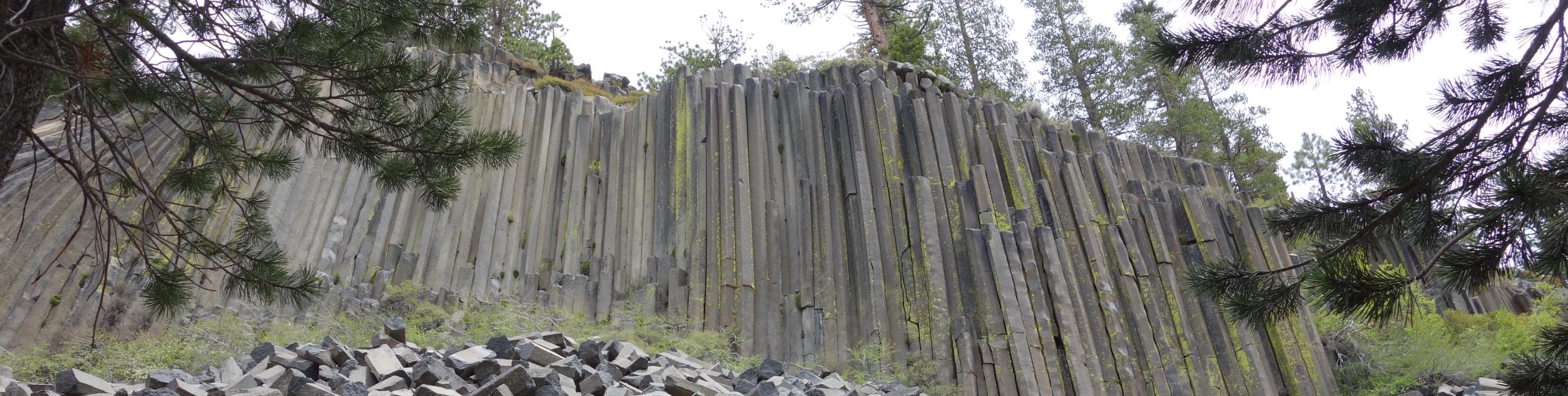
03. Devil's Postpile Loop
Difficulty
Short in distance, and with relatively little elevation gain, the Devil's Postpile Loop is an… Read More
04. Kennedy Meadow to the Bridge via PCT Trail
Difficulty
Kennedy Meadow to the Bridge via PCT Trail is a beautiful route within Inyo National… Read More
05. Treasure Lakes Trail
Difficulty
The Treasure Lakes Trail is a magical route within Inyo National Forest that is ideal… Read More
06. June Lake Loop Trail
Difficulty
An ideal route for intermediate hikers, and families with older children, the June Lake Loop… Read More
07. Saddlebag Lake Trail
Difficulty
A family-friendly route in Inyo National Forest, the Saddlebag Lake Trail is a scenic pathway… Read More
08. Twenty Lakes Basin and Saddlebag Lake Loop
Difficulty
An absolutely stunning route, Twenty Lakes Basin and Saddlebag Lake Loop is a must-do route… Read More
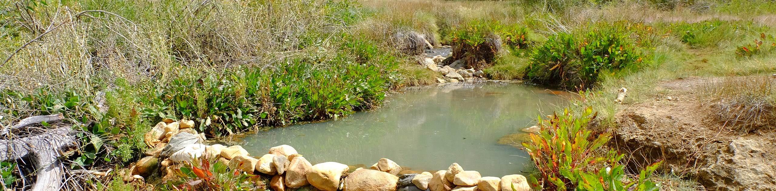
09. Hot Creek Interpretive Trail
Difficulty
The Hot Creek Interpretive Trail is a short route that is appropriate for all skill… Read More
10. Crystal Lake Trail
Difficulty
A stunning route, Crystal Lake Trail traverses some lovely forested terrain before arriving at picturesque… Read More
Yes, there are more than 10
Inyo National Forest is so beautiful that we can not give you only 10 hikes. So here is a list of bonus hikes in Inyo National Forest that you should take a look at as well
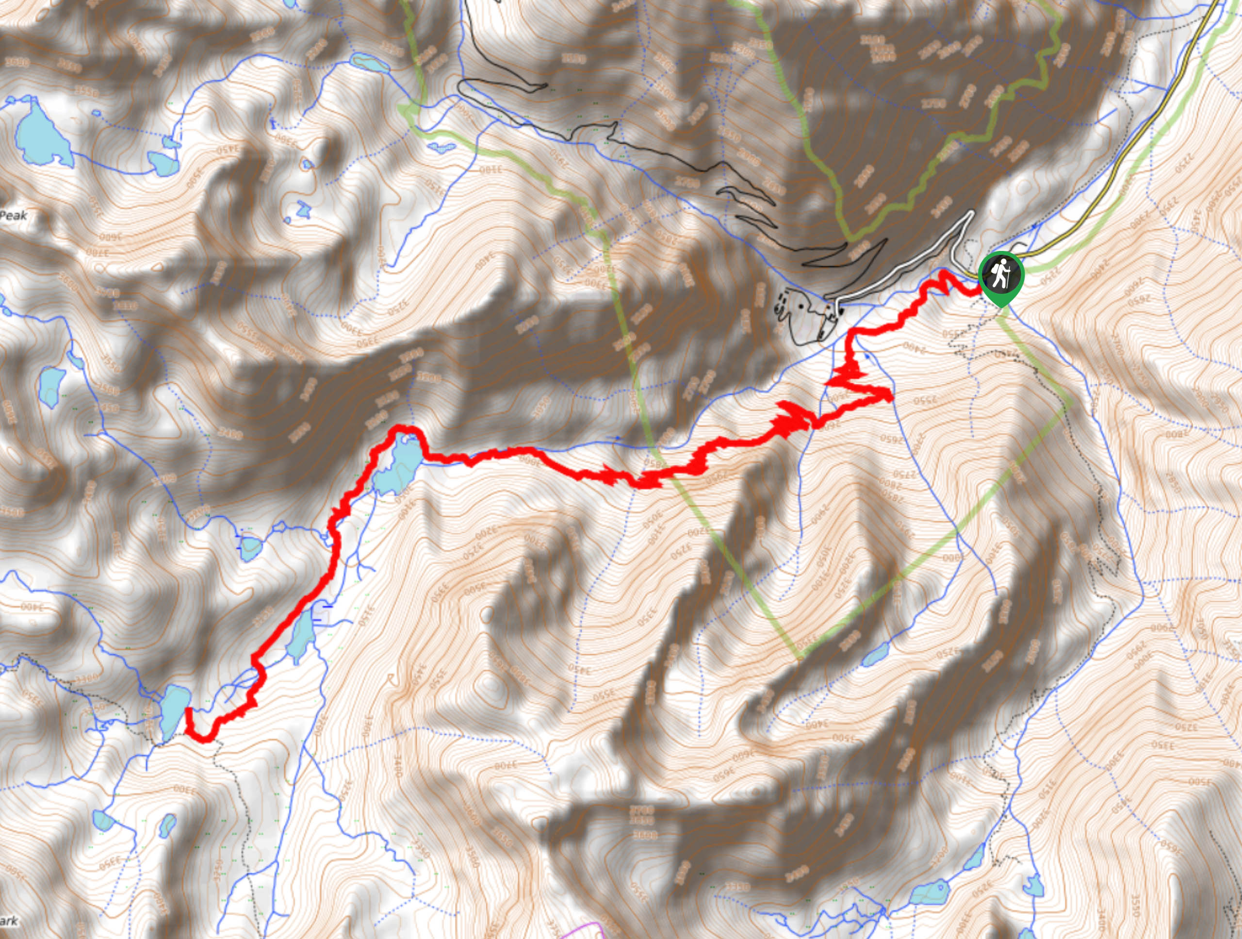
11. Little Lakes Valley to Gem Lakes Trail
Difficulty
The Little Lakes Valley to Gem Lakes Trail is an incredible route that brings you… Read More
12. Mount Whitney Portal to Lone Pine Lake Trail
Difficulty
Considered to be a more challenging route, the Mount Whitney Portal to Lone Pine Lake… Read More
13. Minaret Lake Trail
Difficulty
Taking you through stunning mountain topography, alongside charming creeks, and eventually ending at the picturesque… Read More
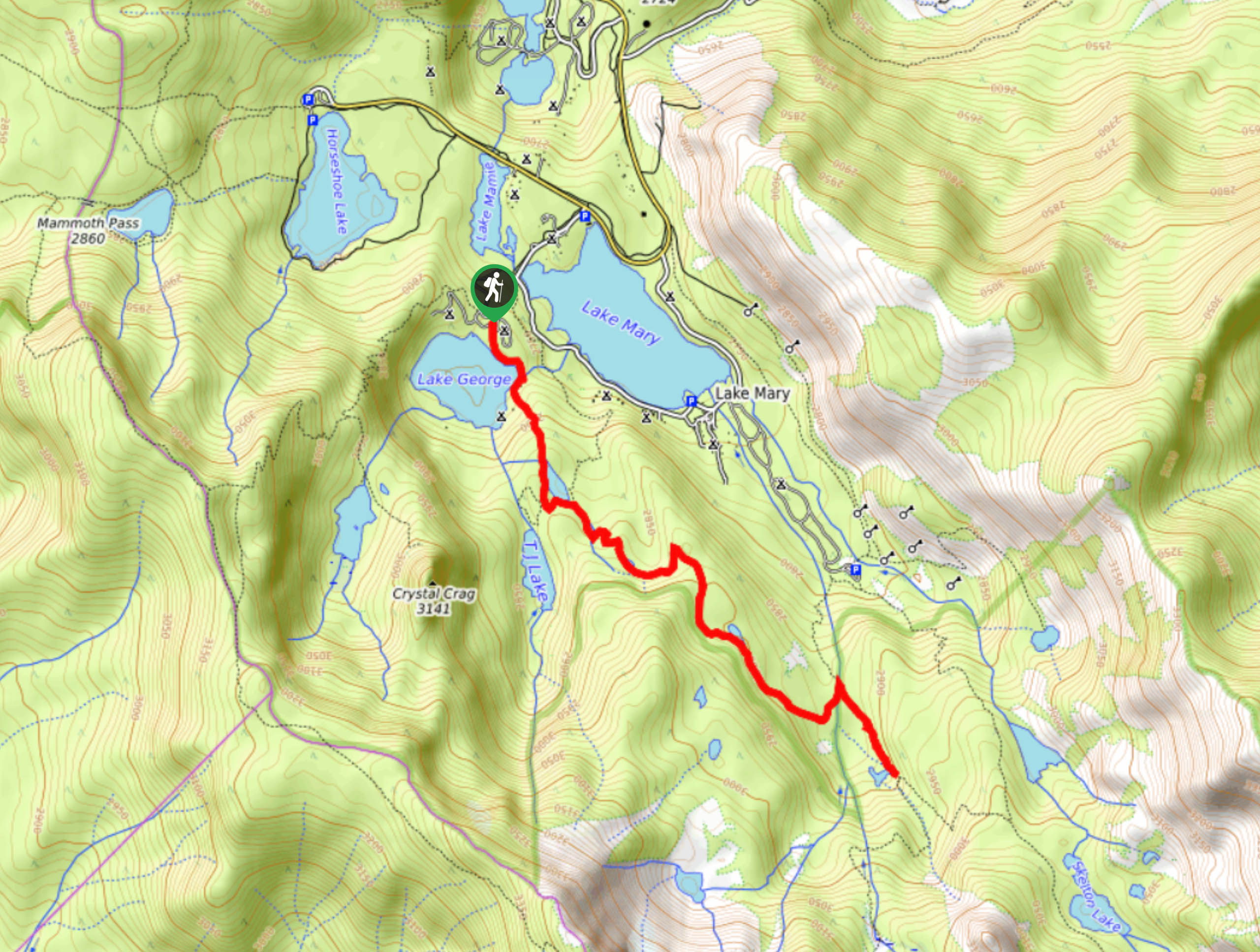
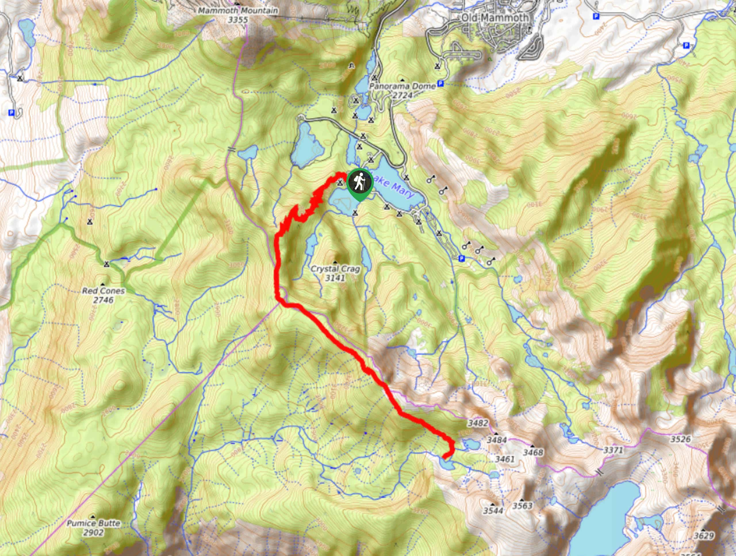
14. Lake Mary Loop
Difficulty
The Lake Mary Loop is a short route within Inyo National Forest that is ideal… Read More
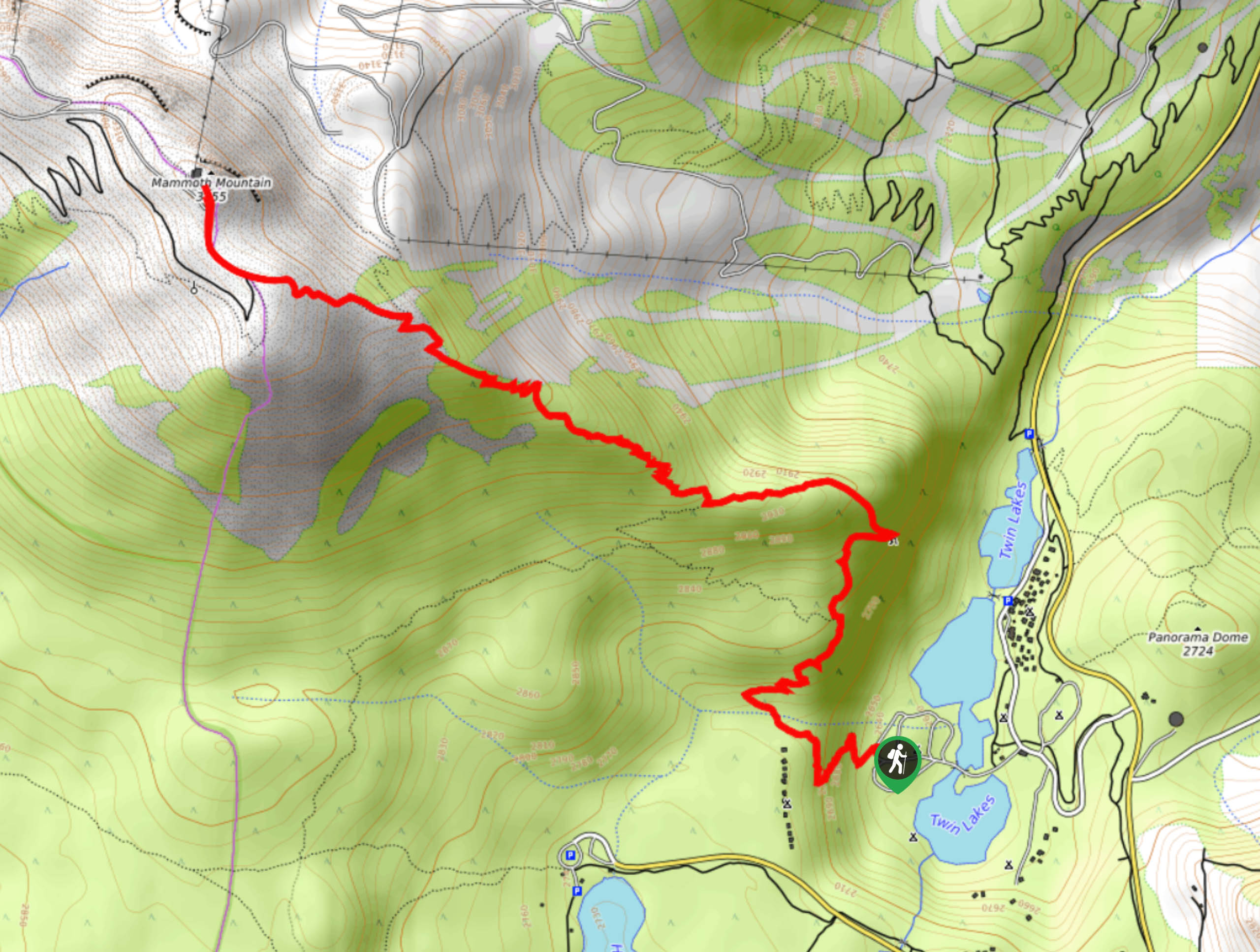
15. Mammoth Mountain Trail
Difficulty
A scenic route that offers incredible sightlines of the surrounding region, the Mammoth Mountain Trail… Read More
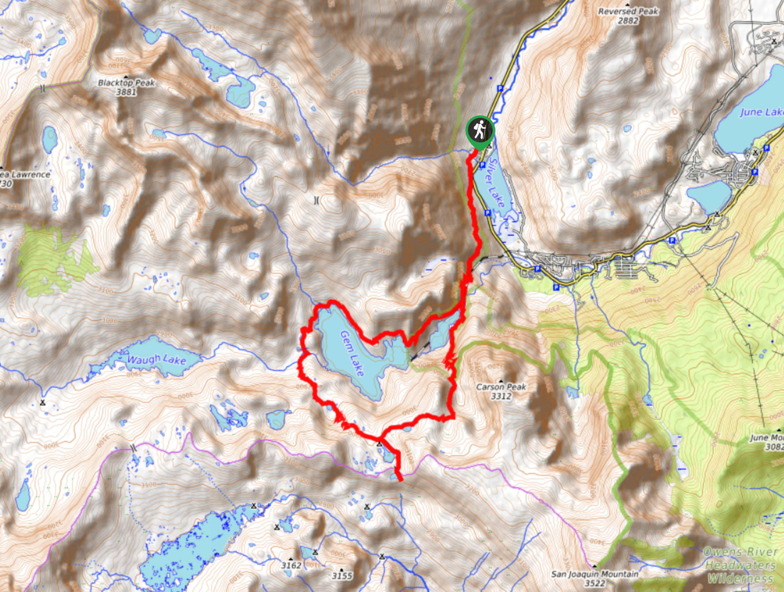
16. Gem Lake via Rush Creek Trail
Difficulty
The Gem Lake via Rush Creek Trail is a beautiful route within Inyo National Forest.… Read More
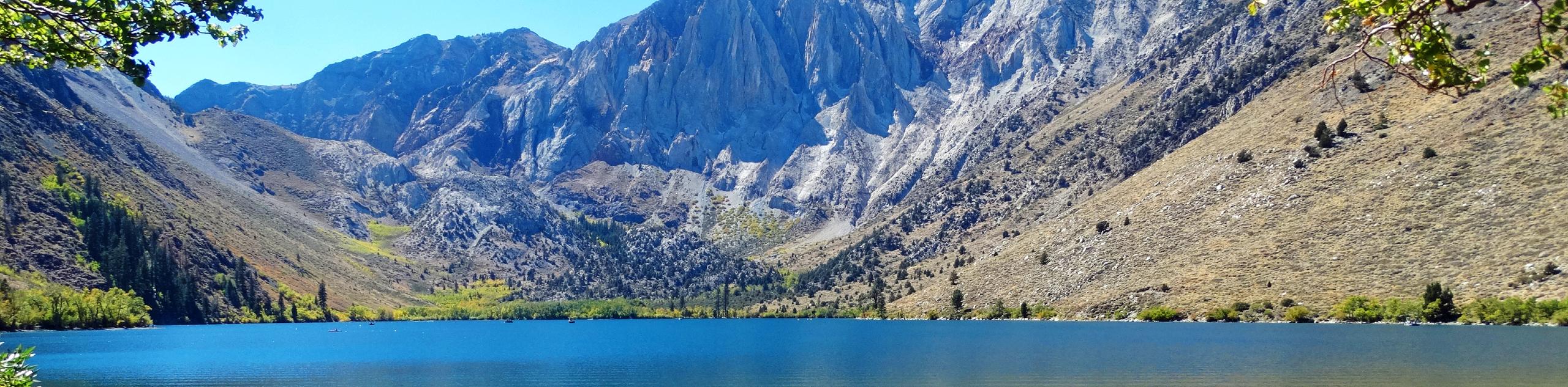
17. Convict Lake Loop Trail
Difficulty
Convict Lake Loop Trail is a beautiful route in Inyo National Forest. Short in distance… Read More
18. Jordan Hot Springs via Casa Vieja Trail
Difficulty
Traversing alongside quaint creeks and through charming meadows, the Jordan Hot Springs via Casa Vieja… Read More
19. Sky Meadows Trail
Difficulty
The Sky Meadows Trail is a great route for beginner hikers and families with younger… Read More
20. Fern Lake Trail
Difficulty
Appropriate for intermediate hikers and families with older children, Fern Lake Trail is a beautiful… Read More
21. Earthquake Fault Trail
Difficulty
The Earthquake Fault Trail is a short and easily accessible route that is appropriate for… Read More
22. Big Pine Creek Campground and Glacier Lodge Loop Trail
Difficulty
Short in distance, and with relatively little elevation gain, Big Pine Creek Campground and Glacier… Read More
23. Lake George Trail
Difficulty
An adventurous route, Lake George Trail brings you along the shoreline of its namesake. Although… Read More
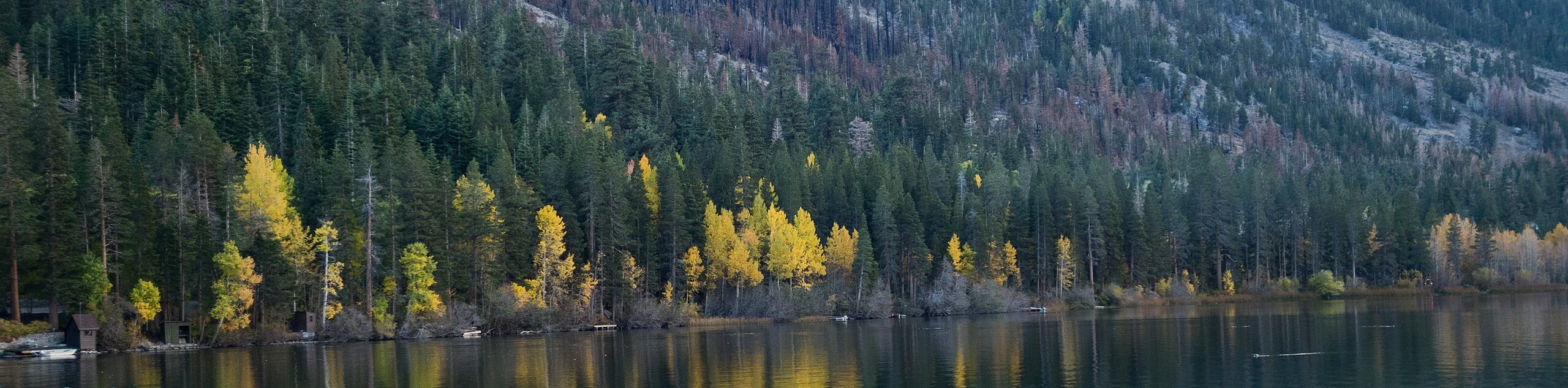
24. Twin Lakes Campground Trail
Difficulty
With great views of the surrounding Sierra Nevada Mountains, the Twin Lakes Campground Trail is… Read More
25. Gibbs Lake Trail
Difficulty
The Gibbs Lake Trail is a stunning route within Inyo National Forest that leads you… Read More
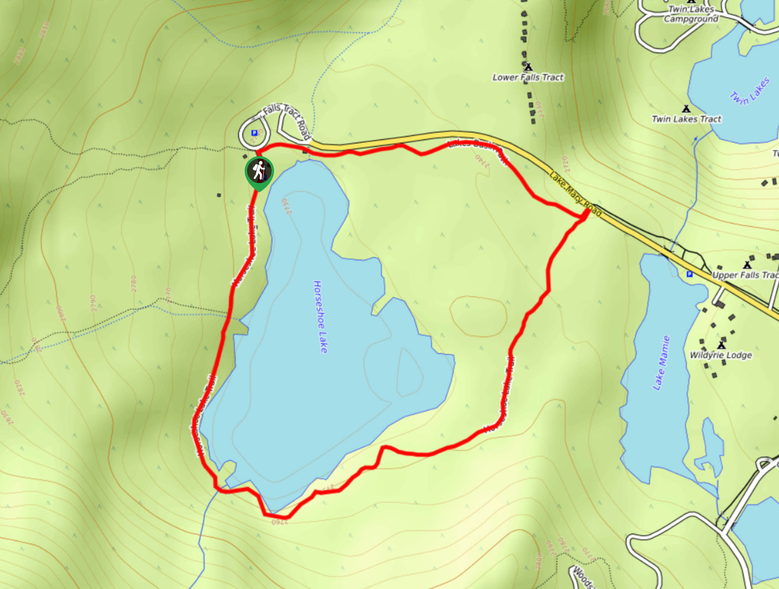
26. Horseshoe Lake Trail
Difficulty
A short route with little elevation incline, Horseshoe Lake Trail is an ideal route for… Read More
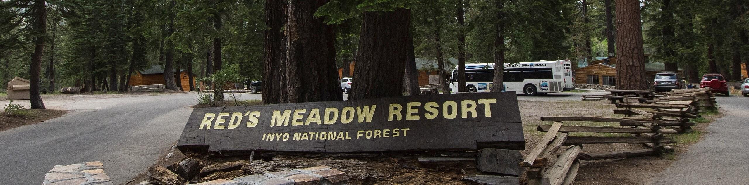
27. Red Meadow Resort to Lower Falls Trail
Difficulty
Red Meadow Resort to Lower Falls Trail is a moderately difficult route in Inyo National… Read More
28. Barney Lake Trail
Difficulty
Barney Lake Trail is a moderately difficult route within Inyo National Forest. The beautiful route… Read More
29. McLeod Lake Trail
Difficulty
McLeod Lake Trail is a fairly short route that possesses little elevation gain, and is… Read More
30. Seven Lakes Point via Dragon’s Back Trail
Difficulty
Seven Lakes Point via Dragon’s Back Trail is a scenic route within Inyo National Forest… Read More
31. Gull Lake Loop
Difficulty
Taking you along the shoreline of charming Gull Lake, the Gull Lake Loop is an… Read More
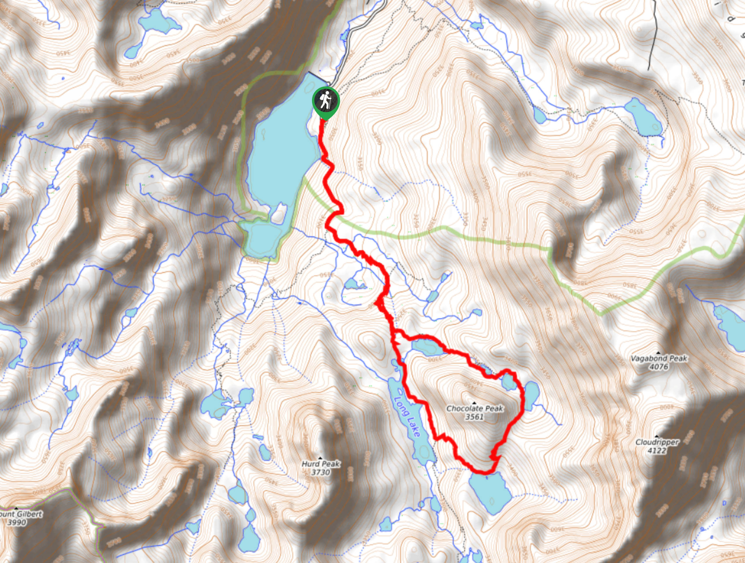
32. Chocolate Lakes Loop Trail
Difficulty
A stunning route within Inyo National Forest, the Chocolate Lakes Loop is an ideal route… Read More
33. Emerald Lake Trail
Difficulty
Short in distance and with relatively little elevation incline, the Emerald Lake Trail is ideal… Read More
34. McGee Creek to Horsetail Creek Trail
Difficulty
McGee Creek to Horsetail Creek Trail is a family-friendly route in Inyo National Forest. The… Read More
35. Horton Lake Trail
Difficulty
Horton Lake Trail is fairly long and possesses a relatively large elevation incline and is… Read More
36. Rush Creek Trail to Agnew Lake Trail
Difficulty
A moderately difficult route, Rush Creek Trail to Agnew Lake Trail leads you through the… Read More
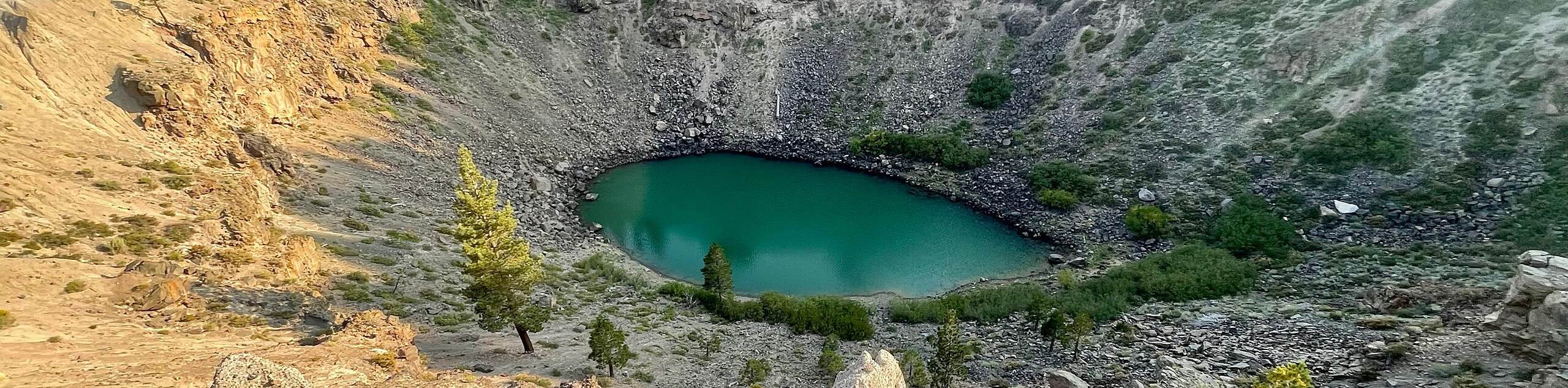
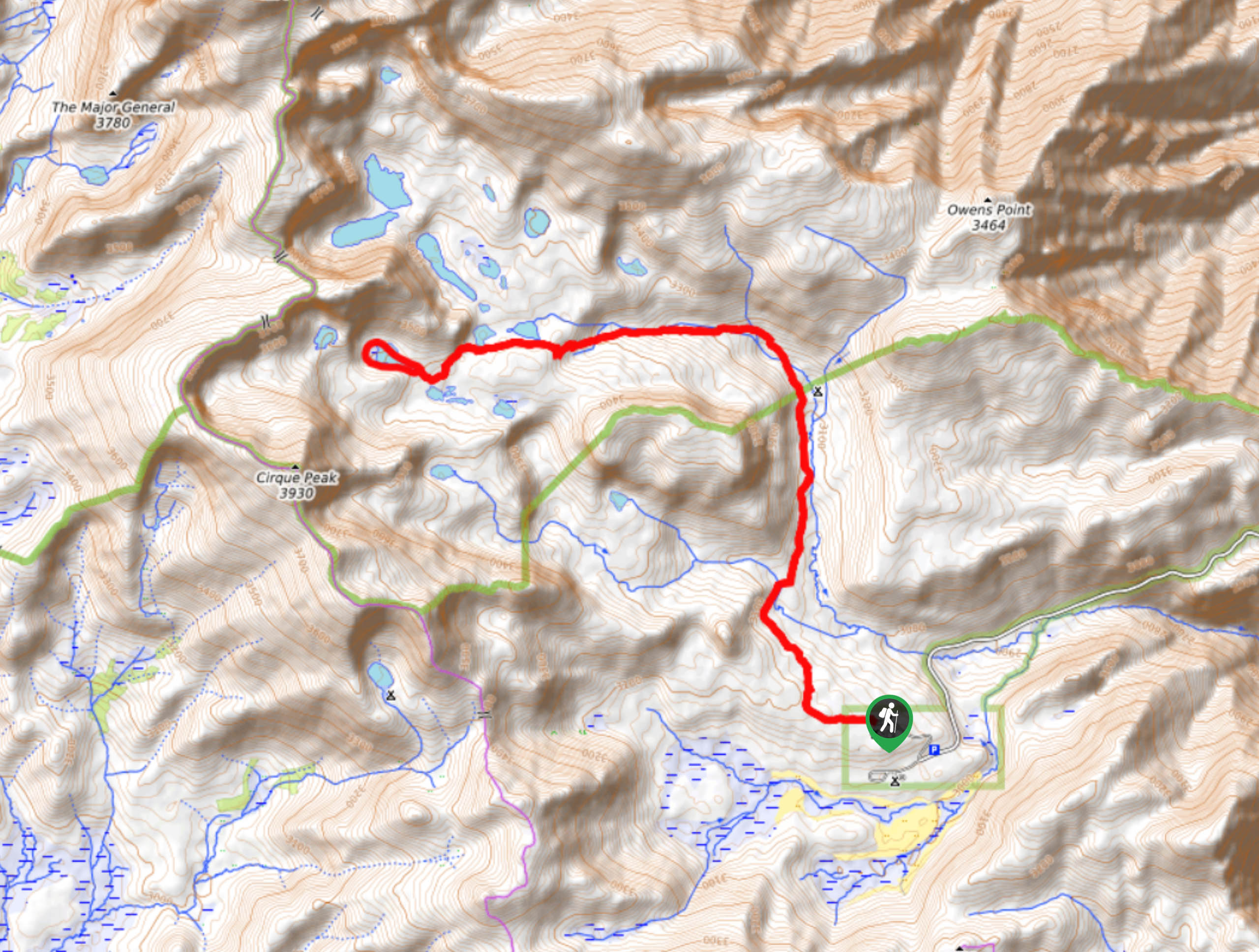
37. Inyo Craters Trail
Difficulty
Taking you alongside two impressive volcanic craters, the Inyo Craters Trail is an easily accessible… Read More
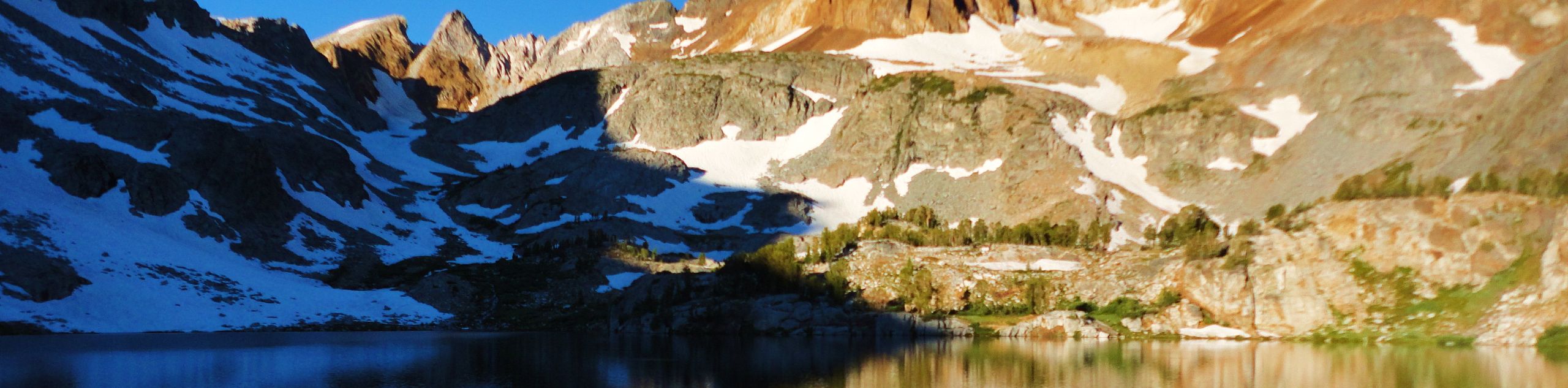
38. Cottonwood Lakes Trail
Difficulty
The Cottonwood Lakes Trail is an excellent route within Inyo National Forest. Primarily used as… Read More
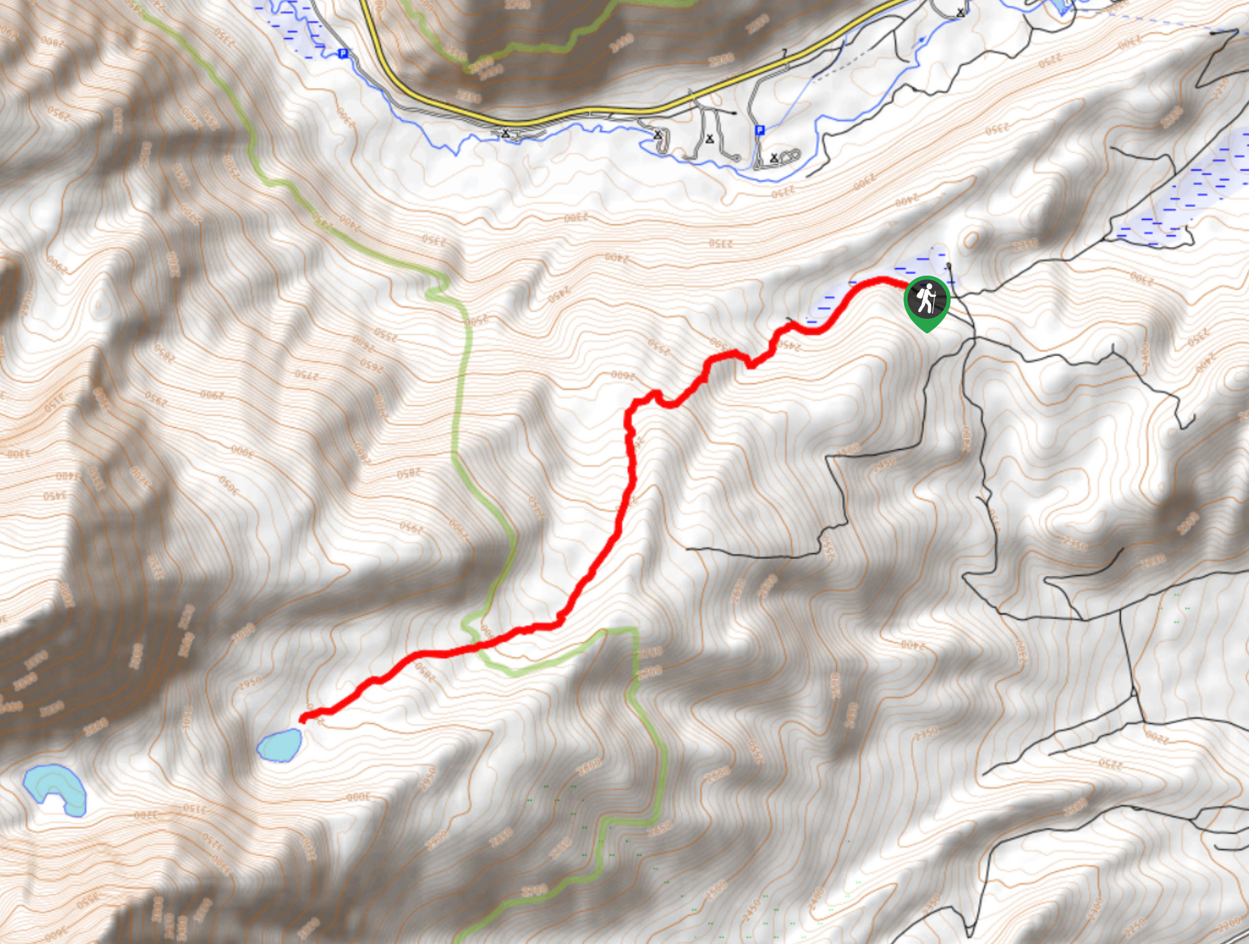
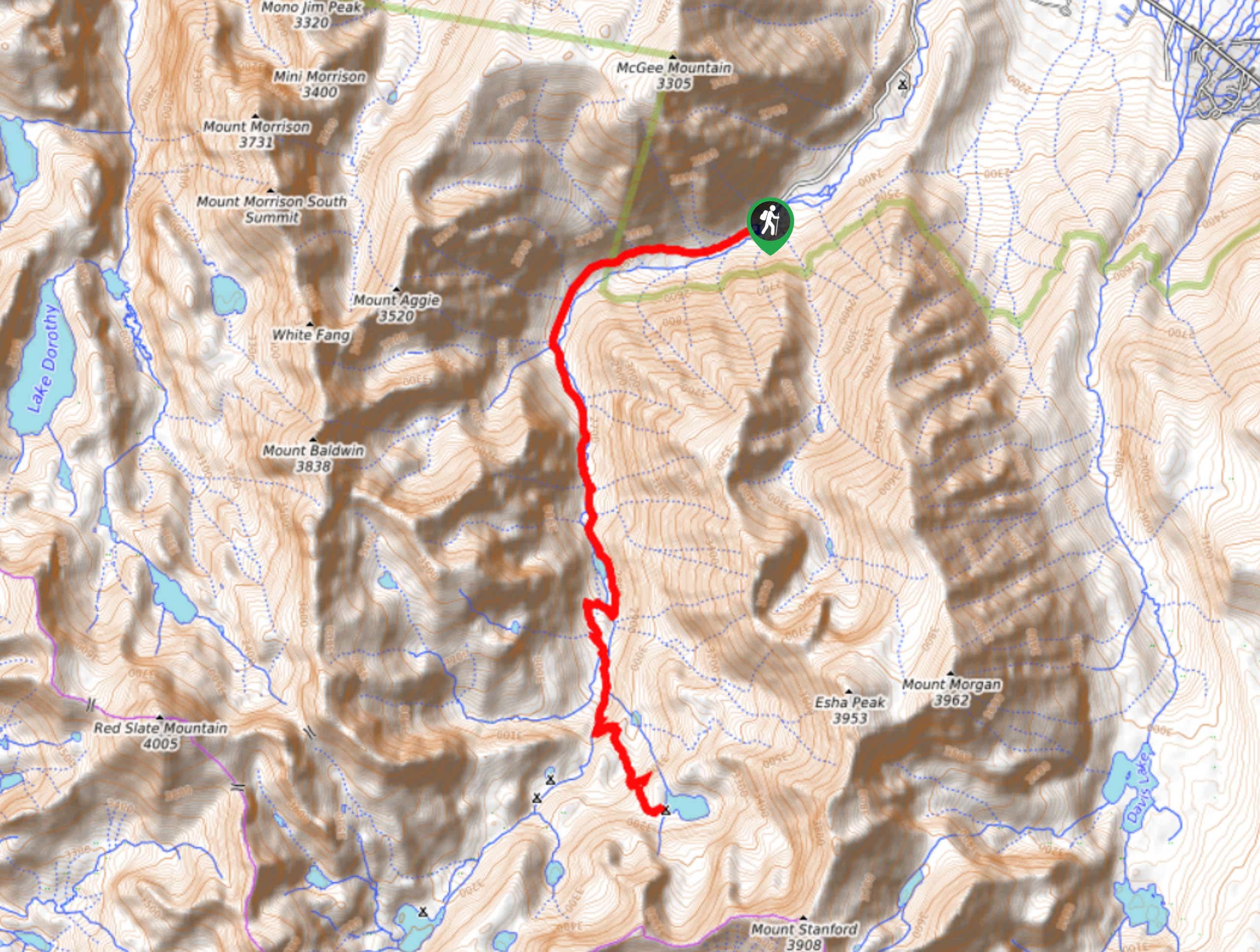
39. Big McGee Lake Trail
Difficulty
A stunning route within Inyo National Forest, Big McGee Lake Trail traverses some stunning Sierra… Read More
40. Heart Lake Trail
Difficulty
The Heart Lake Trail is an excellent, family oriented route within Inyo National Forest. A… Read More
41. Lower Rock Creek Canyon Trail
Difficulty
A scenic route within Inyo National Forest, the Lower Rock Creek Canyon Trail is an… Read More
42. Silver Lakes Sierras Trail
Difficulty
The Silver Lakes Sierras Trail takes you alongside a number of tranquil lakes, all while… Read More
43. Hungry Packer Lake Trail
Difficulty
The Hungry Packer Lake Trail is a lightly trafficked route within Inyo National Forest. The… Read More
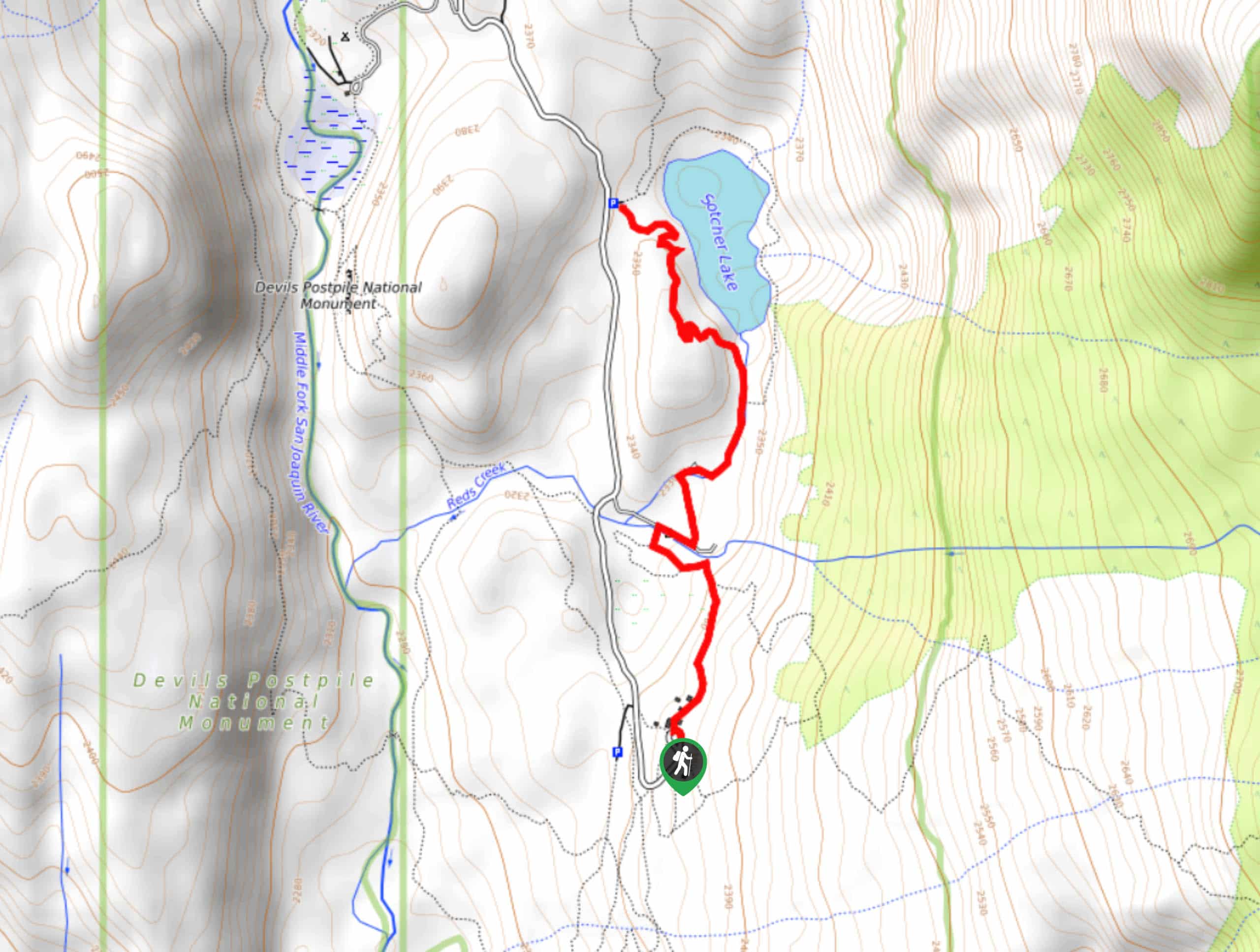
44. Sotcher Lake Trail
Difficulty
A beautiful route, Sotcher Lake Trail is ideal for families and those seeking a more… Read More
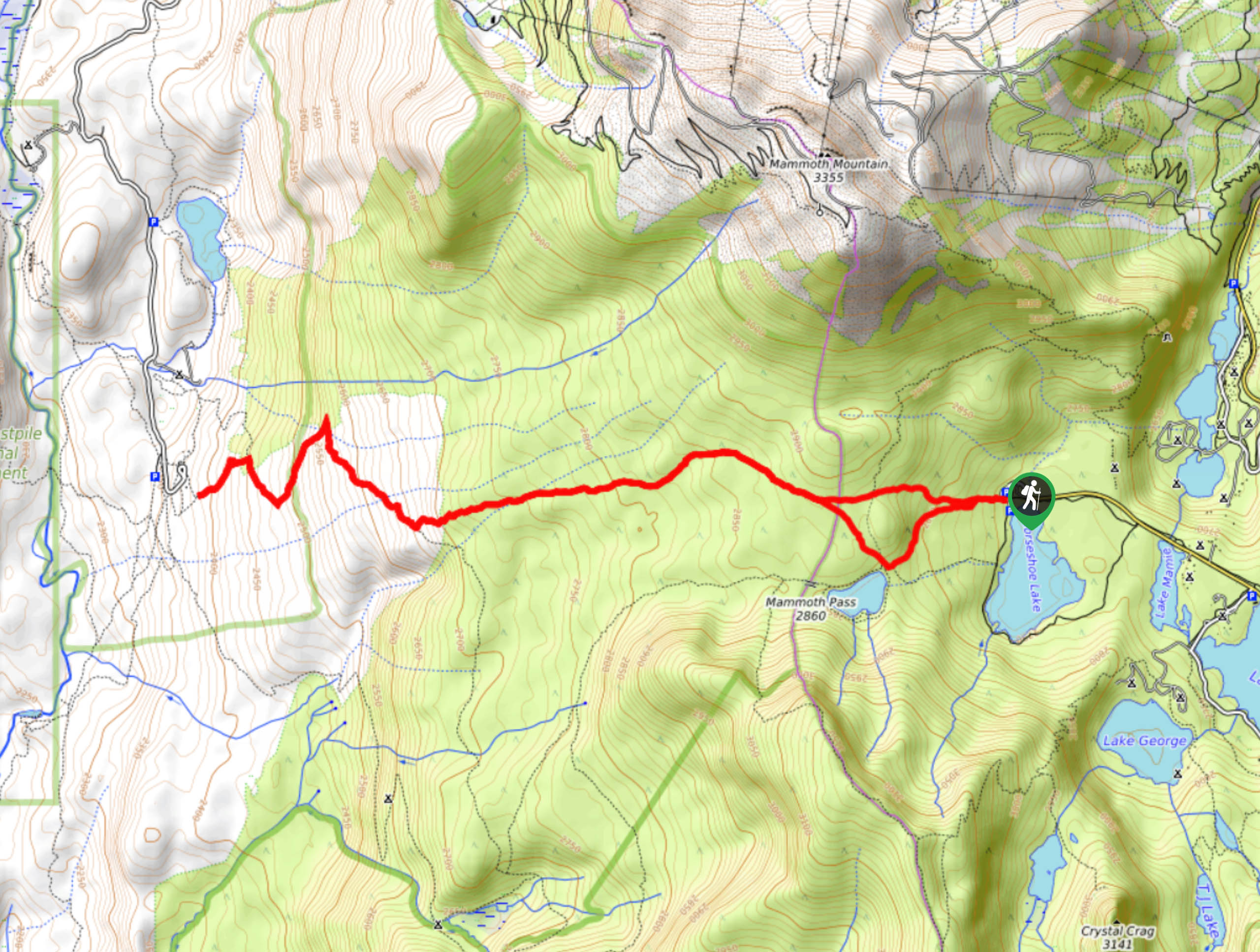
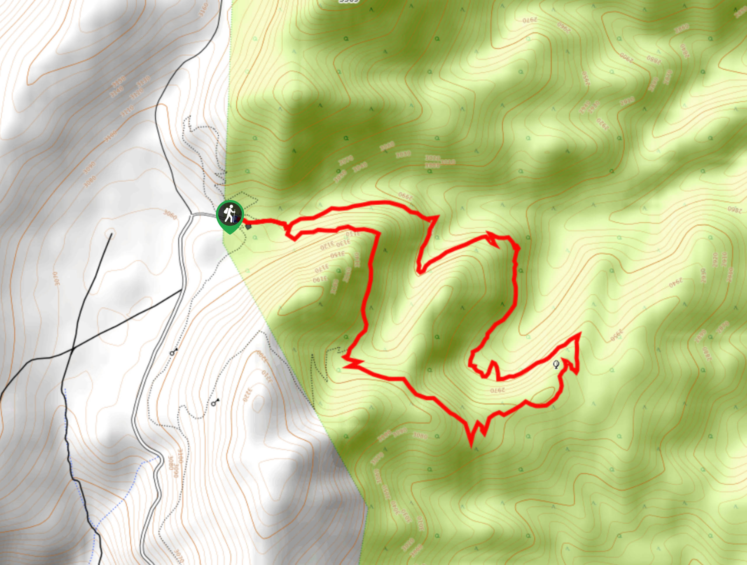
45. Mammoth Pass and McLeod Lake Trail
Difficulty
Mammoth Pass and McLeod Lake Trail is a beautiful route within Inyo National Forest. Traversing… Read More
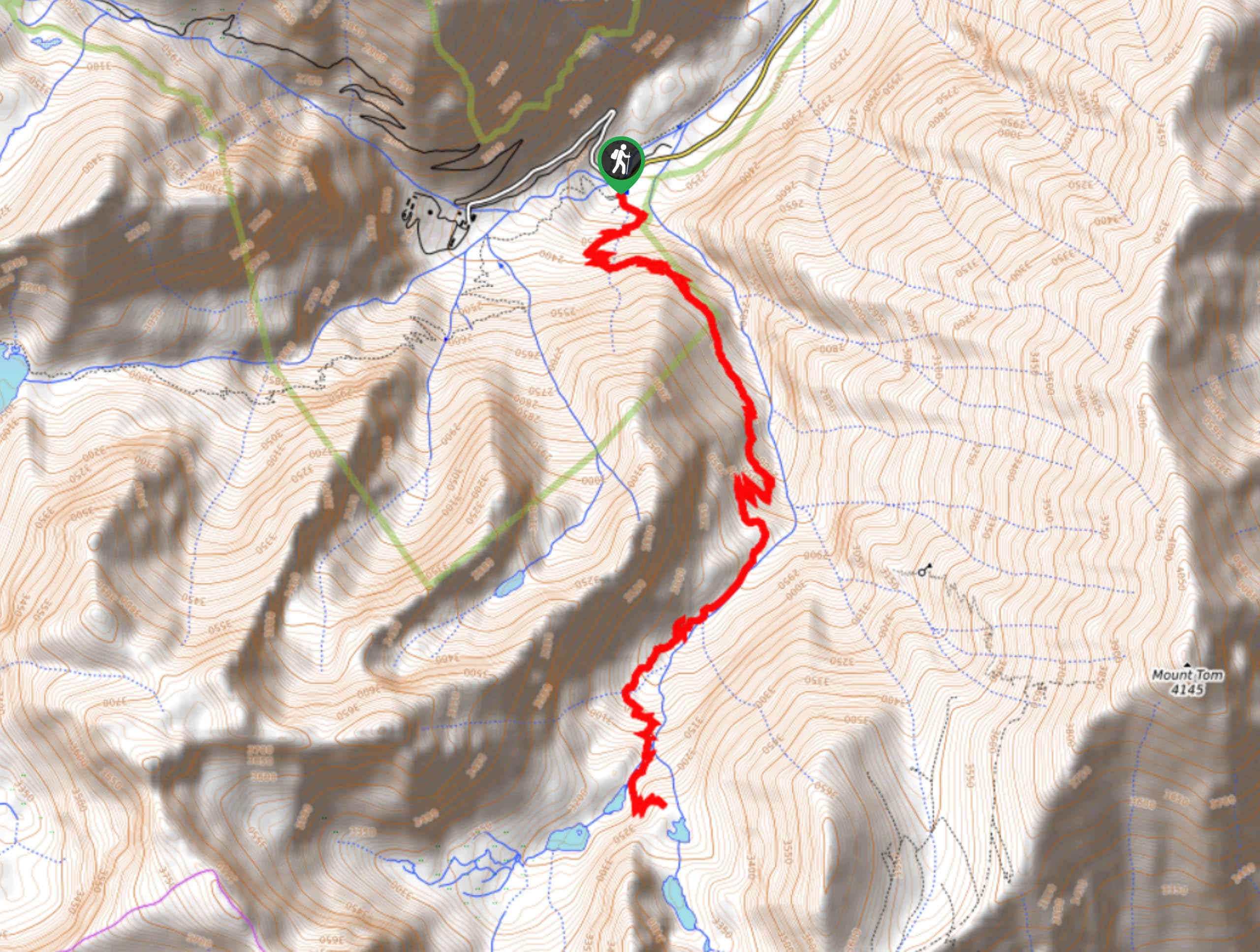
46. Honeymoon Lake Trail
Difficulty
A fairly long route with a notable amount of elevation incline, the Honeymoon Lake Trail… Read More
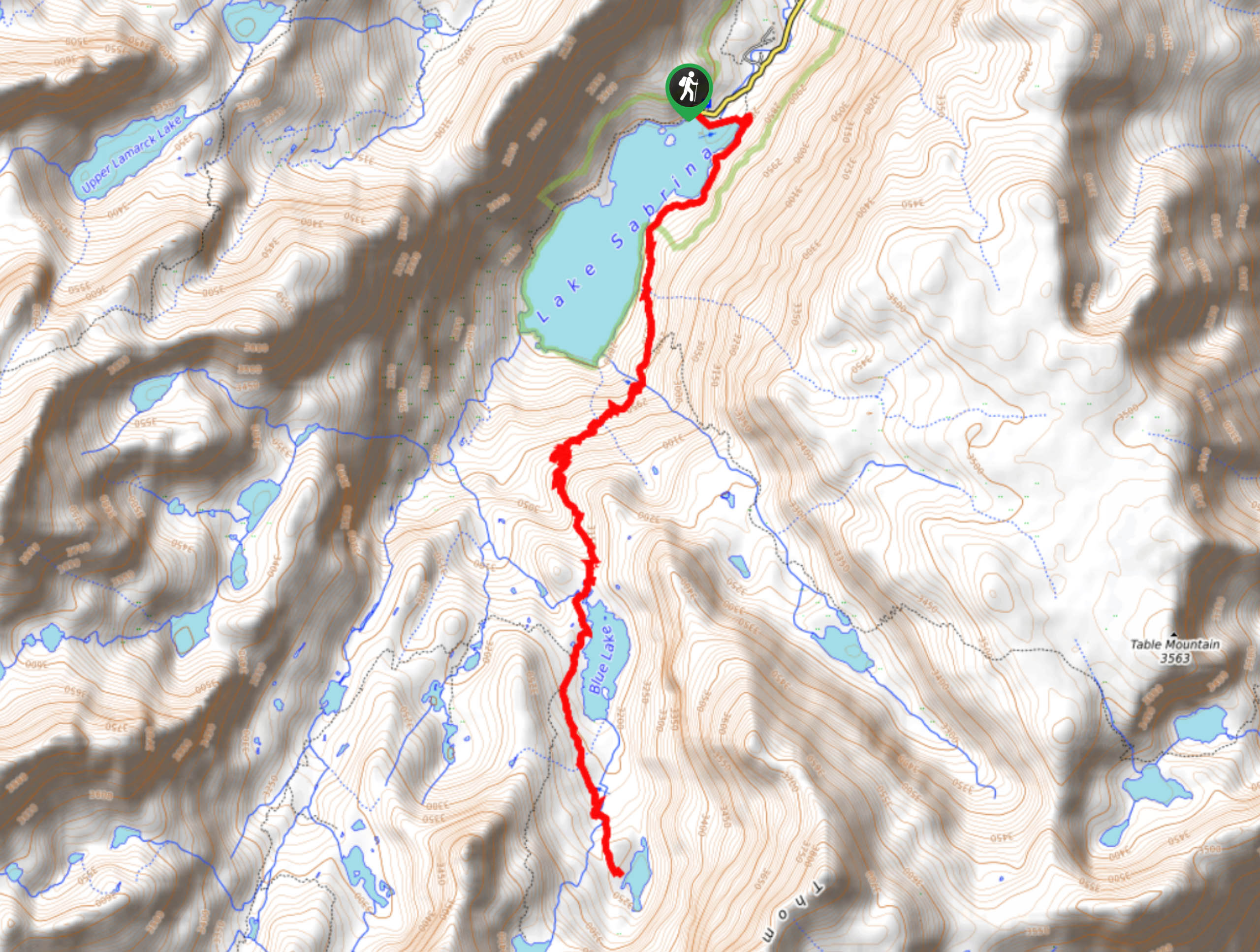
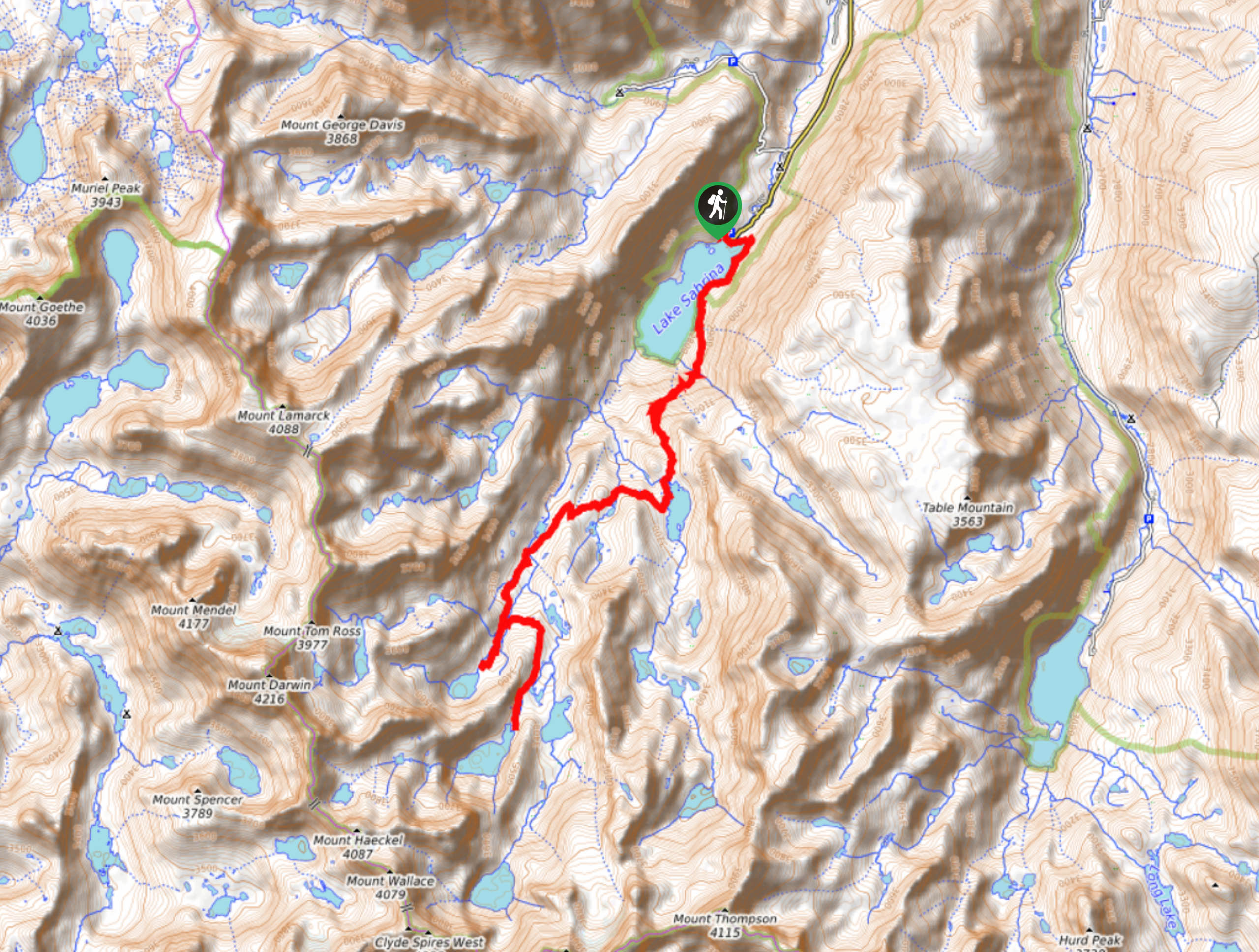
47. Sabrina Basin to Donkey Lake Trail
Difficulty
Sabrina Basin to Donkey Lake Trail is a scenic route within Inyo National Forest that… Read More
48. Conness Lake from Saddlebag Lake Trail
Difficulty
A scenic route within Inyo National Forest, Conness Lake from Saddlebag Lake Trail is ideal… Read More
49. Bristlecone Pine Forest to Mexican Mine Ruins Trail
Difficulty
The Bristlecone Pine Forest to Mexican Mine Ruins Trail is a unique route within Inyo… Read More
50. Lake George to Emerald Lake via Coldwater Campground Trail
Difficulty
An ideal route for families with young children, Lake George to Emerald Lake via Coldwater… Read More
51. Methuselah Trail
Difficulty
The Methuselah Trail is a scenic route within Inyo National Forest. Taking you through an… Read More
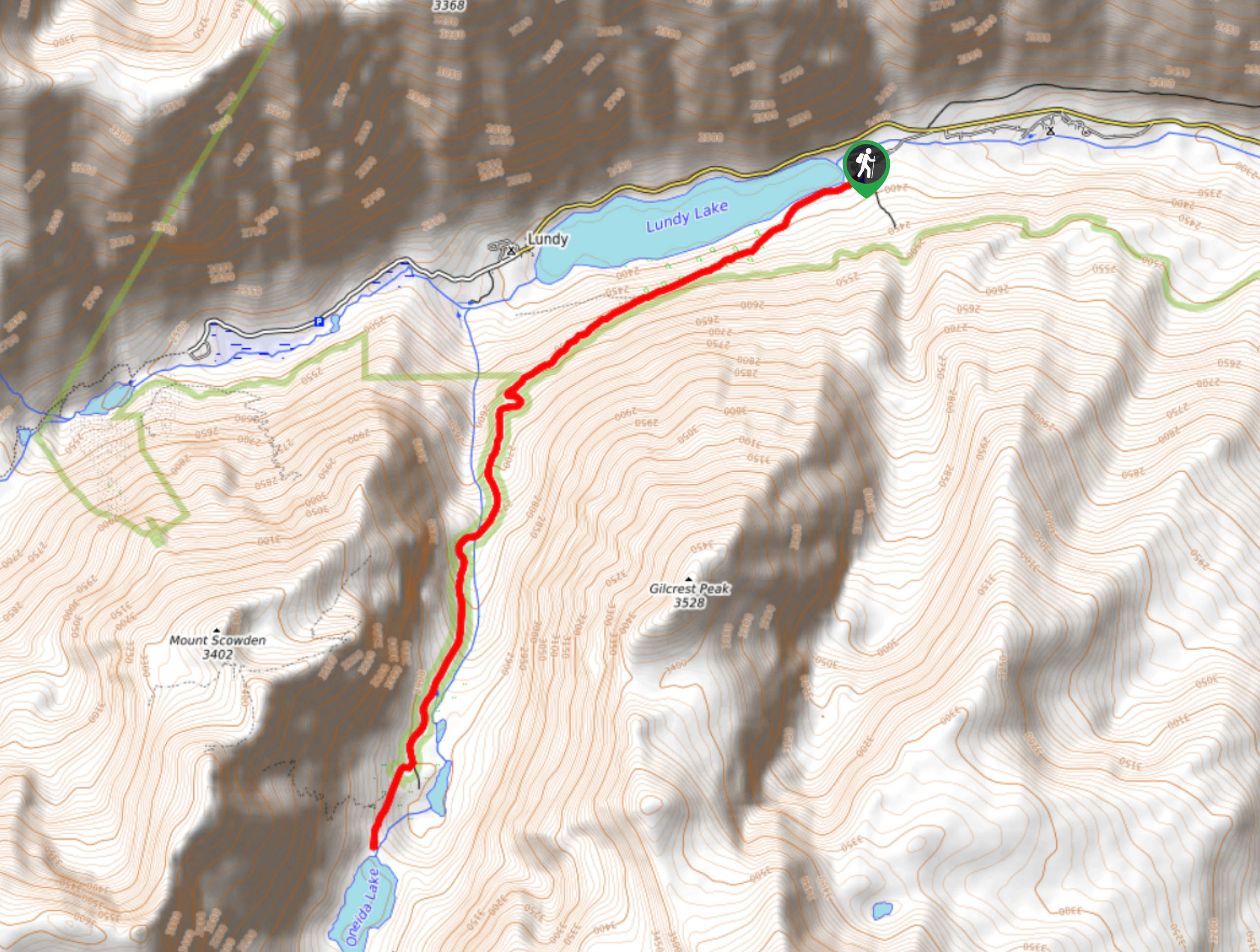
52. Lundy to Oneida Lake Trail
Difficulty
A scenic route within Inyo National Forest, Lundy to Oneida Lake Trail is ideal for… Read More
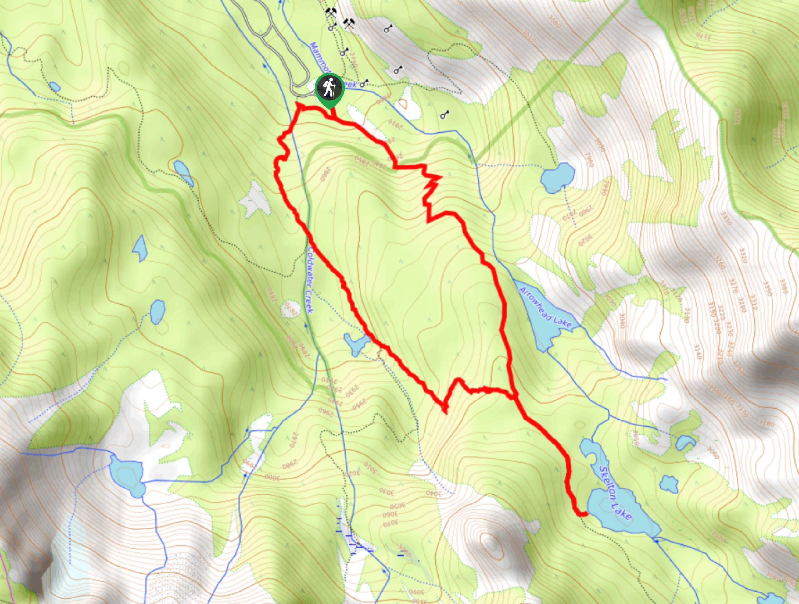
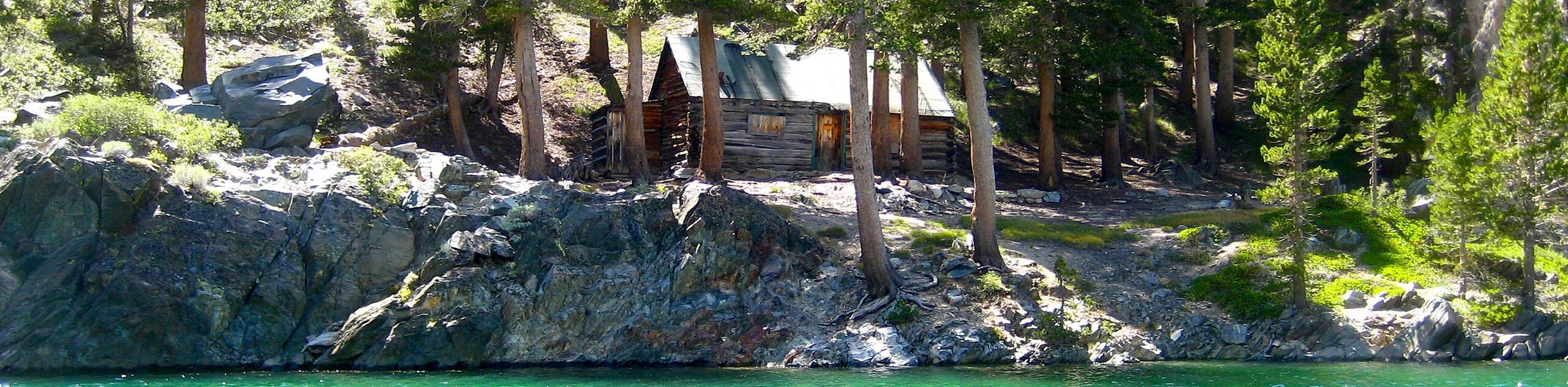
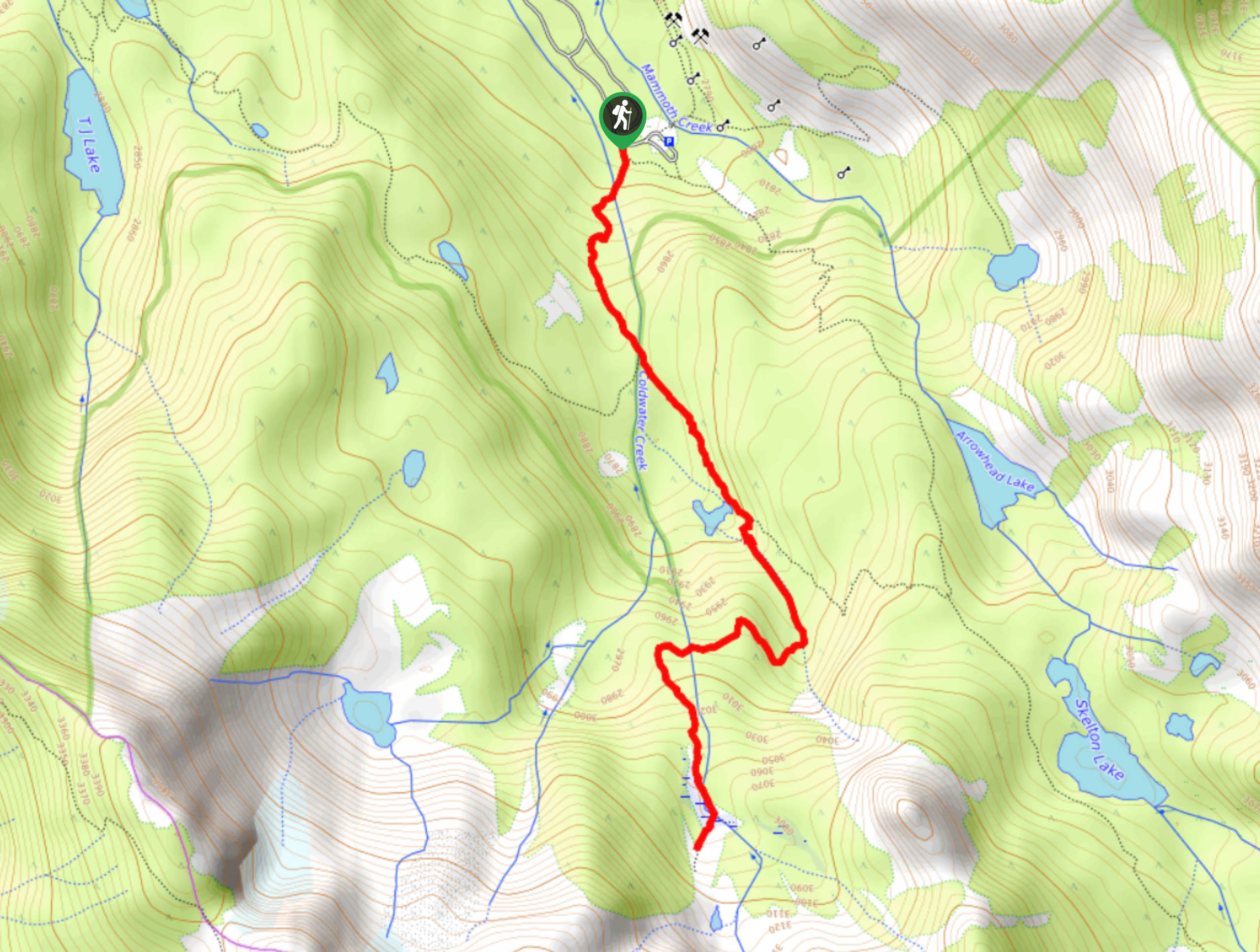
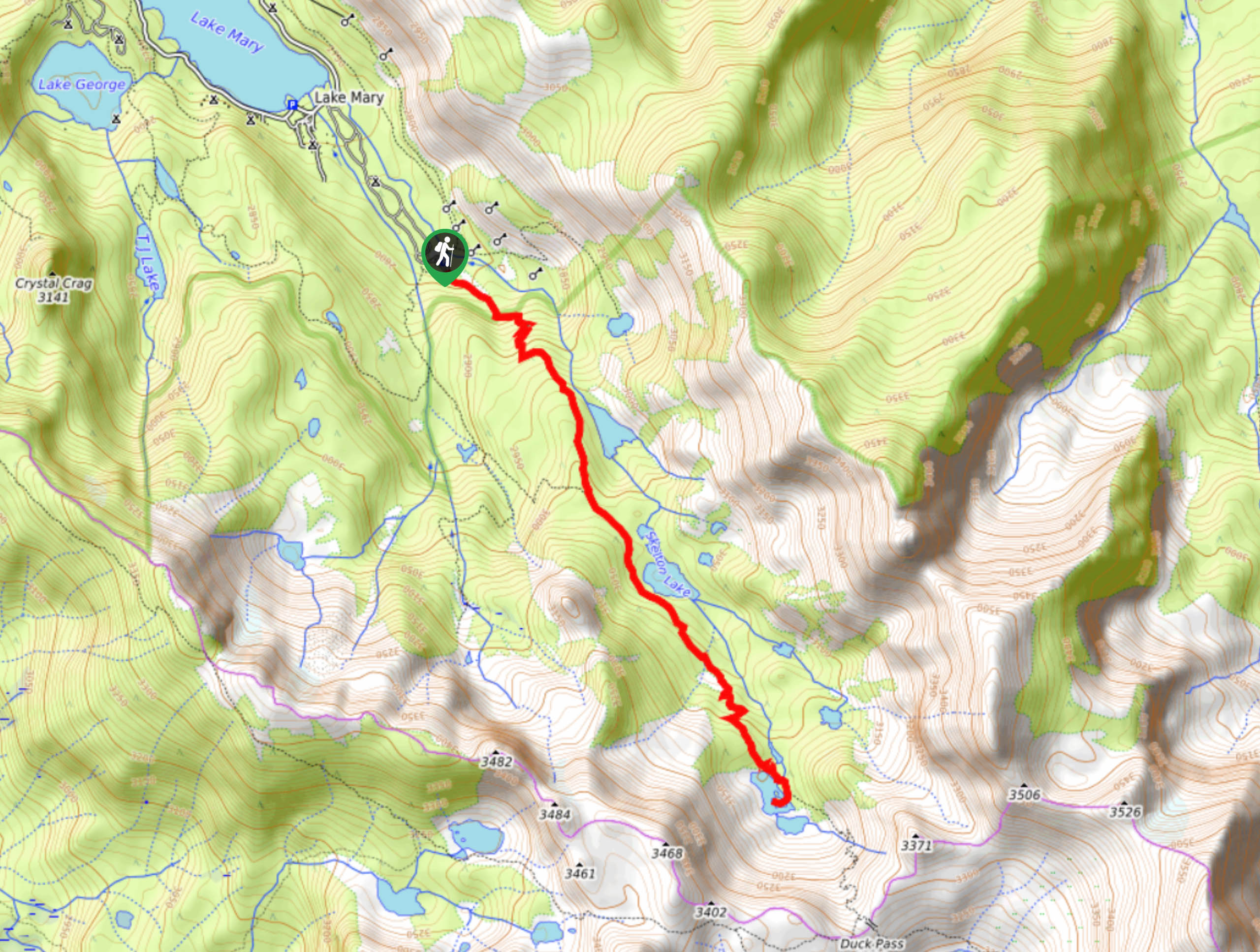
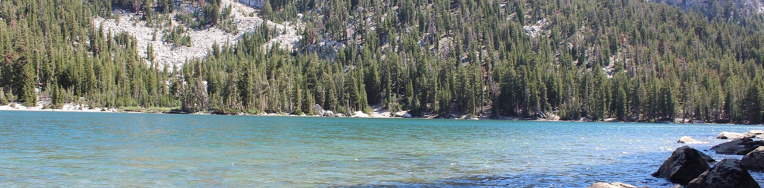
53. Skelton Lake Loop
Difficulty
A beautiful route within Inyo National Forest, the Skelton Lake Loop traverses the stunning alpine… Read More
54. La Hupp Picnic Area To Green Lake Trail
Difficulty
A trail that boasts incredible views of the surrounding alpine environment, the La Hupp Picnic… Read More
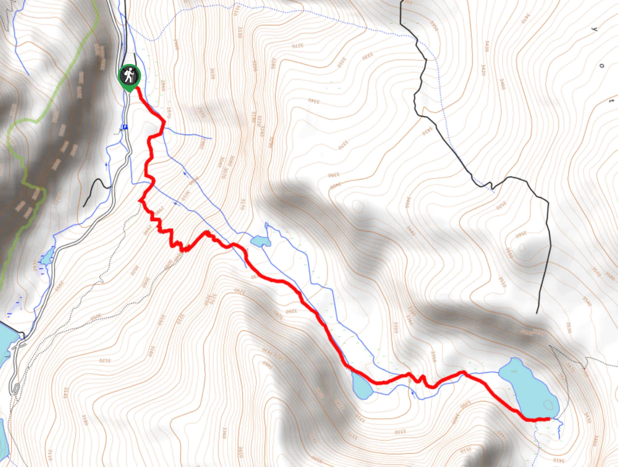
55. Yost Creek to Yost Lake Trail
Difficulty
Yost Creek to Yost Lake Trail is a beautiful route within Inyo National Forest that… Read More
56. Steelhead Lake via McGee Pass Trail
Difficulty
Steelhead Lake cia McGee Pass Trail is a beautiful route within Inyo National Forest. A… Read More

57. Cirque Lake via Cottonwood Lakes Trail
Difficulty
Cirque Lake via Cottonwood Lakes Trail is an incredible route within the eastern Sierra Nevada… Read More
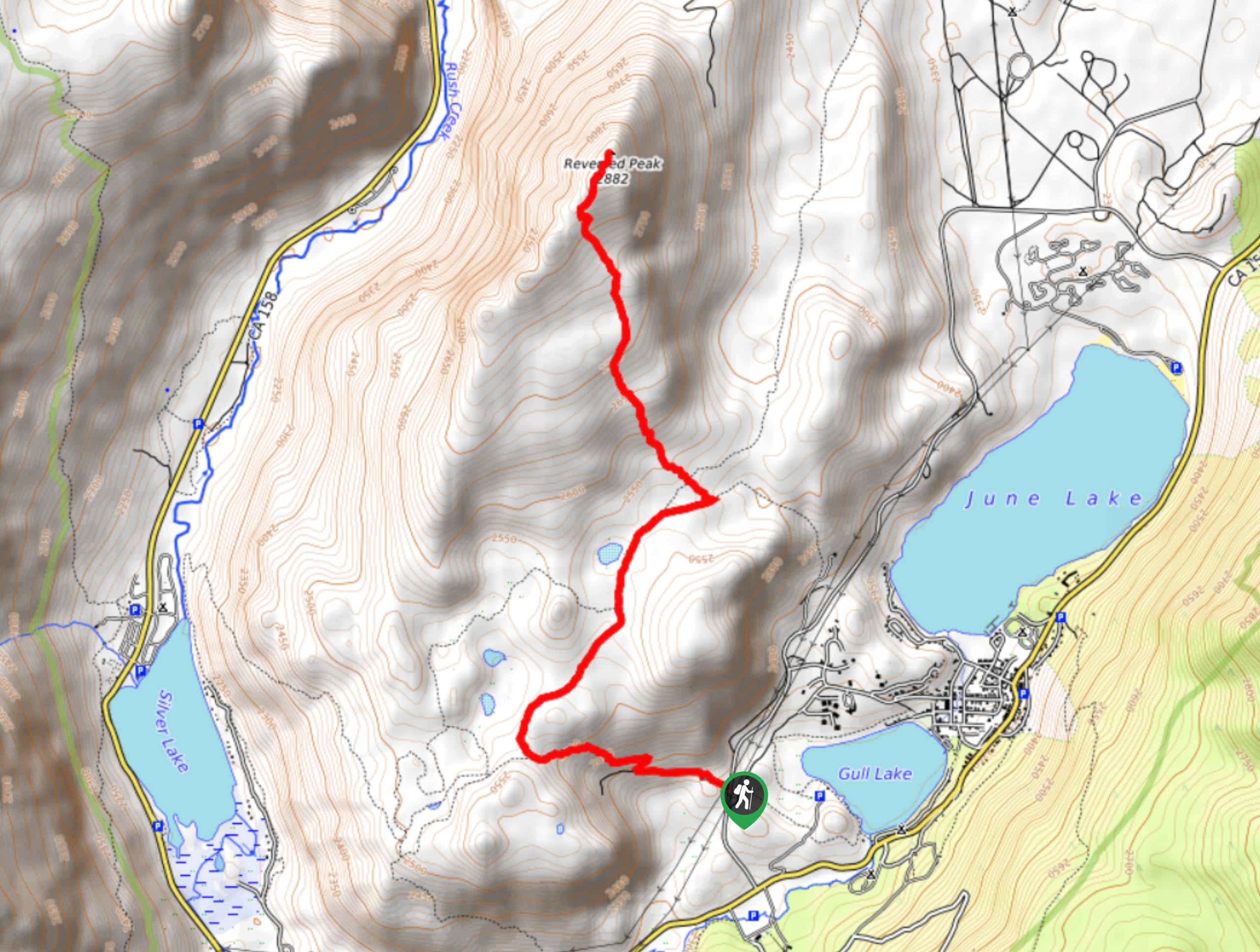
58. Reversed Peak Trail
Difficulty
Reversed Peak Trail is undoubtedly an underrated route within Inyo National Forest. A lightly trafficked… Read More
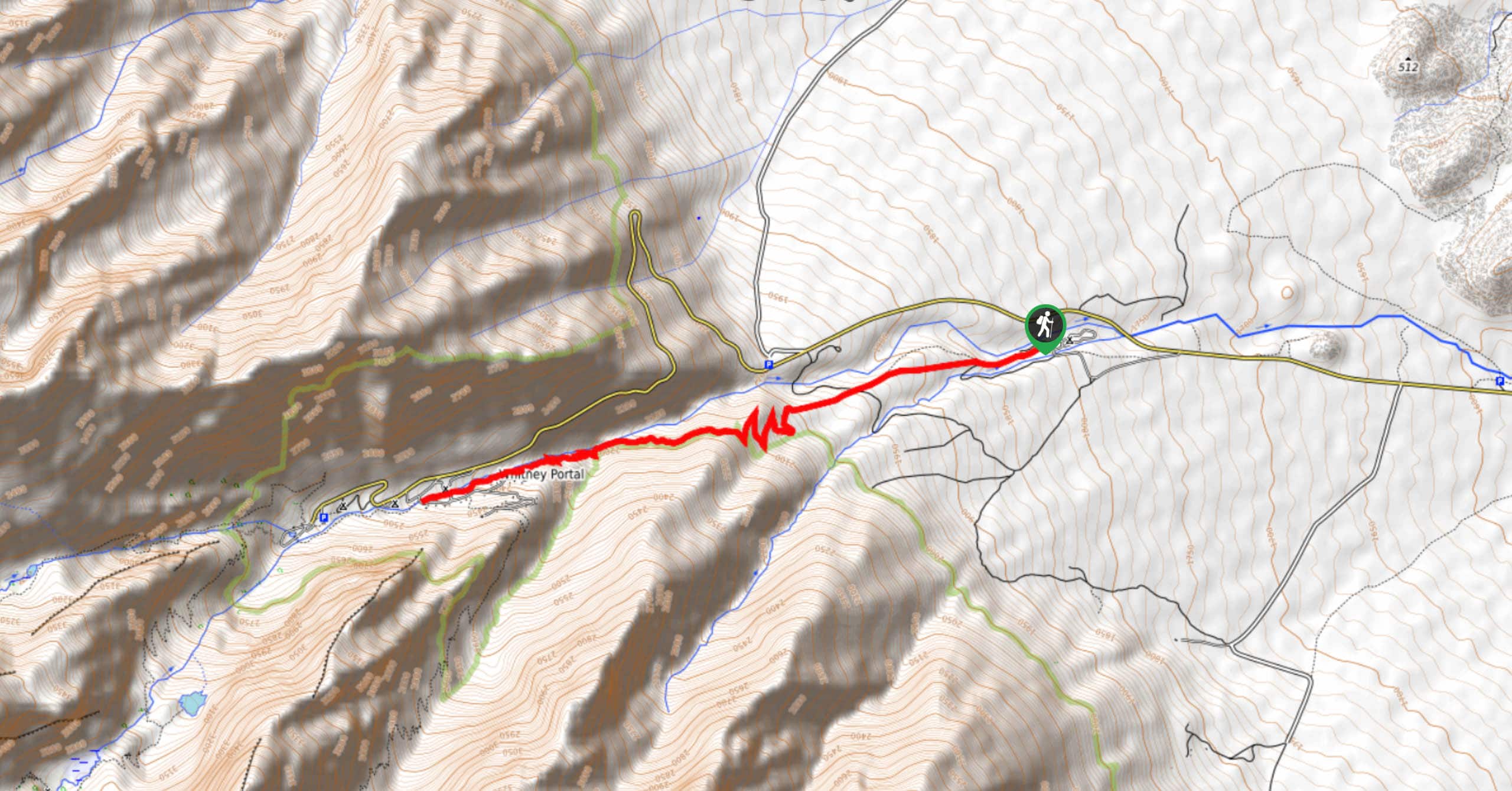
59. Lone Pine Campground to Whitney Portal Trail
Difficulty
The Lone Pine Campground to Whitney Portal Trail boasts incredible views of the surrounding landscape.… Read More
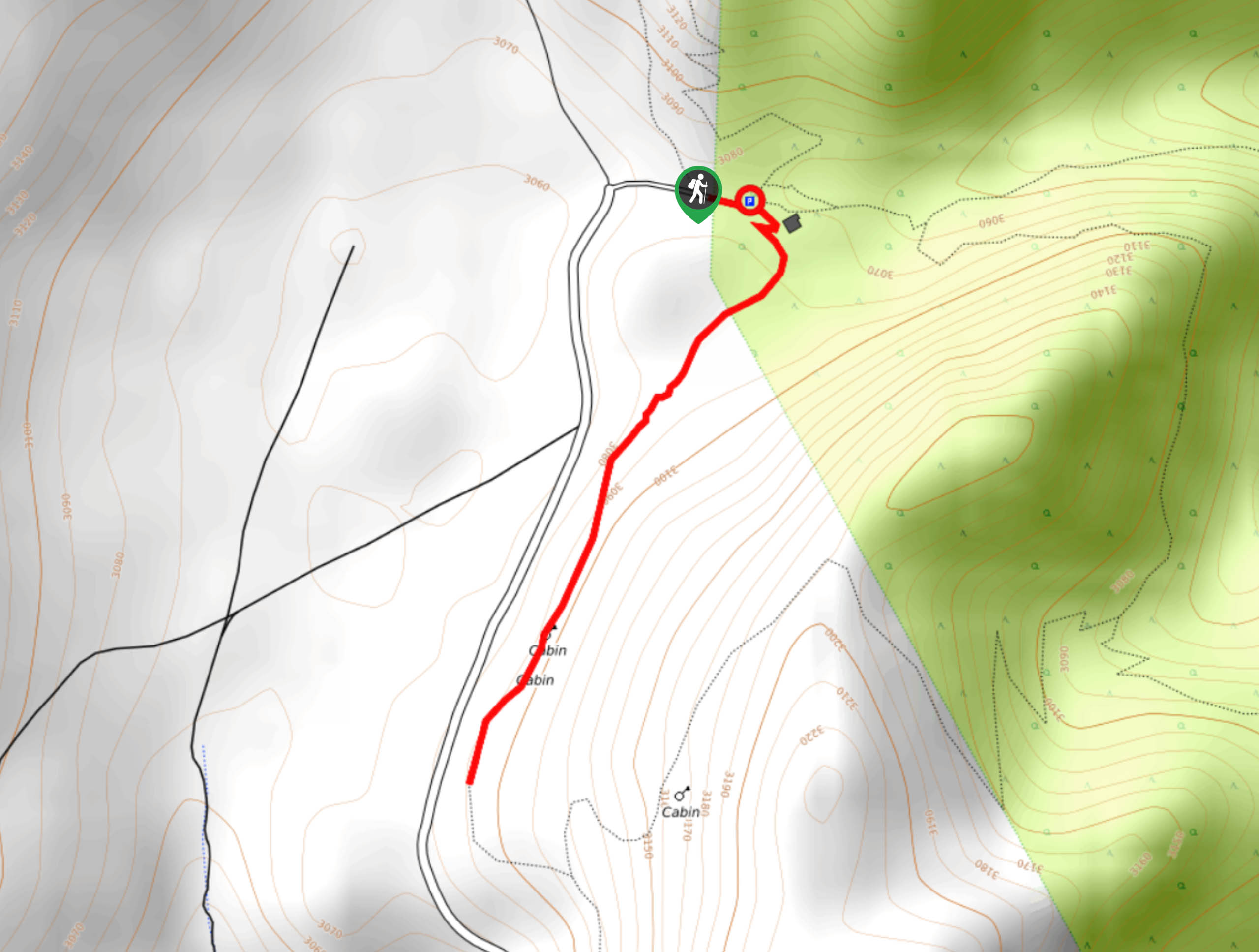
60. Cabin Trail to Methuselah Loop
Difficulty
Cabin Trail to Methuselah Loop is an excellent choice for your next hiking route within… Read More
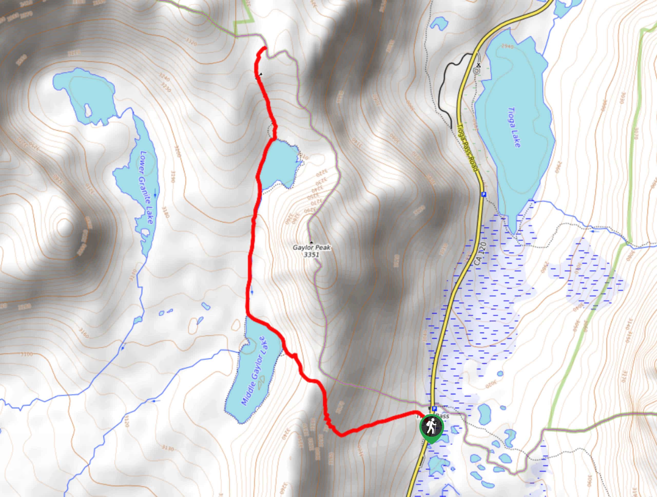
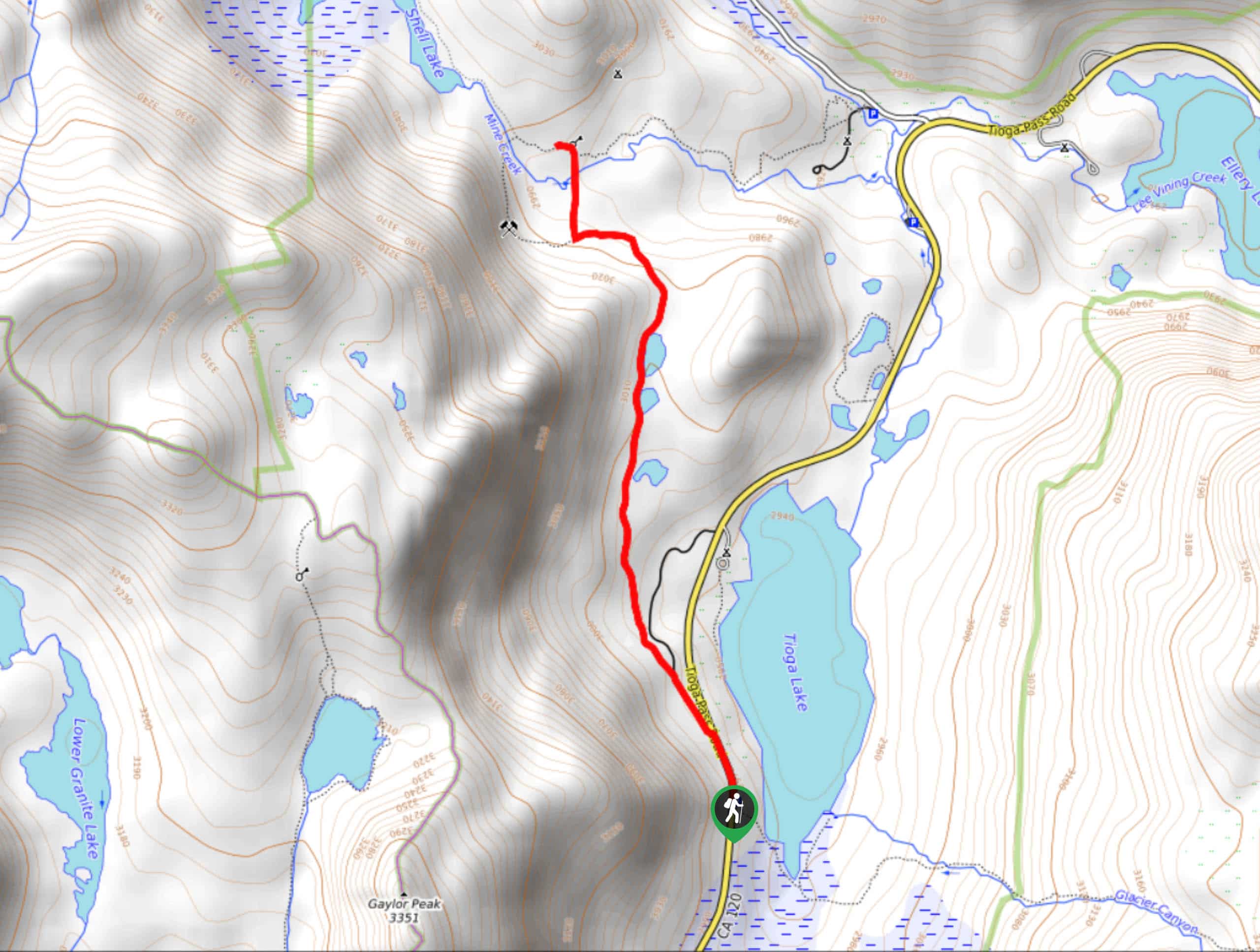
61. Great Sierra Mine via Gaylor Lakes Trail
Difficulty
The Great Serra Mine via Gaylor Lakes Trail is a stunning route that takes you… Read More
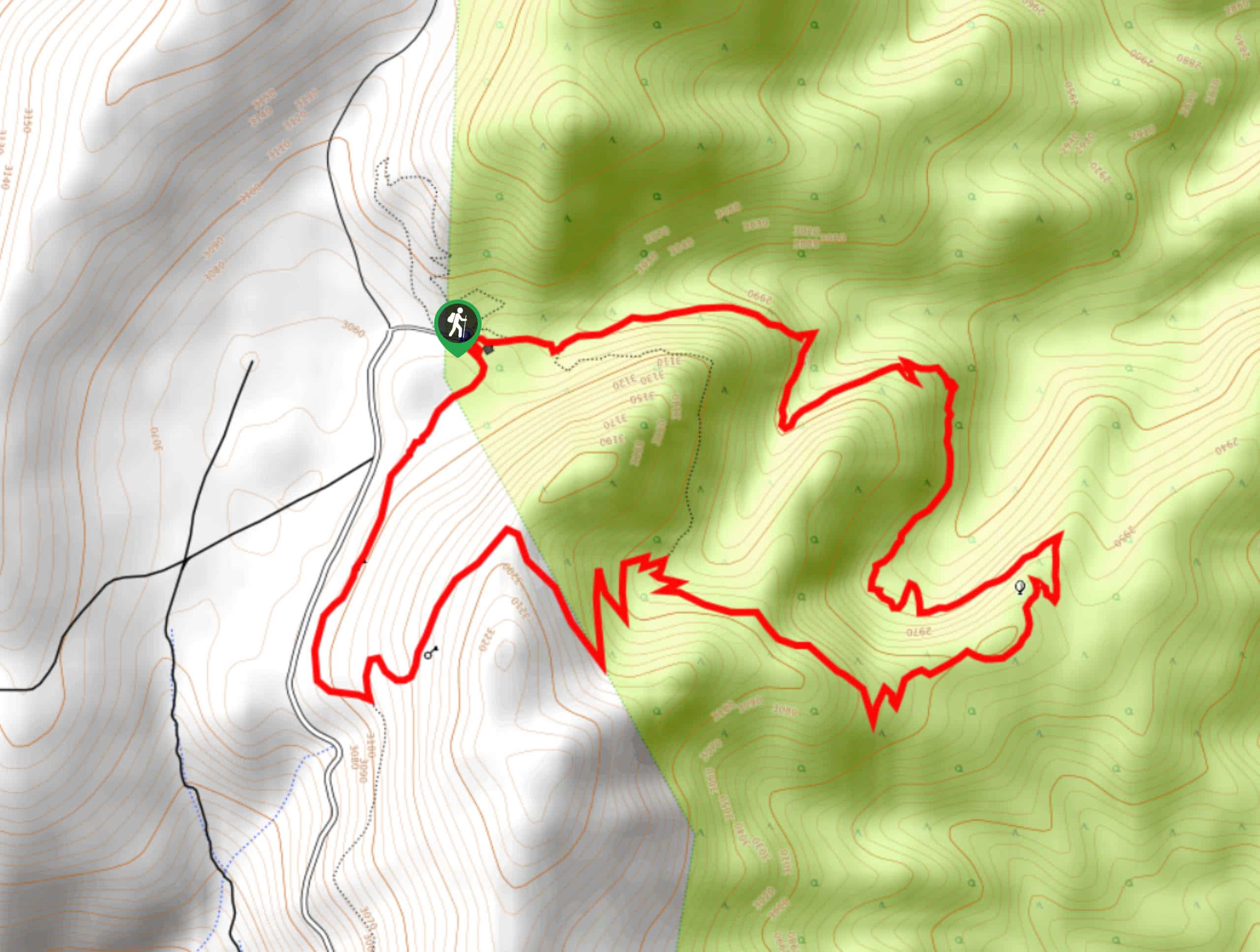
62. Nunatak Nature Trail
Difficulty
Nunatak Nature Trail is an ideal route for those seeking a casual hiking experience! Short… Read More
63. Sierra Viewpoint Trail
Difficulty
The Sierra Viewpoint Trail is a short route with hardly any notable elevation incline and… Read More
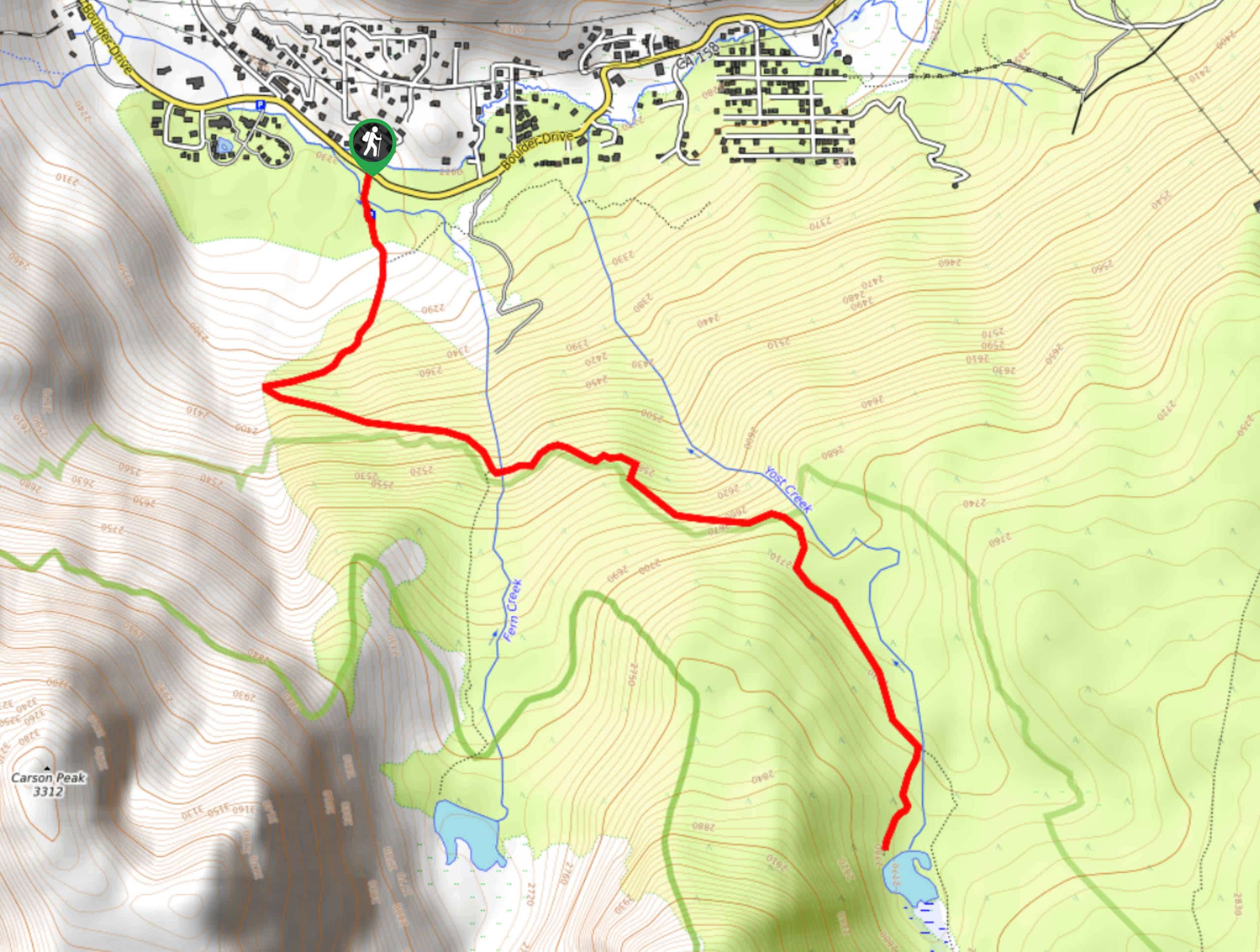
64. June Lake Loop Trail to Yost Creek Trail
Difficulty
An easily accessible route within Inyo National Forest, June Lake Loop Trail to Yost Creek… Read More
65. Dinosaur Falls Trail
Difficulty
Dinosaur Falls Trail is a beautiful route within Inyo National Forest. Easily accessible, the route… Read More
66. Bennettville Trail
Difficulty
The Bennettville Trail is an easily accessible, family-friendly route within Inyo National Forest. The route… Read More
67. Lake George to Deer Lakes Trail
Difficulty
Lake George to Deer Lakes Trail is an easily accessible, yet fairly challenging route within… Read More
68. Gable Lakes Trail
Difficulty
A challenging route within Inyo National Forest, the Gable Lakes Trail leads you through stunning… Read More
69. Upper Pine Lake via Italy Pass Trail
Difficulty
A more challenging route, Upper Pine Lake via Italy Pass Trail is ideal for more… Read More
70. Cottonwood Lakes and Army Pass Trail
Difficulty
Cottonwood Lakes and Army Pass Trail is a scenic route within the high alpine environment… Read More

71. Mountain View and 3S89 Road Loop
Difficulty
Mountain View and 3S89 Road Loop is a delightful route within Inyo National Forest. Leading… Read More

72. Lakes Basin Path to Pack Trail
Difficulty
A more challenging route within Inyo National Forest, Lakes Basin Path to Pack Trail is… Read More

73. Valentine Lake Trail
Difficulty
An underrated route within Inyo National Forest, Valentine Lake Trail is without a doubt worth… Read More
Are we missing your favourite hike?
Tell us! If you've got photos, a GPS track and know the hike, we'd love to share your favourite hike with the rest of the 10Adventures community.