
Lower Rock Creek Canyon Trail
View Photos
Lower Rock Creek Canyon Trail
Difficulty Rating:
A scenic route within Inyo National Forest, the Lower Rock Creek Canyon Trail is an excellent route for intermediate hikes, and families with older children. Autumn is an especially nice time of year to do the route, as the colors of the changing leaves are sublime.
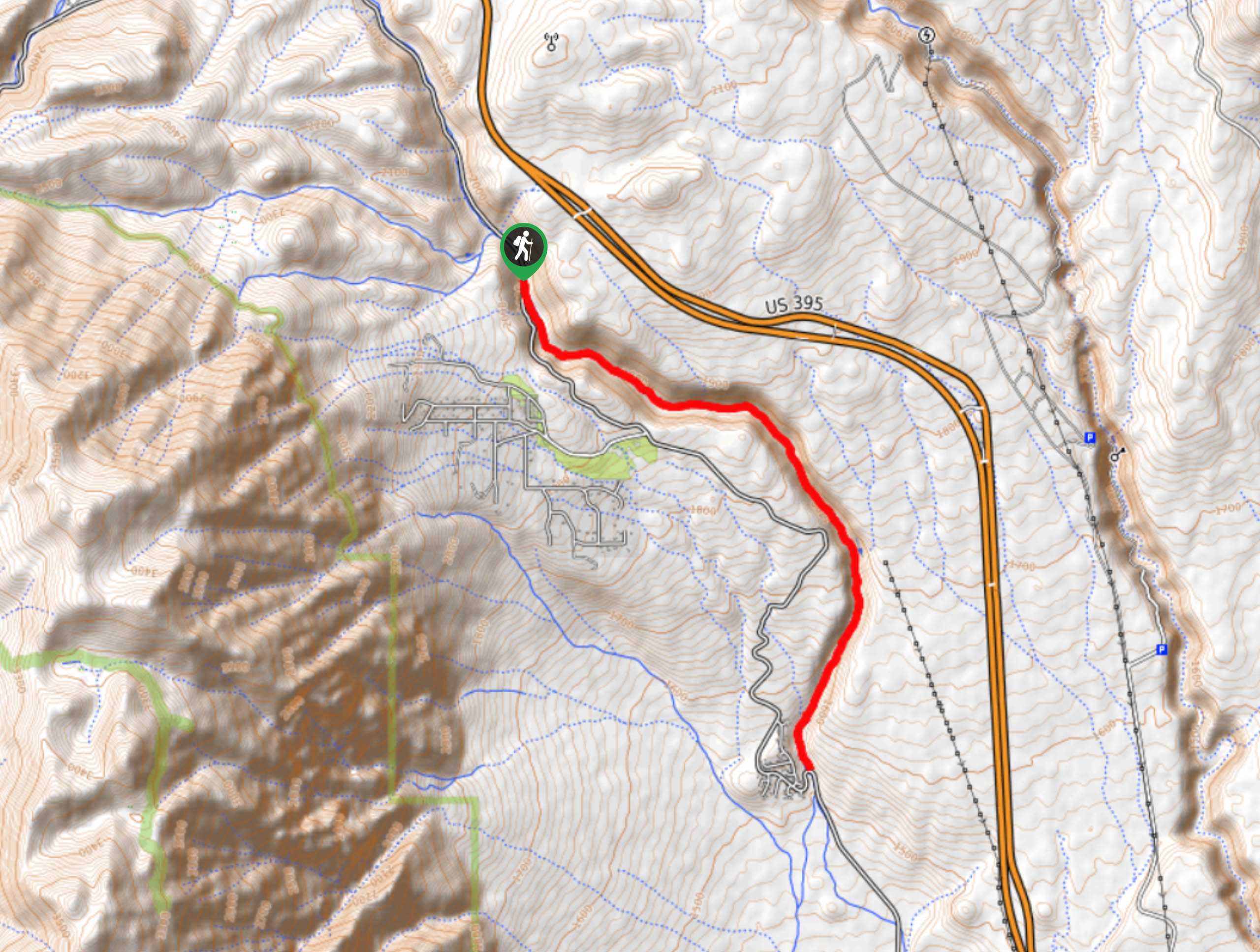
Getting there
The trailhead for Lower Rock Creek Canyon Trail is located off Lower Rock Creek Road.

About
| Backcountry Campground | No |
| When to do | April-November |
| Pets allowed | Yes |
| Family friendly | Older Children only |
| Route Signage | Average |
| Crowd Levels | High |
| Route Type | Out and back |
Lower Rock Creek Canyon Trail
Elevation Graph
Weather
Lower Rock Creek Canyon Trail Description
As Lower Rock Creek Canyon Trail is a popular route within Inyo National Forest, it can become rather busy at times. Those who are seeking a more secluded hiking experience may want to arrive at the trailhead early in the morning to avoid the larger crowds that sometimes develop midday or even skip the route altogether in favor of a less frequented one.
Having parked your vehicle, follow Lower Rock Creek Trail as it makes its way south alongside Lower Rock Creek. From here, the route is incredibly easy to follow. Simply follow the trail as it runs adjacent to Lower Rock Creek. The route is within a canyon, and after the canyon walls taper off and you arrive at some private property, all you need to do is backtrack your steps towards the trailhead.
Similar hikes to the Lower Rock Creek Canyon Trail hike

Valentine Lake Trail
An underrated route within Inyo National Forest, Valentine Lake Trail is without a doubt worth the effort! Boasting sublime scenery…

Lakes Basin Path to Pack Trail
A more challenging route within Inyo National Forest, Lakes Basin Path to Pack Trail is ideal for more experienced hikers…

Mountain View and 3S89 Road Loop
Mountain View and 3S89 Road Loop is a delightful route within Inyo National Forest. Leading you through a lovely forested…
Comments