

Lakes Basin Path to Pack Trail
View Photos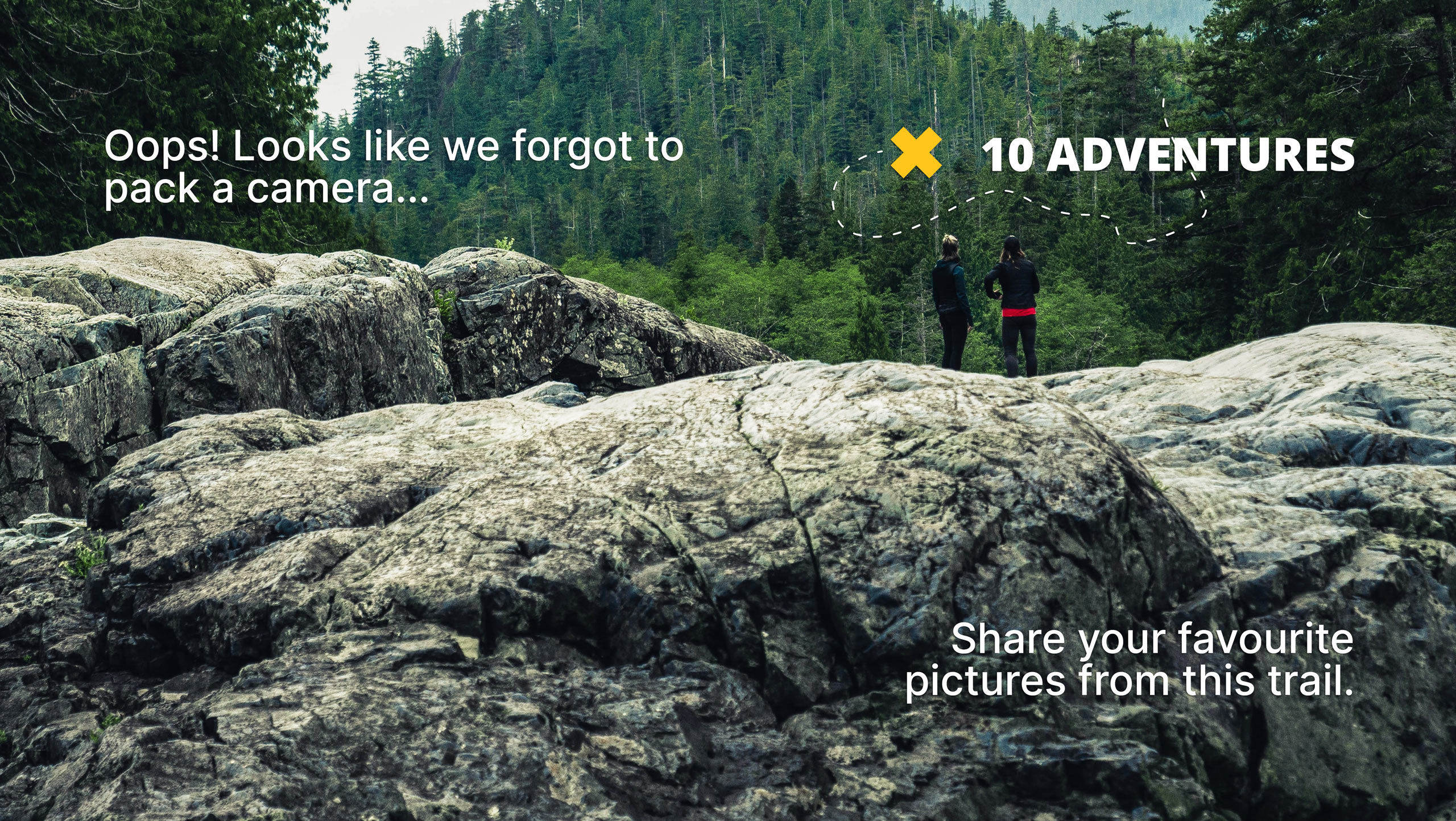
Lakes Basin Path to Pack Trail
Difficulty Rating:
A more challenging route within Inyo National Forest, Lakes Basin Path to Pack Trail is ideal for more experienced hikers who are looking for a challenge. The route traverses the stunning alpine environment of the eastern Sierra Nevada Mountain range and takes you alongside charming creeks and picturesque lakes.
Getting there
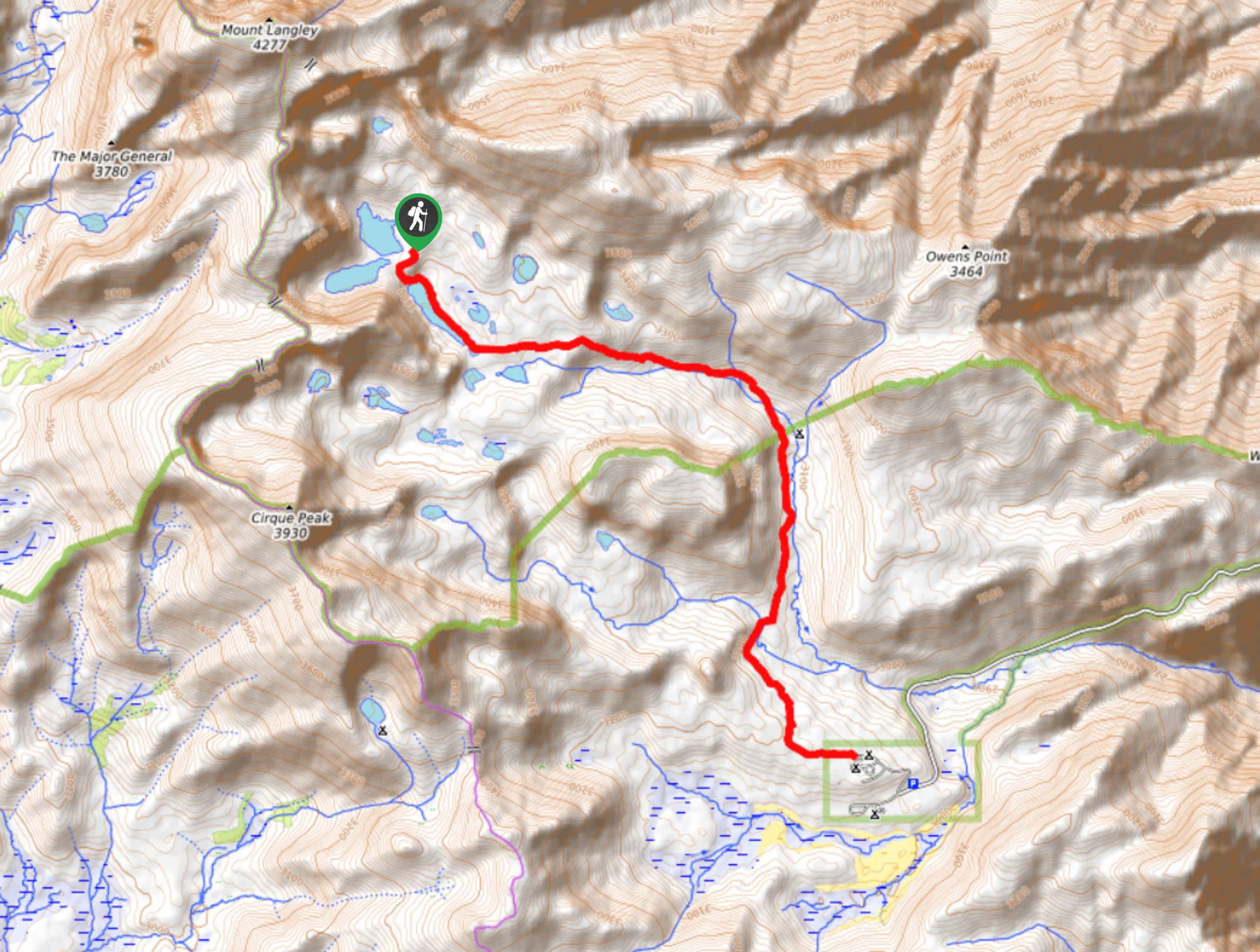
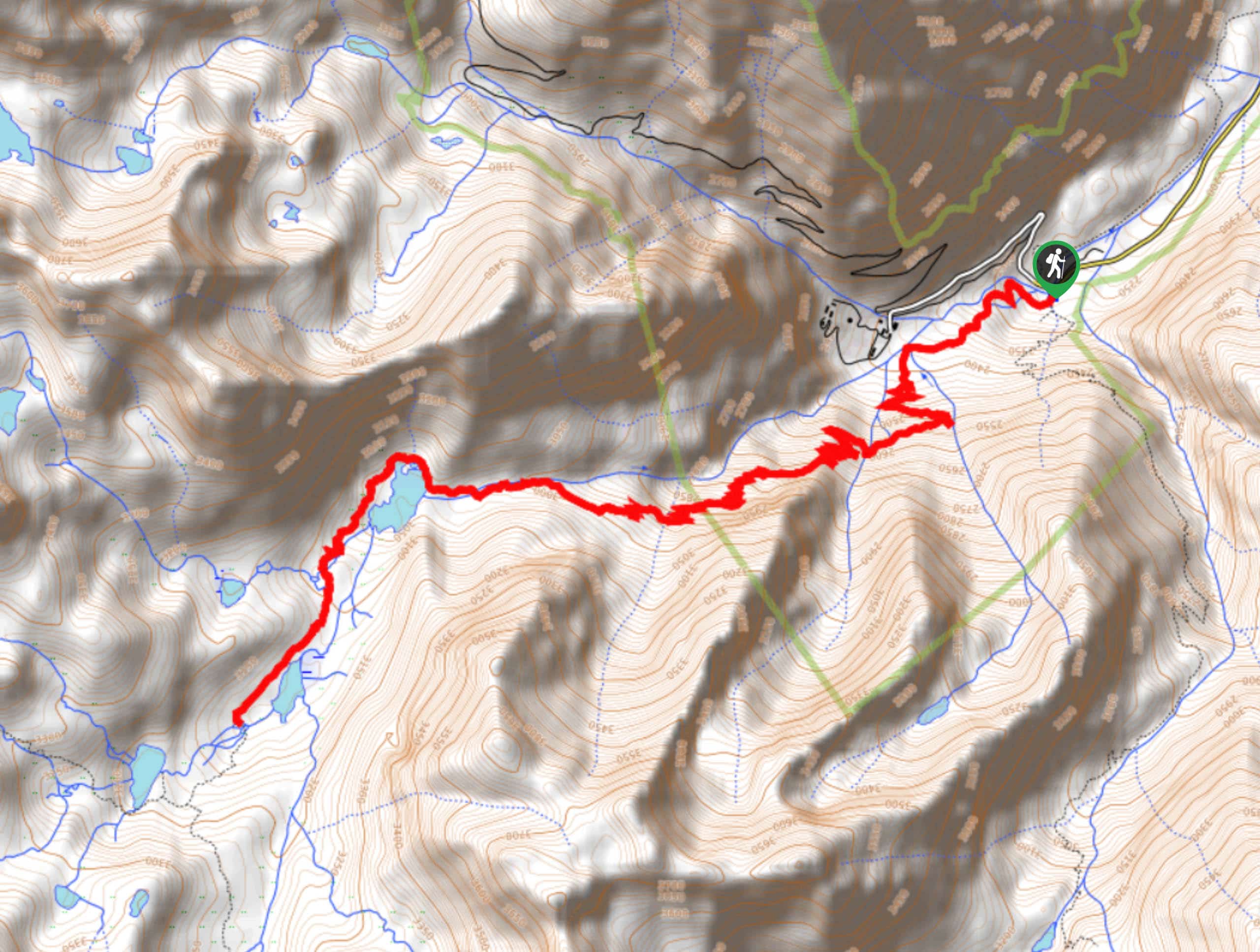
The trailhead for Lakes Basin to Pack Trail is located off Lake Mary Road.

About
| Backcountry Campground | |
| When to do | March-April |
| Pets allowed | Yes |
| Family friendly | No |
| Route Signage | Poor |
| Crowd Levels | High |
| Route Type | Out and back |
Lakes Basin Path to Pack Trail
Elevation Graph
Weather
Lakes Basin Path to Pack Trail Description
As the Lakes Basin Path to Pack Trail is within the alpine environment of the eastern Sierra Nevada Mountain range, care should be taken when attempting. It is important that you monitor yourself and your group members for the effects of altitude sickness and that you drink plenty of water and eat constantly to help mitigate its effects.
Having parked your vehicle, follow Lakes Basin Path shortly before taking Horseshoe Lake Trail to the south. Horseshoe Lake Trail will wrap around the southern and western shoreline of Horseshoe Lake before veering sharply to the southwest and arriving at Mammoth Pass Cutoff Trail. Follow Mammoth Pass Cutoff Trail as it makes its way along the northern shore of McLeod Lake and continue westwards.
With craggy terrain to its east, Mammoth Pass Cutoff Trail will veer south and arrive at a junction within the trail. At the junction, stay on Mammoth Pass Cutoff Trail by taking the eastern pathway, and continue on it until you reach the next junction. From here, follow John Muir Trail as it makes its way north, past the Red Cones, and delivers you to the route’s end. Take some time to enjoy the sightlines before backtracking your steps towards the trailhead.
Similar hikes to the Lakes Basin Path to Pack Trail hike

Valentine Lake Trail
An underrated route within Inyo National Forest, Valentine Lake Trail is without a doubt worth the effort! Boasting sublime scenery…
Cottonwood Lakes and Army Pass Trail
Cottonwood Lakes and Army Pass Trail is a scenic route within the high alpine environment of the eastern Sierra Nevada…
Upper Pine Lake via Italy Pass Trail
A more challenging route, Upper Pine Lake via Italy Pass Trail is ideal for more experienced hikers who are seeking…
Comments