
Cottonwood Lakes and Army Pass Trail
View Photos
Cottonwood Lakes and Army Pass Trail
Difficulty Rating:
Cottonwood Lakes and Army Pass Trail is a scenic route within the high alpine environment of the eastern Sierra Nevada Mountain range. A longer - and therefore more challenging route - the trail is ideal for more experienced hikers and those seeking a challenge. Boasting great views of the surrounding Inyo National Forest landscape, Cottonwood Lakes and Army Pass Trail will not leave you disappointed.
Getting there
The trailhead for Cottonwood Lakes and Army Pass Trail is located at Cottonwood Lakes Trailhead Campground.

About
| Backcountry Campground | |
| When to do | April-September |
| Pets allowed | No |
| Family friendly | No |
| Route Signage | Average |
| Crowd Levels | Moderate |
| Route Type | Out and back |
Cottonwood Lakes and Army Pass Trail
Elevation Graph
Weather
Cottonwood Lakes and Army Pass Trail Description
As Cottonwood Lakes and Army Pass Trail is within the high alpine environment of the eastern Sierra Nevada Mountain range, it is important that you prepare yourself for the mountainous conditions. The weather can change rapidly along the route’s duration, so we recommend bringing extra clothing so you can layer up as needed. Likewise, due to the route’s high elevation, it is important that you monitor yourself and your group members for the effects of altitude sickness.
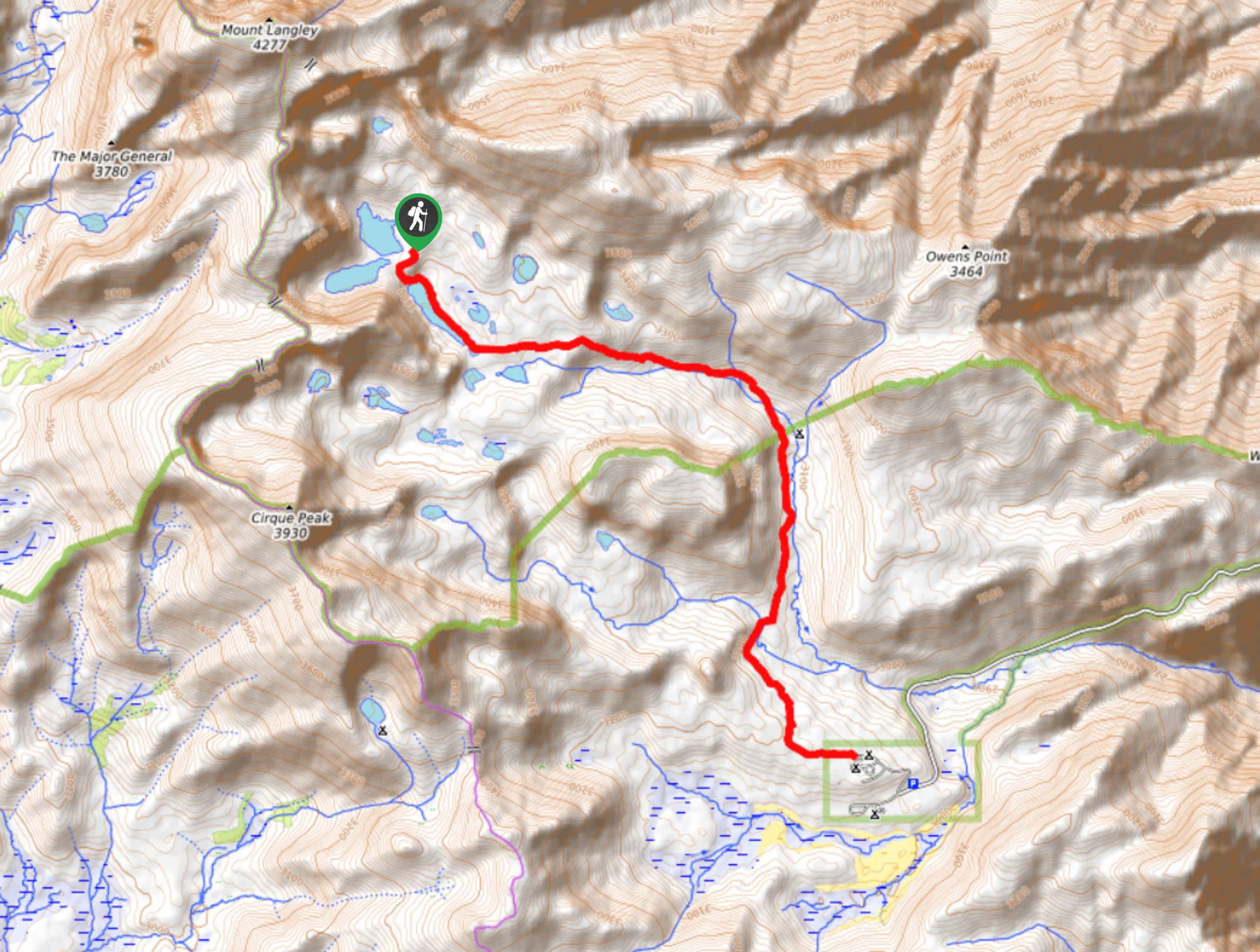
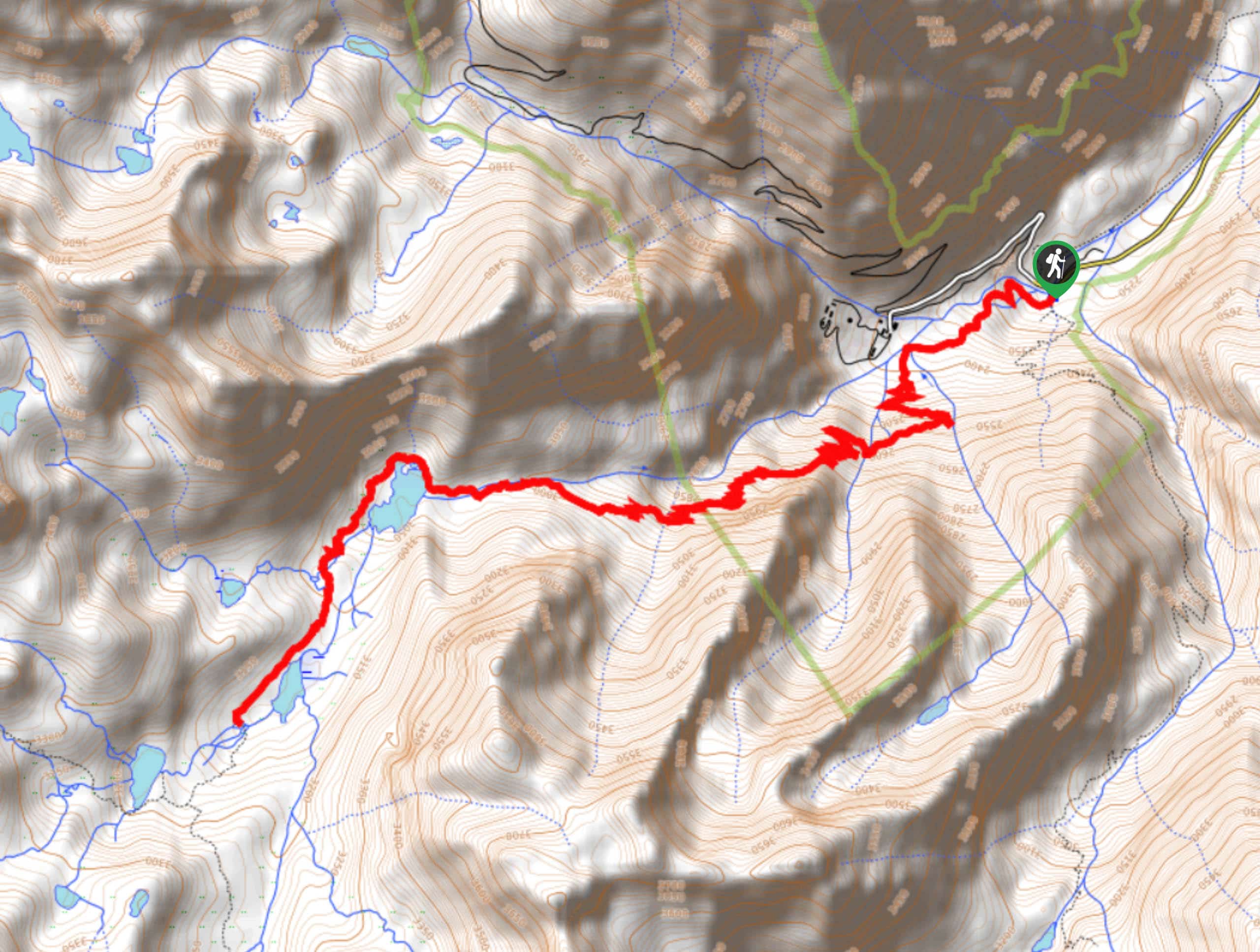
With your vehicle parked, locate the trailhead and follow Cottonwood Lakes Trail as it makes its way northwest. The terrain will gradually incline as you reach a junction within the trail. At the junction, continue on along Cottonwood Lakes Trail by taking the eastern pathway. From here, carry on along Cottonwood Lakes Trail as it heads west adjacent to Cottonwood Creek.
The Cottonwood Lakes and Army Pass Trail will then cross Cottonwood Creek to its northern side, and begin to veer west. Picking up elevation as it goes, the route will diverge from Cottonwood Creek before arriving at several junction points within the trail. At each junction, continue on along Cottonwood Lakes Trail as it bypasses several small lakes and delivers you to the Cottonwood Lakes cluster. Once you’ve arrived, take some time to enjoy the scenery! When you’re ready to return to the trailhead, simply backtrack your steps.
Similar hikes to the Cottonwood Lakes and Army Pass Trail hike

Valentine Lake Trail
An underrated route within Inyo National Forest, Valentine Lake Trail is without a doubt worth the effort! Boasting sublime scenery…

Lakes Basin Path to Pack Trail
A more challenging route within Inyo National Forest, Lakes Basin Path to Pack Trail is ideal for more experienced hikers…
Upper Pine Lake via Italy Pass Trail
A more challenging route, Upper Pine Lake via Italy Pass Trail is ideal for more experienced hikers who are seeking…
Comments