
Upper Pine Lake via Italy Pass Trail
View Photos
Upper Pine Lake via Italy Pass Trail
Difficulty Rating:
A more challenging route, Upper Pine Lake via Italy Pass Trail is ideal for more experienced hikers who are seeking a challenge. That being said, with great views of the surrounding Inyo National Forest landscape, Upper Pine Lake via Italy Pass Trail is more than worth the effort!
Getting there
The trailhead for Upper Pine Lake via Italy Pass Trail is located at a parking lot off of Pine Creek Road.

About
| Backcountry Campground | No |
| When to do | July-October |
| Pets allowed | Yes - On Leash |
| Family friendly | No |
| Route Signage | Average |
| Crowd Levels | Moderate |
| Route Type | Out and back |
Upper Pine Lake via Italy Pass Trail
Elevation Graph
Weather
Upper Pine Lake via Italy Pass Trail Description
A longer route with a fair amount of elevation, Upper Pine Lake via Italy Pass Trail, is likely not appropriate for children and those seeking a more casual hiking experience. Due to the route’s difficulty, you must prepare yourself by wearing good hiking shoes and bringing ample amounts of water.
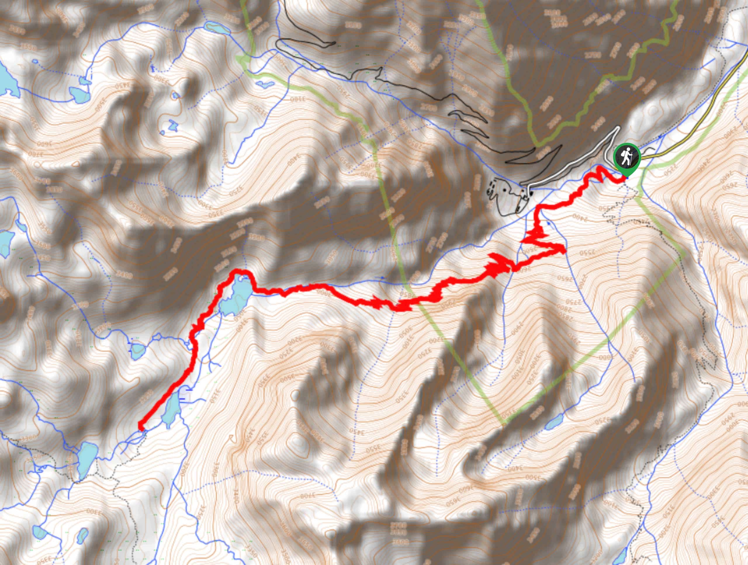
Once you have parked your car, locate the trailhead at the southern section of the parking lot. Follow the Pine Creek Pass Trail as it makes its way west, crossing several creeks as it goes. The Pine Creek Pass Trail will begin to veer south, and the pathway will turn into a series of switchbacks to help aid you along the steep terrain. With the initial switchback section completed, the route will head to the west and once again turn into a series of switchbacks.
With the switchbacks completed, the Pine Creek Pass Trail will deliver you to Pine Lake, where it will follow the northern shore before veering south. Having passed Pine Lake on its western shore, the route will arrive at Upper Pine Lake before ending at a scenic vista. Take your time to enjoy the views, and maybe stop for a picnic! Once you’re ready, simply backtrack your steps towards the trailhead.
Similar hikes to the Upper Pine Lake via Italy Pass Trail hike

Valentine Lake Trail
An underrated route within Inyo National Forest, Valentine Lake Trail is without a doubt worth the effort! Boasting sublime scenery…

Lakes Basin Path to Pack Trail
A more challenging route within Inyo National Forest, Lakes Basin Path to Pack Trail is ideal for more experienced hikers…
Cottonwood Lakes and Army Pass Trail
Cottonwood Lakes and Army Pass Trail is a scenic route within the high alpine environment of the eastern Sierra Nevada…
Comments