
Cabin Trail to Methuselah Loop
View Photos
Cabin Trail to Methuselah Loop
Difficulty Rating:
Cabin Trail to Methuselah Loop is an excellent choice for your next hiking route within Inyo National Forest. Boasting sublime views of the surrounding eastern Sierra Nevada mountain landscape, Cabin Trail to Methuselah Loop is a breathtaking trail that is also considered to be an excellent location for wildlife viewing.
Getting there
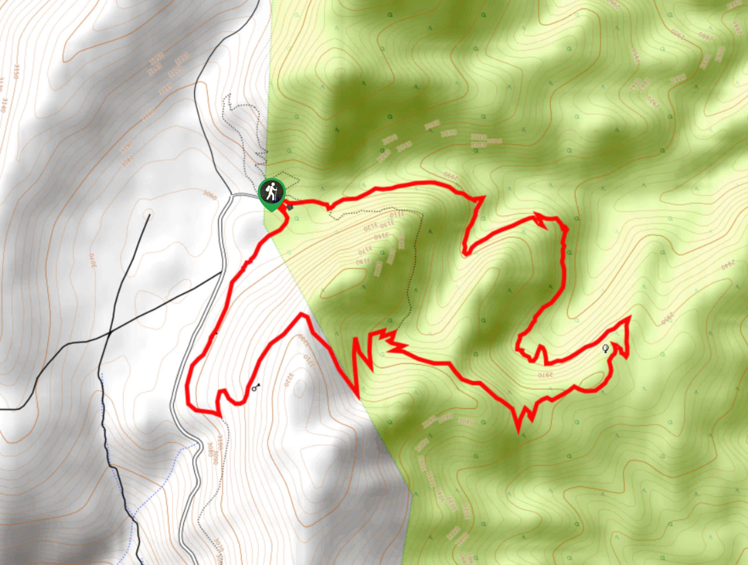
The trailhead for the Cabin Trail to Methuselah Loop is located at the Schulman Grove Picnic Area.

About
| Backcountry Campground | No |
| When to do | April-September |
| Pets allowed | Yes - On Leash |
| Family friendly | Older Children only |
| Route Signage | Average |
| Crowd Levels | Moderate |
| Route Type | Circuit |
Cabin Trail to Methuselah Loop
Elevation Graph
Weather
Cabin Trail to Methuselah Loop Description
As the Cabin Trail to Methuselah Loop is within the high alpine environment of the eastern Sierra Nevada Mountain range, you must prepare for the conditions. Continuously monitor yourself and your group members for the signs of altitude sickness. Be aware that the route will likely be more physically demanding than the numbers indicate due to the high altitude.
Having parked your car at the Schulman Grove Picnic Area, locate the trailhead adjacent to the Schulman Grove Visitor Center. As the Cabin Trail to Methuselah Loop is a circuit, it can be completed in either direction. Whatever direction you choose to complete the trail, as long as you ensure you do not accidentally take any of the veering pathways off the circuit, the route will deliver you back to the trailhead.
Similar hikes to the Cabin Trail to Methuselah Loop hike

Valentine Lake Trail
An underrated route within Inyo National Forest, Valentine Lake Trail is without a doubt worth the effort! Boasting sublime scenery…

Lakes Basin Path to Pack Trail
A more challenging route within Inyo National Forest, Lakes Basin Path to Pack Trail is ideal for more experienced hikers…

Mountain View and 3S89 Road Loop
Mountain View and 3S89 Road Loop is a delightful route within Inyo National Forest. Leading you through a lovely forested…
Comments