Great Sierra Mine via Gaylor Lakes Trail
View Photos
Great Sierra Mine via Gaylor Lakes Trail
Difficulty Rating:
The Great Serra Mine via Gaylor Lakes Trail is a stunning route that takes you through the breathtaking mountainous terrain of Inyo National Forest. Passing alongside two picturesque lakes before delivering you to an interesting abandoned mining complex, the route is ideal for intermediate hikers who are also interested in the history of resource extraction within the region.
Getting there
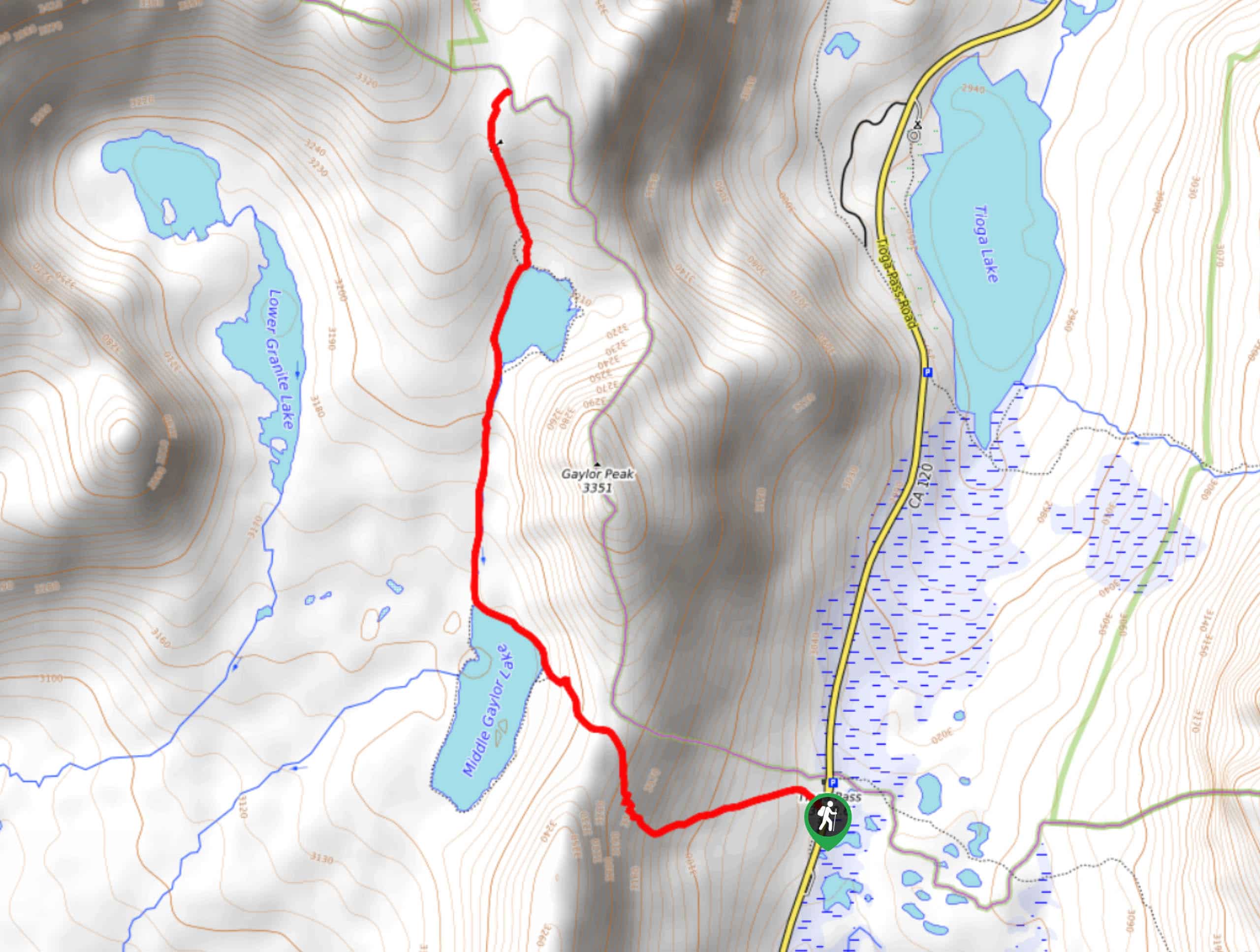
The trailhead for Great Sierra Mine via Gaylor Lakes Trail is located off of Tioga Pass Road.

About
| Backcountry Campground | |
| When to do | May-October |
| Pets allowed | No |
| Family friendly | Older Children only |
| Route Signage | Average |
| Crowd Levels | Moderate |
| Route Type | Out and back |
Great Sierra Mine via Gaylor Lakes Trail
Elevation Graph
Weather
Great Sierra Mine via Gaylor Lakes Trail Description
The Great Sierra Mine via Gaylor Lakes Trail’s length and elevation incline make it likely not appropriate for beginner hikers and those traveling with young children. In similar fashion, the Great Sierra Mine via Gaylor Lakes Trail is within the high alpine environment of the eastern Sierra Nevada Mountain range, so it is therefore important that you monitor yourself and your group members for the effects of altitude sickness. Ensure you take your time and that you are drinking plenty of water and eating food throughout the route’s duration to help mitigate the effects of the high altitude.
Having parked your vehicle, follow the Gaylor Lakes Trail as it heads west over steadily inclining terrain. The route will begin to veer northwards and will eventually bring you to the north shoreline of Middle Gaylor Lake. After passing alongside the lakeshore, the route will continue north adjacent to a creek.
The terrain will plateau as you approach the western shoreline of Upper Gaylor Lake. Once you have reached Upper Gaylor Lake, continue northwards along the pathway that makes its way up the steep terrain in the foreground. Having climbed more elevation, the route will deliver you to Great Sierra Mine, where you should take some time and explore the historic ruins. Once you have had an opportunity to enjoy the abandoned mine, backtrack your steps towards the trailhead.
Similar hikes to the Great Sierra Mine via Gaylor Lakes Trail hike

Valentine Lake Trail
An underrated route within Inyo National Forest, Valentine Lake Trail is without a doubt worth the effort! Boasting sublime scenery…

Lakes Basin Path to Pack Trail
A more challenging route within Inyo National Forest, Lakes Basin Path to Pack Trail is ideal for more experienced hikers…

Mountain View and 3S89 Road Loop
Mountain View and 3S89 Road Loop is a delightful route within Inyo National Forest. Leading you through a lovely forested…
Comments