
Cottonwood Lakes Trail
View Photos
Cottonwood Lakes Trail
Difficulty Rating:
The Cottonwood Lakes Trail is an excellent route within Inyo National Forest. Primarily used as an overnight backpacking route, the trail can be completed in a day as long as you are willing to travel a fair distance. The route is also considered to be an excellent location to view wildlife.
Getting there
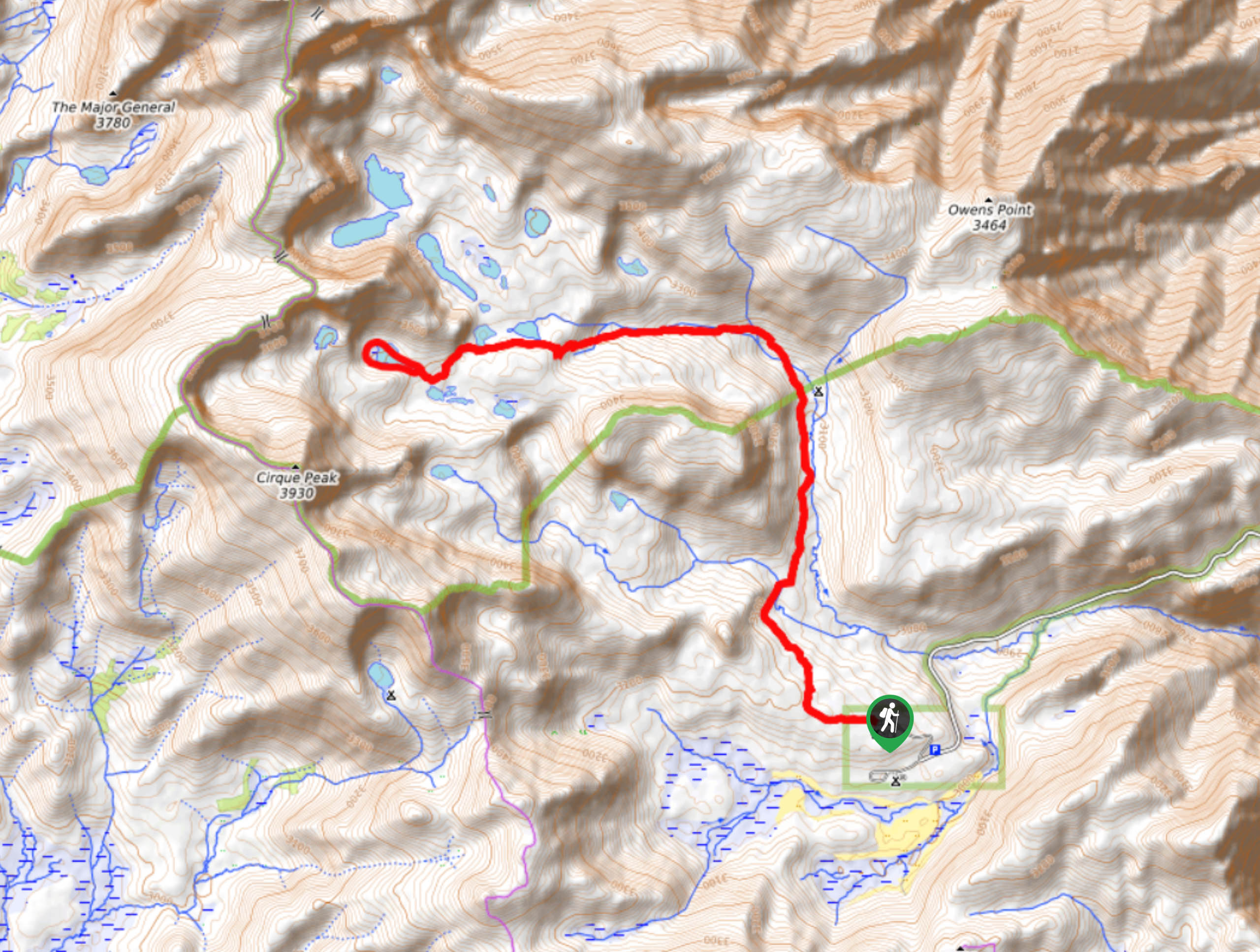
The trailhead for the Cottonwood Lakes Trail is located at Cottonwood Lakes Trailhead Campground.

About
| Backcountry Campground | |
| When to do | April-September |
| Pets allowed | No |
| Family friendly | Older Children only |
| Route Signage | Average |
| Crowd Levels | Moderate |
| Route Type | Lollipop |
Cottonwood Lakes Trail
Elevation Graph
Weather
Cottonwood Lakes Trail Description
The Cottonwood Lakes Trail is long and possesses a fair amount of elevation incline. Rated as moderate, it is likely not appropriate for young children and those seeking a more casual hiking experience. We recommend wearing lots of sunscreen and a good hat to help protect you from the effects of the powerful alpine sun.
With your vehicle parked at Cottonwood Lakes Trailhead Campground, follow Cottonwood Lakes Trail as it makes its way northwest across steadily inclining terrain. The pathway will continue on its northwestern heading, travelling adjacent to some craggy terrain to its west. After crossing a creek, you will arrive at a junction within the trail. At the junction, continue on along the Cottonwood Lakes Trail, and continue to do so at the next three junctions.
At the fourth junction, take the New Army Pass Trail as it makes its way west adjacent to Cottonwood Creek. Keep along the New Army Pass Trail as it passes alongside both Cottonwood Lakes, and then circumnavigates Long Lake. Having completed your circumnavigation of Long Lake, simply backtrack your steps towards the trailhead.
Similar hikes to the Cottonwood Lakes Trail hike

Valentine Lake Trail
An underrated route within Inyo National Forest, Valentine Lake Trail is without a doubt worth the effort! Boasting sublime scenery…

Lakes Basin Path to Pack Trail
A more challenging route within Inyo National Forest, Lakes Basin Path to Pack Trail is ideal for more experienced hikers…

Mountain View and 3S89 Road Loop
Mountain View and 3S89 Road Loop is a delightful route within Inyo National Forest. Leading you through a lovely forested…
Comments