Saddlebag Lake Trail
View Photos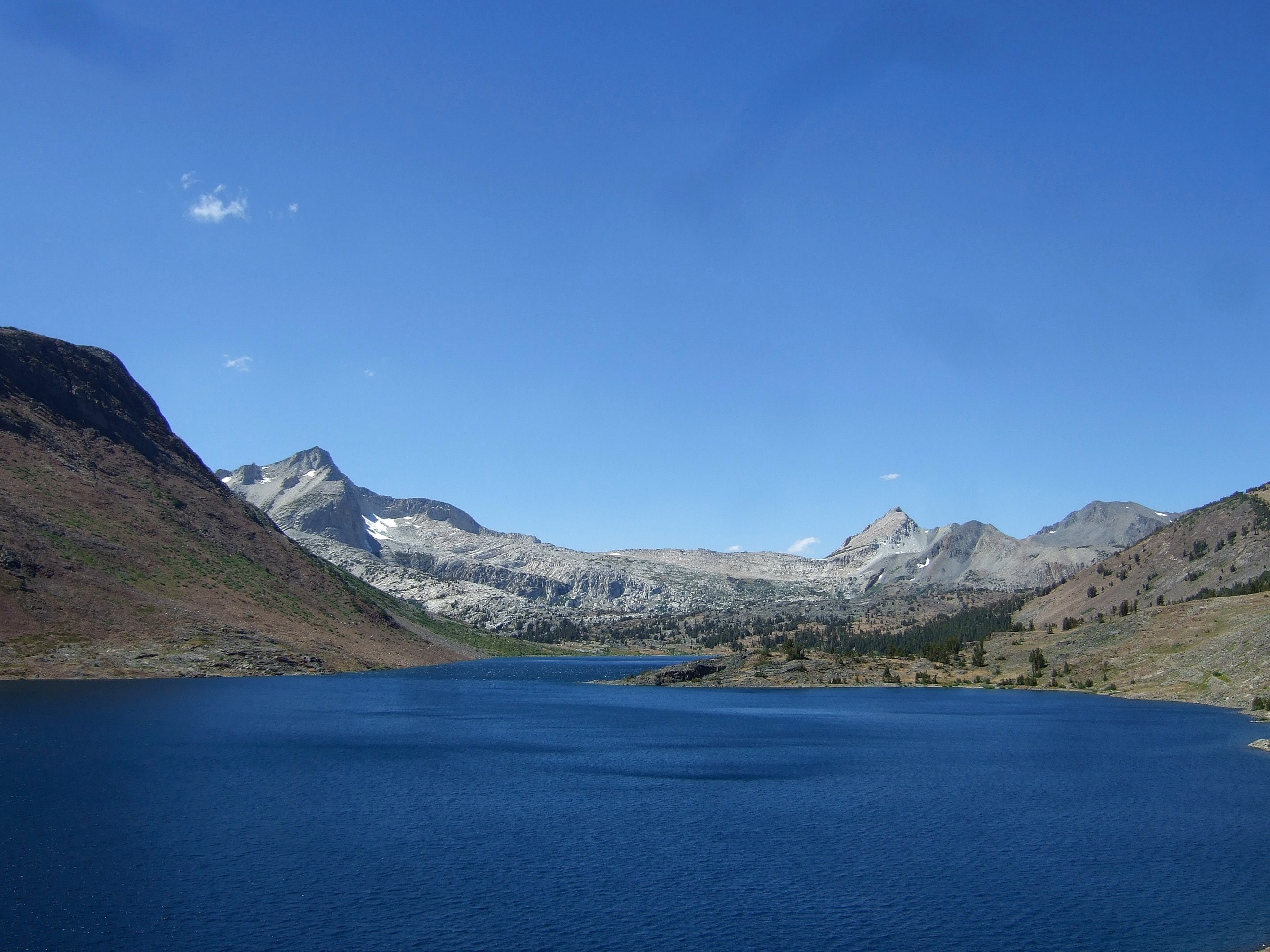
Saddlebag Lake Trail
Difficulty Rating:
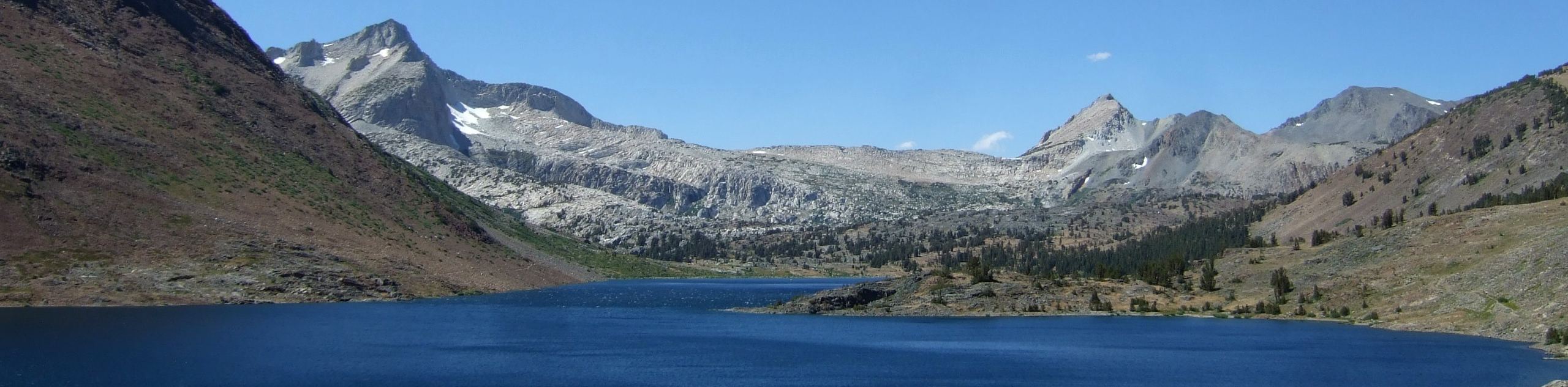
A family-friendly route in Inyo National Forest, the Saddlebag Lake Trail is a scenic pathway that traverses the shoreline of beautiful Saddlebag Lake. A route with great views of the surrounding landscape, Saddlebag Lake Trail is also considered an excellent place to view wildlife.
Getting there
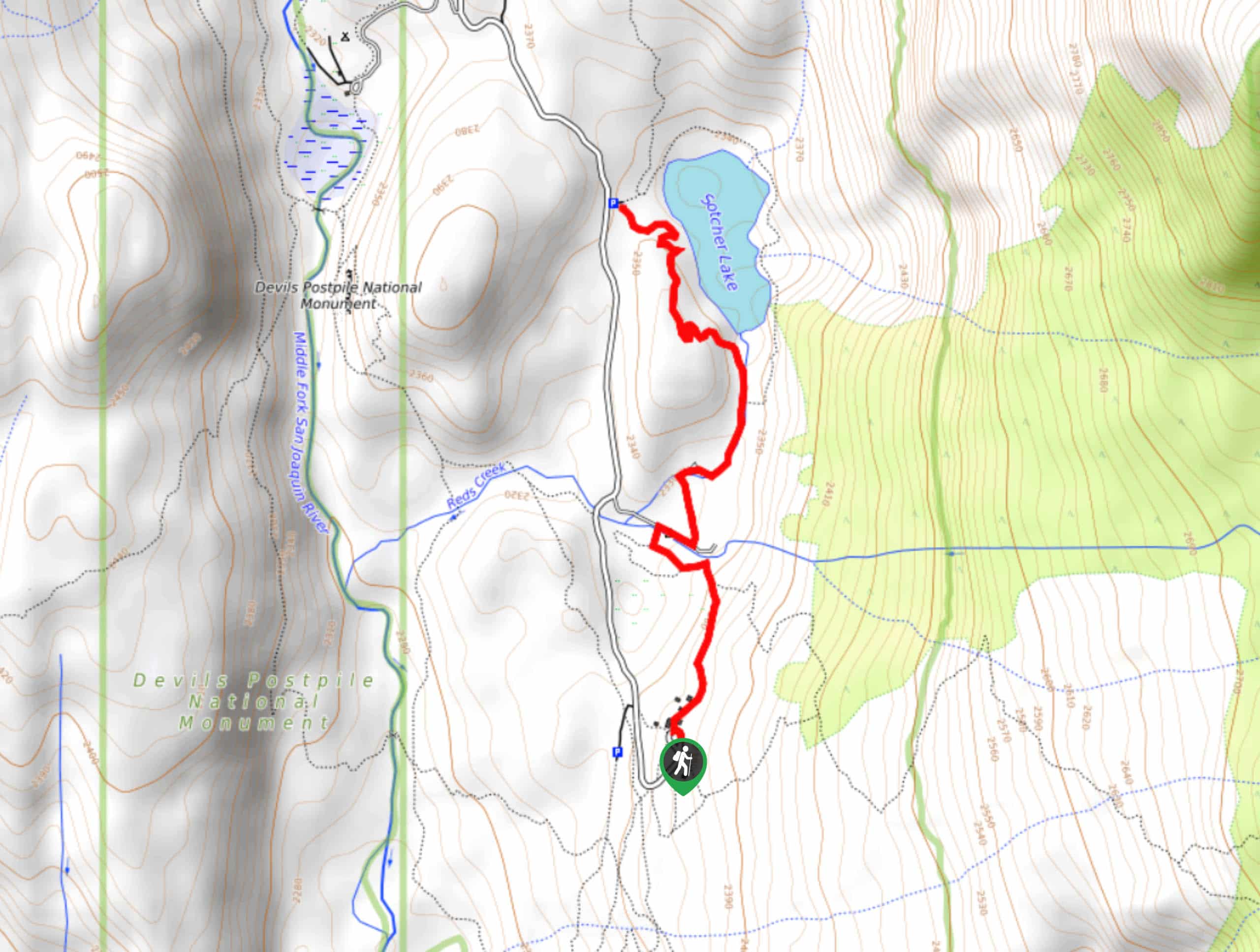
The trailhead for Saddlebag Lake Trail is located off of Saddlebag Lake Road.

About
| Backcountry Campground | |
| Pets allowed | Yes |
| Family friendly | Yes |
| Route Signage | Good |
| Crowd Levels | Moderate |
| Route Type | Circuit |
| When to do | June-September |
Saddlebag Lake Trail
Elevation Graph
Weather
Saddlebag Lake Trail Description
Due to its high altitude, the Saddlebag Lake Trail can get rather cold – even during the summer months – and so it is important you prepare yourself for the conditions. We recommend bringing extra clothes with you, so you can layer and delayer as needed. Likewise, sections of the Saddlebag Lake Trail are along loose scree rock, and so it is suggested you wear good hiking shoes. Your ankles will thank you!
The Saddlebag Lake Trail is an excellent choice for your next hike within Inyo National Forest because of the stunning scenery that surrounds it. Imposing mountains can be seen and admired in every direction that you look, and the lake itself is pristine. Not lacking biodiversity, the Saddlebag Lake Trail is a great wildlife viewing location, and boasts an abundance of high-elevation dwelling vegetation.
Having arrived at the trailhead, follow Saddlebag Lake Loop Trail as it makes its way around the shoreline of Saddlebag Lake. The Saddlebag Lake Loop is incredibly straightforward, and as long as you ensure you don’t accidentally follow any of the veering pathways at any of the various junctions throughout the route, you will have no issues.
The Saddlebag Lake Loop begins at Saddlebag Lake Resort. Having arrived at the trailhead, you can choose to do the route in either a clockwise or counterclockwise direction. That being said, we suggested traversing the route counterclockwise, as the vistas are more scenic and enjoyable. Heading out in a counterclockwise direction, the Saddlebag Lake Loop travels over rolling terrain on the eastern side of the lake.
After reaching the northern shore of Saddlebag Lake, the trail will veer down the western shoreline of the lake, where the terrain becomes more uneven as it leads you across some scree. Soon the resort will be visible and, after crossing a small dam, the route will arrive back at the parking lot, and your waiting vehicle.
Trail Highlights
Mount Conness
One of the highest peaks in the Sierra Nevada Mountain Range, Mount Conness is truly a sight to behold. Visible from the Saddlebag Lake Trail to the east, Mount Conness is a renowned outdoor adventure location as one can ski, rock climb, scramble, and hike along its mighty breadth. Named after California Senator John Coness, Mount Conness attracts adventures from throughout North American and, beyond
Insider Hints
Make sure you bring some sunglasses, as the glare from Saddlebag Lake on sunny days can be blinding!
A great choice for an acclimatization hike before attempting more challenging routes within the region.
Depending on the time of day you're hiking, not much shade exists, so wear sunscreen and a hat.
The north end of Saddlebag Lake is a great place for a picnic!
Similar hikes to the Saddlebag Lake Trail hike

Valentine Lake Trail
An underrated route within Inyo National Forest, Valentine Lake Trail is without a doubt worth the effort! Boasting sublime scenery…

Mountain View and 3S89 Road Loop
Mountain View and 3S89 Road Loop is a delightful route within Inyo National Forest. Leading you through a lovely forested…
Dinosaur Falls Trail
Dinosaur Falls Trail is a beautiful route within Inyo National Forest. Easily accessible, the route is ideal for families with…
Comments