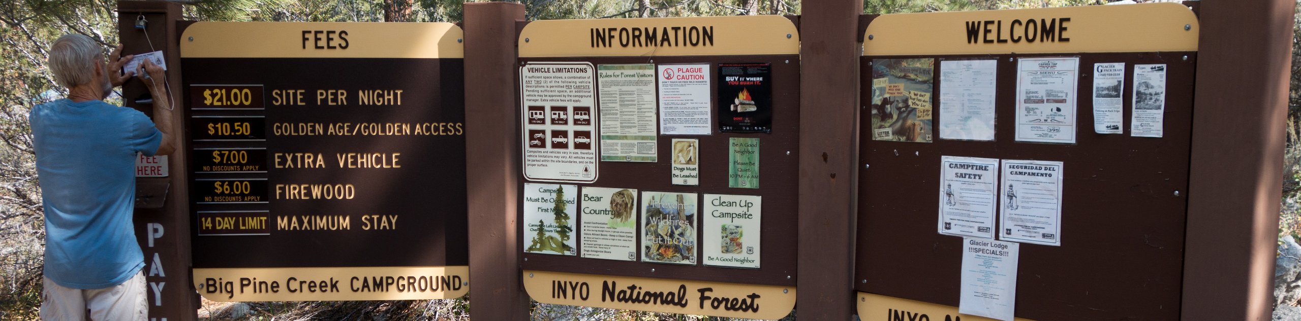
Big Pine Creek Campground and Glacier Lodge Loop Trail
View Photos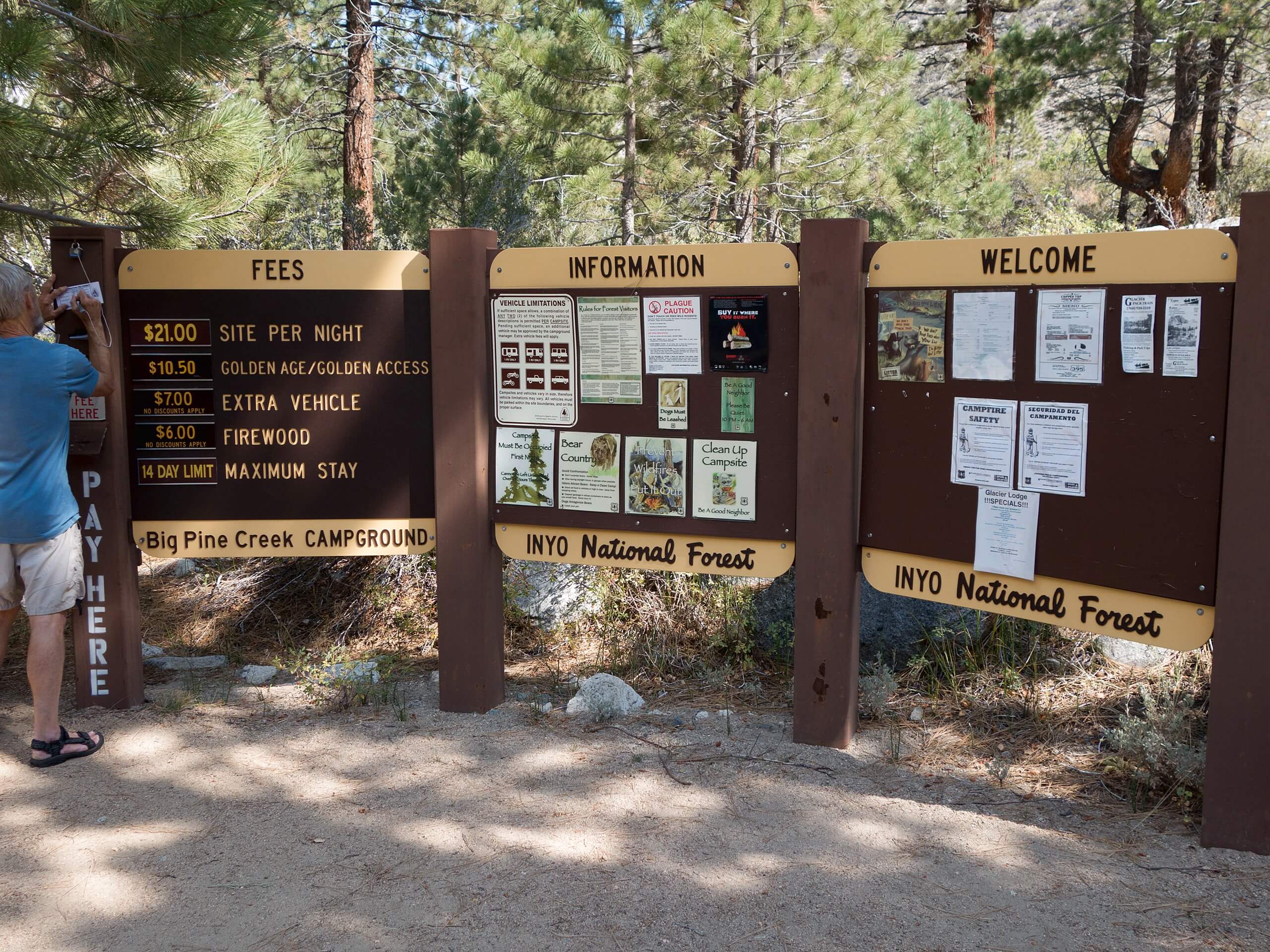
Big Pine Creek Campground and Glacier Lodge Loop Trail
Difficulty Rating:
Short in distance, and with relatively little elevation gain, Big Pine Creek Campground and Glacier Lodge Loop Trail is a family-friendly route within Inyo National Forest. Leading you through stunning mountain terrain and over cascading creeks, the route is considered to be an excellent trail for wildlife viewing.
Getting there
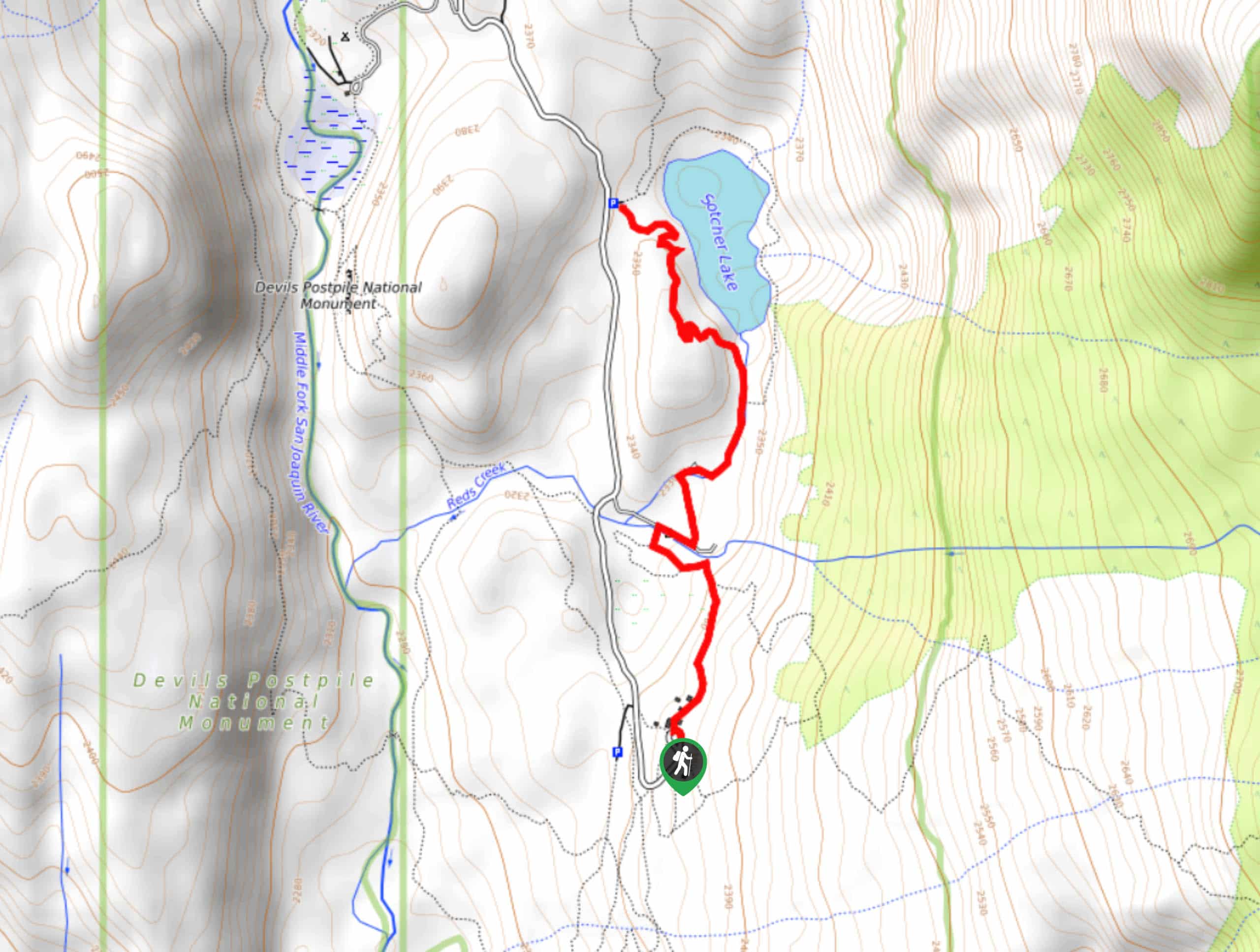
The trailhead of Big Pine Campground and Glacier Lodge Loop Trail is located at a parking lot off of Glacier Lodge Road.

About
| Backcountry Campground | |
| When to do | May-October |
| Pets allowed | Yes - On Leash |
| Family friendly | Yes |
| Route Signage | Average |
| Crowd Levels | Low |
| Route Type | Lollipop |
Big Pine Creek Campground and Glacier Lodge Loop Trail
Elevation Graph
Weather
Big Pine Creek Campground and Glacier Lodge Loop Trail Description
Depending on the time of year you plan on doing the Big Pine Creek Campground and Glacier Lodge Loop Trail, the mosquitoes along the route can become prolific, and so it is suggested you bring lots of bug spray and wear long pants and sleeves during the spring season. Likewise, when in flood, Big Pine Creek can become dangerous, and so it is important that you watch your footing when traveling alongside it.
With your vehicle parked at the allotted spot, make your way west along Glacier Lodge Road. The road will soon turn into a pathway as it makes its way over Big Pine Creek via a footbridge. Here, stunning views of the cascading creek can be enjoyed, so take a break and admire the scenery. Having crossed the bridge, follow the route to a junction within the pathway.
At the junction, follow the southern route over the steadily inclining terrain. The route will bring you to a four-way junction, where you are to take the northernmost pathway over more steadily inclining terrain. Continue on along the pathway until you arrive at a third junction, where you will take the eastern route onto a series of switchbacks that decline in elevation, and deliver you back to Big Pine Creek. From here, backtrack your steps towards the trailhead, and your waiting vehicle.
Similar hikes to the Big Pine Creek Campground and Glacier Lodge Loop Trail hike

Valentine Lake Trail
An underrated route within Inyo National Forest, Valentine Lake Trail is without a doubt worth the effort! Boasting sublime scenery…

Mountain View and 3S89 Road Loop
Mountain View and 3S89 Road Loop is a delightful route within Inyo National Forest. Leading you through a lovely forested…
Dinosaur Falls Trail
Dinosaur Falls Trail is a beautiful route within Inyo National Forest. Easily accessible, the route is ideal for families with…
Comments