Earthquake Fault Trail
View Photos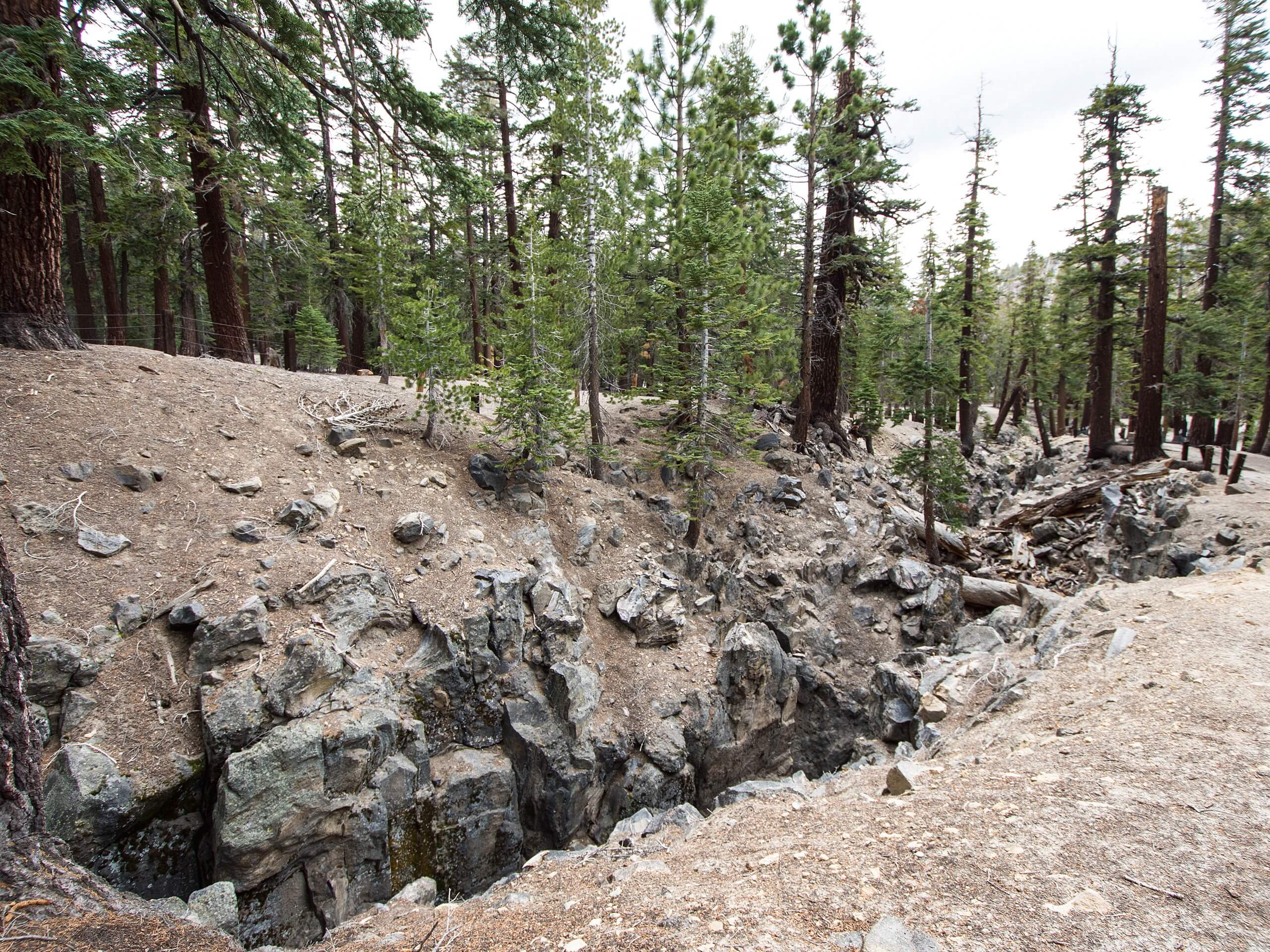
Earthquake Fault Trail
Difficulty Rating:
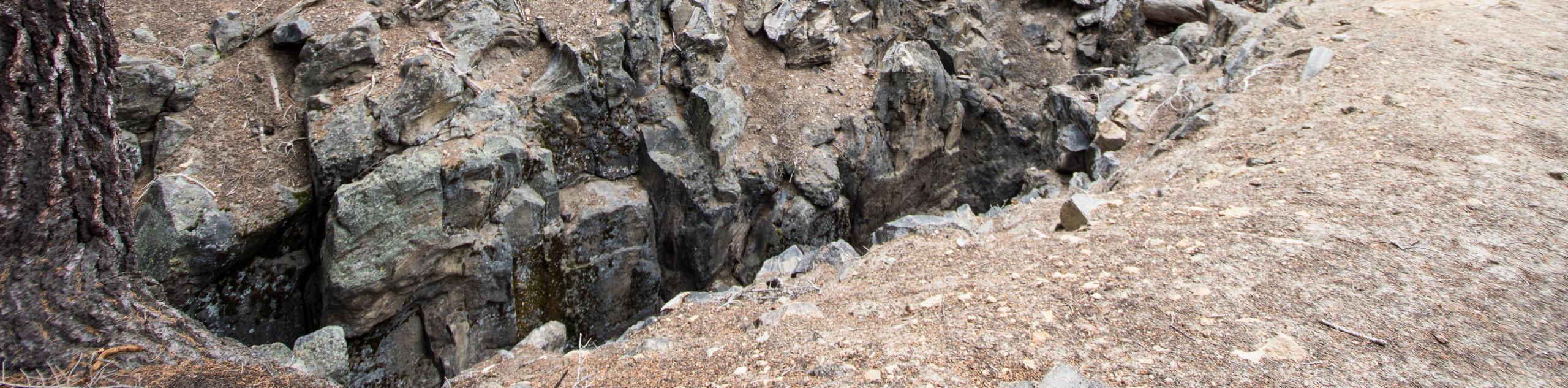
The Earthquake Fault Trail is a short and easily accessible route that is appropriate for all skill levels and families with young children. The trail takes you to a set of deep earthquake fault lines that showcase the power of the geological forces beneath the ground. Along with the intriguing geology, the route boasts scenic vistas of the surrounding Inyo National Forest landscape.
Getting there
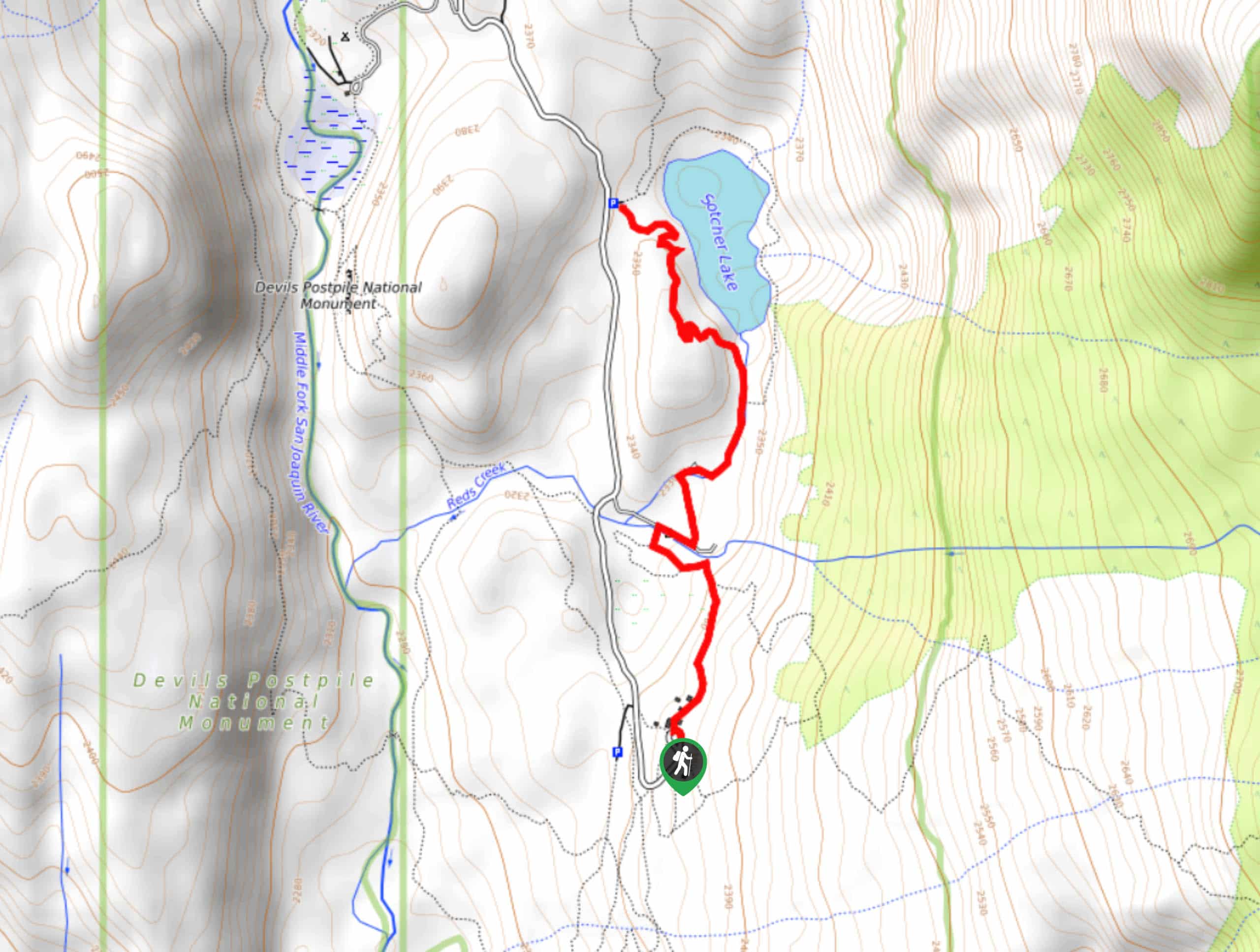
The trailhead for Earthquake Fault Trail is located at a parking lot off of Earthquake Falls Parking Access Road.

About
| Backcountry Campground | No |
| When to do | Year Round |
| Pets allowed | Yes - On Leash |
| Family friendly | Yes |
| Route Signage | Average |
| Crowd Levels | Moderate |
| Route Type | Lollipop |
Earthquake Fault Trail
Elevation Graph
Weather
Earthquake Fault Trail Description
While the Earthquake Fault Trail is not considered to be a difficult route, it is important that you are mindful when traversing around the deep fault line cravases. As some of the fault lines run rather deep into the earth, an untimely fall here could result in injury, and so you should ensure that you are careful with your footing and that you keep an eye on young children.
With your vehicle parked, make your way to the Earthquake Fault Overlook Trail. Follow the trail as it makes its way north, where you will soon arrive at the route’s namesake – the Earthquake Fault lines themselves. Take some time to carefully explore the imposing craveses before backtracking your steps towards the trailhead. If interested, you can also extend the route slightly by following the Earthquake Fault Trail as it makes its way south to a scenic vista.
Similar hikes to the Earthquake Fault Trail hike

Mountain View and 3S89 Road Loop
Mountain View and 3S89 Road Loop is a delightful route within Inyo National Forest. Leading you through a lovely forested…
Dinosaur Falls Trail
Dinosaur Falls Trail is a beautiful route within Inyo National Forest. Easily accessible, the route is ideal for families with…
Bennettville Trail
The Bennettville Trail is an easily accessible, family-friendly route within Inyo National Forest. The route takes you alongside charming creeks…
Comments