Minaret Lake Trail
View Photos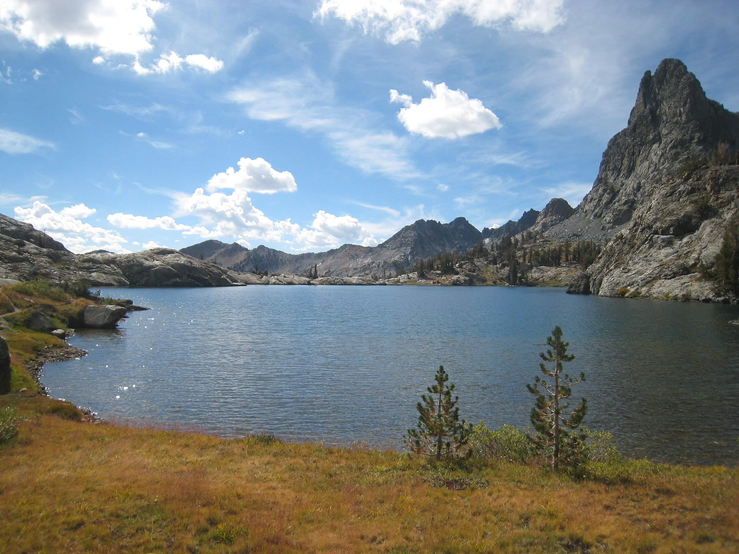
Minaret Lake Trail
Difficulty Rating:
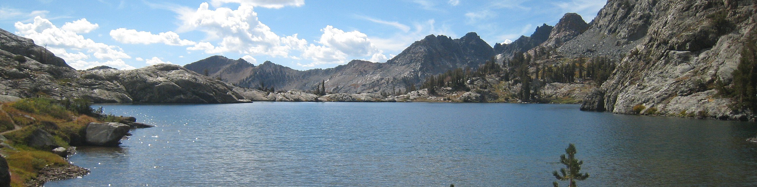
Taking you through stunning mountain topography, alongside charming creeks, and eventually ending at the picturesque Minaret Lake, the Minaret Lake Trail is an incredible route. A longer trail with a fair amount of elevation incline, the Minaret Lake Trail is ideal for more experienced hikers and those looking for a challenge in Inyo National Forest.
Getting there
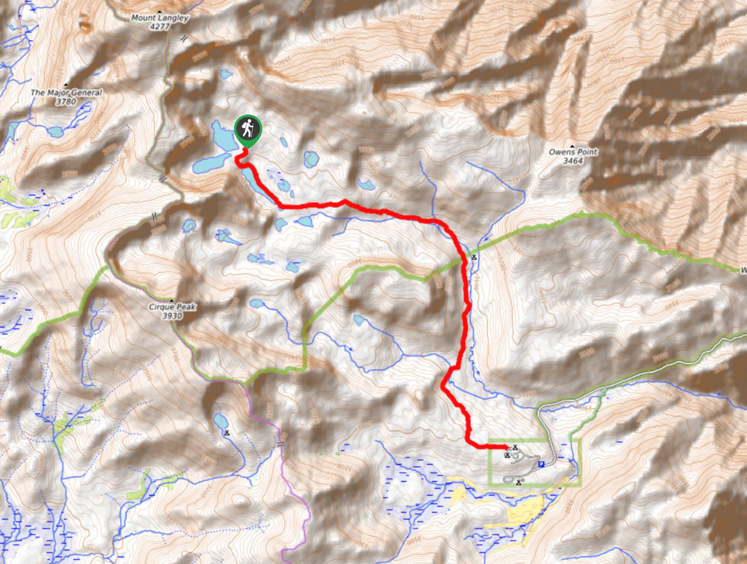
The trailhead for Minaret Lake Trail is located at a parking lot off of Minaret Summit Road.

About
| Backcountry Campground | |
| When to do | July-October |
| Pets allowed | Yes - On Leash |
| Family friendly | No |
| Route Signage | Average |
| Crowd Levels | Moderate |
| Route Type | Out and back |
Minaret Lake Trail
Elevation Graph
Weather
Minaret Lake Trail Description
The Minaret Lake Trail is long in distance, and possesses a fair amount of elevation incline. The trail is therefore not appropriate for beginner hikes or families with children. Depending on the time of year you are planning on doing the Minaret Lake Trail, it can also become rather busy. We recommend starting the hike earlier in the day to more easily find parking and beat the midday crowds.
Having arrived at the trailhead, follow the John Muir Trail around Soda Spring Meadows. Once past the meadows, continue on along John Muir Trail as it makes its way northwest over steadily inclining terrain. Continue along John Muir Trail until you reach the junction with Minaret Creek Trail. Follow Minaret Creek Trail as it heads northwest, consistently inclining in elevation as it goes.
After crossing, and passing by a number of creeks, the route will deliver you to its namesake – Minaret Lake. Take some time enjoying the incredible views that can be had along the lakeshore and maybe stop for some lunch. When you are ready, simply backtrack your steps towards the trailhead and your waiting vehicle.
Similar hikes to the Minaret Lake Trail hike

Valentine Lake Trail
An underrated route within Inyo National Forest, Valentine Lake Trail is without a doubt worth the effort! Boasting sublime scenery…

Lakes Basin Path to Pack Trail
A more challenging route within Inyo National Forest, Lakes Basin Path to Pack Trail is ideal for more experienced hikers…
Cottonwood Lakes and Army Pass Trail
Cottonwood Lakes and Army Pass Trail is a scenic route within the high alpine environment of the eastern Sierra Nevada…
Comments