Methuselah Trail
View Photos
Methuselah Trail
Difficulty Rating:
The Methuselah Trail is a scenic route within Inyo National Forest. Taking you through an ancient pine forest, Methuselah Trail possesses some of the most unique scenery found within the Eastern Sierra Nevada Mountain range.
Getting there
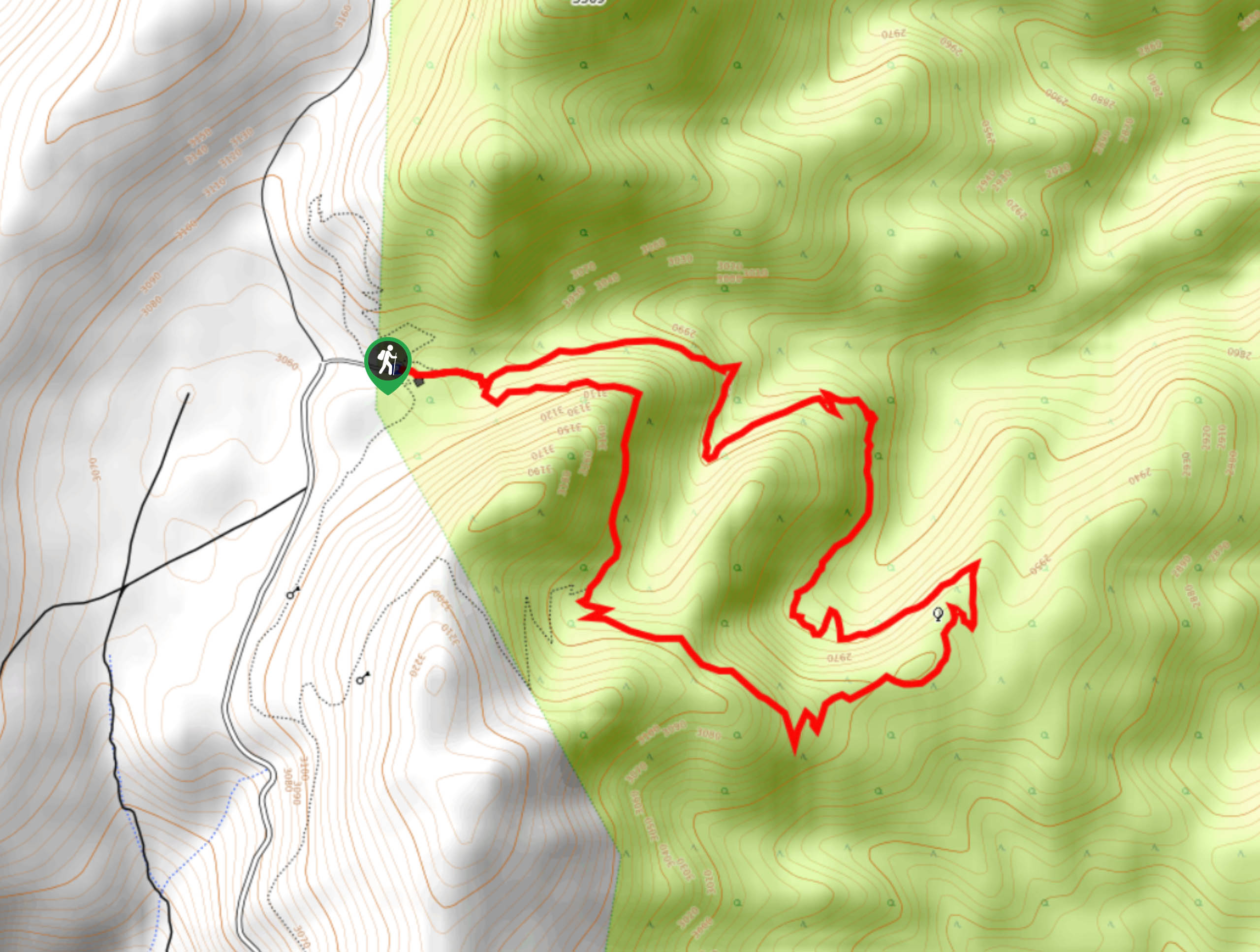
The trailhead for Methuselah Trail is located at the Schulman Grove Picnic Area.

About
| Backcountry Campground | No |
| When to do | April-September |
| Pets allowed | Yes - On Leash |
| Family friendly | Older Children only |
| Route Signage | Average |
| Crowd Levels | High |
| Route Type | Lollipop |
Methuselah Trail
Elevation Graph
Weather
Methuselah Trail
Prior to attempting the Methuselah Trail, it is important to remember that it is within the high altitude alpine environment of the Sierra Nevada Mountains and you should be observant of the effects of altitude sickness. Especially if you are coming from near sea-level, take your time and drink lots of water as the Methuselah Trail will be more challenging than it otherwise would be.
Having arrived at the trailhead, follow the pathway as it makes its way east. You will soon arrive at a junction within the trail, where you can choose to go either way as from here the route is a circuit. Whatever direction you choose to go, Methuselah Trail is fairly straightforward. Simply follow the pathway as it circumvents the highlands in the middle of the circuit. Ensuring you don’t deviate from the trail at the one junction along its extent, the Methuselah Trail will deliver you back to the start of the circuit, where the parking lot is only a short distance away.
Similar hikes to the Methuselah Trail hike

Valentine Lake Trail
An underrated route within Inyo National Forest, Valentine Lake Trail is without a doubt worth the effort! Boasting sublime scenery…

Mountain View and 3S89 Road Loop
Mountain View and 3S89 Road Loop is a delightful route within Inyo National Forest. Leading you through a lovely forested…
Dinosaur Falls Trail
Dinosaur Falls Trail is a beautiful route within Inyo National Forest. Easily accessible, the route is ideal for families with…
Comments