Mount Whitney Trail
View Photos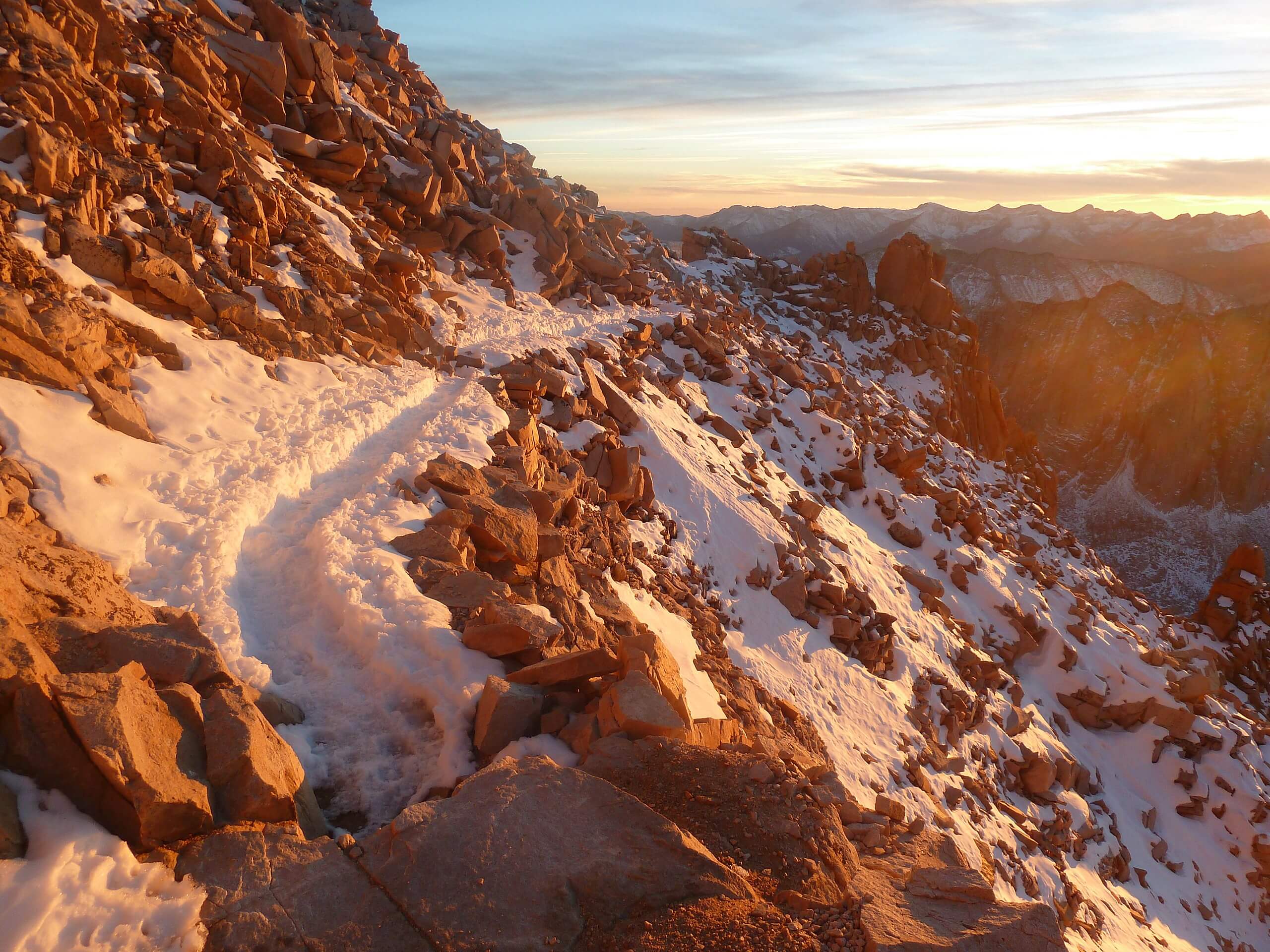
Mount Whitney Trail
Difficulty Rating:
A physically demanding and technically formidable route, the Mount Whitney Trail is a must-do for the seasoned hiker who enjoys a challenge. Traversing steep switchbacks and taking you alongside sheer cliffs, the route should only be attempted by experienced hikers whose skills, physical ability and equipment are sufficient enough for the rigours of the imposing mountain.
Getting there
The trailhead for Mount Whitney Trail is located off of Whitney Portal Road.

About
| Backcountry Campground | |
| When to do | April-October |
| Pets allowed | No |
| Family friendly | No |
| Route Signage | Good |
| Crowd Levels | High |
| Route Type | Out and back |
Mount Whitney Trail
Elevation Graph
Weather
Mount Whitney Trail Description
The Mount Whitney Trail is not for everyone. It is a physically demanding route with tangible consequences and should be treated as such. Prior to attempting, you need to ensure that your physical ability, equipment, and technical knowledge are sufficient to embark on this mesmerizing but formidable route. It is also highly recommended that you spend some time acclimatizing to the high altitude. It is not uncommon for hikers to experience altitude sickness, and many are forced to turn around and abandon their push to the summit because of it.
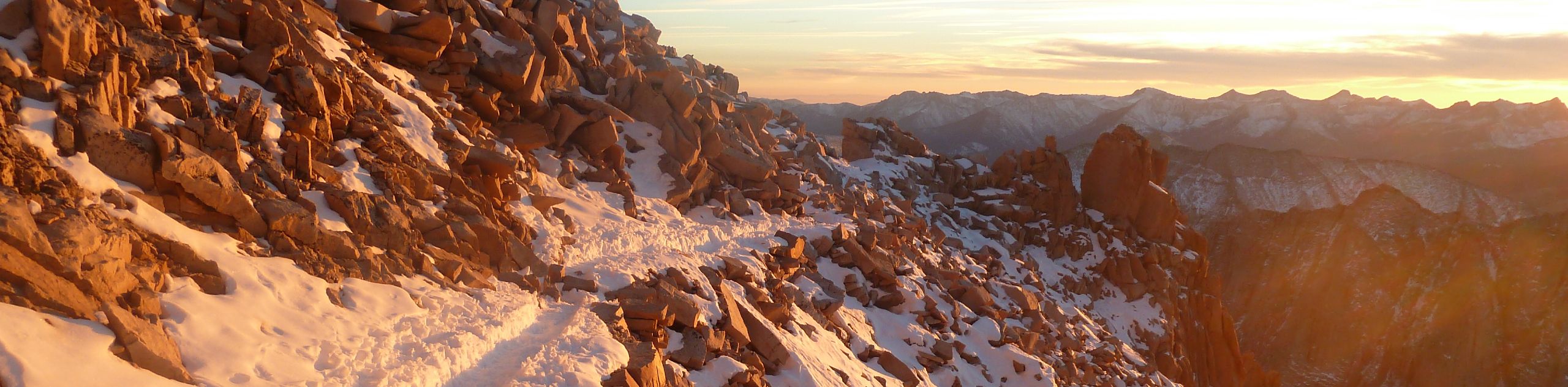
While the Mount Whitney Trail is a demanding route, there is a reason it is one of the most popular trails within Inyo National Forest, and indeed all of California – it is simply majestic. The views found at the summit of Mount Whitney are seemingly endless, as you can enjoy unobstructed sightlines of the sublime Eastern Sierra Nevada Mountain Range. Likewise, as the route is so challenging, the sense of accomplishment from summiting the imposing mountain can not be understated.
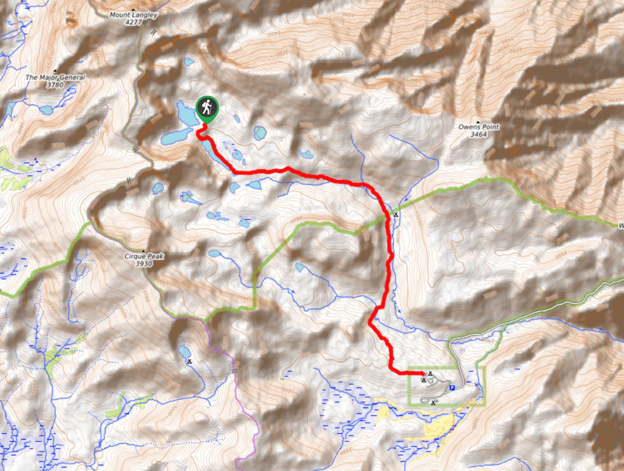
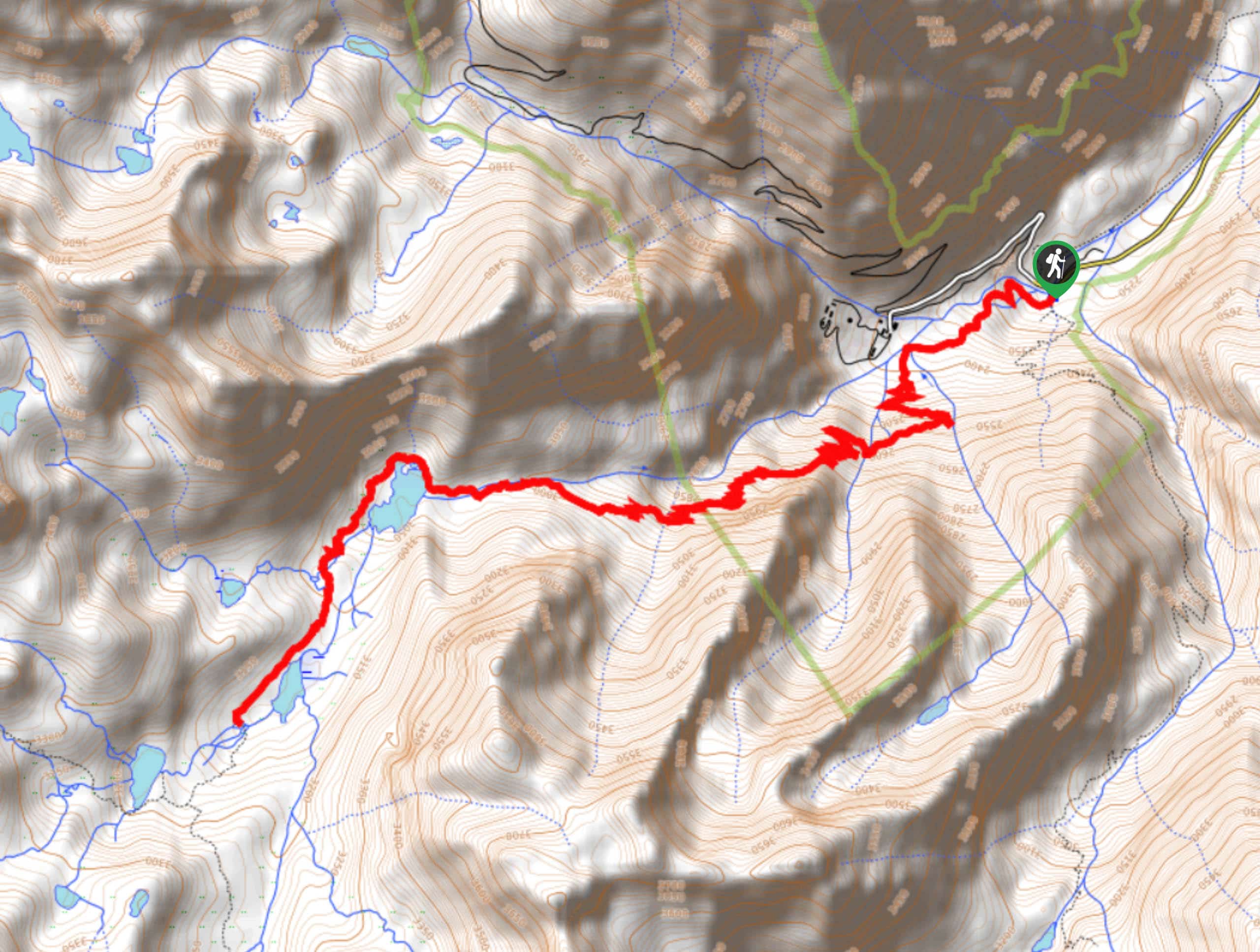
Having left your vehicle at the parking lot, follow the Mount Whitney Trail as it makes its way first north, then sharply veers to the west. After crossing a stream, the trail will head to the southwest to climb a series of switchbacks. With the initial switchback section completed, the trail will straighten out before once again turning into another series of switchbacks that will end as you approach Lone Pine Creek.
After the creek, the trail will make its way west alongside the Lone Pine Creek, inclining in elevation as it goes. The Mount Whitney Trail will once again cross Lone Pine Creek – this time from the south – and the trail will develop into more switchbacks as it takes you along the eastern shore of Mirror Lake. Having passed Mirror Lake, the route will follow along the Lone Pine Creekside before once again crossing it from the north. Having crossed the creek, you will be adjacent to the northern shore of Consolation Lake, and after a short plateau within the trail, you will arrive at the notorious “97 switchbacks”.
Make your way up the gruelling switchback section, ensuring you take your time as you do so. Once you have completed the section, you will arrive at a ridgeline and, not long after, a junction within the trail. At the junction, follow the John Muir Trail as it makes its way along the backside of Mount Muir. The John Muir Trail will follow along the ridgeline as it approaches Mount Whitney in the foreground. Having passed a number of peaks to the west, the trail will veer east and deliver you to the summit of Mount Whitney. Relish the moment; you’ve earned it! Once you’re ready, backtrack your steps to the trailhead.
Trail Highlights
Mount Whitney
The highest mountain in the contiguous United States, Mount Whitney, is truly a sight to behold. Located near many of the Sierra Nevada’s highest peaks, the sightlines at its summit are simply breathtaking and are without a doubt worth the strenuous effort it takes to reach it. At an elevation of 14505ft, Mount Whitney attracts people from all over the world who come to adventure along its majestic breadth.
Frequently Asked Questions
Do you need a permit to hike Mount Whitney?
A permit is required to climb Mount Whitney. The rangers will send you back to the trailhead if you get caught attempting to hike Mount Whitney without one.
Is Mount Whitney getting taller?
Utilizing the latest technology, scientists have found that Mount Whitney is growing at a pace of about a millimeter each year.
How hard is it to get a permit for Mount Whitney?
Obtaining a permit for Mount Whitney is fairly difficult due to high demand. A lottery system exists in order to make the process as fair as possible. Entrance to the lottery costs $6 a person.
Insider Hints
An early morning start is recommended if you're planning on doing Mount Whitney Trail in a day.
Expect snow and ice along the route in spring and early summer.
Trekking poles will make a huge difference along sections of the route with steep incline and decline.
Bring extra layers including a rain jacket and an insulated puffy.
Make sure you are eating and drinking lots of water throughout the day!
Similar hikes to the Mount Whitney Trail hike

Lakes Basin Path to Pack Trail
A more challenging route within Inyo National Forest, Lakes Basin Path to Pack Trail is ideal for more experienced hikers…
Cottonwood Lakes and Army Pass Trail
Cottonwood Lakes and Army Pass Trail is a scenic route within the high alpine environment of the eastern Sierra Nevada…
Upper Pine Lake via Italy Pass Trail
A more challenging route, Upper Pine Lake via Italy Pass Trail is ideal for more experienced hikers who are seeking…
Comments