Horseshoe Lake Trail
View Photos
Horseshoe Lake Trail
Difficulty Rating:
A short route with little elevation incline, Horseshoe Lake Trail is an ideal route for beginner hikers and families with young children. Taking you along the shoreline of beautiful Horseshoe Lake, the route is incredibly charming, and offers great sightlines of the surrounding eastern Sierra Nevada Mountain Range.
Getting there
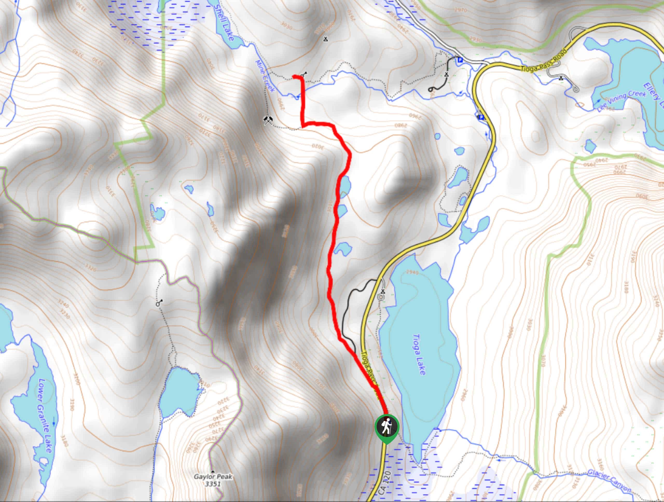
The trailhead for Horseshoe Lake Trail is located at a parking lot off of Falls Tract Road.

About
| Backcountry Campground | |
| When to do | April-September |
| Pets allowed | Yes |
| Family friendly | Yes |
| Route Signage | Average |
| Crowd Levels | High |
| Route Type | Circuit |
Horseshoe Lake Trail
Elevation Graph
Weather
Horseshoe Lake Trail Description
Horseshoe Lake Trail is a popular route with cyclists and can therefore become rather crowded at certain times of the day. When doing the route, make sure you stay vigilant of bike traffic to ensure no collisions occur. Parking can also be hard to find on weekends, so it is recommended that you show up early if you are planning on doing the Horseshoe Lake Trail then.
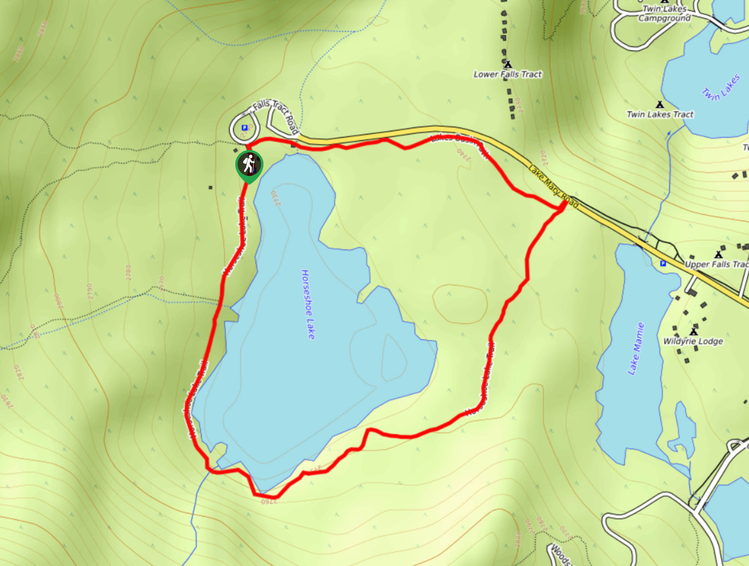
With your vehicle parked, make your way to the Horseshoe Lake Trailhead on the southern side of the parking lot. Follow the pathway as it makes its way south along the western shore of Horseshoe Lake. After crossing a stream, the route will continue on to the southern shore of the lake before crossing a second stream. Having crossed the second stream, Horseshoe Lake Trail will begin to veer away from the shore of Horseshoe Lake and start to head east.
The route will then begin to head north and, after a few hundred feet, will arrive at a junction with Lake Basin Path. Follow Lake Basin Path as it makes its way west alongside Lake Mary Road. The route will arrive at the northern shore of Horseshoe Lake and after crossing one last stream, will bring you to the trailhead, and the parking lot where you left your vehicle.
Similar hikes to the Horseshoe Lake Trail hike

Mountain View and 3S89 Road Loop
Mountain View and 3S89 Road Loop is a delightful route within Inyo National Forest. Leading you through a lovely forested…
Dinosaur Falls Trail
Dinosaur Falls Trail is a beautiful route within Inyo National Forest. Easily accessible, the route is ideal for families with…
Bennettville Trail
The Bennettville Trail is an easily accessible, family-friendly route within Inyo National Forest. The route takes you alongside charming creeks…
Comments