hikes in Angeles National Forest
Angeles National Forest Hikes
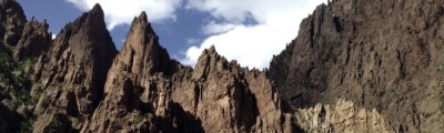
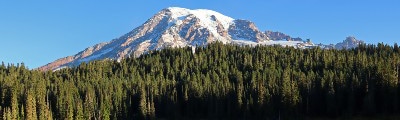
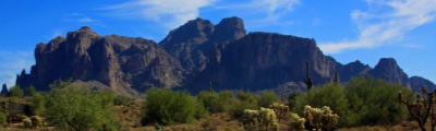
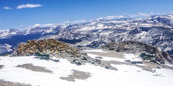
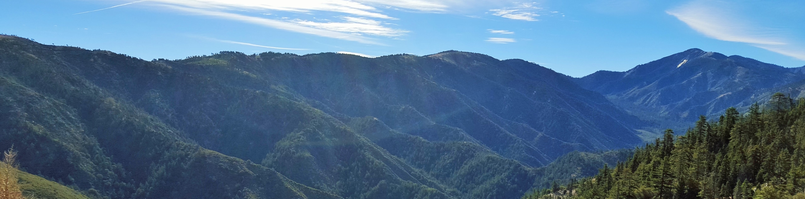
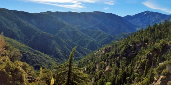
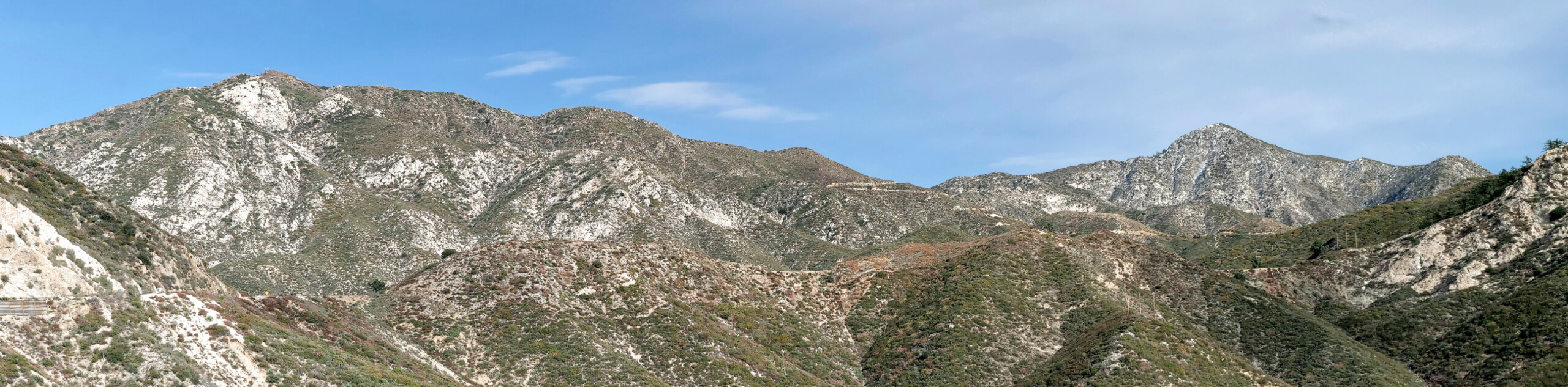
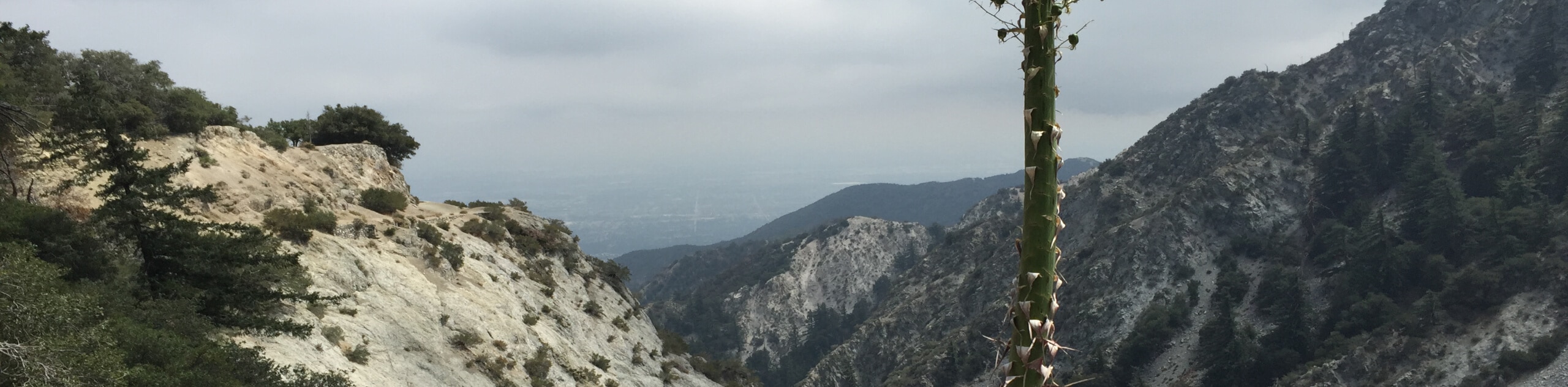
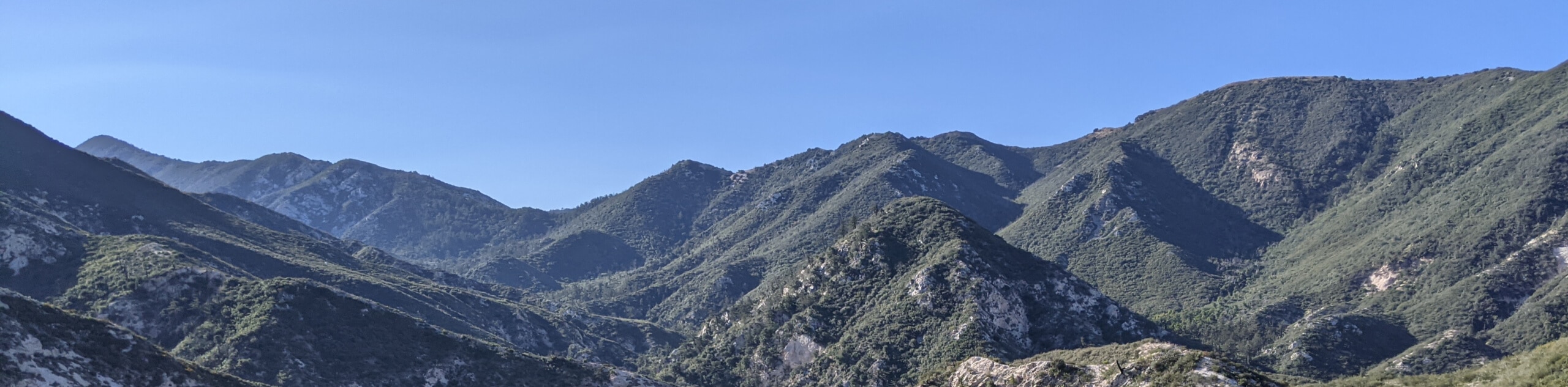
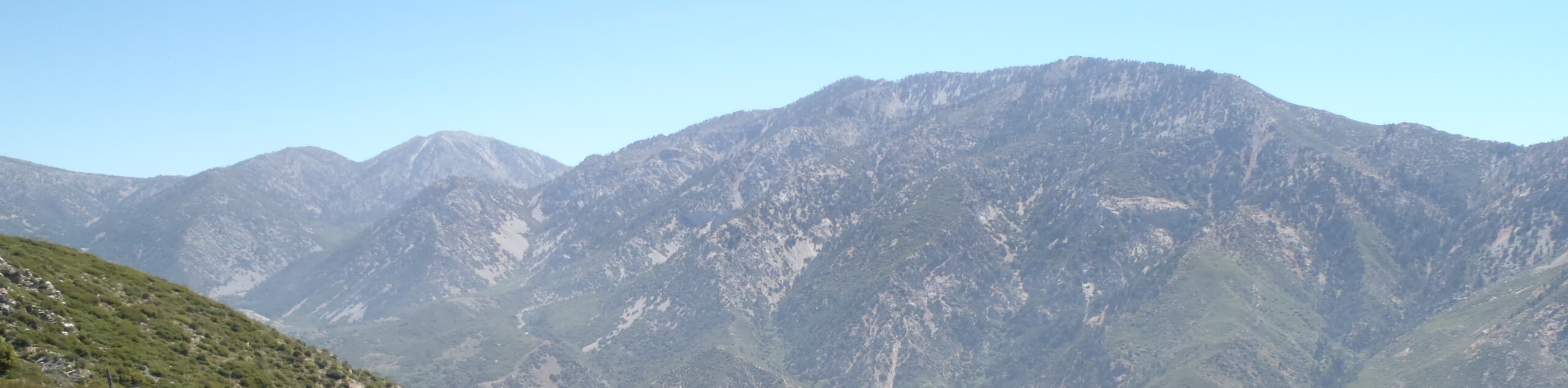
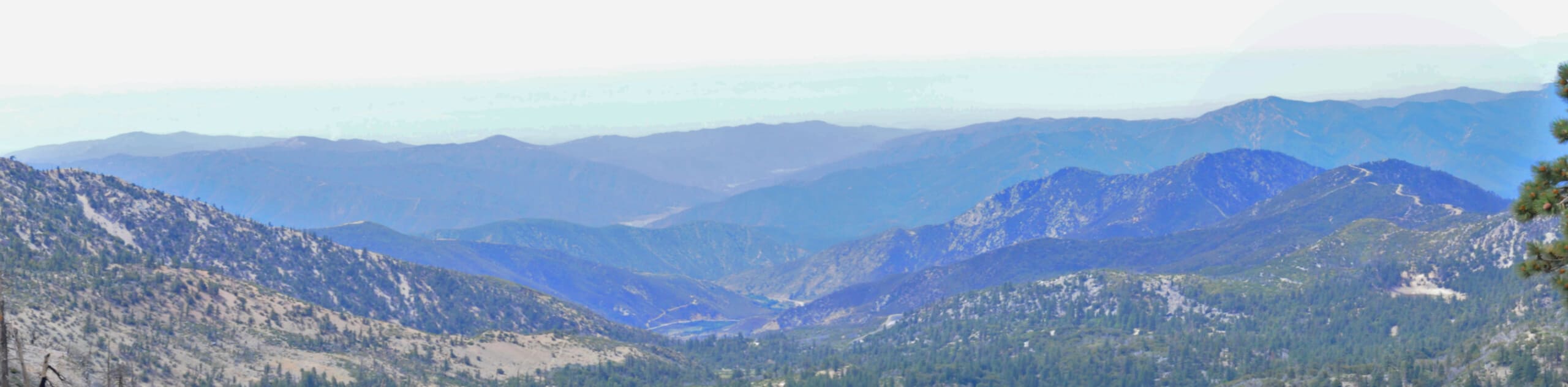
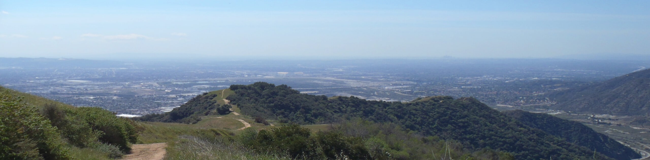
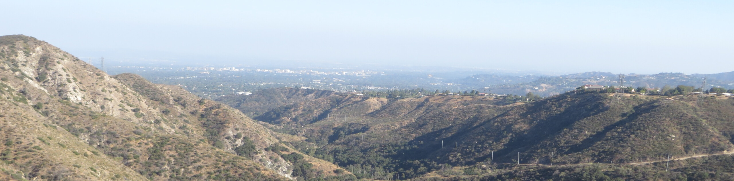
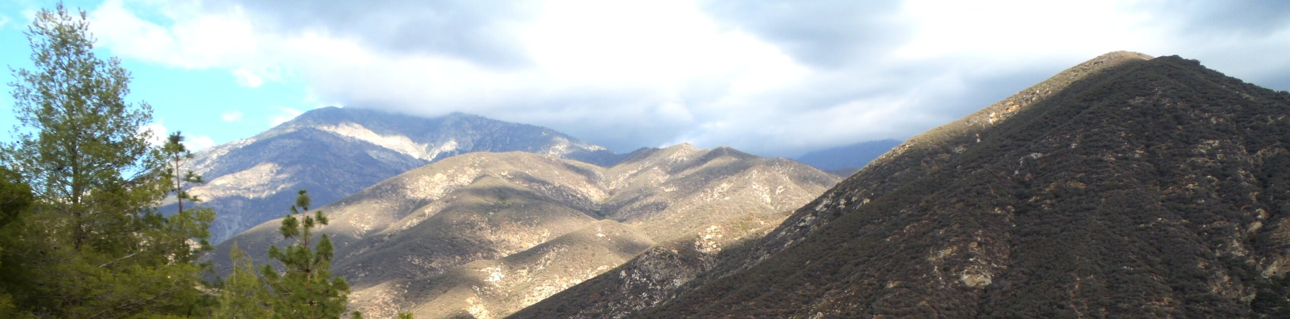
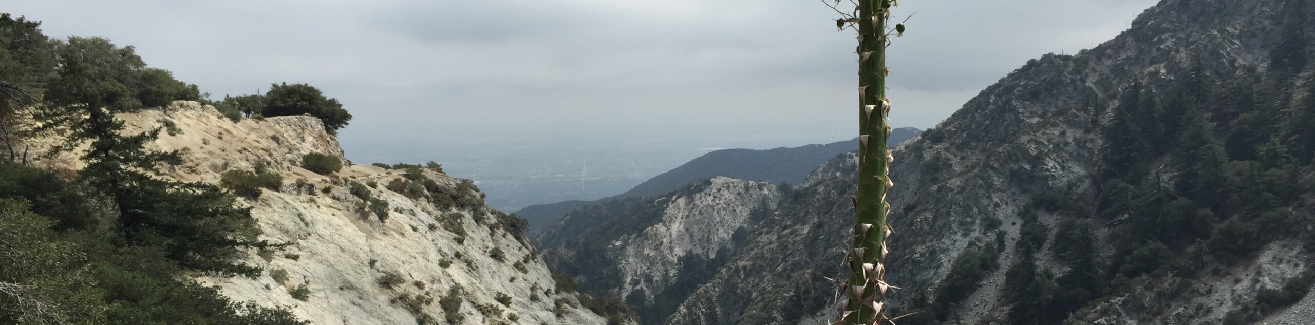
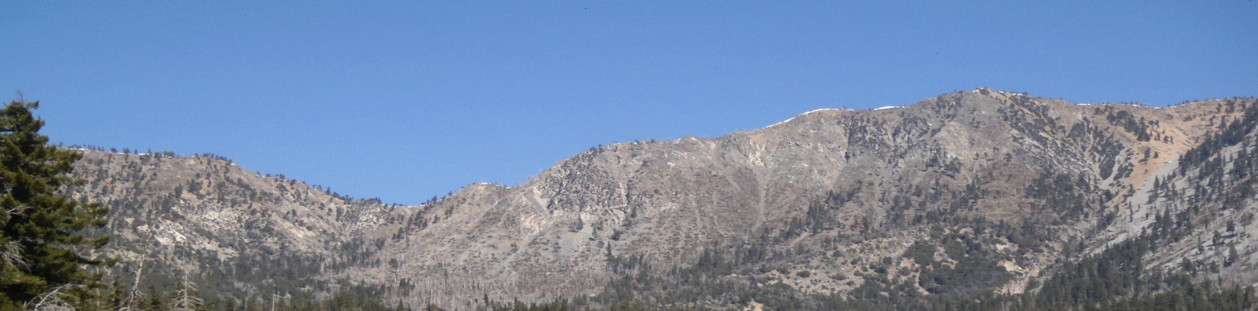
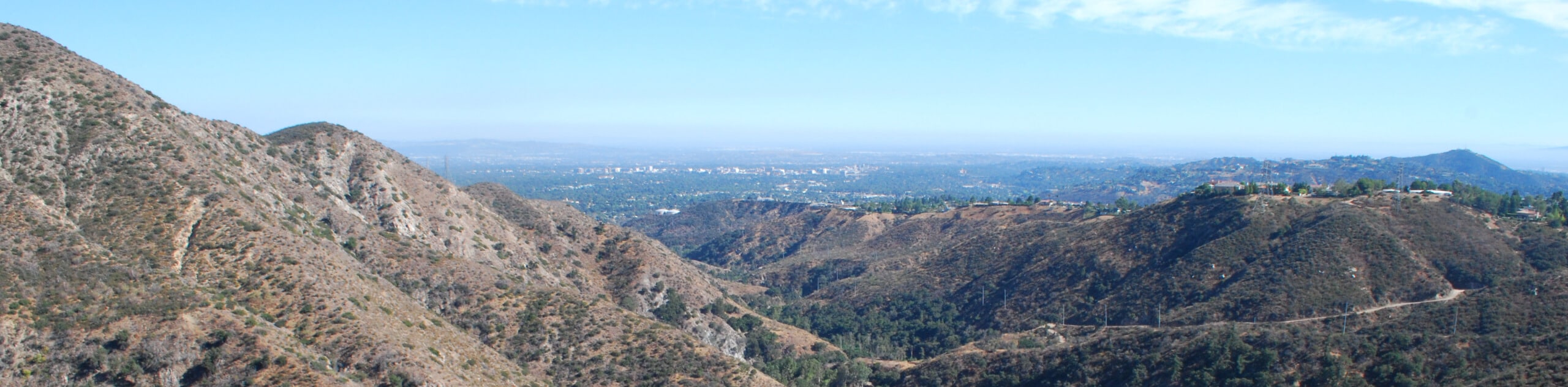
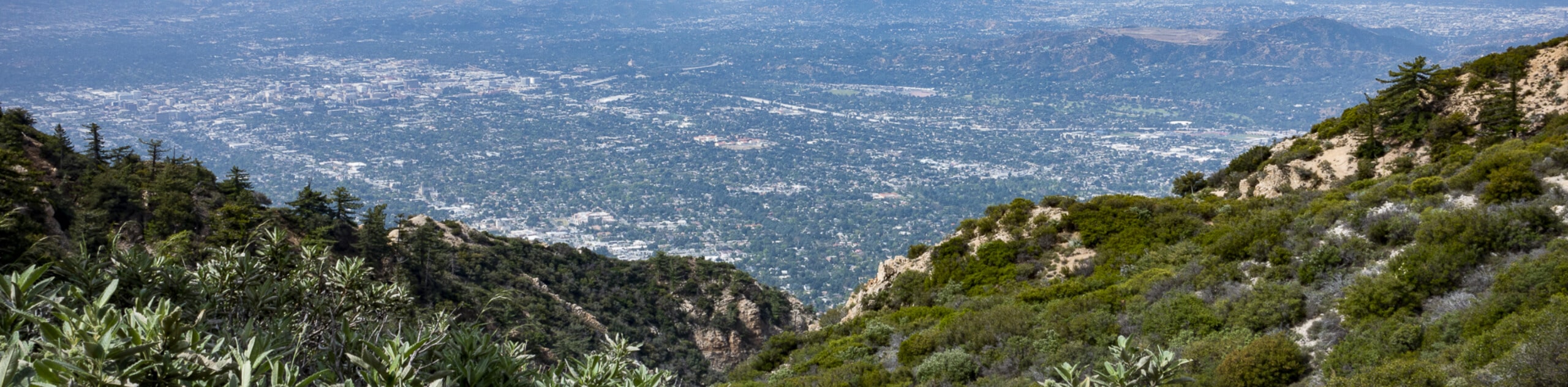
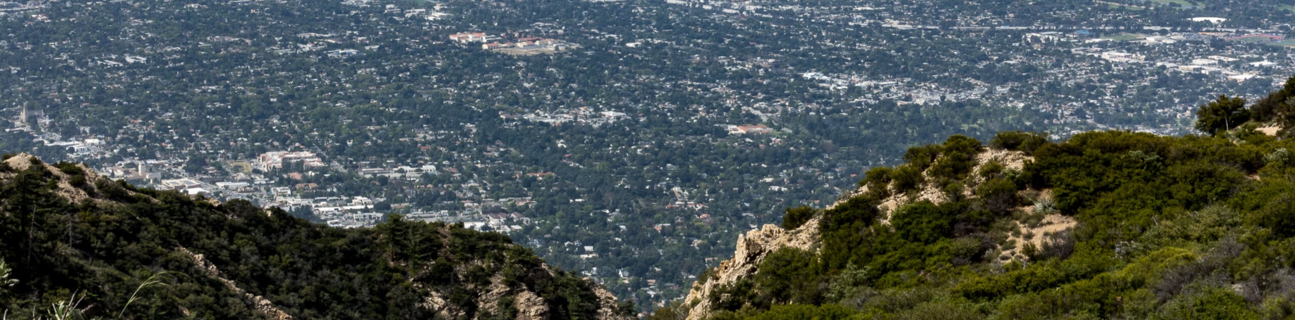
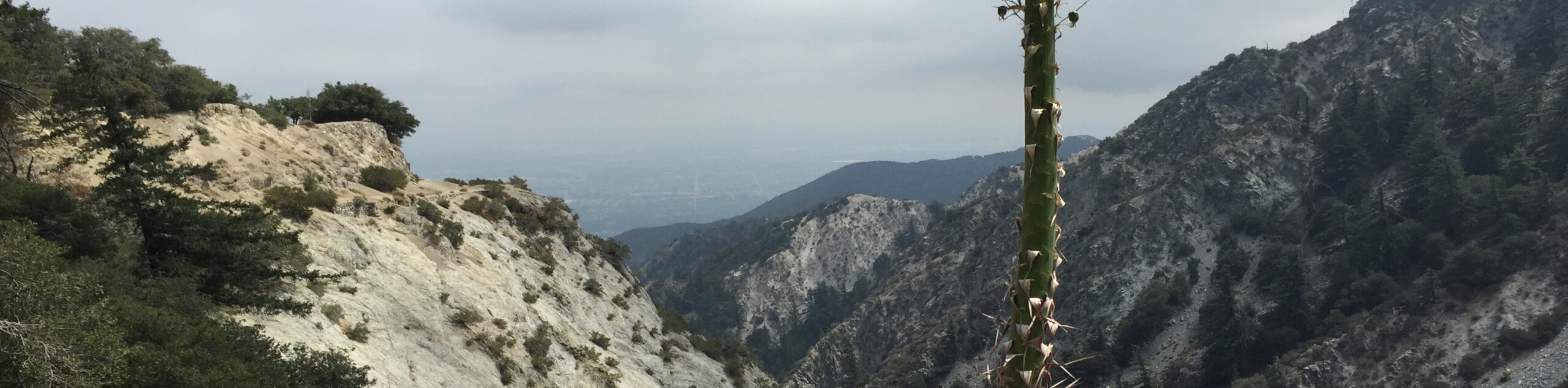
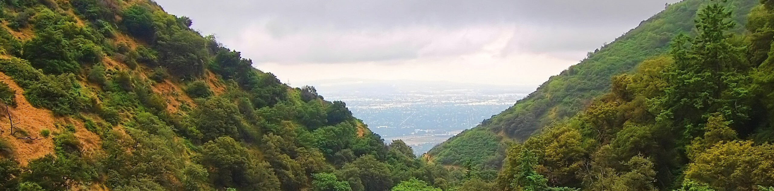
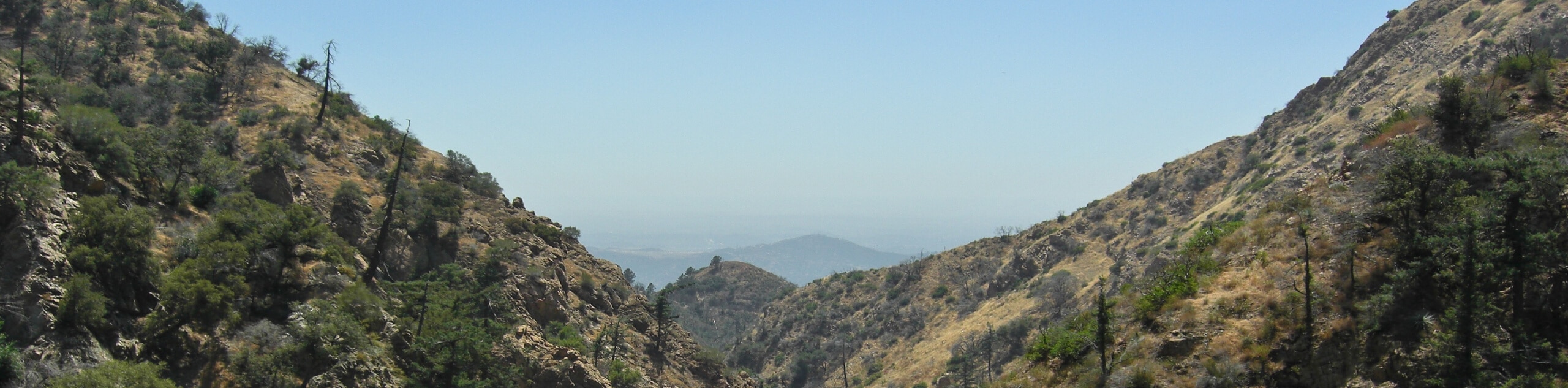
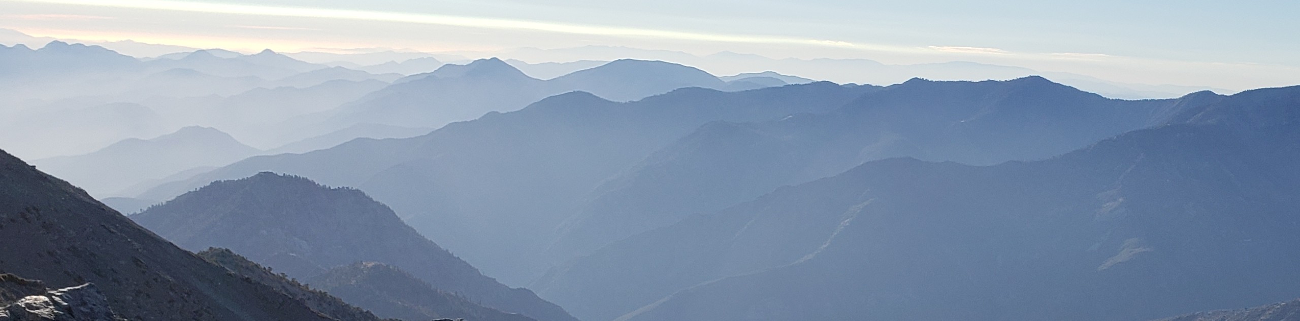
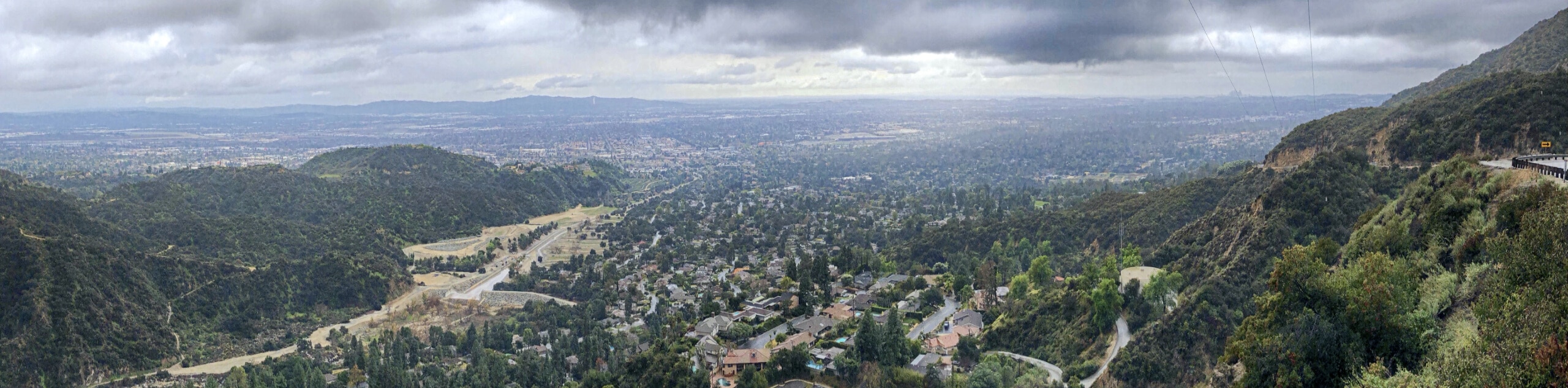
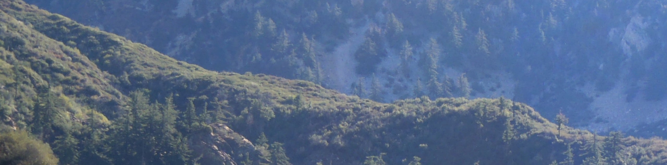
Angeles National Forest hikes are a great escape from the hustle and bustle of the city, providing Angelenos with the perfect outdoor getaway without having to travel too far. Located just north of the Greater Los Angeles Area and situated mostly within Los Angeles County, the Angeles National Forest is a vast area that blends the rugged nature of the Southern California wilderness with the convenience of nearby metropolitan areas. Whether you are visiting L.A. or consider yourself a local, Angeles National Forest Hikes are the best way to experience the picturesque landscapes around the city.
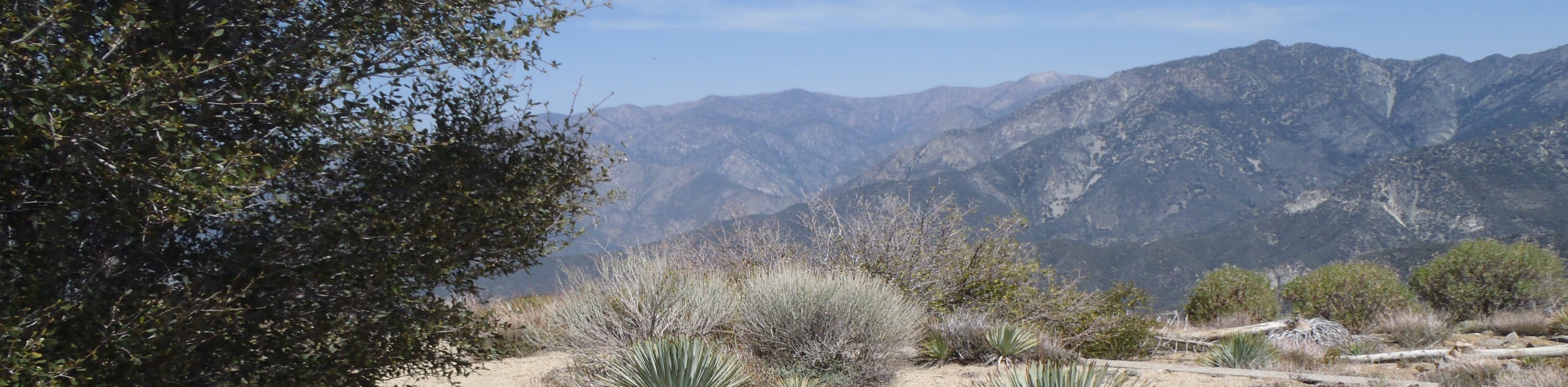
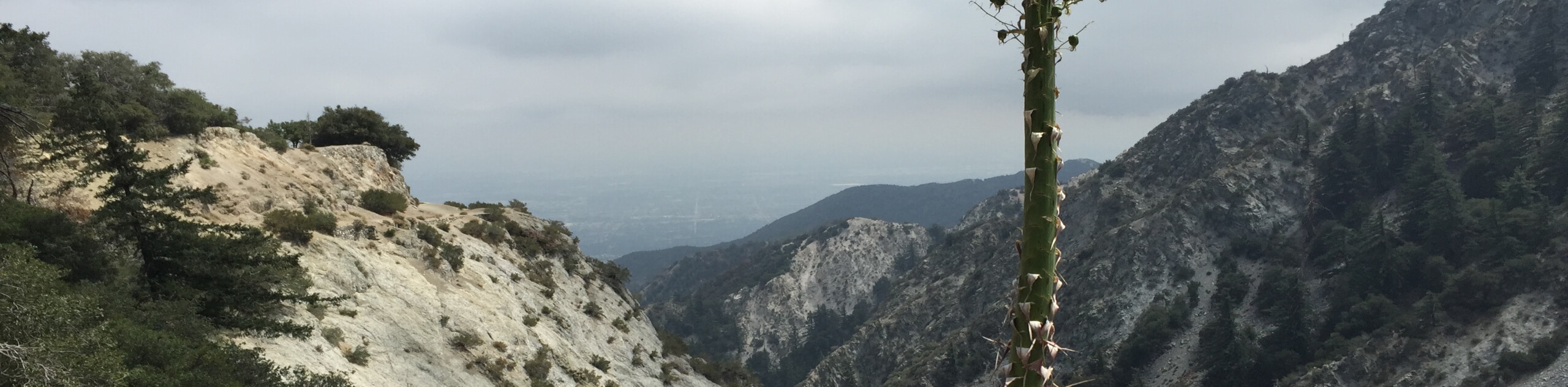
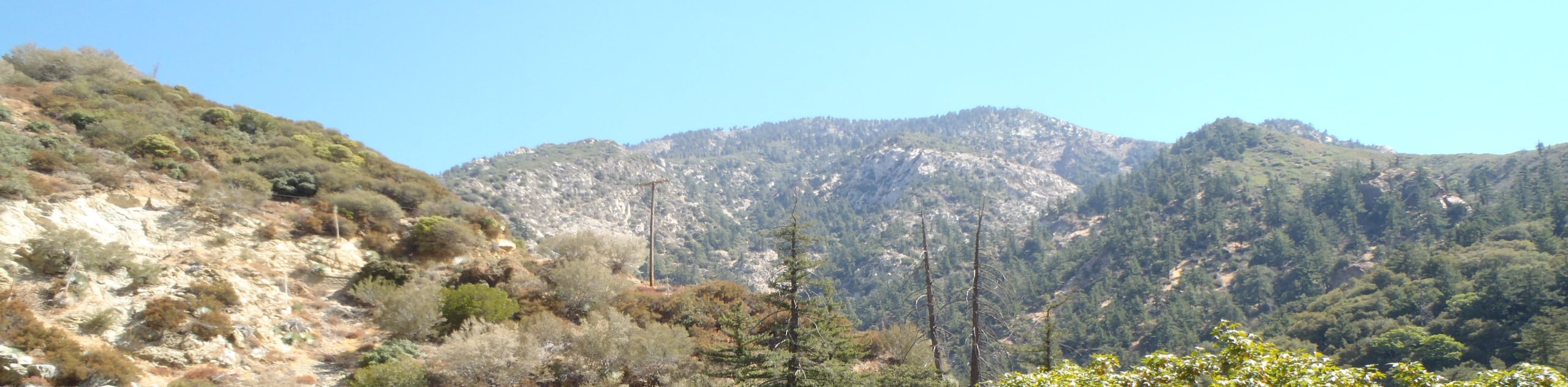
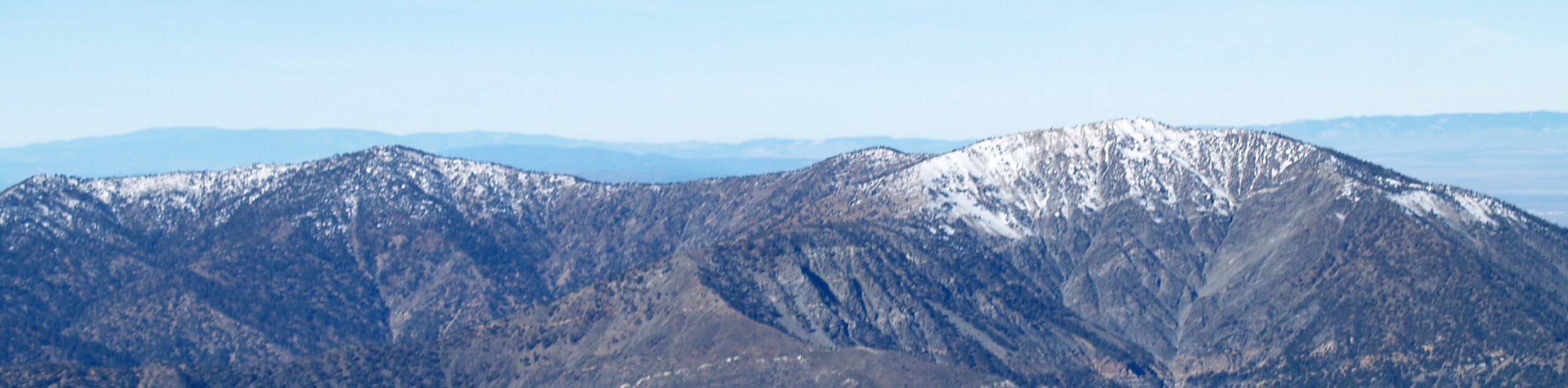
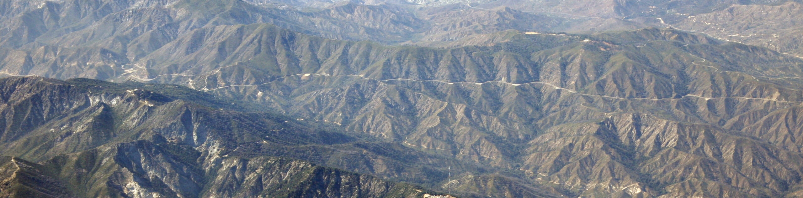
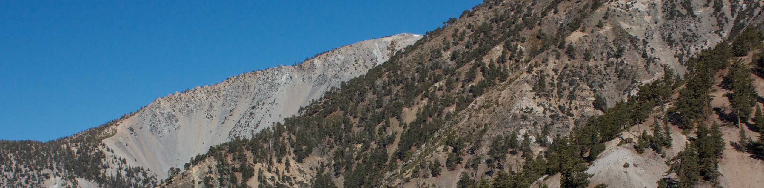
Established in 1908, the Angeles National Forest covers an area of 700,176 acres (1,094 mi²/2,833.5 km²), most of which is characterized by the rugged terrain of the San Gabriel and Sierra Pelona mountains.
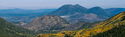
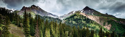
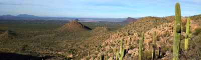
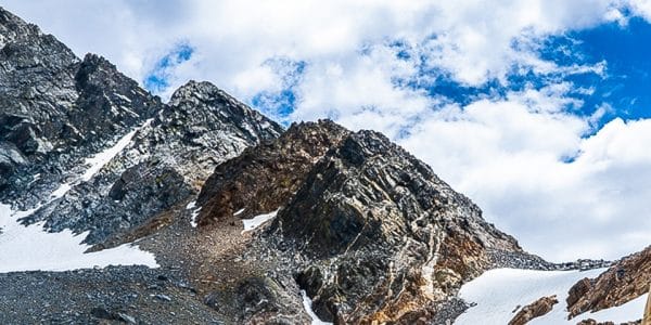
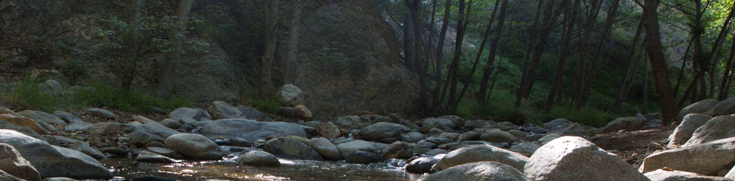
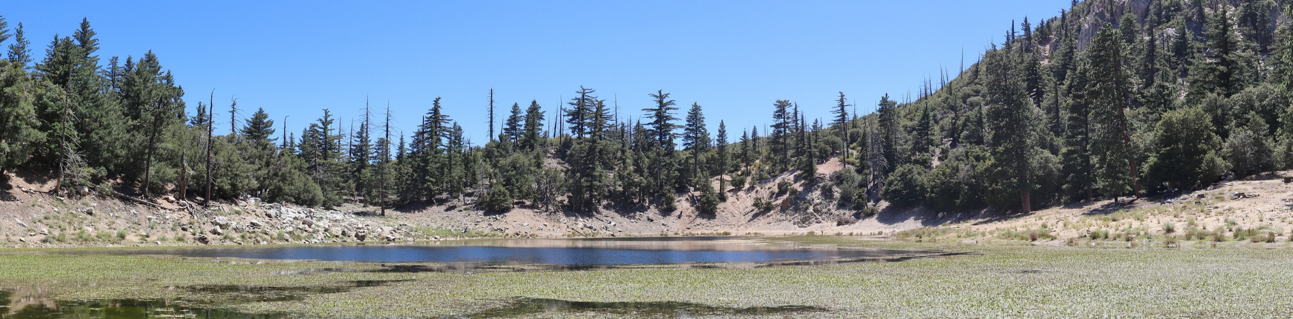
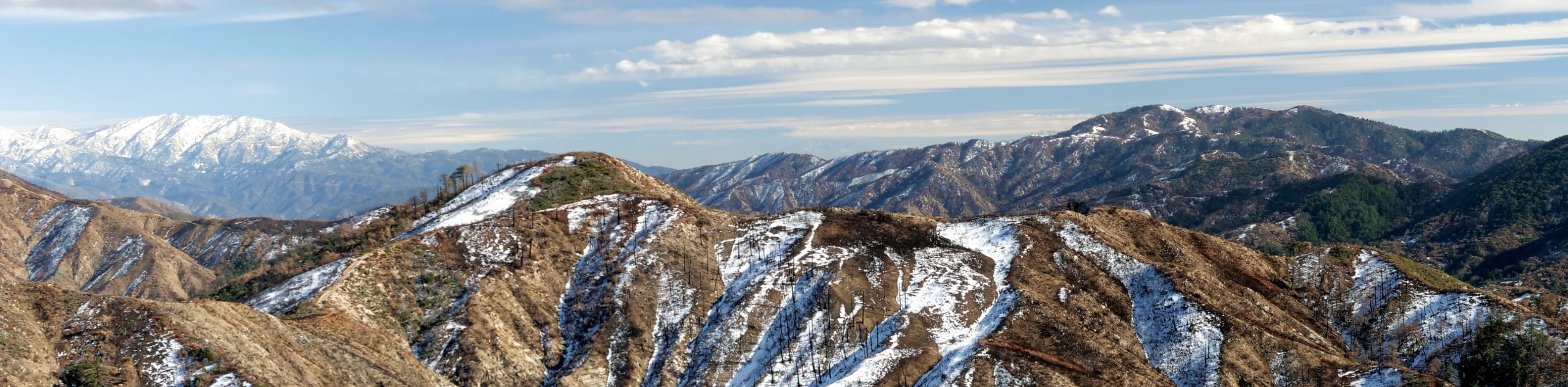
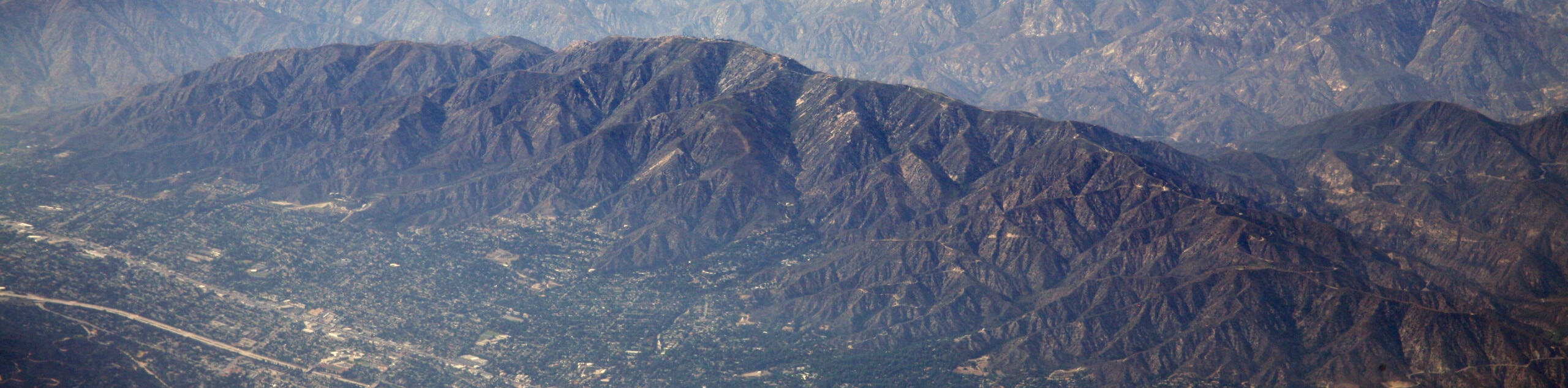
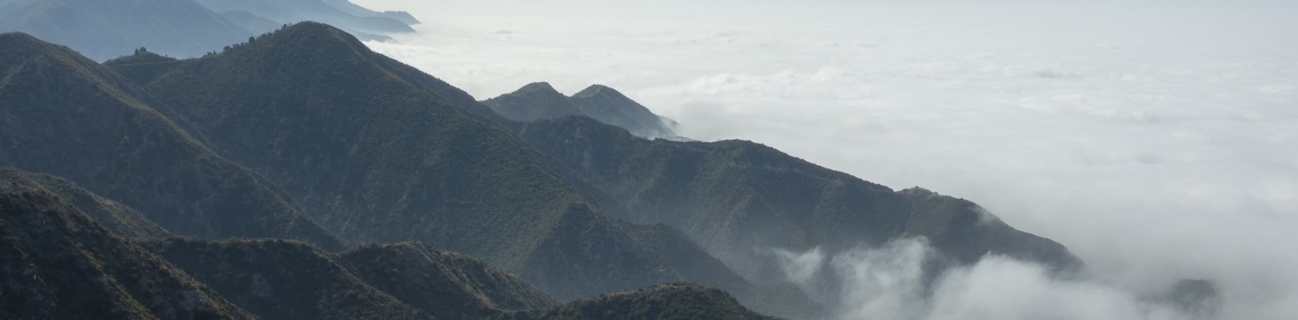
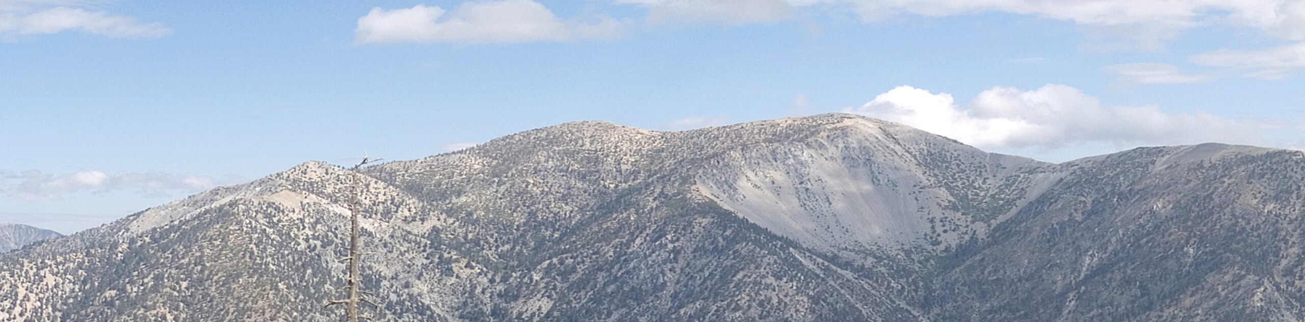
With such an undulating landscape, the Angeles National Forest is a popular destination for a wide variety of outdoor enthusiasts, particularly hikers, mountain bikers, horseback riders, and OHV drivers. Due to the arid climate of the region, it is prone to wildfires that have historically devastated stretches of the park, most notably the Loop Fire of 1966, the Station Fire of 2009, and the Bobcat Fire of 2020. Even still, the Angeles National Forest remains a beautifully scenic stretch of Southern California and there are many Angeles National Forest hikes that beg to be explored, making it the ideal jumping off point for your next outdoor adventure.
10 Epic Hiking Routes in the Angeles National Forest
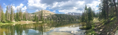
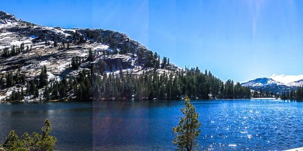
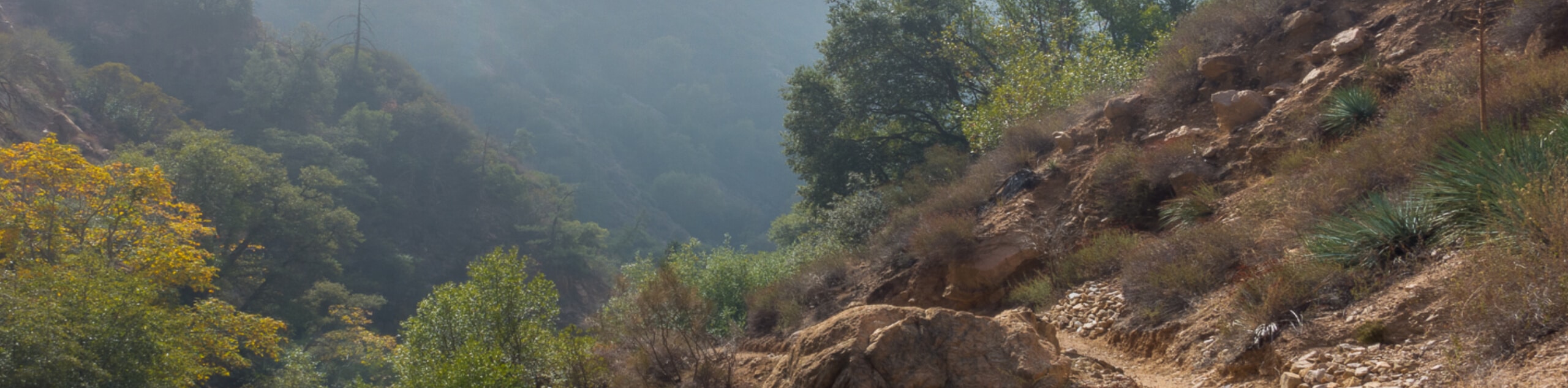
Featuring hundreds of miles of multi-use trails and a diverse landscape of green forests, stunning peaks, and undulating canyons, the Angeles National Forest is an amazing place to set out on your next hiking adventure. While some of the terrain here can seem a bit on the rugged side, easy access from metropolitan areas and a wide range of trail types means that this is the perfect place to explore, no matter your age or skill level. Whether you are an accomplished trekking enthusiast or are simply hoping to get outside for a few hours with the kids, check out the following list of Angeles National Forest hikes that we’ve put together to start experiencing the natural beauty of Southern California:
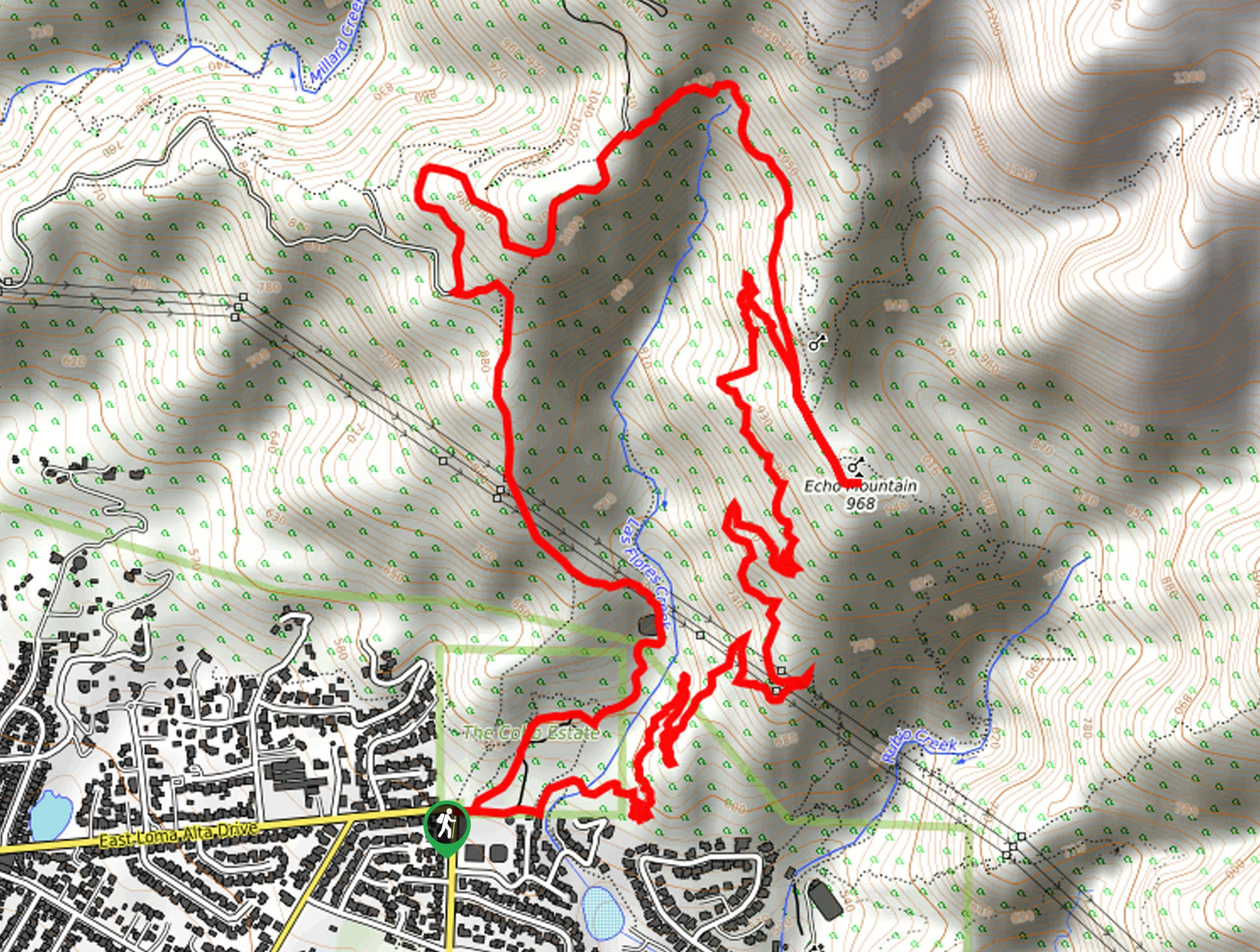
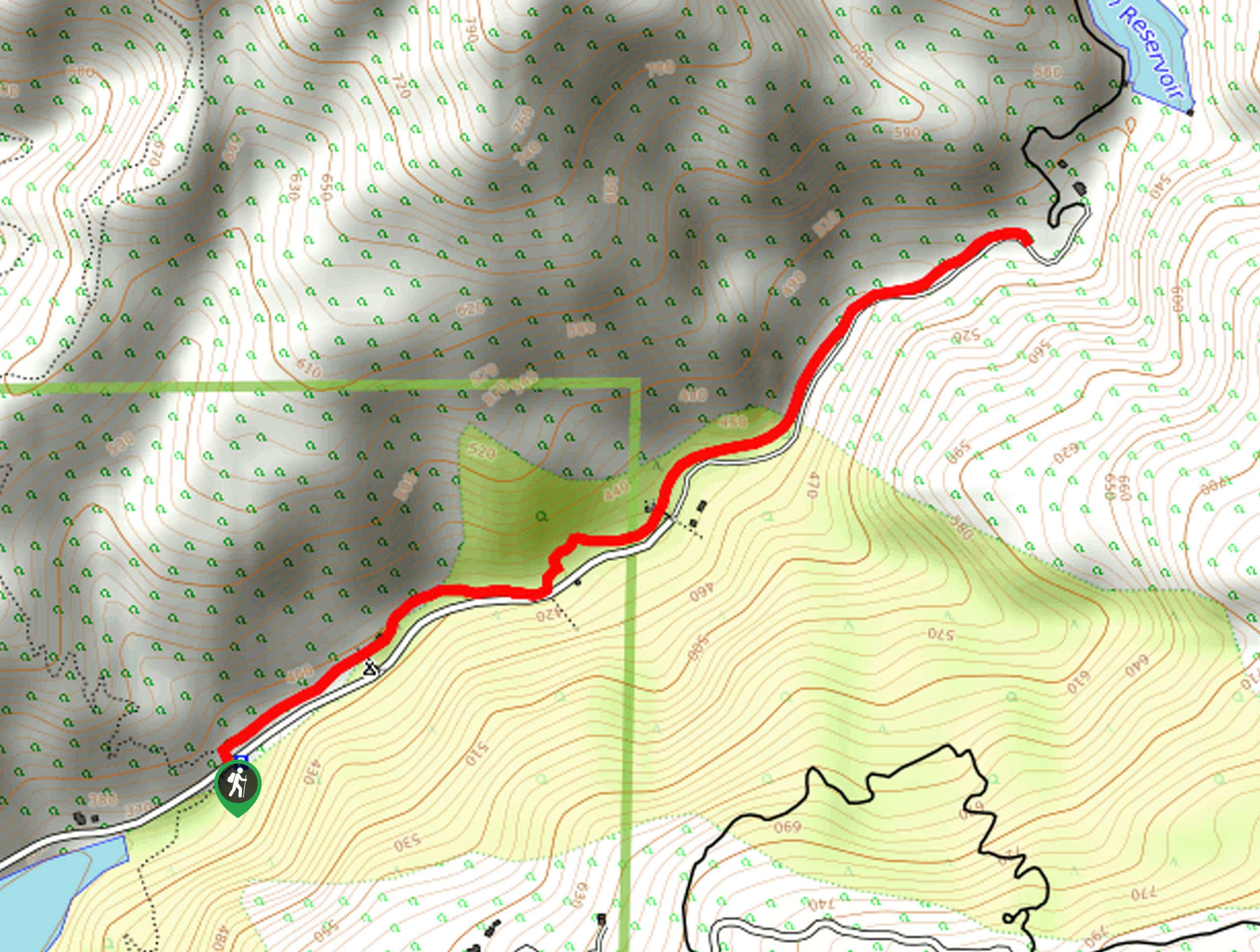
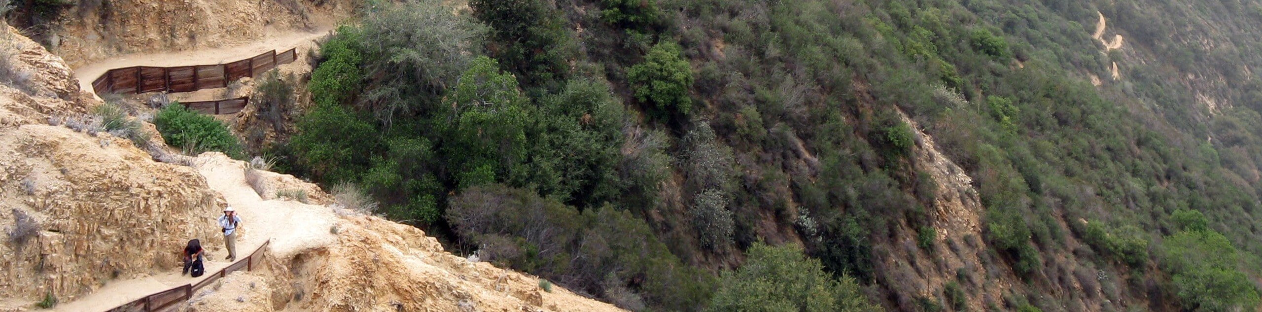
- Echo Mountain via Sam Merrill Trail: This hike can be a bit on the crowded side, but what it lacks in personal space it more than makes up for with gorgeous views from atop Echo Mountain.
- Mount San Antonio and Mount Baldy Notch Trail: If you are looking to push your physical limits while still experiencing some stunning views, this route will take you through some rugged terrain to scenic waterfall and mountain top viewpoints.
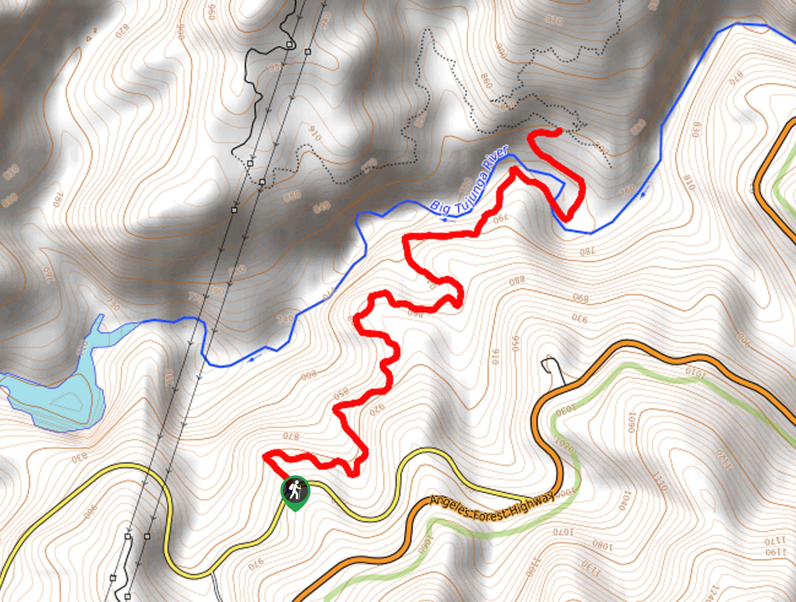
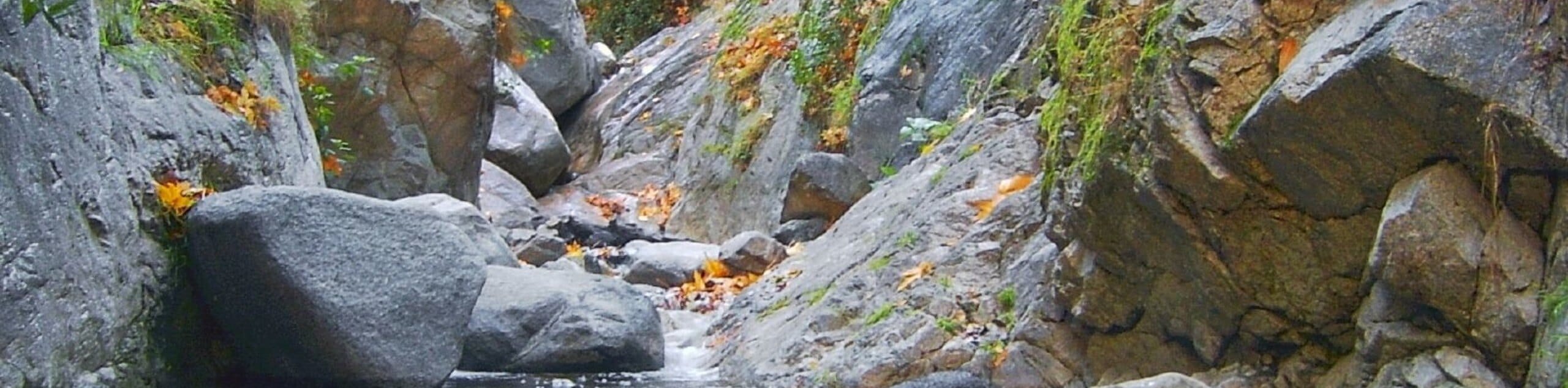
- Bridge to Nowhere via East Fork Trail: A great intermediate length trail with a scenic waterside setting, this hike will take you along the banks of the East Fork San Gabriel River for some beautiful canyon views.
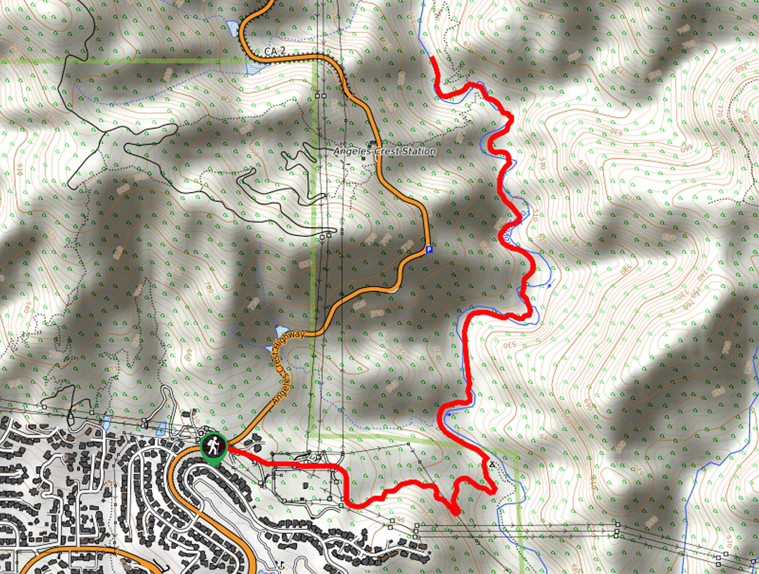
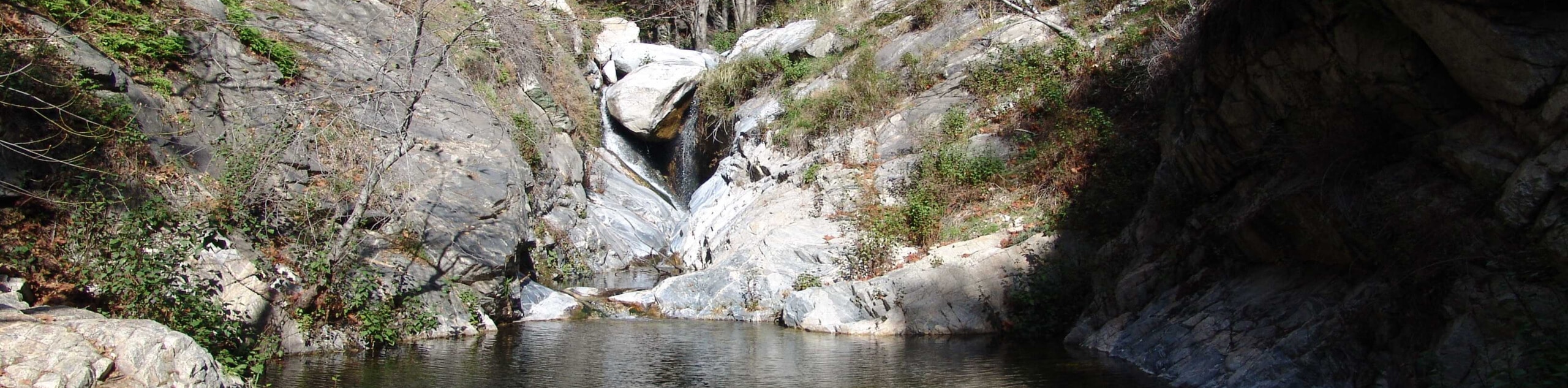
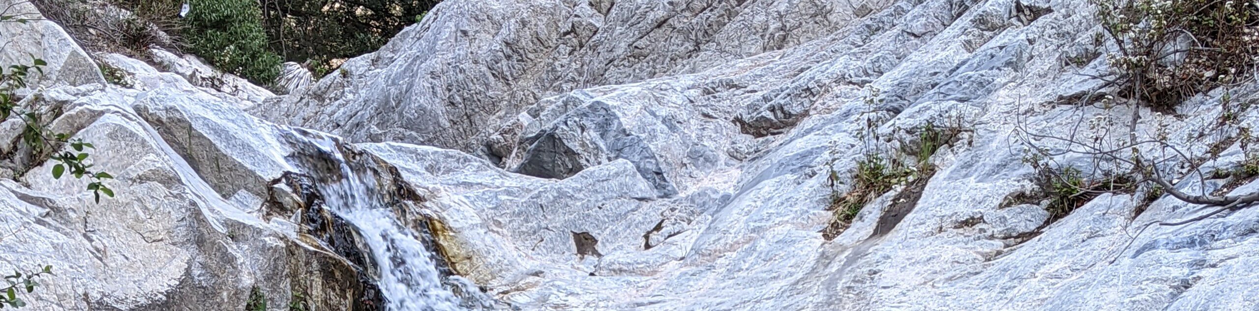
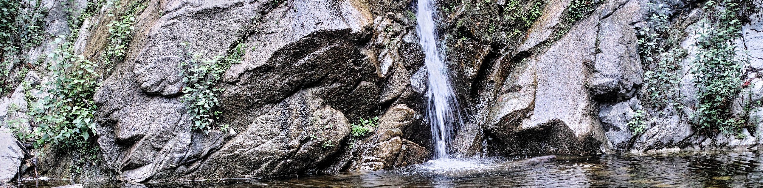
- Eaton Canyon Trail: Featuring an interesting nature center and some cascading waterfalls, the Eaton Canyon Trail is the perfect Angeles National Forest hike that the entire family will be sure to love.
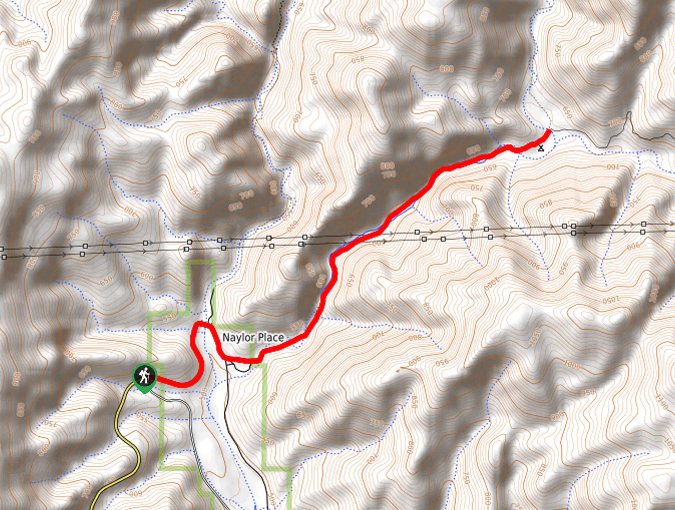
- Dawn Mine and Sunset Trail Loop: Beautiful canyon views and an historic mine await on this intermediate length hike just outside of Pasadena, California.
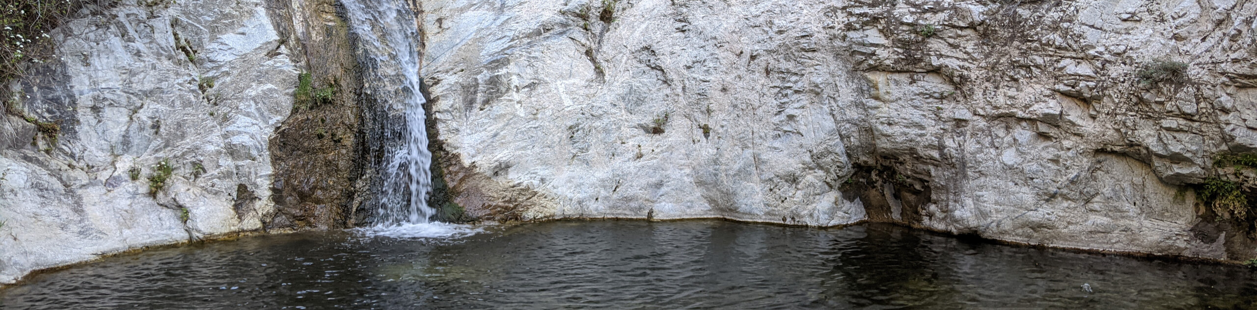
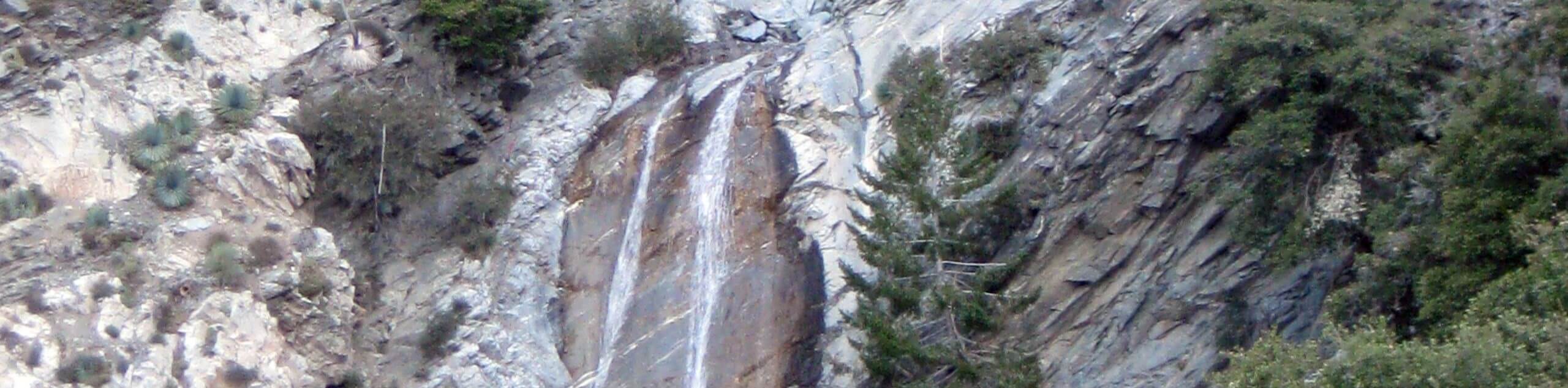
- Lewis Falls Trail: Quick and fairly easy, the Lewis Falls Trail is a lovely waterfall adventure that serves as the perfect outdoor escape when you can’t commit to a longer journey.
- Millard Canyon Falls Trail: Another relatively short waterfall hike, the Millard Canyon Falls Trail passes through a campsite and follows alongside the banks of Millard Creek for some beautiful views of the canyon and a cascading waterfall.
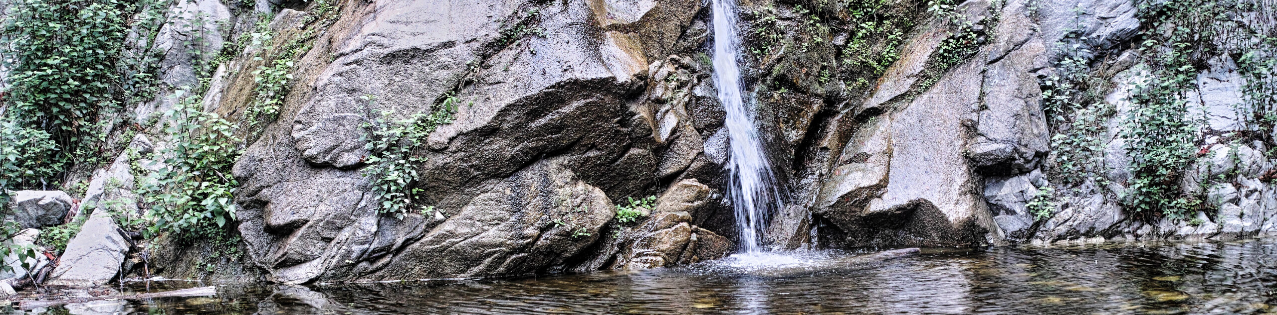
- Sturtevant Falls Trail: One of the most popular waterfall hikes within Angeles National Forest, this route will take you to a charming cascade that flows into a peaceful pool of water.
- Switzer Falls via Gabrielino Trail: Featuring a campsite and several sets of waterfalls, this is a nice trail if you are looking for a beautiful day hike or an easy-going multi-day adventure.
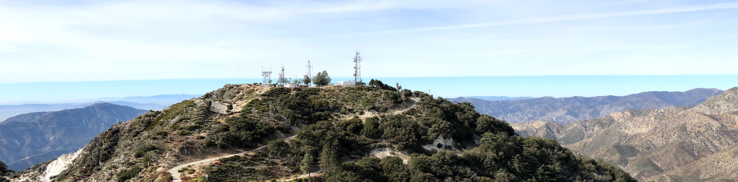
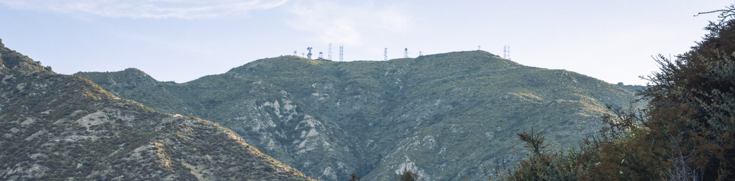
- Sturtevant, Mount Wilson, and Winter Creek Trail Loop: A bit on the longer side, this rugged hiking route will take you to the beautiful cascades of Sturtevant Falls, the historic Mount Wilson Observatory, and through the mountainous terrain of the Angeles National Forest.
When is the Best Time to Hike in Angeles National Forest?
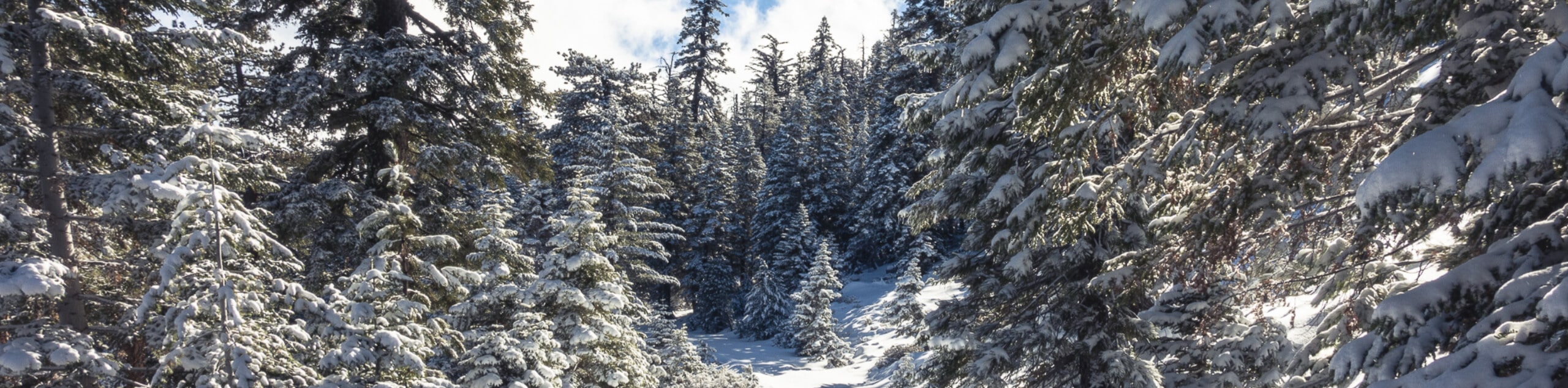
A good portion of the Angeles National Forest hikes are accessible year-round, although some - particularly at higher elevations in the mountains - are not suitable for use during the winter. If you are looking to experience as many trails as possible while on your next hiking adventure in the Angeles National Forest, then make sure to time your trip for the spring to autumn window to catch the best weather.
Other Outdoor Activities in the Angeles National Forest
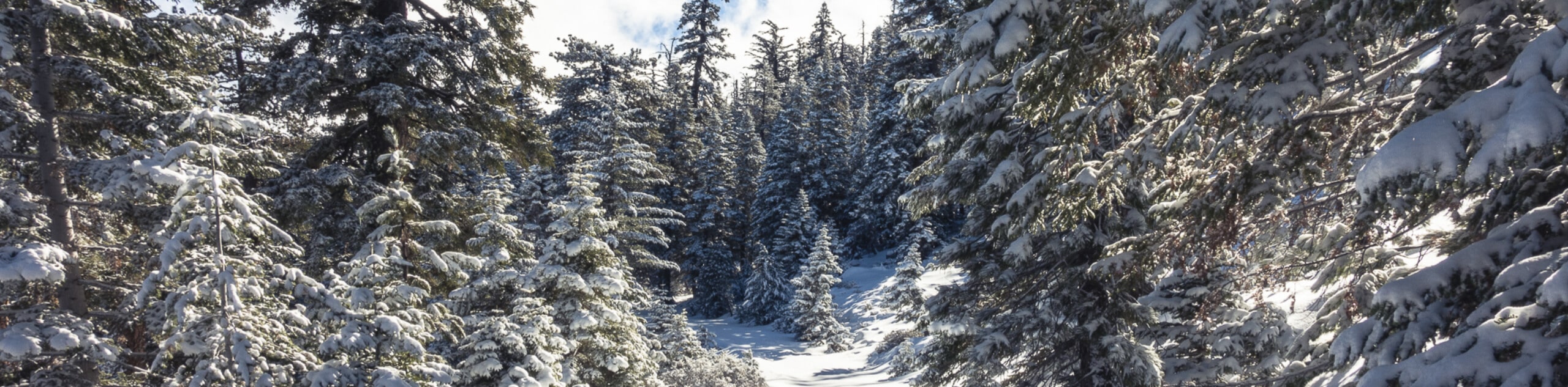
With its close proximity to both the city and a vast expanse of wilderness, the Angeles National Forest is certainly filled with plenty of outdoor activities to occupy your time. As the area features hundreds of miles of recreational trails, hiking is definitely one of the more popular activities in the Angeles National Forest; however, other popular adventures include camping, cycling, horseback riding, hunting, fishing, and wildlife viewing, in addition to water sports like canoeing, kayaking, and paddleboarding. If you would rather head outdoors during the winter months, alpine activities like skiing, snowboarding, snowshoeing, and even snowmobiling can be available in some higher elevation areas close by.
Fantastic Adventure Tours Near the Angeles National Forest
There are countless Angeles National Forest hikes that are just waiting to be explored, but the number of options can sometimes make planning a fun hiking trip a bit confusing or complicated, especially if you are unfamiliar with the area.
Frequently Asked Questions About the Angeles National Forest
How much does it cost to go to the Angeles National Forest?
As many areas within Angeles National Forest require maintenance, visitors will need to purchase a valid adventure pass, which costs $5 per day or $30 annually.
Can you hike in Angeles National Forest?
Hiking is one of the most popular outdoor activities in the Angeles National Forest, with over 500.0mi of dedicated trails.
Does it snow in the Angeles National Forest?
Snowfall is common in the Angeles National Forest during the winter months, providing a wealth of opportunity for outdoor activities like skiing, snowboarding, and snowshoeing.
Find other fantastic hiking regions in the California
Read MoreThe best hikes in Angeles National Forest
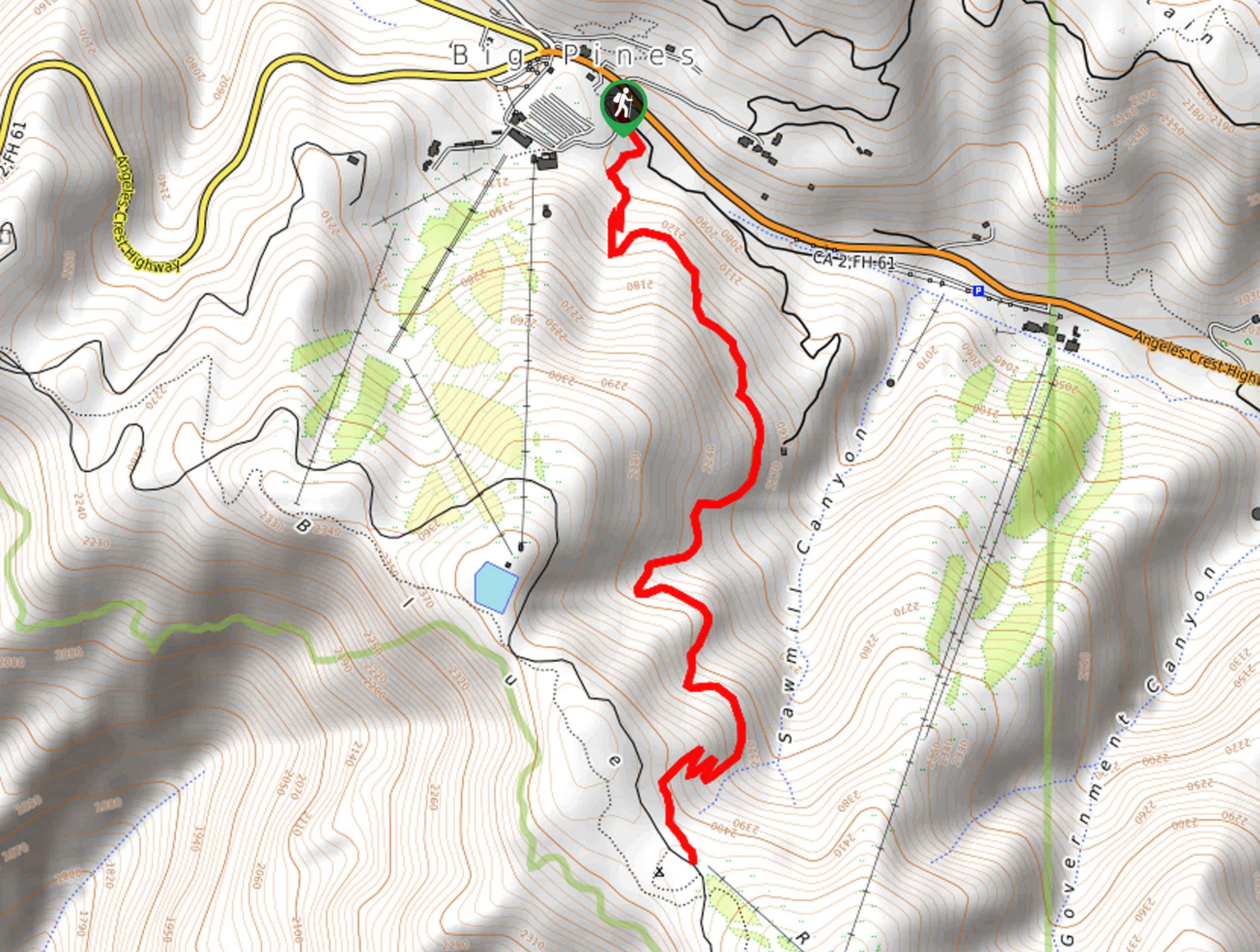
01. Eaton Canyon Trail
Difficulty
Hiking the Eaton Canyon Trail is a fantastic family-friendly adventure in the Angeles National Forest… Read More
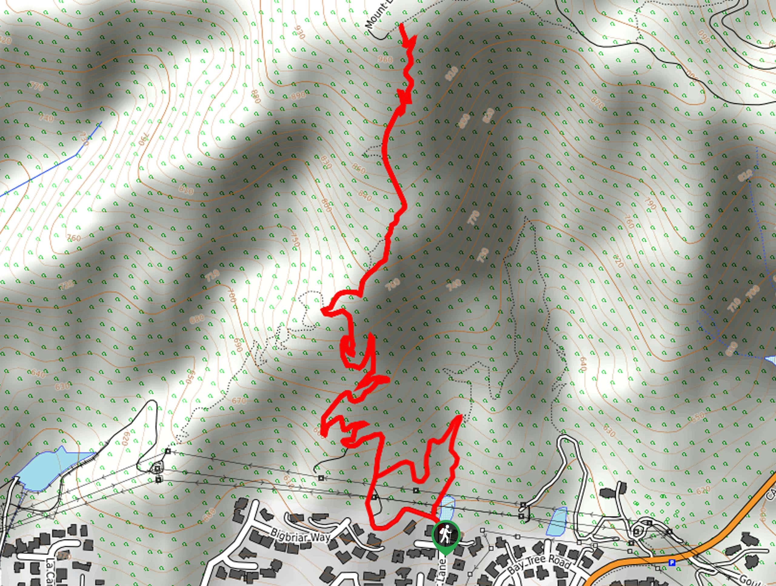
02. Dawn Mine and Sunset Trail Loop
Difficulty
The Dawn Mine and Sunset Trail Loop is a popular adventure in the Angeles National… Read More
03. Blue Ridge Trail
Difficulty
Hiking the Blue Ridge Trail is a great experience in Angeles National Forest that will… Read More
04. Mount Wilson Observatory Walking Trail
Difficulty
The Mount Wilson Observatory Walking Trail is a quick and easy journey in the Angeles… Read More
05. Mount Islip via Little Jimmy Campground Hike
Difficulty
The Mount Islip via Little Jimmy Campground Hike is a fun outdoor excursion in Angeles… Read More
06. Spruce Grove Campground Trail
Difficulty
The Spruce Grove Campground Trail is a great intermediate-length hiking route in the Angeles National… Read More
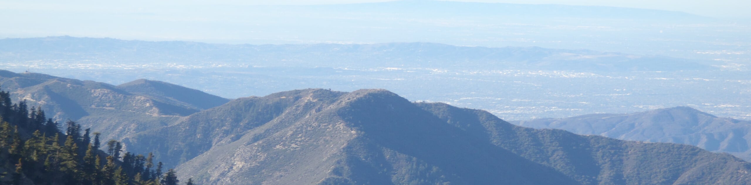
07. Mount Baldy via Bentley’s Dream Hike
Difficulty
The Mount Baldy via Bentley’s Dream Hike is a fun adventure in the Angeles National… Read More
08. Strawberry Peak Trail
Difficulty
The Strawberry Peak Trail is a challenging Southern California hiking route that will see you… Read More
09. Crystal Lake Trail
Difficulty
The Crystal Lake Trail is a lovely little hiking route in Angeles National Forest that… Read More
10. Mount Disappointment and San Gabriel Peak Hike
Difficulty
The Mount Disappointment and San Gabriel Peak Hike is a great adventure in the Angeles… Read More
Yes, there are more than 10
Angeles National Forest is so beautiful that we can not give you only 10 hikes. So here is a list of bonus hikes in Angeles National Forest that you should take a look at as well
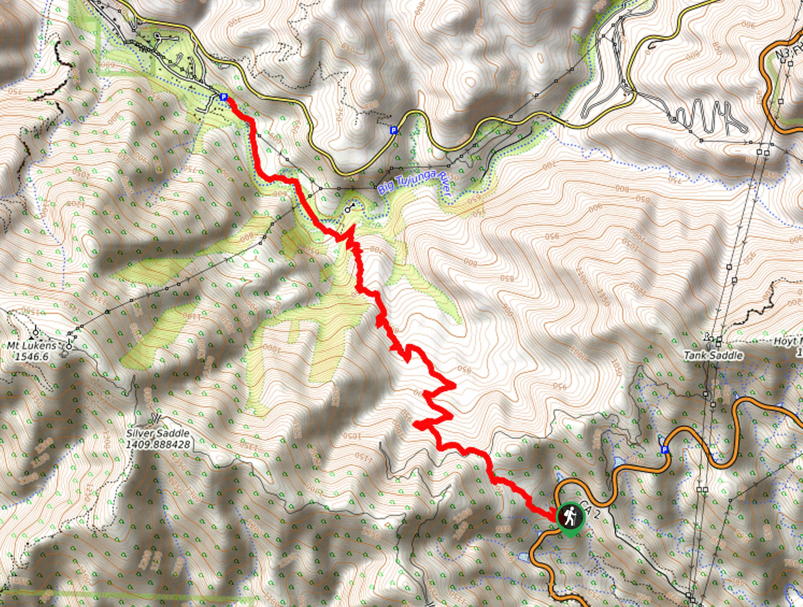
11. Mount Lukens via Dunsmore Canyon Hike
Difficulty
The Mount Lukens via Dunsmore Canyon Hike is a long and challenging excursion in Southern… Read More
12. Mount Lowe Railway Loop Trail
Difficulty
The Mount Lowe Railway Loop Trail is a great hiking route in Angeles National Forest… Read More
13. Little Jimmy Campground Hike
Difficulty
The Little Jimmy Campground Hike is a fun little trail in Angeles National Forest that… Read More
14. Gabrielino Trail
Difficulty
The Gabrielino Trail is a fantastic family-friendly hiking route in Angeles National Forest that utilizes… Read More
15. Sunset Ridge Saddle Loop Hike
Difficulty
The Sunset Ridge Saddle Loop Hike is a great activity in the Angeles National Forest… Read More
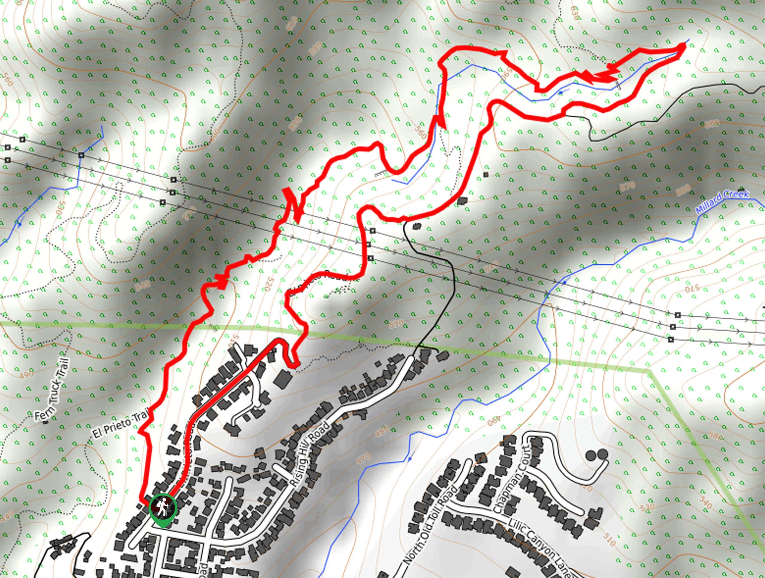
16. El Prieto Loop Trail
Difficulty
The El Prieto Loop Trail is a great hiking route in the Angeles National Forest… Read More
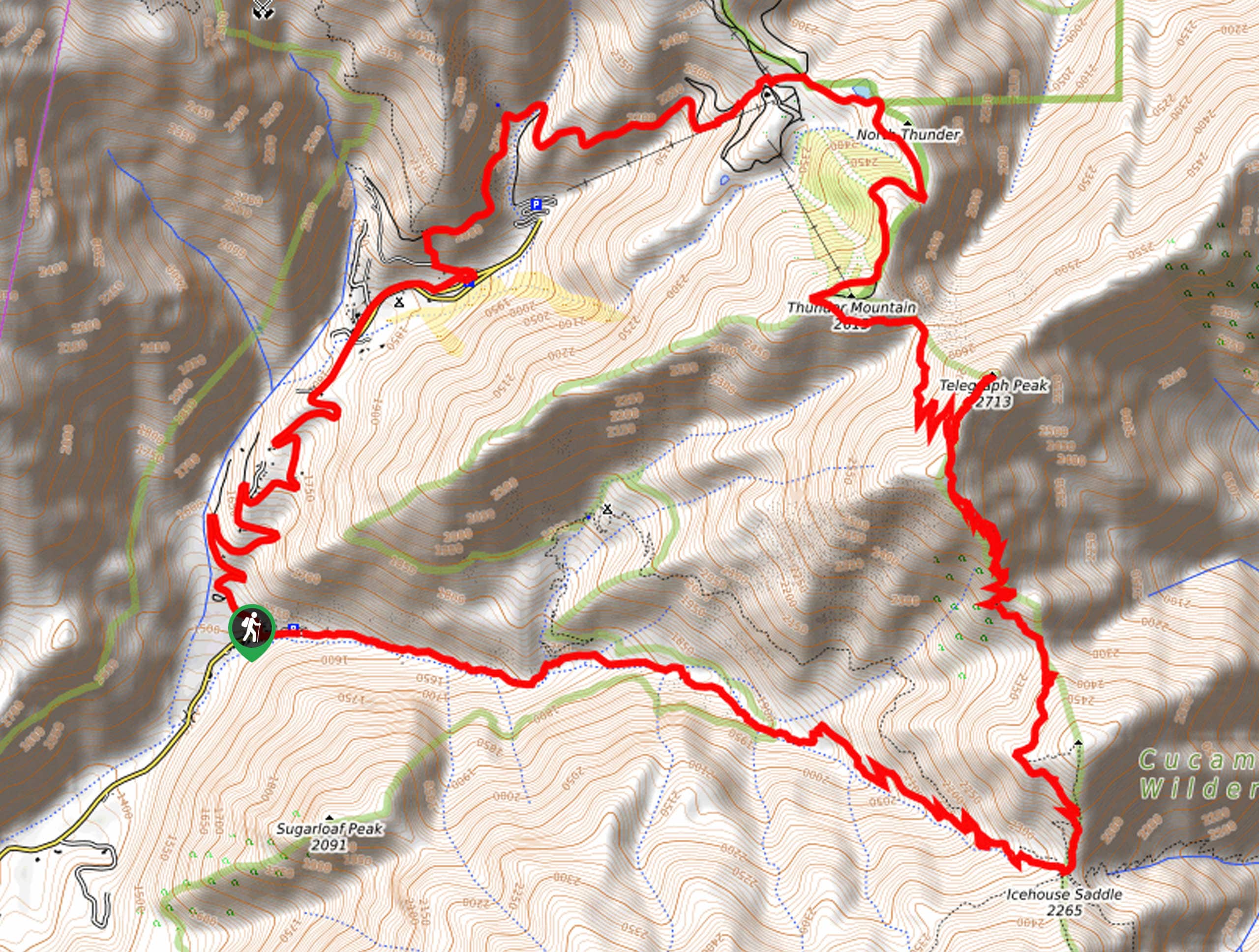
17. Telegraph Peak via Manker Flats Hike
Difficulty
The Telegraph Peak via Manker Flats Hike is a long and challenging adventure in the… Read More
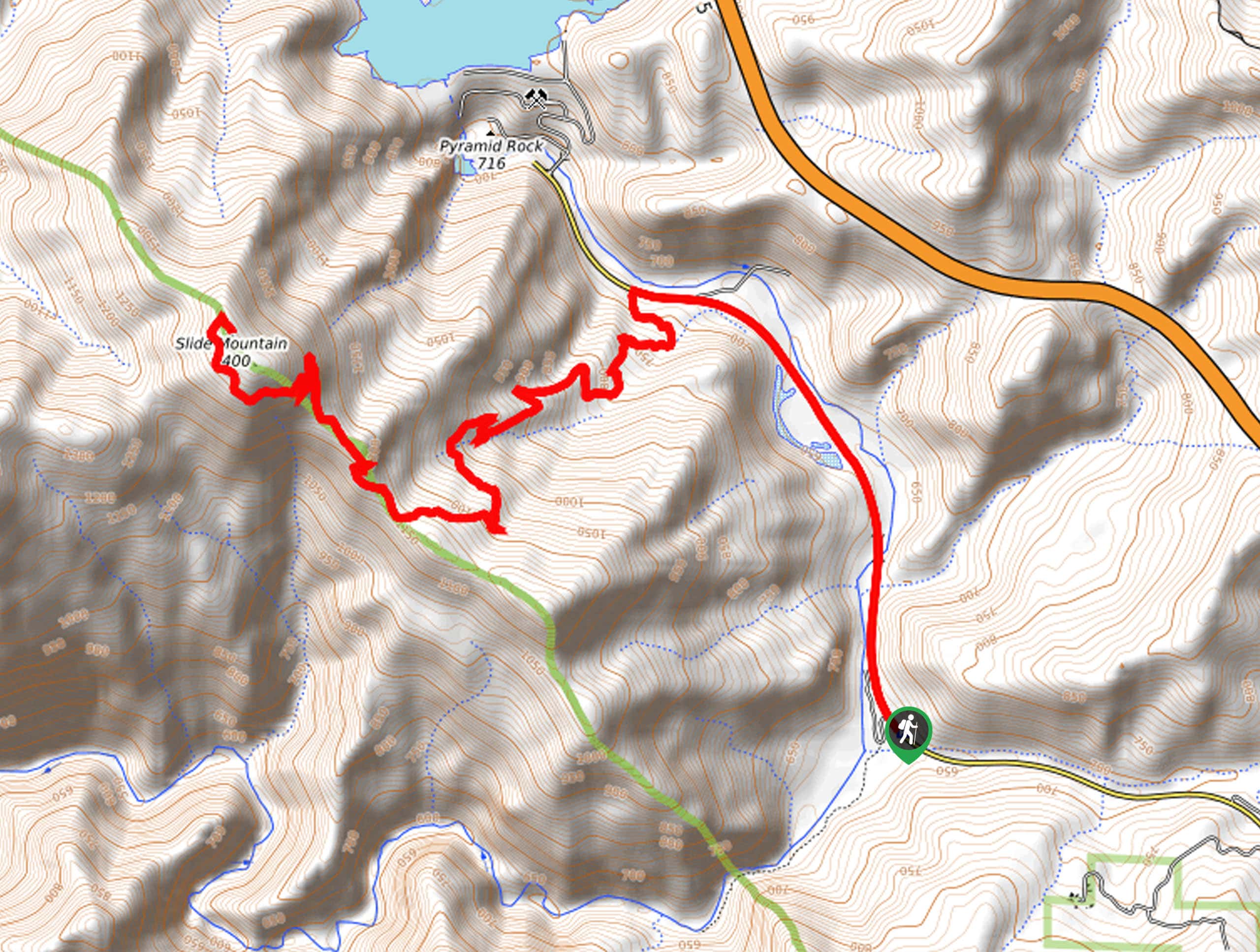
18. Slide Mountain Trail
Difficulty
Hiking the Slide Mountain Trail is a fantastic experience in the Angeles National Forest that… Read More
19. Crystal Lake, Mount Islip, and Windy Gap Loop Hike
Difficulty
The Crystal Lake, Mount Islip, and Windy Gap Loop Hike is a challenging adventure in… Read More
20. Windy Gap, Mount Islip, and Big Cienega Trail
Difficulty
The Windy Gap, Mount Islip, and Big Cienega Trail is a rough and rocky trail… Read More
21. Glendora Ridge Motorway Hike
Difficulty
The Glendora Ridge Motorway Hike is a laid back, intermediate-length adventure in Angeles National Forest… Read More
22. Dawn Mine Hike
Difficulty
The Dawn Mine Hike is a fun adventure in the Angeles National Forest that will… Read More

23. San Gabriel Peak Trail
Difficulty
The San Gabriel Peak Trail is a short, but rugged, adventure in the Angeles National… Read More
24. Mount Wilson Road to Idlehour Campground Hike
Difficulty
The Mount Wilson Road to Idlehour Campground Hike is a long and challenging excursion in… Read More
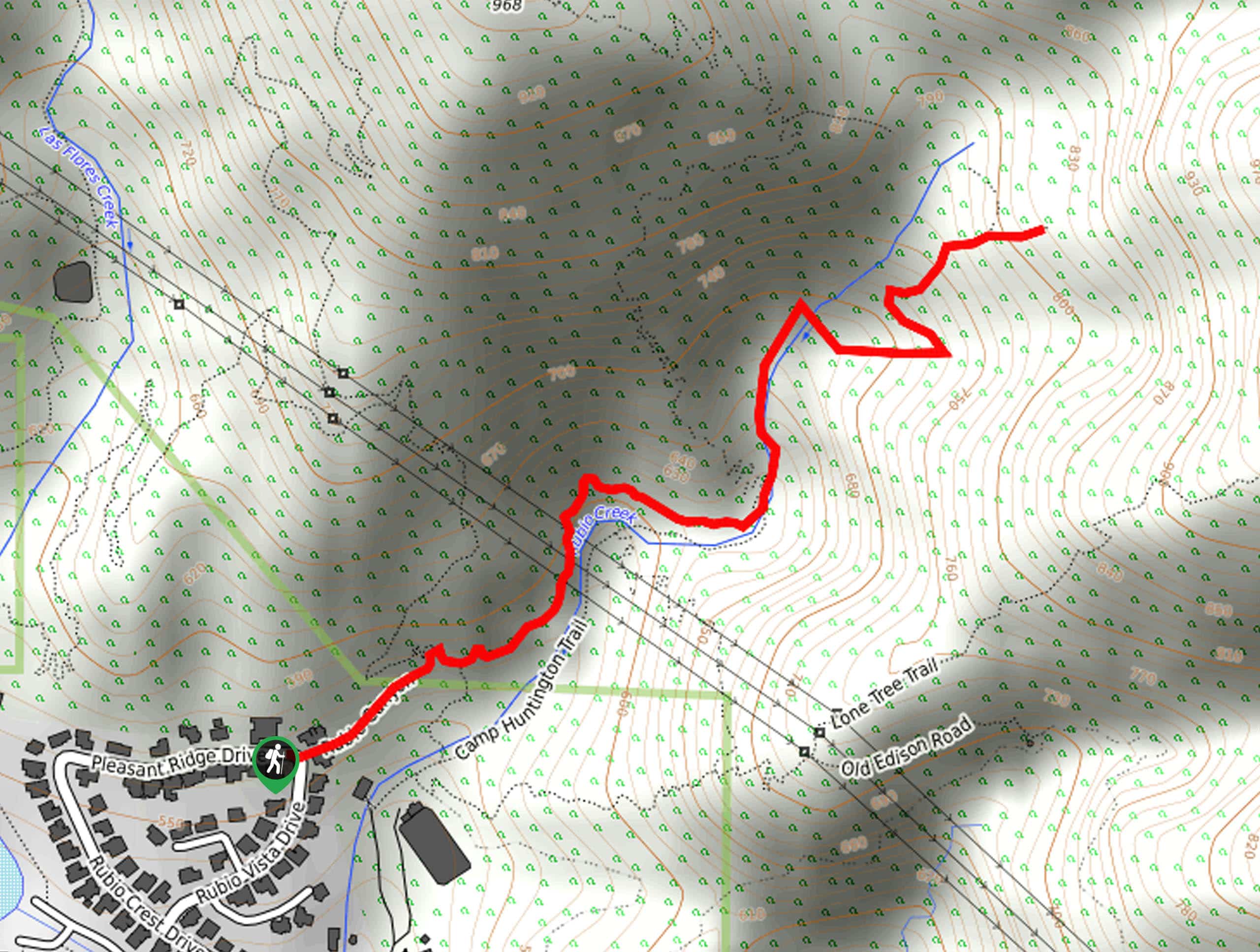
25. Rubio Canyon Trail
Difficulty
The Rubio Canyon Trail is a short, but deceptively challenging, hiking route in Angeles National… Read More
26. Sunset Ridge Road Hike
Difficulty
The Sunset Ridge Road Hike is a wonderful adventure in Southern California that follows a… Read More
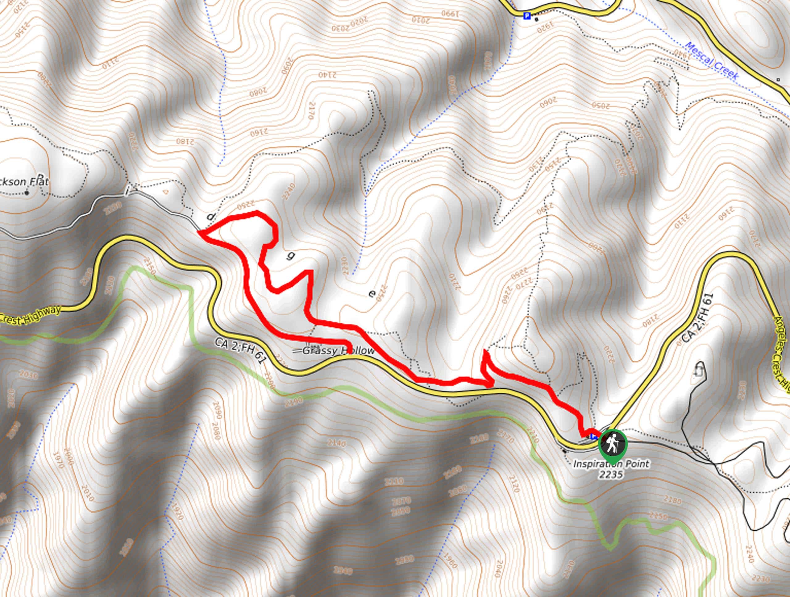
27. Inspiration Point and Grassy Hollow Hike
Difficulty
The Inspiration Point and Grassy Hollow Hike is a fantastic family-friendly adventure in the Angeles… Read More
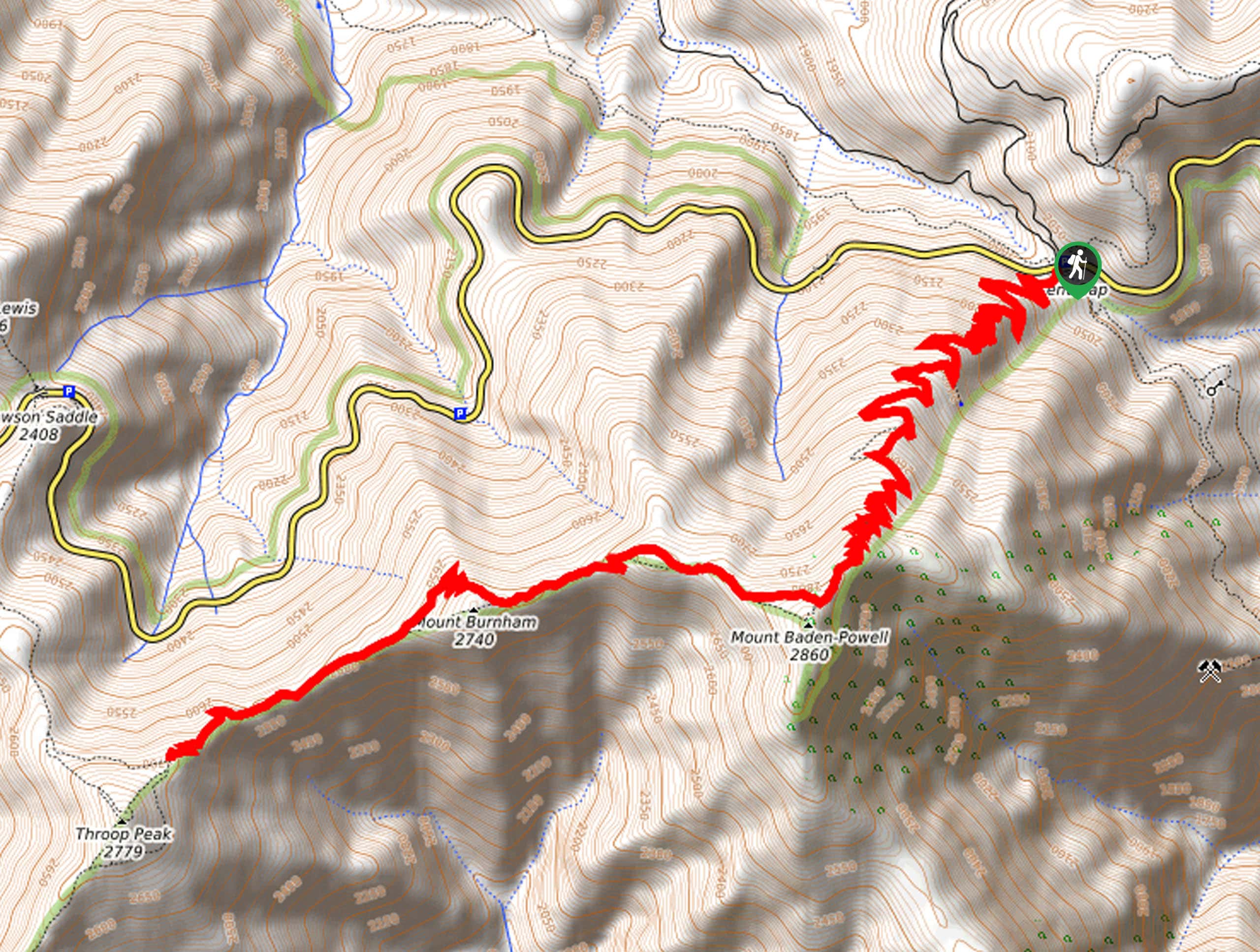
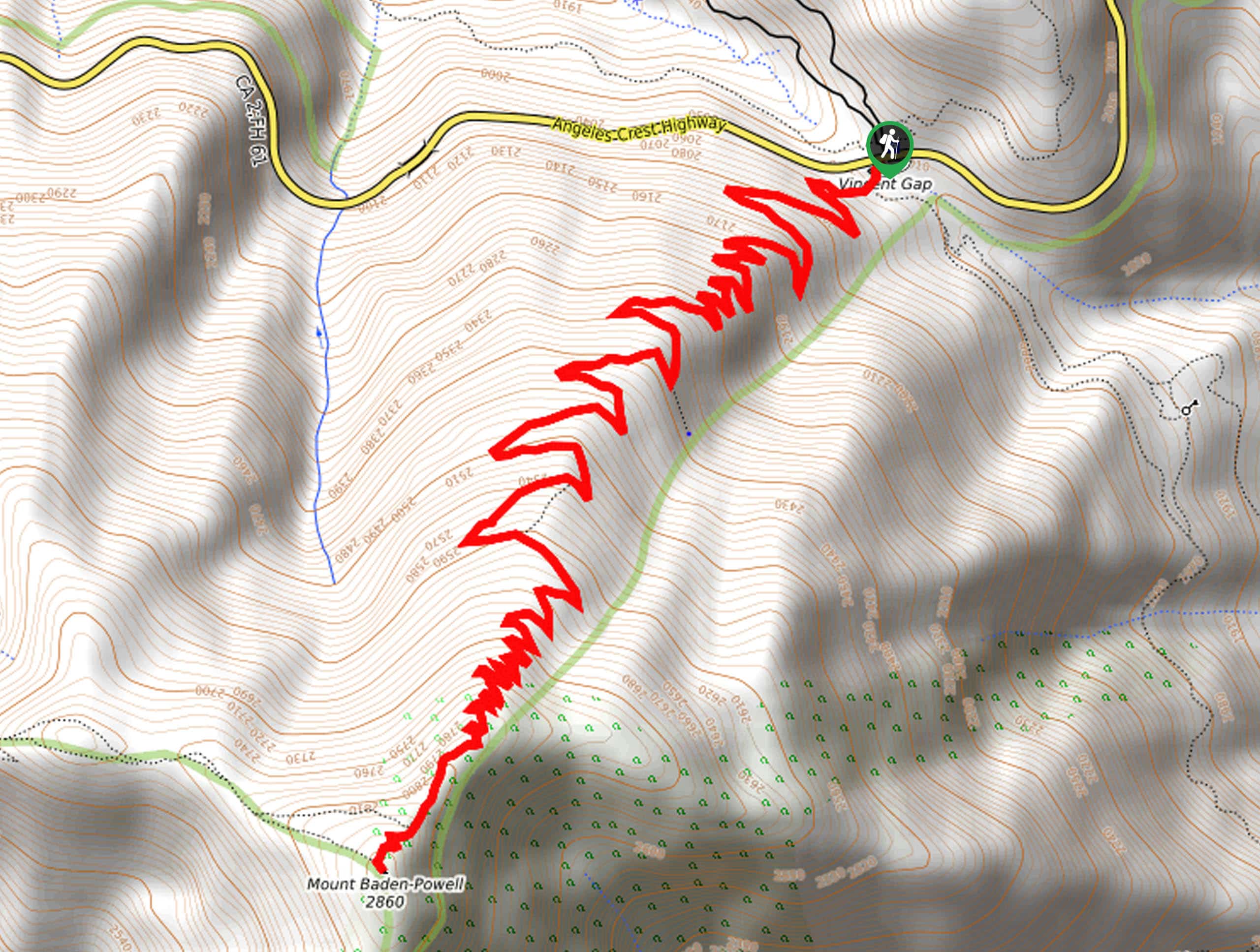
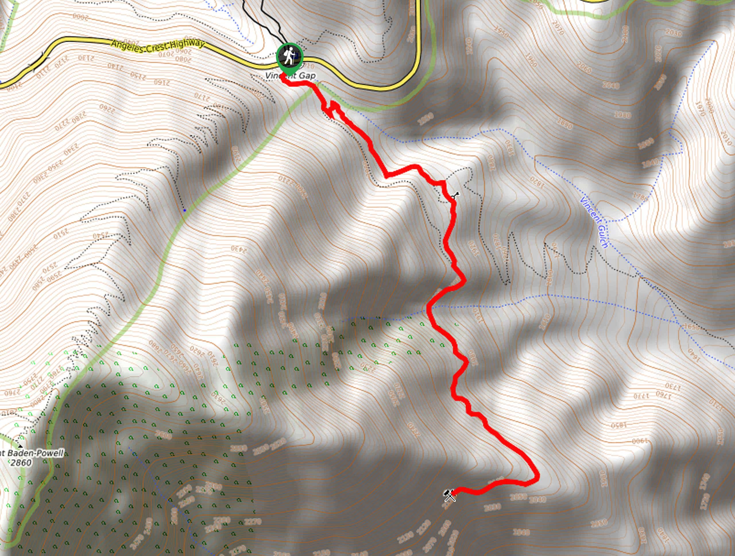
28. Vincent Gap to Mount Baden-Powell Hike
Difficulty
The Vincent Gap to Mount Baden-Powell Hike is a challenging, yet beautiful scenic excursion in… Read More
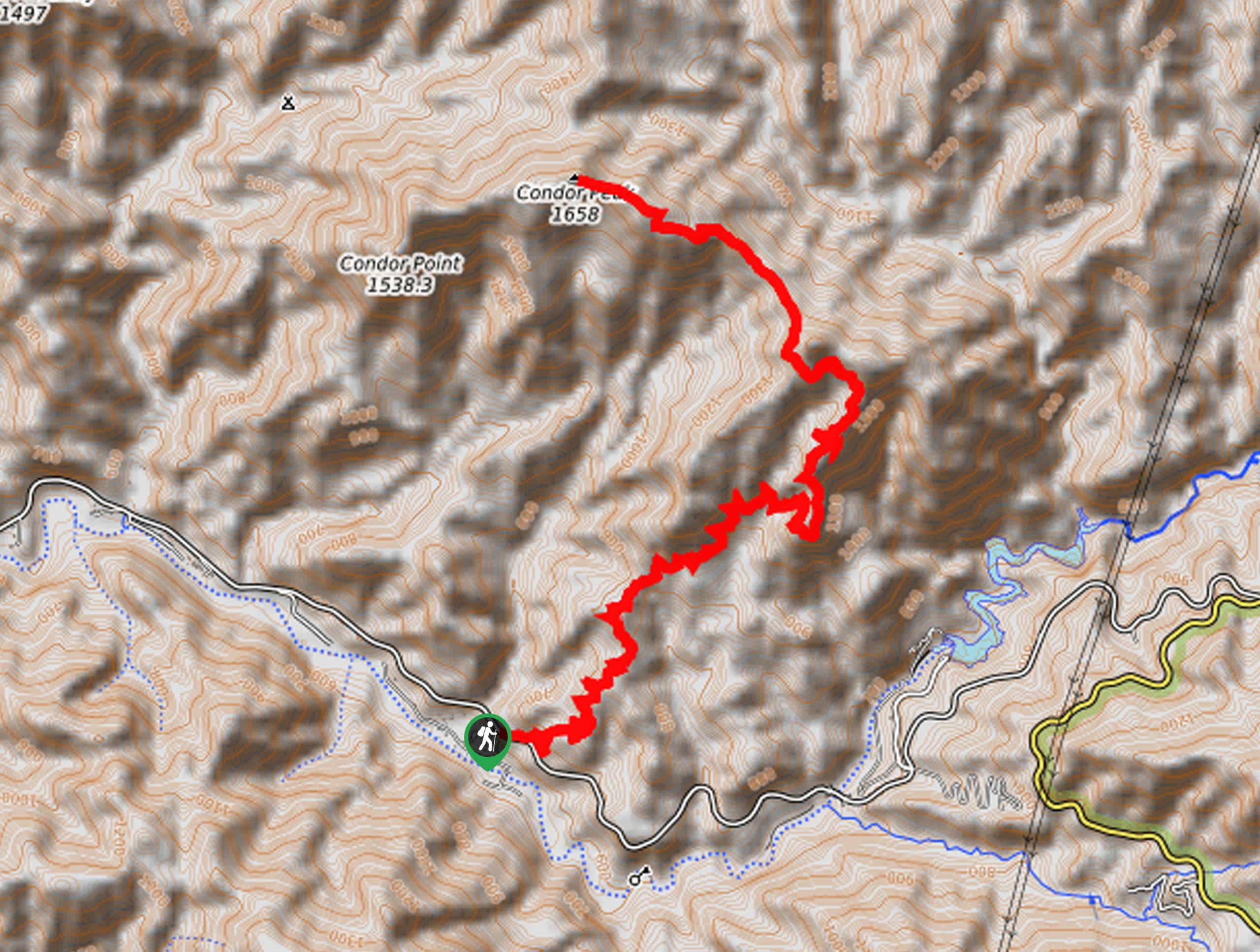
29. Condor Peak Trail
Difficulty
The Condor Peak Trail is a difficult hiking route in the Angeles National Forest that… Read More
30. Three Ts Trail
Difficulty
The Three Ts Trail is an exceptional hiking route in Angeles National Forest that is… Read More
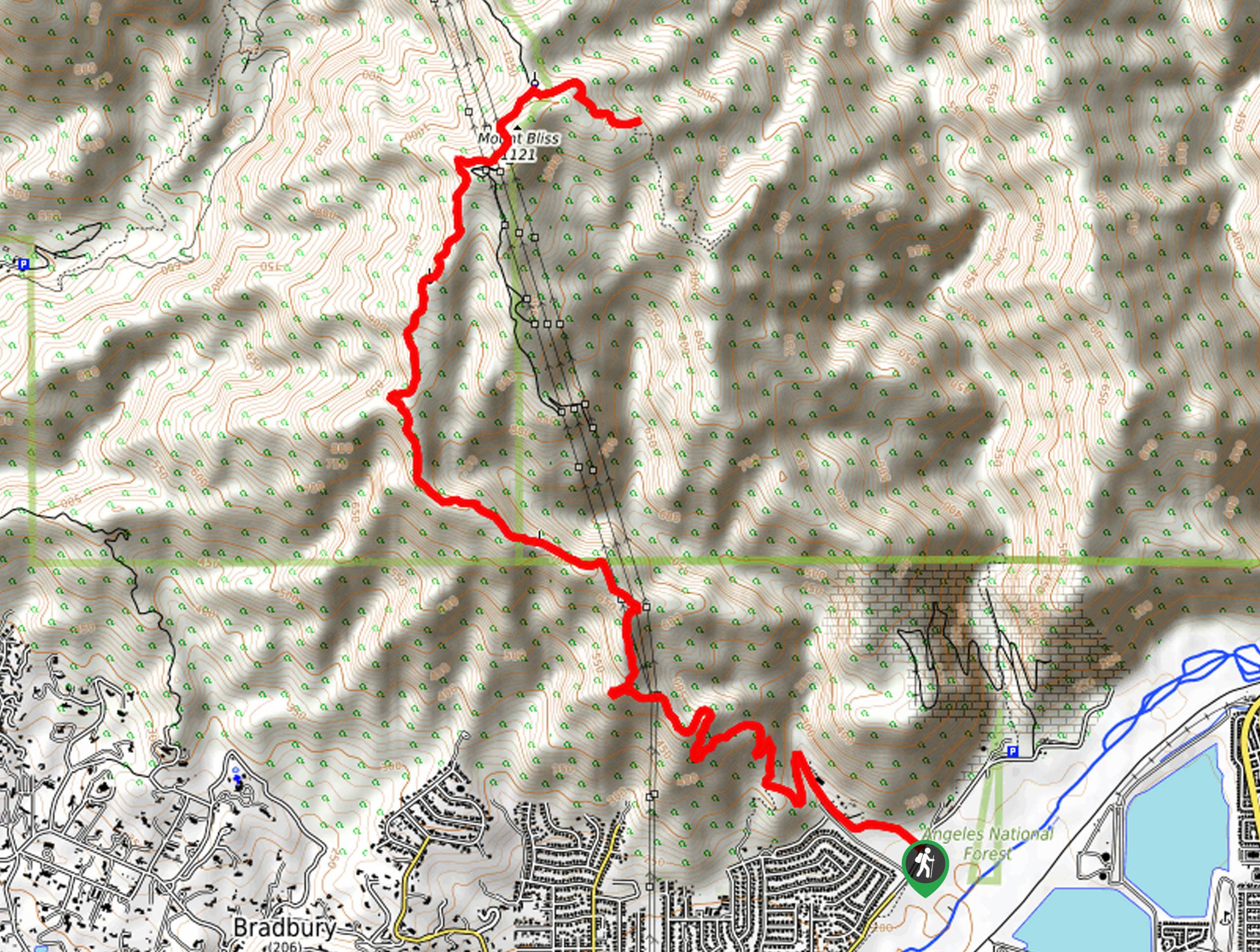
31. Mount Bliss: Van Tassel Trail
Difficulty
Hiking the Mount Bliss: Van Tassel Trail is a tough adventure in Southern California that… Read More
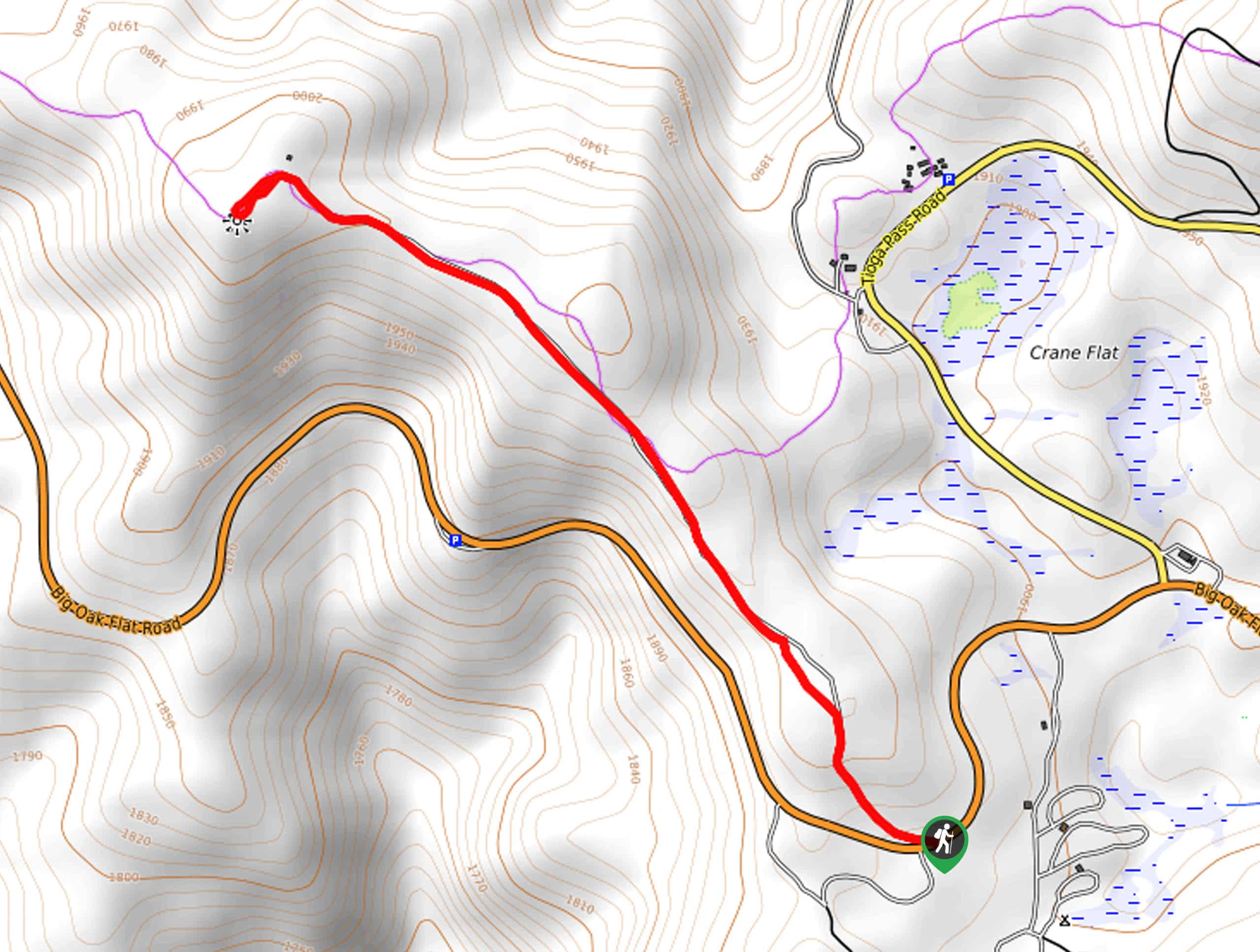
32. Crane Flat Lookout Trail
Difficulty
The Crane Flat Lookout Trail is an awesome, versatile adventure that the whole family can… Read More
33. Shoemaker Canyon Road Hike
Difficulty
The Shoemaker Canyon Road Hike is a fairly laidback adventure in Southern California that follows… Read More
34. Mount Lowe Campground Trail
Difficulty
Hiking the Mount Lowe Campground Trail is a great adventure in the Angeles National Forest… Read More
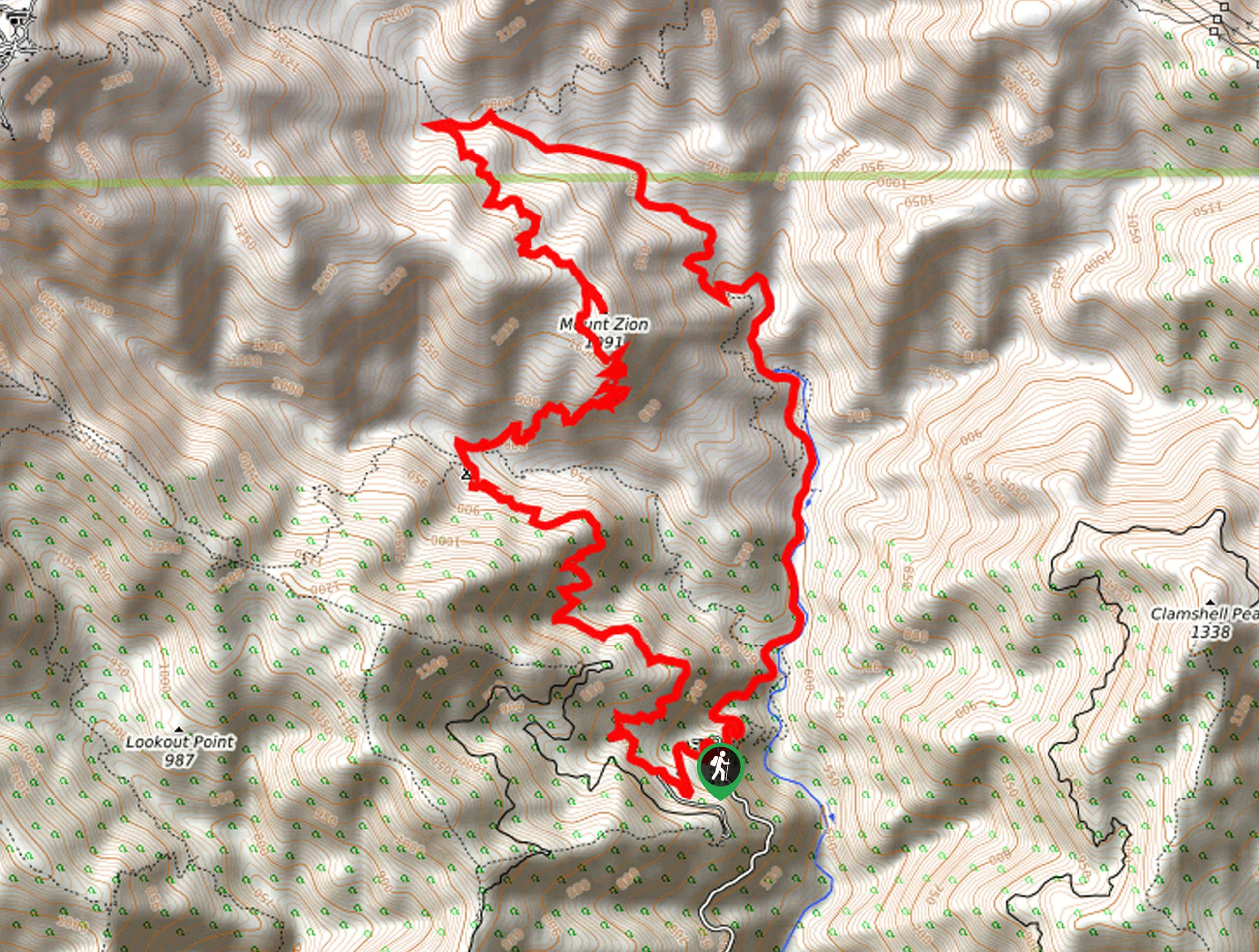
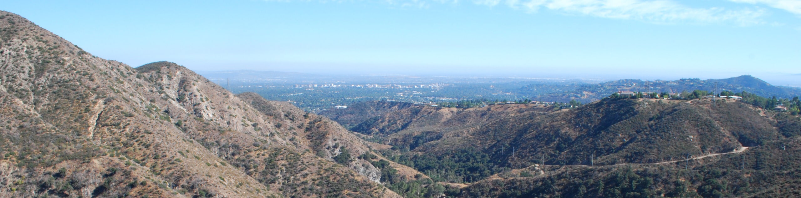
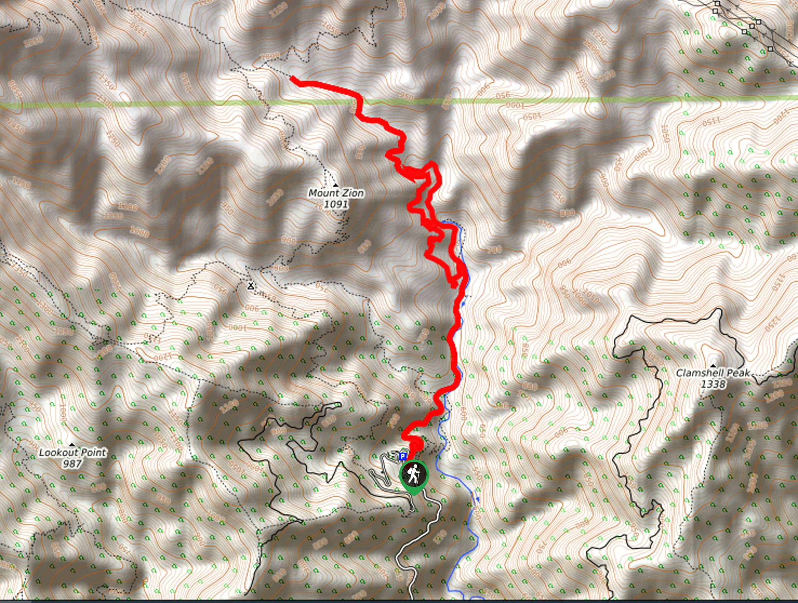
35. Mount Zion Loop Trail
Difficulty
Hiking the Mount Zion loop Trail is a wonderful experience in the Angeles National Forest… Read More
36. Mount Baldy and San Antonio Falls Hike
Difficulty
The Mount Baldy and San Antonio Falls Hike is a tough, but wonderfully scenic, excursion… Read More

37. Orchard Camp via Mount Wilson Trail
Difficulty
The Orchard Camp via Mount Wilson Trail is a great hiking route in the Angeles… Read More
38. Gould Mesa Road Hike
Difficulty
The Gould Mesa Road Hike is a fun little adventure in the Angeles National Forest… Read More
39. Grizzly Flat Trail
Difficulty
Hiking the Grizzly Flat Trail is a fun experience in Southern California that will take… Read More
40. Angeles Crest Scenic Byway Hike
Difficulty
The Angeles Crest Scenic Byway Hike is a great family-friendly excursion in Southern California that… Read More
41. Little Jimmy Springs Hike
Difficulty
The Little Jimmy Springs Hike is a great family-friendly adventure in the Angeles National Forest… Read More
42. Mount Lowe via Eaton Saddle Hike
Difficulty
The Mount Lowe via Eaton Saddle Hike is a great moderate-length trail in Southern California… Read More
43. Switzer Falls and Bear Canyon Camp Hike
Difficulty
The Switzer Falls and Bear Canyon Camp Hike is a fantastic outdoor excursion in the… Read More
44. Jupiter Mountain Loop Trail
Difficulty
The Jupiter Mountain Loop Trail is a challenging hiking route in the Angeles National Forest… Read More

45. Chantry Flats to Mount Wilson Hike
Difficulty
The Chantry Flats to Mount Wilson Hike is a difficult undertaking in Angeles National Forest… Read More
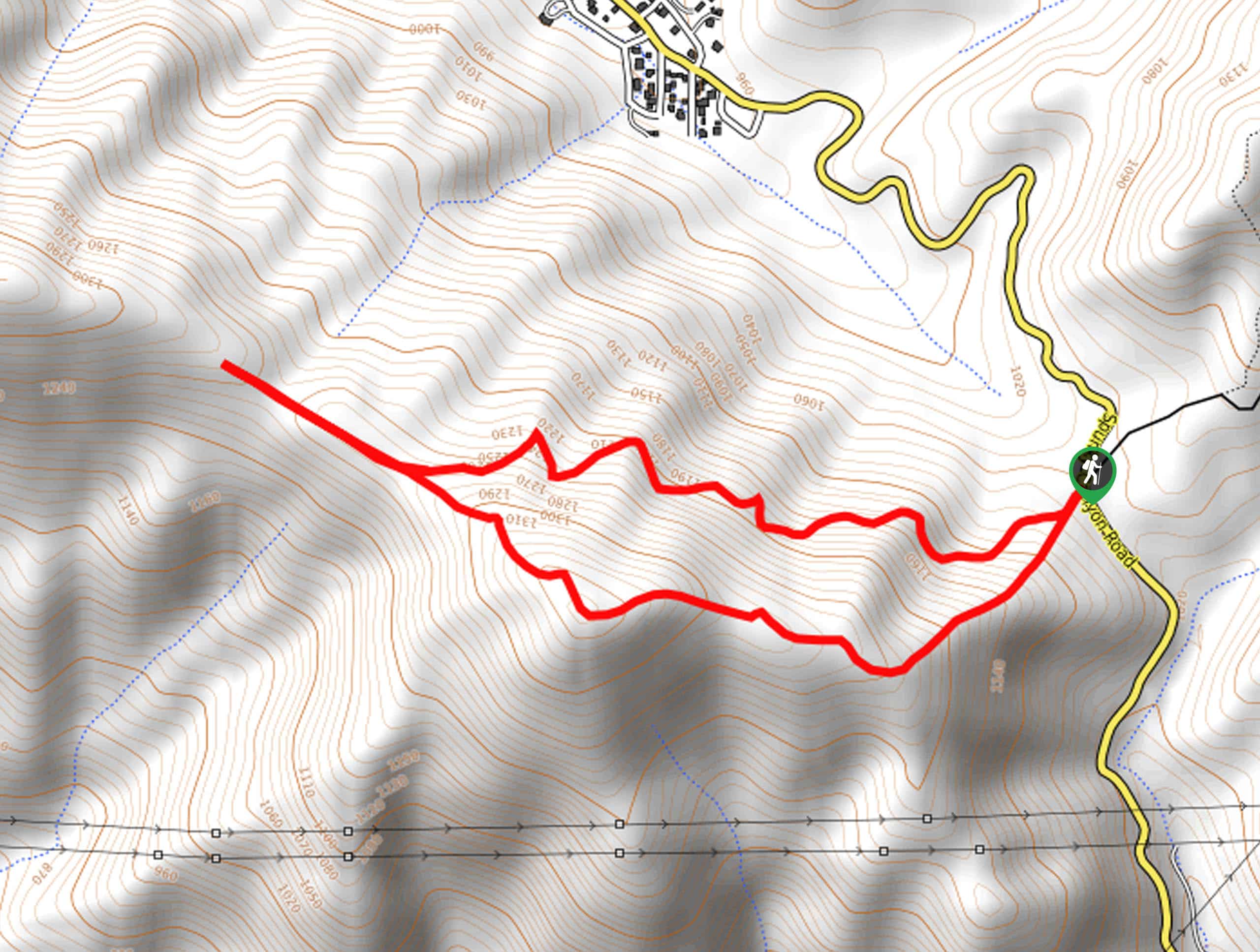
46. Jones Peak Loop Trail
Difficulty
The Jones Peak Loop Trail is a moderate length hike in Angeles National Forest that… Read More
47. Hermit Falls to Sturtevant Falls Loop Hike
Difficulty
The Hermit Falls to Sturtevant Falls Loop Hike is a wonderfully scenic adventure in the… Read More
48. Old Mount Baldy Trail
Difficulty
The Old Mount Baldy Trail is a lengthy hike in the Angeles National Forest of… Read More
49. Fall Creek Trail
Difficulty
The Fall Creek Trail is a lovely outdoor adventure in the Angeles National Forest that… Read More
50. Fish Creek Narrows Hike
Difficulty
The Fish Creek Narrows Hike is a laidback adventure in the Angeles National Forest that… Read More
51. Poop Out Trail
Difficulty
The Poop Out Trail is a tough hiking route in the Angeles National Forest of… Read More
52. Haines Canyon to Mount Lukens Trail
Difficulty
The Haines Canyon to Mount Lukens Trail is a challenging uphill hike that will take… Read More
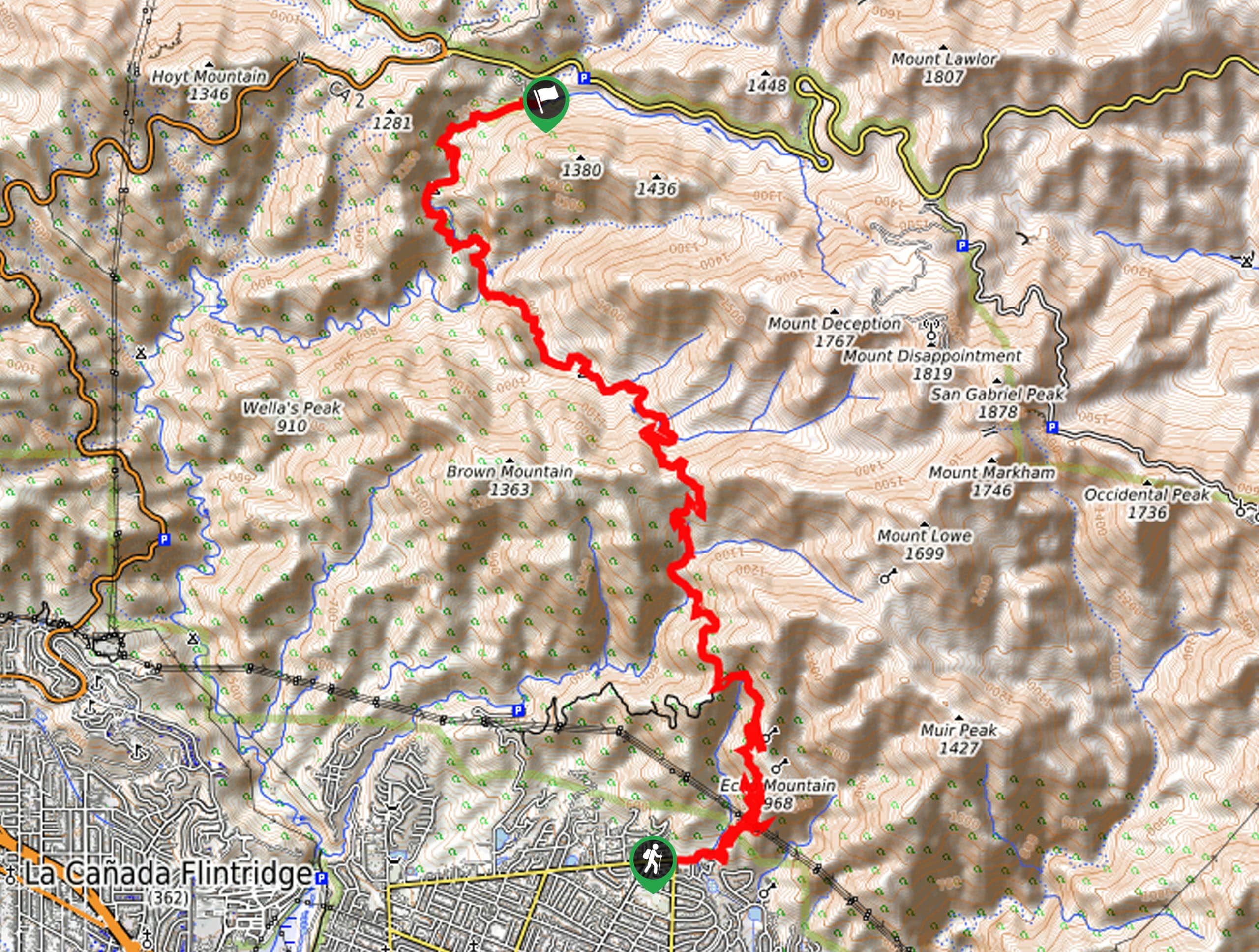
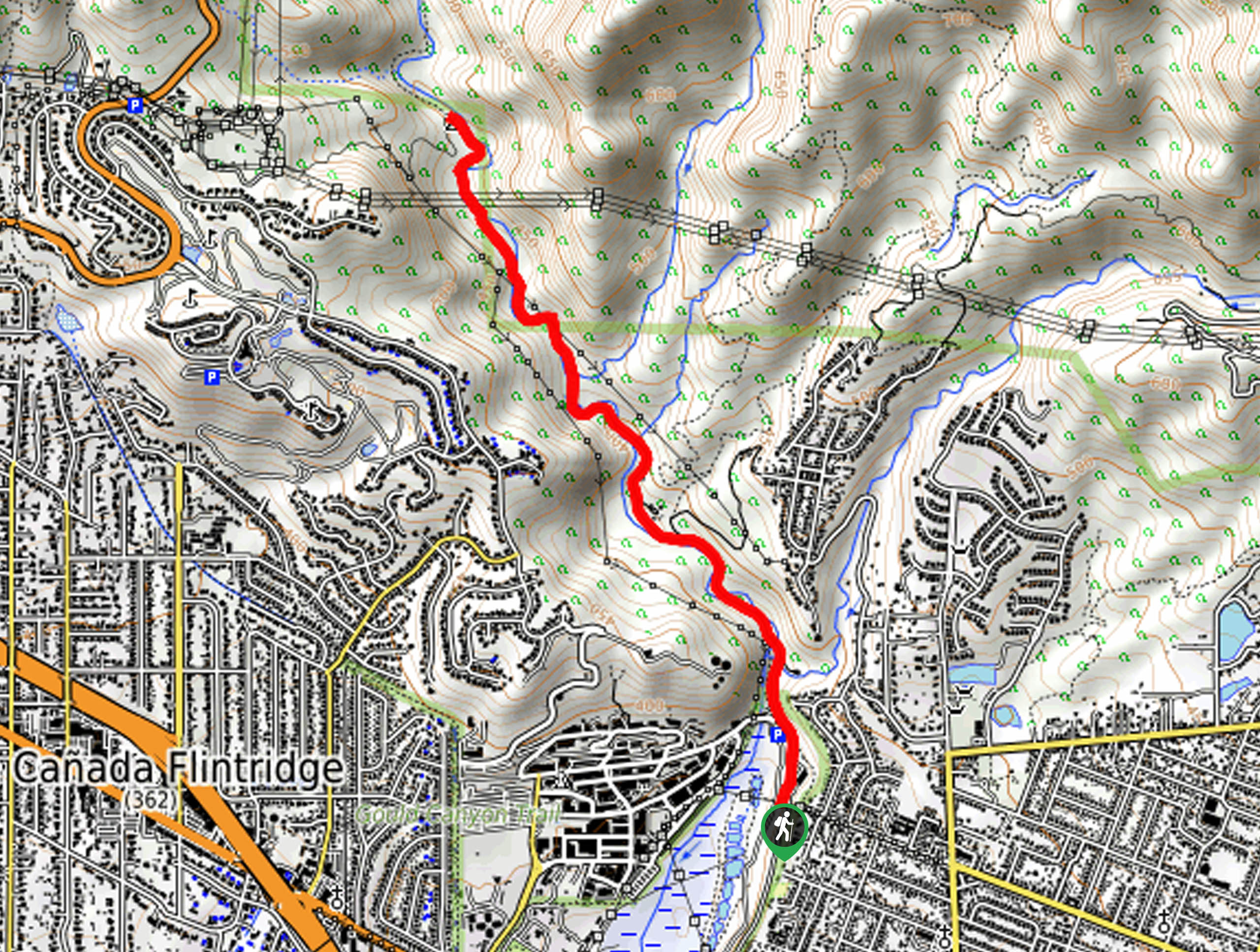
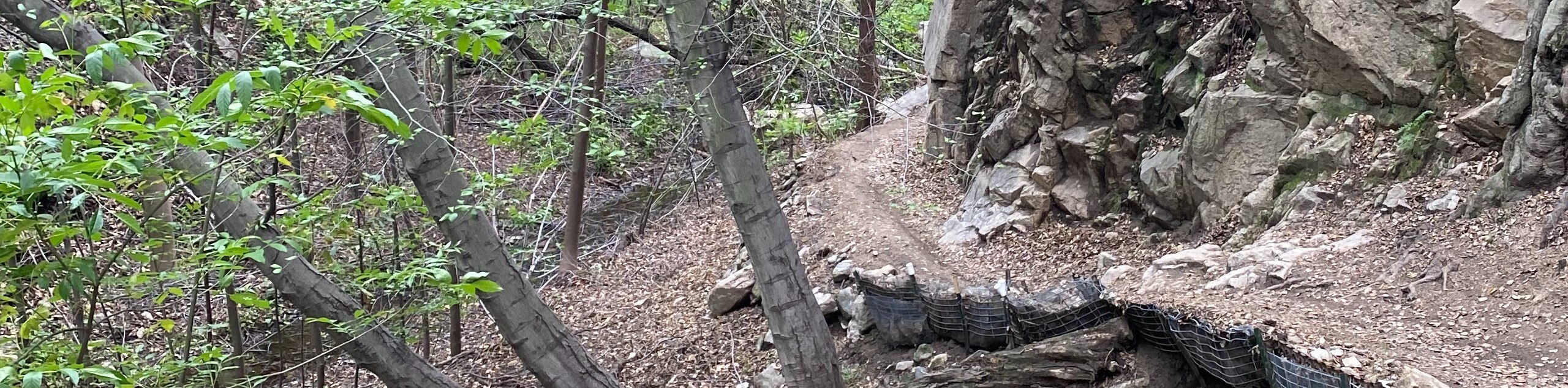
53. Cobb Estate to Switzer Station Hike
Difficulty
The Cobb Estate to Switzer Station Hike is a lengthy adventure that will take you… Read More
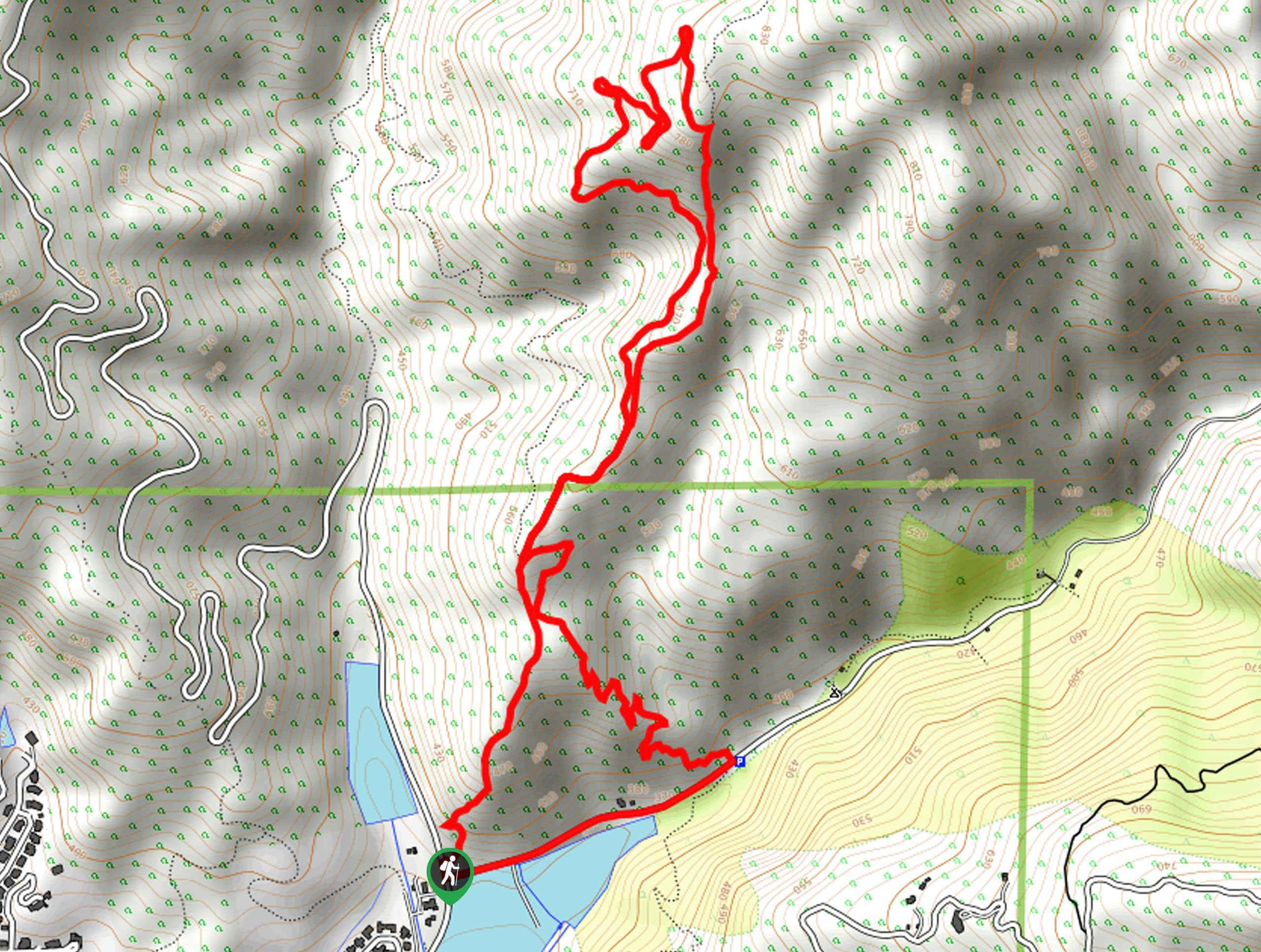
54. Echo Mountain Loop Trail
Difficulty
The Echo Mountain Loop Trail is a tough climb into the mountains outside of Altadena… Read More
55. Mount Wilson via Sierra Madre Hike
Difficulty
The Mount Wilson via Sierra Madre Hike is a difficult undertaking in Southern California that… Read More
56. Mount Lukens via Stone Canyon Hike
Difficulty
The Mount Lukens via Stone Canyon Hike is a rough and rugged adventure in the… Read More
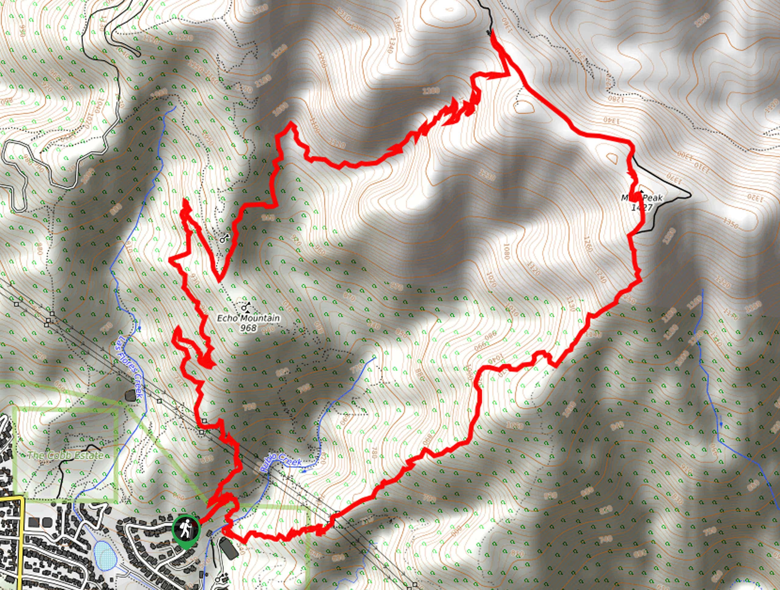
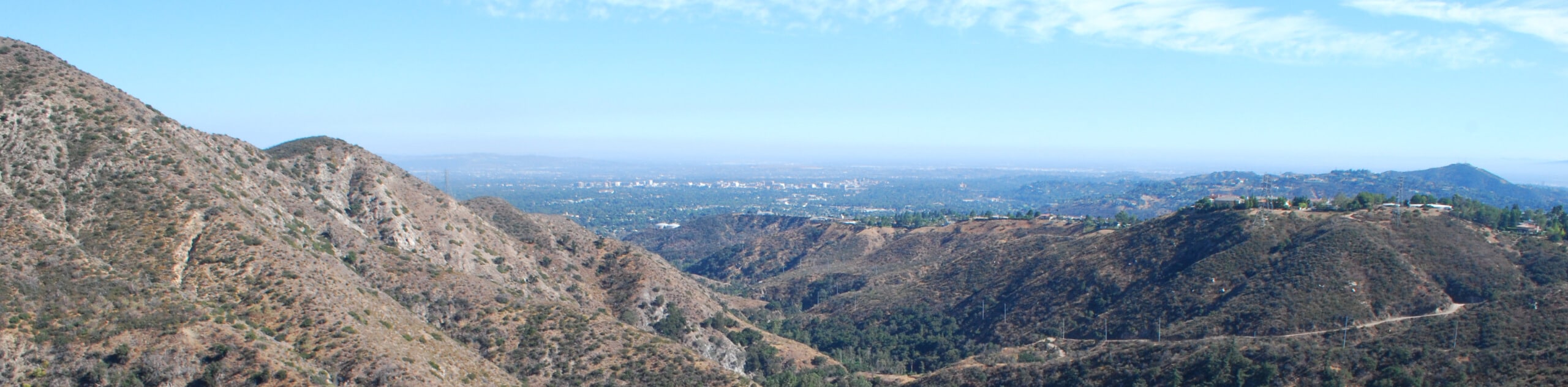
57. Muir Peak Loop Trail
Difficulty
Hiking the Muir Peak Loop Trail is an epic adventure in Southern California that will… Read More

58. Castle Canyon Trail to Inspiration Point
Difficulty
The Castle Canyon Trail to Inspiration Point is a challenging hike within the boundaries of… Read More
59. Gould Mesa Hike
Difficulty
The Gould Mesa Hike is a nice and easy hiking route in Southern California that… Read More
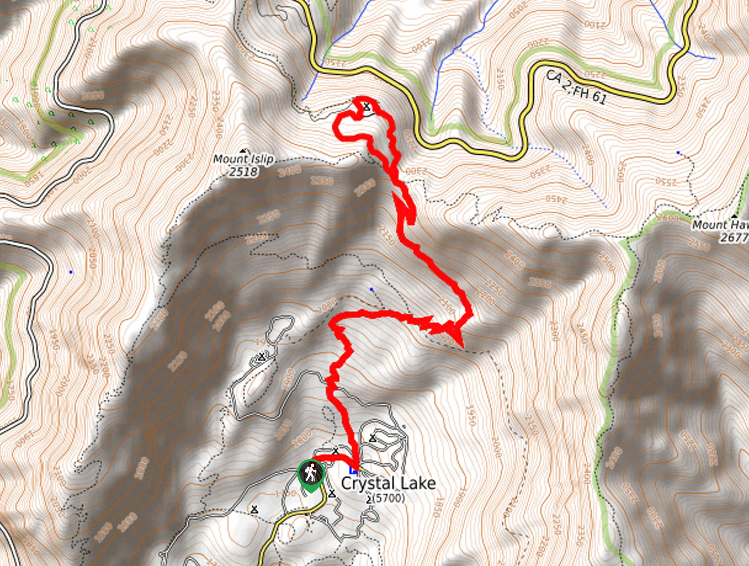
60. Crystal Lake to South Mount Hawkins Trail
Difficulty
The Crystal Lake to South Mount Hawkins Trail is a wonderful hiking route in Southern… Read More
61. Crystal Lake to Throop Peak Hike
Difficulty
The Crystal Lake to Throop Peak Hike is a lengthy hike in Angeles National Forest… Read More
62. Throop Peak via Dawson Gap Hike
Difficulty
The Hike to Throop Peak via Dawson Gap is a great excursion in Angeles National… Read More

63. Bear Flats via Bear Canyon Trail
Difficulty
The Bear Flats via Bear Canyon Trail is a laid back adventure in the Angeles… Read More
64. Big Dalton Canyon Trail
Difficulty
Hiking the Big Dalton Canyon Trail is a fun experience in the Angeles National Forest… Read More
65. Manzanita Ridge via Mount Wilson Trail
Difficulty
The Manzanita Ridge via Mount Wilson Trail is a tough hike through the rugged terrain… Read More
66. Mount Lowe Road to Inspiration Point Hike
Difficulty
The Mount Lowe Road to Inspiration Point is a great little adventure in the Angeles… Read More
67. Inspiration Point and Mount Lowe Loop Hike
Difficulty
The Inspiration Point and Mount Lowe Loop Hike is a challenging excursion in Southern California… Read More
68. San Gabriel Peaks Hike
Difficulty
The San Gabriel Peaks Hike is a tough, but beautiful hike in the Angeles National… Read More
69. Mount Lowe Canyon Loop Trail
Difficulty
The Mount Lowe Canyon Loop Trail is a fun little adventure in the Angeles National… Read More
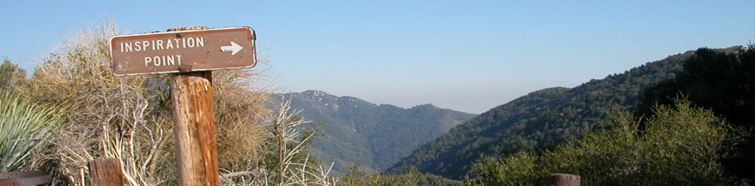
70. Inspiration Point via Mount Lowe Trail
Difficulty
Hiking to Inspiration Point via Mount Lowe Trail is a wonderfully scenic adventure in the… Read More
71. Le Canada Teepee via Crosstown Trail
Difficulty
The La Canada Teepee via Crosstown Trail is a relatively short and fun hiking experience… Read More
72. Fern Truck, Brown Mountain, and El Prieto Trail Loop
Difficulty
The Fern Truck, Brown Mountain, and El Prieto Trail Loop is a great intermediate-length trail… Read More
73. Mount Wilson Trail to Bailey Canyon Loop
Difficulty
The Mount Wilson Trail to Bailey Canyon Loop is a challenging adventure in Southern California… Read More

74. Mount Lawlor via Strawberry Peak Trail Loop
Difficulty
The hike up Mount Lawlor via the Strawberry Peak Trail Loop is a challenging adventure… Read More

75. Register Ridge to Mount San Antonio Hike
Difficulty
The Register Ridge to Mount San Antonio Hike is equal parts scenic and incredibly challenging.… Read More

76. Sunset Peak Alternate Approach Hike
Difficulty
The Sunset Peak Alternate Approach Hike is a great intermediate-length route in Southern California that… Read More

77. Graveyard Truck Trail
Difficulty
Hiking the Graveyard Truck Trail is a pleasant experience in Southern California that features easy-going… Read More

78. Castaic Falls Trail
Difficulty
Hiking the Castaic Falls Trail is a fun little adventure in the Angeles National Forest… Read More

79. Mount Zion via Lower Winter Creek Trail Loop
Difficulty
The Mount Zion via Lower Winter Creek Trail Loop is a physically demanding Southern California… Read More
80. Millard Canyon Falls Trail
Difficulty
The Millard Canyon Falls Trail is a fantastic hiking route in Southern California that will… Read More
81. Sturtevant Falls Trail
Difficulty
The Sturtevant Falls Trail is a beautifully scenic hiking route in Southern California that will… Read More
82. Switzer Falls via Gabrielino Trail
Difficulty
Hiking to Switzer Falls via the Gabrielino Trail is a fun experience in the Angeles… Read More
83. Sturtevant, Mount Wilson, and Winter Creek Trail Loop
Difficulty
The Sturtevant, Mount Wilson, and Winter Creek Trail Loop is a long and challenging hiking… Read More
84. Mount Baldy via Devil’s Backbone Trail
Difficulty
The Mount Baldy via Devil’s Backbone Trail is a challenging hiking route in the Angeles… Read More
85. Mount Baden Powell Trail
Difficulty
The Mount Baden Powell Trail is a tough, uphill hiking adventure in the Angeles National… Read More
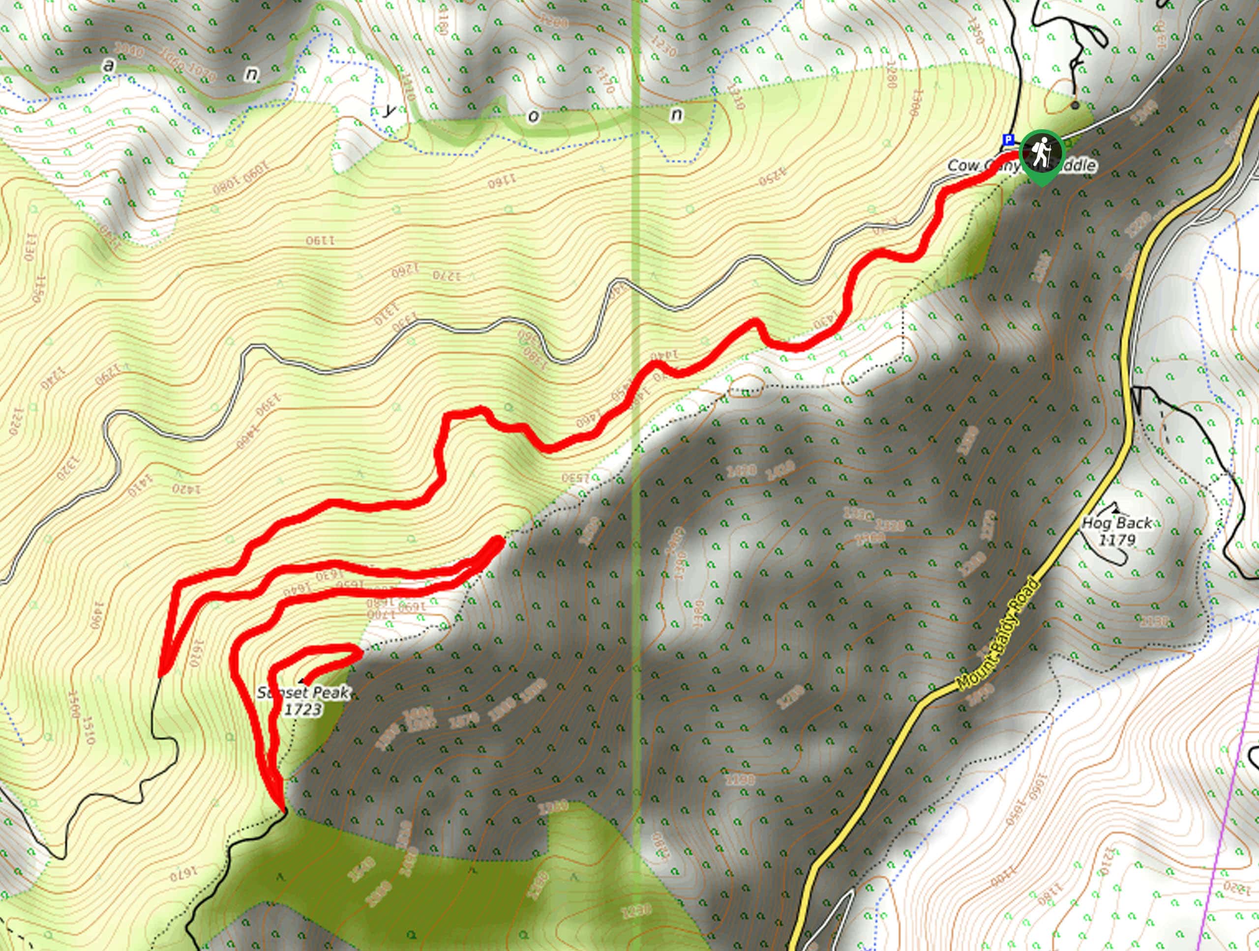
86. Sunset Peak Trail
Difficulty
The Sunset Peak Trail is a wonderful hiking route that can be found in the… Read More
87. Mount San Antonio via Baldy Bowl Trail
Difficulty
Hiking up to the summit of Mount San Antonio via the Baldy Bowl Trail will… Read More
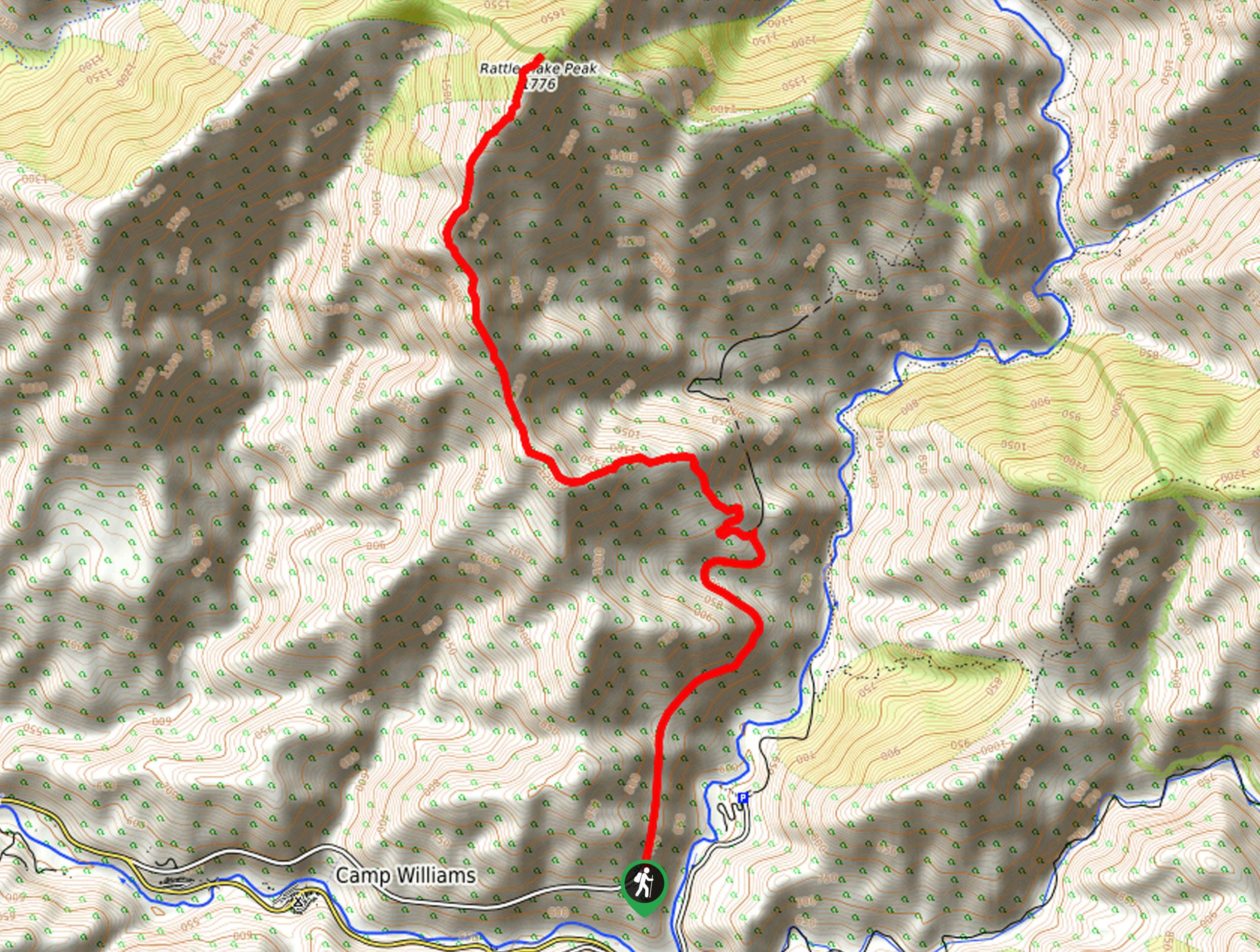
88. Rattlesnake Peak Trail
Difficulty
Hiking the Rattlesnake Peak Trail is a rough and rugged outdoor experience in Southern California… Read More
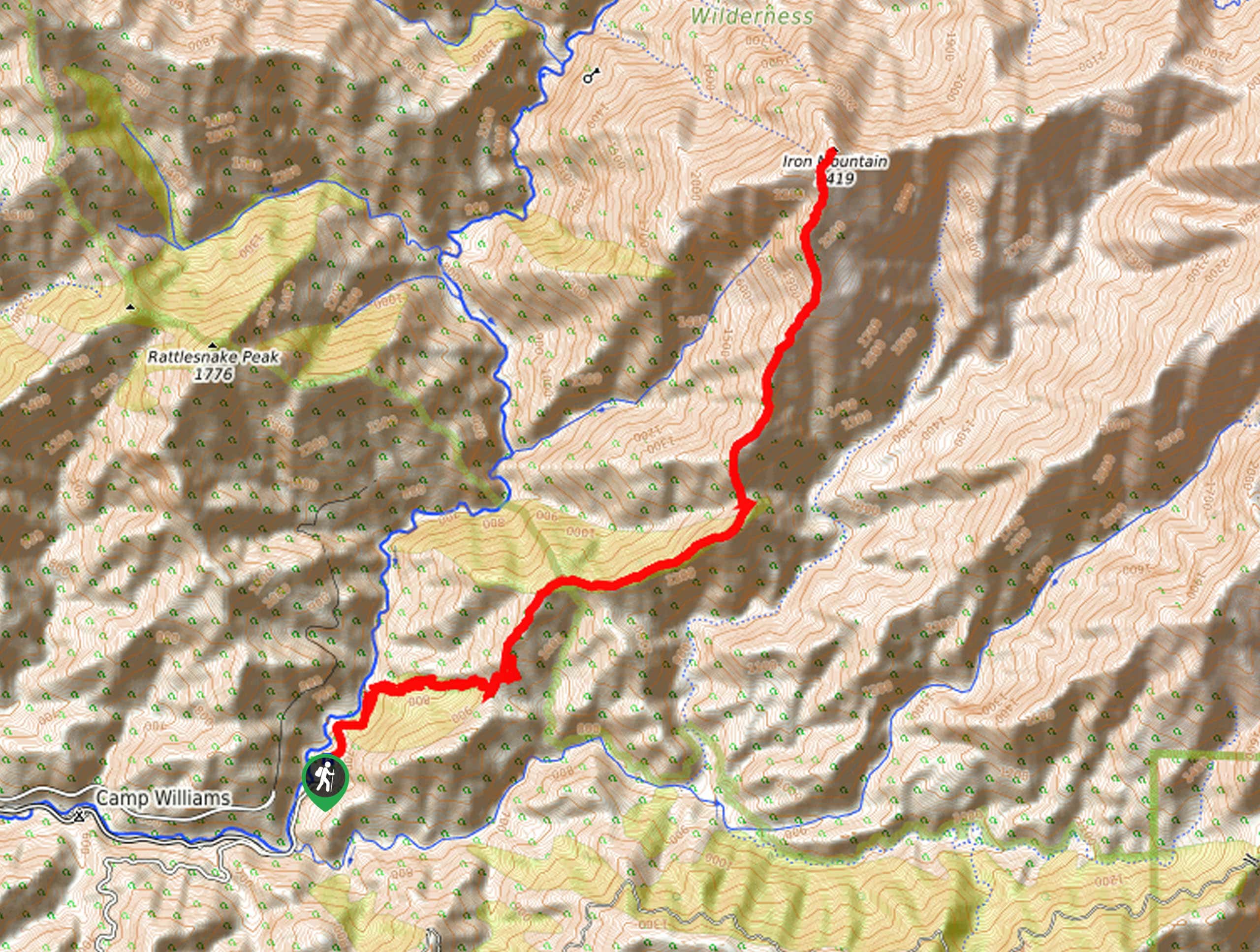
89. Iron Mountain via Heaton Flats Trail
Difficulty
Hiking to the summit of Iron Mountain via Heaton Flats Trail is a physically demanding… Read More
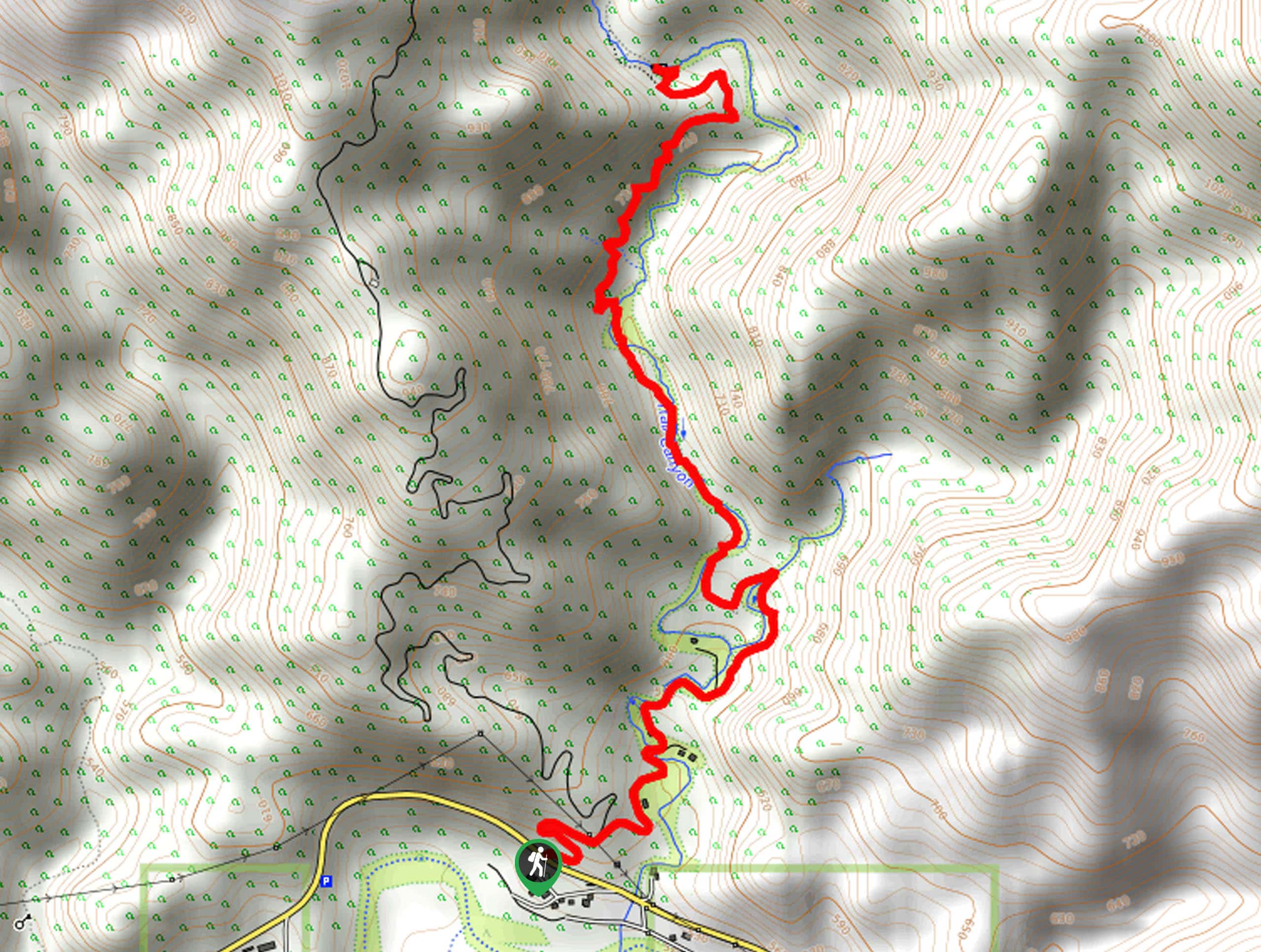
90. Trail Canyon Falls
Difficulty
The hike to Trail Canyon Falls is a pleasant adventure in Southern California that features… Read More
91. Inspiration Point via Sam Merrill and Castle Canyon Loop
Difficulty
Hiking to Inspiration Point via Sam Merrill and Castle Canyon Loop is a beautifully scenic,… Read More
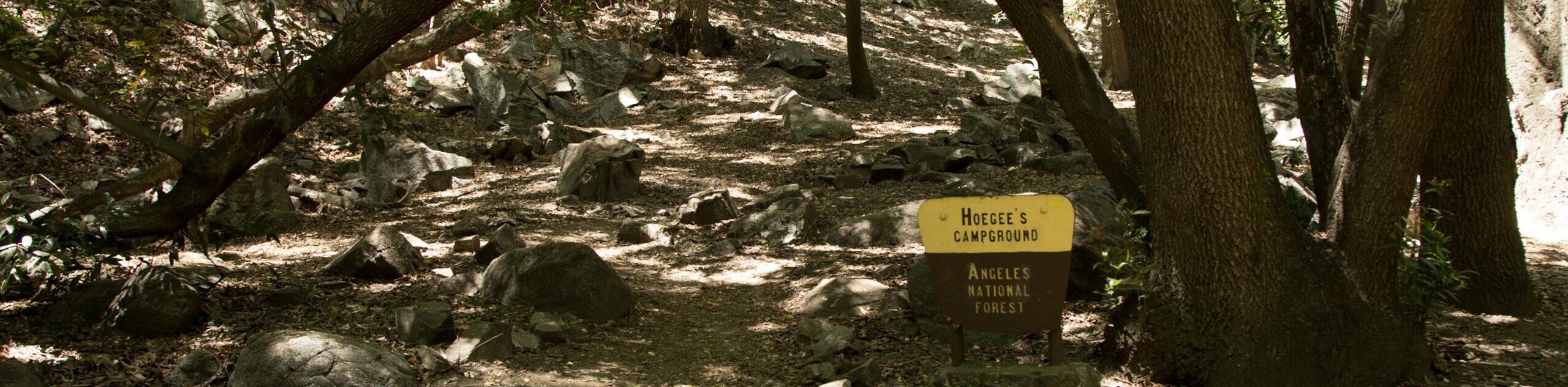
92. Chantry Flats to Hoegee’s Camp Hike
Difficulty
The Chantry Flats to Hoegee’s Camp Hike is a fun adventure in Southern California that… Read More
93. Big Horn Mine Trail
Difficulty
Hiking the Big Horn Mine Trail is a great family-friendly experience in Southern California that… Read More
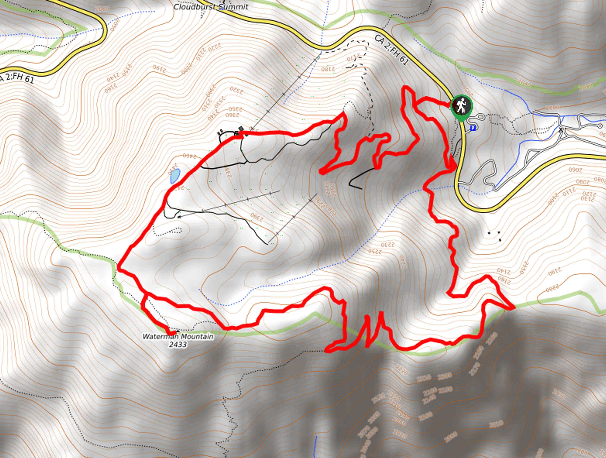
94. Waterman Mountain Loop Trail
Difficulty
The Waterman Mountain Loop Trail is a fantastic hiking route in Southern California that features… Read More
95. San Antonio Falls Trail
Difficulty
Hiking the San Antonio Falls Trail is a laid back, family-friendly experience in Southern California… Read More
96. Mount Wilson via Little Santa Anita Canyon Hike
Difficulty
The Mount Wilson via Little Anita Canyon Hike is a challenging excursion in Southern California… Read More
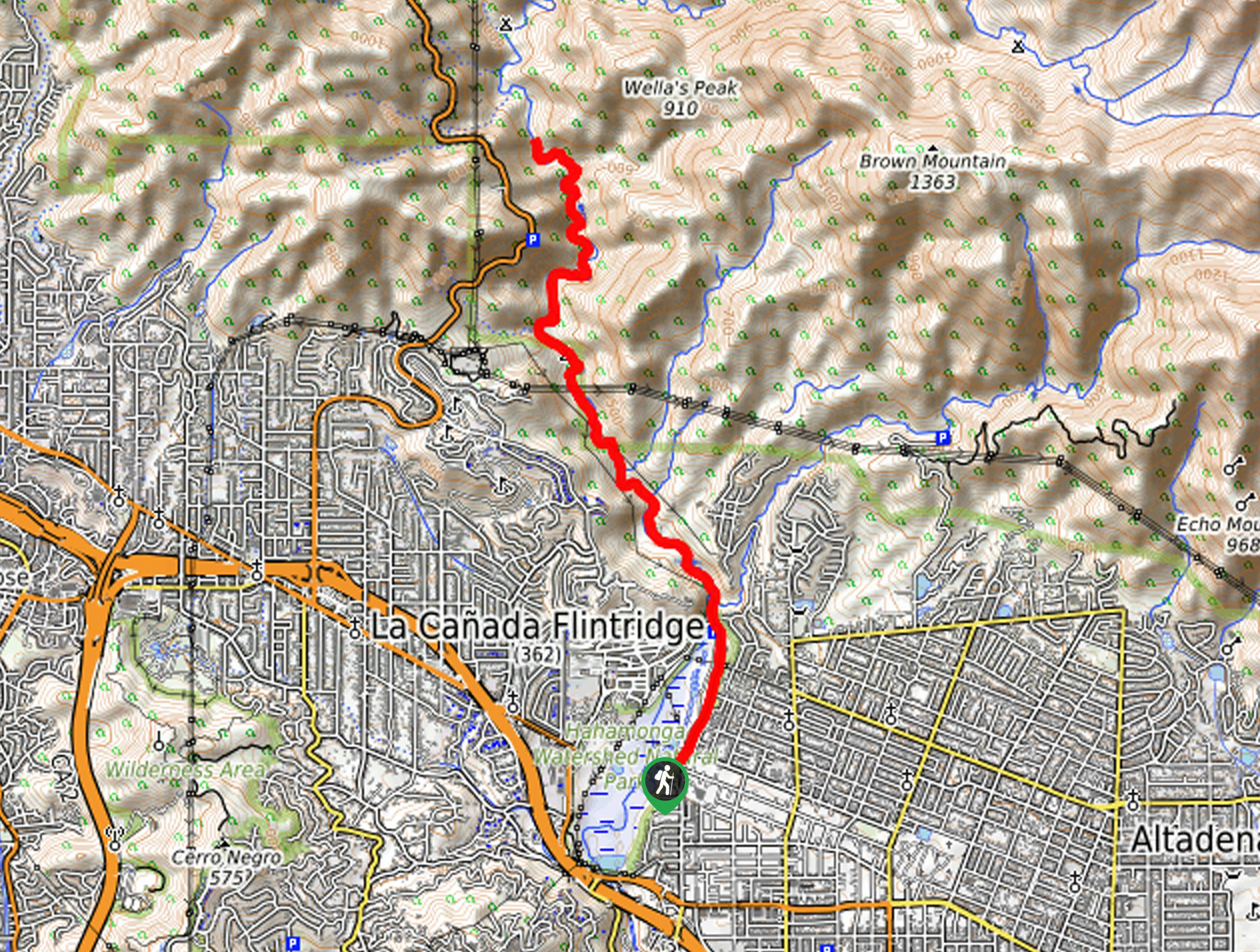
97. Brown Mountain Dam Waterfall Hike
Difficulty
The Brown Mountain Dam Waterfall Hike is a great intermediate-length adventure for families who want… Read More
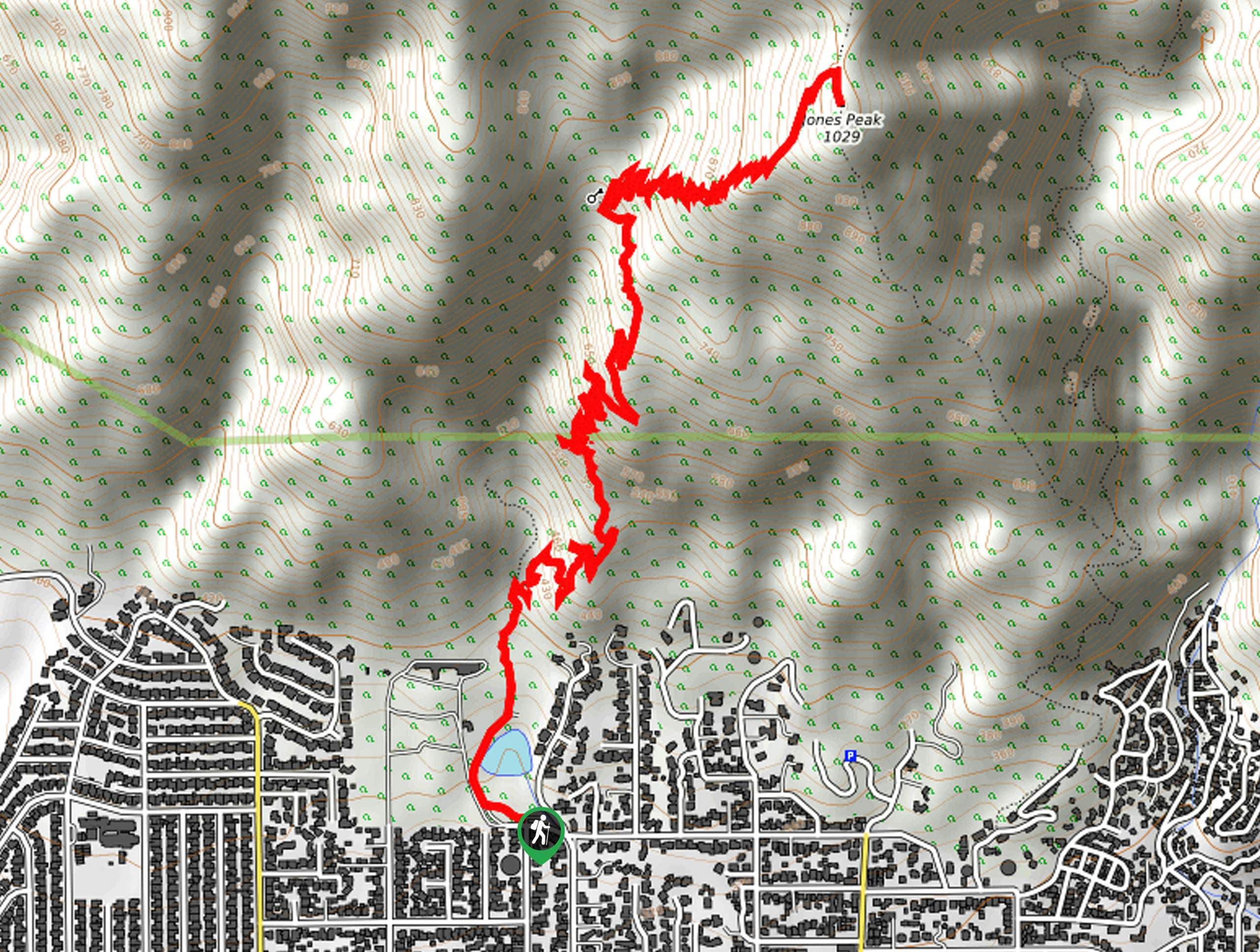
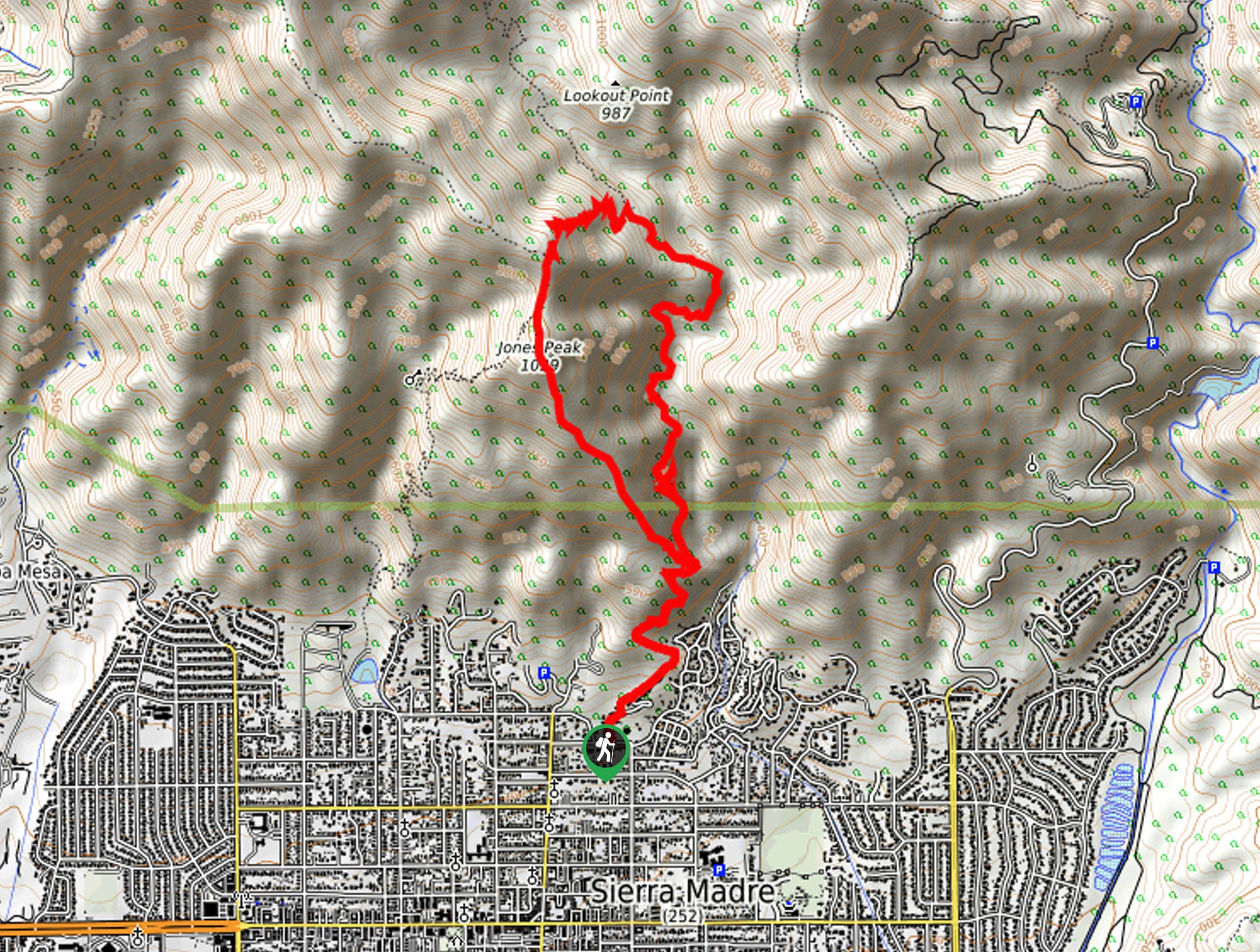
98. Bailey Canyon Trail to Jones Peak
Difficulty
The Bailey Canyon Trail to Jones Peak is a winding, uphill hike that will take… Read More
99. Stoddard Peak Hike
Difficulty
The Stoddard Peak Hike is a great excursion for those times when you feel like… Read More
100. First Water via Mount Wilson Trail
Difficulty
The First Water via Mount Wilson Trail is a great little adventure in the Angeles… Read More
Are we missing your favourite hike?
Tell us! If you've got photos, a GPS track and know the hike, we'd love to share your favourite hike with the rest of the 10Adventures community.