
Le Canada Teepee via Crosstown Trail
View Photos
Le Canada Teepee via Crosstown Trail
Difficulty Rating:
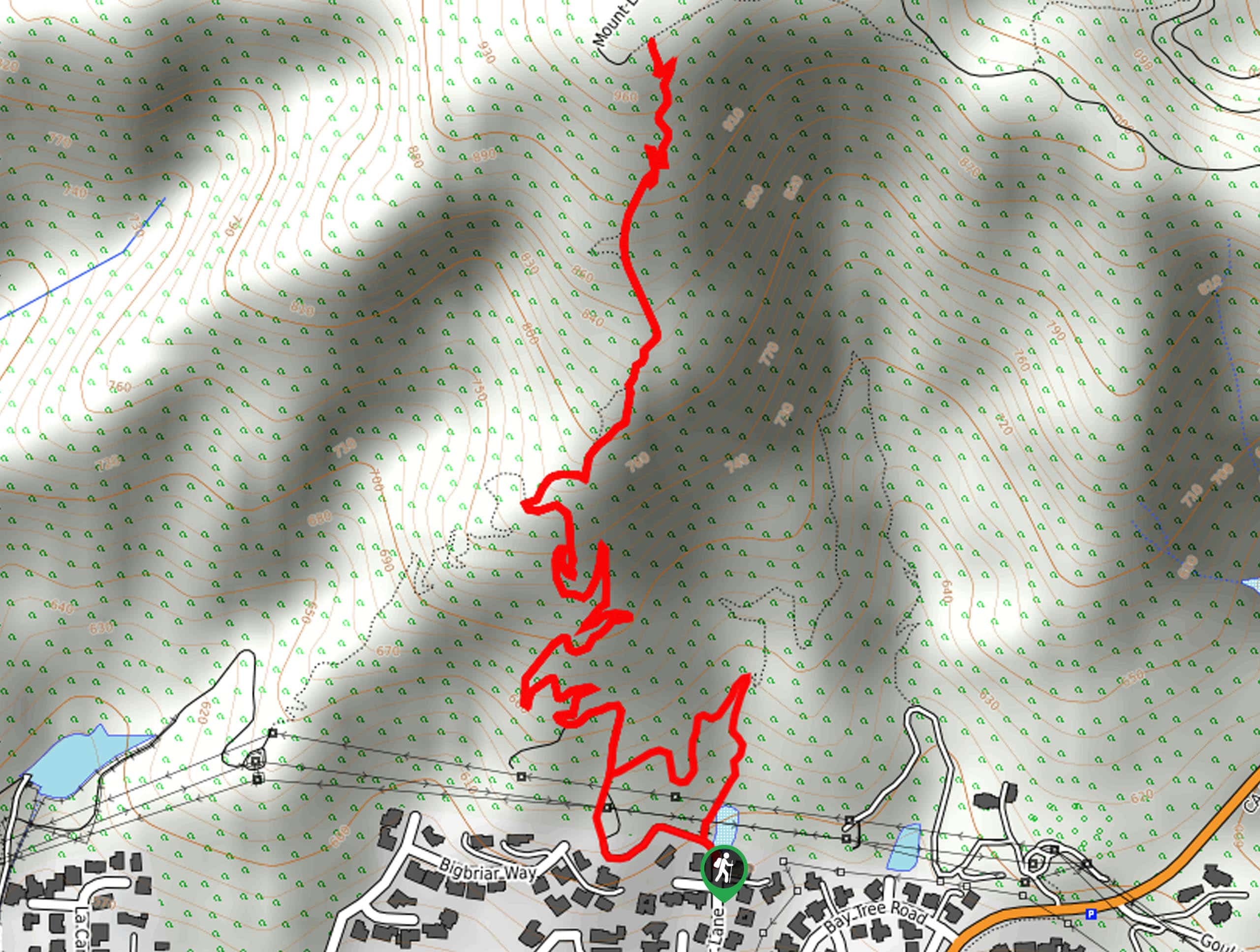
The La Canada Teepee via Crosstown Trail is a relatively short and fun hiking experience in the Angeles National Forest that will take you up into the mountains above La Cañada Flintridge. While out on your adventure, you will steadily climb uphill along a path lined with brush, taking in the natural beauty of the Southern California landscape as you gain elevation. Be sure to have your adventure pass visible in your vehicle prior to starting your hike.
Getting there
The starting point for this hike can be found at the Le Canada Open Space Trailhead at the end of Harter Lane.

About
| Backcountry Campground | No |
| When to do | Year-Round |
| Pets allowed | Yes - On Leash |
| Family friendly | Yes |
| Route Signage | Average |
| Crowd Levels | Moderate |
| Route Type | Lollipop |
Le Canada Teepee via Crosstown Trail
Elevation Graph
Weather
Le Canada Teepee via Crosstown Trail Description
For those who want to experience a fairly short hiking route in the Angeles National Forest that still features some elevation gain, the La Canada Teepee via Crosstown Trail is a good option to explore. This route is suitable for a fun family adventure, but take note that there are some steep and rocky sections of trail that might not be suitable for very young hikers.
Setting out from the trailhead, you will head north to make your way into the mountainous terrain. As you trudge up the hillside, take some time to appreciate the stunning beauty of the California landscape that spreads out in every direction.
Eventually, you will arrive at the top of the trail, where you can visit a mountaintop teepee and gaze out at the horizon. After taking in the views, simply head back downhill to return to the trailhead.
Similar hikes to the Le Canada Teepee via Crosstown Trail hike

Mount Zion via Lower Winter Creek Trail Loop
The Mount Zion via Lower Winter Creek Trail Loop is a physically demanding Southern California adventure that features waterfall and…

Castaic Falls Trail
Hiking the Castaic Falls Trail is a fun little adventure in the Angeles National Forest that features a charming waterfall.…

Graveyard Truck Trail
Hiking the Graveyard Truck Trail is a pleasant experience in Southern California that features easy-going terrain and views of the…
Comments