

Castaic Falls Trail
View Photos
Castaic Falls Trail
Difficulty Rating:
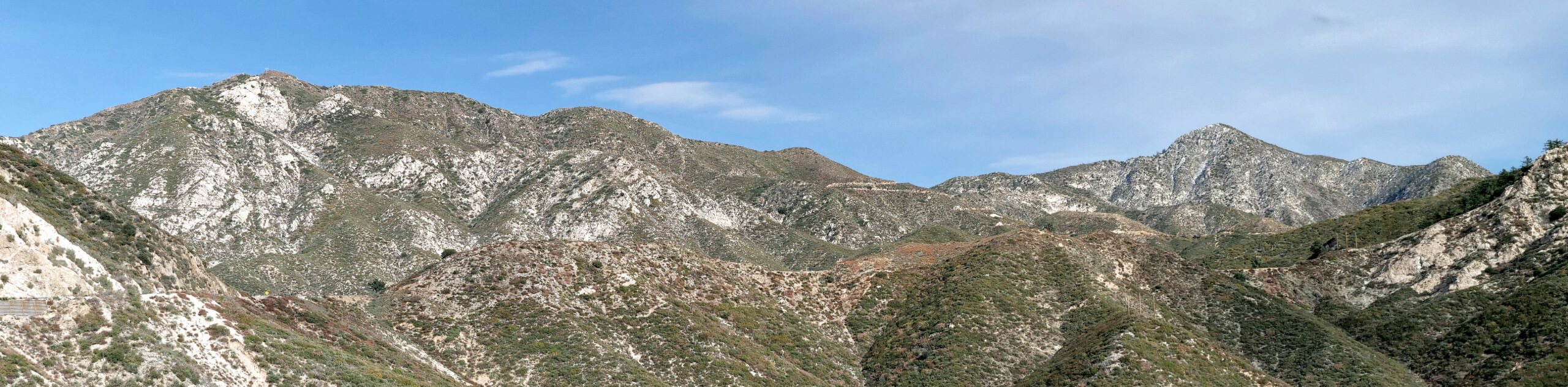
Hiking the Castaic Falls Trail is a fun little adventure in the Angeles National Forest that features a charming waterfall. While out on the trail, you will follow the banks of Fish Creek along a trail that can be a bit rocky in certain areas, before arriving at the Castaic Falls themselves. While this route is available to hike year-round, try visiting in the spring season when water levels at the waterfall will be higher.
Getting there
The trailhead for this hike can be found along Lake Hughes Road, just west of Cottonwood Campground.

About
| Backcountry Campground | No |
| When to do | Year-Round |
| Pets allowed | Yes - On Leash |
| Family friendly | Yes |
| Route Signage | Average |
| Crowd Levels | Moderate |
| Route Type | Out and back |
Castaic Falls Trail
Elevation Graph
Weather
Castaic Falls Trail Description
If you are looking to get the whole family out on the trails to enjoy the natural beauty of the outdoors, then the Castaic Falls Trail is a great option in Southern California that can be completed rather quickly and without much fuss.
Setting out from the trailhead, you will follow along the path as it runs next to the waters of Fish Creek. After navigating the slightly overgrown trail, you will arrive at the site of Castaic Falls, which will be much more impressive during the spring season. After taking in the views and relaxing by the falls, turn back along the path to begin making your way back to the trailhead.
Similar hikes to the Castaic Falls Trail hike

Graveyard Truck Trail
Hiking the Graveyard Truck Trail is a pleasant experience in Southern California that features easy-going terrain and views of the…

Sunset Peak Alternate Approach Hike
The Sunset Peak Alternate Approach Hike is a great intermediate-length route in Southern California that features some gorgeous canyon views.…
Mount Lawlor via Strawberry Peak Trail Loop
The hike up Mount Lawlor via the Strawberry Peak Trail Loop is a challenging adventure in the Angeles National Forest…
Comments