Mount Baldy via Devil’s Backbone Trail
View Photos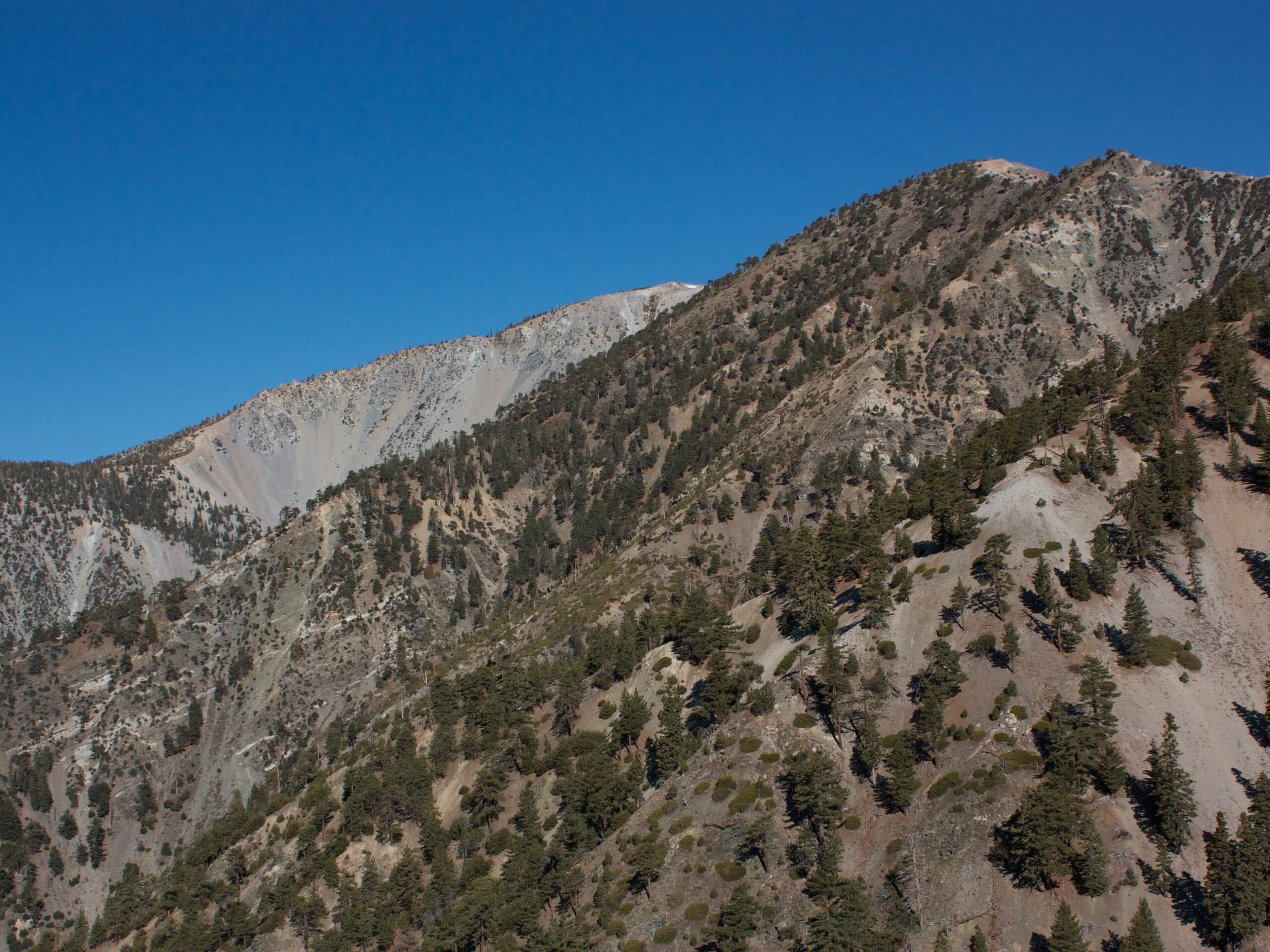
Mount Baldy via Devil’s Backbone Trail
Difficulty Rating:
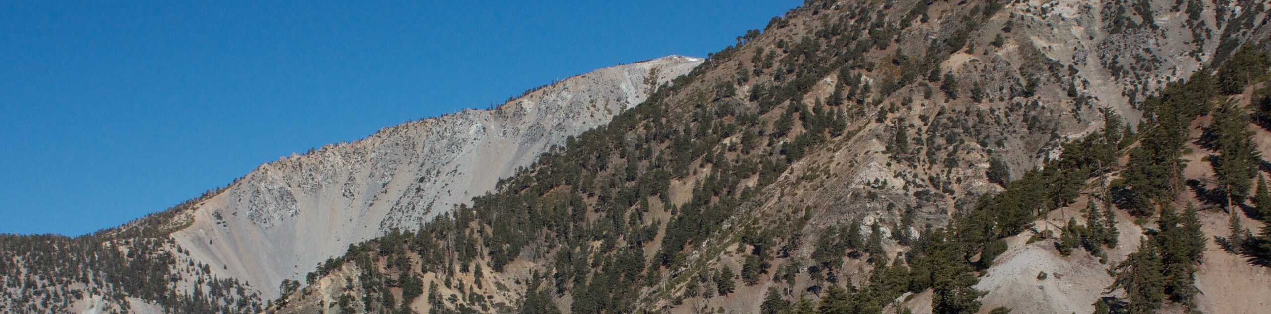
The Mount Baldy via Devil’s Backbone Trail is a challenging hiking route in the Angeles National Forest that features some rugged mountaintop terrain and beautiful views. While out on the trail, you will pass by the cascade of the San Antonio Falls, before traversing the treacherous Devil’s Backbone Ridge to reach the top of Mount San Antonio, often referred to as Mount Baldy or “Old Baldy” due to the bare nature of the summit. Make sure that you have an adventure pass displayed in your vehicle when undertaking this excursion.
Getting there
The trailhead for this hiking adventure can be found along Mt Baldy Road, just past the Manker Flats campsite.

About
| Backcountry Campground | Manker Flats |
| When to do | April-October |
| Pets allowed | Yes - On Leash |
| Family friendly | No |
| Route Signage | Average |
| Crowd Levels | High |
| Route Type | Out and back |
Mount Baldy via Devil’s Backbone Trail
Elevation Graph
Weather
Mount Baldy via Devil’s Backbone Trail Description
If you are up for a physically demanding hike that features epic Southern California views, then Mount Baldy via Devil’s Backbone Trail is a great route to explore, but keep in mind that the terrain here is quite rugged and can be difficult to traverse. Make sure to come prepared with sturdy hiking boots, trekking poles, plenty of water, and some snacks to stay fueled. Additionally, make sure to arrive early to secure parking, as there are a number of very popular hiking trails in the area.
For those with the right level of experience and physical fitness, this is an excellent route that will get your heartrate up and provide some breathtaking views. Mount San Antonio/Old Baldy is a SoCal landmark that can be seen and recognized from pretty well anywhere, so why not set out on an adventure and tackle this well-known peak in the Angeles National Forest.
Setting out from the trailhead, you will follow along Falls Road as it leads to the northwest, where you will quickly arrive at the site of San Antonio Falls. Take a few minutes to appreciate the wild nature of the torrent cascading over the rock, before continuing on your way. After the falls, the road will temporarily turn to the southeast, before arriving at a junction.
Continue straight through the junction and keep following Baldy Road as it cuts across the undulating terrain of Manker Canyon to the northeast. Eventually, you will arrive at the Mount Baldy Notch, where you can pop into the Top of the Notch restaurant for a snack if you wish. If not, head northeast along the road for a short distance until you meet a junction with the Three Ts Trail.
Turning left here, you will follow the trail as it climbs uphill below a ski lift, traversing the mountain slope to reach the top of the Devil’s Backbone Ridge. Turning left at the top, you will now need to traverse the rugged – and at times perilous – ridgeline in order to reach the top of Mount San Antonio to the west.
Once you have reached the summit of “Old Baldy”, take some time to soak up the breathtaking views, before extending your hike west to reach the summit of West Baldy. Once this secondary summit has also been conquered, simply head back along the same path, carefully retracing your steps along the ridge and down the mountainside to return to the trailhead where you began.
Those who wish to complete a similar route that features an alternate route for the return can also check out the Mount San Antonio and Mount Baldy Notch Trail.
Trail Highlights
Mount San Antonio
Often referred to as Mount Baldy or Old Baldy due to its bare summit, Mount San Antonio is a prominent summit in the San Gabriel Mountain Range of Southern California. At 10066ft in height, the peak is the high point of the surrounding mountain range and is instantly recognizable as a landmark in the region. Views from the summit extend out across the expanse of the Angeles National Forest, as well as the Greater Los Angeles area.
Frequently Asked Questions
Is Mount Baldy the same as Mount San Antonio?
Mount Baldy and Mount San Antonio are one and the same. The latter is the official name, although Mount Baldy has stuck as a nickname due to the fact that the summit is tree-less, giving it a “bald” look.
Are there any bears around Mount Baldy?
The landscape surrounding Mount Baldy/Mount San Antonio is teeming with wildlife, including black bears that are often seen in the region. Be sure to exercise all precautions and bring bear spray.
Insider Hints
Arrive early to secure parking
Have your adventure pass displayed in your vehicle
Bring bear spray and remain bear aware
Wear sturdy hiking boots with good support
Similar hikes to the Mount Baldy via Devil’s Backbone Trail hike

Mount Zion via Lower Winter Creek Trail Loop
The Mount Zion via Lower Winter Creek Trail Loop is a physically demanding Southern California adventure that features waterfall and…

Sunset Peak Alternate Approach Hike
The Sunset Peak Alternate Approach Hike is a great intermediate-length route in Southern California that features some gorgeous canyon views.…

Register Ridge to Mount San Antonio Hike
The Register Ridge to Mount San Antonio Hike is equal parts scenic and incredibly challenging. While out on the trail,…
Comments