
Mount Baden Powell Trail
View Photos
Mount Baden Powell Trail
Difficulty Rating:
The Mount Baden Powell Trail is a tough, uphill hiking adventure in the Angeles National Forest of Southern California that will be sure to make you break a sweat. While out on the trail, you will steadily work your way up the mountainside, navigating a seemingly endless set of switchbacks to reach the summit of Mount Baden Powell. Make sure that you bring plenty of water and snacks to stay fueled on this leg-burner of a hike!
Getting there
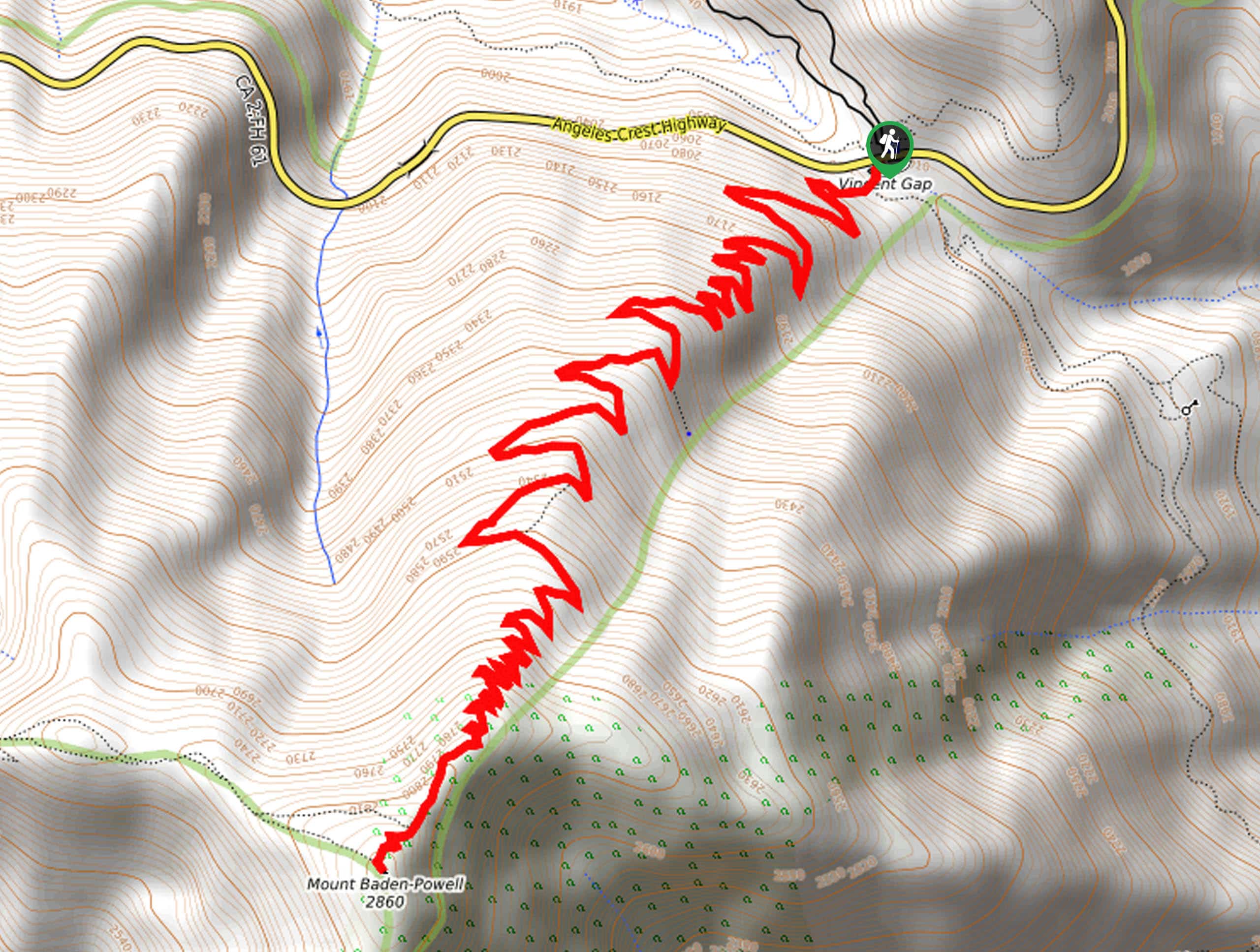
The starting point for this hike can be found at the Vincent Gap parking lot along CA-2.

About
| Backcountry Campground | No |
| When to do | March-October |
| Pets allowed | Yes - On Leash |
| Family friendly | No |
| Route Signage | Average |
| Crowd Levels | High |
| Route Type | Out and back |
Mount Baden Powell Trail
Elevation Graph
Weather
Mount Baden Powell Trail Description
Featuring a relentless uphill climb, the Mount Baden Powell Trail is a great adventure for those who want a real leg workout. Make sure to pack plenty of water and snacks to stay fueled on the trail. Additionally, you will need to purchase and display an adventure pass in your vehicle when setting out on this hike. Lastly, be sure to arrive early to secure parking, as this is a popular trail.
As mentioned above, this route is spectacular for those who want to push the limits of their physical fitness, as it features a winding set of 40 switchbacks that zig-zag up the mountainside. The views from the summit of Mount Baden Powell are also incredible, making this a challenging adventure that will reward you for your efforts.
Setting out from the trailhead, you will make your way to the southwest along the Pacific Crest Trail as it enters into the cover of the forest. Here, you will almost immediately begin to climb uphill along the slopes of Mount Baden Powell.
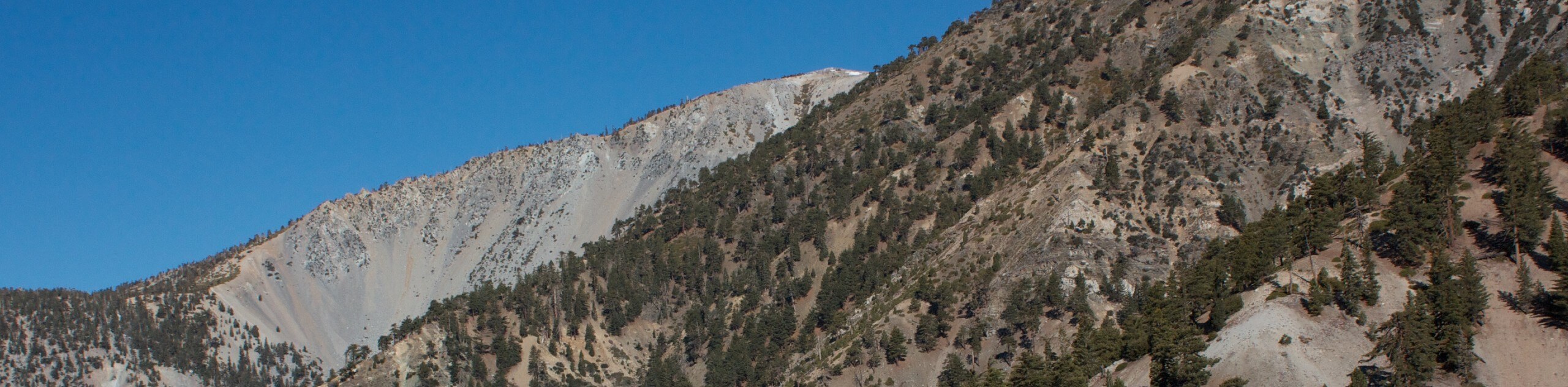
Take your time as you work through the winding switchbacks of the trail, enjoying the calm woodland setting and peaceful atmosphere of the outdoors as you steadily gain elevation. Here, you will be able to spot a number of different tree types, including Jeffrey Pine, Oak, Lodgepole Pine, Incense Cedar, and White Fir. Eventually, the cover of the forest will begin to thin out as you make the final approach to the summit.
After navigating a tighter, more narrow set of switchbacks, you will continue on to the southwest and make the final push to the top of Mount Baden Powell, where you will enjoy some gorgeous views of the surrounding SoCal landscape, including the Mojave Desert and Southern Sierra.
Take a few moments to rest up and enjoy the picture-perfect scenery, before setting out to begin your descent of the mountainside. Carefully head back downhill to the northeast, following the same path as the first leg of your journey to pass once again through the forest on the return to the trailhead where you began your adventure on the Mount Baden Powell Trail.
Trail Highlights
Mount Baden Powell
With a height of 9407ft, Mount Baden Powell is the 4th highest mountain in the San Gabriel Range, and is the tallest that is not a part of the Mount San Antonio massif. It was named after Robert Baden-Powell, the 1st Baron Baden-Powell and founder of the World Scouting Movement.
Frequently Asked Questions
Where is Mount Baden Powell located?
Mount Baden Powell can be found within the San Gabriel Mountains of Southern California. The range is mostly located within the Angeles National Forest.
How many switchbacks does Mount Baden Powell have?
There are a total of 40 winding switchbacks along the trail leading to the summit of Mount Baden Powell.
Similar hikes to the Mount Baden Powell Trail hike

Mount Zion via Lower Winter Creek Trail Loop
The Mount Zion via Lower Winter Creek Trail Loop is a physically demanding Southern California adventure that features waterfall and…

Sunset Peak Alternate Approach Hike
The Sunset Peak Alternate Approach Hike is a great intermediate-length route in Southern California that features some gorgeous canyon views.…
Register Ridge to Mount San Antonio Hike
The Register Ridge to Mount San Antonio Hike is equal parts scenic and incredibly challenging. While out on the trail,…
Comments