Sturtevant, Mount Wilson, and Winter Creek Trail Loop
View Photos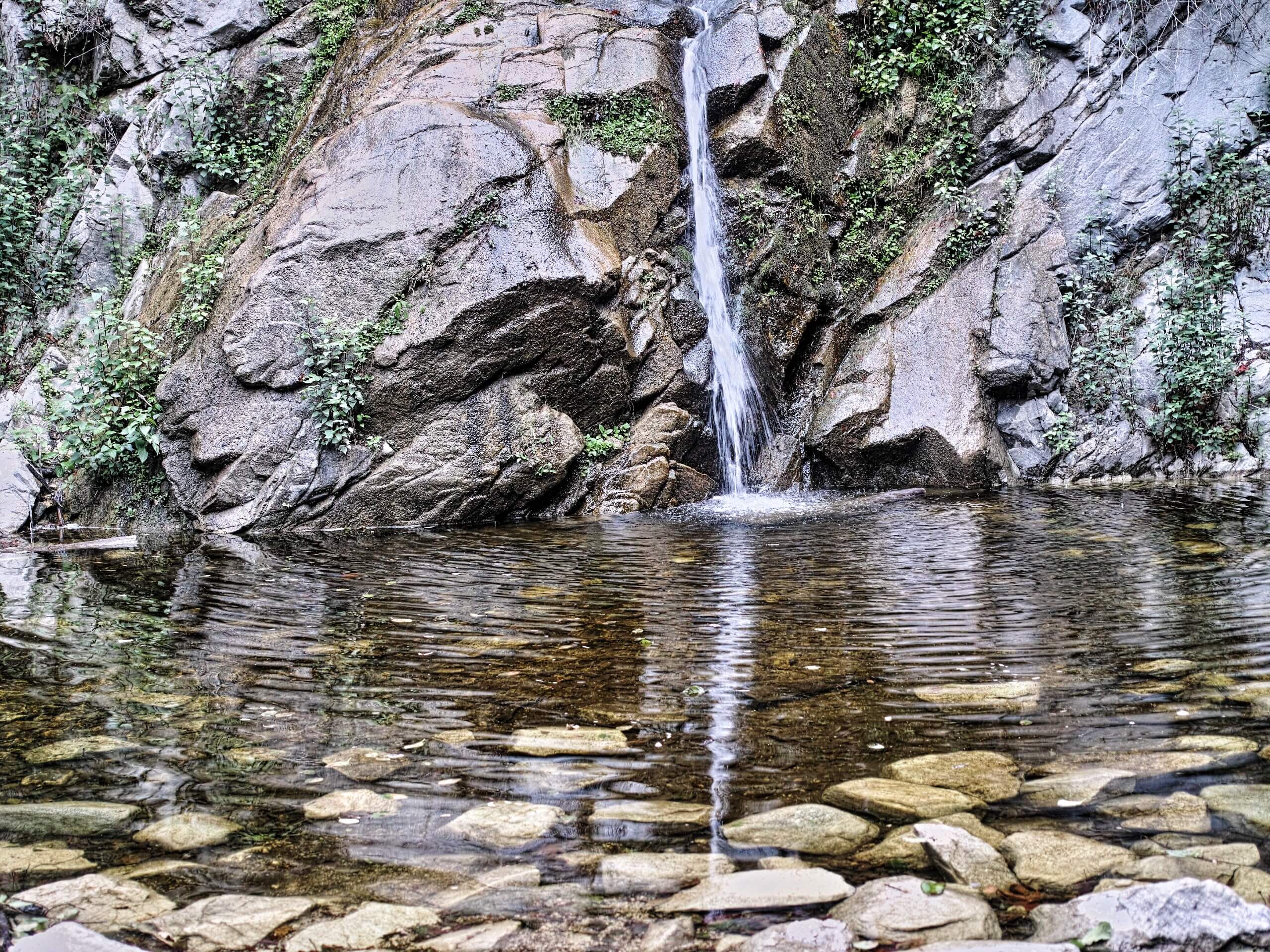
Sturtevant, Mount Wilson, and Winter Creek Trail Loop
Difficulty Rating:
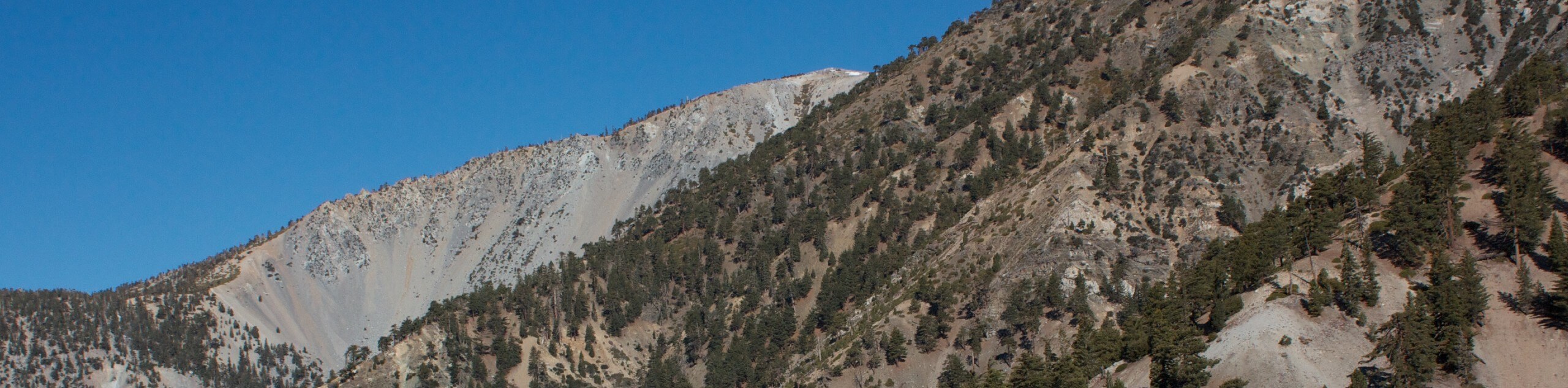
The Sturtevant, Mount Wilson, and Winter Creek Trail Loop is a long and challenging hiking route that will take you through the rugged landscape of the San Gabriel Mountains. While out on the trail, you will climb uphill across undulating terrain to reach the historic Mount Wilson Observatory, before descending past Sturtevant Falls for a return along the banks of Big Santa Anita Creek. Make sure to purchase and display an adventure pass prior to setting out on your excursion to avoid getting a fine.
This trail is currently closed due to wildfires in the area. Expected reopening is April 2023.
Getting there
The trailhead for this hike can be found at the Chantry Flats parking lot along Santa Anita Canyon Avenue.

About
| Backcountry Campground | Hoegee’s Camp |
| When to do | April-October |
| Pets allowed | Yes - On Leash |
| Family friendly | No |
| Route Signage | Average |
| Crowd Levels | High |
| Route Type | Lollipop |
Sturtevant, Mount Wilson, and Winter Creek Trail Loop
Elevation Graph
Weather
Sturtevant, Mount Wilson, and Winter Creek Trail Loop Description
Make no mistake, the Sturtevant, Mount Wilson, and Winter Creek Trail Loop is a difficult and physically demanding trail that will require plenty of preparedness and endurance. Stay clear of this route if you do not have the required experience hiking longer distances. Additionally, the parking lot at the trailhead services a number of popular routes in the area, so make sure to arrive early to secure a space.
Even though it presents a real challenge, this is still a fantastic trail that will showcase the natural beauty of the San Gabriel Mountains. Whether you plan on enjoying the view from the Mount Wilson Observatory or want to relax by the crashing waters of Sturtevant Falls, this is a great hike for those looking to test the limits of their fitness.
Setting out from the Chantry Flats parking lot, you will head west along the Chantry Flats Truck Trail for 0.34mi, before picking up the Upper Winter Creek Trail on your right. Here, you will follow this trail over the next 2.14mi, as it leads into the mountains to eventually arrive at Hoegee’s Camp.
Keeping left at the junction, you will continue following the Winter Creek Trail northwest, where you will eventually meet up with the old Mount Wilson Toll Road after 2.2mi. Following this to the right for 0.5mi, you will pick up a footpath on your right that will take you up to the summit of Mount Wilson, where you will enjoy some scenic views of the surrounding SoCal landscape and can also investigate the Mount Wilson Observatory.
Once you’ve finished exploring the area, you will make your way east towards Echo Rock and follow the trail as it descends through a series of switchbacks. Keep left along this trail for 2.3mi, at which point you will turn right at the junction to descend further into Santa Anita Canyon.
After passing by the Spruce Grove Campground, continue on to the southeast, where you will eventually arrive at the site of the magnificent Sturtevant Falls. Take some time to admire the beauty of the cascade, before continuing on through the canyon in a southward direction.
For this final portion of the excursion you will be hiking along the winding banks of Big Santa Anita Creek. Take some time over the next 1.51mi to appreciate the natural beauty of the canyon landscape and listen to the sound of the running water. Eventually, you will arrive back at the Chantry Flats parking lot where you began your adventure on the Sturtevant, Mount Wilson, and Winter Creek Trail Loop.
Trail Highlights
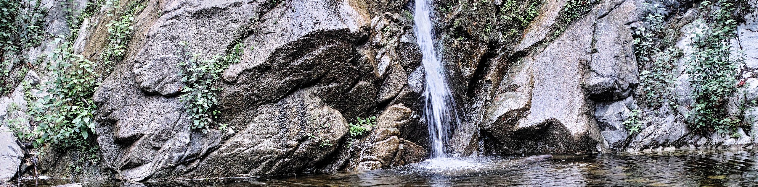
Sturtevant Falls
Located along the pristine Big Santa Anita Creek, Sturtevant Falls is one of the most scenic, and popular, waterfalls to visit within the boundary of the Angeles National Forest. The cascade of water drops over 50ft down a moss-covered rock face into a serene pool below, which is often used by hikers as a swimming hole to escape the heat of the day.
Frequently Asked Questions
Can I swim below Sturtevant Falls?
Swimming is permitted in the pool below Sturtevant Falls; however, they are advised to not swim near the storm drain or after a period of heavy rainfall.
Are dogs permitted on the Sturtevant, Mount Wilson, and Winter Creek Trail Loop?
Yes, dogs are permitted along the Sturtevant, Mount Wilson, and Winter Creek Trail Loop, although they need to be kept on a leash.
Insider Hints
Wear proper hiking boots and bring trekking poles for support
Bring plenty of water and snacks
Arrive early to secure parking
Similar hikes to the Sturtevant, Mount Wilson, and Winter Creek Trail Loop hike

Mount Zion via Lower Winter Creek Trail Loop
The Mount Zion via Lower Winter Creek Trail Loop is a physically demanding Southern California adventure that features waterfall and…

Sunset Peak Alternate Approach Hike
The Sunset Peak Alternate Approach Hike is a great intermediate-length route in Southern California that features some gorgeous canyon views.…
Register Ridge to Mount San Antonio Hike
The Register Ridge to Mount San Antonio Hike is equal parts scenic and incredibly challenging. While out on the trail,…
Comments