
Three Ts Trail
View Photos
Three Ts Trail
Difficulty Rating:
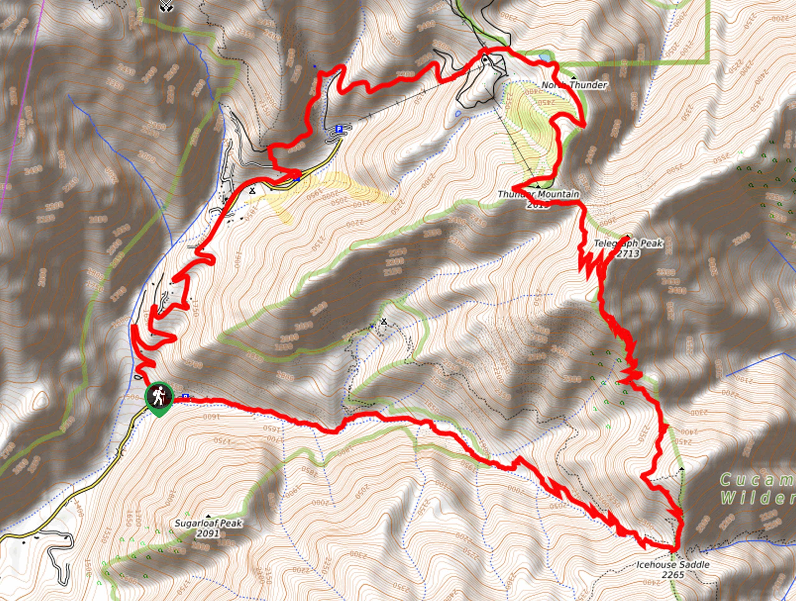
The Three Ts Trail is an exceptional hiking route in Angeles National Forest that is quite long, but offers amazing scenic views of Southern California. While out on the trail, you will climb uphill through the Icehouse Canyon to reach a saddle, before traversing Timber Mountain, Telegraph Peak, and Thunder Mountain. If you are after a shorter trail in the same area, be sure to check out the Mount Baldy Notch via Bentley’s Dream Hike.
Getting there
The starting point for the Three Ts Trail can be found at the Icehouse Canyon Trailhead along Icehouse Canyon Road.

About
| Backcountry Campground | No |
| When to do | May-October |
| Pets allowed | Yes - On Leash |
| Family friendly | No |
| Route Signage | Average |
| Crowd Levels | Moderate |
| Route Type | Circuit |
Three Ts Trail
Elevation Graph
Weather
Three Ts Trail Description
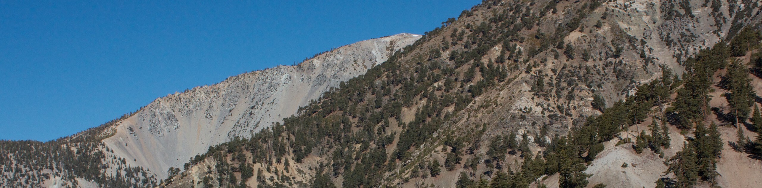
A long and beautifully scenic loop, the Three Ts Trail will see you traverse the summits of Timber Mountain, Telegraph Peak, and Thunder Mountain, making for an unforgettable day out on the trails of Southern California. This is a physically demanding adventure, so make sure that you wear sturdy hiking footwear, bring poles for stability, and pack plenty of snacks and water.
Setting out from the trailhead, you will initially make your way to the southeast alongside Icehouse Creek as it flows through the canyon. After gaining some elevation through Icehouse Canyon by means of a series of switchbacks, the trail will turn to the north to reach the summit of Timber Mountain.
After taking in the views, you will crack on through the mountainous terrain in order to traverse Telegraph Peak and Thunder Mountain, before descending through Baldy Notch, where you can pop into the Top of the Notch restaurant for a mid-hike snack. From here, you will follow along Baldy Road and visit the cascading San Antonio Falls, before arriving back at the trailhead where you began.
Similar hikes to the Three Ts Trail hike

Mount Zion via Lower Winter Creek Trail Loop
The Mount Zion via Lower Winter Creek Trail Loop is a physically demanding Southern California adventure that features waterfall and…

Sunset Peak Alternate Approach Hike
The Sunset Peak Alternate Approach Hike is a great intermediate-length route in Southern California that features some gorgeous canyon views.…
Register Ridge to Mount San Antonio Hike
The Register Ridge to Mount San Antonio Hike is equal parts scenic and incredibly challenging. While out on the trail,…
Comments