Big Horn Mine Trail
View Photos
Big Horn Mine Trail
Difficulty Rating:
Hiking the Big Horn Mine Trail is a great family-friendly experience in Southern California that will take you along the lower slopes of a mountain for some wonderfully scenic views. While out on the trail, you will gain a small amount of elevation along the slopes of Mount Baden-Powell, all while experiencing the crisp mountain air and views of the surrounding peaks. Make sure to purchase and display a valid adventure pass prior to setting out on your hike.
Getting there
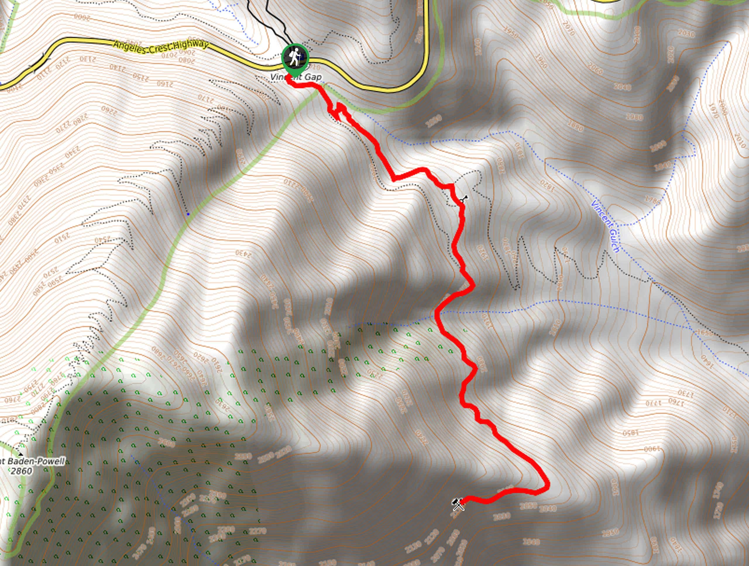
The starting point for the Big Horn Mine Trail can be found at the Vincent Gap along CA-2.

About
| Backcountry Campground | No |
| When to do | April-October |
| Pets allowed | Yes - On Leash |
| Family friendly | Yes |
| Route Signage | Average |
| Crowd Levels | Moderate |
| Route Type | Out and back |
Big Horn Mine Trail
Elevation Graph
Weather
Big Horn Mine Trail Description
If you want to take the family out on the trails to breathe in some fresh mountain air, or are looking for a laidback trail where you can experience some solitude, then the Big Horn Mine Trail in Angeles National Forest is the perfect route.
Setting out from the trailhead at the Vincent Gap, you will make your way to the southeast along the lower slopes of Mount Baden-Powell. Here, you will pass through a mixture of meadow and light forest terrain, while taking in the natural beauty of the surrounding mountains. After arriving at the end of the route, you will turn back and retrace your steps to return to your starting point.
Similar hikes to the Big Horn Mine Trail hike

Castaic Falls Trail
Hiking the Castaic Falls Trail is a fun little adventure in the Angeles National Forest that features a charming waterfall.…

Graveyard Truck Trail
Hiking the Graveyard Truck Trail is a pleasant experience in Southern California that features easy-going terrain and views of the…

Sunset Peak Alternate Approach Hike
The Sunset Peak Alternate Approach Hike is a great intermediate-length route in Southern California that features some gorgeous canyon views.…
Comments