
Gould Mesa Hike
View Photos
Gould Mesa Hike
Difficulty Rating:
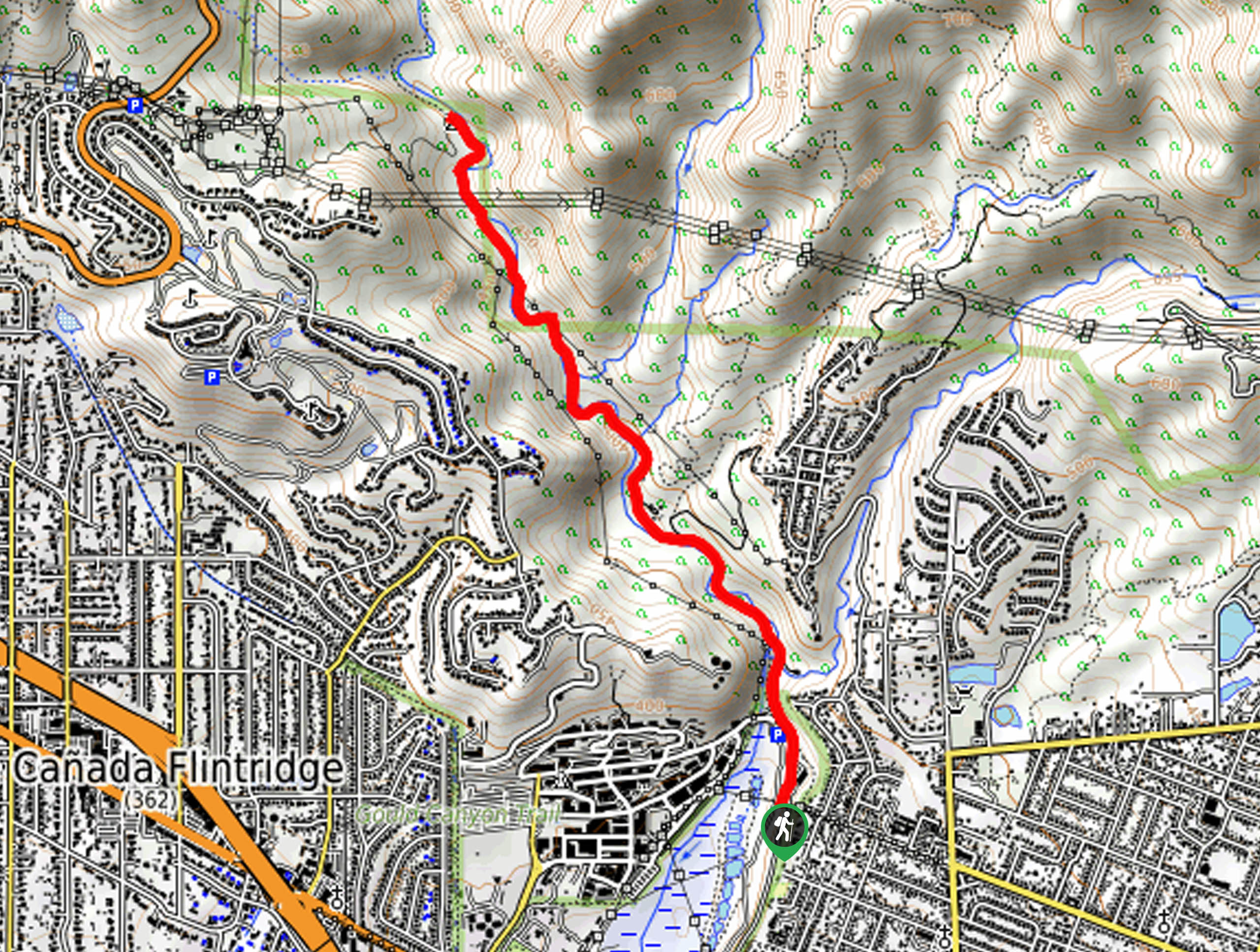
The Gould Mesa Hike is a nice and easy hiking route in Southern California that follows along a quiet river. Although busy, the relaxing waterside setting is very peaceful and makes for a fun day on the trails as you hike to the Gould Mesa campground. Remember to display your adventure pass before starting your hike!
Getting there
The trailhead for this hike can be found near the Gabrielino Trailhead in Altadena.

About
| Backcountry Campground | Gould Mesa |
| When to do | Year-Round |
| Pets allowed | Yes - On Leash |
| Family friendly | Yes |
| Route Signage | Average |
| Crowd Levels | High |
| Route Type | Lollipop |
Gould Mesa Hike
Elevation Graph
Weather
Gould Mesa Hike Description
If you are after a relaxing hike through the Angeles National Forest that isn’t too far from the city and the entire family will be able to enjoy, then you will certainly want to check out this hike.
Setting out from the trailhead, you will follow along the edge of the Arroyo Seco river as it heads into the undulating landscape to the northwest. Here, you will be able to relax in the outdoors, as you walk along shady paths and take in the natural beauty of the riverside setting.
Eventually, you will arrive at the Gould Mesa Campground, which is a great spot to set up camp and spend a few nights outdoors. If you are keen on returning, simply follow the same trail back to the starting point of your hike.
Similar hikes to the Gould Mesa Hike hike

Mount Zion via Lower Winter Creek Trail Loop
The Mount Zion via Lower Winter Creek Trail Loop is a physically demanding Southern California adventure that features waterfall and…

Castaic Falls Trail
Hiking the Castaic Falls Trail is a fun little adventure in the Angeles National Forest that features a charming waterfall.…

Graveyard Truck Trail
Hiking the Graveyard Truck Trail is a pleasant experience in Southern California that features easy-going terrain and views of the…
Comments