Mount San Antonio via Baldy Bowl Trail
View Photos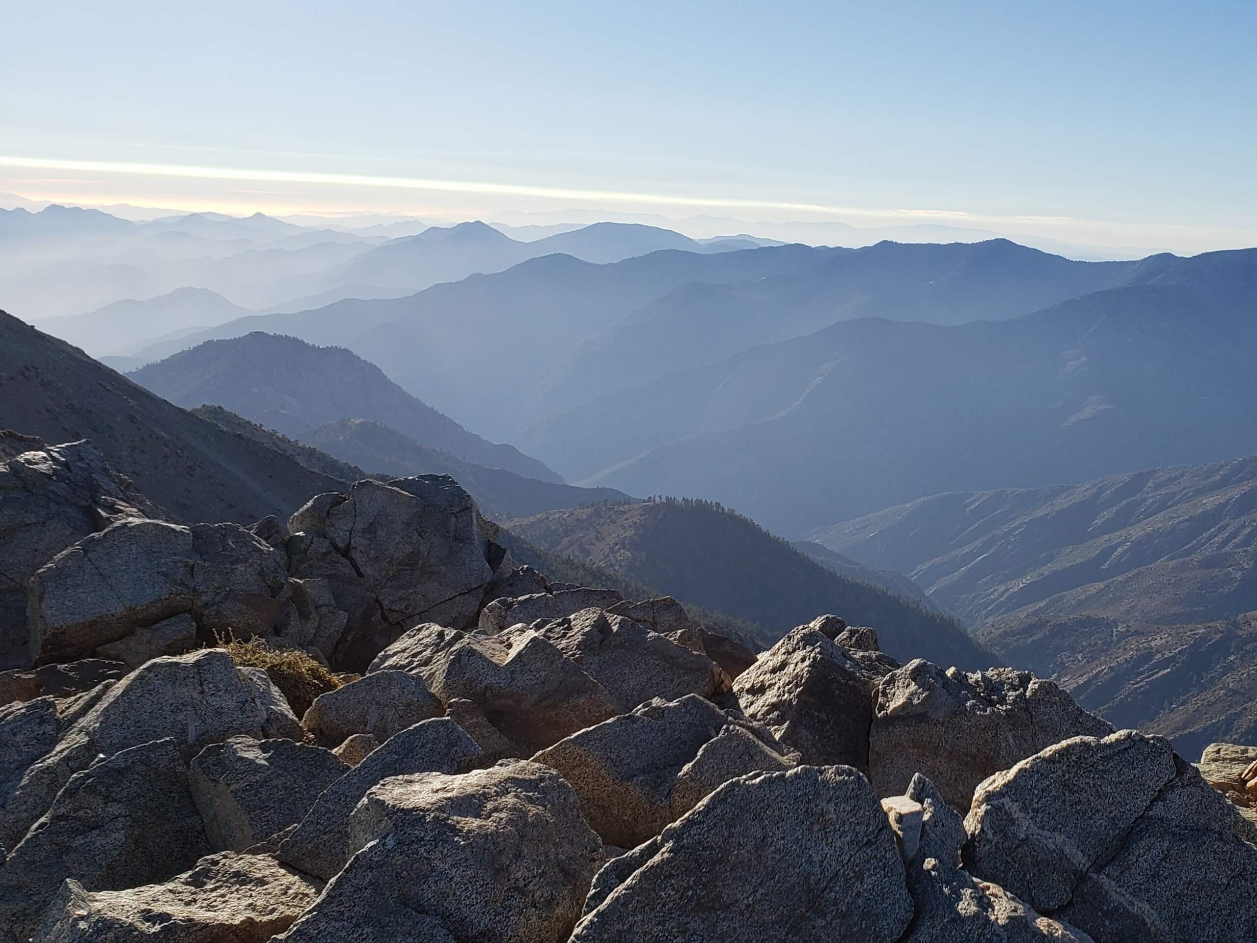
Mount San Antonio via Baldy Bowl Trail
Difficulty Rating:
Hiking up to the summit of Mount San Antonio via the Baldy Bowl Trail will definitely give you a run for your money, but will also produce some gorgeous views that stretch out across the SoCal landscape. While out on the trail, you will work your way past the San Antonio Falls and into the mountains, pushing your way uphill to reach the summit of “Old Baldy” itself. Make sure that you have a valid adventure pass displayed in your vehicle when setting out on this hiking excursion.
Getting there
The trailhead for this adventure can be found along Mt Baldy Road at Manker Flats.

About
| Backcountry Campground | Manker Flats |
| When to do | April-October |
| Pets allowed | Yes - On Leash |
| Family friendly | No |
| Route Signage | Average |
| Crowd Levels | High |
| Route Type | Out and back |
Mount San Antonio via Baldy Bowl Trail
Elevation Graph
Weather
Mount San Antonio via Baldy Bowl Trail Description
The hike to the summit of Mount San Antonio via Baldy Bowl Trail is a rugged adventure that will require a good level of fitness and resolve. Make sure that you wear proper hiking boots with good support, bring plenty of water, and take your time on this demanding trail. Additionally, you will want to arrive early to secure parking, as this is a popular area with all types of outdoor enthusiasts.
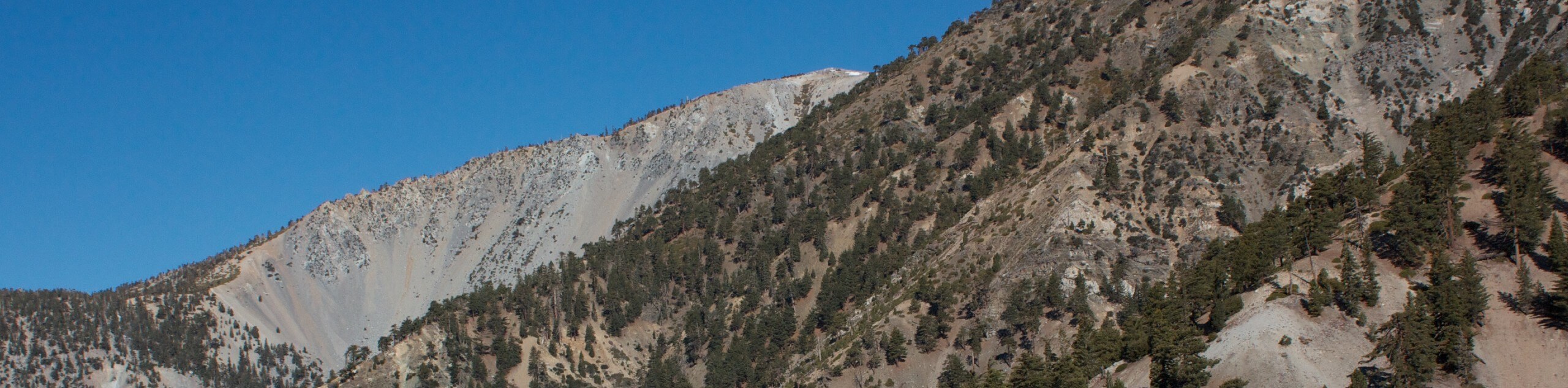
While it may be a bit on the tough side, this is an exceptional hiking route if you are looking for a great workout and rewarding views. Steep mountain slopes, rocky terrain, a gorgeous waterfall, and breathtaking mountain top views await on this epic SoCal excursion.
Setting out from the trailhead, you will make your way northwest along Falls Road for 0.6mi, where you will quickly arrive at the viewpoint for the San Antonio Falls. Take a few moments here to appreciate the scenery, before continuing on your way.
After another 0.3mi, you will come to a junction in the path and turn left onto the Baldy Bowl Trail. This will take you up the mountainside to the summit of Mount San Antonio, so keep straight in order to traverse the steep and rugged terrain. In 1.5mi, you will pass by the San Antonio Ski Hut and follow the trail as it bends temporarily to the southwest for another 0.6mi across a rocky scree slope.
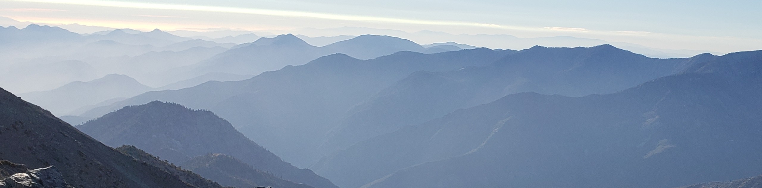
Here, the path will bend back to the north, traversing some rocky terrain for the final push up to the summit of “Old Baldy”. Be sure to exercise caution through this part of the hike and watch your footing on the rocks. After trudging over the uneven surfaces of the mountainside – and getting a solid leg burn in the process – you will arrive at the top of Mount San Antonio, where you will enjoy some spectacular views that sweep across the entirety of the Angeles National Forest.
Take some time here to explore the mountaintop and appreciate the picturesque scenery, before setting out on your descent. When you are ready, carefully retrace your steps back down the mountainside along the same route, once again passing by the ski hut and the falls enroute to the trailhead where you began.
Trail Highlights
Mount San Antonio
Often referred to as Mount Baldy or Old Baldy due to its bare summit, Mount San Antonio is a prominent summit in the San Gabriel Mountain Range of Southern California. At 10066ft in height, the peak is the high point of the surrounding mountain range and is instantly recognizable as a landmark in the region. Views from the summit extend out across the expanse of the Angeles National Forest, as well as the Greater Los Angeles area.
Frequently Asked Questions
Are Mount Baldy and Mount San Antonio the same?
Yes, Mount Baldy and Mount San Antonio are one and the same. The latter is the official name, although Mount Baldy has stuck as a nickname due to the fact that the summit has no trees, giving it a “bald” look.
Are there any bears around Mount Baldy?
The landscape surrounding Mount Baldy/Mount San Antonio is teeming with wildlife, including black bears that are often seen in the region. Be sure to exercise all precautions and bring bear spray.
Insider Hints
Wear sturdy, comfortable hiking footwear, as this trail features steep and rugged terrain.
Keep your dog on a leash at all times.
Bring plenty of water, as this route is physically demanding and exposed to the sun.
Similar hikes to the Mount San Antonio via Baldy Bowl Trail hike

Mount Zion via Lower Winter Creek Trail Loop
The Mount Zion via Lower Winter Creek Trail Loop is a physically demanding Southern California adventure that features waterfall and…

Sunset Peak Alternate Approach Hike
The Sunset Peak Alternate Approach Hike is a great intermediate-length route in Southern California that features some gorgeous canyon views.…
Register Ridge to Mount San Antonio Hike
The Register Ridge to Mount San Antonio Hike is equal parts scenic and incredibly challenging. While out on the trail,…
Comments