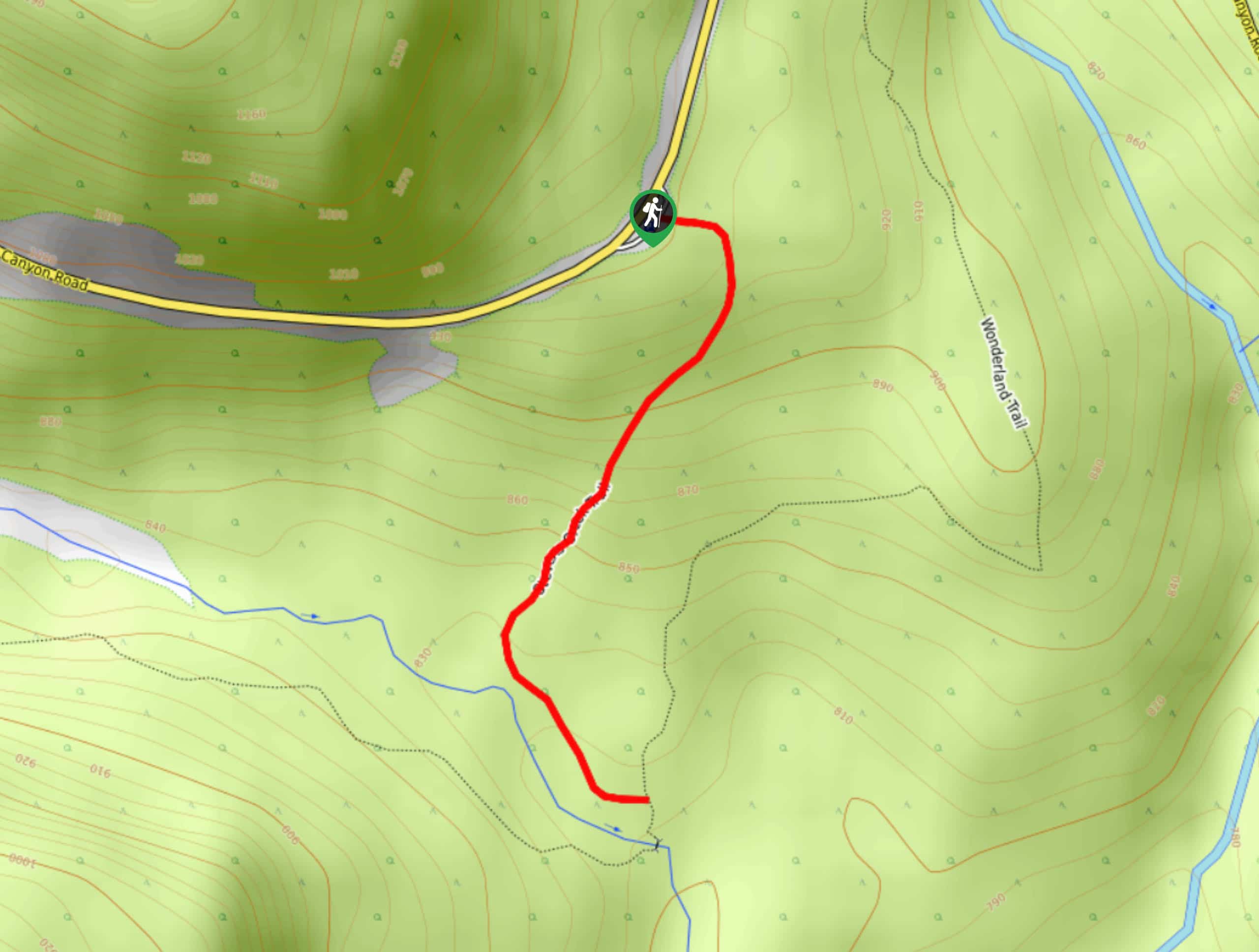
hikes in Mount Rainier National Park
Mt. Rainier Hikes
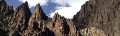
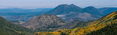
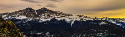
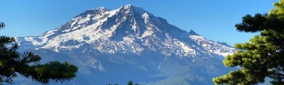
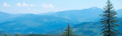
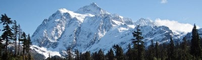
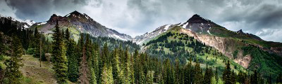
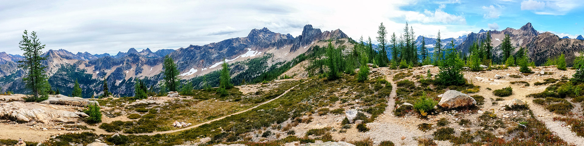
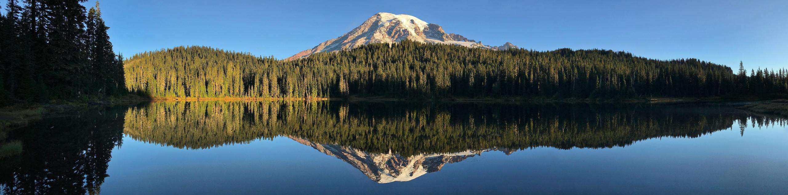
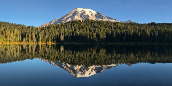
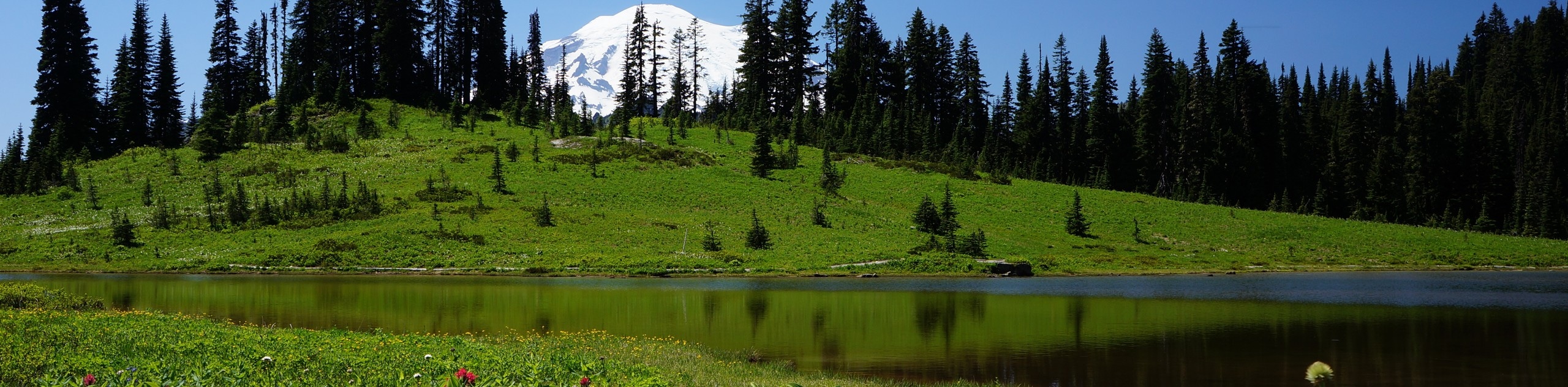
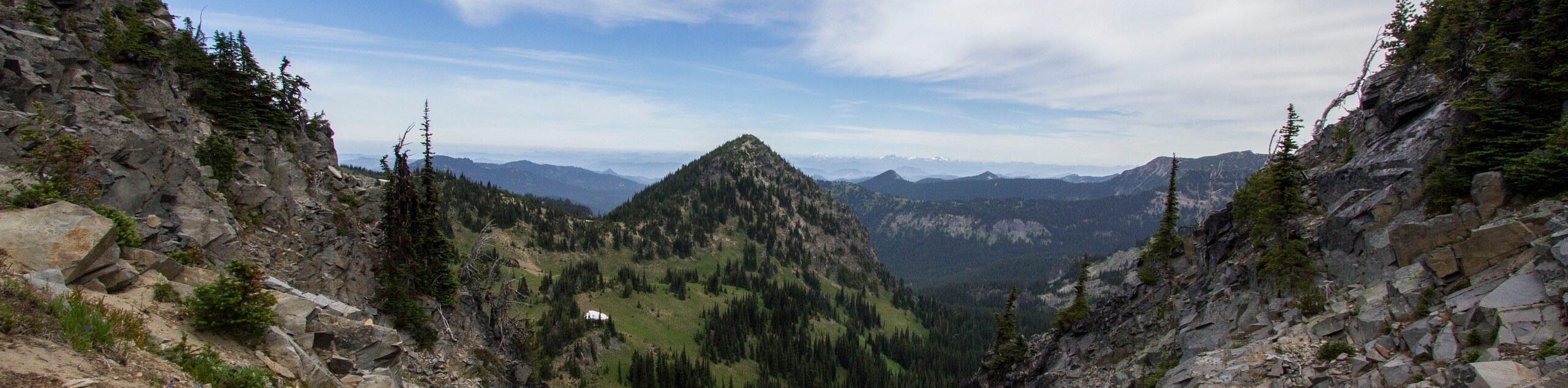
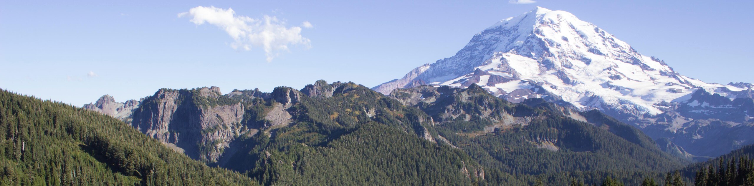
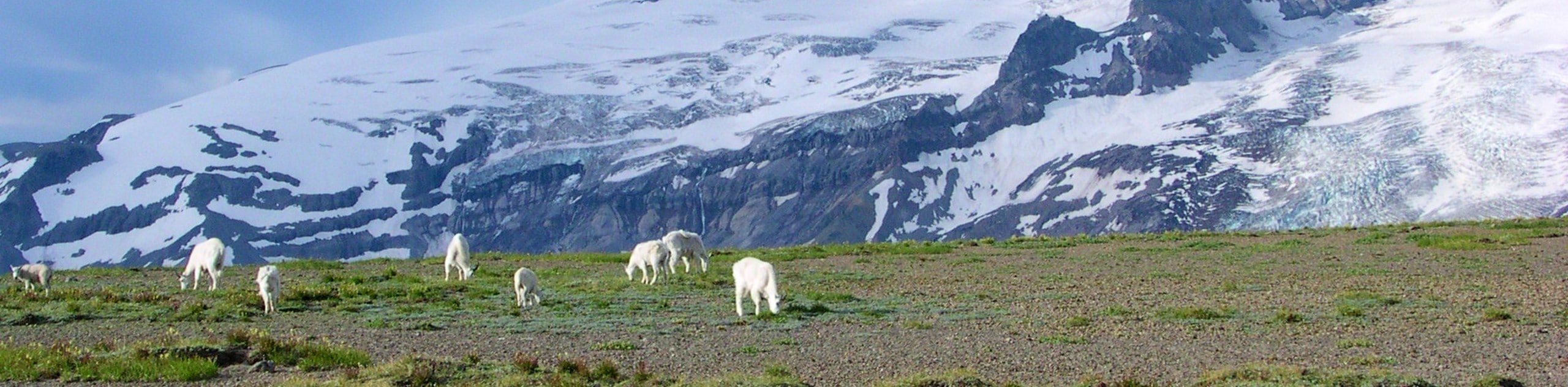
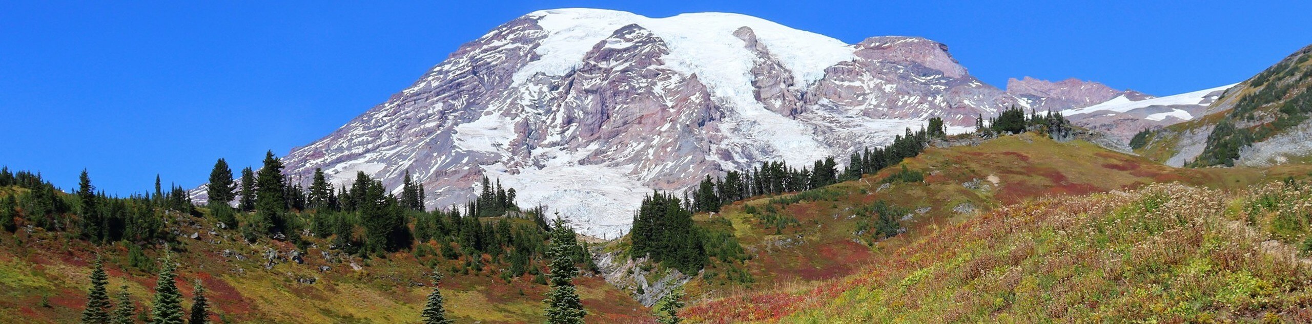
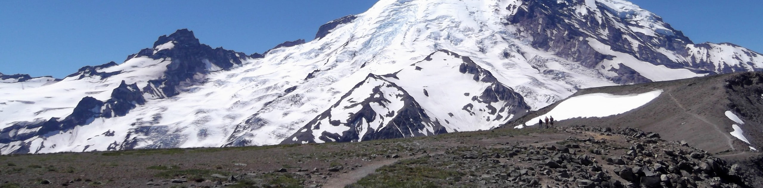
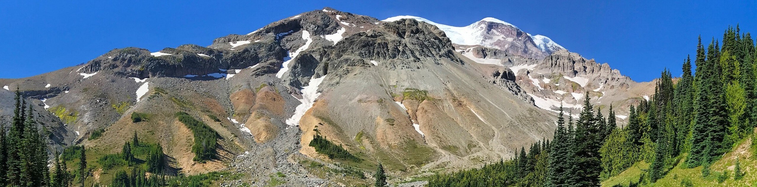
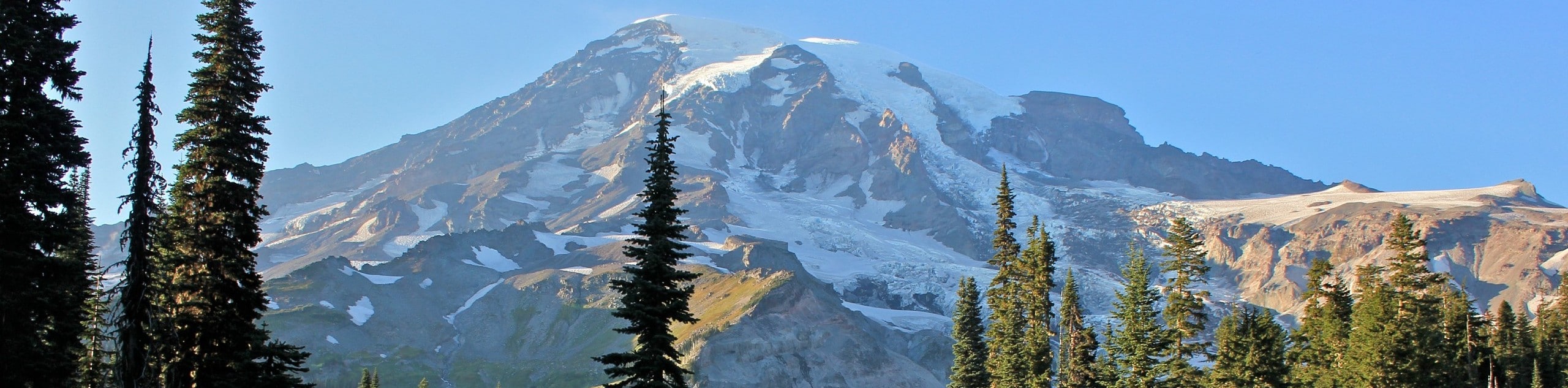
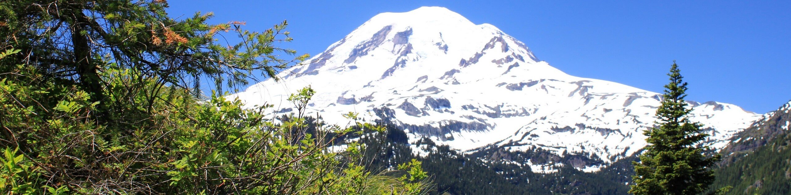
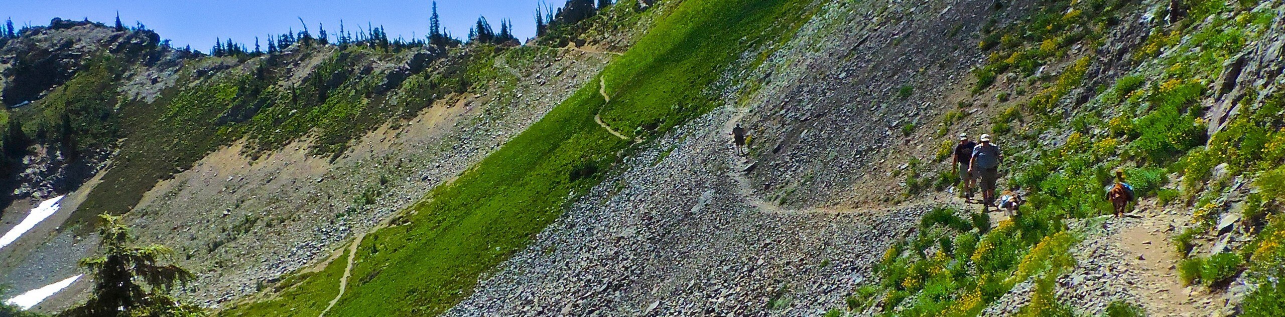
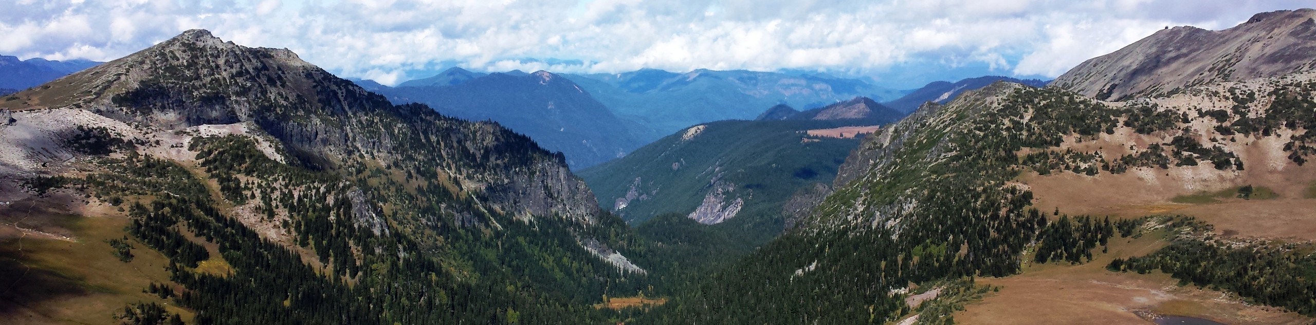
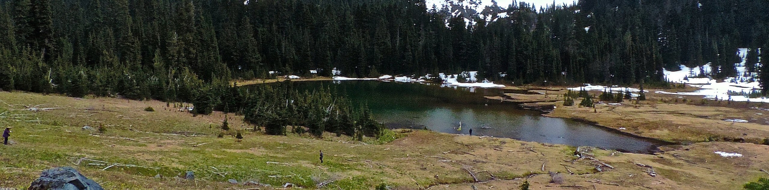
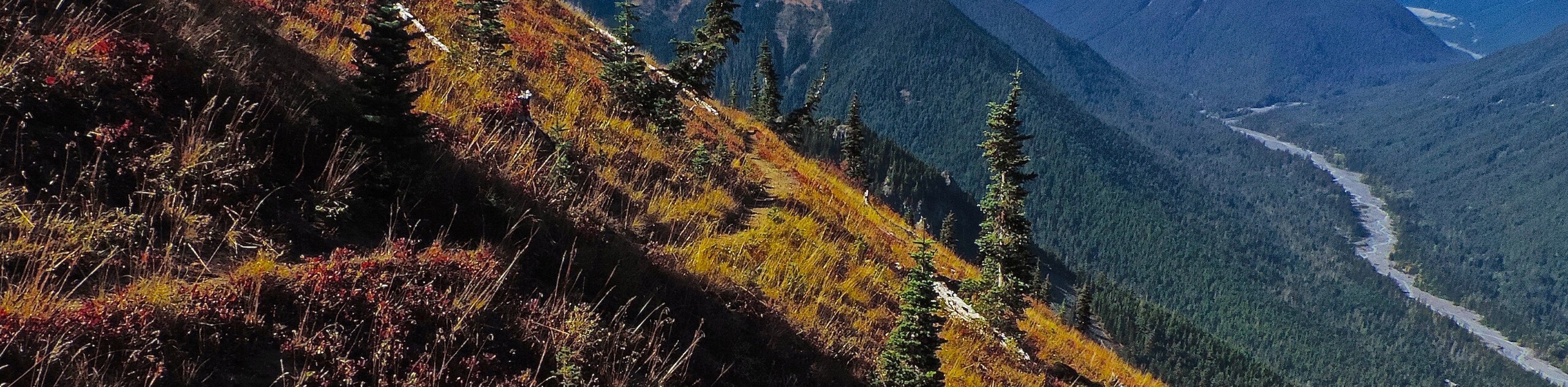
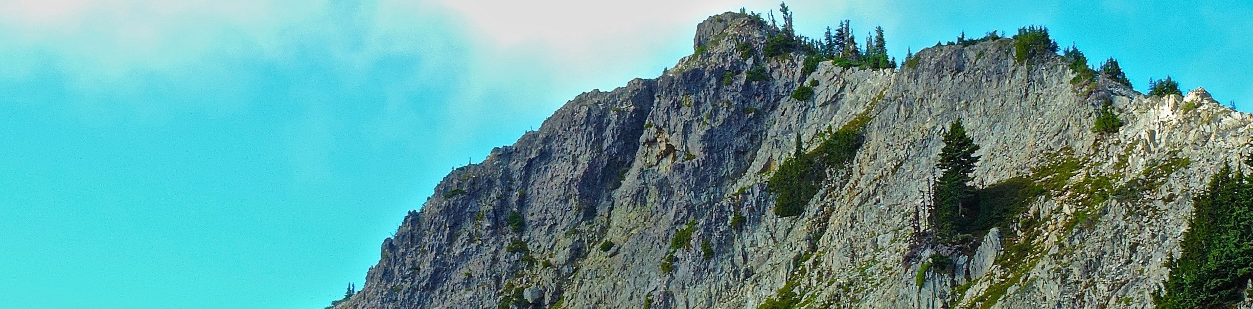
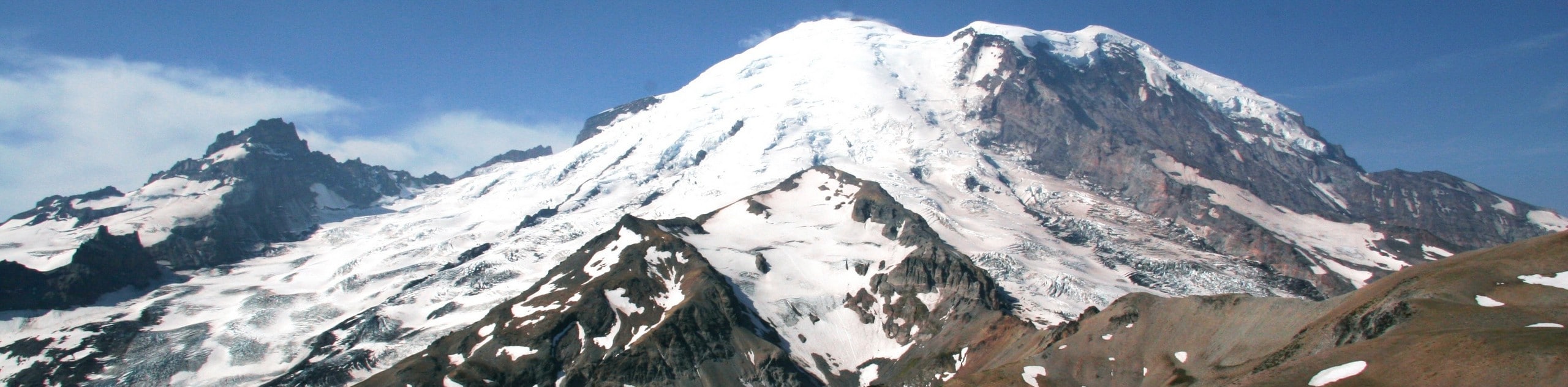
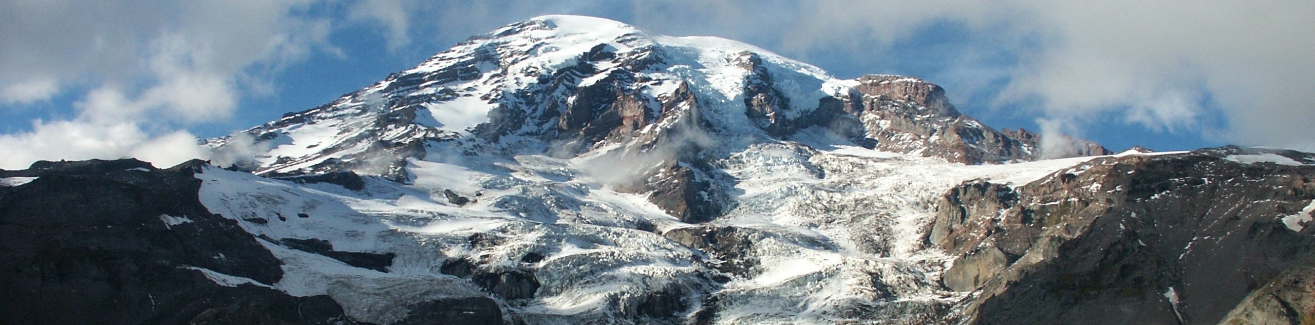
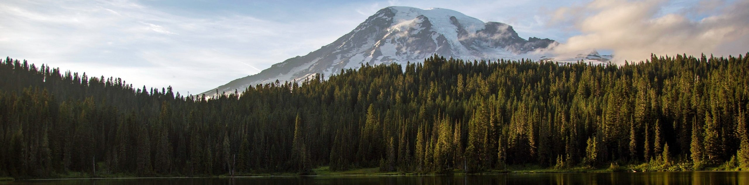
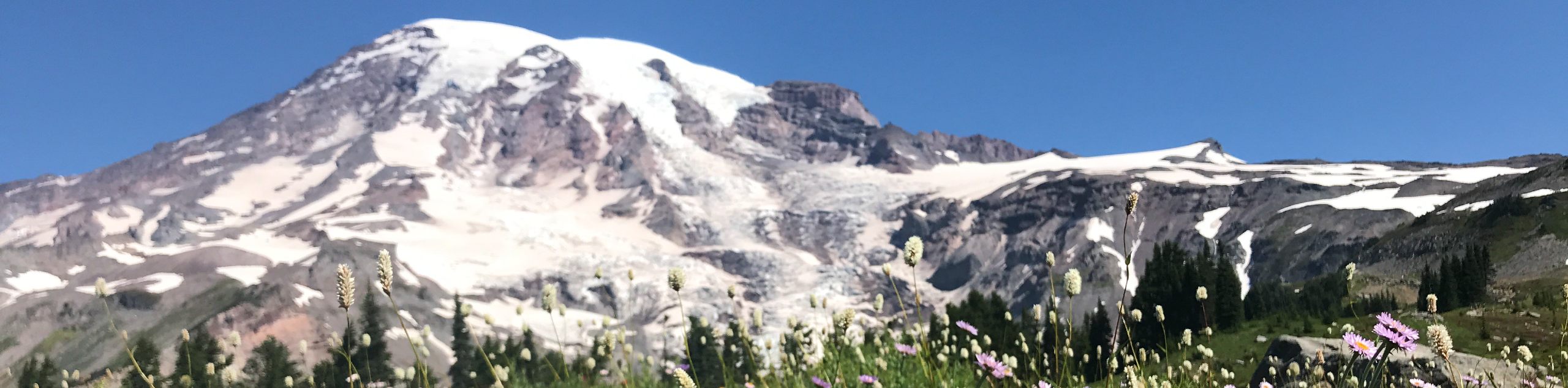
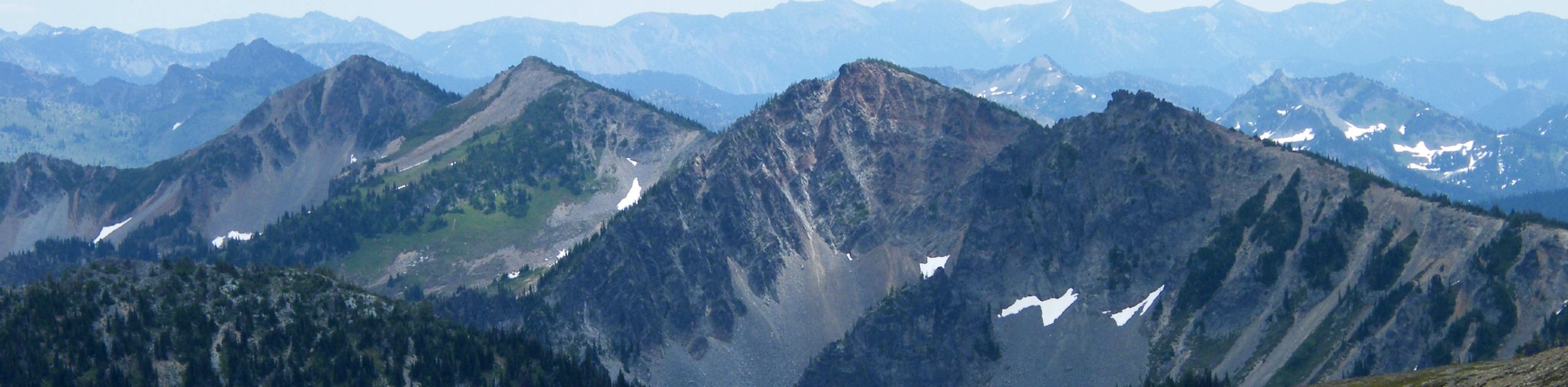
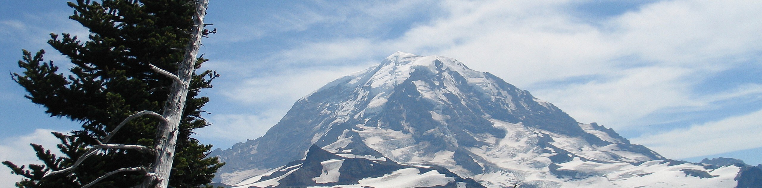
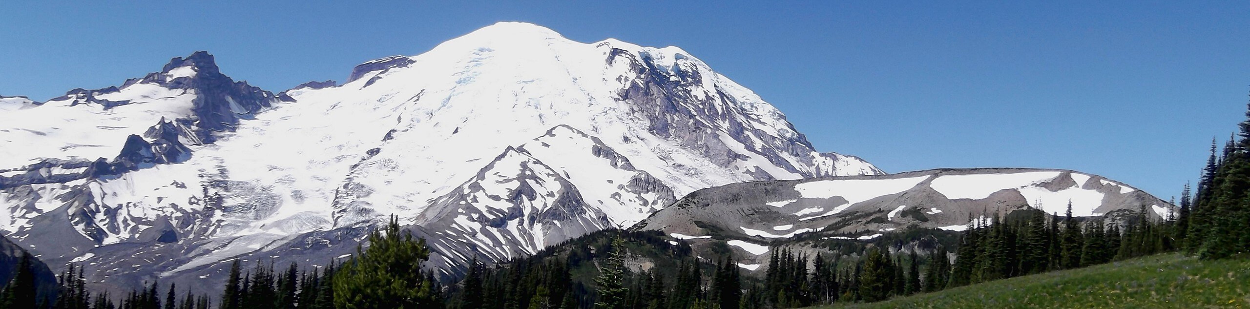
Mt. Rainier hikes are an incredibly popular adventure with outdoor enthusiasts, as Mount Rainier National Park is the gem of Washington State. Comprising nearly 370 square miles of pristine scenery, the star of the show is 14410ft Mount Rainier, the tallest mountain in the state. With endless carpets of lush wildflowers, dense forests, and rushing waterfalls around every turn, Mt. Rainier hikes are certainly a dream for hikers and adventurers of all ages. Drawing over 2 million visitors each year, Mount Rainier National Park is a a premier destination in the Pacific Northwest and a haven for hiking, photographing, camping, skiing, snowboarding, and snowshoeing. If you are after a scenic adventure in Washington, there are a wide variety of Mt. Rainier hikes that will be sure not to disappoint!
Mount Rainier National Park was established in 1899 as the fifth national park in the United States. The park protects a portion of the Cascade Range, 91,000 acres of old-growth forest, and countless gorgeous wildflower meadows, glaciers, and valleys. As the foundation document for the park reads, “The purpose of Mount Rainier National Park is to protect and preserve unimpaired the majestic icon of Mount Rainier, along with its natural and cultural resources, values, and dynamic processes. The park provides opportunities for people to experience, understand, and care for the park environment, and also provides for wilderness experiences and sustains wilderness values.”
With a dizzying array of trails, campsites, and stellar corners to explore, we’ve put together a list of our favorite Mt. Rainier hikes to help you plan your trip. This is just the start, though- there’s so much to see here!
The 10 Epic Hikes in Mount Rainier National Park
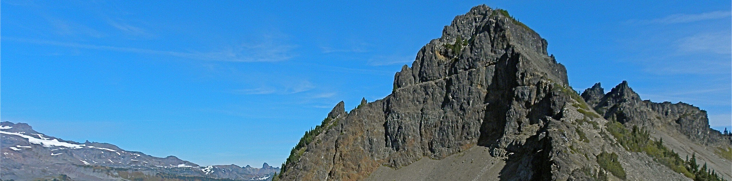
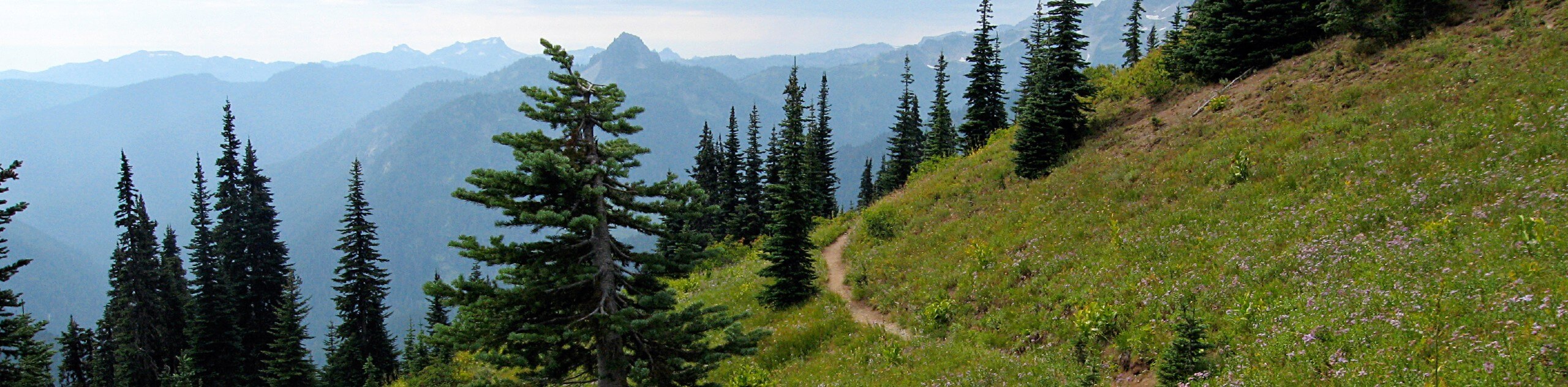
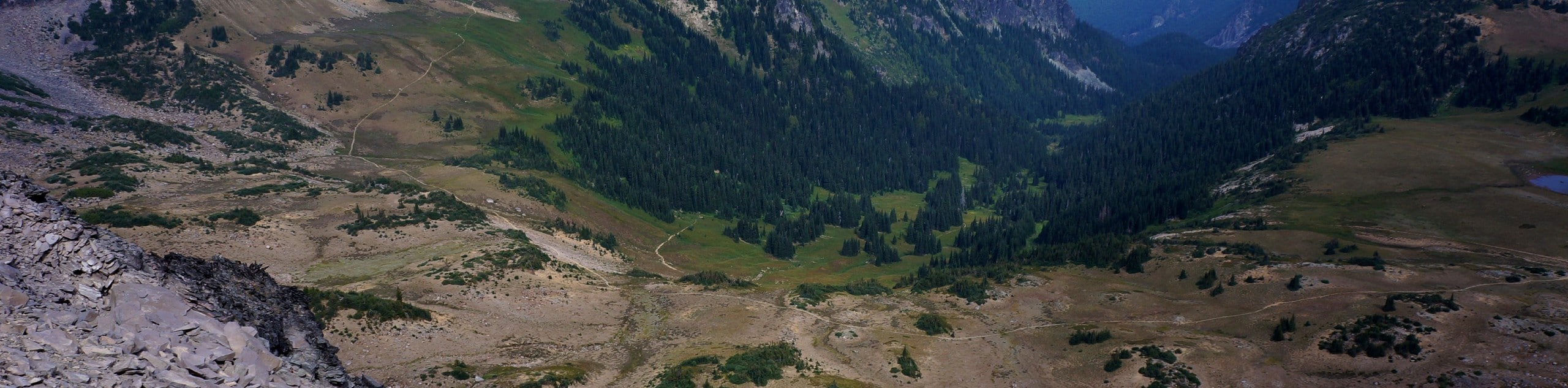
There are so many hikes to choose from in Mount Rainier National Park, it can be hard to know where to start! We’ve chosen some of our favourite trails in all corners of the park to help you choose your adventure.
Every kind of trail junkie can find their perfect Mt. Rainier hike here. There are family-friendly trails, more challenging hikes, and long multi-day backpacking trips on offer, so you’ll be able to choose the right trail no matter what you’re in the mood for. With lots of mid-difficulty routes in the park, intermediate hikers can balance a good workout and fabulous views. On hot days, hikes featuring waterfalls are a hugely popular choice in the park. And if you’ve got little ones tagging along, you can even find stroller-friendly trails to enjoy!
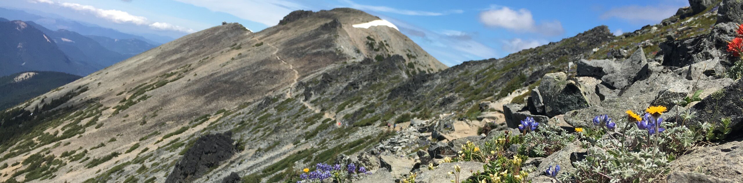
No matter which one of these Mt. Ranier hikes you decide to take, you’ll be treated to splendid views of the snow-clad Cascades, countless flowers, waterfalls, or ancient trees.
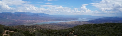
- Pinnacle Peak Saddle Trail - The Pinnacle Peak Saddle trail offers a lofty viewpoint over the Paradise area with only moderate effort required. With no technical challenges and a consistent steady incline, it offers a great quick workout with views of Mount Rainier and Mount Adams to reward you.
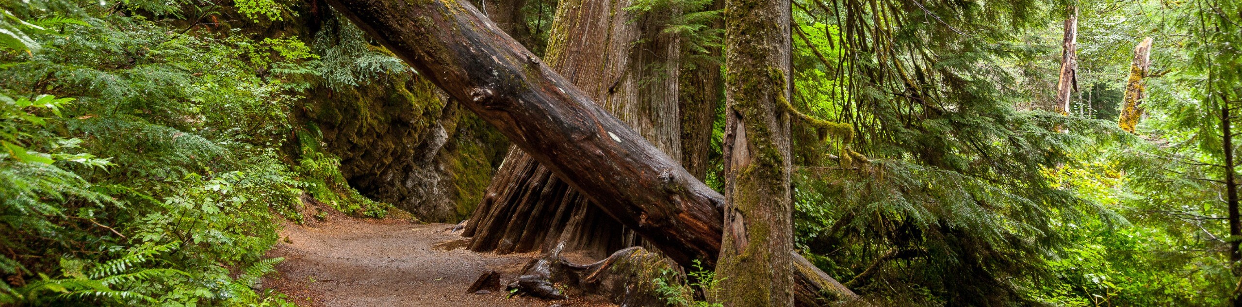
- Grove of the Patriarchs Trail - The Grove of the Patriarchs hike is a family-friendly hike that takes you through an old-growth forest and over a suspension bridge. This relaxed path requires very little elevation gain but gets you right up next to trees over 300ft tall. En route, you’ll notice interpretive signs that offer nice insight into the natural flora and fauna of the forest.
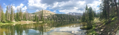
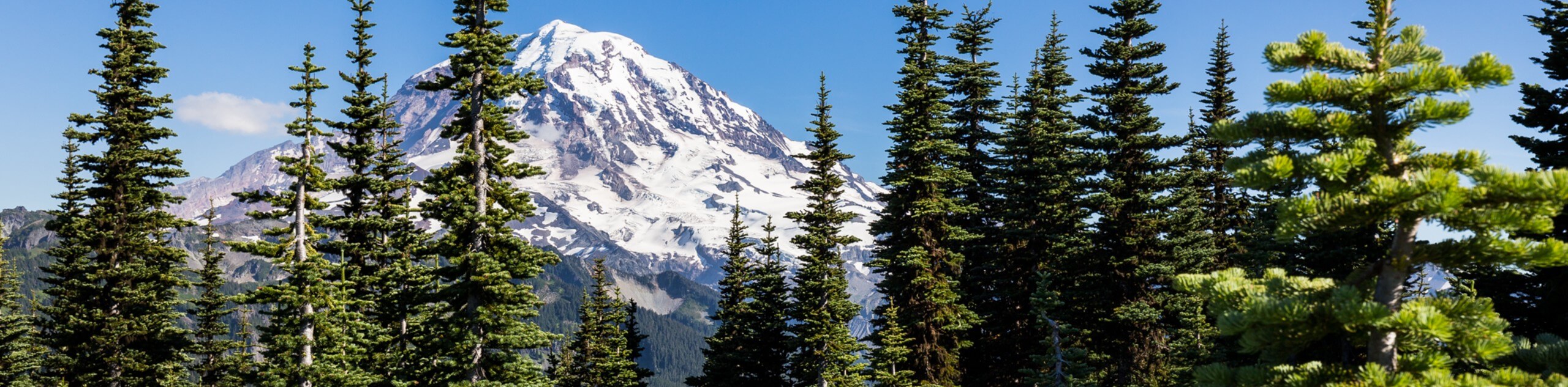
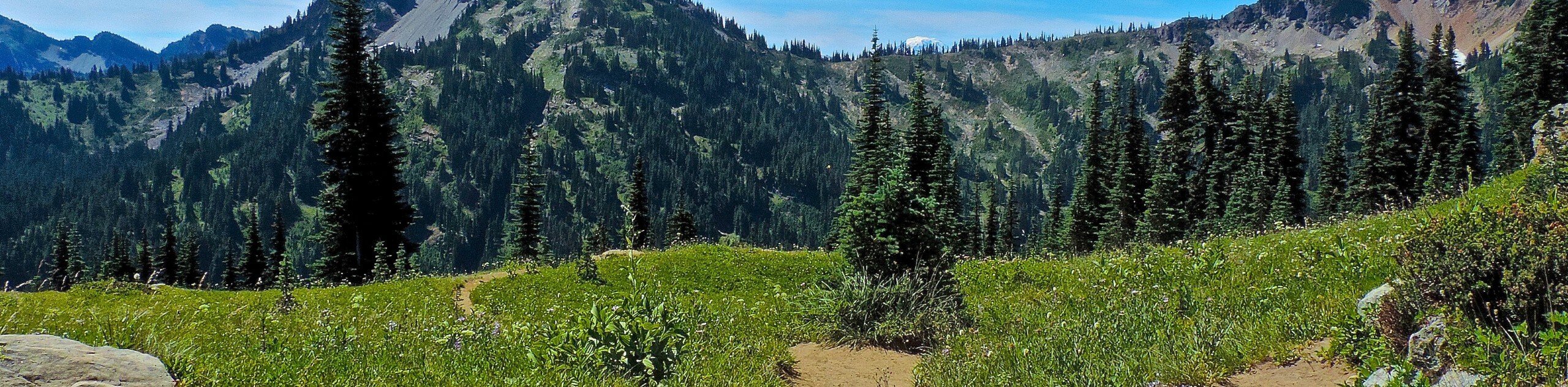
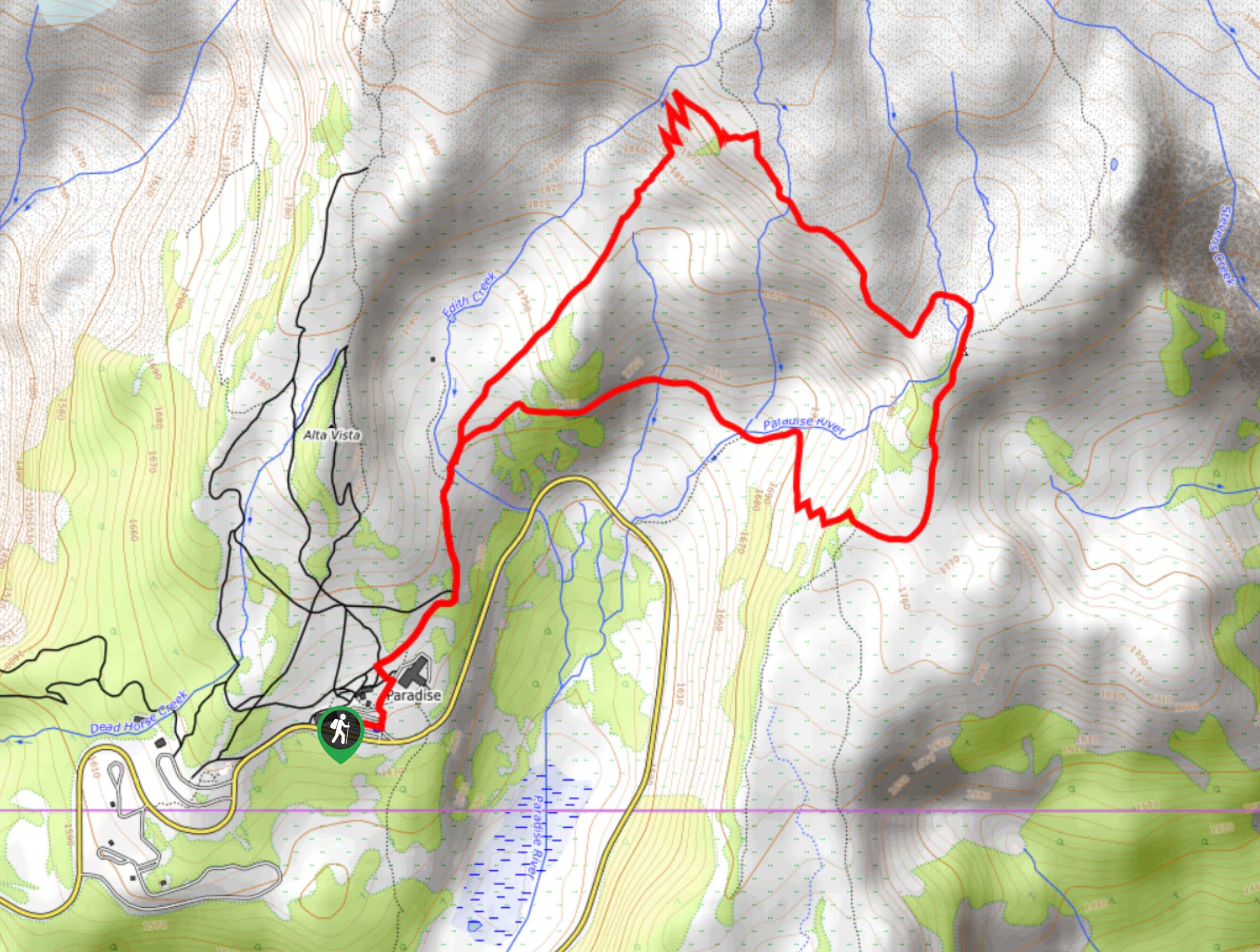
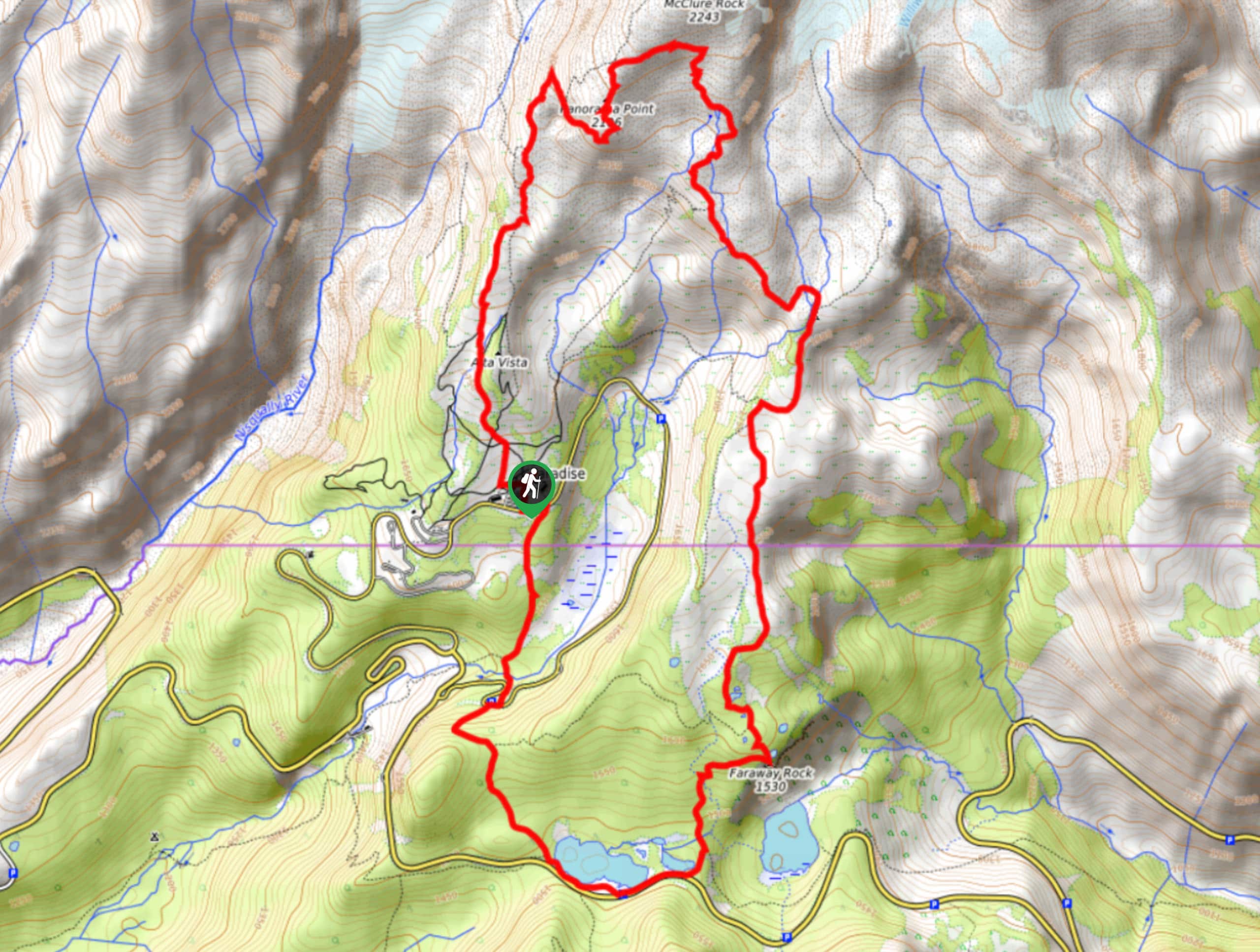
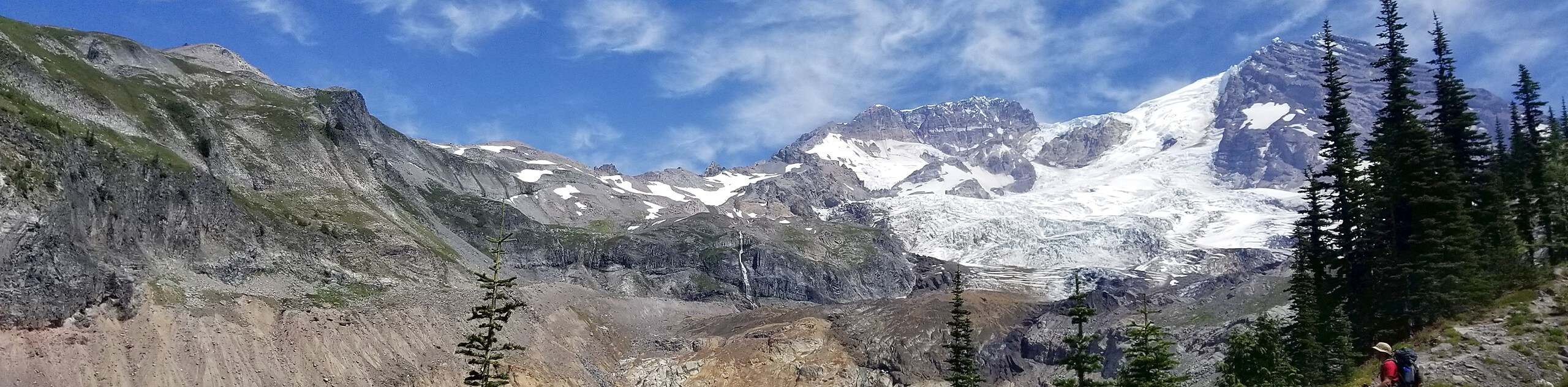
- Skyline Loop Trail - The Skyline Loop Trail boasts exceptional views and wide swathes of wildflowers in the summertime. Not only will you see countless wildflowers, but this moderate-length hike packs a punch when it comes to stunning scenery. Expect to pass by cascading waterfalls and mighty glaciers. Of course, the star of the show is the grand view of Mount Rainier.
- Tipsoo Lake Trail - The Tipsoo Lake Loop is an easy, short hike around a lake suitable for all ages and skill levels. This short hike is often combined with an ascent of Naches Peak, but the lake loop in itself is perfect for a low-key outing. It offers extremely mild elevation gain and the chance to see lush wildflowers.
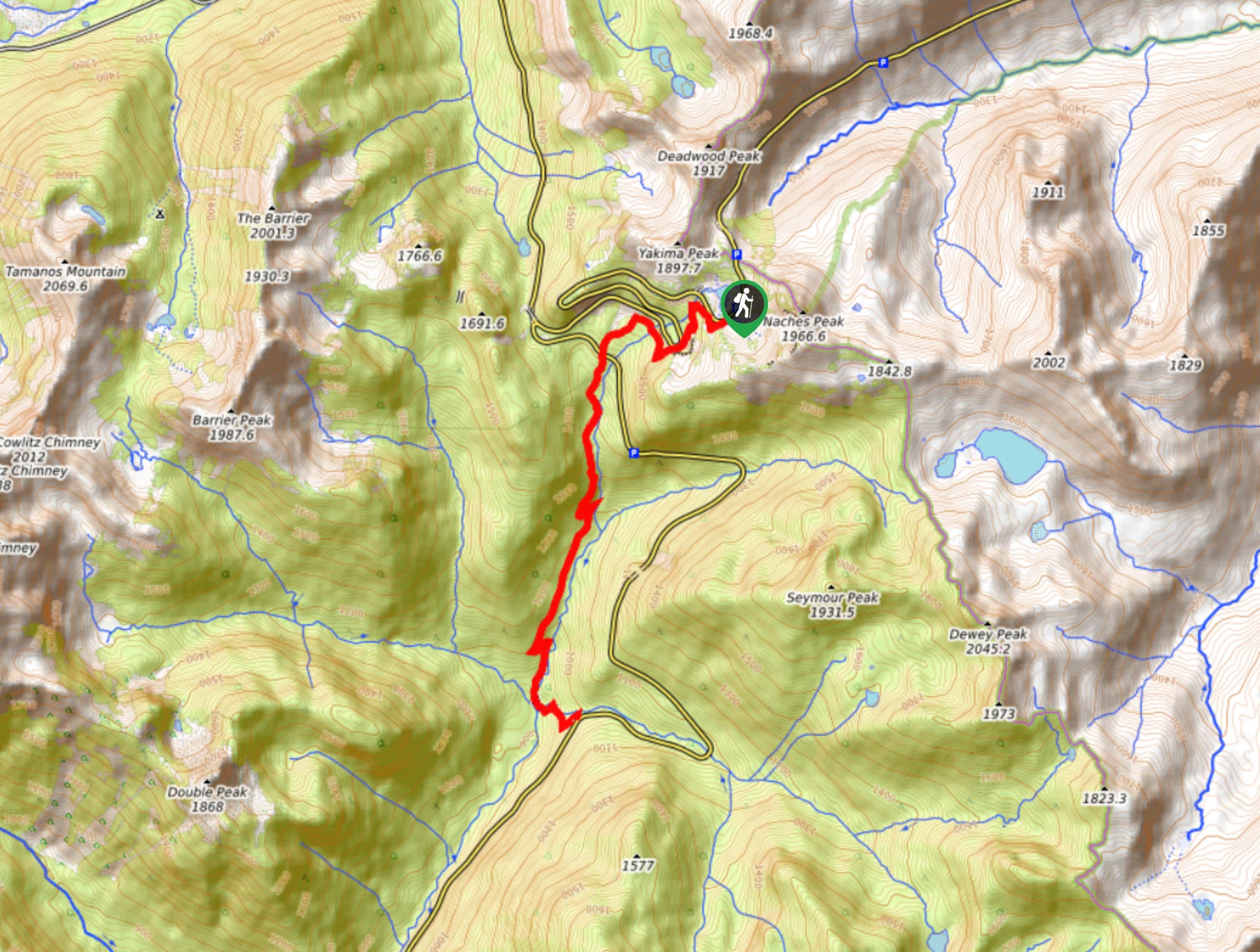
- Naches Peak Loop - The popular Naches Peak Loop hike offers diverse alpine scenery in a short, easy to complete loop. You’ll crest a small valley, enjoy views of Tipsoo Lake, walk through vast wildflower meadows, and do it all with views of Mount Rainier. The Naches Peak Loop hike follows the Pacific Crest Trail for a portion of the trek, giving you the honor of a few steps on an epic thru-hike.
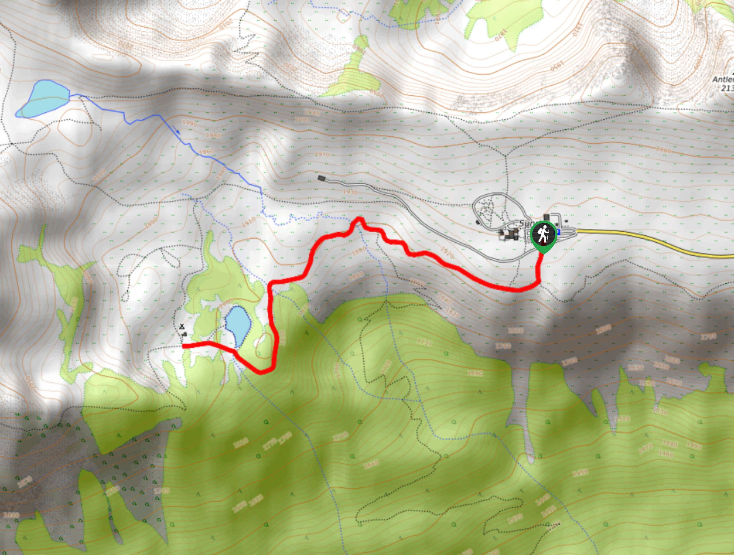
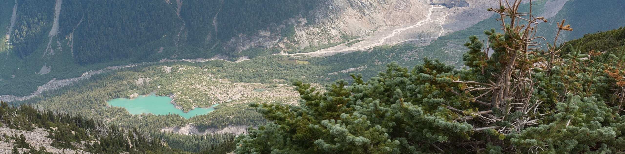
- Tolmie Peak Trail - The Tolmie Peak Trail takes you up to an old fire lookout, where you’ll enjoy incredible up-close views of Mount Rainier and Eunice Lake. These two viewpoints are go-to spots for sunrise and sunset photographers. The Tolmie Peak Trail crosses over part of the Wonderland Trail, one of Washington’s most impressive long-distance trails.
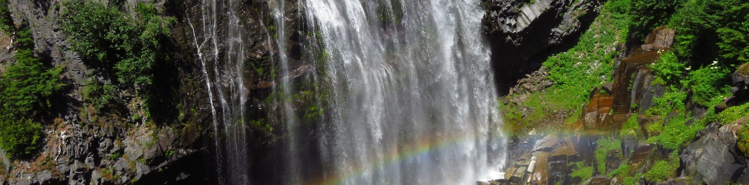
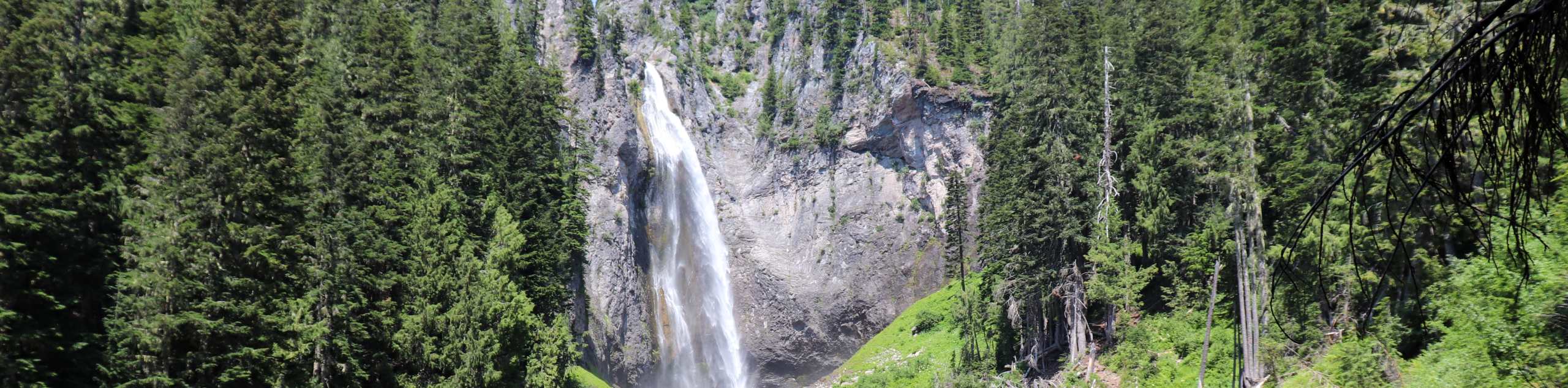
- Narada Falls to Reflection Lake - The hike between Narada Falls and Reflection Lake links the serene Reflection Lake with the thundering Narada Falls. Instead of driving to see both, you can take this enjoyable trail in between. This trail can be hiked in either direction, allowing you to tailor your adventure to your day’s plans. On a hot day, the cool mist of the falls and water of the lake is a welcome treat.
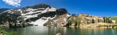
- Frozen Lake via Sourdough Ridge - The Frozen Lake via Sourdough Ridge trail is an easy hike in Mount Rainier National Park that takes you to a small, icy lake. The trail also rewards you with great views from Sourdough Ridge of Mount Rainier itself. The hike is fairly short, requires little elevation gain, and is perfect for a quick outing or a trip with adventurous kids. Enjoy this quiet, scenic hike and savour those peaceful moments on the lakeshore.
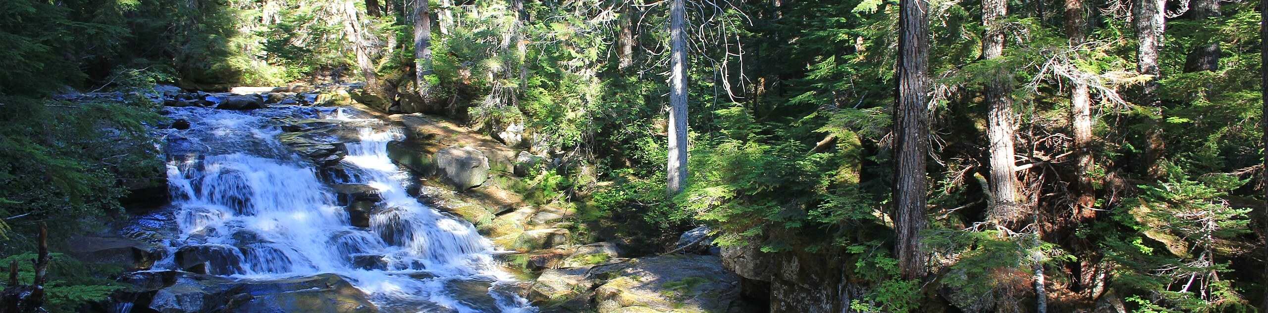
- Silver Falls Hike - The Silver Falls hike is a family-friendly hike that takes you to a cascading waterfall and that can be easily linked with the popular Grove of the Patriarchs trail. The hike requires little elevation gain and the trail is wide, making it a nice choice for families. As you hike, you can read the collection of interpretive signs along the trail that highlight the history of this spot.
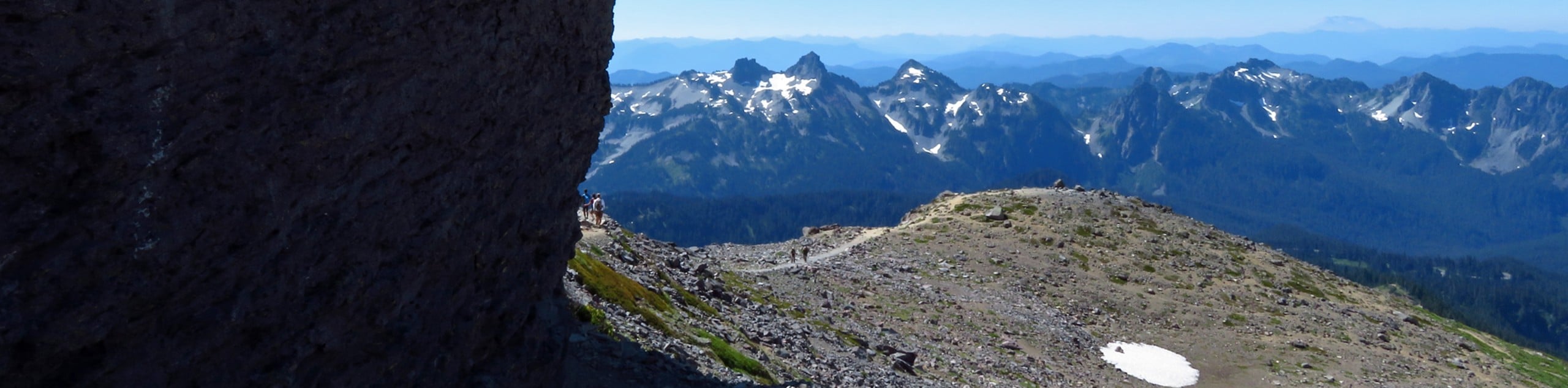
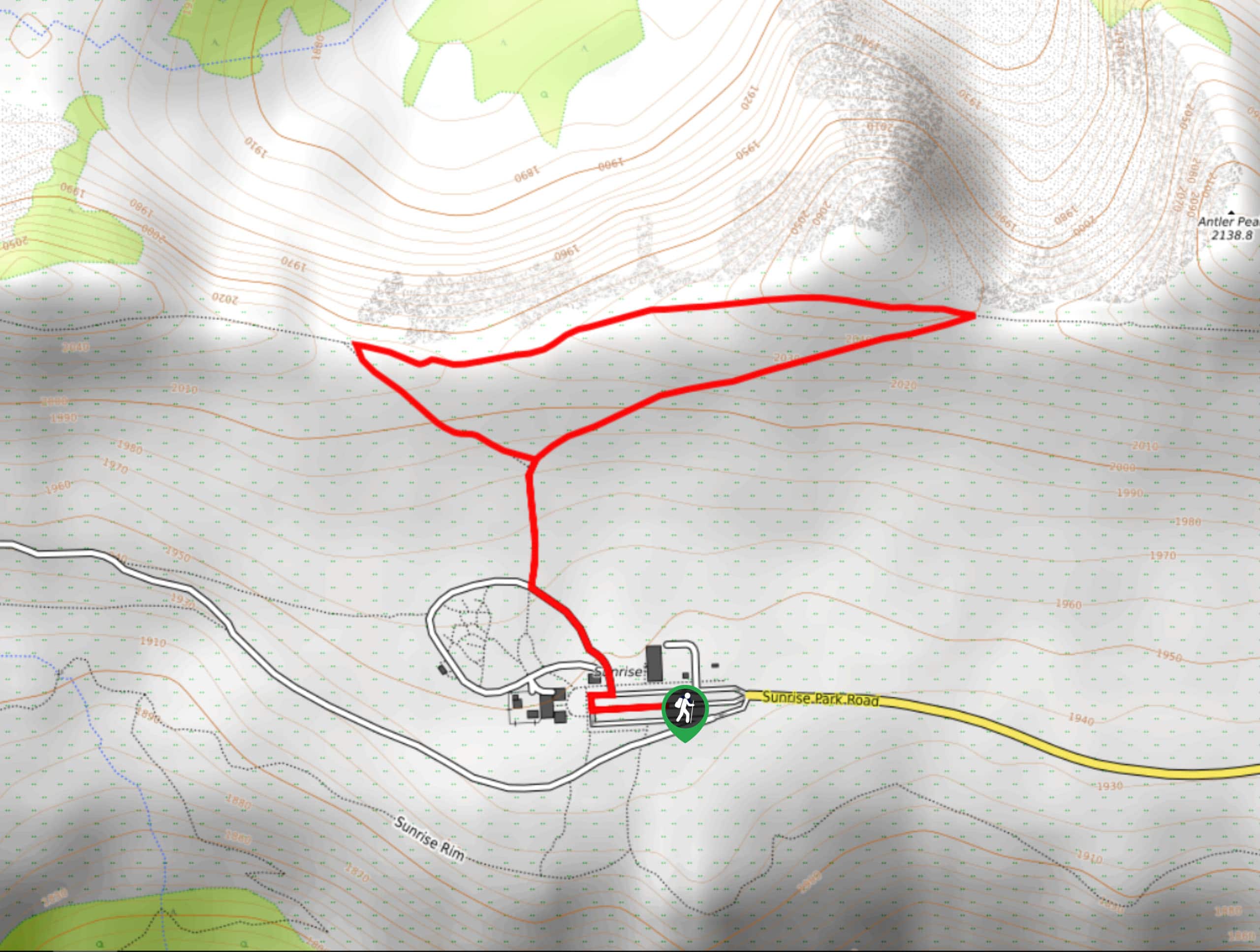
- Fremont Lookout Trail - Watchmen used to watch for wildfires from the cabin atop Mount Fremont, but now the Mount Fremont Lookout Trail serves to give you an excellent vantage point over Grand Peak, Redstone Peak, and Skyscraper Mountain. Take this perfect half-day hike in Rainier National Park for great views and just enough of a challenge!
Scroll down to see the full list of hiking trails in Mount Rainier National Park.
When is the Best Time to Hike in Mount Rainier National Park?
Mount Rainier National Park experiences warm, enjoyable summers and cool winters with lots of precipitation. Parts of the park close in the late fall and remain closed through the spring, so we recommend visiting in the summer months of June through September if you are looking to experience the best of the Mt. Rainier hikes. If you’re hoping to catch the wildflower blooms in their full glory, a trip between mid-July and mid-August tends to be the best option.
While the summer months offer the best weather and best flowers, they do also bring the heaviest crowds. If you’re okay with running into potential leftover snow on the trail or missing the flowers, visiting in June or mid-September can give you more privacy on the trails while still offering suitable hiking weather.
If you’re seeking to enjoy winter activities in the park, like snowshoeing, visiting between December and early March will be your best bet. Just come prepared, as rangers and services may be unavailable. Take care to plan your visit carefully, since some roads in the park are subject to seasonal closures.
Other Outdoor Activities in Mount Rainier National Park
Mt. Rainier hikes are by far the most popular activity within the national park, but it’s certainly not the only way to spend your time here. The park is a fantastic spot to camp, with both soft-side and hard-side sites available. There are also some backcountry spots you can use during your time in the park, especially if you’re completing a backpacking trip. Most sites need to be booked in advance.
In the winter months, snowshoeing, cross-country skiing, and backcountry skiing and snowboarding are very popular. Many hiking trails are suitable for snowshoeing, and most backcountry users will hike up to Camp Muir to ski or snowboard the Muir snowfields.
For downhill skiing and snowboarding in-bounds, Crystal Mountain is a huge draw. This top-rated resort boasts lots of expert runs. If you’re a powder hound, try White Pass Ski Area, a more off the beaten path zone with great natural terrain.
How to Plan a Trip to Mount Rainier National Park
A hiking trip in Mount Rainier National Park is an unforgettable adventure, but you’ll want to put enough time and energy into planning to make your trip smooth. Whenever you’re planning a trip to a national park, there are fees, permits, transportation requirements, and day-to-day logistics to consider. The official website of the park is a great resource for trip planning, as is the National Park Service, which also posts up-to-date trail conditions, closures, and other important information.
Mount Rainier National Park Adventure Tours
Not so excited about hashing out the details of your itinerary? Letting the pros plan your adventure in Mount Rainier National Park takes the stress out of your holiday, letting you focus on your experiences. Check out some incredible adventure tours in Mount Rainier National Park.
Frequently Asked Questions About Mount Rainier National Park
Do I need a pass or permit to enter Mount Rainier National Park?
Yes, you’ll need to purchase either a day pass or an America the Beautiful Pass to enter the park. This can be done online in advance or when entering the park gates.
How many days do you need in Mount Rainier National Park?
You could spend anywhere from a day to two weeks exploring the park! Most visitors come for one day or a weekend, but some devoted backpackers (like those completing the Wonderland Trail) will spend nearly two weeks in the park. We recommend two full days to have the time to enjoy several different hikes in the park.
Which city is closest to Mount Rainier National Park?
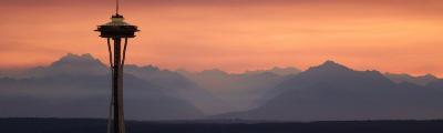
The closest major city to Mount Rainier National Park is Tacoma (50.0mi), which also has the closest international airport, the Seattle-Tacoma International Airport (SEA). Seattle is about 80.0mi from the park.
Can you camp in Mount Rainier National Park?
There are both frontcountry and backcountry campsites in the park. Make sure you book your spot ahead and get all the necessary permits before you pitch your tent.
Are dogs allowed in Mount Rainier National Park?
Dogs are not allowed on trails, in the wilderness, inside buildings, in amphitheatres, or on snow in the park. You can have your dog in the car and parking lot with you (on leash only), but because of the firm restrictions in nearly all other parts of the park, we do not recommend bringing dogs into the park at all.
Service animals (not including emotional support animals) are exempted.
Do you need a car in Mount Rainier National Park?
Currently, there is no public transportation available in the park. We recommend either driving your own car, renting a car, or booking a tour that includes transportation.
Explore other great hiking regions in Washington State:
Or check out other amazing hiking regions to explore in the United States.
Read MoreThe best hikes in Mount Rainier National Park
01. Pinnacle Peak Saddle Trail
Difficulty
The Pinnacle Peak Saddle trail offers a lofty viewpoint over the Paradise area with only… Read More
02. Grove of the Patriarchs Trail
Difficulty
The Grove of the Patriarchs hike is a family-friendly 1.5mi hike in Mount… Read More
03. Skyline Loop Trail
Difficulty
The Skyline Loop Trail is a 5.5mi moderately difficult trail in Mount Rainier… Read More
04. Tipsoo Lake Trail
Difficulty
The Tipsoo Lake Loop is an easy, short hike around a lake suitable for all… Read More
05. Naches Peak Loop Hike
Difficulty
The popular Naches Peak Loop hike offers diverse alpine scenery in a short, easy to… Read More
06. Tolmie Peak Trail
Difficulty
The Tolmie Peak Trail is a moderate hike in Mount Rainier National Park that takes… Read More
07. Narada Falls Trail
Difficulty
The Narada Falls Trail is an easy, family-friendly out and back route in Mount Rainier… Read More
08. Frozen Lake via Sourdough Ridge Trail
Difficulty
The Frozen Lake via Sourdough Ridge trail is an easy hike in Mount Rainier National… Read More
09. Silver Falls Hike
Difficulty
The Silver Falls hike is a 3.0mi family-friendly hike in the southeastern portion… Read More
10. Fremont Lookout Trail
Difficulty
Watchmen used to watch for wildfires from the cabin atop Mount Fremont, but now the… Read More
Yes, there are more than 10
Mount Rainier National Park is so beautiful that we can not give you only 10 hikes. So here is a list of bonus hikes in Mount Rainier National Park that you should take a look at as well
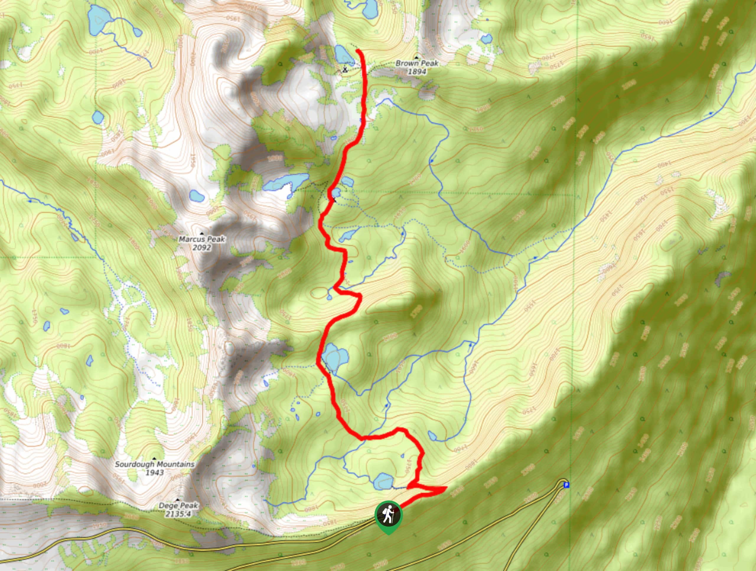
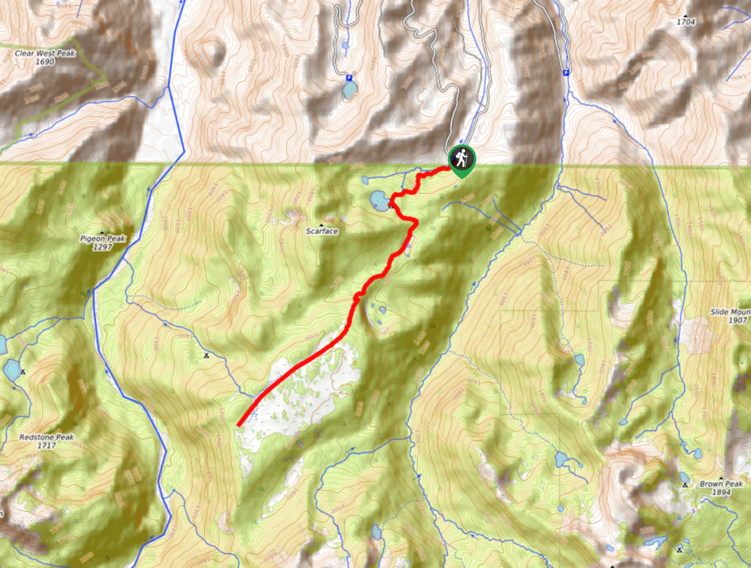
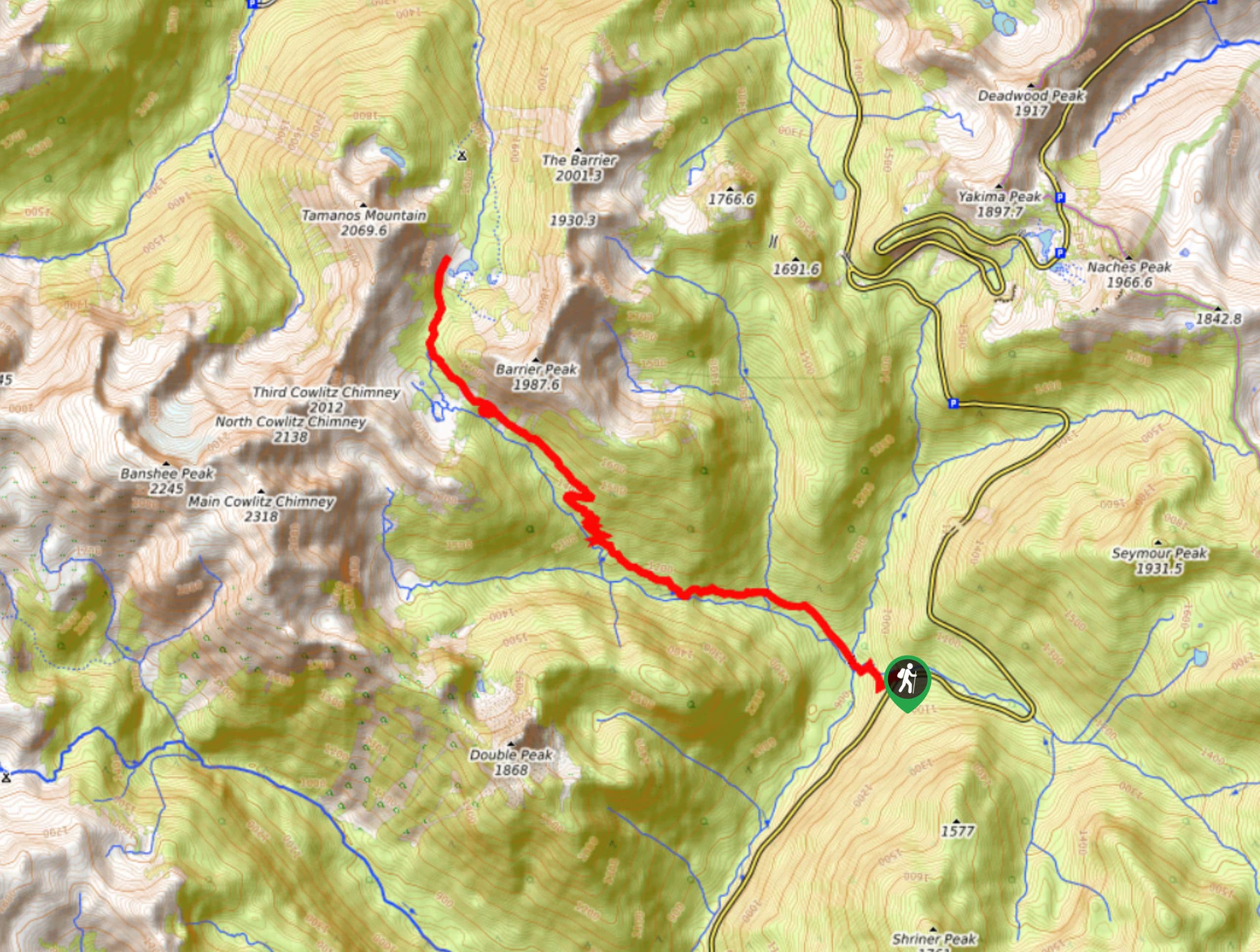
11. Tolmie Peak, Alki Crest, and Florence Peak
Difficulty
The Tolmie Peak, Alki Crest, and Florence Peak trail is a moderate hike in Mount… Read More
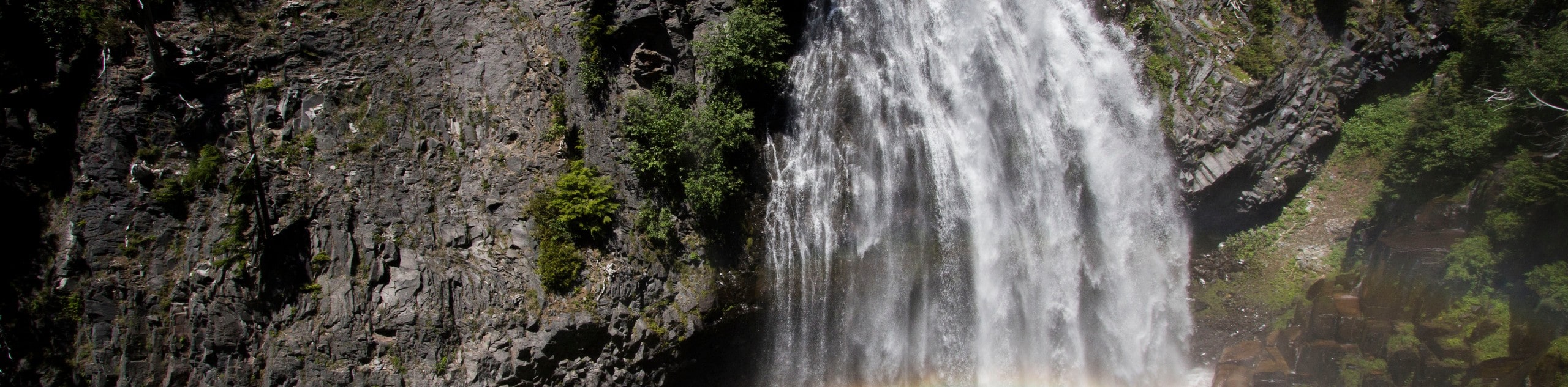
12. Narada Falls to Reflection Lake Hike
Difficulty
The hike between Narada Falls and Reflection Lake is a moderate trek in Rainier National… Read More
13. Comet and Christine Falls Trail
Difficulty
The Comet and Christine Falls Trail is a moderate hike in Mount Rainier National Park… Read More

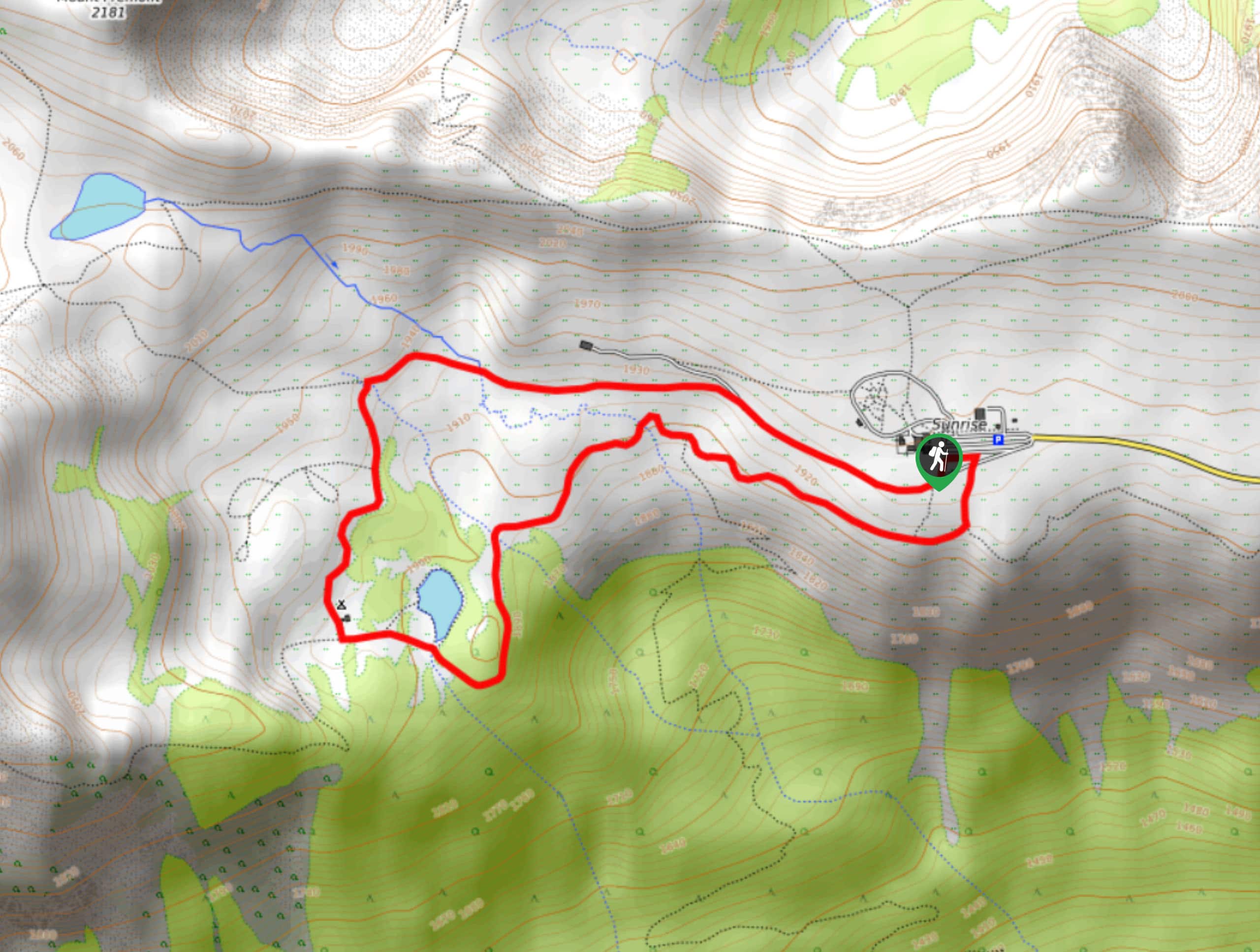
14. Sunrise Rim Trail and Fremont Lookout
Difficulty
The Sunrise Rim Trail and Fremont Lookout hike is a 8.7mi moderately challenging… Read More
15. Burroughs Mountain Loop via Glacier Basin Trail
Difficulty
The Burroughs Mountain Loop via Glacier Basin Trail is a 10.3mi hard hike… Read More
16. Myrtle Falls Hike
Difficulty
The Myrtle Falls hike is a short, easy trail in Mount Rainier National Park that… Read More
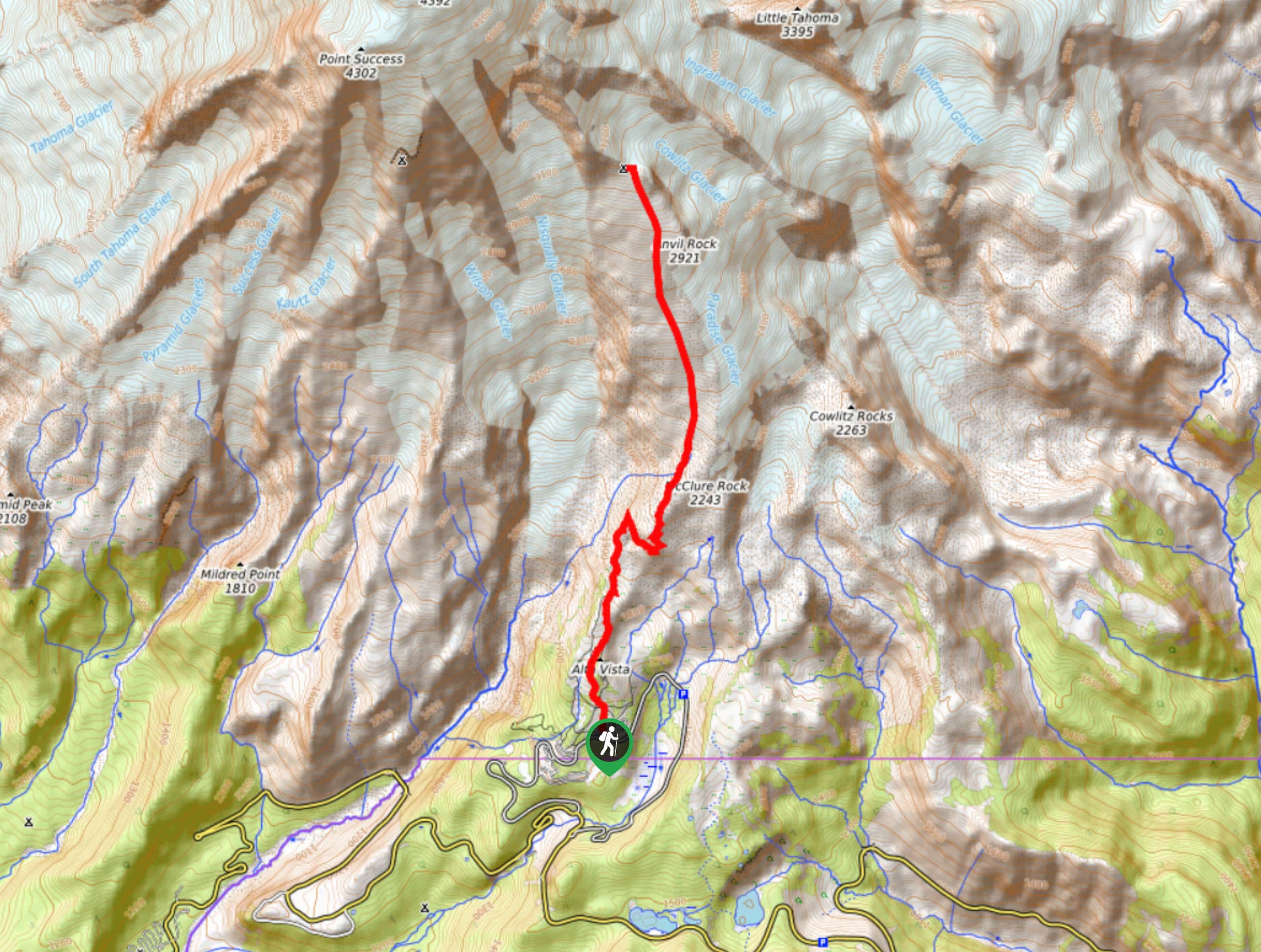
17. Camp Muir Hike
Difficulty
The hike to Camp Muir is a challenging, intense 8.0mi trek that should… Read More
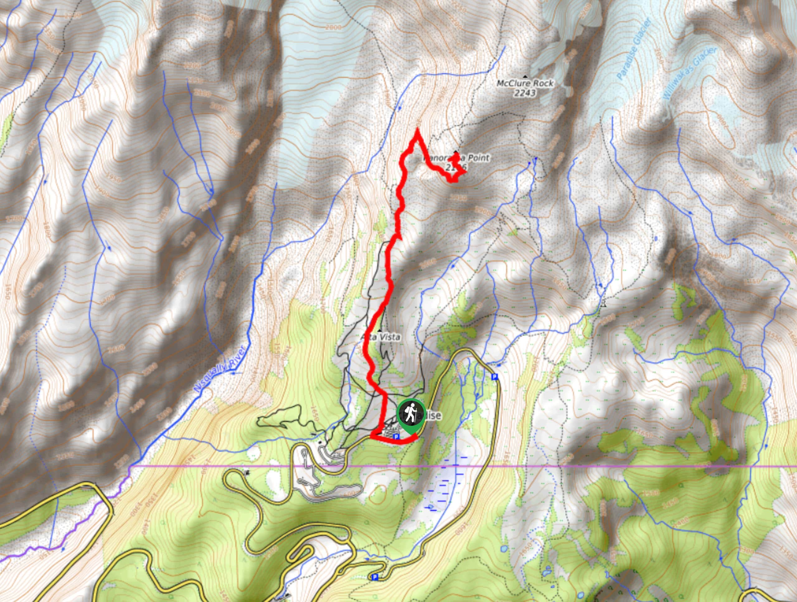
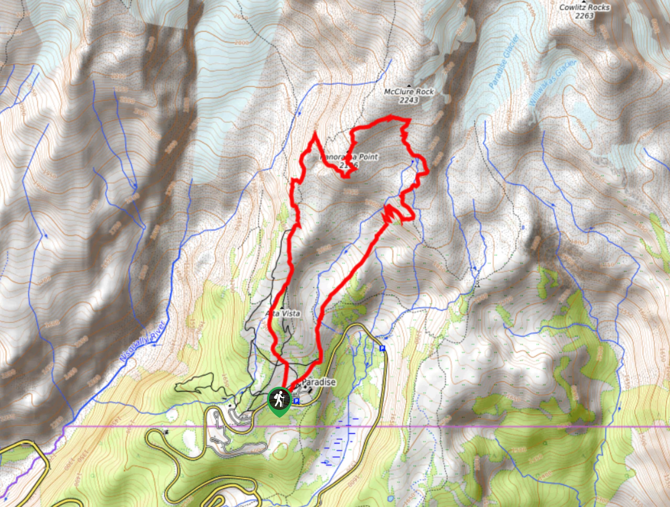
18. Panorama Point Hike
Difficulty
The hike from Paradise Inn to Panorama Point is a popular choice in Mount Rainier… Read More
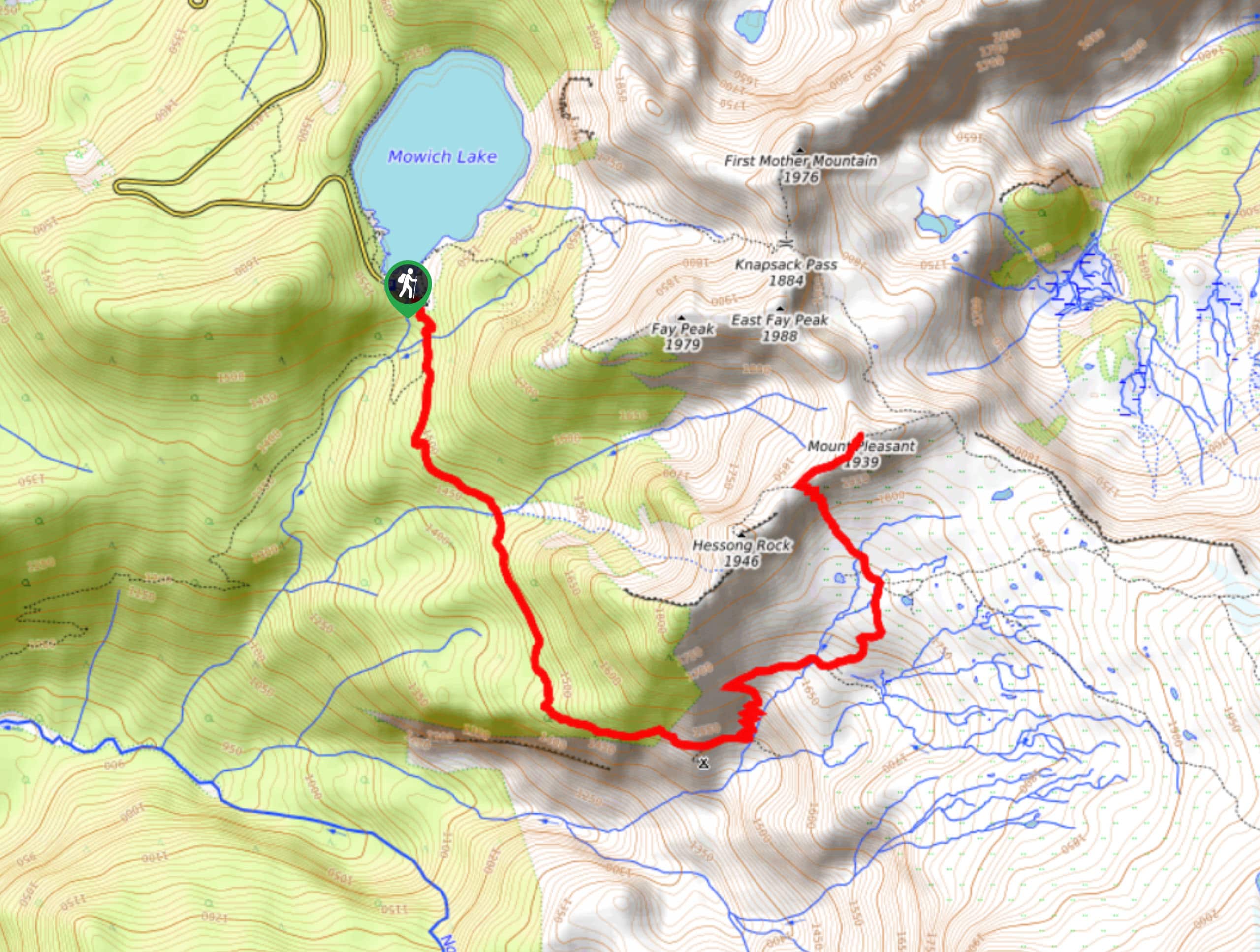
19. Spray Park Trail to Mount Pleasant
Difficulty
Spray Park is the perfect starting point for a trek to Mount Pleasant, and this… Read More
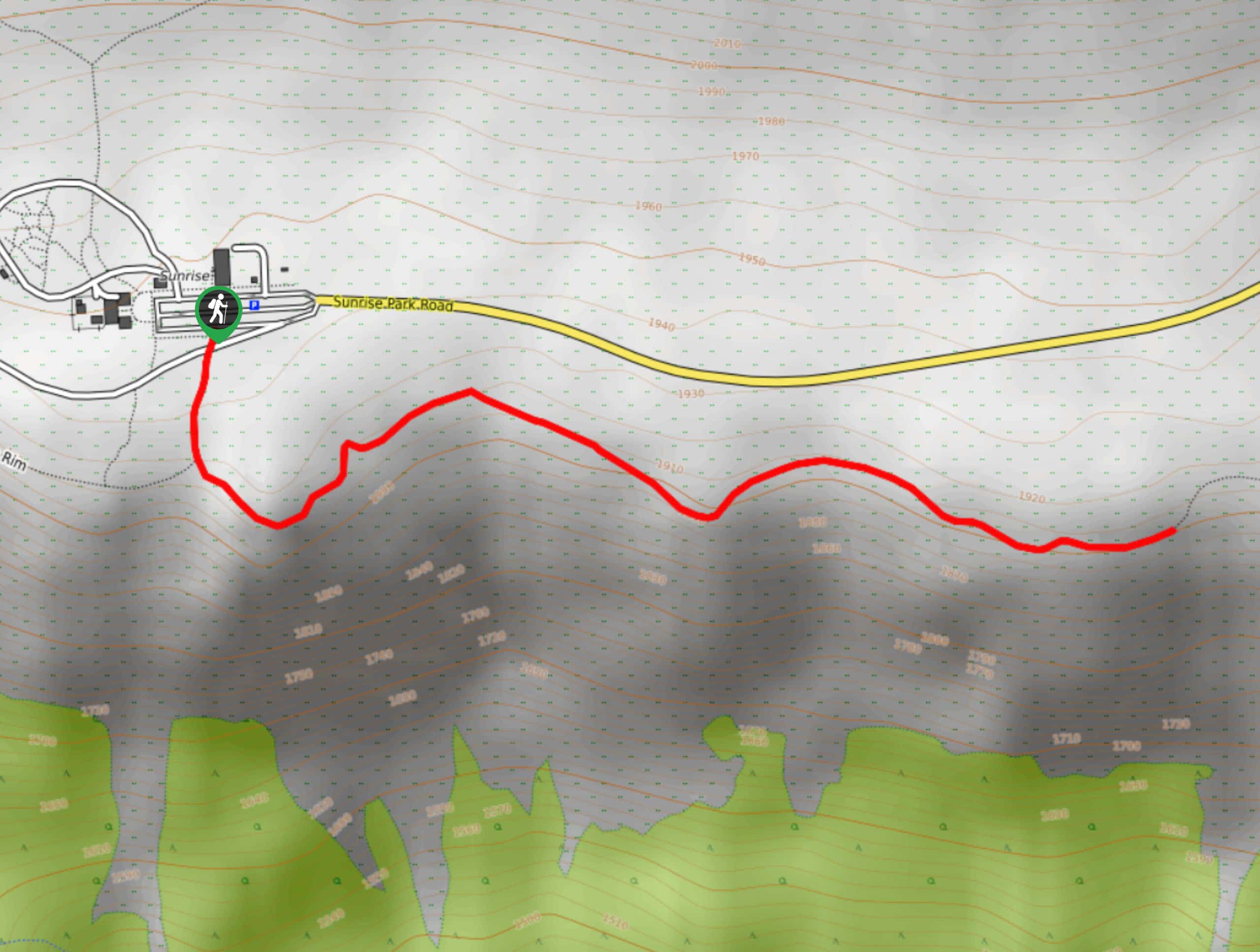
20. Sunrise Rim Trail
Difficulty
The Sunrise Rim Trail is a 5.0mi moderately challenging loop trail in Mount… Read More
21. Burroughs Mountain Trail
Difficulty
The Burroughs Mountain Trail is a 9.0mi hard hike in Mount Rainier National… Read More
22. Dewey Lake Trail
Difficulty
The Dewey Lake Trail is a 6.0mi moderately trafficked trail in Mount Rainier… Read More
23. Stevens Creek Trail
Difficulty
The Stevens Creek Trail is a just over 1.0mi trail in Mount Rainier… Read More
24. Glacier Basin Trail
Difficulty
The Glacier Basin Trail is a 6.5mi moderately trafficked route in Mount Rainier… Read More
25. Wonderland Trail to Camp Summerland
Difficulty
The Wonderland Trail to Camp Summerland hike is a 10.1mi out and back… Read More
26. Nisqually Vista Trail
Difficulty
The Nisqually Vista Trail is a short, easy trail in Mount Rainier National Park that… Read More
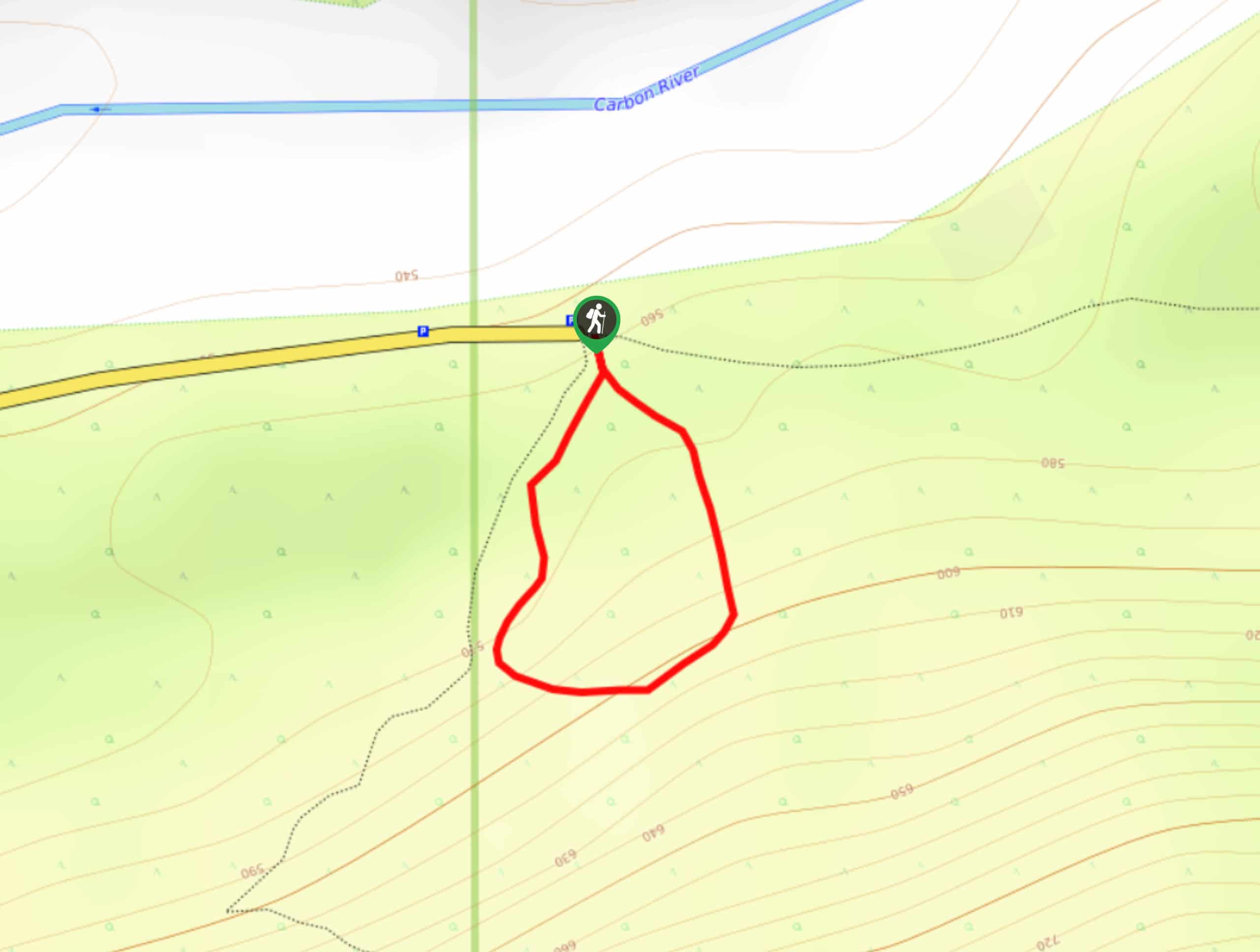
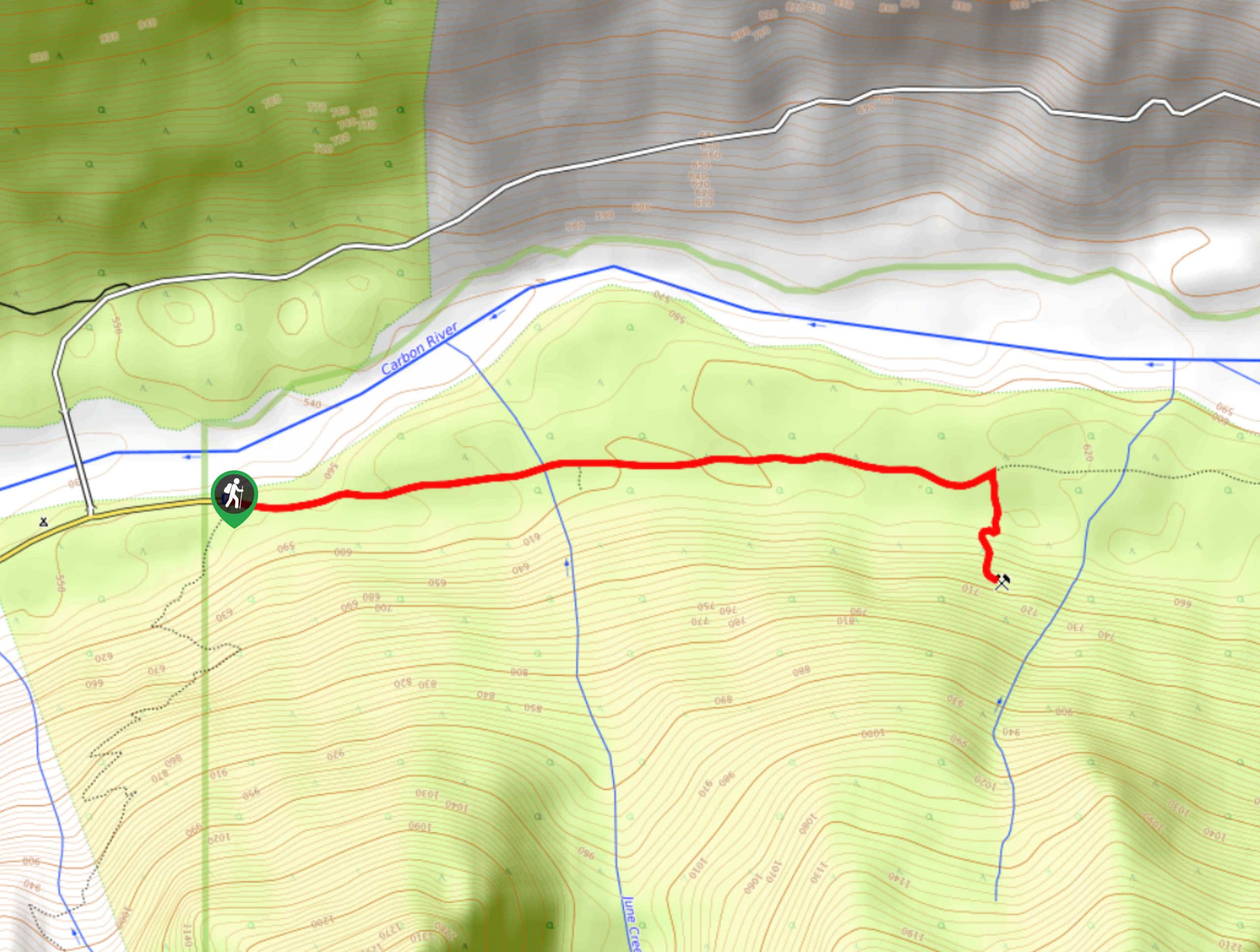
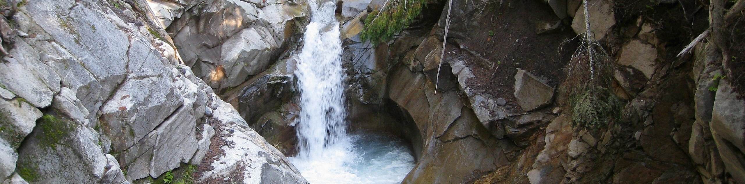
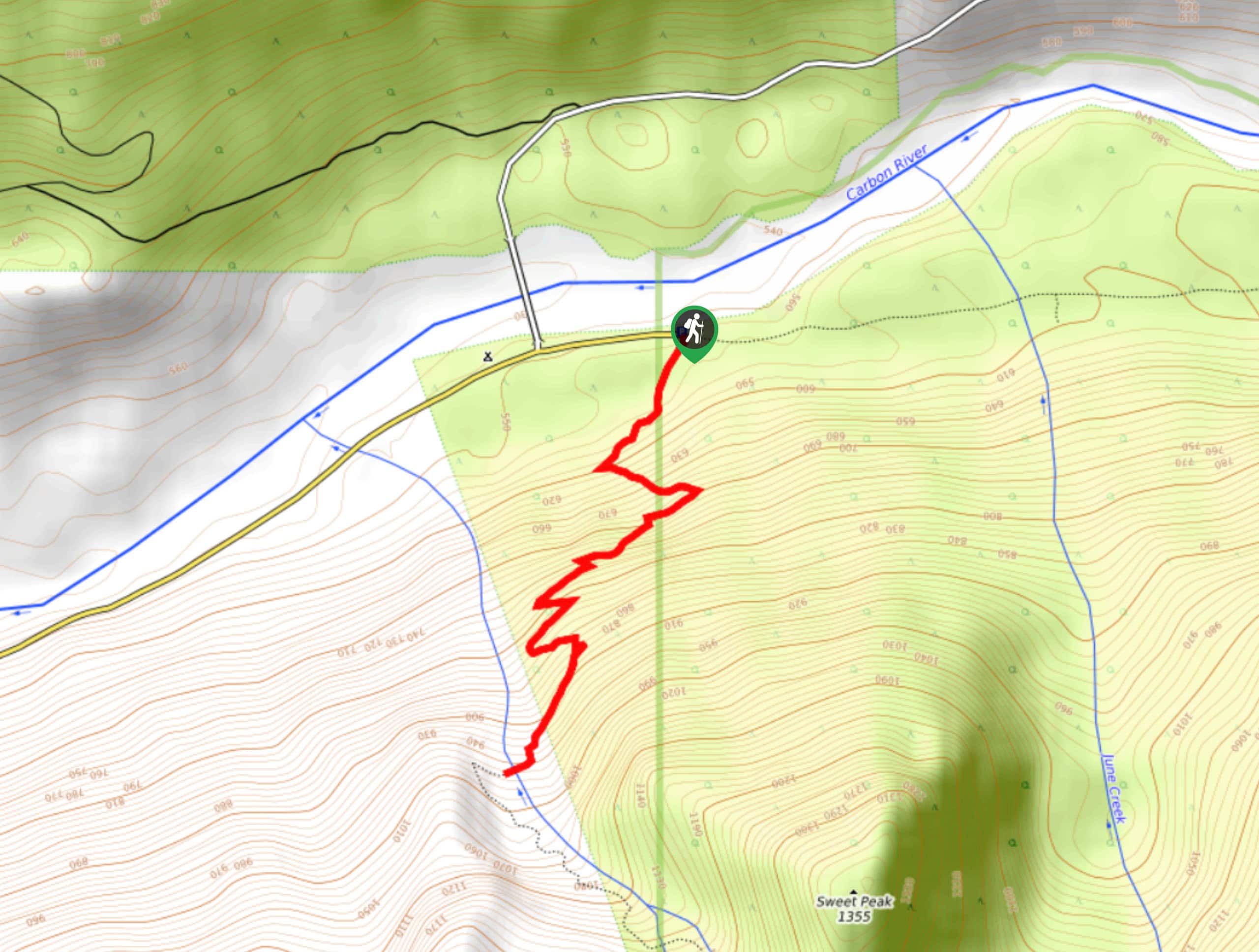
27. Carbon River Rainforest Nature Trail
Difficulty
The Carbon River Rainforest Trail is a short, easy hike in Mount Rainier National Park… Read More
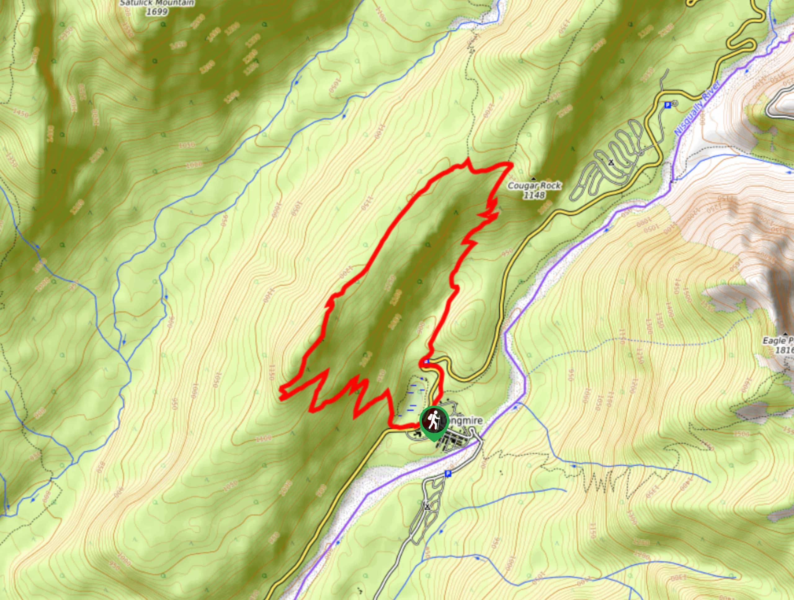
28. Rampart Ridge Hike
Difficulty
The Rampart Ridge hike is a loop trail in Mount Rainier National Park that is… Read More
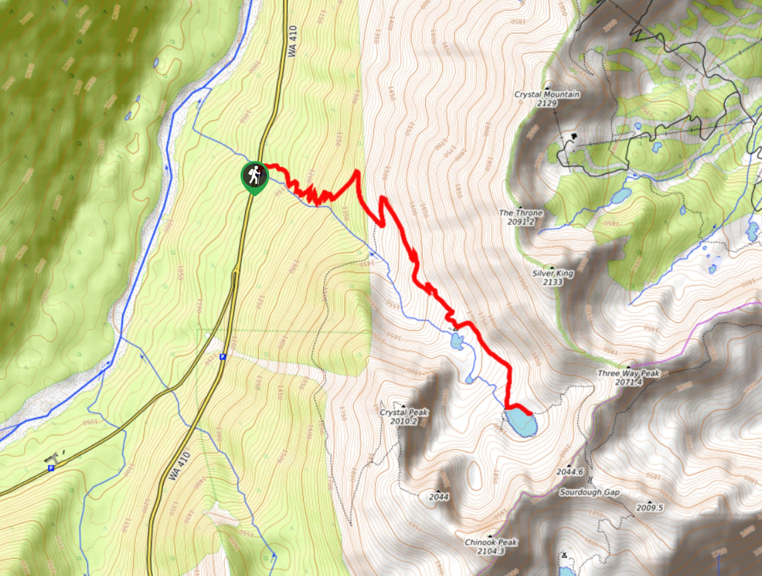
29. Crystal Lake Trail to Sourdough Gap
Difficulty
The Crystal Lake Trail to Sourdough Gap is a 6.0mi trail to a… Read More
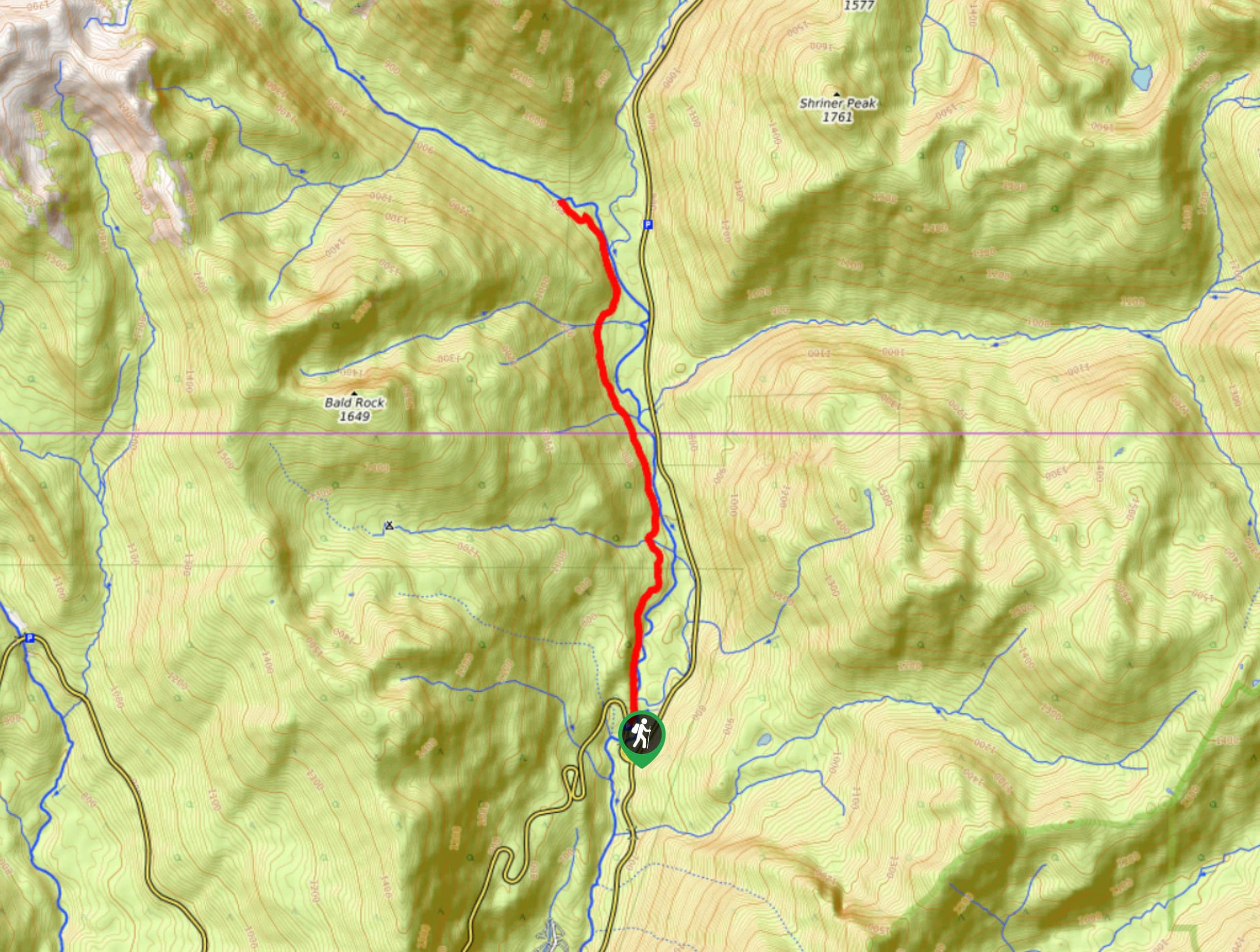
30. Shriner Peak Hike
Difficulty
The hike to Shriner Peak is an 8.5mi lightly trafficked trail in Mount… Read More
31. Mildred Point Trail
Difficulty
The Mildred Point hike is a 6.1mi out and back trail in Mount… Read More
32. Palisades Lakes Trail
Difficulty
The Palisades Lakes Trail is a 7.0mi out and back trail in Mount… Read More
33. Sourdough Gap from Sheep Lake
Difficulty
The hike to Sourdough Gap from Sheep Lake is an enjoyable moderate outing, clocking in… Read More
34. Shadow Lakes Trail to Sunrise Camp
Difficulty
There are lots of ways to reach Sunrise Camp, but the easy hike on Shadow… Read More
35. Sunrise Nature Trail
Difficulty
The Sunrise Nature Trail is a short and sweet nature walk in Mount Rainier National… Read More
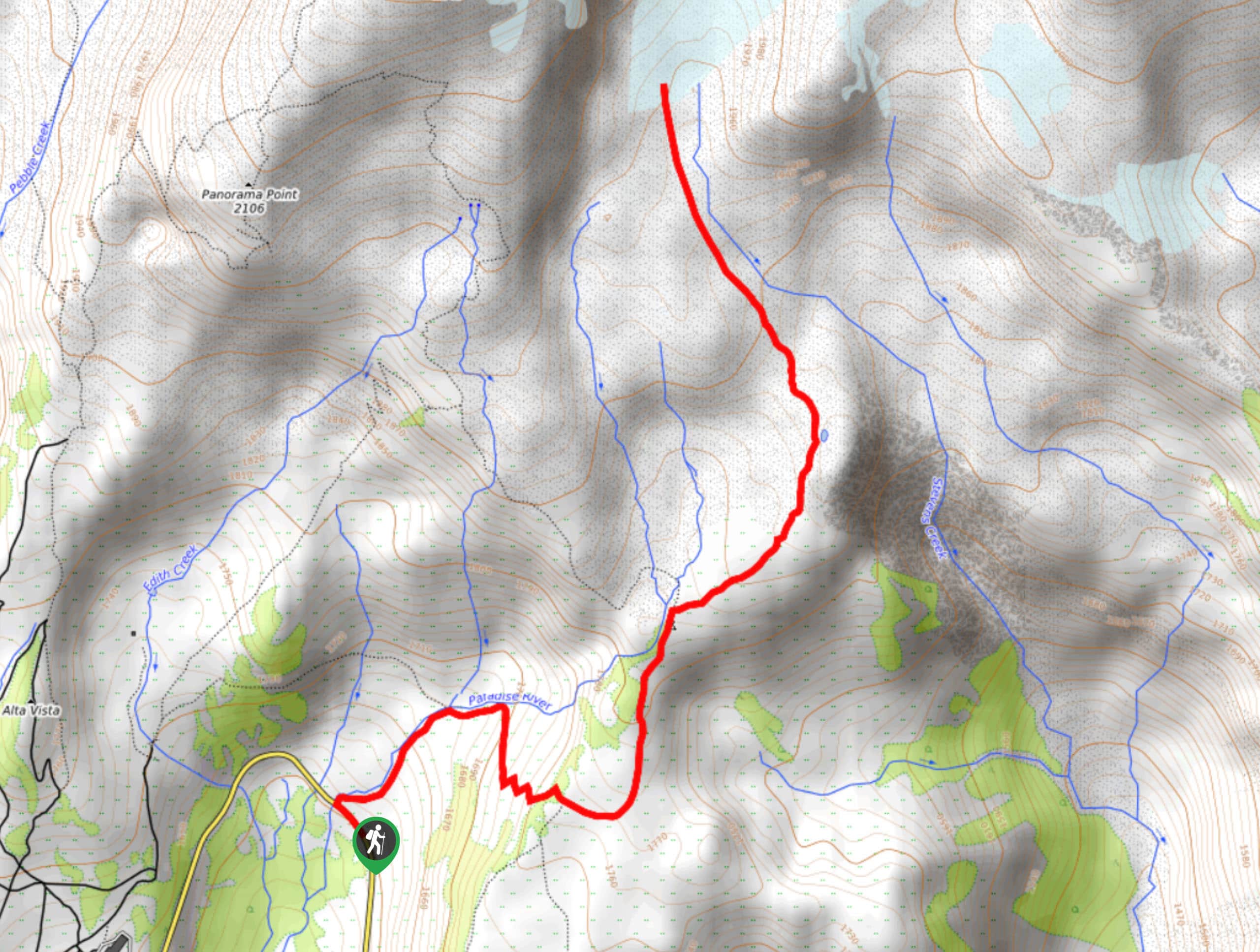
36. Paradise Glacier Trail
Difficulty
The Paradise Glacier Trail in Mount Rainier National Park is a moderately challenging 10.0mi Read More
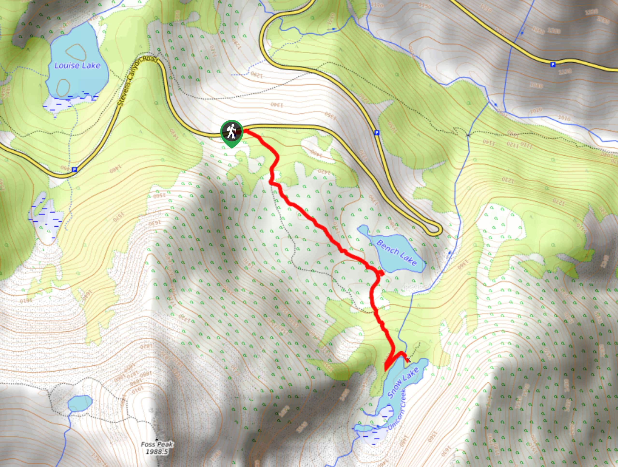
37. Bench and Snow Lakes Trail
Difficulty
The Bench and Snow Lakes Trail is an easy 2.0mi trail in Mount… Read More
38. Dege Peak Trail
Difficulty
The Dege Peak Trail is a 4.0mi lightly trafficked hike in Mount Rainier… Read More
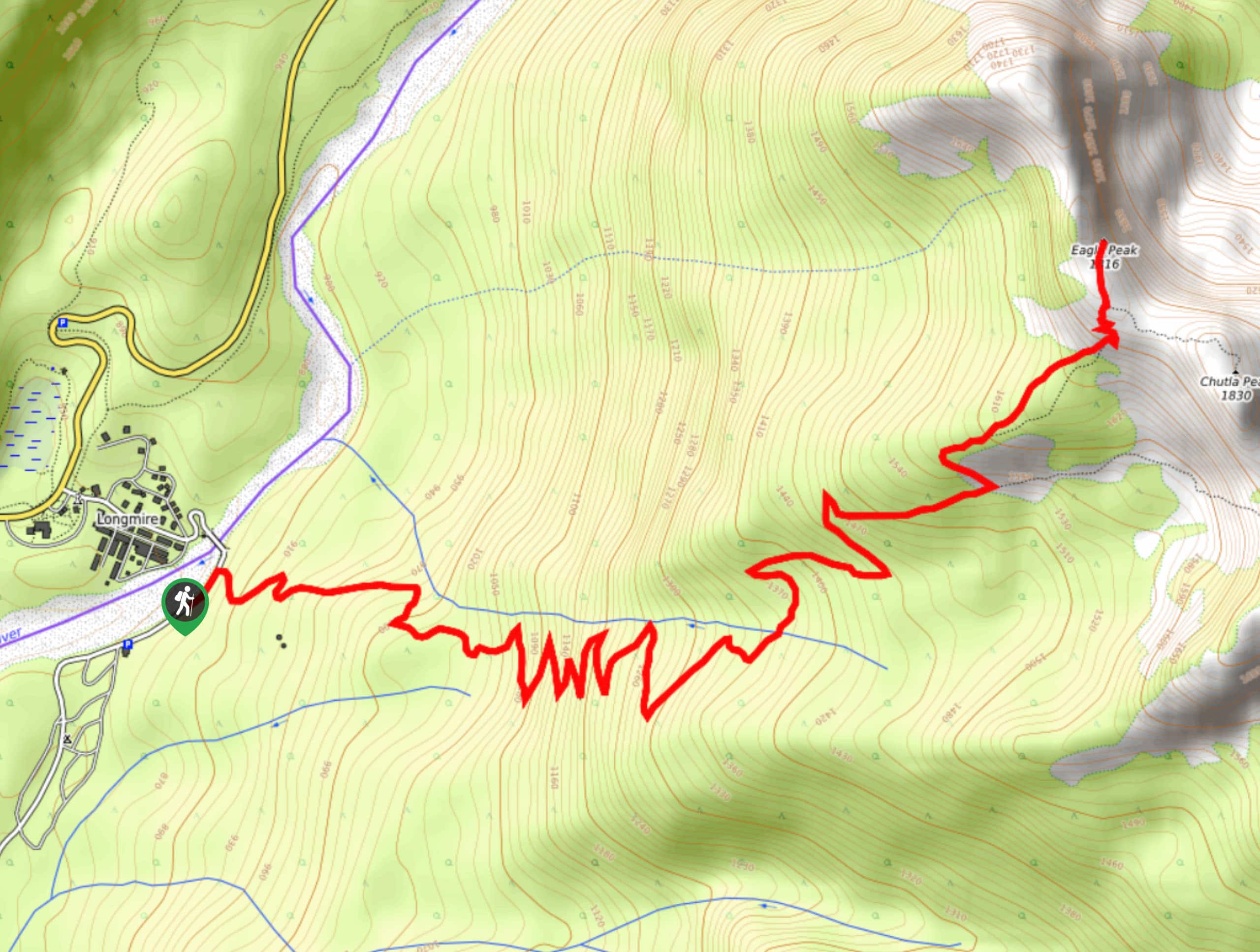
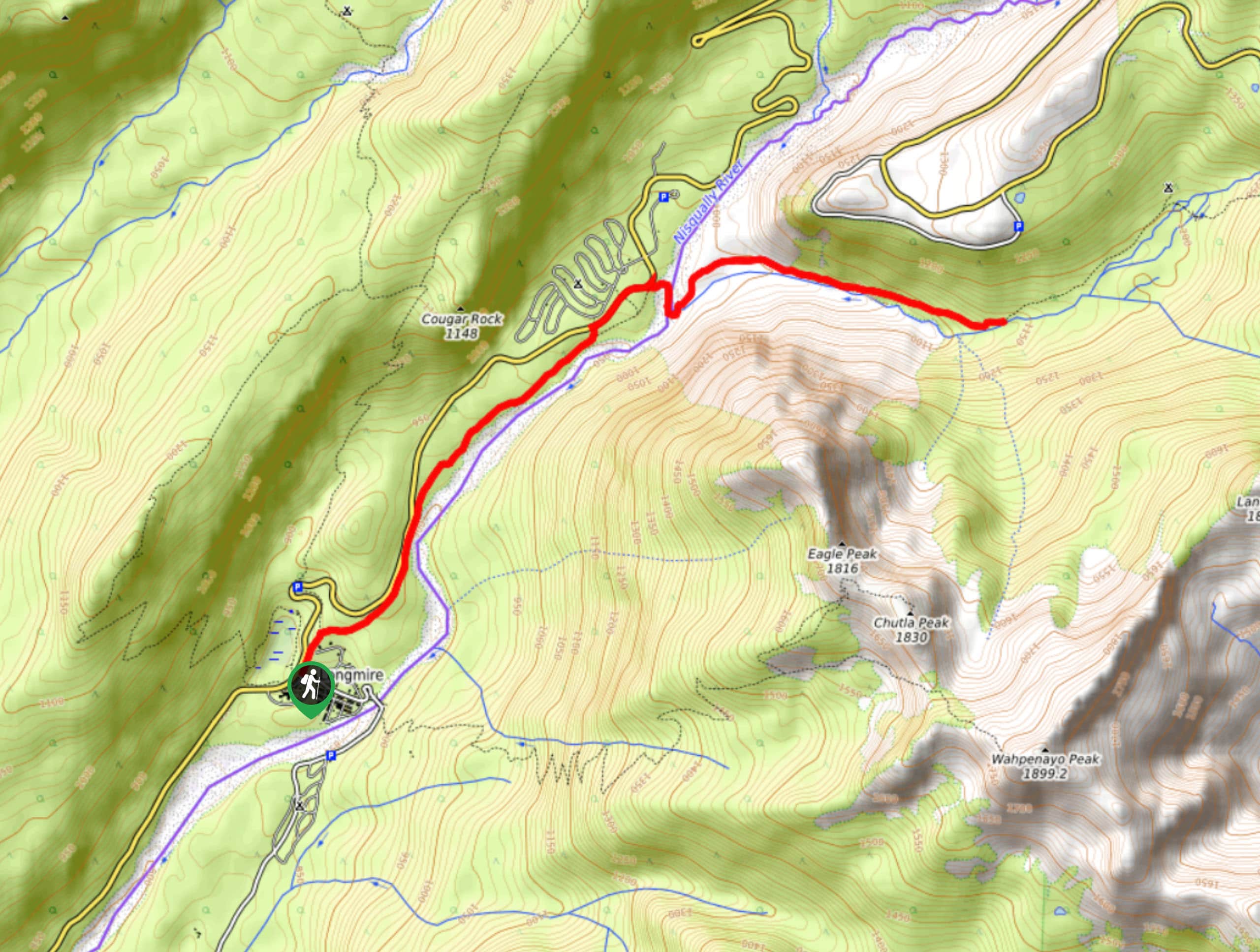
39. Eagle Peak Trail
Difficulty
For a classic hiking-in-Rainier experience, the 7.2mi Eagle Peak Trail delivers. This hard… Read More
40. Golden Gate Trail
Difficulty
The Golden Gate Trail is a 3.8mi moderately difficult hike in Mount Rainier… Read More
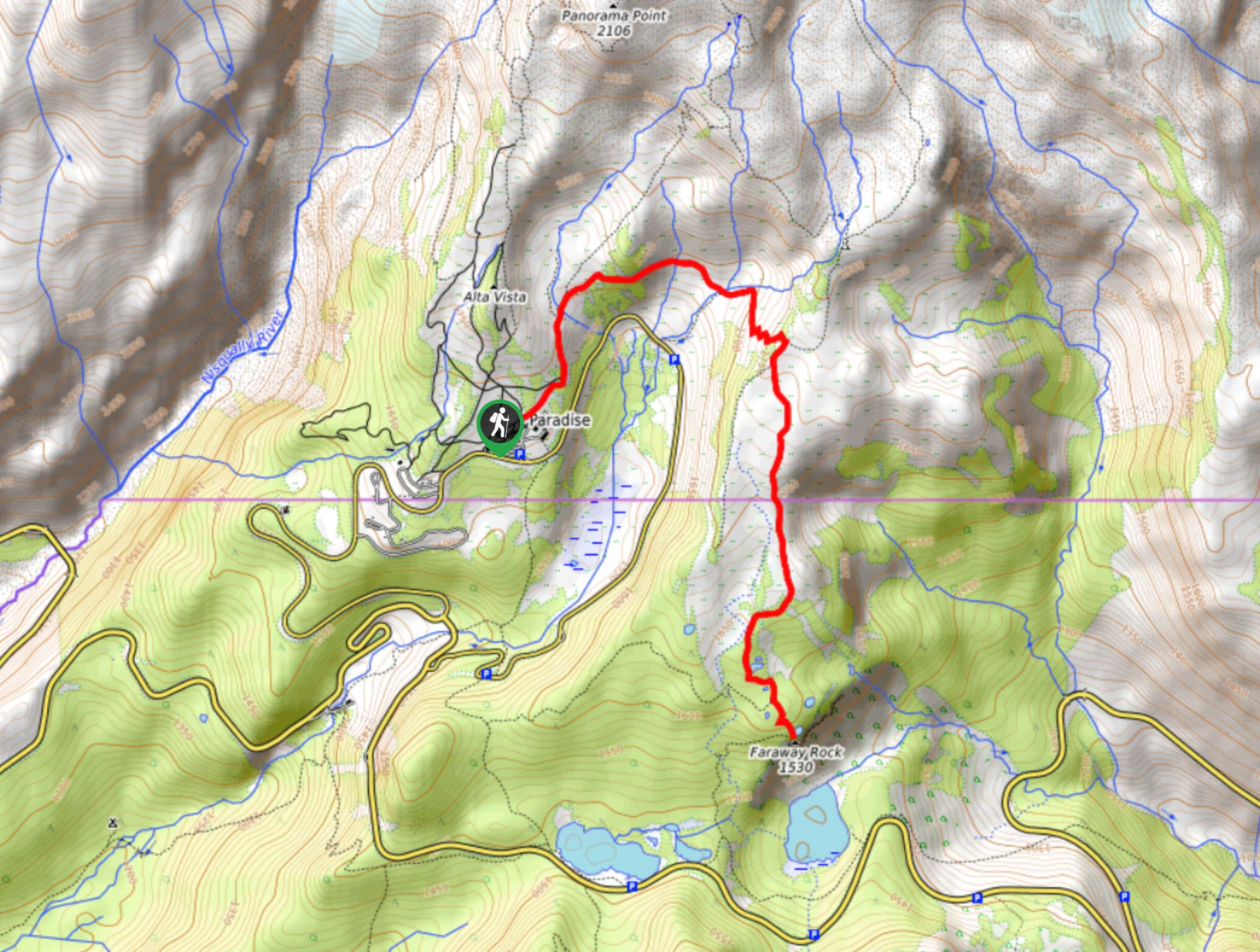
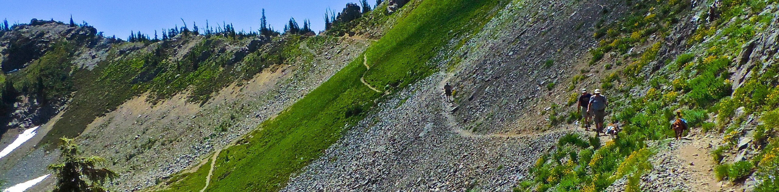
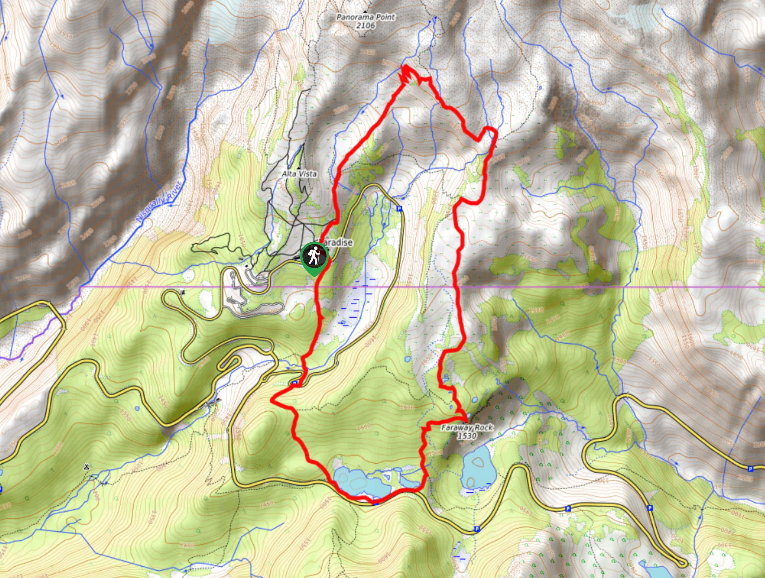
41. Mazama Ridge Trail to Faraway Rock
Difficulty
The Mazama Ridge Trail to Faraway Rock is a hard hike in Mount Rainier National… Read More
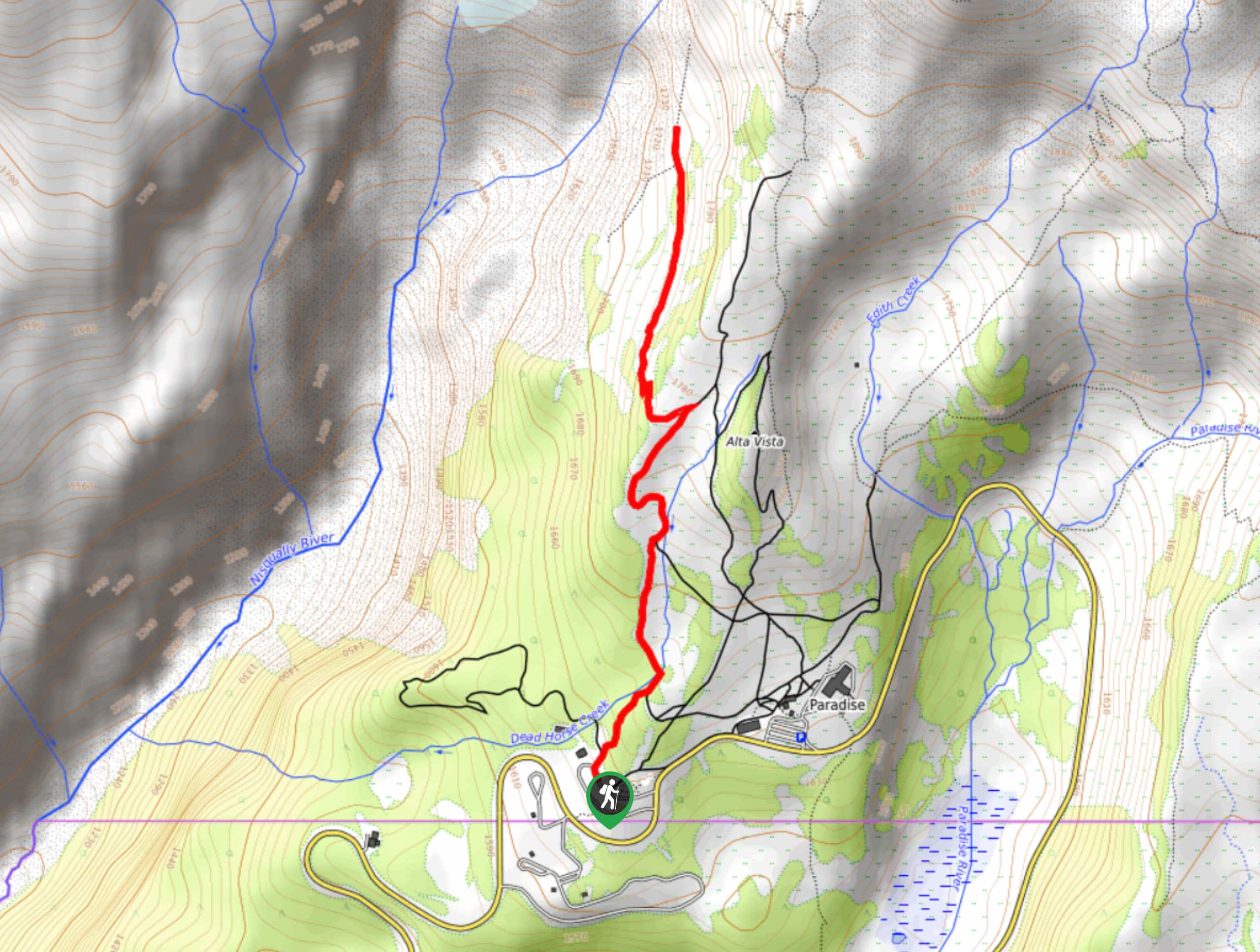
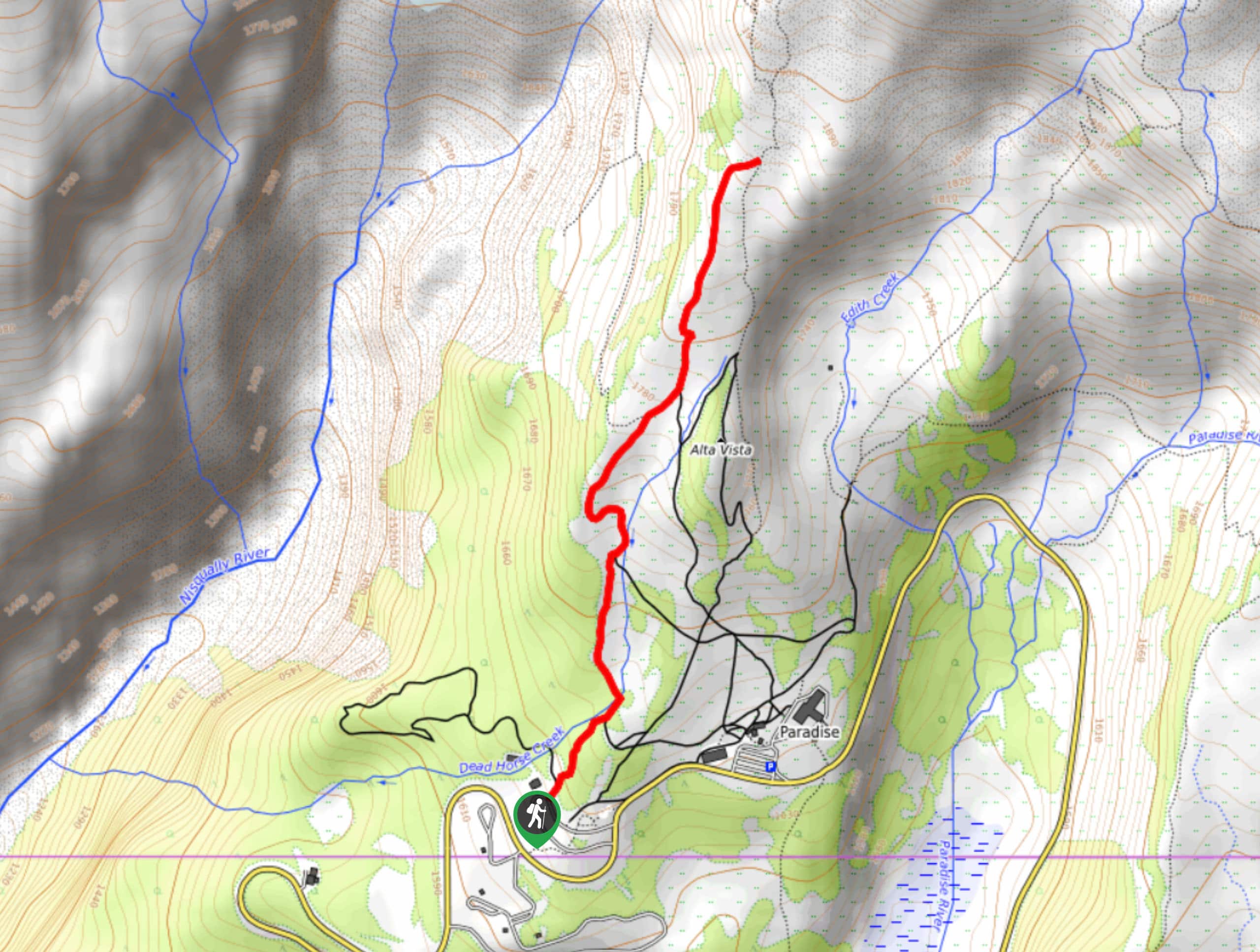
42. Alta Vista Trail
Difficulty
The Alta Vista Trail is a 1.8mi heavily trafficked trail in the Paradise… Read More
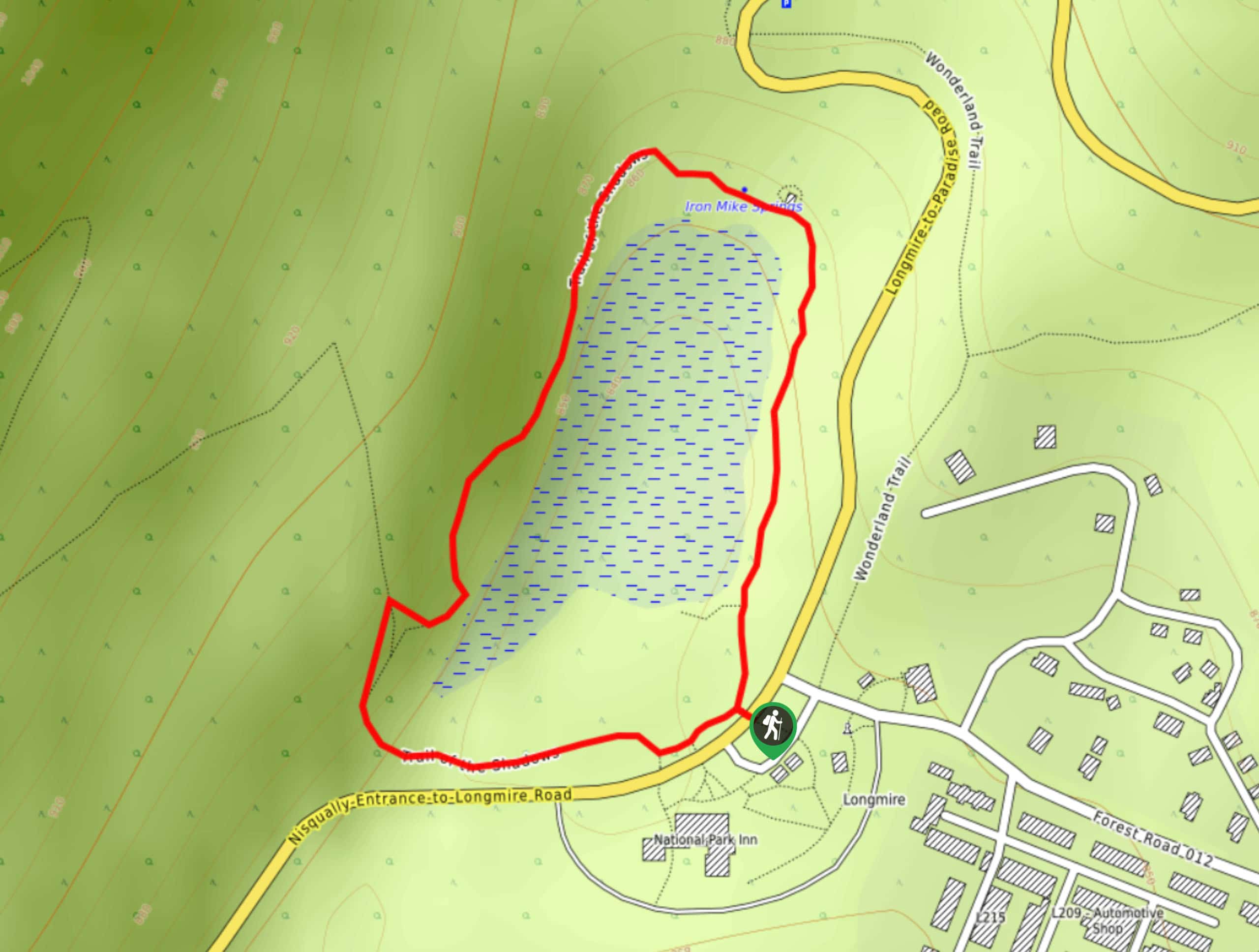
43. Trail of the Shadows
Difficulty
The Trail of the Shadows is a quick, easy loop trail in Mount Rainier National… Read More
44. Chenuis Falls Hike
Difficulty
Where the Carbon River once washed out a road, there is now the 8.0mi Read More
45. Skyscraper Mountain Hike
Difficulty
Skyscraper Mountain is an 8.0mi moderately difficult hike in Mount Rainier National Park… Read More

46. Tahoma Creek Suspension Bridge and Emerald Ridge Loop
Difficulty
The Tahoma Creek Suspension Bridge to Emerald Ridge Loop is a 11.8mi lightly… Read More
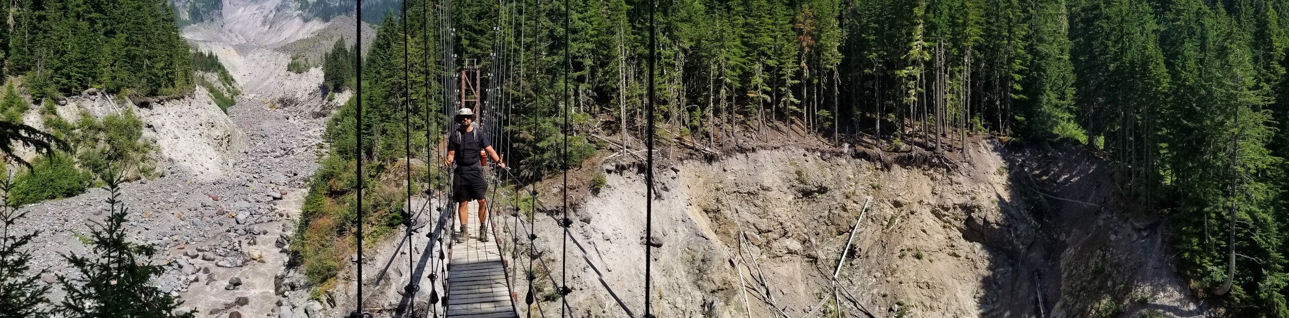
47. Tahoma Creek Suspension Bridge Hike
Difficulty
The Tahoma Creek Suspension Bridge hike is a 6.3mi lightly trafficked trail in… Read More
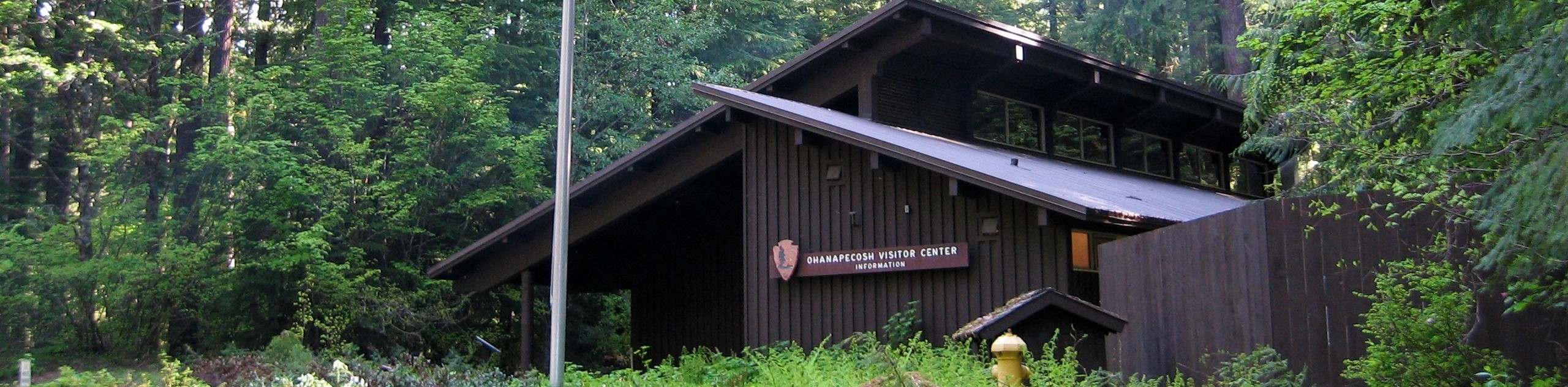
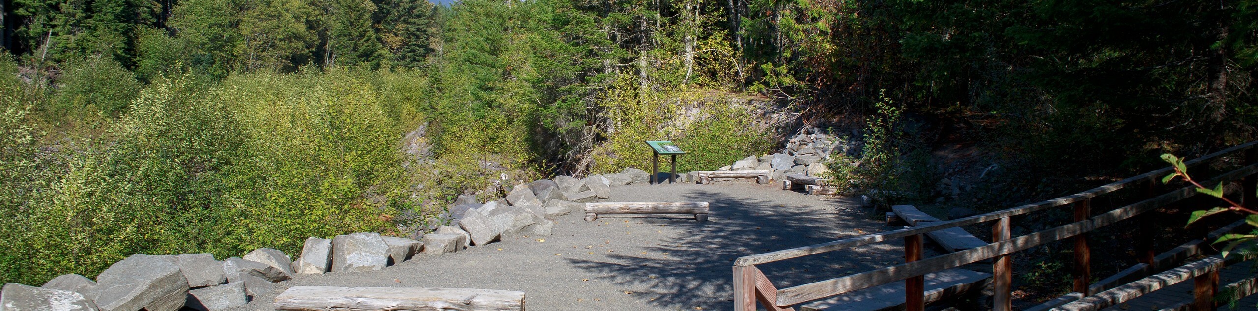
48. Ohanapecosh Hot Springs Trail
Difficulty
The Ohanapecosh Hot Springs Trail is a 1.0mi easy trail in Mount Rainier… Read More
49. Kautz Creek Trail
Difficulty
The Kautz Creek Trail to Indian Henry’s Hunting Ground is an 11.0mi hard… Read More
50. Owyhigh Lakes Trail
Difficulty
The scenic Owyhigh Lakes Trail in Mount Rainier National Park is a moderate trail that… Read More
51. Crystal Peak Trail
Difficulty
The Crystal Peak Trail is an 8.0mi hike in Mount Rainier National Park… Read More
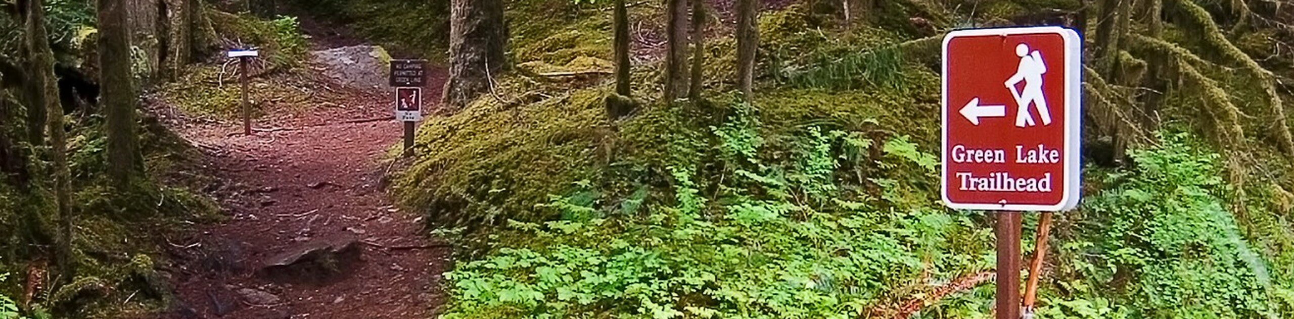
52. Green Lake Trail
Difficulty
The Green Lake Trail is a 9.1mi heavily trafficked trail in Mount Rainier… Read More
53. Plummer Peak Hike
Difficulty
The hike to Plummer Peak via Pinnacle Peak Trail is a short but rewarding trip… Read More
54. Moraine Trail
Difficulty
The Moraine Trail in Mount Rainier National Park is a 2.5mi out-and-back trail… Read More
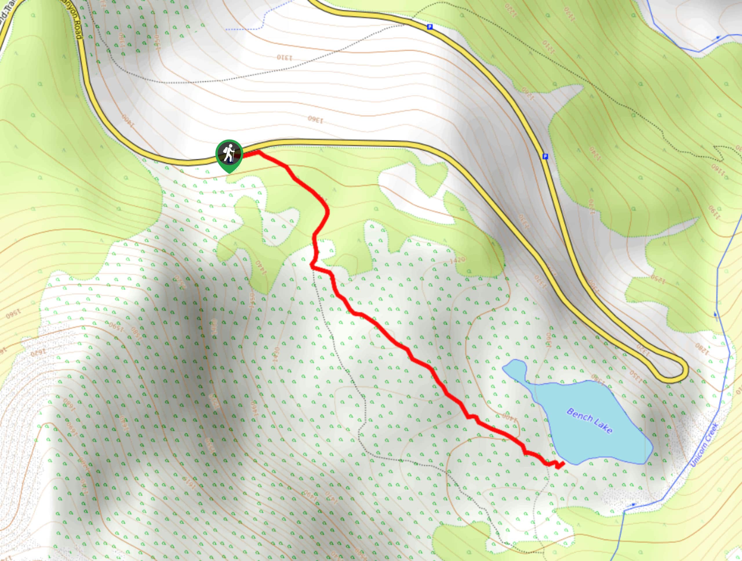
55. Bench Lake Trail
Difficulty
The Bench Lake Trail is a short, easy hike in Mount Rainier National Park that… Read More
56. Kautz Creek Trail to Mirror Lakes
Difficulty
The Kautz Creek Trail to Mirror Lakes hike is an 11.0mi hard hike… Read More

57. Kautz Creek Trail to Longmire
Difficulty
The Kautz Creek Trail to Longmire via Indian Henry’s Hunting Ground hike is a 12.1mi Read More
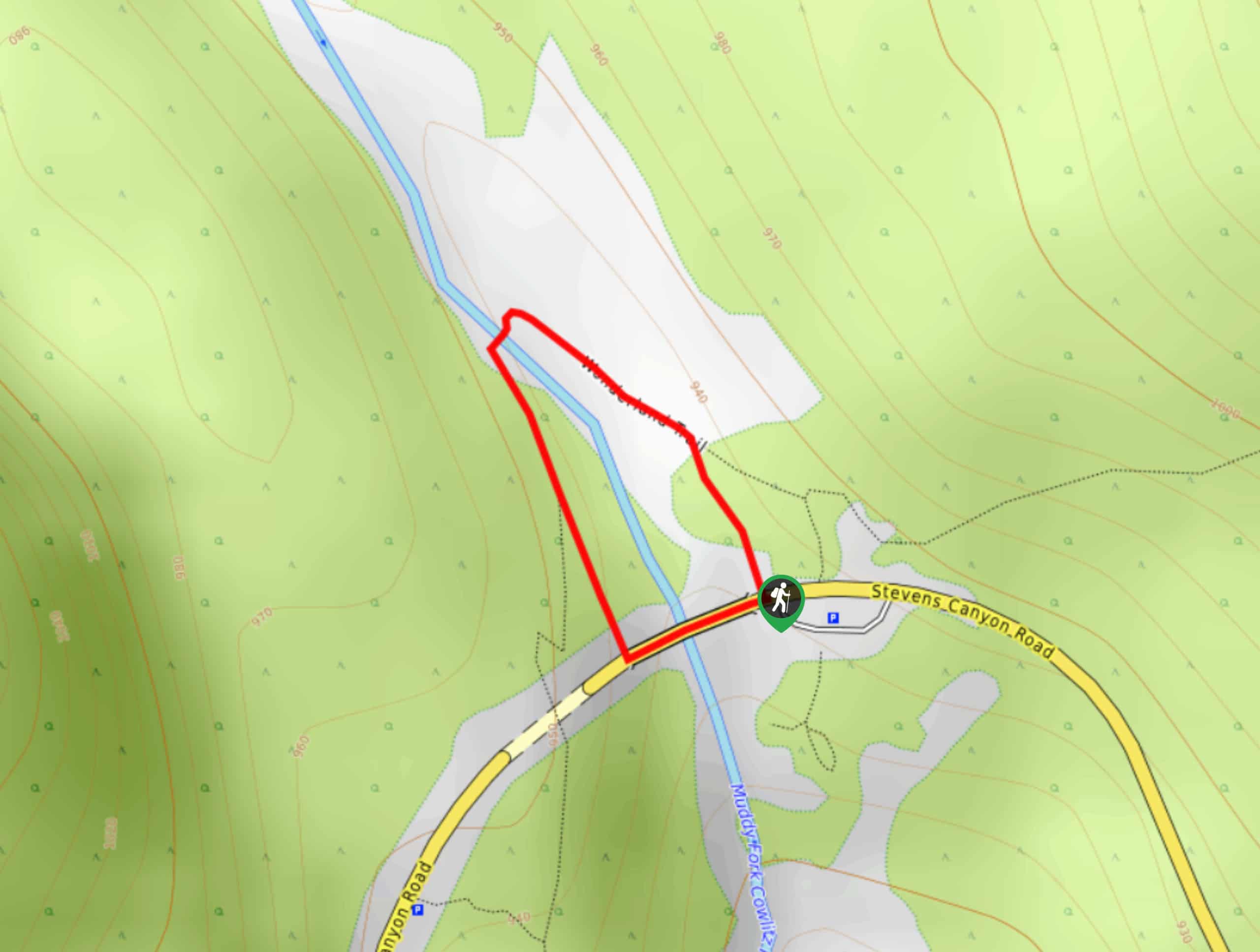
58. Box Canyon Trail
Difficulty
The Box Canyon Trail in Mount Rainier National Park is a 0.3mi loop… Read More
59. Carter Falls Hike
Difficulty
The hike to Carter Falls in Mount Rainier National Park is a moderate 2.8mi Read More
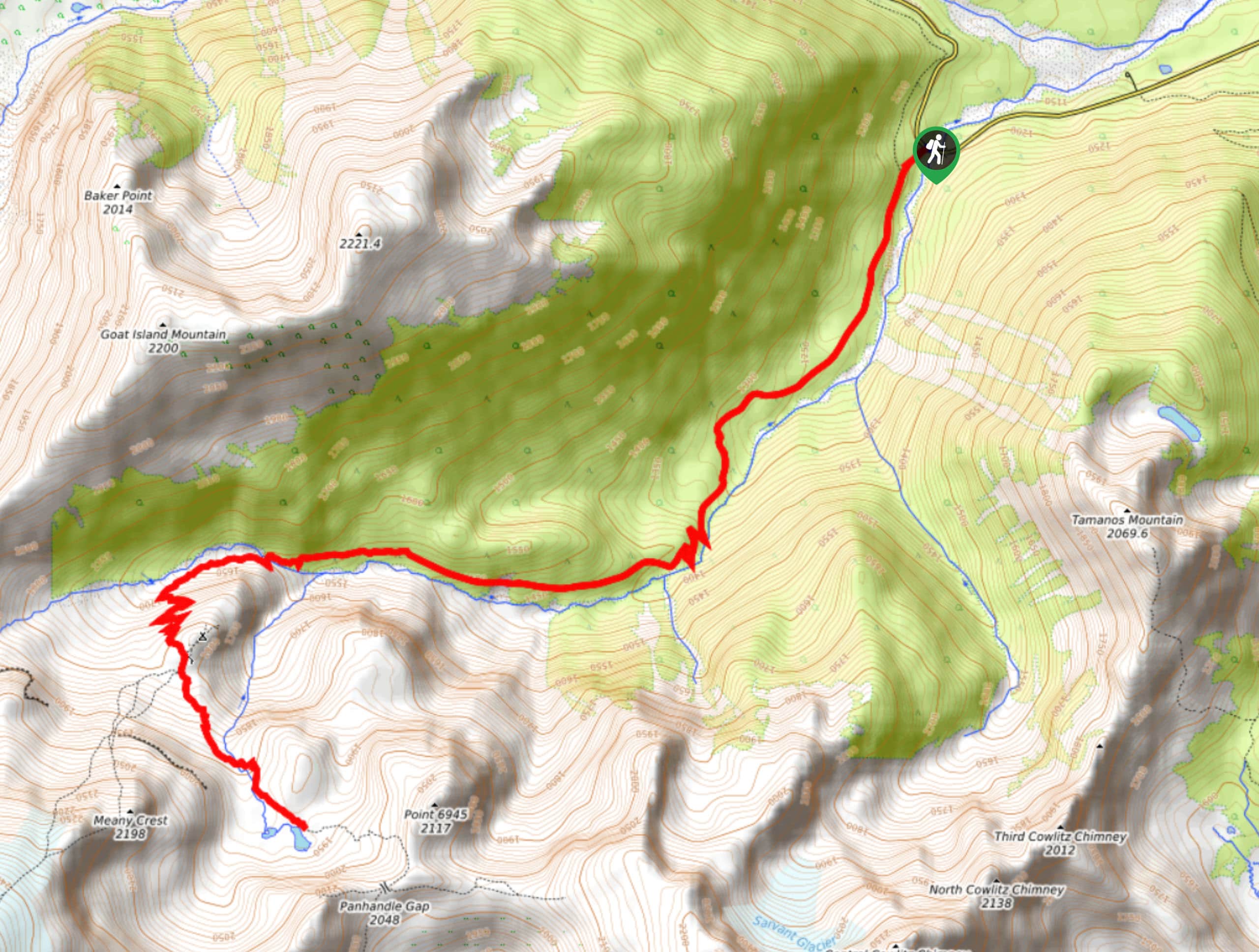
60. Panhandle Gap Hike
Difficulty
The Panhandle Gap hike is a 11.1mi trail in Mount Rainier National Park… Read More
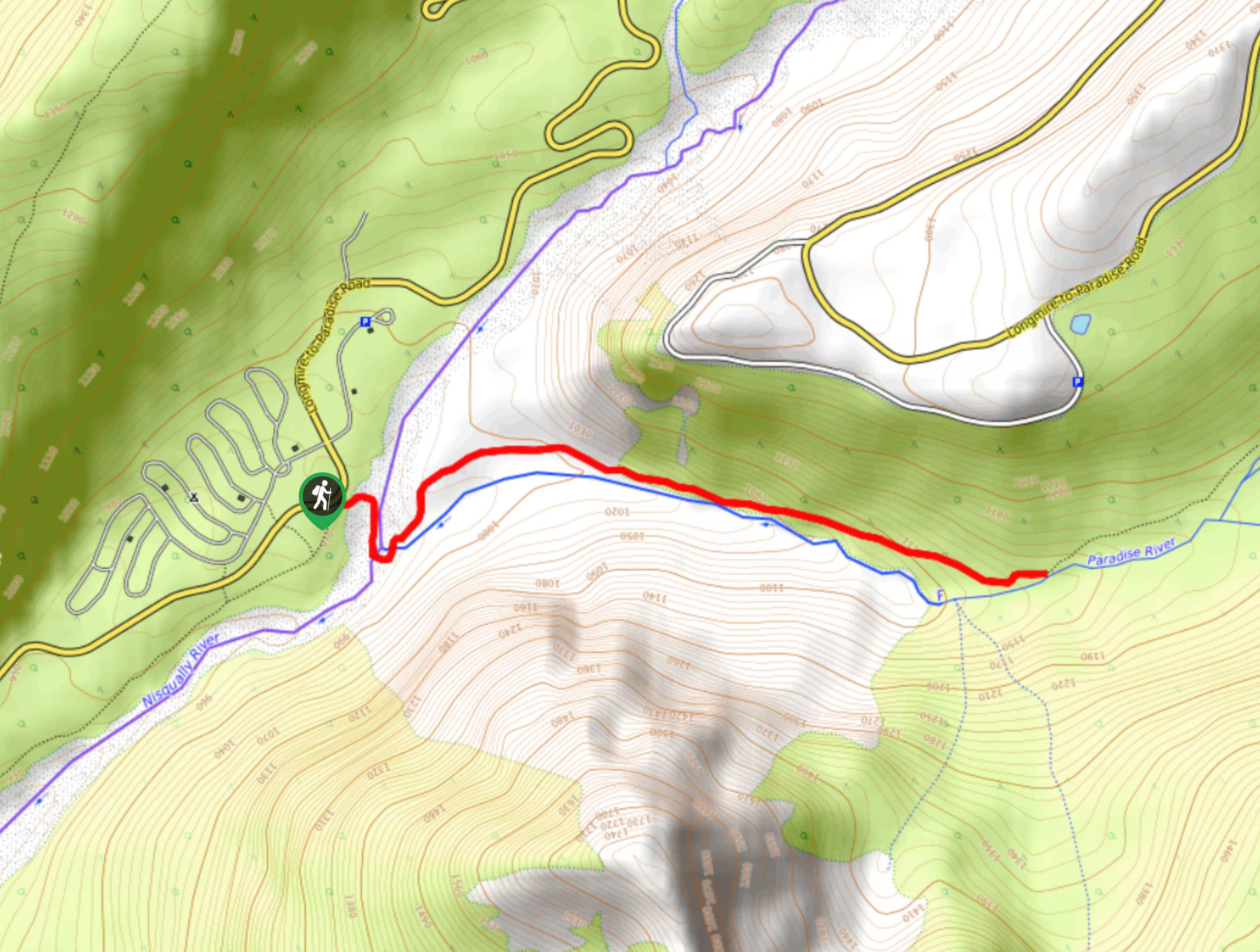
61. Dead Horse Creek Trail
Difficulty
The Dead Horse Creek Trail is an easy 2.2mi hike in Mount Rainier… Read More
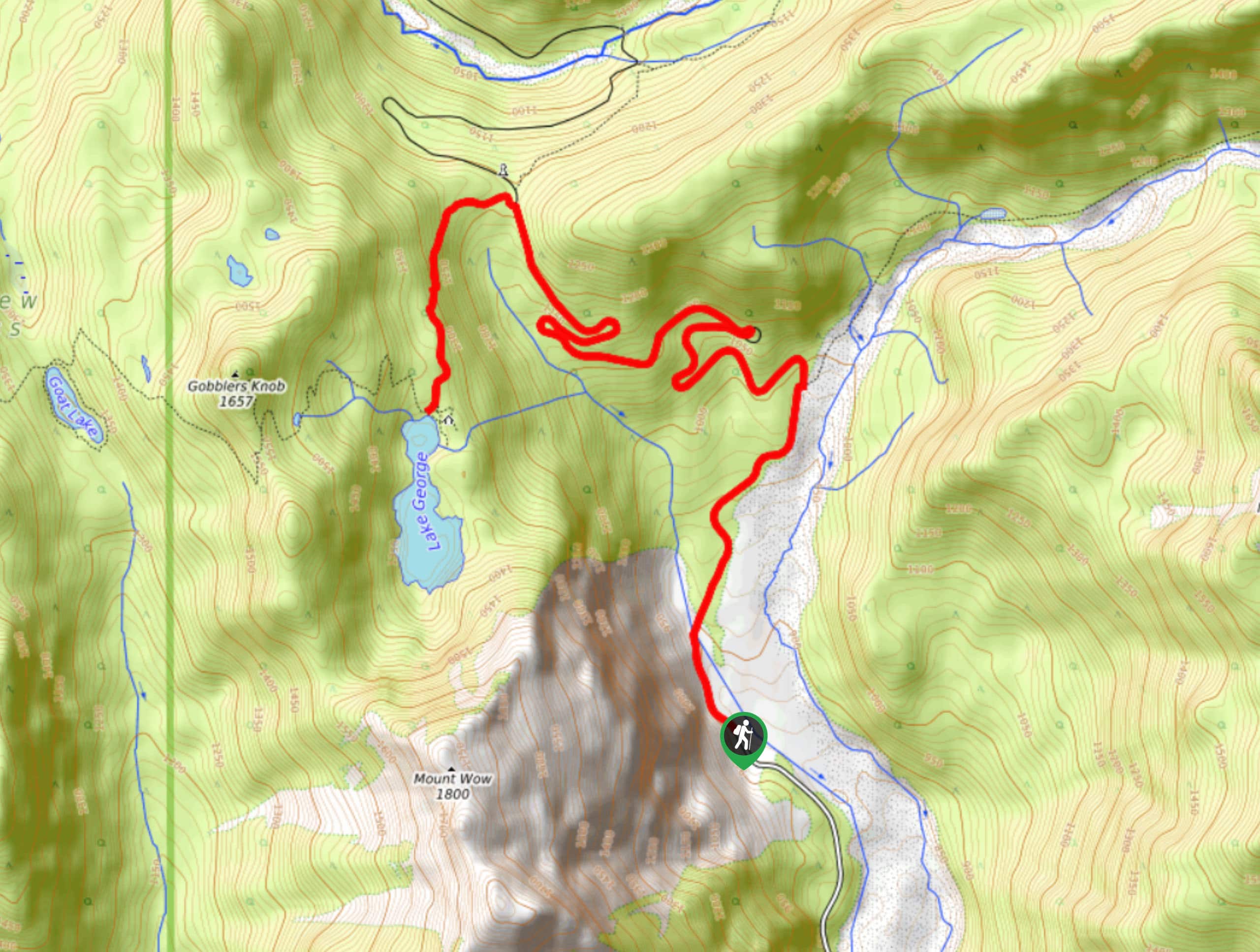
62. Lake George Trail
Difficulty
The Lake George Trail hike is a 8.7mi trip in Mount Rainier National… Read More
63. Grand Park via Lake Eleanor Trail
Difficulty
The hike to Grand Park via Lake Eleanor Trail is a moderate 8.1mi… Read More
64. Steamboat Prow via Glacier Basin Trail
Difficulty
The hike up Steamboat Prow via Glacier Basin Trail is an 11.4mi lightly… Read More
65. Knapsack Pass Hike
Difficulty
Knapsack Pass is a 2.9mi hike in Mount Rainier National Park. This trail… Read More
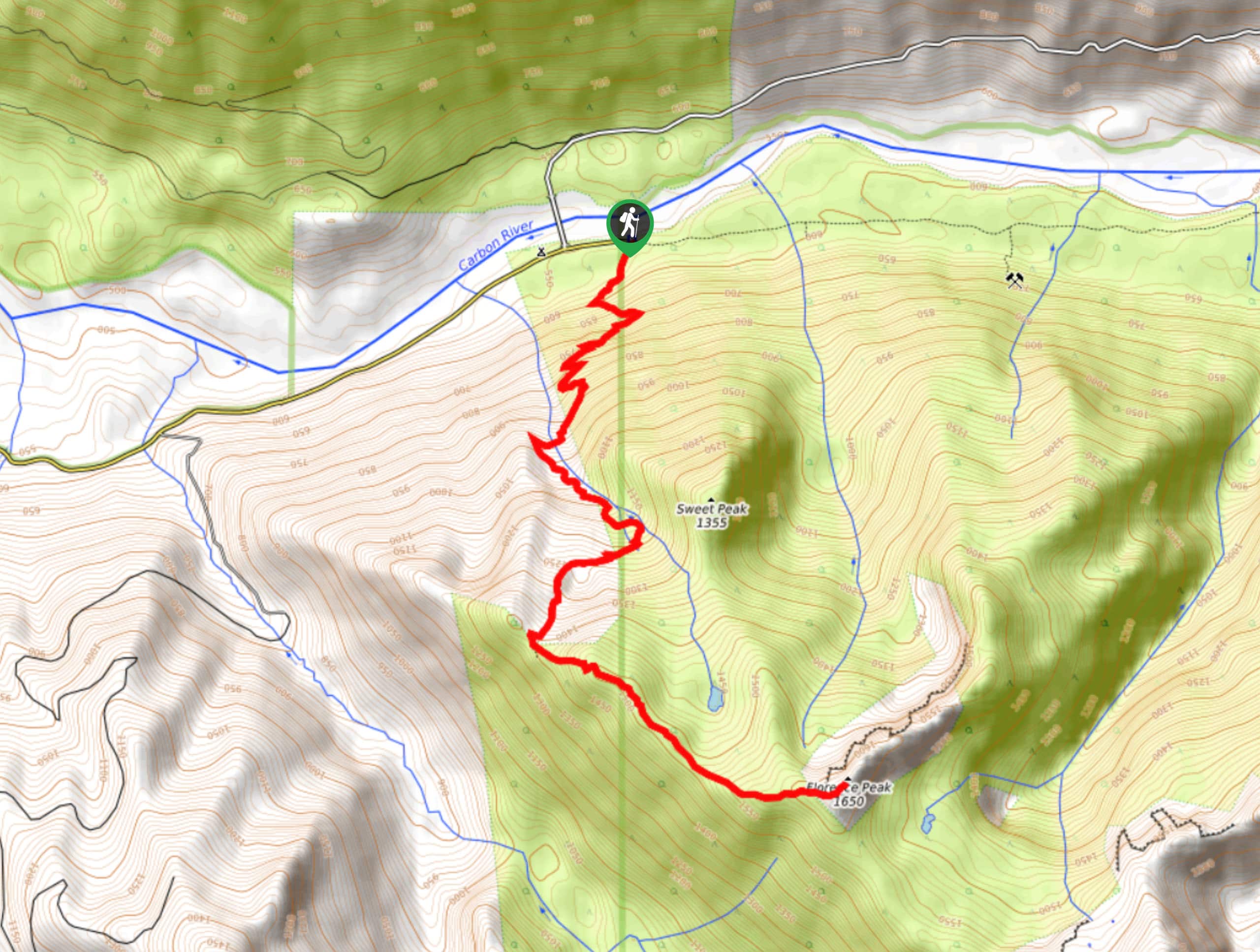
66. Florence Peak Trail
Difficulty
Florence Peak Trail is an 7.1mi lightly trafficked trail in Mount Rainier National… Read More
67. Skyline and Golden Gate Loop
Difficulty
The Skyline and Golden Gate Loop trail is a 4.6mi moderately difficult trail… Read More
68. Glacier Vista Trail
Difficulty
The Glacier Vista Trail hike via Skyline is a 4.2mi easy-moderate hike in… Read More
69. High Lakes Trail
Difficulty
The High Lakes Trail is a 3.2mi loop in Mount Rainier National Park… Read More
70. Emmons Moraine Trail
Difficulty
The Emmons Moraine Trail is a 6.6mi moderately trafficked trail in Mount Rainier… Read More
71. Silver Forest Trail
Difficulty
The Silver Forest Trail is a 1.9mi lightly trafficked out and back trail… Read More
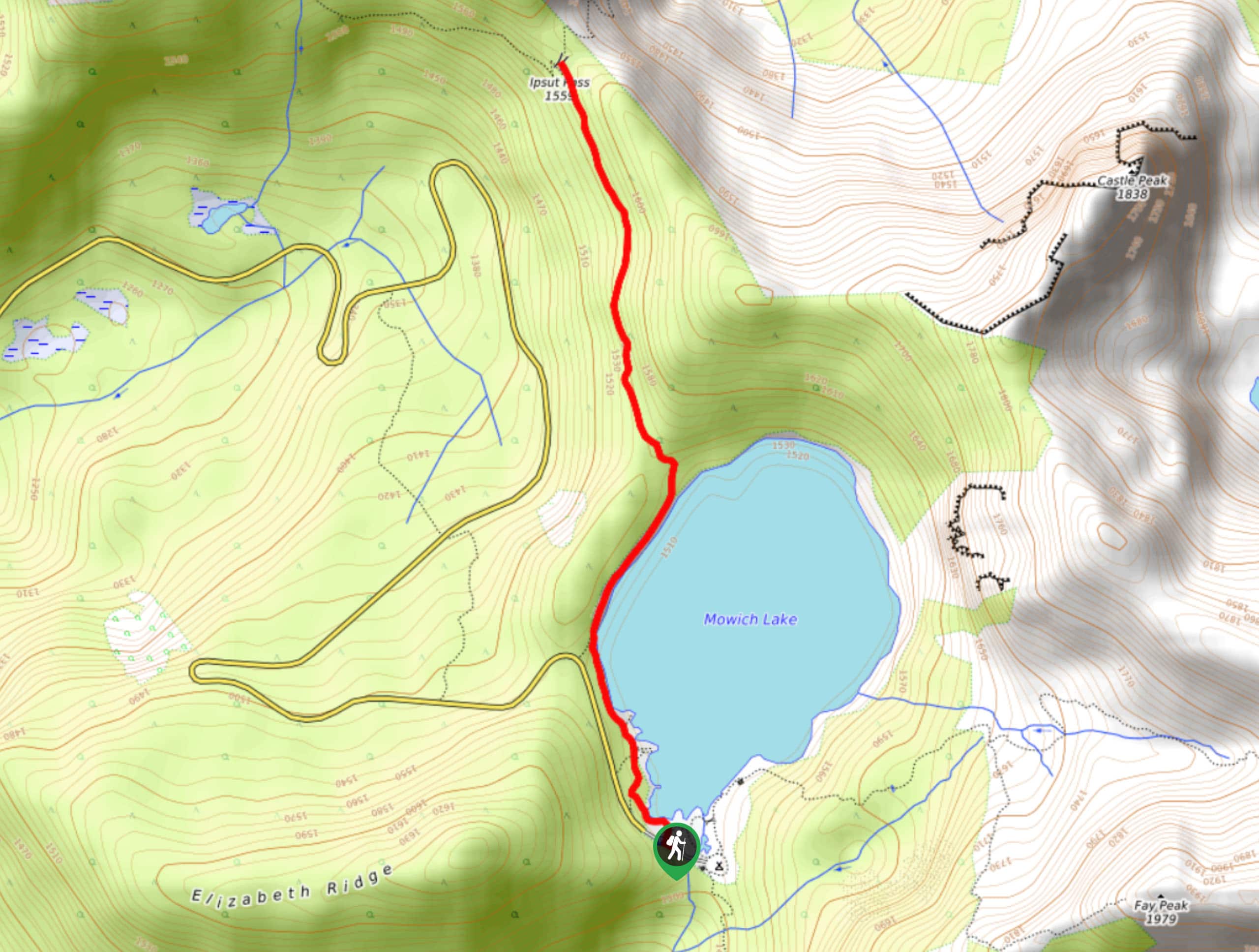
72. Ipsut Pass Hike
Difficulty
The Ipsut Pass hike on Wonderland and Lakeshore trails is a 2.7mi moderately… Read More
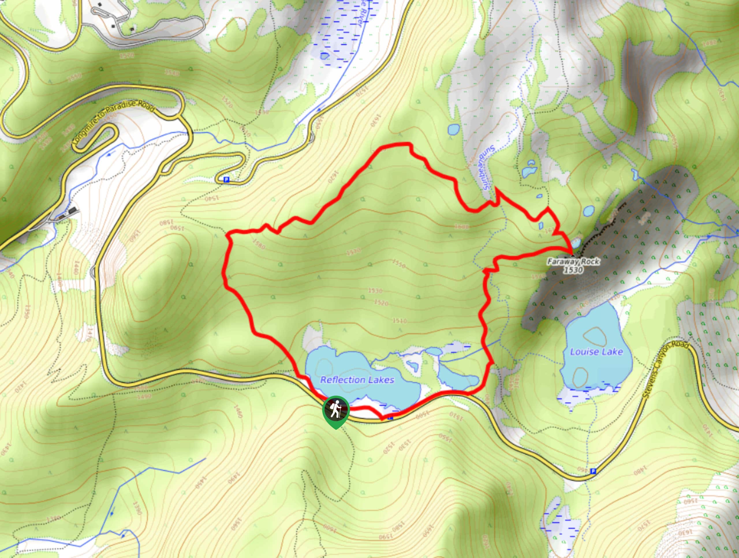
73. Faraway Rock via Reflection Lakes Hike
Difficulty
The hike to Faraway Rock from Reflection Lakes on Mazama Ridge Trail is a 1.3mi Read More
74. Berkeley Park Trail
Difficulty
The hike to Berkeley Park is an 11.3mi moderately difficult out and back… Read More
75. Crystal Lake via Sourdough Gap
Difficulty
The hike to Crystal Lake via Sourdough Gap and Sheep Lake is a 7.8mi Read More
76. Reflection Lakes via Mazama Ridge Loop
Difficulty
The Reflection Lakes via Mazama Ridge Loop hike is a 6.5mi heavily trafficked… Read More
77. Old Mine Trail
Difficulty
The Old Mine Trail is a 3.4mi easy hike in Mount Rainier National… Read More
78. Deadhorse Creek Trail to Golden Gate Loop
Difficulty
The Deadhorse Creek Trail to Golden Gate Loop is a 4.8mi moderately trafficked… Read More
79. Sunrise Backcountry Camp Loop
Difficulty
The Sunrise Backcountry Camp Loop is a 2.7mi heavily trafficked loop trail in… Read More
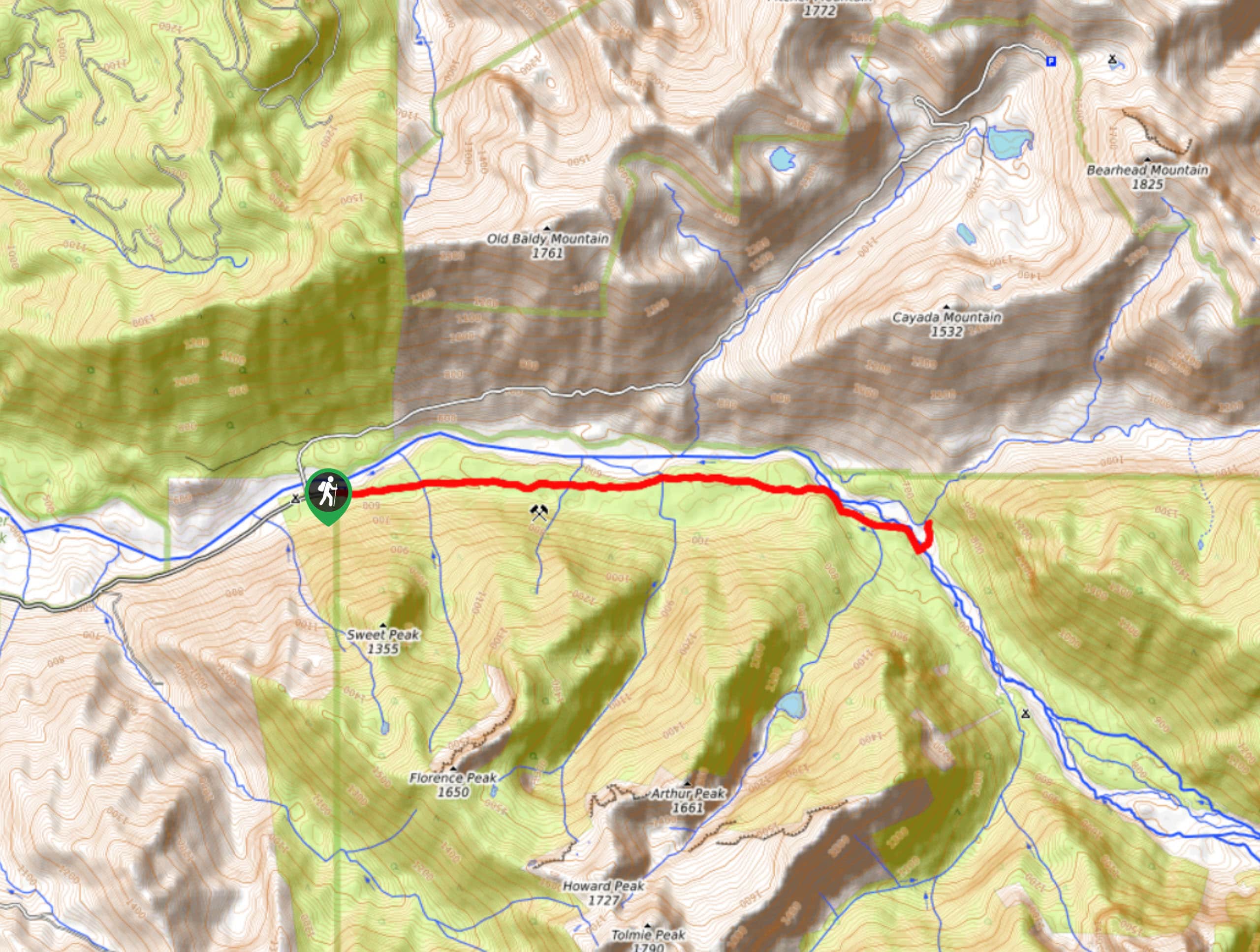
80. Eastside Trail
Difficulty
The Eastside Trail is an 7.2mi moderately trafficked easy trail in Mount Rainier… Read More
81. Madcap Falls Hike
Difficulty
The Madcap Falls hike is an easy 2.9mi trail in Mount Rainier National… Read More
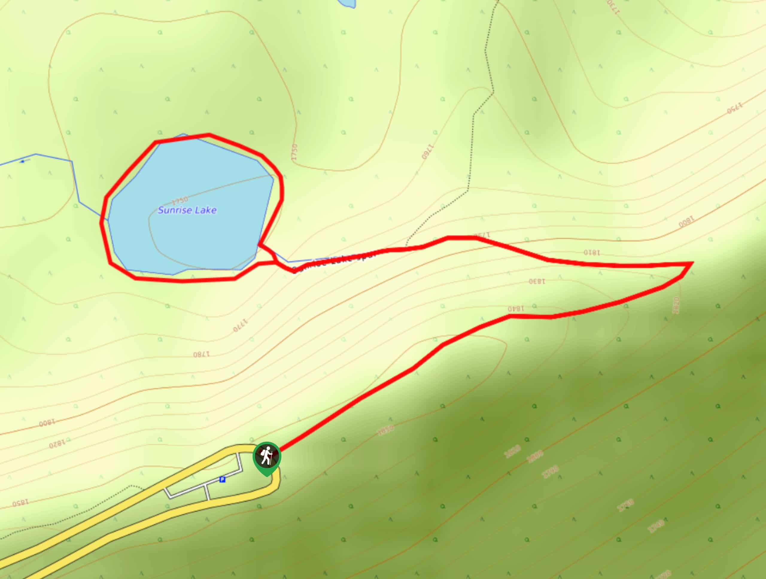
82. Sunrise Lake Trail
Difficulty
The Sunrise Lake Trail is an easy, short, family-friendly hike in Mount Rainier National Park… Read More
83. Skyline, Mazama, Wonderland, and Lower Lakes Loop
Difficulty
The Skyline, Mazama, Wonderland, and Lower Lakes Trail Loop is a 8.4mi hard… Read More
84. Mount Ruth via Glacier Basin and Emmons Moraine Trails
Difficulty
The Mount Ruth via Glacier Basin and Emmons Moraine Trails hike is a 8.4mi Read More
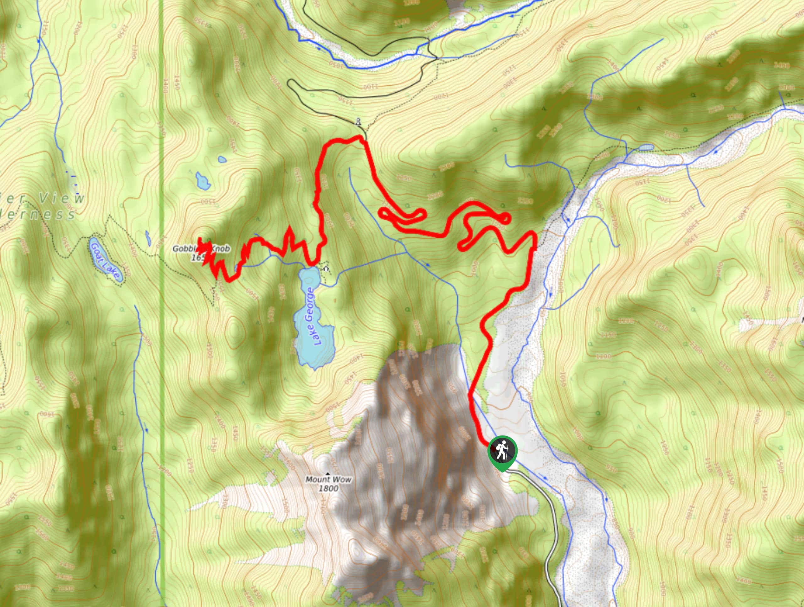
85. Gobblers Knob Fire Lookout
Difficulty
The Gobblers Knob Fire Lookout hike in Mount Rainier National Park is an 11.5mi Read More
86. Deer Creek Falls to Owyhigh Lakes Trail
Difficulty
The Deer Creek Falls to Owyhigh Lakes Trail hike is a 9.3mi out… Read More
87. Van Trump Trail
Difficulty
The Van Trump Trail in Mount Rainier National Park is a 9.3mi moderately… Read More
88. Forest Lake via Huckleberry Creek and Sourdough Ridge
Difficulty
The hike to Forest Lake via Huckleberry Creek and Sourdough Ridge is an 5.3mi Read More
89. Fay Peak Trail
Difficulty
The Fay Peak Trail is a 2.7mi lightly trafficked trail in Mount Rainier… Read More
90. Rainforest Trail
Difficulty
The Rainforest Trail is a 2.3mi lightly trafficked out and back trail in… Read More
91. Carter Falls and Madcap Falls via Longmire
Difficulty
The Carter Falls and Madcap Falls via Longmire hike is a 5.9mi lightly… Read More
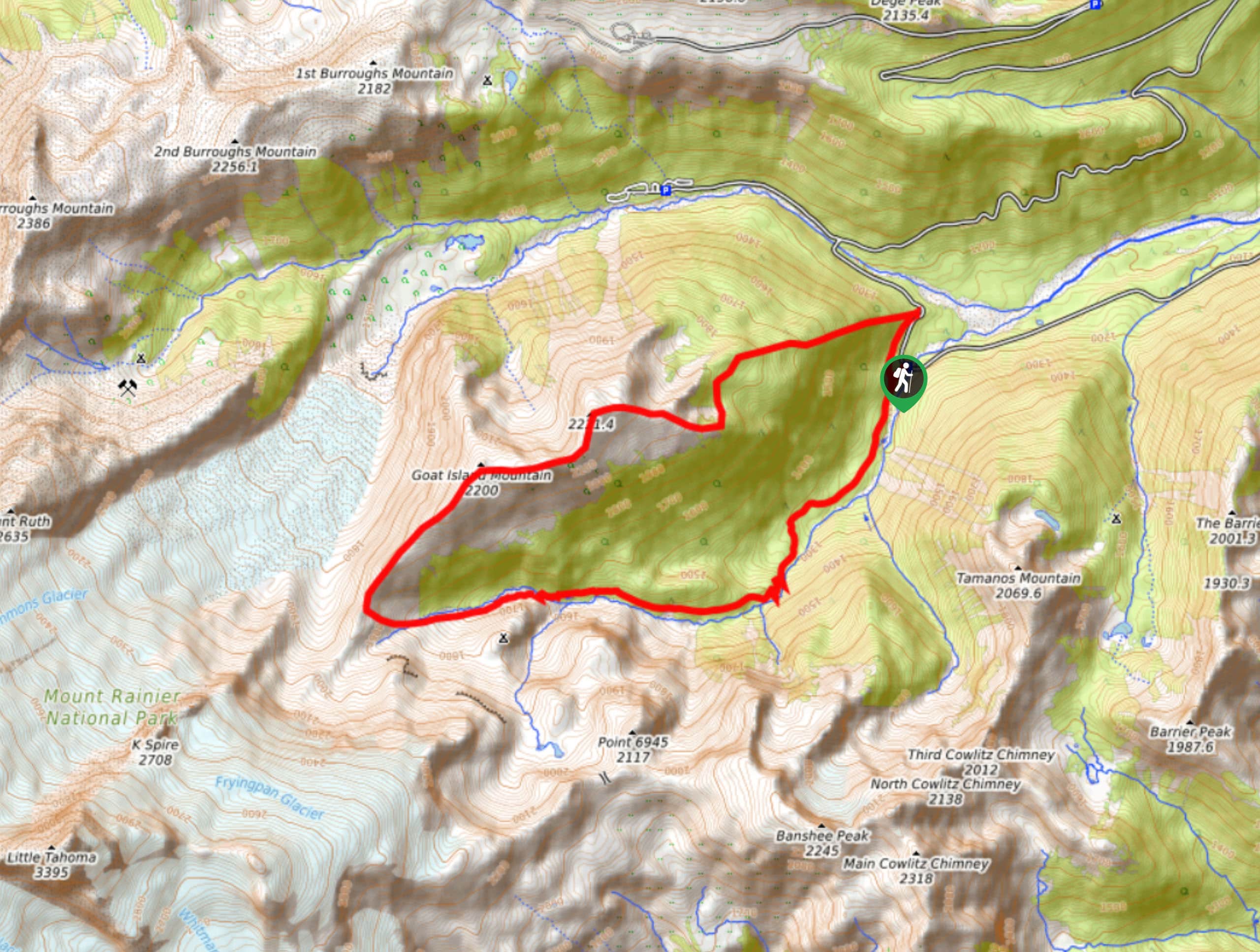
92. Goat Island Mountain Trail
Difficulty
The Goat Island Mountain Trail is a 8.7mi lightly trafficked loop trail in… Read More
93. South Puyallup Trail
Difficulty
The South Puyallup Trail is a 2.9mi lightly trafficked trail in Mount Rainier… Read More
94. Skyscraper Pass and Burroughs Mountain via Wonderland Trail
Difficulty
Skyscraper Pass and Burroughs Mountain via Wonderland Trail is a 8.2mi moderately trafficked… Read More
95. Eastside Trail to Deer Creek Camp
Difficulty
The Eastside Trail is a 8.8mi lightly trafficked trail in Mount Rainier National… Read More

96. Camp Summerland via Wonderland Trail
Difficulty
The hike to Camp Summerland on the Wonderland Trail is a 8.4mi moderately… Read More

97. Narada Falls to Mazama Ridge Loop
Difficulty
The Narada Falls to Mazama Ridge loop is an 7.4mi moderately trafficked route… Read More

98. Paul Peak Trail
Difficulty
The Paul Peak Trail is a 6.3mi lightly trafficked out and back trail… Read More
99. Twin Firs Loop Trail
Difficulty
Twin Firs Loop is a 0.3mi hike in Mount Rainier National Park that… Read More
Are we missing your favourite hike?
Tell us! If you've got photos, a GPS track and know the hike, we'd love to share your favourite hike with the rest of the 10Adventures community.