Camp Muir Hike
View Photos
Camp Muir Hike
Difficulty Rating:
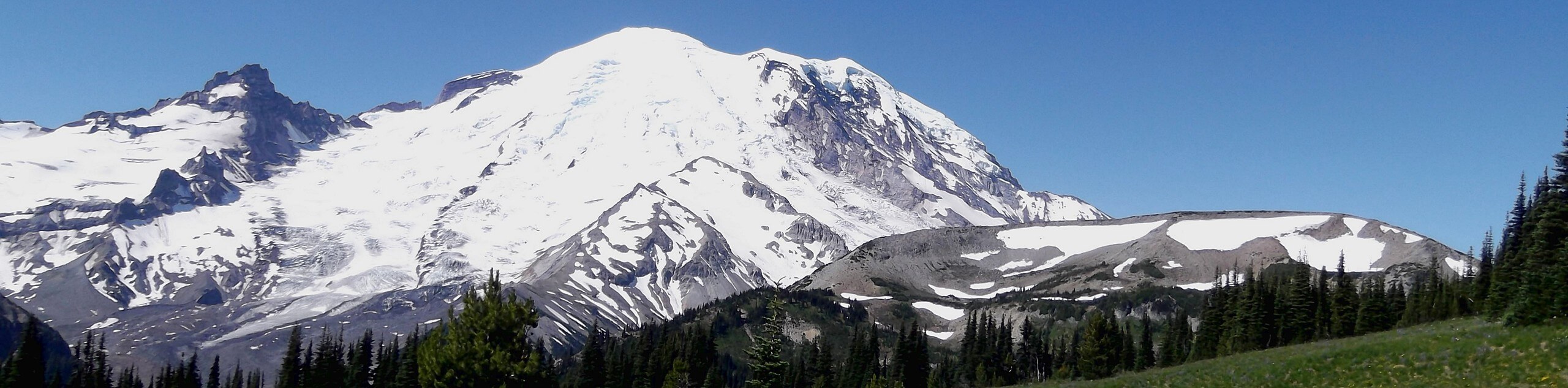
The hike to Camp Muir is a challenging, intense 8.0mi trek that should only be attempted by experienced adventurers. This hike is the highest you can get in Mount Rainier National Park without a climbing permit, offering up-close views of hanging glaciers, seracs, crevasses, and peaks that few hikers in the park ever find. The stone camp halfway up Mount Rainier has stood for nearly a century. It was named for naturalist John Muir, who mistakenly believed that the spot the camp sits on would provide shelter from the wind. Despite the wind that still heavily blows through the camp, the site still honors his legacy as one of the most influential individuals in the founding of this park.
This route is strenuous, technical, snowy, and demanding both physically and mentally. The high elevation of the camp (over 10000ft) makes it a particular challenge for hikers not used to altitude. While this is the adventure of a lifetime for some, we recommend waiting until you have a foundational knowledge of mountaineering to attempt this trail.
Getting there
To get to the trailhead for the Camp Muir hike from the Nisqually entrance to the park, follow Paradise Road East for about 17.5mi to the Paradise parking lot. From the east, you can take Highway 123 to Stevens Canyon Road for 19.0mi to Paradise Road East.

About
| Backcountry Campground | Camp Muir |
| When to do | July-September |
| Pets allowed | No |
| Family friendly | No |
| Route Signage | Poor |
| Crowd Levels | Moderate |
| Route Type | Out and back |
Camp Muir Hike
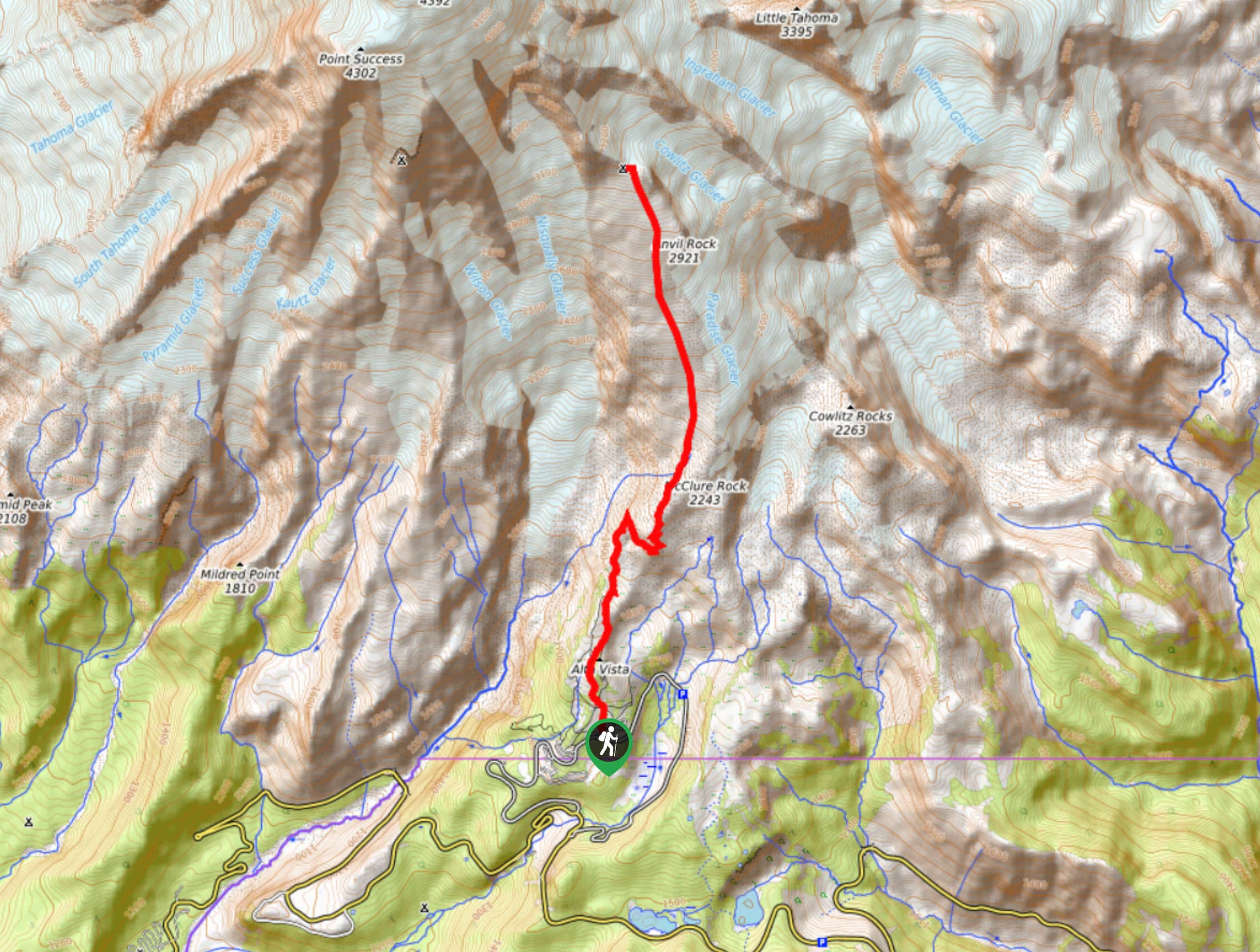
Elevation Graph
Weather
Camp Muir Trail Description
The Camp Muir hike is a defining route for many hikers, representing the upper limit of what can be reached without true mountaineering skills. The views are simply sublime, and you can’t possibly leave this trail without feeling like you earned those views with grit and determination. The scenery is unmatched by other day hikes in the park and you’ll feel like a real alpine adventurer from Camp Muir.
Now, this trail represents a serious undertaking and should only be attempted by experienced hikers. Most of the trail is snowbound well into August, making navigation a challenge and proper equipment (GPS, compass, crampons, poles) essential. Additionally, the melting snow can make descending hazardous and disorienting. While many hikers glissade down the snow, this still poses a risk and should be avoided unless you know how to self-arrest. The weather can be extremely unpredictable, so come prepared with suitable layers of clothing.
The Camp Muir hike begins from the Paradise parking lot. Take the Skyline Trail from the stairs behind the visitor center. The trail is often snowed in from the start, but if you’re visiting in hot weather, you may spend the first two miles hiking through subalpine meadows over paved or rocky trail.
Not long after a hairpin turn, you’ll turn left and follow a creek, where the way to Camp Muir is signed. At about the two-mile mark, cross through a gully (your last source of water on the hike).
You’ll soon reach the Muir Snowfield, where the trail becomes steep and stays that way until the summit. As you grind through the snow, take some time to enjoy the views of Mount Hood, Mount St. Helens, and Tatoosh Ridge that begin to unveil themselves.
At about 8000ft, the trail evens out slightly, but only briefly. 1000ft feet later, you’ll be able to make out Camp Muir in the distance. Although it seems close at this point, many hikers report that these last 250ft vertical feet feel never-ending. The air is noticeably thinner at this point, so take your time as you push through this extremely challenging portion of the trail.
Upon reaching the camp, soak up the views of the Cowlitz Glacier, the Gibraltar Rock, Cathedral Rock, and Little Tahoma. Climbers bound for the summit will likely be camping here.
The descent is often one of the most dangerous parts of this hike. Depending on the conditions, the snow can either be slick and slippery or hard-packed and icy. If visibility is poor, it can be easy to wander off-track. We recommend paying close attention to your GPS and remaining well in control of your body as you navigate the slush and snow. Resist the urge to follow the slope of the hill, as it leads to the dangerously crevassed Nisqually Glacier.
Having hiked halfway up the tallest mountain in Washington, revel in your accomplishment as you descend the snow back to Paradise.
Insider Hints
Some hikers glissade down from the summit on trash bags. Use extreme caution if you choose to do this, and come prepared with an ice axe and the ability to self-arrest.
Prioritize sun protection on the snowfield, as reflected rays can quickly burn your skin. Sunscreen, sunglasses, and hats are important on this trail.
Poles are essential for this trail, and microspikes or crampons can be massively helpful.
Hikers from low elevations should allow themselves to acclimatize before attempting this trail due to the high camp elevation.
The descent can be disorienting in solid snow. Bring a GPS or compass to stay on track.
This hike is a taste of true alpine experience in a day hike. Come prepared with lots of layers and the right gear, more water than you expect to need, and food. This is not a suitable hike for beginner or intermediate adventurers.
There is no toilet paper at Camp Muir. Bring a roll if you plan to use the facilities.
Similar hikes to the Camp Muir Hike hike

Camp Summerland via Wonderland Trail
The hike to Camp Summerland on the Wonderland Trail is a 8.4mi moderately trafficked out and back trail…
Skyscraper Pass and Burroughs Mountain via Wonderland Trail
Skyscraper Pass and Burroughs Mountain via Wonderland Trail is a 8.2mi moderately trafficked route in Mount Rainier National…
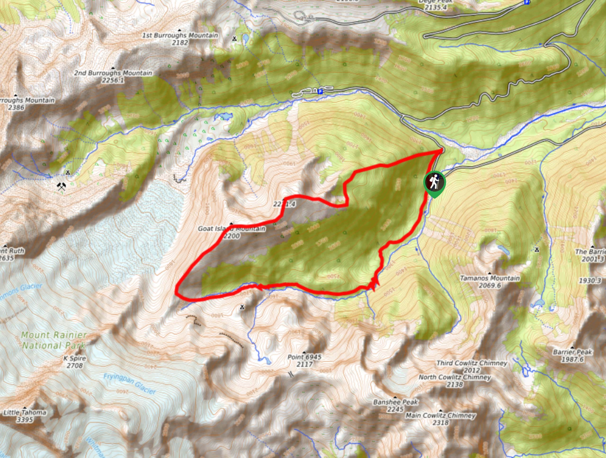
Goat Island Mountain Trail
The Goat Island Mountain Trail is a 8.7mi lightly trafficked loop trail in Mount Rainier National Park that…
Comments