
Rainforest Trail
View Photos
Rainforest Trail
Difficulty Rating:
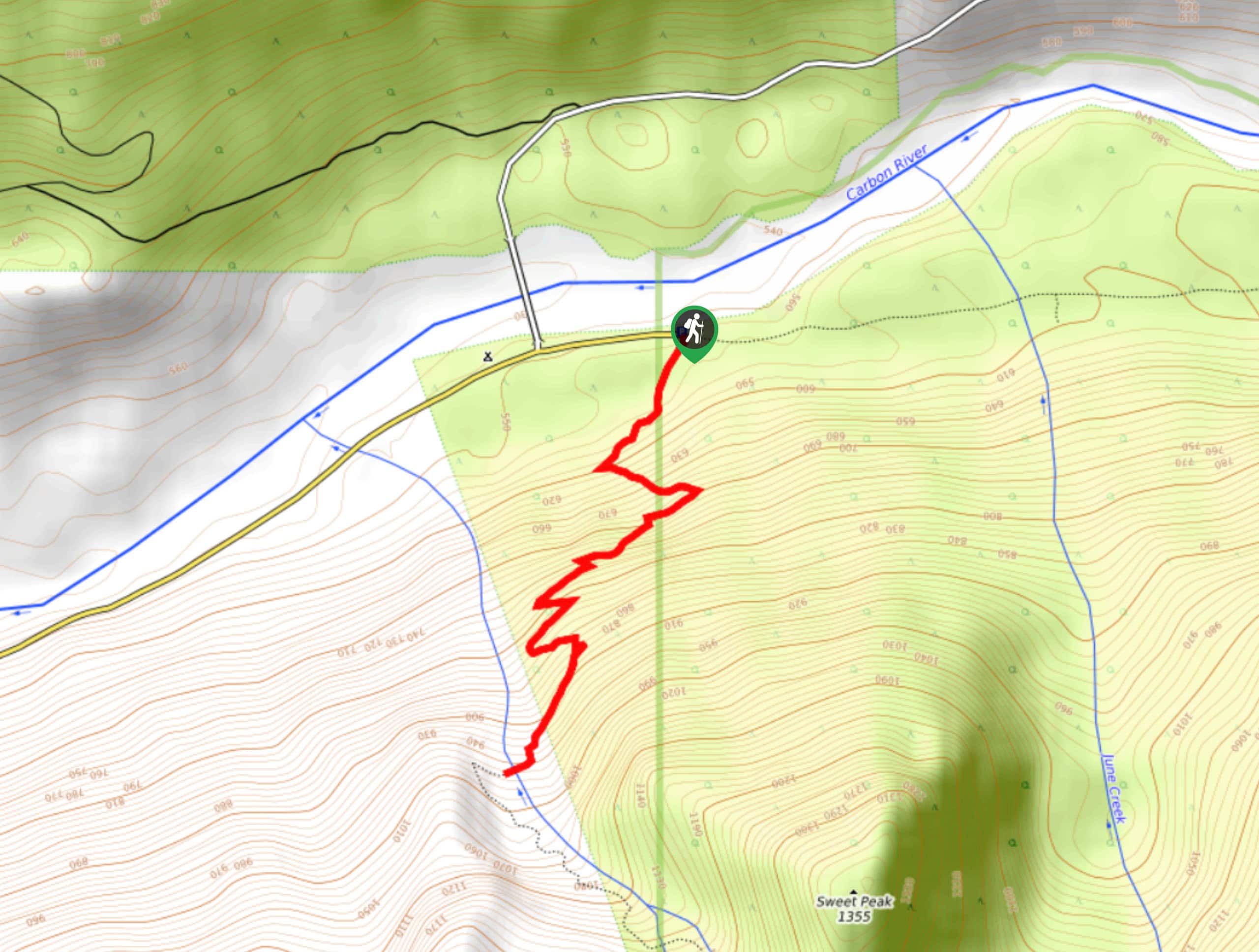
The Rainforest Trail is a 2.3mi lightly trafficked out and back trail in Mount Rainier National Park and Mt. Baker-Snoqualmie National Forest that provides waterfall views. This trail is short but includes some steeper sections that may be unsuitable for smaller children. Bring bug spray for this hike.
Getting there
The trailhead for the Rainforest Trail is just inside of the northwestern boundary at the end of Fairfax Forest Reserve Road E. The trail begins where the road turns into the Carbon River Trail.

About
| Backcountry Campground | No |
| When to do | April-October |
| Pets allowed | No |
| Family friendly | Older Children only |
| Route Signage | Average |
| Crowd Levels | Low |
| Route Type | Out and back |
Rainforest Trail
Elevation Graph
Weather
Rainforest Trail Description
Rainforest Trail is a quick hike that offers waterfall views and the experience of being wrapped up in a canopy of Pacific Northwest rainforest. This trail is suitable for children, but younger ones may struggle a bit with the steeper sections. Bring bug spray!
The hike begins where the road ends and Carbon River Trail begins. Head south on the marked trail. You’ll slowly zig-zag in and out of the park boundary. Enjoy the cool of the forest and the tall trees overhead.
At the end of the trail, you’ll find a waterfall to enjoy. This is a great spot to rest on a hot day. Beyond this, the trail becomes scrambly, so we recommend turning around at the river.
Similar hikes to the Rainforest Trail hike

Paul Peak Trail
The Paul Peak Trail is a 6.3mi lightly trafficked out and back trail in Mount Rainier National Park…

Narada Falls to Mazama Ridge Loop
The Narada Falls to Mazama Ridge loop is an 7.4mi moderately trafficked route in Mount Rainier National Park…

Camp Summerland via Wonderland Trail
The hike to Camp Summerland on the Wonderland Trail is a 8.4mi moderately trafficked out and back trail…
Comments