
Narada Falls to Mazama Ridge Loop
View Photos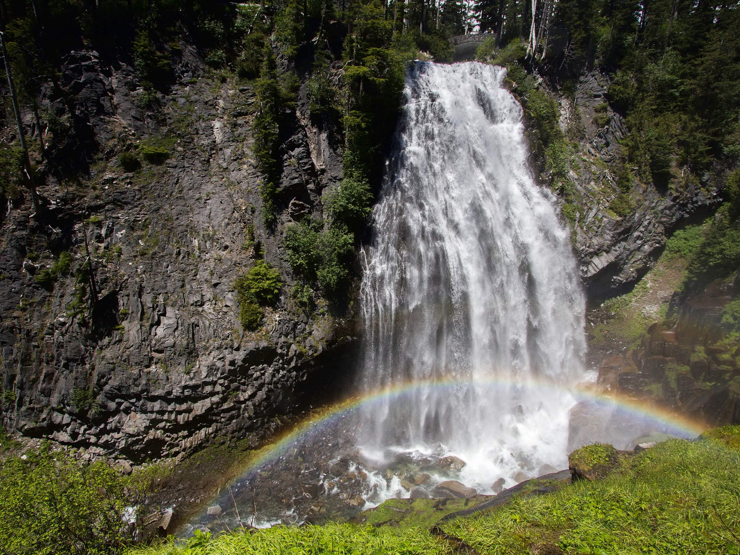
Narada Falls to Mazama Ridge Loop
Difficulty Rating:
The Narada Falls to Mazama Ridge loop is an 7.4mi moderately trafficked route in Mount Rainier National Park that offers waterfall and mountain views. This trail is an enjoyable use of the interconnecting web of trails in the Paradise area of the park and can be shortened or lengthened if you’d like to customize your trip.
Getting there
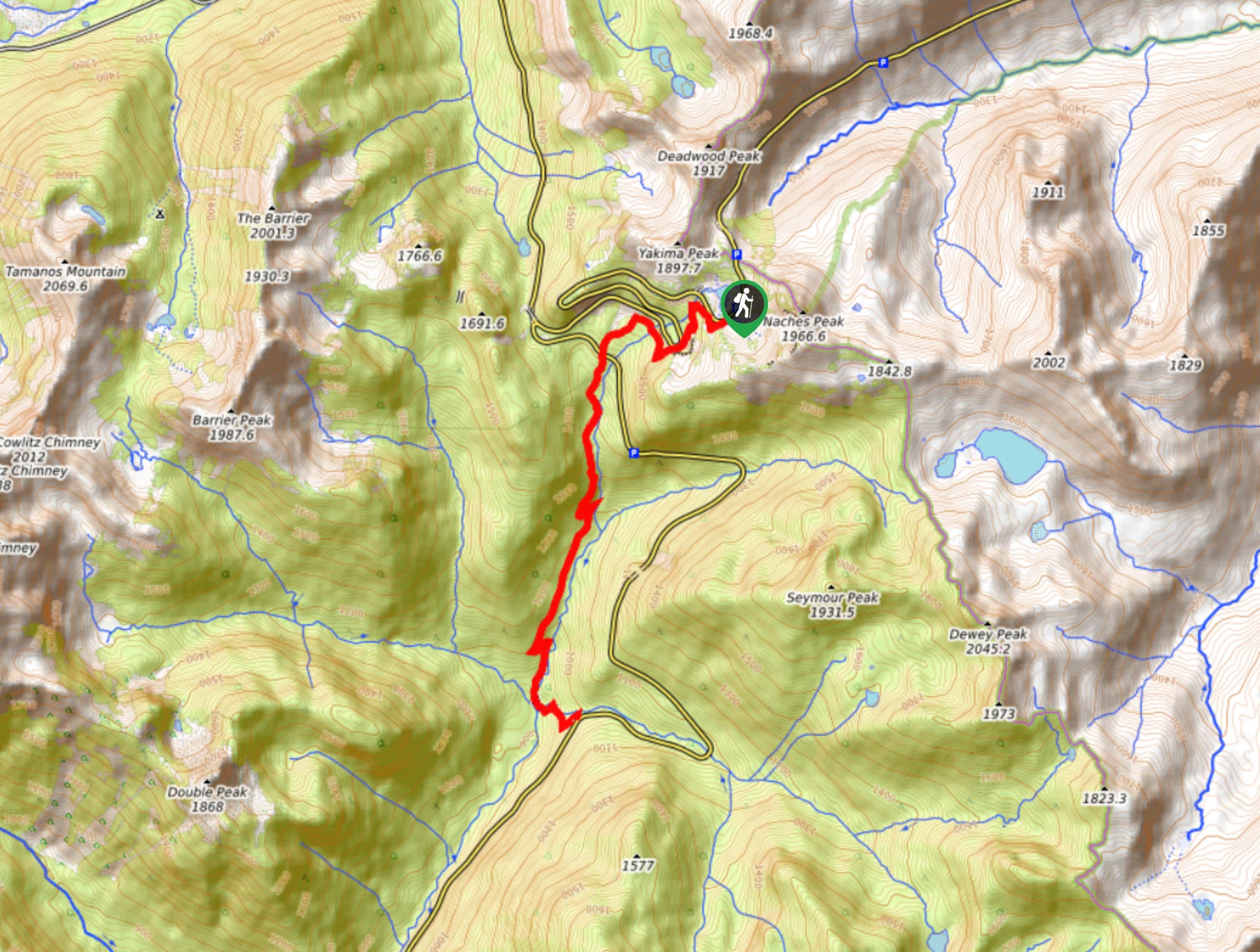
To get to the trailhead for the Narada Falls to Mazama Ridge Loop from the Nisqually entrance to the park, drive east on State Route 706, following the road to the Paradise Inn and parking here.

About
| Backcountry Campground | No |
| When to do | June-October |
| Pets allowed | No |
| Family friendly | Older Children only |
| Route Signage | Average |
| Crowd Levels | Moderate |
| Route Type | Loop |
Narada Falls to Mazama Ridge Loop
Elevation Graph
Weather
Narada Falls to Mazama Ridge Loop Description
With laidback strolls through flower-filled meadows and cool, misty waterfalls, the Narada Falls to Mazama Ridge Loop is a diverse, fun trail. We describe this route going clockwise, but you could do it either way.
This trail begins from the Paradise parking area. Head north out of the lot on the Skyline Trail. Cross Edith Creek above Myrtle Falls and then stay left onto Golden Gate Trail. Take a minute to appreciate Golden Gate Falls after a set of switchbacks, then keep right onto Skyline Trail.
Pass the Stevens-Van Trump Historical Monument and Sluiskin Falls. At the two junctions that come up next, stay left onto Mazama Ridge Trail. Enjoy the far-out views at Faraway Rock, cross Sunbeam Creek twice, and then stay right to skirt under Reflection Lakes. On the Wonderland Trail, stay left after the last lake and cross Stevens Canyon Road.
Take Wonderland to Narada Falls, then to the Washington Cascades, and then to Ruby Falls. Go straight into Lower Lakes Trail, gaining a final bit of elevation to return to Paradise.
Similar hikes to the Narada Falls to Mazama Ridge Loop hike

Paul Peak Trail
The Paul Peak Trail is a 6.3mi lightly trafficked out and back trail in Mount Rainier National Park…

Camp Summerland via Wonderland Trail
The hike to Camp Summerland on the Wonderland Trail is a 8.4mi moderately trafficked out and back trail…
Eastside Trail to Deer Creek Camp
The Eastside Trail is a 8.8mi lightly trafficked trail in Mount Rainier National Park that provides access to…
Comments