Naches Peak Loop Hike
View Photos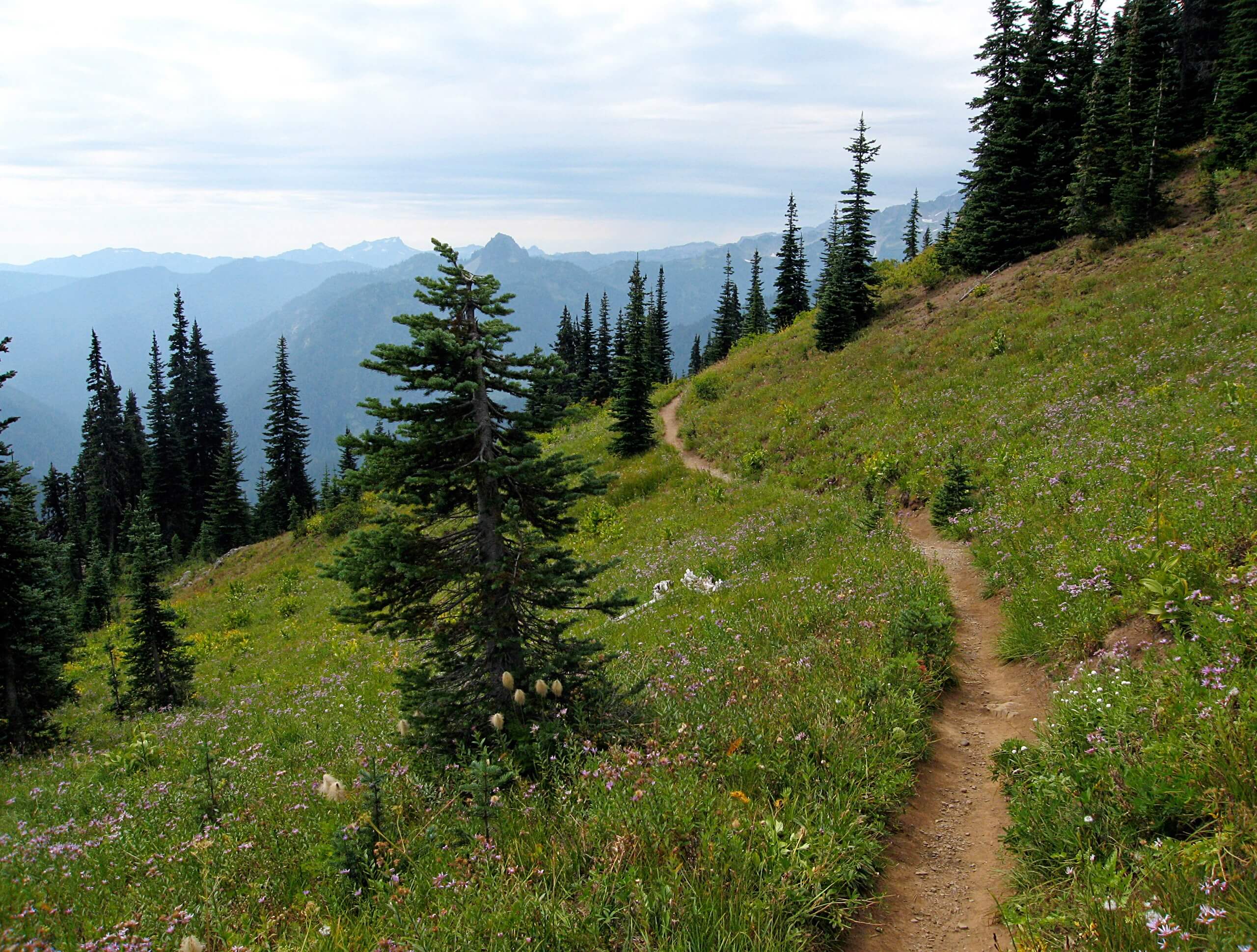
Naches Peak Loop Hike
Difficulty Rating:
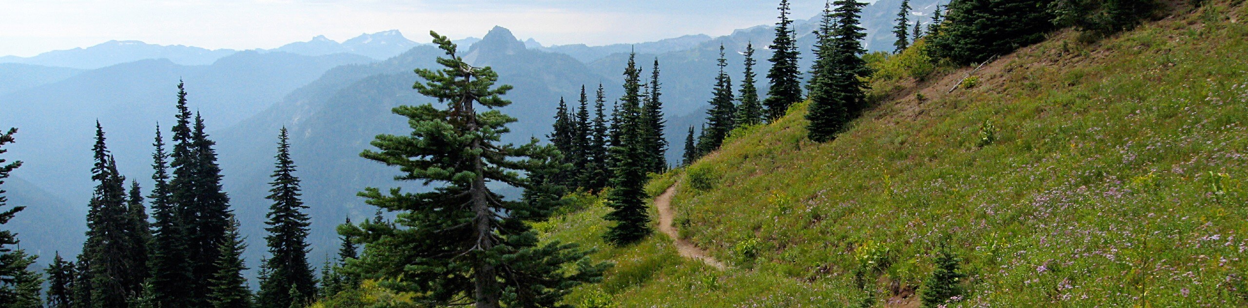
The popular Naches Peak Loop hike offers diverse alpine scenery in a short, easy to complete loop. You’ll crest a small valley, enjoy views of Tipsoo Lake, walk through vast wildflower meadows, and do it all with views of Mount Rainier.
The Naches Peak Loop hike follows the Pacific Crest Trail for a portion of the trek, giving you the honor of a few steps on an epic thru-hike.
Getting there
To get to the Naches Peak Loop trailhead from the ranger station in Enumclaw, drive east on State Route 410. After 44.0mi, watch for the Tipsoo Lake parking area.

About
| When to do | May-October |
| Backcountry Campsites | No |
| Pets allowed | No |
| Family friendly | Older Children only |
| Route Signage | Average |
| Crowd Levels | Moderate |
| Route Type | Circuit |
Naches Peak Loop Hike
Elevation Graph
Weather
Naches Peak Loop Hike Description
Naches Peak Loop is the perfect hike to pack lots of scenery into a shorter day. The trail offers knockout views and diverse landscapes over a few short miles. Note that some of this trail is on National Forest land and some is in the national park. Dogs are not permitted on Mount Rainier National Park trails, so please consult a map to confirm the areas in which dogs are permitted.
The Naches Peak Loop Hike leaves from the Tipsoo Lake parking lot and picks up the Pacific Crest Trail along the northern edge of Naches Peak. You’ll start at Tipsoo Lake, pulling off to climb a steep hillside. While Tipsoo Lake is often fairly busy, rest assured that the crowds tend to thin out on the trail to Naches Peak. The valley you’ll hike along is exceptionally beautiful in wildflower season! Look for blue lupine, magenta paintbrush, and white bistort. From the valley, continue to a small unnamed lake, then wrap around to the eastern side of Naches Peak.
Enjoy the viewpoint over Dewey Lake, then come to a junction where the Naches Peak Loop trail intersects. Go right and follow the route around the southern side of Naches Peak, savouring views of Mount Rainier. This is the most beautiful portion of the loop, so enjoy it!
Continue along the trail as it descends to Tipsoo Lake, then into the parking lot where you began. Adding a quick loop around Tipsoo Lake is an easy way to extend your hike on a non-demanding trail.
Hiking Route Highlights
Wildflower Meadows
Mount Rainier National Park is lucky to be awash in wildflowers in the summer months. The best time to enjoy the flowers tends to be July and August, when a large quantity and variety of wildflowers takes over the meadows of the park. Please respect the flowers by staying on the path and resisting the urge to pick them.
Frequently Asked Questions
Are dogs allowed on Naches Peak Loop trail?
Dogs are not permitted on the trails of Mount Rainier National Park, so although a portion of this trail is outside of the park boundary, you cannot complete the full hike with any furry friends in tow. Dogs are permitted only on the PCT section of the trail.
Do you need a pass for Tipsoo Lake?
You’ll need to either have a yearly pass or pay a daily entry fee when entering Mount Rainier National Park to enjoy Tipsoo Lake.
Can you swim in Tipsoo Lake?
Yes, you can swim in Tipsoo Lake.
Insider Hints
You can add on the short, easy Tipsoo Lake Trail to extend your hike with little effort.
Bring bug spray for this hike.
The trail can get busy in the late morning, so we recommend arriving early or coming later in the afternoon.
Similar hikes to the Naches Peak Loop Hike hike

Paul Peak Trail
The Paul Peak Trail is a 6.3mi lightly trafficked out and back trail in Mount Rainier National Park…

Narada Falls to Mazama Ridge Loop
The Narada Falls to Mazama Ridge loop is an 7.4mi moderately trafficked route in Mount Rainier National Park…

Camp Summerland via Wonderland Trail
The hike to Camp Summerland on the Wonderland Trail is a 8.4mi moderately trafficked out and back trail…
Comments